Blog

  • GNSS Receiver from Galileo Satellite Navigation Now on Cadence Core

    A software-based GNSS receiver is now available on Tensilica ConnX DSP IP cores, according to an announcement by Cadence Design Systems and Galileo Satellite Navigation, Ltd. (GSN), a developer of multi-system GNSS products including software receiver technology. The core is being demonstrated at the Cadence booth at Mobile World Congress, being held this week in Barcelona, Spain.

    The GSN GNSS receiver running on a Cadence ConnX BBE16 DSP consumes very little power — as low as 10mW of power on a 40nm process — and has the ability to work in lower rates, or snapshots for ultra-low-power mobile scenarios. The solution delivers high-sensitivity tracking, offering a seamless GNSS experience in challenging environments, the companies said.

    “GSN’s software-based approach for satellite receivers perfectly complements Cadence DSPs, taking maximum advantage of the flexibility of our DSP architecture,” said Jack Guedj, corporate vice president of Research and Development at Cadence. “The availability of GSN’s software on our ConnX BBE16 further reinforces the strength of our low-power programmable modem strategy for advanced communications.”

    “The Tensilica ConnX BBE16 DSP delivers outstanding performance for implementing our GNSS receivers and with a low-power footprint. This provides customers with the ability to easily upgrade their designs to include future satellite systems including Beidou, GLONASS, and Galileo via software,” said Eli Ariel, CEO at GSN. “With no additional silicon costs and at a low cost of deployment, this software-based solution results in a very compelling approach to implement satellite navigation functionality in many products where it otherwise might be impractical.”

  • Airbus Helicopters Selects Honeywell Navigation System

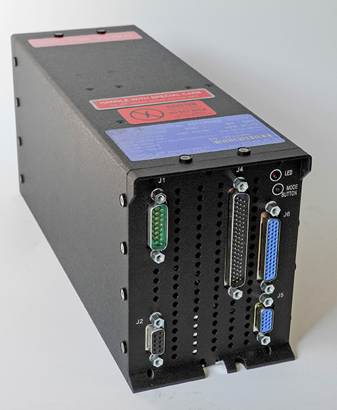
    Honeywell Aerospace’s LASEREF VI navigation system has been selected by Airbus Helicopters for its light helicopter platforms, the EC145 T2 and EC645 T2 family.

    The LASEREF inertial reference unit (IRU) allows helicopter operators to always have an autonomous navigation source available in the absence of a GNSS and radio navigation. The capability is especially useful when navigating during a mission when the GNSS is unavailable due to terrain masking, limited satellite constellation availability, or unintentional or intentional jamming.

    “LASEREF will provide Airbus Helicopters with exactly what they’re looking for — an always-available and highly reliable navigation system,” said Varant Panossian, customer business manager at Honeywell Aerospace. “When you’re in extreme situations, navigation is essential for everything from crew safety to completing critical missions.”

    Designed for fixed-wing and rotary-wing applications, the LASEREF is a light, small IRU that delivers the highest reliability in the industry, according to Honeywell. Its integration with GPS prevents delays in information delivery and keeps operations running safely and efficiently even under harsh environments and demanding mission situations.

  • GeoLearn with Geospatial Online Learning Opens Its Doors

    GeoLearn with Geospatial Online Learning Opens Its Doors

    Geo-learn-logoGeoLearn, a start-up devoted to servicing the geospatial industry with online learning and continuing education credits, has launched its website and training portal with an initial catalog of 22 one-hour-long courses taught by industry-leading faculty members. Course topics available at launch include “Unmanned Aerial Vehicles (UAV’s),” “ALTA/ACSM Land Title Surveys,” and “National Flood Plain Insurance.”

    “We want to provide quality professional development to satisfy continuing education requirements that also enables you to deliver services to your clients from a higher quality knowledge base,” said GeoLearn Principal Joe Paiva. “You often have to get continuing education to satisfy licensing requirements; at GeoLearn you will also leave enriched — a plus for any geospatial organization.” While catering to professionals, GeoLearn will begin to build up courses suitable for technicians as well, including a series that supports those pursuing Certified Survey Technician (CST) status.

    GeoLearn faculty members are nationally recognized experts in the geospatial field. Initial faculty include Gary Kent of the Schneider Corporation, Wendy Lathrop of Cadastral Consulting and GeoLearn Principal Joseph Paiva. More courses will come soon from other notable professionals in the geospatial industry.

    “A key motivation to start GeoLearn has been the desire to significantly improve the learning experience for busy professionals and technicians,” said GeoLearn Principal Bob Morris. “With limited time availability and the growing cost of travel associated with more traditional methods of securing continuing education credits, we hope to provide an attractive option using of state-of-the-art multi-media through our online training portal.”

    GeoLearn has invested in a multi-camera video production studio optimized for online learning, and hired Emmy Award-winning marketing and video expert Peter Barrett to head up those efforts.

  • Esri Launches Geotrigger Service for Mobile Developers

    esri-logoEsri announced today that its cloud-based Geotrigger Service is now available, making it easier for developers to add location awareness and messaging to their iPhone and Android apps. With the Geotrigger Software Development Kit (SDK), mobile apps can send custom messages when a user enters or leaves locations specified by the application developer.

    “The Esri location platform currently offers many services for developers, from geocoding and geoenrichment to routing and maps,” said Johan Herrlin, Esri senior business strategist. “Geotrigger boosts these existing services with location awareness and location-based alerts.”

    Esri’s Geotrigger Service expands on the native geofencing features available within iOS and Android, including the ability to create complex polygon geofences and notify other servers or services when triggers are fired. Geotrigger Service also adds additional logic to reduce the battery drain when using location services on mobile devices. Geotrigger SDKs provide a consistent interface supporting faster development of apps for both iOS and Android.

    Developers can add the following location-based functions to apps with Geotrigger Service:

    • Notify citizens about road closures, emergencies, or public safety warnings based on their past or current location.
    • Inform tourists about interesting places as they explore your city, theme park, and so forth.
    • Engage customers with personalized content or deals the moment they enter a store­or a set amount of time later.
    • Optimize customer service by notifying employees when a customer who just ordered something arrives at your store.

    Esri’s Geotrigger Service is the new and improved version of Geoloqi’s original technology. Esri acquired Geoloqi in 2012, and its team formed Esri’s R&D Center in Portland, Oregon. Since joining the company, the team has improved existing core location technology and added to the Esri suite of tools for developers on the newly launched developers.arcgis.com.

    Current Geoloqi customers are encouraged to migrate to Esri’s Geotrigger Service to take advantage of the easier-to-use SDKs, improved tools, overall increased performance, and lower pricing. The original service will retire 18 months after the launch of Geotrigger Service. Migration tools will be provided to existing Geoloqi customers.

    “Geotrigger Service opens up a whole world of use cases, from stores wanting to engage customers to cities wanting to release an app to send civic alerts, local event information, or tourism info,” said Amber Case, director of Esri’s R&D Center in Portland. “Create an invisible button on a map, and when your phone gets within that button ­that invisible region ­something will happen. Your phone could even turn the lights on in your home as you pull into the driveway, and turn them off when you leave. When you combine Geotrigger Service with the other capabilities of the Esri developer platform, such as geocoding, data visualization, and demographics, developers can create powerful solutions.”

    For more information on the Geotrigger service, visit developers.arcgis.com/features/geotrigger-service or visit esri.com/events/developers/main for additional information on Esri’s comprehensive program for developers.

  • Northrop Grumman Provides Navigation for Vertical Take-Off Aircraft

    Northrop Grumman Provides Navigation for Vertical Take-Off Aircraft

    Northrop Grumman has been selected by AgustaWestland to supply the LCR-110 Inertial Reference System for the new AW609 TiltRotor aircraft.
    Northrop Grumman has been selected by AgustaWestland to supply the LCR-110 Inertial Reference System for the new AW609 TiltRotor aircraft.

    Northrop Grumman Corporation has been selected by AgustaWestland, a Finmeccanica company, to provide flight-critical inertial instruments on the new AW609 TiltRotor aircraft undergoing civil certification through the Federal Aviation Administration.

    The LCR-110 Inertial Reference System and the LCR‑300A Air Data Attitude Heading Reference System have been chosen as standard inertial navigation products for the advanced AW609 TiltRotor. The LCR‑110 features a high-performance, fiber-optic gyro-based inertial measurement unit and an advanced micro-electromechanical system (MEMS) triad accelerometer. The system offers hybrid navigation via GNSS data, in addition to aircraft autonomous integrity monitoring for GPS signal integration and integrity checks. These features are essential for precise Required Navigation Performance flight operations.

    The LCR‑110 evolved from the successful, longstanding LCR‑100 product family that has been selected for numerous rotorcraft and fixed-wing platforms.

    The systems were developed by Northrop Grumman Navigation and Maritime Systems Division’s subsidiary in Germany, Northrop Grumman LITEF.

    “This suite of combined equipment provides critical flight control and navigation data to help the aircraft achieve required availability, precision and the highest levels of integrity,” said Eckehardt Keip, managing director for Northrop Grumman LITEF. “Our products enhance precision navigation operations, improve safety margins, save weight and volume, and provide attractive commercial advantages.”

    The LCR‑300A is being introduced after several years of independent research and development. The system’s MEMS gyro provides advanced attitude heading reference system performance in combination with a magnetic sensing unit. It also features directional gyro mode, which minimizes magnetic compass errors.

    The digital air data computer module, which is embedded in the LCR‑300A, was developed by Curtiss-Wright Corporation’s Defense Solutions division. It weighs less than 0.9 pound, yet contains the pneumatic sensors and processing electronics to generate the complete International Civil Aviation Organization air data parameter set. The module is designed using the latest high stability, low drift pressure transducer technologies, providing exceptional repeatability and reliability, Northrop Grumman said.

    The twin engine, fly-by-wire AW609 TiltRotor combines the benefits of a helicopter and fixed-wing aircraft into one platform. The aircraft is a natural choice for civil and para-public roles, flying above adverse weather conditions at 25,000 feet in a comfortable and pressurised cabin at twice the speed and the range typical of helicopters.

  • Rx Networks Launches BeiDou Services

    Rx Networks, Inc., a mobile location technology and services company, has completed the upgrade of its GPStream Global Reference Network (GRN) to include the BeiDou constellation. A top-tier GNSS semiconductor vendor has already incorporated this new feature so its platform can take advantage of the extra satellites now available in the BeiDou constellation, the company said.

    Global real-time assistance and high-accuracy long-term orbit and clock prediction products are now uniformly available across the GPS, GLONASS and BeiDou constellations. In the second quarter of 2014, BeiDou support will also extend to GPStream PGPS — Rx Networks’ popular synthetic A-GNSS software that has been deployed in more than 100 million smartphones and personal navigation devices worldwide.

    In commercial service since 2006, the GPStream GRN is a collection of 26 highly reliable earth stations deployed in 21 countries. It forms the foundation underneath many of Rx Networks’ products, on which nearly a billion devices rely for their GNSS performance. The network is highly redundant and, combined with a carrier-grade service delivery network, is provided with a 99.999 percent service-level availability (SLA). A further upgrade, to support the European-run Galileo constellation, will be available later this year.

    From network operators’ commercial and E911 location servers to GNSS chipset vendors and device OEMs, the addition of BeiDou means faster and higher availability GNSS location fixes.

    “The addition of BeiDou to our existing GPStream GRN service meant a complete overhaul of our reference network and service delivery architecture while maintaining the 99.999 percent SLA we’re well known for,” commented Guylain Roy-MacHabee, CEO of Rx Networks. “As multi-GNSS chipsets come to market, there is commensurate requirement for a uniform, reliable and device-independent assistance data service like our GPStream GRN.”

  • Mediatek Announces Five-in-One Wireless Connectivity Chip for Mobile Devices

    Mediatek has released a five-in-one combo wireless system-on-a-chip (SOC), with multi-system GNSS, to support full featured smartphones, tablets, and other premium mobile devices.

    The MT6630 dramatically reduces the component count and eBOM while improving ease-of-design for manufacturers by eliminating external low noise amplifiers and integrating the Wi-Fi 2.4 GHz and 5 GHz power amplifiers, Bluetooth power amplifiers, and transmit-receive (T/R) switch into a PCBA footprint less than 65 square millimeters.

    Features include:

    • Concurrent tri-band reception of GPS, GLONASS, Beidou, Galileo, and QZSS with industry leading sensitivity, low power, positioning accuracy, and the longest prediction engine
    • Dual-band single-stream 802.11a/b/g/n/ac with 20/40/80MHz channel bandwidth
    • 802.11v time of flight protocol support and management engines to enable higher accuracy of indoor positioning via Wi-Fi
    • Advanced support for Wi-Fi Direct Services and Miracast optimization for easier pairing, increased robustness, advanced use-cases, and lower power
    • Bluetooth 4.1 with Classic, High-Speed and Low-Energy support, and ANT+ for compatibility with the latest fitness tracking, health monitoring, and point of information devices and applications
    • FM transceiver with RDS/RBDS
    • Integrated engines and algorithms for full concurrent operation and co-existence, including industry-leading throughput during LTE transmission
    • The MT6630 delivers full concurrent operation of all 5 systems operating at maximum compute intensity with no degradation compared to single-system operation while offloading the mobile device CPU for design ease and extended battery life.

    As a focus on low power and digital home convergence, the MT6630 uses a configurable PA architecture to save current at commonly used power levels, including those used for Miracast Wi-Fi Direct services. The MT6630 implements advanced co-existence techniques, including for LTE to deliver industry-leading throughputs. The MT6630 also supports Wi-Fi diversity for premium smartphones and tablets to improve antenna angle sensitivity and handheld scenarios.

    “The MT6630 makes it simple for manufacturers to bring mobile devices to market with sophisticated wireless features, lower power and uncompromised performance,” said SR Tsai, general manager of MediaTek’s Connectivity Business Unit. “The MT6630 furthers MediaTek’s focus to deliver the best experiences across the digital home and mobile applications by using its unique leadership position in digital TV host processors, smartphone platforms, and connectivity.”

    The small-footprint design is available in 5 x 5-mm wafer-level chip-scale package (WLCSP) or a 7 x 7 mm quad flat no-leads (QFN) and requires only 44 components, which is around half that of other integrated wireless solutions, the company said.

    Mediatek’s MT6630 is sampling now and complements the recently announced MT6595 octa-core SOC with LTE for premium mobile devices. The first commercially available devices to use the MT6630 are expected in the second half of 2014.

  • Anritsu Offers Atomic Clock for Spectrum Master without Need for GPS

    Anritsu Company is launching an internal atomic clock option for its MS2720T Spectrum Master handheld spectrum analyzer that allows users to acquire excellent frequency accuracy, including in environments in which the GPS cannot be used.

    Integrating the atomic clock inside the MS2720T provides field engineers and technicians with a durable, handheld spectrum analyzer that can deliver the extremely high accuracy necessary to prove regulatory compliance.

    By using the atomic clock, users can acquire a very accurate frequency reference without the need of the GPS. Calibration accuracy of the atomic clock is 1×10⁻⁹. The MS2720T can be configured with the GPS receiver and the atomic clock to achieve both high-frequency accuracy and GPS location stamping of measurements.

    Because the atomic clock module mounts inside the instrument, there are no loose cables that can potentially snag on branches, antennas or other extensions prevalent in the field environments in which the MS2720T is used, the company said. The atomic clock is automatically used once it is installed.

    The Spectrum Master MS2720T series features the highest performance handheld spectrum analyzers on the market, the company said. Providing field technicians and engineers with performance that rivals a benchtop spectrum analyzer, the MS2720T features a touchscreen and best-in-class performance for dynamic range, DANL, phase noise, and sweep speed, providing unprecedented levels of spectrum monitoring, hidden signal detection, RF/microwave measurements, and testing of microwave backhauls and cellular signals.

    Continuous frequency coverage from 9 kHz to 20 GHz is provided by the MS2720T with the option 1 internal atomic clock. An improved sweep mode allows users to set resolution bandwidth from 30 kHz to 10 MHz with minimal effect on sweep speed. Because the sweep speed with a 30 kHz bandwidth is nearly the same as a 10 MHz RBW, sensitivity can be selected without the need for long sweep times.

    The MS2720T has dynamic range of > 106 dB in 1 Hz RBW, DANL of -163 dBm in 1 Hz RBW, and phase noise of -112 dBm @ 10 kHz offset at 1 GHz. These best-in-class specifications are complemented by unprecedented measurement capabilities. A burst detect sweep mode function allows emitters as short as 200 microseconds to be captured every time, allowing the MS2720T to detect bursty signals that can lead to finding intermittent or bursty emitters. The burst detect sweep mode increases sweep speed more than 1,000 times in a 15-MHz span.

    The internal atomic clock has a U.S. price of $5,900 and is available in 6 to 8 weeks.

  • Qualcomm Offers Commercial Advanced Chipset for Automotive

    Qualcomm Technologies, Inc., has added the Qualcomm Gobi 9×30 platform with extended lifecycle support to Snapdragon Automotive Solutions, enabling advanced telematics and infotainment features for next-generation systems.

    The announcement was made at Mobile World Congress, being held this week in Barcelona, Spain.

    Based on Qualcomm Technologies’ fourth-generation LTE platform, the Gobi 9×30 supports LTE Advanced Category 6 with up to 300 Mbps downlink data rates, enabling broadband vehicle connectivity for enhanced navigation, Wi-Fi hotspot, infotainment content and telematics services.

    Gobi 9×30 builds upon Qualcomm Technologies’ LTE modem technology for automotive, the Gobi 9×15, and promises to enable a superior next-generation GNSS engine and fast 3G and 4G LTE connections worldwide, while supporting broad multi-region coverage in a single SKU with the Qualcomm RF360 front-end solution. The Gobi 9×30 is based on the 20-nm technology node with support for global carrier aggregation deployments up to 40 MHz in both LTE FDD and TDD modes. The Gobi 9×30 features broad multi-mode capability with support for all other major cellular technologies, including LTE TDD networks in China.

    In addition to 3G/LTE connectivity, the new platform is pre-integrated with QCA6574, a dual-stream 802.11ac Wi-Fi and Bluetooth 4.1 chipset designed to simultaneously support in-car Wi-Fi hotspot functions and Bluetooth profiles. The QCA6574 also supports DSRC (dedicated short-range communications), a technology required to comply with future regulation recently announced by the National Highway Traffic Safety Administration (NHTSA) to increase safety through vehicle-to-vehicle (V2V) communication. The Gobi 9×30 and QCA6574 will also be pre-integrated with Qualcomm Technologies’ recently-announced automotive-grade Snapdragon 602A processor.

    “The need for high-speed connectivity in the automobile is driving ever-increasing data rates as well as greater integration of features and technologies,” said Kanwalinder Singh, senior vice president of business development for Qualcomm Technologies, Inc. “Adding Gobi 9×30 to our technology leading LTE lineup offers to our module, Tier-1 and automaker customers the flexibility of a global SKU with next-generation LTE features including data rates up to 300 Mbps and carrier aggregation. The Gobi 9×30 sets a new bar for features and integration: 20 nm technology node; support for both LTE FDD and TDD modes; built-in next-generation GNSS engine; pre-integration with Snapdragon 602A; and pre-integration with QCA 6574, supporting 802.11ac, BT 4.1, and DSRC.”

    Gobi 9×30 is currently sampling to customers.

  • Three More Companies Sign on to AT&T Connected Car Center

    Three More Companies Sign on to AT&T Connected Car Center

    AT&TDriveStudio

    Three additional companies — Qualcomm, Red Bend and QuickPlay — have signed on to work with the connected car industry at the AT&T Drive Studio, a connected car center for innovation and research in Atlanta, Georgia.

    “This is an exciting ecosystem and we are committed to leading the way to take the connected car to the next level for auto manufacturers and their drivers,” said Glenn Lurie, president, AT&T Emerging Enterprises and Partnerships, AT&T Mobility. “That’s the essence of the AT&T Drive Studio, to bring together the best players in the auto industry ecosystem to collaborate and create the future faster.”

    The AT&T Drive Studio will now include support from the following companies:

    Qualcomm Technologies, Inc., intends to showcase its newly announced Qualcomm Snapdragon Automotive Solutions for infotainment and telematics at the AT&T Drive Studio. Qualcomm Technologies plans to integrate these solutions with AT&T’s Drive portfolio, including AT&T’s global SIM, bifurcated billing, voice recognition, and the nation’s most reliable 4G LTE network.

    AT&T has selected Red Bend Software to be a solution provider to remotely manage automotive software in the new AT&T Drive Studio. Hosted in the AT&T cloud, the Red Bend Software Management Center is an OMA-DM standard-based platform designed for car manufacturers to manage in-vehicle software and applications over the air with reliability and efficiency. Red Bend’s comprehensive software management platform significantly reduces the time and cost for automotive OEMs to manage the lifecycle of all in-vehicle software, from head units to map content and ECUs.

    AT&T has selected QuickPlay Media to develop an in-vehicle video service. The offering will be powered by QuickPlay’s OpenVideo platform and will deliver Live Linear TV and streaming video on demand services to automotive manufacturers collaborating in the AT&T Drive Studio. QuickPlay’s solution will enable AT&T to provide in-car “infotainment” by delivering secure streaming of hundreds of live linear TV channels and hours of premium VoD content. The solution includes a configurable, customizable client application, support for adaptive streaming, complete content protection with DRM solutions like Microsoft PlayReady, user entitlements, dynamic advertising, banner ad support, multi-language support and featured content.

    Opened in January 2014, the AT&T Drive Studio is a dedicated facility for connected car innovation and research. Located in Atlanta, the more than 5,000-square foot AT&T Drive Studio features working garage bays, a speech lab, and a full showroom to exhibit the latest innovations.  The AT&T Drive Studio integrates AT&T solutions across multiple companies and serves as a hub where AT&T can respond to needs of automotive manufacturers and the auto ecosystem at large.

  • Blackphone Designed for Privacy Launches At Mobile World Congress 2014

    Blackphone Designed for Privacy Launches At Mobile World Congress 2014

    Blackphone-O
    photo: SGP Technologies

    SGP Technologies, a joint venture of Silent Circle and Geeksphone, has unveiled the Blackphone, a smartphone that places privacy and control directly in the hands of its users. The smartphone was launched at Mobile World Congress being held this week in Barcelona.

    Blackphone includes a unique combination of operating system and application tools that offer unparalleled security and privacy to information workers, executives, public figures, and anyone else seeking privacy, the company said. Blackphone’s PrivatOS, built on Android and combined with a full suite of privacy-enabled applications, “allows users to regain control over their communications activities. No longer will the use of a smartphone demand acceptance of unauthorized surveillance, commercial exploitation of activity data, and the loss of privacy, security and fundamental human rights,” the company said in a press release.

    Blackphone is powered by a >2 GHz quad-core SoC and features a full set of premium features, including GPS, a 4.7-inch HD IPS screen, LTE, HSPA+, 2GB DDR3 RAM, 16GB of storage, >8MP primary camera with flash and 1.3MP front camera, Bluetooth 4.0, and 802.11n WiFi.

    Blackphone comes unlocked and features several pre-installed privacy tools, including the Silent Circle suite of apps (Silent Phone, Silent Text, and Silent Contacts); anonymous search, private browsing, and VPN from Disconnect; and secure cloud file storage from SpiderOak. In addition, Blackphone ships with the Smart WiFi Manager from Mike Kershaw, Chief Architect for SGP Technologies, and a powerful remote-wipe and device recovery tool.

    Blackphone is available for pre-order to individuals and enterprises as an unlocked device with a starting price of US$629, and will also be available through selected partner carriers from launch, including KPN Mobile, the inaugural launch carrier for Blackphone serving European regions including Belgium, the Netherlands, and Germany. Customers will always have the option of buying direct rather than through a carrier if that is their preference.

    Blackphone is scheduled to ship to the first end users in June 2014, and testing units will be provided to partner carriers in the April timeframe.

  • Septentrio, Imec Co-Design Antenna for High-Precision GNSS

    Septentrio, Imec Co-Design Antenna for High-Precision GNSS

    antenne copy-W
    photo: Imec and Septentrio

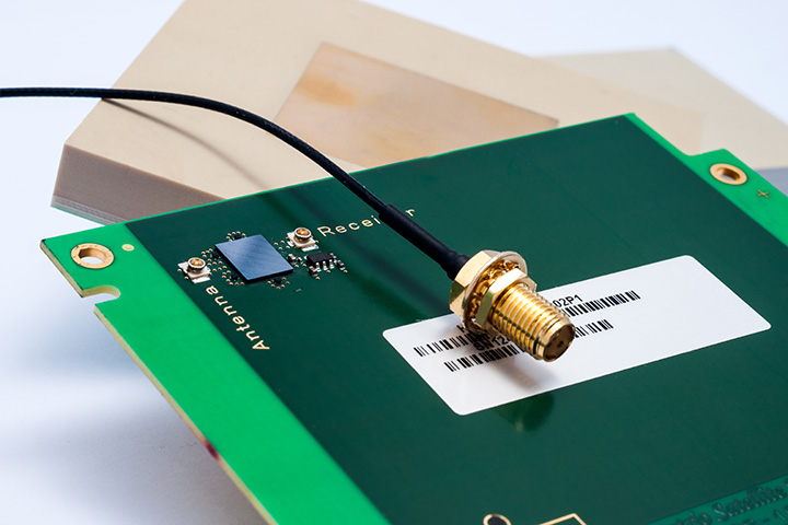
    Imec and Septentrio have collaborated to design multi-frequency GNSS antenna that simultaneously receives all GPS, GLONASS, BeiDou, and Galileo bands. Developed under the European Community’s Seventh Framework Programme project Handheld, the compact antenna can be integrated in multi-frequency handheld GNSS devices for high-precision location applications up to 1 centimeter.

    The announcement came at the Mobile World Congress being held this week in Barcelona, Spain.

    The compact antenna integrates Imec’s GNSS antenna and Septentrio’s GNSS RF front-end. Imec’s antenna design satisfies the requirements for the high-accuracy GNSS market while remaining small enough to fit in a handheld surveyor device, the companies said. The antenna has desired uniform gain and phase coverage over the complete upper hemisphere, with strong suppression of unwanted reflected signals below or in the vicinity of the GNSS receiver.

    The GNSS RF front-end, based on established front-end technology developed by Septentrio, is characterized by a superb out-of-band interference rejection to avoid notably device self-interference with other radiation sources such as Bluetooth and WLAN radios, as well as other ambient intentional and non-intentional interference. The compact multi-frequency antenna is a perfect companion of Septentrio’s compact and low-power AsteRx-m receiver, a credit card-sized dual frequency GNSS receiver that provides centimeter accuracy at less than 500-mW power consumption, by far the lowest power consumption in the professional GNSS market.

    The research leading to these results has received funding from the European Union Framework Programme (FP7/2007-2013) under grant agreement n°287183.