
Blog

  • Nautiz X1 Ultra-Rugged Smartphone Is Now Shipping

    Nautiz X1 Ultra-Rugged Smartphone Is Now Shipping

    The Nautiz X1.
    The Nautiz X1.

    Handheld Group, a manufacturer of rugged mobile computers, PDAs and smartphones, has started shipping the Nautiz X1. The Nautiz X1 is a rugged enterprise smartphone — it’s waterproof, dustproof, shock-resistant and can handle extreme temperatures, yet it’s also slim, lightweight and smartly designed for both work and play, the company said.

    The Nautiz X1 is now shipping to customers worldwide. Interest in Handheld’s ultra-rugged smartphone has been tremendous, and the first batches are completely sold out, the company said.

    The Nautiz X1 is part of the Nautiz product family of rugged and ultra-rugged PDAs and smartphones. It has an IP67 ingress protection rating, which means it’s fully dust- and waterproof and can withstand immersion in water, and it also meets stringent MIL-STD-810G military test standards for enduring humidity, vibration, shock and extreme high and low temperatures.

    “As a company specializing in rugged computers, we know our customers expect all our products to be built rugged from the inside out. The Nautiz X1 is no exception — it comes with the reliability and sturdiness of an ultra-rugged computer,” says Product Manager Johan Hed of Handheld Group. “People are increasingly using their smartphones all the time, everywhere, and they’re expecting mobility and connectivity anytime, anywhere, and in all environments and weather conditions. The Nautiz X1 ultra-rugged smartphone is a natural choice, as it’s built to survive these challenges.”

    “This is the toughest smartphone ever built,” said Jerker Hellström, CEO of Handheld Group. “We see a huge demand for truly rugged smartphones among field professionals and outdoor enthusiasts who want to be constantly connected. We’re excited to see the great response this product receives from the market.”

    The Nautiz X1 is slim and lightweight, weighing in at less than 180 grams (6.3 ounces). It has a 4-inch special sunlight-readable capacitive touchscreen and ultra-durable Gorilla Glass. It runs on a powerful 1 GHz dual-core processor and has 1 GB of RAM. It features Bluetooth, Wi-Fi, a compass, a professional u-blox GPS, and a 5-megapixel camera. The Nautiz X1 comes with Android 4.0 (Ice Cream Sandwich) or Windows Embedded Handheld 6.5 operating system, and runs on both GSM and CDMA networks. Multiple battery options enable a full day’s work in the most demanding environments.
  • Raytheon Receives $16M Contract for Miniaturized Airborne GPS Receivers

    Raytheon Receives $16M Contract for Miniaturized Airborne GPS Receivers

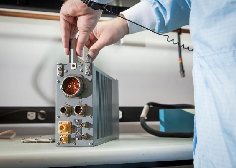
    The open architecture design of MAGR 2000-S24 allows modernization and upgrade of GPS functional capabilities through replacement of a single electronics module.
    The open architecture design of MAGR 2000-S24 allows modernization and upgrade of GPS functional capabilities through replacement of a single electronics module.

    Raytheon Company has received a $15.8 million contract order for its MAGR 2000-S24 miniaturized airborne GPS receiver. The order, which includes new production and sustainment of existing systems, is the first under an Indefinite Delivery-Indefinite Quantity (IDIQ) contract awarded to the company in September 2013 by the U.S. Air Force Space and Missile Systems Center.

    Raytheon recently completed its 2,000th delivery of MAGR 2000 systems to the U.S. military and its allies in Europe, the Middle East and the Asia Pacific region. Flown on 20 types of fixed- and rotary-wing platforms, the MAGR 2000-S24 provides unparalleled navigation accuracy and resistance to interference and jamming. Its open architecture design allows for insertion of future GPS modernization enhancements, such as the new military code signal, without having to replace the unit itself.

    “With the increasingly sophisticated threats posed by potential enemy nations, our customers recognize Raytheon as the gold standard for highly secure, highly adaptable GPS receivers for the airborne military environment,” said Sharon Black, director of GPS and Navigation Systems for Raytheon’s Space and Airborne Systems business. “Our innovative MAGR 2000-S24 design makes future unit replacement virtually unnecessary. Capability enhancements are as simple as swapping out the electronics module card, providing a highly cost-effective path for keeping fleets up-to-date with the latest GPS technology.”

    The current MAGR 2000-S24 IDIQ contract extends through September 2017. The first order of 323 production units is scheduled for completion in June 2015.

  • Proliferation of GPS-enabled Smartphones Spurs Growth of Global Location-based Applications Market

    The global market for location-based applications is poised for rapid growth, as the mass adoption of global positioning system (GPS)-enabled smartphones is encouraging developers to introduce numerous advanced applications, says market research agency Frost & Sullivan.

    New analysis from Frost & Sullivan finds that indoor connectivity, augmented reality, big data and wearable devices are the key technology trends likely to fuel the uptake of location-based applications. Location-based technology and data can then be combined to facilitate the development of smart spaces in every city and community.

    “Location-based application developers have so far focused on the development of outdoor applications due to the adoption of GPS positioning in smartphones,” noted Frost & Sullivan Information & Communication Technologies Research Analyst Shuba Ramkumar. “However, as individuals spend more time indoors, there is a need to roll out indoor location-based applications that capitalise on various functionalities such as mapping, navigation and geo-fencing.”

    According to the announcement, augmented reality technology could also be used to make location-based applications more interactive. Further, the widening ecosystem of wearable devices such as Google Glass and Samsung Galaxy Gear infuses technology into the daily lives of individuals, widening the scope of context-aware applications. However there are several challenges restricting the growth of the location-based applications market. The lack of standardisation in indoor positioning technologies such as Wi-Fi, sensors and Bluetooth is complicating the development of indoor applications. Location-based application providers will need to wait until wearable device manufacturers address the issues of limited battery life and dependence on smartphones for outdoor connectivity.

    Frsot & Sullivan reports that market participants also find it difficult to monetise applications due to the absence of a clear business model. In this scenario, application developers should seek to identify new sources of revenue. They can expedite market expansion by establishing contracts with indoor venues to provide customised applications, and by working with wearable device manufacturers to create related applications.

    “Stakeholders should work together to identify the most reliable and accurate indoor positioning technologies that can steer the indoor connectivity market forward,” said Ramkumar “The In-Location Alliance is one such initiative formed by market participants to discuss and resolve issues concerning indoor positioning technologies.”

  • Lockheed Receives $200M for GPS III 5 and 6

    Lockheed Receives $200M for GPS III 5 and 6

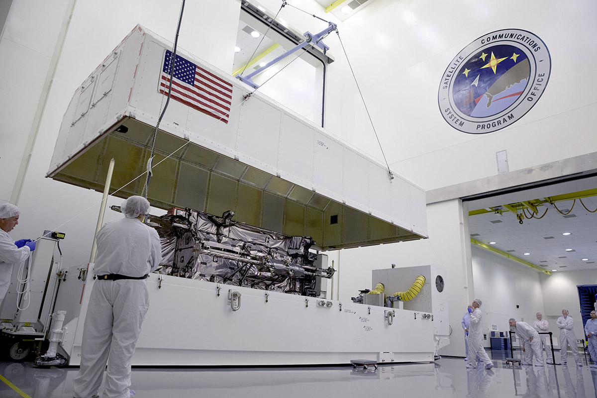
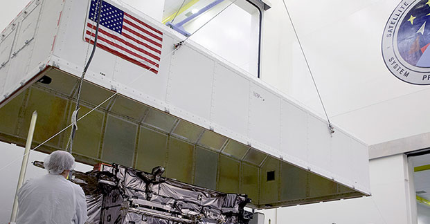
    During the August test, the GPS III Non-flight Satellite Testbed (GNST) proved that it could connect with and receive commands from the Launch and Check Out System.
    During the August test, the GPS III Non-flight Satellite Testbed (GNST) proved that it could connect with and receive commands from the Launch and Check Out System.

    Lockheed Martin Corporation has been awarded $200 million to produce GPS III satellites SV05 and SV06 by the U.S. Air Force. Lockheed Marin originally received funding to procure long-lead parts for satellites five through eight (SV05-08) in February.

    The award is a $200,700,415 cost-plus-incentive-fee modification (P00276) on an existing contract (FA8807-08-C-0010). Work will be performed at Littleton, Colorado, and Clifton, New Jersey.

    Work is expected to be completed by December 14, 2017, for space vehicle 05, and June 14, 2018, for space vehicle 06.

    Fiscal 2013 missile procurement funds in the amount of $200,700,415 are being obligated at time of award. The Air Force Space and Missile Systems Center Contracting Directorate, Los Angeles Air Force Base, California, is the contracting activity.

  • Air Force Directs Early Civil Navigation (CNAV) Message-Populated L2C and L5 Signals

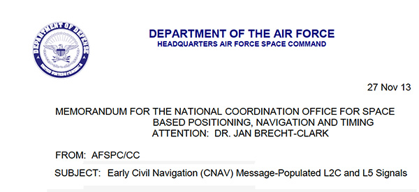
    Photo: CNAV

    The U.S. Air Force is directing transmission of continuous CNAV message-populated L2C and L5 signals starting in April 2014. The move is designed to help development of user equipment compatible with the civil signals. Full text of the CNAV memo appears below.


    MEMORANDUM FOR THE NATIONAL COORDINATION OFFICE FOR SPACE BASED POSITIONING, NAVIGATION AND TIMING

    ATTENTION: DR. JAN BRECHT-CLARK

    FROM: AFSPC/CC
    Peterson AFB CO

    SUBJECT: Early Civil Navigation (CNAV) Message-Populated L2C and L5 Signals

    1. I have directed transmission of continuous CNAV message-populated L2C and L5 signals prior to fielding the Next Generation Operational Control Segment. This provision of populated signals will facilitate development of compatible user equipment and a CNAV Operations Concept.
    2. The message-populated broadcast is projected to begin April 2014. Users should expect initial CNAV signal accuracy to be less than the legacy signals. Upon full implementation in December 2014, CNAV signal accuracy should meet or exceed the legacy signals.
    3. Air Force Space Command is committed to ensuring GPS remains the world’s gold standard for PNT services. The user community can anticipate additional information on CNAV message implementation in the months preceding the initial April broadcast.

    WILLIAM L. SHELTON
    General, USAF
    Commander

  • Topcon Ag Introduces X14 for Entry-Level Guidance

    Topcon Ag Introduces X14 for Entry-Level Guidance

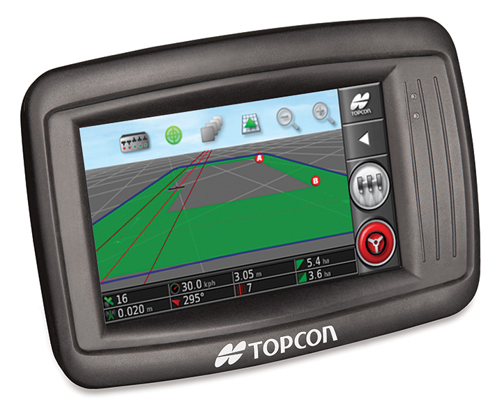
    Topcon's X14 touchscreen display for precision agriculture.
    Topcon’s X14 touchscreen display for precision agriculture.

    Topcon Precision Agriculture is introducing a new 3D color touchscreen display, the X14. The precision farming in-cab display offers entry-level guidance with the look and feel of TPA’s larger, easy-to-use X30 touchscreen console, the company said.

    The 10.9-cm (4.3-inch) full-color 3D touchscreen offers moving map visualization and an on-screen, software-based virtual lightbar. For low-cost guidance, the X14 can be paired with Topcon’s SGR-1 GNSS receiver featuring TruPass technology.

    For high-accuracy autosteering, the X14 can be paired with Topcon’s new AGI-4 GNSS receiver/steering controller, which provides autosteering performance and modular upgradeability to add high-accuracy inertial sensors or RTK correction communication.

    “The X14 offers a simple, icon-based, user-definable interface with a full range of guidance patterns including boundary and U-turn recognition,” said Kevin Cobb, TPA director of product management. “The bright, sunlight readable display offers easy setup on leading market vehicles, and is an outstanding addition to our growing line of innovative, easy-to-use, full-featured color touchscreen consoles.”

  • Father of GPS Brad Parkinson to Deliver Keynote at ENC 2014

    Brad Parkinson
    Brad Parkinson

    Bradford Parkinson, who is known as “the father of GPS,” will give a keynote speech during the opening session of the European Navigation Conference 2014. The conference will be held April 15-17, 2014, in Rotterdam, The Netherlands.

    Parkinson’s speech is titled “Assured PNT – Assured World Economic Benefits.” Representatives of the European Commission, the European GNSS Agency, and the European Space Agency will also present keynotes in the opening program.

    The conference focuses on technology, innovation and business. Special sessions are scheduled on the Galileo IOV, Galileo PRS, alternatives and back-ups to GNSS ,and PNT applications in the various sectors of land, sea and air.

    The conference program will be complemented with an icebreaker party on April 14 at WTC and a conference dinner on board the paddle steamer De Majesteit on April 16. The City of Rotterdam has invited conference delegates to a reception at Rotterdam City Hall on April 15. Accompanying persons are welcome to join these events, as well as the guided walking tour on Tuesday.

    With Easter following the conference, there is a good opportunity to visit Rotterdam, tulip fields, windmills, museums and other attractions in The Netherlands.

    Deadline for abstracts is December 31. Early bird registration is possible until February 15, 2014.


  • Averna DP-360 DOCSIS Protocol Analyzer Supports 16×4 Channel Bonding

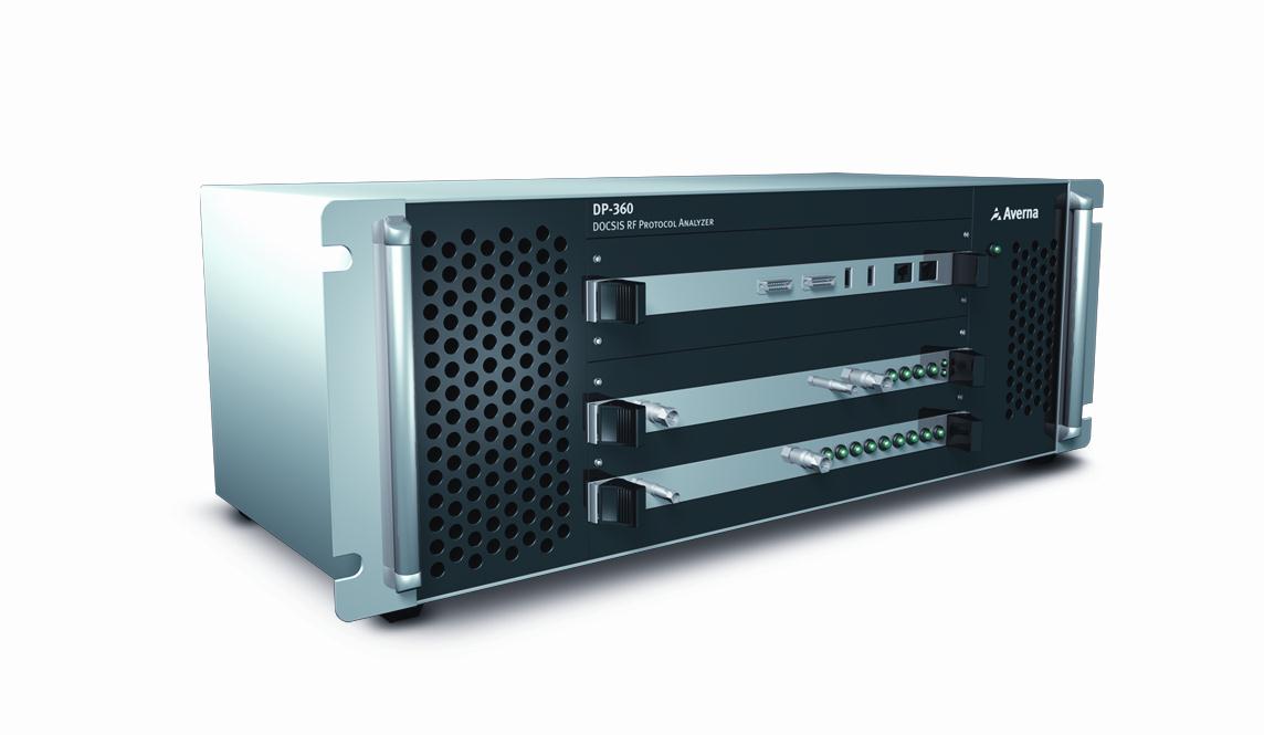
    The Averna DP-360 protocol analyzer.
    The Averna DP-360 protocol analyzer.

    Averna has issued a new software release for the DP-360 DOCSIS Protocol Analyzer, featuring support for 16×4 channel bonding for broadband testing.

    Averna’s DP-360 provides functional DOCSIS and EuroDOCSIS network analysis, allowing for exceptional visibility into all layers of the network, the company said. Multiple system operators (MSOs), chipset manufacturers, product developers and certification bodies use the DP-360 to quickly find and correct trouble spots.

    New DP-360 release highlights:

    • Supports up to 16 single or bonded downstream channels for testing 16×4 configuration.
    • Upstream gain control, MER reading and power reading available in the remote API for automated power adjustment.
    • Automatic detection of modulation type (64-QAM or 256-QAM) and DOCSIS on downstream channels and lock on 4 upstream frequencies for faster setup and analysis.
    • Support for DOCSIS 3.0 Energy Management messages (EM-REQ & EM-RSP).

    DP-360 clients also have access to Averna’s new DOCSIS 3.1 Early Adopter Program, which offers MSOs and equipment vendors a smooth and cost-effective transition to Averna’s next-generation solution for testing their cable equipment based on the new DOCSIS 3.1 standard. Contact us for more details.

    “Our DOCSIS 3.1 Early Adopter Program covers current D3.0 as well as upcoming D3.1 testing needs and is specifically designed to make the technology switch as easy and cost effective as possible for our clients and partners,” commented Alex Pelland, Director of Broadband Test Strategy for Averna. “The DP-360 is the most advanced DOCSIS protocol analyzer available today and, with our forward-looking transition program, it will provide a substantial return on investment for years to come.”

    The new DP-360 software release is available at no cost to customers with a valid DP-360 maintenance and support agreement.

  • skobbler Updates GPS Navigation App for iOS 7

    skobbler has launched a new version of GPS Navigation optimized for iOS 7. The app now includes a travel guide, hyperlocal search, and mapping technology provided by skobbler’s NGx map engine.

    Powered by data from the OpenStreetMap — a free and editable map of the world built by over 1 million voluntary contributors and map enthusiasts — GPS Navigation delivers true “hybrid” functionality, allowing users to switch between online or optional offline access through in-app purchases of downloadable maps, regardless of location or cellular connection, skobbler said.

    Offline functionality allows for fast and reliable results using only a device’s GPS receiver rather than a network connection, meaning turn-by-turn navigation, alternate routing and various search capabilities are provided in full without a data connection.

    GPS Navigation now features a comprehensive in-app travel guide and hyperlocal search via Wikitravel — which provides users with more than 90,000 pages of worldwide travel information in the English language alone — and TripAdvisor integrations.

    Much like GPS Navigation’s online-offline mapping functionality, users can also access travel guide information with or without Internet connectivity, allowing access to the app’s travel features without roaming charges by opting for offline usage.

    GPS Navigation is available for a one-time purchase of $0.99 via the iTunes App Store.

  • Proteus Provides Satellite-Derived Bathymetric and Seafloor Maps for Military Exercise

    Proteus FZC, a provider of satellite-derived mapping solutions, has delivered accurate bathymetric and seafloor classification maps for a joint UK-France amphibious military exercise on the Island of Corsica. In the pilot managed by the UK Hydrographic Office (UKHO), Proteus partnered with DigitalGlobe to derive accurate bathymetric measurements and identify four seabed types to a depth of 12 meters from multispectral satellite imagery without ground control.

    “We completed the Corsica coastal marine mapping project at about one-tenth the time and cost of traditional sonar or LiDAR,” said Proteus CEO David Critchley. “Because the data is derived exclusively from satellite imagery, we leave no environmental footprint and face no airspace restrictions.”

    For the joint military operation, the British and French armed forces requested detailed information about water depth and the submerged seabed along specific sections of the Corsican coastline so that amphibious military vehicles could be launched from larger vessels anchored offshore and safely landed on the island’s beaches. The custom maps created by Proteus were used by the military to select precisely where the landings would occur.

    “The vertical accuracy of our bathymetric maps was verified at 10-15 percent of water depth,” said Critchley. “If ground truth data were available, the measurements would have been accurate to a solid 10 percent of depth.”

    Working with eight-band multispectral image data with two-meter resolution collected by DigitalGlobe’s WorldView-2 satellite, the Proteus-led team achieved the bathymetric measurements in Corsica’s Mediterranean coastal zone to a total depth of 12 meters. In a separate processing procedure, the team also extracted four critical seafloor types from the imagery – sand, rock/debris, vegetation and mixed seabed.

    Since 2011, Proteus has been producing seafloor survey and seabed classification projects using multispectral satellite imagery. The product generation technology that can be carried out in a fraction of the time and cost of traditional methods. These mapping projects have been delivered for environmental, oil and gas, marine biology and other coastal zone applications in Europe, the Middle East and Caribbean. Derived products have high accuracy, meeting the requirements of engineering, environmental monitoring and strategic geospatial planning applications.

    The project was written up in the January/February 2013 issue of Hydro International magazine.

  • Meitrack Offers MT90 Personal Tracker

    Meitrack Offers MT90 Personal Tracker

    The Meitrack MT90.
    The Meitrack MT90.

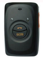
    GPS tracking company Meitrack is offering the MT90, a GPS personal tracker for elderly, children, patients and lone workers. It can be hung around the neck or carried in a pocket or bag. The MT90 weights 65 grams and is 77 x 47 x 20 millimeters in size.

    The MT90 can last 16 hours in normal mode and up to 60 hours in power-saving mode. It is waterproof to IP66 standards, and can handle 5% to 95% air humidity, which ensures it is reliable in the case of unexpected rain or accidents with small children.

    MT90 is Meitrack’s first GPS tracker that works with SiRFStar IV GPS and quad band GSM 850/900/1800/1900 Mhz base station, facilitating bi-module positioning technology. Using this advanced technology, the MT90 can more accurately and precisely track its location.

    Equipped with an SOS button, people using the MT90 tracking device are only one click away from calling the Rescue Service Center for help. In addition, the SOS button can be programmed to call multiple emergency numbers until one picks up. This device can facilitate two-way communication along with the option to listen-in, which can be helpful when discretely trying to locate a missing person.

    The MT90 GPS tracker uses Meitrack’s protocol to track by SMS and GPRS. The MT90 has an built-in motion sensor, built-in battery, GPS blind area alarm, low-battery alarm and speeding alarm.

  • Galileo Achieves First Airborne Tracking

    Galileo Achieves First Airborne Tracking

    Aircraft position as obtained by Galileo-only receiver during Netherlands flight.
    Aircraft position as obtained by Galileo-only receiver during Netherlands flight.

    The European Space Agency’s Galileo satellites have achieved their first aerial fix of longitude, latitude and altitude, enabling the inflight tracking of a test aircraft. ESA’s four Galileo satellites in orbit have supported months of positioning tests on the ground across Europe since the first fix in March.

    Now the first aerial tracking using Galileo has taken place, marking the first time that Europe has been able to determine the position of an aircraft using only its own independent navigation system. The milestone took place on a Fairchild Metro-II above Gilze-Rijen Air Force Base in the Netherlands at 12:38 GMT on November 12. It was part of an aerial campaign overseen jointly by ESA and the National Aerospace Laboratory of the Netherlands, NLR, with the support of Eurocontrol, the European Organisation for the Safety of Air Navigation, and LVNL, the Dutch Air Navigation Service Provider.

    A pair of Galileo test receivers was used aboard the aircraft, the same kind employed for Galileo testing in the field and in labs across Europe. They were connected to an aeronautical-certified triple-frequency Galileo-ready antenna mounted on top of the aircraft.

    Fairchild Metro-II aircraft used for Galileo airborne testing.
    Fairchild Metro-II aircraft used for Galileo airborne testing.

    Tests were scheduled during periods when all four Galileo satellites were visible in the sky – four being the minimum needed for positioning fixes. The receivers fixed the plane’s position and, as well as determining key variables such as the position, velocity and timing accuracy; time to first fix; signal-to-noise ratio; range error; and range–rate error.

    Testing covered both Galileo’s publicly available Open Service and the more precise, encrypted Public Regulated Service, whose availability is limited to governmental entities.

    Flights covered all major phases: take off, straight and level flight with constant speed, orbit, straight and level flight with alternating speeds, turns with a maximum bank angle of 60º, pull-ups and push-overs, approaches and landings.

    They also allowed positioning to be carried out during a wide variety of conditions, such as vibrations, speeds up to 456 km/h, accelerations up to 2 ghorizontal and 0.5–1.5 gvertical, and rapid jerks. The maximum altitude reached during the flights were 3000 m.

    NLR’s Fairchild Metro-II has previously performed initial European GPS testing in the 1980s, and the first tests of the European Geostationary Navigation Overlay Service, EGNOS, which sharpens GPS accuracy and monitors its reliability over Europe for high-accuracy or even safety-of-life uses.

    The definition and development of Galileo’s in-orbit validation phase were carried out by ESA and co-funded by ESA and the EU.

    The Full Operational Capability phase is managed and fully funded by the European Commission. The Commission and ESA have signed a delegation agreement by which ESA acts as design and procurement agent on behalf of the Commission.