Loctronix Corporation, a provider of unified positioning solutions for GNSS-challenged environments, announced that it has begun shipments of its new software-defined radio (SDR) module, the ASR-2300, for developing high-performance positioning, navigation and timing (PNT), and communication applications.
“The ASR-2300 delivers advanced SDR capabilities in a small, mobile form-factor enabling developers to readily create and field complex SDR-based solutions. Featuring a 2×2 multiple-input, multiple-output (MIMO) RF transceiver and an array of inertial sensors, the open-source ASR-2300 is an ideal platform for tapping advanced, multi-sensor/signals of opportunity for high-performance PNT,” said Michael Mathews, Loctronix’ CEO and founder.
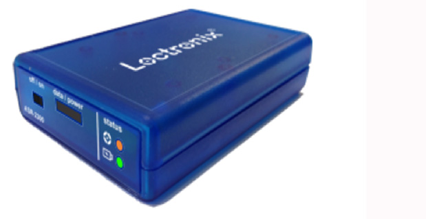
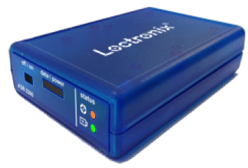
Loctronix ASR-2300 kit.
“Unique amongst the growing number of SDRs, Loctronix’ ASR-2300 provides multiple, fully-integrated RF paths supporting reception of GNSS, cellular, ISM band, and UHF signals of opportunity, making it well-suited for demanding scientific, military, aerospace and commercial/industrial applications, such as UAV/UAS navigation, GPS-challenged or -denied tracking and navigation, combined communications and navigation radios, and GPS integrity monitoring and validation,” Mathews noted.
The MIMO transceiver module incorporates two wideband Field Programmable RF (FPRF) transceivers (300 MHz to 3.8 GHz), 10-axis accelerometer/gyro/compass/barometer sensors, and a large programmable FPGA capable of over 300 MiB/sec sustained communications with a host processor via USB 3.0 interface. The module’s nine integrated RF path options and low size, weight, and power characteristics contribute to ease of integration and portability, Loctronix said. Accommodating both internal 1 PPM TCXO or external frequency reference, multiple ASR-2300s can be inter-connected via an expansion port and/or UART interface, supporting real-time reception / transmission of 4, 6, 8 or more signals without the need for significant additional hardware.
Developers looking to create solutions for demanding military, scientific and industrial applications will realize greater functionality with the ASR-2300, thanks to its multiple sensor and multiple frequency capabilities, Loctronix said. Additionally, access to a variety of user-friendly development tools facilitates waveform experimentation and helps speed the creation of these new solutions, resulting in shorter development times and lower development costs for high-performance PNT applications.
Bundled kits, which include the module, housing, and power/data communications/RF interfaces, are priced at $1,600 with a special educational discount available for qualified institutions. The ASR-2300 SDR is available directly from Loctronix.
In recent years, we’ve seen explosive growth in the Unmanned Air Vehicle (UAV) market segment, with most on-board navigation systems relying on GNSS or GNSS with inertial aiding. As military budgets decline, interest in civilian commercial applications is growing rapidly. The U.S. Federal Aviation Administration (FAA) recently awarded special type certification to two UAVs for commercial Arctic operations and released a Roadmap for UAV certification. The industry is now poised for the opening of the regulation floodgates to address a growing commercial demand.
On November 21, I hosted a GPS World webcast where industry leaders in GNSS-based navigation for UAVs, for both military and civilian sectors, presented what they are doing in UAV navigation and how they see this exciting market unfolding. A record number attended; for those who were unable to attend, here’s an overview of the GPS WorldUnmanned Aircraft Navigation webinar, with answers to questions posed at the end of the article. You can still view the entire presentation through GPS World’s Webinar page.
The presenters:
Olivier Casabianca, Business Area Manager of the Trimble GNSS OEM portfolio, which includes both the Trimble and Ashtech receiver module product lines.
Eric Brewer, Senior Systems engineer for Rockwell Collins. He develops and tests guidance, navigation, and control algorithms for unmanned and optionally piloted aircraft.
Neil Gerein ofNovAtel, responsible for the navigation warfare product lines, including the GPS anti-jam antenna and SAASM receiver used on unmanned vehicle systems.
Hal Adams, Accord Technology, Chief Operating Officer, and founder of AvValues LLC, which is partnered with Accord Software & Systems, Bangalore, India.
Howard Loewen, president of MicroPilot, which supplies single-board, fully integrated UAV autopilots, ultra lightweight autopilots, and triple redundant UAV autopilots.
Trimble has a wide product line with many applications in UAVs. Its receivers are multi-constellation and multi-frequency with low power and small form-factor. High-precision modules can also use Omnistar precise point positioning (PPP) aiding, have multiple external interfaces, and can provide precise heading and attitude.
Some of the UAV solutions presented include moving baseline (relative) RTK between UAVs, and “swarms” of UAVs, autonomous landing and autonomous refueling between UAVs.
Autonomous landing.
Autonomous refueling.
Precise positioning and attitude.
Other applications include precise positioning and full GNSS attitude, and of course the Applanix line of inertial aiding sensors is a key element for aiding and GNSS-denied environments.
With the recent release of the FAA Roadmap for UAV certification and integration into the National Airspace System (NAS), our experts were asked to give us their views on what this means for the industry. Olivier Casabiance highlighted the FAA Modernization and Reform Act, which calls on the FAA to integrate UAS (Unmanned Aircraft Systems) into the NAS by September 2015, and extensive U.S. and European committee activity to develop standards — all leading to a requirement that GPS/GNSS navigation systems for UAVs may need to be FAA TSO (Technical Standard Order) qualified, just as they are now for manned aircraft.
This coming requirement will make extensive use of ADS-B (Automatic Dependence Surveillance Broadcast) and certified receivers, such as the Trimble/Ashtech SkyNav GG12W receiver, which is FAA qualified/certifiable, with firmware developed to RTCA DO-178B level B standards, hardware to DO-208, and meeting DO-217 special category 1 landing requirements.
SkyNav GG12W receiver.
Unmanned aircraft application.
Eric Brewer then presented Rockwell Collins’ Controlled Technologies products and outlook on unmanned aircraft. Rockwell acquired Athena Technologies some time ago, which specializes in autopilots for unmanned aircraft. Athena is the Center of Excellence for Rockwell Collins in guidance, navigation, control, and estimation technologies. Athena solutions combine GPS-coupled inertial navigation system (INS), air-data sensing, and flight-control computing. Various levels of inertial sensor performance are available with a number of analog/digital interfaces and appropriate levels of hardware environmental qualification. With single string and triplex solutions, this product family has amassed more than one million flight hours in operation. Athena also supplies a range of mission computers which are used with these autopilots.
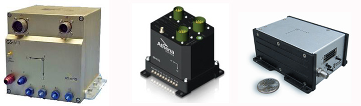
Athena autopilots.Athena mission computers.
One of the principle UAS applications for this system is on the Navy’s Small Tactical UAS (Boeing/Insitu Scan Eagle) system, where Rockwell provides the GPS SAASM-RTK (Precision RelNav) System.
STUAS capture.Airborne anti-jam.
Each system consists of both base-station and airborne modules integrating the Rockwell 24-channel all-in-view tracking and navigation L1/L2 SAASM P-code GPS receiver (MPE-S Type II), with an external processor running custom RTK software. It provides better than 20-cm (1 sigma) 3-D relative position accuracy for a baseline of up to 30 km. Rockwell also has a number of GPS “hardening” anti-jam solutions for both airborne and missile applications.
Looking ahead, Rockwell sees reduced growth in the UAS domestic military markets and a potential split in UAS development roadmaps. Larger higher reliability, higher complexity systems may move toward NAS integration and FAA compliance, while significantly smaller and cheaper systems may end up restricted to applications outside the NAS.
Neil Gerein provided an overview of NovAtel’s receivers and capabilities, and highlighted some of NovAtel’s UAV applications. NovAtel’s OEM6 series of receivers comes in a number of different configurations with comprehensive support for all current and upcoming GPS, GLONASS, Galileo and BeiDou satellite signals.
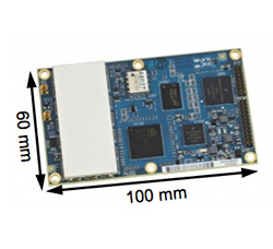
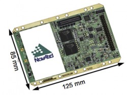
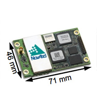
OEM 628 – three-frequency GNSS.
OEM 638 – three-frequency GNSS, 240 channels.
OEM 615 – dual-frequency GNSS.
These receivers find (or could find) applications in UAV precision landing, payload sensor positioning, and civil anti-spoofing. And the OEM625S SAASM receiver combines civil L1/L2 GPS (including GLONASS and Galileo) with the L-3 IEC XFACTOR SAASM capability for military UAV precision navigation and landing.
Align heading generates high-precision heading and pitch angles between two receivers for real-time navigation for rotary-wing aircraft, enabling precise capture into nets and for other retrieval/capture systems. Align relative positioning generates a high-precision 3-D vector between two or more mobile receivers for high-precision monitoring and automation.
NovAtel also has the SPAN line of GPS/Inertial solutions, which may be used on UAVs for intelligence, surveillance, target acquisition, reconnaissance, airborne mapping, and shipboard landings. The GAJT-AE compact null forming electronics for UAS and other small platforms provides protection of GPS L1 and L2 from interfering sources and works with a variety of four-element antenna arrays enabling flexible installation options.
GAJT-AE anti-jam system.
Gerein thinks that UAV growth has been largely due to affordability and ease of use, and allowing UAVs to have regular access to the NAS will create even more growth. The existing FAA timelines are aggressive, considering the number of interested parties, so equipment suppliers should work closely with FAA to ensure that the level of certification is appropriate for the safety of the public, while remaining affordable and practical so that the industry is not stifled.
Next, Hal Adams from Accord Technology gave his views on navigation for UAVs. Accord Technology has its base in Phoenix, with facilities in Anchorage, Alaska, while the principle R&D base is in Bangalore, India. The Accord NexNav receiver is airborne-qualified and is sold as an end-item enclosure and as a receiver board, and the NexNav-mini variant is sold as a receiver card for OEM integration.
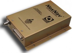
NexNav receiver enclosure.
NexNav OEM receiver.
NexNav mini OEM receiver.
These receivers are qualified to RTCA DO-178B software and DO-254 hardware and meet FAA TSOA (C145c) requirements. So they are already at the required standard for manned (GA) aircraft use — integrators wishing to move towards FAA compliance may be able to reduce the work to meet vehicle certification requirements by incorporating receivers such as these in their UAVs.
Adams reviewed the FAA’s plans to implement ADS-B throughout the U.S., and indicated that all aircraft operating in the NAS will be required to equip and use ADS-B by 2020. The FAA is rolling out the ADS-B ground infrastructure, and air-traffic operations are already underway using ADS-B in Alaska. ADS-B requires an approved GPS source meeting FAA AC 20-165A providing it with the necessary data — and the NexNav products apparently already meet this requirement.
As far as where the FAA is going on UAVs and how regulations will affect them, Adams related statements from the FAA that UAVs, “Must be as safe as manned aircraft, including systems.”
He felt, therefore, that UAS will have to comply or operate separately, outside of the air-traffic system. UAVs wishing to operate in the NAS will likely have to be certified and approved by the FAA to NextGen standards. NextGen is the next-generation Air Traffic Control system under development by FAA.
Finally, Howard Loewen,president of MicroPilot, provided insight into MicroPilot’s UAS products, the company’s use of GNSS, and how it sees things evolving. MicroPilot has been around since 1995, so it has already watched the UAS market evolve. MicroPilot develops and fields autopilots for manned and unmanned aircraft using GPS in a number of different configurations, including consumer-level GPS, carrier-phase RTK, and moving baseline RTK.
Consumer GPS.
RTK.
Moving baseline RTK.
UAVs have a number of challenges to overcome — RF frequency allocations for control links, privacy concerns, meeting security and regulatory requirements, incorporating airborne standards into their development, developing “see-and-be-seen” (sense and avoid) technology, and competing with existing manned aircraft capability for their business. Loewen made some interesting comparisons between the use of UAVs and that of (manned) Cessna operations. While a Cessna payload can be significant, there are few flight restrictions and the technology is mature. UAVs are relatively immature and have both payload and flight restrictions. The market will have to decide if the potential for lower UAVs operating costs will be enough to win out.
Nevertheless, Micropilot is already preparing for the requirements of FAA certification for UAS autopilots and has developed hardware and software verification/validation tools.
Loewen sees pluses and minuses for UAVs in the future – FAA selection of UAS test sites will continue to be delayed, standards will begin to emerge from European efforts to integrate UAS into their airspace (maybe sooner than in the U.S,?), small UAS (sUAS) will continue to be popular in areas of the world where regulations have yet to be put in place, and there is even the possibility that the FAA may back off trying to control sUAS (because of the commercial volume?), that large UAS such as the Predator will provide no advantage over Cessna-type manned aircraft, and that the FAA will continue to delay regulations as it concerns itself over details that may not seem to be totally relevant — like the “cockpit door” issue highlighted in the recent FAA Roadmap.
There was a great deal of interest from a large audience for the webcast, and we received a number of questions before and during the webcast. Our experts did their best to provide answers wherever possible, and this Q&A is presented at the end of this article.
Overall, we seem to have covered a lot of ground in the webcast on UAV navigation – providing an insight into both existing capabilities and how some key industry leaders see the future unfolding. Almost every day there are new and interesting developments – I’m sure by now we’ve all seen the video clips from 60 Minutes and how Amazon demonstrated delivery within 30 minutes using small UAVs to pick up packages at their distribution plant and deposit them on the buyer’s doorstep, and of course the potential delivery of hot pizza right to your door.
Let’s see if some of this stuff sticks and we can actually make this sort of progress safely, usefully and efficiently.
Tony Murfin
GNSS Aerospace
Webinar Q&A
Here are some brief responses for questions received. Questions were submitted during the webinar by the audience, and answered post-webinar, in writing, by the panelists and moderator. The views expressed are those of the authors and are not necessarily supported by GPS World.
Q:What are the safety consequences for self-navigating, self-separating unmanned aircraft?
A: No rules yet published, but expected that UAS will be required to meet the same flight regulations as manned aircraft.
Q: We have light rail and buses. Is any company, agency one planning on using this technology to monitor these type of vehicles movements for security, prediction arrival, etc.?
A: This is a typical application for UAS — not aware of any current operations like this
Q: Could we use UAVs to survey bird species that go every year to the same spot to breed? I am thinking specifically on Greater Sage-Grouse.
A: This is a typical application for UAS – several wild life monitoring operations already exist
Q: I was told by a UAV manufacturer that they are not illegal if you fly below 400′. Is that true?
A: No UAS rules yet, but someone was just indicted by FAA for ‘buzzing’ building at low altitude in New York.
Q: What are the rules for the use in the private industry?
A: Rules being developed by FAA for civil operations — U.S. Congress has set deadline for integration of UAS into civil airspace by September 2015. FAA just published a “Roadmap” for how they see this process going forward.
Q: Why should general aviation pilots not be concerned about UAV collisions?
A: Rules are needed for the operation of UAS in civil airspace & these are expected to be equivalent to those for General Aviation aircraft.
Q: Is machine learning the most significant part of the UAN?
A: Do you mean UAS? Not really – most systems are pre-programmed and well defined. For use in civil airspace all systems on an aircraft need to be fixed and pre-qualified and approved – no room for changes in or-board systems.
Q: What are the flight rules in Alaska near airports or military controlled airspace for UAVs?
A: GPS and other GNSS basic unaided accuracy is several meters, with PPP or L-Band satellite corrections we get close to 1 meter and with Real Time Kinematic we can get a few centimeters. Risk (?) is always a good question, but that’s what the FAA and other certification/regulation agencies are there to ensure that risk is minimized. People have been using GPS/GNSS for over 20 years, and there are very few incidents of systems failures, rather temporary loss of signal, or degraded accuracy. This is why manned aircraft which use GPS have back-up systems and UAS will need similar redundant systems.
Q: What is the application of mUAS for agriculture and surveying?
A: Lot of activity in high precision surveying using UAS is already underway. Crop spraying using helicopter UAS has been in use in Japan for many years – its expected use will grow exponentially in these areas when there is open access to airspace.
Q: What FAA regulations prevent organizations from flying at low elevations, if any?
A: No rules yet published, but expected that UAS will be required to meet the same flight regulations as manned aircraft. There is a chart in Accord’s briefing showing the layout of NAS with the ADS-B requirements.
Q: How do payload applications access GNSS data, Position, Navigation, Timing, and utilize the precise 1PPS for synchronization if the Navigation function is NOT to be compromised?
A: Payload applications and the navigation function typically use separate GNSS receivers to ensure the navigation function is not compromised. Actually, for manned aircraft ADS-B, per FAA the ADS-B GPS source must meet AC 20-165A and can be independent of nav functions, including GPS based navigators. FAA will know “exactly where the platform is “lost” and to a high degree of confidence.”
Q: GPS spoofing has been demonstrated by the University of Texas as an effective means to redirect a drone aircraft. What is the industry doing to protect against command/control & navigation hijacking?
A: UAVs operated by the US Government and Allied Forces can use SAASM receivers to protect against spoofing. For civil user, multi-GNSS receivers with positioning backups such as inertial technology are also effective against spoofing attacks.
As mentioned above, a SAASM is the best way to prevent spoofing. Jamming is also of particular concern, and Antijam GPS technology is a good way to mitigate the effects of jamming.
Q: What is the best technology to pursue as a backup to GPS? (e.g. D-LORAN, Magnetic Field Nav., Cell Tower Triangulation, etc.)
A: GNSS+Inertial is a way to backup GNSS only in GNSS denied environments. Could be use to augment the information (heading / attitude on top of position) or for continuous positioning…
Procedures are the primary back-up for manned aircraft. If I loose transponder or comms, etc., there is a procedure for operations in those events. If I loose comms the FAA increases separation, clears airspace, etc., to help insure no conflicts. UAS will likely have to have some mitigation like manned procedures. Of course, with a person on the flight deck, it is a somewhat different. I think there will have to be new considerations, like lose of link to the UAS and alternative on the platform and with the NAS manager (ATC). If a pilot looses consciousness on the flight deck, it is kind of like a UAS loosing the command link. So, what happens with person on flight deck if that person cannot operate the aircraft? Seems problematic to resolve or mitigate.
This is a hot topic of research. Some current solutions include using Magnetometers and Deduced Reckoning (i.e. using a wind estimate and airspeed measurements). There is also research into using image-based navigation (there are some details about this in Rockwell slides).
Q: Could be GNSS a stand-alone sensor for navigation, and what is the GNSS coverage above 80 N/S parallel?
Actually, during GBAS International Working Group session in Seattle this summer there were a couple of presentation regarding ionospheric effects on GNSS which seem to support the following statement:
Challenges for GNSS in the Arctic
For GNSS, presently GPS and GLONASS but in the future also for Galileo, the performance in the Arctic region is reduced compared to the performance obtained by users at mid-latitudes. The reasons are mainly the satellite-receiver geometry and the ionospheric effects on the satellite signals, but also users do not have the benefits of satellite based augmentation systems (SBAS) at a larger scale.
Q: el % de errores y eficases de estos, y si en poco tiempo podrian activarse y desaptivarse automaticamente segun sea el caso
A: We didn’t have any Spanish speakers, but this is our best-guess answer. Most GNSS receivers have some form of Receiver Autonomous Integrity Monitoring (RAIM) and airborne systems need to conform to Minimum Operational Performance Standards (MOPS), which define error rates for all known situations.
Q: Which industries will see the greatest increase in usage of unmanned systems once the FAA opens up regulations for integrating unmanned aerial vehicles into society?
A: Its likely that the most intense civilian applications of UAS have yet to be invented. But we do know that crop & pipeline monitoring, precision and non-precision surveying, flying-camera applications for all forms of news and security, potential package delivery, and even vehicle traffic monitoring are popular applications waiting for more open access to airspace.
Q: Per the FAA’s recently released Civil UAS Roadmap, what exactly constitutes a “small UAS (sUAS) with very limited operational range?”
A: It seems that the FAA has yet to publish regulations which would define sUAS. These apparently have been drafted and are still under consideration by FAA.
Q: Per the FAA’s recently released Civil UAS Roadmap, what exactly constitutes a “small UAS (sUAS) with very limited operational range?”
A: The FAA has yet to publish regulations which would define sUAS. These apparently have been drafted for some time and are still under consideration by FAA.
Q: What is the risk of the aircraft crashing due to a last minute wind gust as it approaches the wire (referring to the Rockwell Collins product used to land the UAV on the wire on the ship)?
A: The safety is evaluated through both simulation and flight testing. The wind gust disturbance rejection is a primary constraint, and the operational envelope (wind envelope, ship motion, wind over deck, capture speed) is selected to ensure that risks are maintained at acceptably low levels.
Q: Question for all: Can any of these products produce primitive data (pseudorange, carrier phase) prior to demodulation of an ephemeris. (We are looking for the fastest possible acquisition time.)
A: Yes, we (Rockwell Collins) have products available which can output uncorrected pseudorange and carrier phase before receipt of ephemeris data. Feel free to email me for more details.
Q: Have any of these products been used in missile range-safety applications? (Missile = BIG UAS)
CoreLogic released its annual Natural Hazard Risk Summary and Analysis detailing the most significant natural disasters that struck the United States in 2013. The report provides an analysis of the impact of hurricane, flood, tornado, wildfire and sinkhole events over the course of the year, as well as a summary of potential risk from natural hazards in 2014.
Compiled by CoreLogic hazard scientists, the report summarizes the property and structure, geographic and financial impact of natural disasters across the U.S. over the course of the year.
“Many predicted that 2013 would be a record year of catastrophic destruction, but the number of natural disasters that typically cause widespread destruction, mainly hurricanes, wildfires and tornadoes, were far less than anticipated and in comparison to last year’s record-setting hazard seasons,” said Dr. Thomas Jeffery, senior principal scientist for CoreLogic. “Interestingly, one natural hazard that tends to receive very little attention took center stage in 2013 as three separate sinkhole catastrophes took place in Florida. Though massive damage and loss of life from sinkholes is uncommon, this year’s events were large enough disasters to draw significant media coverage, raising public awareness of the true risk associated with this often-overlooked hazard.”
Among key findings, the CoreLogic 2013 Natural Hazard Risk Summary and Analysis notes:
Hurricane
• There was little hurricane activity in 2013. With only 13 named storms, just two reached hurricane classification and hurricane totals were both lower than pre-season predictions and disproportionately lower than previous hurricane seasons dating back to 2003.
• None of the storms in 2013 had a direct impact on the U.S., and as such, there was relatively minor damage related to Atlantic storms.
• The first official hurricane of the year, Hurricane Humberto, formed on September 11, just three hours short of setting the record for the latest formation of the season’s first hurricane.
Flood
• Flooding in the U.S. was moderate compared with recent years, partly due to the low number of Atlantic storms and the related coastal flooding. National flood losses for 2013 are expected to total approximately $2 billion.
• The most significant flooding event of the year was a September storm in Boulder, Colorado, which caused the damage or destruction of more than 19,000 homes and resulted in record-setting levels of precipitation and flooding affecting 17 Colorado counties.
• To identify the metropolitan areas located in transitional areas between high and low elevations and therefore at risk for catastrophic flood events, CoreLogic developed the first National Catchment Slope Map in 2013, illustrating the structural hydrology of the U.S. landscape.
Tornado
• Total tornado activity in 2013 was at a historic low, with 229 fewer tornadoes than any year in the past decade as of October 25. Nonetheless, the severity of numerous Oklahoma storms and an unusually violent wave of late-season storms affecting 12 states in the Midwest were no less catastrophic.
• Following three days of storms with numerous tornado sightings, on May 20 an EF5 tornado swept a 17-mile path through Moore, Oklahoma, killing 23 people, injuring 377 others, and causing an estimated $2 billion in damage.
• The widest tornado ever recorded, 2.6 miles at its widest point, struck El Reno, Oklahoma in early June, resulting in eight fatalities and nearly $40 million in damage.
Wildfire
• The number of wildfires and total acreage burned in 2013 were lower than both the 2012 season and the 10-year average. Excluding California, Colorado, Idaho and Washington, which perpetuated their 10-year average in terms of acreage affected, the Western states saw dramatically lower wildfire activity than in recent years.
• Several individual fires caused massive destruction, including Arizona’s Yarnell Hill Fire, which destroyed 8,400 acres and 129 homes, and Colorado’s Black Forest Fire, which burned 14,000 acres and destroyed or damaged over 500 homes and resulted in a total property loss expected to exceed $300 million.
• The Rim Fire, on the outskirts of several densely populated communities approximately 100 miles east of San Francisco, was the third largest fire in California state history, destroying only 11 homes but burning over 257,000 acres, including much of the Stanislaus National Forest and Yosemite National Park.
• Probable increase in fuel load in wildfire areas, as well as persisting drought conditions in California, Nevada, Arizona, New Mexico, Texas, Utah and Colorado, indicate potential for increased wildfire risk in 2014.
Sinkhole
• Three unusually severe examples of sinkhole activity in Florida captured public attention in 2013. A sinkhole in Seffner, Florida caused a tragic death in March when it formed underneath a man’s home. A tourist villa was heavily damaged when a 100-foot sinkhole formed near Clermont, Florida, and a 90-foot wide by 50-foot deep sinkhole resulted in the collapse of two homes in Dunedin.
• The CoreLogic sinkhole database currently recognizes 23,000 identified sinkholes, suggesting that sinkhole activity and subsequent property damage will continue to be a substantial risk across the nation and for Florida residents in particular.
“Though there have been fewer billion-dollar catastrophes over the course of 2013, history has demonstrated time and time again that a temporary reprieve from natural disasters cannot and should not be expected to continue into the future,” said Jeffery. “Going into 2014, it’s important to remember that hazard-driven property damage and loss can and does occur each year, and with the cyclical nature of some of these events, this year should be considered fair warning that next year will likely see a return to the higher average numbers of damaging natural disasters.”
According to the announcement, CoreLogic generated findings for the Natural Hazard Risk Summary and Analysis using the company’s comprehensive parcel database and natural hazard risk analytics, as well as data from reputable sources, such as the National Climatic Data Center, NIFC, EQECAT, Inc. and the National Weather Service.
For a copy of the 2013 CoreLogic Natural Hazard Risk Summary and Analysis, which includes maps, charts and images, click here.
Reportstack has announced a new report on The Global Military GPS/GNSS Market 2013-2023. This report offers the reader detailed analysis of the global military GPS/GNSS market over the next 10 years, alongside potential market opportunities to enter the industry, using detailed market size forecasts, Reportstack said.
A satellite navigation system provides GPS positioning from a global perspective, and is therefore of utmost importance for modern-day military operations, which rely on accurate real-time data on hostile forces in order to carry out precision attacks, Reportstack said. It is here that GPS/GNSS devices assume an important role, as they are imperative to transfer signals from these satellites back to earth.
The U.S. is the highest spender on military GPS/GNSS navigation, and is responsible for 42.9% of the global military GNSS devices market. Others major spenders in this sector include Russia, the UK, China and India. In July 2013, India launched the IRNSS-1A, the first of seven satellite constellation to be deployed under the Indian Regional Navigation Satellite System (IRNSS) program to be completed between 2015-2016. And China’s BeiDou is scheduled to be operational by 2020.
Another factor driving the market is the integration of satellite navigation technology with other navigation systems, such as the inertial navigation system (INS) and gyro, as GPS devices are to be used in order to decipher data correctly, Reportstack said.
The increasing demand for satellite navigation and communications is driven primarily by the desire of militaries to monitor more areas and derive accurate information by a range of GNSS receivers/sensors in the shortest time possible. Major military aircraft and helicopters are dependent on GPS embedded INS systems for effective navigation. Similarly, naval vessels and guided munitions are increasingly relying on the collaboration of laser, gyro, INS, and satellite navigation technologies to derive accurate real time data.
Furthermore, it has been observed that the usage of standard positioning services/open service receivers, which use unencrypted signal for non-combat purposes has increased, and is expected to drive demand and encourage expenditure, Reportstack said. The military GPS/GNSS technology is expanding its horizon beyond the basic characteristics of navigation and tracking. The use of GPS, in conjunction with a number of software applications, has expanded its use in military operations. A number of new technologies are now embedded with GPS receivers to produce a more sophisticated military tool.
Recently, a Swiss-based company developed a device called GPS Log Book based on u-blox technology. The new device has extended the scope of GPS technology to the administrative side of military operations. It provides an easy way for military drivers to automatically keep an accurate travel log book which can be securely accessed later from anywhere via a web interface. Information logged includes route, speed, and distance traveled. It also keeps a close record of fuel used by the vehicle, based on the distance traveled at various speed levels.
The advent of Differential GPS (DGPS), an enhancement to GPS, which provides improved location accuracy, from the 15-meter nominal GPS accuracy to approximately 10 cm, has further expanded the scope of GPS in missile technology. The intercontinental ballistic missiles, which are capable of hitting targets across thousands of miles navigation, use inertial navigation with DGPS receivers. The advent of DGPS is expected to be one of the most significant steps in accurate missile targeting for militaries across regions.
The companies mentioned in this report are Northrop Grumman, Raytheon, Rockwell Collins , Lockheed Martin, ITT Exelis, Thales, and BAE Systems. More details and table of contents about this report can be found by visiting The Global Military GPS/GNSS Market 2013-2023 report.
Remembering a Time before GPS — and a Lifelong Friend
One of my oldest and best friends died today – and he was just a kid, only 62. In the prime of his life, and yet I know he led a very full life and had no regrets when he passed on to that highway in the sky — somewhere where he will hopefully not have to ask directions, because neither one of us was very good at that. Indeed, in our youth, both Gordy and I were GPS-challenged long before GPS was a gleam in Dr. Parkinson’s eye.
I first came across Gordon F. Oates, Jr., and his future wife Valerie at a private media party more than 40 years ago. Gordon was the nephew of Warren Oates, the famous actor — who was a regular on the Gunsmoke and Rawhide westerns in the late 1950s — black and white television ring a bell? Warren Oates was certainly known to have a wild streak in him. As I grew to know Gordy, I always suspected he inherited a bit of Warren’s independent DNA. But I digress — Gordon and I teamed up one summer while I was attending the University of Kentucky, both as a student and as the managing editor of the Kentucky Wildcat newspaper, and Gordon was attending the University of Louisville, also in Kentucky. Our common theme when we met was we were both working for the Courier Journal newspaper at the time. Not that we were well-known columnists or writers — no, we were just two young men of the South from two of Kentucky’s finest universities trying to make a few extra bucks during the summer break. Over the two summers of 1970-71, I think we visited every city, tiny berg, holler, village, and wide spot in the road that existed in eastern Kentucky.
After the Courier Journal paired Gordon and I as a team, assigned us to cover eastern Kentucky, they then notified us we would need to provide our own transportation. I had a 1965 Fiat Spyder that I had brought home after attending college in Europe a few years before, which would barely fit my six-foot-one frame and a suitcase. Gordy, although two years my junior, was a few inches taller, loved basketball, and outweighed me by fifty pounds, so the Fiat was not an option for the both of us. But Gordon’s mode of transportation — Wow! Gordy had a brand-new 1970 bright red 320 Boss Mustang with a huge spoiler. The specs state the original Boss Mustang capable of accelerating from 0-60 mph in 6.9 seconds. The quarter mile took 14.6 seconds at 98 mph and we routinely and brazenly tested those specifications in the mountains of Appalachia — fog, rain, snow, coal trucks, slow-moving farm tractors, blind curves, thousand-foot sheer drops and all. The Dukes of Hazard had nothing on us “City Slickers” (more on that appellation shortly) from the Courier Journal. We visited Hazard and Walker Town, Kentucky, several times those two summers, and although we never met Daisy Mae, we met a young lady whose story changed both our lives.
Lost? Never. Bewildered? Maybe.
When I say we visited several places several times, our repeat visits were not always planned or even generally on purpose. You see, Gordon always drove the Mustang, and while he loved that car and he loved to drive, he was also always a happy soul and not overly concerned with directions. Even when I gave him directions, he could not always hear me because we listened to whatever country station he wanted — driver’s prerogative, of course, and there were few choices — for sure Loretta Lynn and Dolly Parton were on every station singing as loud as the volume knob in that Mustang would take them. Plus, as the driver in charge, it was also Gordy’s privilege not to ask directions. That’s right, it’s a guy thing, and yes, I said not to ask directions. Many of my masculine readers will be familiar with the concept. After all, how could two college boys from the big city of Louisville, the biggest city then and still today in the Commonwealth of Kentucky, ever admit to being lost in the mountains of Appalachia? And how could we ever stoop so low as to ask directions, especially since every single time, rain or shine, we stopped for gas, which was frequently at those speeds, a huge crowd gathered to gawk at that bright red Boss Mustang? Now, just how could we lower ourselves to admit we were lost? Horrors! I can hear the snickers now — big city slickers are lost! So Gordy drove like a bat out of the proverbial nether regions and I attempted to read the map. Ever try to read a Texaco map while careening around curves in the mountains of Appalachia, while avoiding coal trucks and trying to keep your lunch down? Losing your lunch in the Mustang was not an option, just as it was not such a good idea to look down at the rusted hulks of automobiles strewn along the mountainside or at the river gorge so far below you could barely make out the water.
I did not have an inkling then that anything like GPS (Global Positioning System) would be commonplace just 20 years later, but it would have been merely one of the many things I would have been praying for had I known. So we made do with Gordon’s Positioning System — which invariably failed, except for the day it took us to a tiny mountain village in far eastern Kentucky.
Pikeville
We rarely spent more than 30 minutes in one of the tiny hamlets or hollers in Kentucky’s eastern mountains, better known to the world as Appalachia. But I know Gordon never forgot and I will never forget the cold and rainy late fall day we stopped in Pikeville, pronounced proudly by the young lady in the café that day as “PYKE-vull” as in “Howdy gents, water you two city slickers adoin’ in Pikeville?”
We were there merely to have lunch at the only café in the entire village. It featured six tables with mismatched cane-bottom chairs, sawdust on an aromatic, weathered and stained (with what, I did not want to know) pine floor with knotholes every few feet, and a menu that seemingly the locals and our waitress knew by rote, since we never saw one. We, of course, according to our very young waitress, would have the Blue Plate Special, consisting of “burgers, fried ’taters with catch-up, cola and pie.” She “allowed” as we could have a fried egg or gravy on our burger for an extra five cents. I think we both passed.
It was actually the life story our waitress haltingly related that caught and held our attention that day. She said she was 14 years old — our best guess was twelve. She wore a flour-sack dress that could only be described as threadbare — but if you looked carefully, you could still read “50# lbs of bread flour by weight” right on the back of her dress. She wore no socks or shoes, and this was in late November, just the week, according to her, afore Thanksgiving in 1970. Come on back next week, she said, and we could have turkey with all the trimmin’s. Which we hoped meant more than a fried egg and gravy.
Although she spoke with a strong Kentucky burr, she obviously knew the limited menu by heart, as we never saw her write down an order. When she spoke to the cook in the kitchen, her strong accent made her almost indecipherable, even to two Kentucky boys. And, without a doubt, she was clearly the one who gave us the handle “Big City Slickers” and informed us that she “hain’t never read no ‘pepper’ from the big city.” We talked while we were waiting for our food, as everyone else in the café was, as she exclaimed, “out pawin’ and fawin’, over the big red car in the rain with’n the horse on it, parked right in front.” That is, except for an old gentlemen sitting in the corner by the roaring fireplace, who was chewing and spittin’ tobacco. Obviously a favorite appetizer for folks in Pikeville. But I digress — our obviously underage waitress wanted to talk, and she told us about her life back in the holler, living in a log cabin/tarpaper shack over a hog pen. Her daddy was a part-time coal miner and moonshiner, who could get us some shine (moonshine) iffin we wanted it — the cops didn’t make no never mind, she said. She reckoned she was one of eleven children from her Momma, who were livin’! She did not say how many of her brothers and sisters had passed on, but it was obvious the number was not small. She went to school when the truant officers caught her and made her go, but her family needed the five dollars a week plus tips she got from the cafe.
Consider that back in 1970 regular gasoline went for about 36 cents a gallon in Appalachia, cheaper than in Louisville I remember, and it took just about six dollars every time we filled the tank on the Mustang. And this young lady worked as a waitress at twelve years of age so she could make $5 a week plus tips for her family. Of course she said she also received her meals “free” and could occasionally take some food home “if’n she could carry it the five miles yonder to the holler.”
Please don’t get the wrong impression; neither Gordon or I ever made fun of this young lady, of Pikeville, Kentucky, or of Appalachia. We had just never encountered anyone like her or her circumstances previously. After all, we were “big city slickers,” university men, newspapermen, and this young lady was proud of her story — there was not a single “woe is me attitude” on her behalf ever in the short time we knew her. Quite the opposite: she was obviously responsible, and very proud to have her job. She was forthrightly proud of her Momma and her family, and as she said, she respected her Daddy. She was getting a new dress for Christmas, but her only lament was that she had never owned a pair of shoes. But then she said, “It is hard to miss something you never had.
Prior to visiting this particular café in Pikeville, Gordon and I never ate more than one meal in any one restaurant or café for the entire two summers. Moving from town to town several times a day was the name of the game in the newspaper business. However, somehow Gordon kept “getting lost,” and we ate nearly every meal at the same café in Pikeville for three days straight, until it was just too far to “get lost to” anymore. Our meal receipts were always about a dollar, and yet I know we both quietly left five one-dollar bills underneath our plate every time we ate there. Years later we both commented on the fact that it was snowing the week after Thanksgiving, which was the last time we were in Pikeville and in that little café. Our waitress still had no shoes, but she proudly showed us her new wool socks.
Gordon and I have since discussed that we could not find that little café or that waitress in Pikeville ever again with or without a GPS, because hopefully they no longer exist, at least not under the same circumstances. Pikeville is certainly still there, and has grown from a population of less than 5,000 souls in 1970 to just about 7,000 inhabitants today. Our little waitress would be 56 years old today, if she is still living, and believe me, living in Appalachia in a tarpaper shack, longevity is not a given. But her memory still lives in our hearts, along with the highways and byways of Appalachia, and who knows, Gordy may be speaking with her today, because every time we left that little Café she would sing out, not just a wholehearted thank you for the tip, but a loud and obviously heartfelt “God bless y’all! Come back, ya hear!”
Until next time, happy holidays, happy navigating and pick up the phone and call an old friend today — you just never know. Hope to see you right here next year.
CHC Navigation announced today the successful delivery of 520 units of X91+ GNSS receivers to the Settlement and Land Records Department (SLRD), a part of the Myanmar Ministry of Agriculture and Irrigation.
Awarded as one of the world’s largest GNSS tenders, CHC Navigation successfully delivered 520 units of X91+ receivers within the tight 60-day time frame allowed by the tender.
“This might be the largest single contract award for RTK receivers I’ve ever heard of,” commented Eric Gakstatter, GPS World’s survey editor.
The Settlement and Land Records Department activities encompass the collection of agricultural statistics, annual assessment of land revenue, land lease and tenure, and many other agricultural land administration tasks.
CHC Navigation, in cooperation with its distributor, IGS Company Limited, demonstrated the performance of the X91+ during stringent field technical assessments versus other major GNSS industry players.
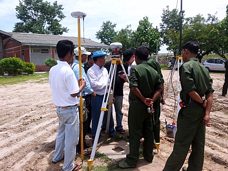
CHC Navigation demonstrates the X91+ during field technical assessments.
“We are excited about the international recognition of CHC’s GNSS solution by leading governmental organizations. I believe the win highlights our firm commitment to provide high precision, outstanding quality products and more over dedicated support and services,” said George Zhao, CEO of CHC. “The award of this significant tender is a real achievement in CHC international development.”
The X91+ GNSS receiver is a compact 220-channel GNSS receiver designed for high accuracy and productivity in harsh environments. According to CHC, the receiver has an easy-to-use, efficient and intuitive work flow, and is optimized for efficient RTK positioning.
Qualcomm Technologies, Inc., has introduced the Qualcomm Snapdragon 410 chipset with integrated 4G LTE World Mode. According to Qualcomm, the delivery of faster connections is important to the growth and adoption of smartphones in emerging regions, and Qualcomm Snapdragon chipsets are poised to address the needs of consumers as 4G LTE begins to ramp in China.
Snapdragon 410 chipsets support all major navigation constellations: GPS, GLONASS, and China’s new BeiDou, which helps deliver enhanced accuracy and speed of location data to Snapdragon-enabled handsets.
The new Snapdragon 410 chipsets are manufactured using 28-nm process technology. They feature processors that are 64-bit capable along with superior graphics performance with the Adreno 306 GPU, 1080p video playback and up to a 13 megapixel camera. Snapdragon 410 chipsets integrate 4G LTE and 3G cellular connectivity for all major modes and frequency bands across the globe and include support for dual and triple SIM. Together with Qualcomm RF360 front-end solution, Snapdragon 410 chipsets will have multiband and multimode support. Snapdragon 410 chipsets also feature Qualcomm’s Wi-Fi, Bluetooth, FM and NFC functionality.
The chipset supports all major operating systems, including the Android, Windows Phone and Firefox operating systems. Qualcomm Reference Design versions of the processor will be available to enable rapid development time and reduce OEM R&D, designed to provide a comprehensive mobile device platform. The Snapdragon 410 processor is anticipated to begin sampling in the first half of 2014 and expected to be in commercial devices in the second half of 2014.
Qualcomm Technologies also announced for the first time the intention to make 4G LTE available across all of the Snapdragon product tiers. The Snapdragon 410 processor gives the 400 product tier several 4G LTE options for high-volume mobile devices, as the third LTE-enabled solution in the product tier. By offering 4G LTE variants to its entry level smartphone lineup, Qualcomm Technologies ensures that emerging regions are equipped for this transition while also having every major 2G and 3G technology available to them. Qualcomm Technologies offers OEMs and operators differentiation through a rich feature set upon which to build innovative high-volume smartphones for budget-conscious consumers.
“We are excited to bring 4G LTE to highly affordable smartphones at a sub $150 ( ~1,000 RMB) price point with the introduction of the Qualcomm Snapdragon 410 processor,” said Jeff Lorbeck, senior vice president and chief operating officer, Qualcomm Technologies, China. “The Snapdragon 410 chipset will also be the first of many 64-bit capable processors as Qualcomm Technologies helps lead the transition of the mobile ecosystem to 64-bit processing.”
Qualcomm Technologies will release the Qualcomm Reference Design (QRD) version of the Snapdragon 410 processor with support for Qualcomm RF360 Front End Solution. The QRD program offers Qualcomm Technologies’ technical innovation; customization options; the QRD Global Enablement Solution, which features regional software packages, modem configurations, testing and acceptance readiness for regional operator requirements; and access to a broad ecosystem of hardware component vendors and software application developers. Under the QRD program, customers can rapidly deliver differentiated smartphones to value-conscious consumers. There have been more than 350 public QRD-based product launches to date in collaboration with more than 40 OEMs in 18 countries.
The Broadcom BCM47531 GNSS chip generates positioning data from five satellite constellations simultaneously, including BeiDou.
Broadcom Corporation has introduced the BCM47531, a GNSS chip that generates positioning data from five satellite constellations simultaneously — GPS, GLONASS, QZSS, SBAS and BeiDou. The newly added BeiDou constellation increases the number of satellites available to a smartphone, enhancing navigation accuracy, particularly in urban settings where buildings and obstructions can affect performance.
More than 226 million mobile phones were sold to end users in Asia in the first quarter of 2013, increasing the region’s share of global mobile phones to 53.1 percent, according to Gartner (“Market Share Analysis: Mobile Phones, Worldwide,” 1Q13). As smartphone adoption continues to accelerate, users continue to identify location and mapping as a top requirement. Broadcom’s new GNSS system-on-chip (SoC) is based on its widely deployed architecture that reduces the time to first fix and allows smartphones to quickly establish location and rapidly deliver mapping data. The SoC also features a tri-band tuner that enables smartphones to receive signals from all major navigation bands (GPS, GLONASS, QZSS, SBAS, and BeiDou) simultaneously. By allowing use of any combination of satellites, users experience more accurate and consistent location performance in Asia and throughout the world.
“Broadcom’s new GNSS chip with BeiDou support provides OEMs with a cost-effective, low-power solution to deliver enhanced positioning capabilities for challenging city environments,” said Charles Abraham, Broadcom vice president & general manager, GPS. “Drawing on Broadcom’s long history of GNSS innovation, our new platform improves the navigation experience of smartphone users in most regions of the world and unlocks new location-aware applications.”
The BCM47531 platform is available with Broadcom’s location-based services (LBS) technology that delivers satellite assistance data to the device and provides an initial fix time within seconds, instead of the minutes that may be required to receive orbit data from the satellites themselves.
Key Features and Benefits:
Simultaneous support of five constellations (GPS, GLONASS, QZSS,SBAS and BeiDou) allows for position calculations based on measurements from any of 88 satellites.
Broadcom’s tri-band tuner brings the ability to receive all navigation bands, GPS (which includes QZSS and SBAS), GLONASS and BeiDou simultaneously to the commercial GNSS market without having to reconfigure and hop between bands.
Utilizes BeiDou signals for up to 2x improved positioning accuracy.
Best-in-class Assisted GNSS (AGNSS) data available worldwide from Broadcom’s hosted reference network.
Allows a device to interchangeably use the best signal from any satellite regardless of the constellation, ensuring better accuracy in urban and mountainous environments.
Features advanced digital signal processing for interference rejection that enables satellite signal search and tracking during LTE transmission.
Leverages Broadcom’s connectivity solutions including Wi-Fi, Bluetooth
Smart, Near Field Communications (NFC), Instant Messaging System (IMES) and handset inertial sensor data for best indoor/outdoor location.
Geoporter, a non-profit focused on leveraging advanced mapping technology to empower communities to address burgeoning problems from within, has launched an Indiegogo crowdsourcing campaign to help support continued work and expansion. Funds will be used to provide resources to current projects in Costa Rica, while allowing the team to establish new operations in other areas globally.
Besides financial donations, the group is seeking serviceable digital cameras, GPS units, and laptop computers — worn but working well.
The organization uses GPS-driven technology to map behaviors in a community, allowing them to better define problems, develop and implement solutions, and evaluate the effectiveness of their efforts for continual improvement. The technology can be used to address a wide variety of problems, from tackling trash build up in the area to monitoring whale patterns in order to facilitate more sustainable tourism practices. In Costa Rica, the Geoporter team worked to map mosquito larva and water treatment to help reduce the risk of exposure to dengue fever.
“It’s exciting and rewarding work,” said co-founder Anita Palmer. “We’re going into areas where we can make a real difference in the everyday lives of people through the power of data analysis. What’s more, we’re helping to reverse trends that would otherwise have regional and, in some cases, global implications.”
Geospatial mapping is not new, but it has traditionally been executed by teams of experts in the aftermath of a crisis. Geoporter’s approach is a proactive one, where experts move into communities as challenges are developing so they can effect change before there’s a real problem. Still, building and sustaining a team of experts would have been cost-prohibitive, so Geoporter decided it would try something radical: teaching people within these communities to use the technology themselves.
“We started by training adults and youth,” explains Geoporter Director Amy Work. “Now, children in the area are taught how to use the technology in and outside of school. We have eight-year-olds navigating commercial-grade geospatial mapping technology like Esri ArcGIS Online better than some of the professionals I’ve known. The lessons they’re learning today will not only enable them to take ownership of their communities, but provide them with skills they can leverage through adulthood.”
Geoporter is hoping to use the IndieGoGo campaign to raise the funds necessary to continue their work in Costa Rica, and are looking to expand into other areas over the course of the next year. Donations will go towards funding technology, educator travel and living expenses, and community staffing.
To support the Geoporter mission or learn more about their work, visit the Indiegogo campaign by clicking here.
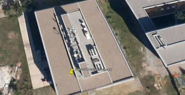
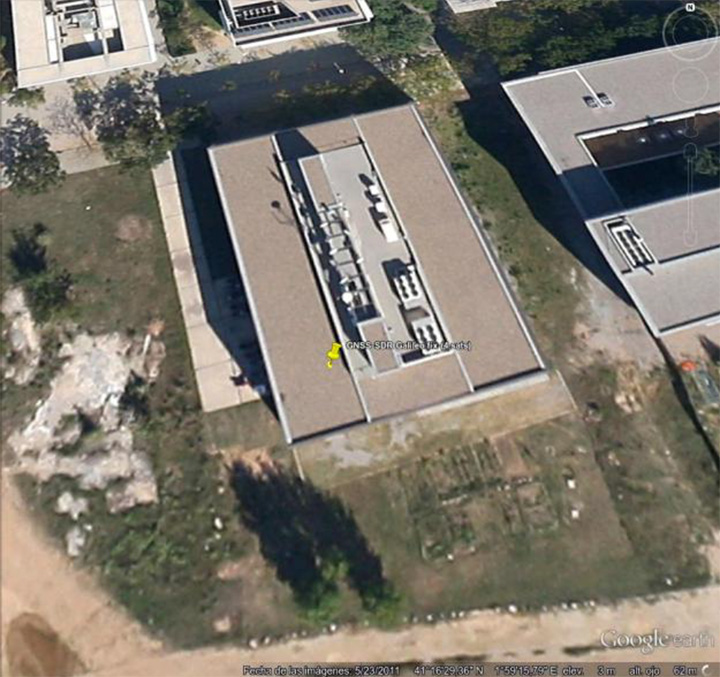
First GNSS-SDR Galileo standalone position fix using the four available satellites (Position obtained at the CTTC headquarters on 2013-Nov-10 15:52:14 UTC).
For the first time, position fixes in real time using signals from Galileo have been achieved with an open source software receiver. The milestone was achieved by a research team from the Statistical Inference Department at the Centre Tecnològic de Telecomunicacions de Catalunya (CTTC), which manages the development of the open source project GNSS-SDR.
Professional, full-featured receivers are expensive, and even in those cases the users have limited access (if any) to know exactly how position and time information were computed, CTTC said. In addition, these receivers exhibit very few upgrading capabilities. A software receiver allows all kind of modifications and inspections. “GNSS-SDR unleashes the full potential of the signals and, best of all, it is open and for free,” said Carles Fernández-Prades, GNSS-SDR project manager and Head of the Communications Systems Division at CTTC.
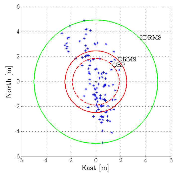
GNSS-SDR 2D ENU coordinates precision for the Galileo position fix.
A GNSS software receiver is a computer program that performs all the signal processing from raw satellite signals to the computation of position, velocity and time, just as is done by the GPS chips that are embedded in smartphones and other devices with satellite-based positioning capabilities. The key difference relies on the great flexibility in the design, upgradability and the experimentation possibilities that the software version allows, in opposition to integrated circuits, true black boxes with inputs and outputs but with no accessible information about what is going on inside of them.
“With GNSS-SDR, researchers and technology enthusiasts can easily change the implementation of a certain functional block and assess the impact of that change on the whole receiver performance,” said Pau Closas, GNSS-SDR scientific advisor and Head of the Statistical Inference Department at CTTC. “This paves the way to innovative mass-market, industrial and scientific applications that could make use of Galileo signals but require non-standard features which are not present in mass-market receivers nor in costly professional equipment.”
The first Galileo-based positioning fix, obtained by Javier Arribas using a general purpose GNSS antenna and a RF front-end connected to a commodity PC running GNSS-SDR represents an important milestone in the research on GNSS receiver design. “Next steps will be devoted to provide outputs in standard formats that will allow the application of geodesic-grade tools for extremely precise positioning (on the order of centimeters) and higher degrees of reliability,” Arribas said.
GNSS-SDR is the first open source solution that offers this possibility, CTTC said. The source code released under the GNU General Public License (GPL) secures practical usability, inspection, and continuous improvement by the research community, allowing the discussion based on tangible code and the analysis of results obtained with real signals. The source code is complemented by a development ecosystem, consisting of a website, as well as a revision control system, instructions for users and developers, and communication tools.
With GNSS-SDR, researchers from CTTC (with the aid of an open community created around the project, such as the students participating in the Google Summer of Code program in 2012 and 2013 Luis Esteve, Mara Branzanti, Daniel Fehr and Marc Molina) are offering a tool that fosters the use of GPS and Galileo signals in unexpected new ways, making possible applications with unforeseen benefits in a wide range of fields, such as geodesy, robotics, unmanned vehicles and safety-related systems.
As the end of the year approaches, I’d like to reflect on 2013. One of the new features of the GPSWorld website allows me to access webpage statistics so I can understand which articles and news items were “hot.” Following is a list of GPS World magazine’s hot topics for 2013 with some commentary from me.
While it seems everyone is conducting webinars today, GPSWorld was a pioneer in offering technical webinars more than six years ago, and they continue to be very popular today. Three of the latest webinars are:
Detect and Locate GPS Jamming
Unmanned Aircraft Navigation
What’s the Latest & Greatest? GNSS Products for 2014 and Beyond
As a side note, I’m trying to talk the GPSWorld publishers into allowing me to host a bi-monthly or monthly 60-minute radio show hosted by myself and featuring various GNSS industry guests. The show would be an informal, roundtable discussion about current events related to high-precision GNSS and similar technology. It would likely be broadcast live over the Internet as well as recorded in MP3 format so you could listen to it using your smartphone or music device at a time convenient to you. Please send me a quick email if you think this is something you’d be interested in listening to.
I wrote this article in March 2013 discussing the myriad of new RTK receivers recently introduced. Since the article was written, even more have been introduced! Smaller, lighter and cheaper is where RTK is headed. The fact that this article was GPSWorld’s second most visited web page in 2013 speaks volumes of the growing interest in centimeter-level, real-time positioning (RTK).
Just recently, my friends at the University of Texas at Austin (UT) took RTK where it hasn’t been before…on a smartphone.
Dr. Todd Humphreys and his graduate assistants, including Ph.D. student Ken Pesyna, are part of the UT Radionavigation Laboratory. This team has been exploring, among other things, the feasibility of implementing RTK technology on smartphones. If you recall, in 2012 at the GPSWorld dinner during the Institute of Navigation (ION) GNSS Conference in Nashville, Dr. Humphreys proclaimed that RTK technology will be readily available on smartphones and tablets by the year 2020.
Well, Dr. Humphreys and his team are doing their part to realize this vision. Just a few short weeks ago, he reported that they have enjoyed some initial success.
However, before I present the details, I’ve been reminded several times over the years that smartphone GNSS chipsets aren’t the problem. In fact, two of the key GNSS engineers on the team (Broadcom) that designed the GNSS chipset used in the Apple iPhone, Dr. Frank Van Diggelen and Charlie Abraham, used to work for Ashtech. They know RTK.
The challenge with implementing RTK in smartphones is the antenna, not the GNSS chipset.
“The smartphone GNSS antenna is nothing more than a cleverly-designed wire trace, as are all smartphone GNSS antennas,” said Dr. Humphreys. “Some have joked that you could do better with a paperclip, and that’s probably not far from the truth.”
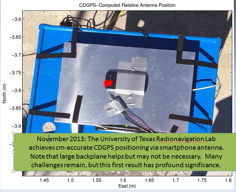
Nevertheless, just a few weeks ago Dr. Humphreys and his team at UT were able to use a standard smartphone antenna (Samsung Galaxy SIII) to achieve an RTK solution. To his knowledge, this is the first time a successful RTK solution has been derived using an off-the-shelf smartphone antenna.
Source: University of Texas at Austin
Ken Pesyna added that RTK initialization took a little under seven minutes using seven satellites. He added that with 10 satellites in view he’s seen RTK initialization drop to about two minutes. Mind you, this is GPS L1-only. Certainly, the addition of L2, GLONASS would further reduce initialization times, not to mention BDS, Galileo, etc.
So, RTK in smartphones next year? Not so fast.
“Many challenges remain”, said Dr. Humphreys, “and in some senses we are cheating (big backplane, good clock). Nonetheless, this is a huge step forward that presages great disruption.”
He added, “We were astonished to find that we could track L2C signals through the smartphone antenna. We didn’t exploit the L2C signals in our solution, but we could have, as the L2C carrier we recovered was quite clean.”
Not far behind the RTK article, in web hits, was the article I co-wrote with Mark Silver on various free online post-processing services available to the general public. The article was super timely, as it was published a day after the U.S. government shutdown and the NGS OPUS website went blank. Therefore, thousands of GNSS users read the article in a very short amount of time.
Dr. Minghai Jia, a key developer of Australia’s AUSPOS online GNSS post-processing service, commented, “This is an excellent article, which has boosted AUSPOS demand significantly.”
Number four on GPSWorld’s website for 2013 was Tony Murfin’s article on the real-time PPP landscape.
Whereas the real-time PPP landscape remained relatively unchanged for many years, with OmniStar and Starfire services being the only games in town for satellite-based precise positioning on land (as opposed to off-shore), this landscape is changing.
In 2012, TerraStar began offering a commercial service very similar to OmniStar and Starfire — real-time decimeter positioning using corrections delivered via satellite (no terrestrial Internet connection required).
Also in 2012, Trimble introduced its satellite-based RTX service, touting 4-cm real-time PPP accuracy.
In April 2013, the IGS announced it began offering a public (free) real-time PPP decimeter service (IGS RTS). While only supporting GPS initially, IGS plans to support GLONASS by the end of 2013.
The challenge for both TerraStar and IGS RTS is that receiver manufacturers need to integrate firmware to utilize these services. It’s unlikely that those companies offering competitive services that also design GNSS receivers (Trimble, Navcom) will do so, thus making it difficult for the new services to gain market traction.
Rounding out the Top 5 GPSWorld web pages of 2013 is The Almanac, featuring GNSS constellation tables compiled by Prof. Richard B. Langley at the University of New Brunswick.
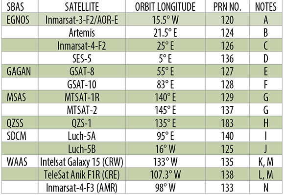
If you want a single, comprehensive webpage that lists all the navigation satellites from the various constellations, this is one you should bookmark in your web browser. Heck, there’s even a PDF version of it. GPS, GLONASS, Galileo, BeiDou, IRNSS, and public SBAS systems are listed in detail as well as many useful links to various GNSS resources.
An updated Almanac will appear in the January issue of GPS World.
If you are not quite feeling the holiday spirit, take a look at these wonderfully talented people in this four-minute music video. They don’t use any instruments besides their amazing voices.
Esri announced the release of ArcGIS for Electric and ArcGIS for Gas—ready-to-use maps and apps designed for utilities. Both are freely available to Esri customers. Developers and utility experts at Esri spent years studying industry needs and trends to come up with solutions that help utilities quickly respond to outages and engage with customers.
“It’s never been easier to geoenable your utility,” said Bill Meehan, Esri’s director of utility solutions. “ArcGIS for Electric and ArcGIS for Gas will help utilities get much more value from their data. More than that, this is a chance for utilities to truly revolutionize their business.”
ArcGIS for Electric includes damage assessment and streetlight problem apps, along with a public outage viewer to help utilities communicate with customers during an outage. ArcGIS for Gas includes damage assessment apps and an exposed pipe collector app. Both applications also help Esri customers get started quickly with ArcGIS Online, where they can create and share interactive maps and apps. They can also access ready-to-use content, apps, and templates available for the web, smartphones, and tablets.