Blog

  • Jamming Threats Explored in GPS World Webinar

    A system to detect and locate GPS jamming will be explored in a free GPS World webinar Thursday, December 5. The webinar, “Detect and Locate GPS Jamming: Provide Actionable Intelligence,” focuses on the Signal Sentry 1000, an Exelis system.

    GPS is an essential element of the global information infrastructure and supports nearly every facet of modern life. However, the availability and usage of low-cost GPS jamming devices has resulted in the increased threat of intentional and unintentional disruption to commercial and industrial systems that rely on precise GPS data. That is why Exelis developed Signal Sentry 1000, a solution that enables authorities to locate with pin-point accuracy the sources of interference thereby assuring safety, efficiency, and revenue. This webinar will discuss the threat and Signal Sentry, and will be of interest to anyone whose organization relies on GPS for information or commerce. Registration is free.

    Date: Thursday, December 5, 2013
    Time: 10 a.m. PST / 1 p.m. EST / 6 p.m. GMT

    Moderator

    Don Jewell, Editor, Defense PNT Newsletter

    Speaker

    Jeff Coffed, Product Marketing Manager, Exelis Inc.

    Jeff Coffed is a marketing professional with over 20 years’ experience in the high-tech sector. Currently, he has product marketing responsibility for the Analytical Instruments, Precision Optics, Precision Structures and Positioning, Navigation and Timing divisions at Exelis.

    Panelists

    Carl Slutsky, Product Manager for Signal Sentry 1000, Exelis

    Carl leads product strategy and development efforts and is responsible for product technology road maps and the engineering requirements for the ongoing development of the Signal Sentry product line.

    Joseph Rolli, Signal Sentry Business Manager, Exelis

    Joseph Rolli is a senior program manager in the Positioning Navigation and Timing group at Exelis.

    Jon Schnabel, Chief Scientist, Geospatial Systems, Exelis

    Jon Schnabel is a Senior Staff Scientist at Exelis Geospatial Systems with 33 years of Systems Engineering experience. He has worked on for 15 years in various Systems Engineering roles on both the Space Segment (Blocks IIR, IIR-M, III) and Ground Segment (OCX) programs.he pace will only accelerate. Sort through the multiple issues and get your roadmap to the future with Janice Partyka and a panel of industry experts.


  • GNSS Simulator in R&S SMBV100A Now Supports BeiDou

    GNSS Simulator in R&S SMBV100A Now Supports BeiDou

    Rohde-Schwarz-Beidou
    R&S SMBV100A

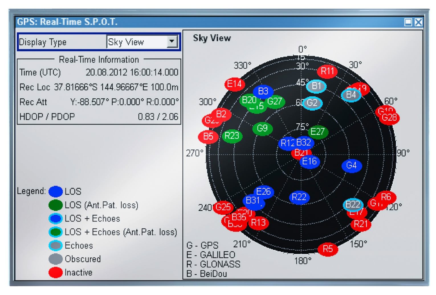
    Rohde & Schwarz extends the functionality of the R&S SMBV100A vector signal generator by adding BeiDou/Compass capability to its integrated GNSS simulator. With the R&S SMBV-K107 option, the GNSS simulator now covers the BeiDou standard as well as the GPS, Galileo and GLONASS satellite navigation systems.

    The new option allows users to generate real-time scenarios with up to 24 BeiDou satellites. R&S SMBV-K107 supports all possible BeiDou orbits and can therefore even simulate satellites that are not yet in orbit. It also supports hybrid scenarios with GPS, Galileo or GLONASS satellites. A software update makes it easy to upgrade existing GNSS simulators for BeiDou. No hardware modifications are required.

    The R&S SMBV100A permits users to quickly define their own satellite scenarios to test GNSS receivers under diverse conditions. A wide range of options are available for simulating realistic effects such as signal obscuration and multipath propagation. These scenarios can now be configured for BeiDou as well.

    This inexpensive solution is one of the few on the market that does not require an external PC for testing receivers and components of satellite-based navigations systems, the company said. In addition to GNSS signals, the R&S SMBV100A can simulate mobile radio, wireless and radio standards, allowing users to test several functions with a single instrument.

    The new R&S SMBV-K107 option is now available from Rohde & Schwarz.

  • Public Geolocation Vault on the Horizon?

    Imagine a vault of highly accurate geolocation data that provides look-up service for any device, in any country, based on publicly sent signal data. It is an appealing idea. Mozilla, best known for its popular Firefox browser, is a nonprofit organization dedicated to openness on the web. No one is better positioned to create the very first public geolocation database. Mozilla wants to build the data service with the end goals of enabling innovation and improving location data privacy. The group makes the point that improving the privacy of user data is counter incentivizing for-profit companies that collect this data. Privacy continues to be a major industry issue that has gotten more than one company in trouble with regulators and customers.

    Mozilla is starting out with a pilot project, named “Mozilla Location Service,” to assess how it would build and operate a location service to provide geolocation look-up for devices. The data will be based on publicly observed cell tower, Wi-Fi or IP address information. Mozilla is enlisting its loyal community to collect the data via a special app for Android-based phones.

    Admitting Wrongness. Those of us who skewered Apple for its map troubles continue to eat crow. The Apple maps have improved and are popular, or at least good enough, with most iPhone and iPad users in the U.S. As you may recall, Google maps were expelled from the iPhone when Google refused to give Apple access to its turn-by-turn navigation. Google, who had delighted in Apple’s map debacle, has now been badly humbled. The company has lost almost 23 million mobile users in the U.S. as a result of its banishment. iOS users can still assess Google Maps, but data from market research firm ComScore suggests that few actually take the trouble to download Google Maps. When iOS 6 began to roll out and introduced Apple’s maps as the default, the number using Google Maps dropped precipitously, even as the number of iPhones and Android phones began rising.

    Big Money from Mapping. The value of being a map provider cannot be underestimated. Both Apple and Google cull anonymous data for traffic reporting and improving their network. More importantly, they have created a gold mine by using the data to glean for behavioral information about users. The data is fed to advertisers who create contextual ads that are more likely to get us to buy. Google also uses the data to improve search results.

    Good news for the Enterprise Industry. A survey of 500 fleet operators conducted by C.J. Driscoll and Associates shows high satisfaction and strong intent to purchase GPS fleet management systems. From an enterprise customer’s standpoint, GPS-enabled solutions are measured by how quickly the company can recoup its outlay. An impressive two thirds of the fleets surveyed reported that they have recouped their investment in their GPS fleet solutions. Of the fleets that haven’t deployed a GPS fleet management system, 16 percent indicated that they expect to do so within the next 18 months. The fleet survey is contained in the C.J. Driscoll 2013-14 Survey of Fleet Operator Interest in MRM Systems and Services report.

    The Final Frontier: Indoor Location. Applications are increasingly hungry for ubiquitous, well-performing location for all devices. Sensor fusion, or the intelligent combination of data from multiple sensors, will become a standard feature to help make this happen in indoor locales. “Sensor fusion will surpass Wi-Fi and Bluetooth low energy (BLE) as the most important handset-based indoor location technology by 2017,” predicts Patrick Connolly of ABI Research. “We see a significant trend towards hybridization, with Wi-Fi, BLE, and sensor fusion proving to be vital.” Companies in this market include Movea, HillCrest, indoo.rs, and Senionlab.

    Wind Blowing in New Direction. PlaceIQ, the location context company, has ventured into location-based behavior analytics. The start-up company had been focused on providing information on the context of location in small geographic areas, 100 by 100 square meter units. One of the company’s new offerings, PIQ Analytics, “can identify which competitors a brand’s audience is most likely to visit, the restaurants where they typically dine, the type of device they use, and the stores that they frequent,” reports the PlaceIQ website. The company’s other new product tracks individuals and “determines where consumers were before arriving at a brand’s physical location.” PlaceIQ is going to have to careful how it treads this ground, if it wants to avoid raising opposition from privacy watchdog groups.

    Mapping Sadness  As you may have heard, a father has discovered that Google Maps shows the body of his son, who was shot to death in 2009 beside a railroad track in Richmond, California. In a written statement, Google announced that it would accelerate the replacement of the satellite image of the map, the first time that it made such a change due to a request. Google indicated would take about eight days to make the change, as the image has continued to be visible on their maps. Perhaps a reader can explain to me why replacing this map segment would take so long, or why the image could not have been obscured by Google until the replacement is made?

    I will be moderating a session at the IEEE International Conference on Connected Vehicles and Expo on December 5 in Las Vegas. The SAE-organized panel is on Connected Infotainment. The panelist are industry experts who will share perspectives in this interactive session.

  • Companies Looking to Profit with Niche Fleet Markets

    Companies Looking to Profit with Niche Fleet Markets

    Logo: American Towman ExpositionNiche markets for location companies are sometimes hit-and-miss. One real opportunity that is gaining more traction among location companies is towing. There are legions of Duck Dynasty-type of towing trade show attendees, but you shouldn’t judge a book by its cover. There is tons of money in the towing industry as banks, insurance companies, motor clubs and other technology entities are flocking to these shows. Many times that scruffy-looking guy in a Duck Dynasty T-shirt is a multi-million-dollar owner of a big towing company. Companies such as Verizon are ramping up their fleet opportunities for more conventional markets, which leads one to say, once again, that the fleet, mobile resource management market is still growing and lucrative.

    BALTIMORE — Although it is a strong niche market, the towing industry is gaining traction among the dozen or so location companies that were exhibing at the recent American Towman Exposition here.

    Location companies exhibiting asked towing operators to look at the usual benefits of their products: fuel savings, dispatching tow trucks to the nearest incident, reducing idle time, reduced overtime hours, monitoring of speeds and other features. The location companies present were TomTom, Teletrac, Fleetmatics, Progressive Platforms and others.

    Several financial institutions were on site who acknowledged the importance of tracking and monitoring technology in towing company fleets and headquarters. One banker said that he will not give a loan to a towing company unless it has, across a fleet, a real-time tracking system. The same goes for many insurance companies.

    TomTom Business Solutions is offering its Webfleet product to tow companies. The company recently integrated the unit with Service Station Computer Systems Digital Dispatch software to reduce administrative tasks between an office and tower site. At the conference, towing software and services companies such as FTI Groups are integrating location company products from BudgetGPS, Geotab, TomTom and sureFleet Mobile into their offerings for transportation markets.

    One challenge that location companies may have in smaller niche markets is volume. One company says it cannot sell to fleets with five or fewer trucks.

    Verizon Partnering with Samsung and XRS on Trucking Product

    Verizon recently partnered with Samsung Telecommunications America and XRS Corp. on a mobile software product, called NXT, for the transportation industry. The unit uses Verizon’s 4G LTE network and works on Samsung Mobile’s devices.

    NXT allows drivers and fleets to use Samsung Mobile devices with an XRS trucking software subscription. The unit is available on the Samsung Galaxy Tab 7.0 and has a $54 per month data and subscription plan. Other fees include $39 for a monthly XRS fee and $15 for wireless data.

    The NXT rollout doesn’t affect sales or shift away from in-vehicle hardware now offered by Verizon, said Michael Toto, Verizon Enterprise Solutions director of strategic global alliances. “We view this as a complementary addition, not a shift away from our in-vehicle solutions,” he said.

    Toto says that the company’s partnerships, with Samsung and XRS, allow Verizon to provide a broader portfolio that allows its customers more business options. With best-in-class partnerships, such as Samsung and XRS, it can provide a broader solution portfolio allowing its customers to select a solution that closely matches business needs.

    Toto believes the NXT deal is a big deal and differentiates Verizon from other wireless carriers’ fleet offerings. “NXT is a game changer in the fleet industry because it is a comprehensive solution to help transportation companies be MAP 21 compliant,” he said. “The elements are available separately, but have never been offered before as a complete end-to-end solution.”

    Toto says Verizon provides high-speed wireless connectivity right now for operators. “Tomorrow we will further integrate the solution with Verizon technologies,” he said.

    Echoing what Toto said, NXT also offers integration with many enterprise transportation products. Over time, the platform collaboration will expand to introduce additional components, including MDM and wearable products, the companies said in a prepared statement.

    The product, which was developed through the Samsung Solutions Exchange program, works in both over-the-road and private carrier configurations — and according to the companies — is tailored to fleets of all sizes. The companies say that since the unit works on certified smartphones, tablets and handhelds, it allows companies to comply with the pending Electronic Logging Device, or ELD, mandate for recording driver’s hours-of-service.

    In other location news:

    • The Federal Communications Commission (FCC) recently said that more than two-thirds of the calls to 911 emergency centers in Texas from wireless phones do not include the accurate location information necessary to find a caller in crisis. The data, provided to the FCC by state and local 911 agencies, show a dramatic drop in more accurate “Phase II” data in Texas from 67 percent of all wireless calls in January 2011 to just 33 percent in June 2013, despite a dramatic increase in cell phone calls over the same period.
    • C.J. Driscoll & Associates released a new multi-client marketing research study covering U.S. fleet operators with Mobile Resource Management systems and services. The 2013-14 Survey of Fleet Operator Interest in MRM Systems and Services assesses fleet operator interest in GPS fleet management, driver behavior management, and GPS-equipped handset/portable solutions for managing mobile workers. The study was partially funded by 14 companies, including major cellular carriers, GPS fleet management solution providers, suppliers of driver behavior management systems, and other leading telematics suppliers to the fleet market. The following are among the key findings of the study: More than three-fourths of the fleets that are using a GPS fleet management system reported a high level of satisfaction with their system and two-thirds reported that they have recouped their investment in the system. Another study finding indicates participating fleets that have never used a GPS fleet management system expect to deploy a system in the next 12-18 months.
    • MapQuest, which hasn’t gotten the publicity of Google Maps or Apple, recently rolled out a new mapping application, which was a nine-month project. The new mapping app features layers of information “around” a user such as coffee, bars, gas, banks and parking. The new app gets traffic updates on the fly and works more like a standard GPS system, according to published reports. MapQuest is still the number 3 mobile map provider, which is a quiet stat given how long the company has been around in the location industry.
  • Esri Launches Public Beta of Geotrigger Service

    Esri introduces the public beta version of its cloud-based Geotrigger Service that helps developers easily create location-aware apps for iPhone and Android without compromising battery life. The beta Geotrigger Service is available at no cost and feedback from developers will be used to shape the official release.
    The Geotrigger Service allows apps built on the Esri location platform to quickly gather business intelligence such as where people are and when the app is used. Developers can also design apps that send messages to users when they arrive at or leave areas defined by a geofence.
    “On the Esri location platform, we already offer a host of services for developers from geocoding and geoenrichment to routing maps. The Geotrigger Service boosts this offering with location-awareness and location-based alerts,” said Johan Herrlin, Esri’s senior business strategist.
    Developers can use the Geotrigger Service for apps across all industries including:
    ·        Retail and Loyalty: Engage customers with personalized content and deals the moment they enter a store.
    ·        Real Estate: Send messages to prospective home buyers when their search criterion matches a nearby home.
    ·        Energy Management: Use location to automatically manage power consumption at home or in the office.
    ·        Tourism: Bring public attractions to life by informing tourists of interesting locations as they explore a city.
    ·        Public Alerts: Notify citizens about events such as road closures or civic emergencies based on past locations.

    For more information, visit 
    esriurl.com/geotrigger. 
  • Qualcomm Collaborates with Samsung to be First to Employ BeiDou for Location-Based Mobile Data

    Qualcomm Incorporated has announced that its subsidiary, Qualcomm Technologies, Inc., is enhancing location precision in smartphones and tablets initially in China with support for China’s BeiDou Satellite Navigation System.

    Supporting the BeiDou constellation within Qualcomm IZat location solutions increases the number of satellites that Qualcomm-based devices can access to provide greater position location accuracy. Qualcomm is collaborating with Samsung to launch the first wave of BeiDou enhanced consumer smartphones, demonstrating the commitment of the companies to provide technology that delivers optimum performance for location-based services within China and globally.

    Powered by the Qualcomm Snapdragon 800 processor (MSM8974), the Samsung Galaxy Note 3 (WCDMA 3G version SM-N9006 & TD-LTE 4G version SM-N9008V) uses the industry’s first, integrated tri-band location platform to provide more accurate and responsive location data to mobile users. It does so by concurrently processing signals from multiple satellite networks. Armed with this capability, users will have more enjoyable experiences using their location-based services, even in the most challenging of environments.

    Leveraging Qualcomm IZat location solutions, Samsung will be able to deliver an optimal user experience with quick and accurate location information and services in China. Historically, this has been a challenge in some locations, especially in urban canyons, where devices may suffer from low visibility to satellites blocked by tall buildings that obstruct the signals. Bringing BeiDou-enabled phones to China means the Galaxy Note 3 has access to more satellites, which increases location accuracy. This ultimately improves customers’ pedestrian navigation, speeds local searches and enhances other location-based services.

    Qualcomm’s mobile chipsets feature interoperability with existing constellations, which use tri-band hardware integration to deliver improved location capabilities in an optimal way, with enhanced accuracy, and with no additional increase in power consumption. In Snapdragon and Gobi™ chipsets, global positioning support is built into the modem and RF chips, enabling the location signals to be processed in the modem, instead of waking up the apps processor, thus saving power without sacrificing location accuracy.

    “This industry-first implementation of BeiDou in a smartphone underscores Qualcomm’s leadership in the location industry. More than 3 billion devices which feature Qualcomm’s location technology have shipped to date and the introduction of BeiDou is the latest step to evolve our technology,” said Amir Faintuch, president, Qualcomm Atheros. “We see BeiDou’s support being an important factor for OEMs in China, and globally as well. With this new location enhancement, we believe our customers can bring greater differentiation with advanced performance, applications and services.”

  • GPS III Prototype Proves Compatibility with Existing Constellation

    GPS III Prototype Proves Compatibility with Existing Constellation

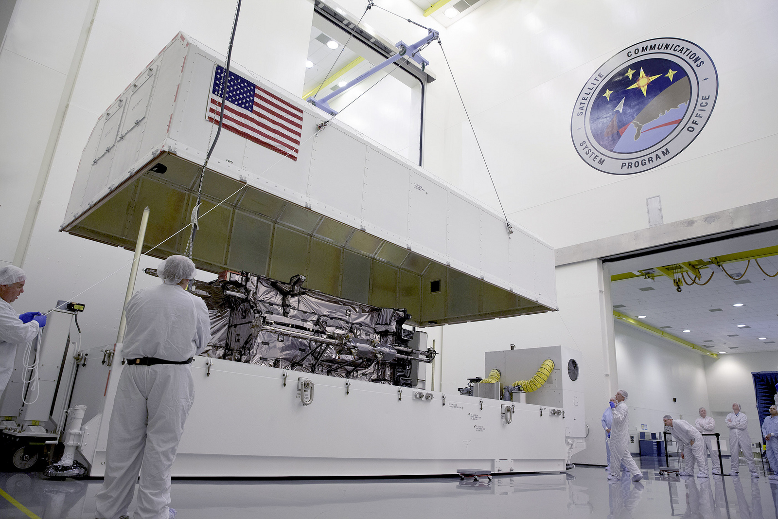
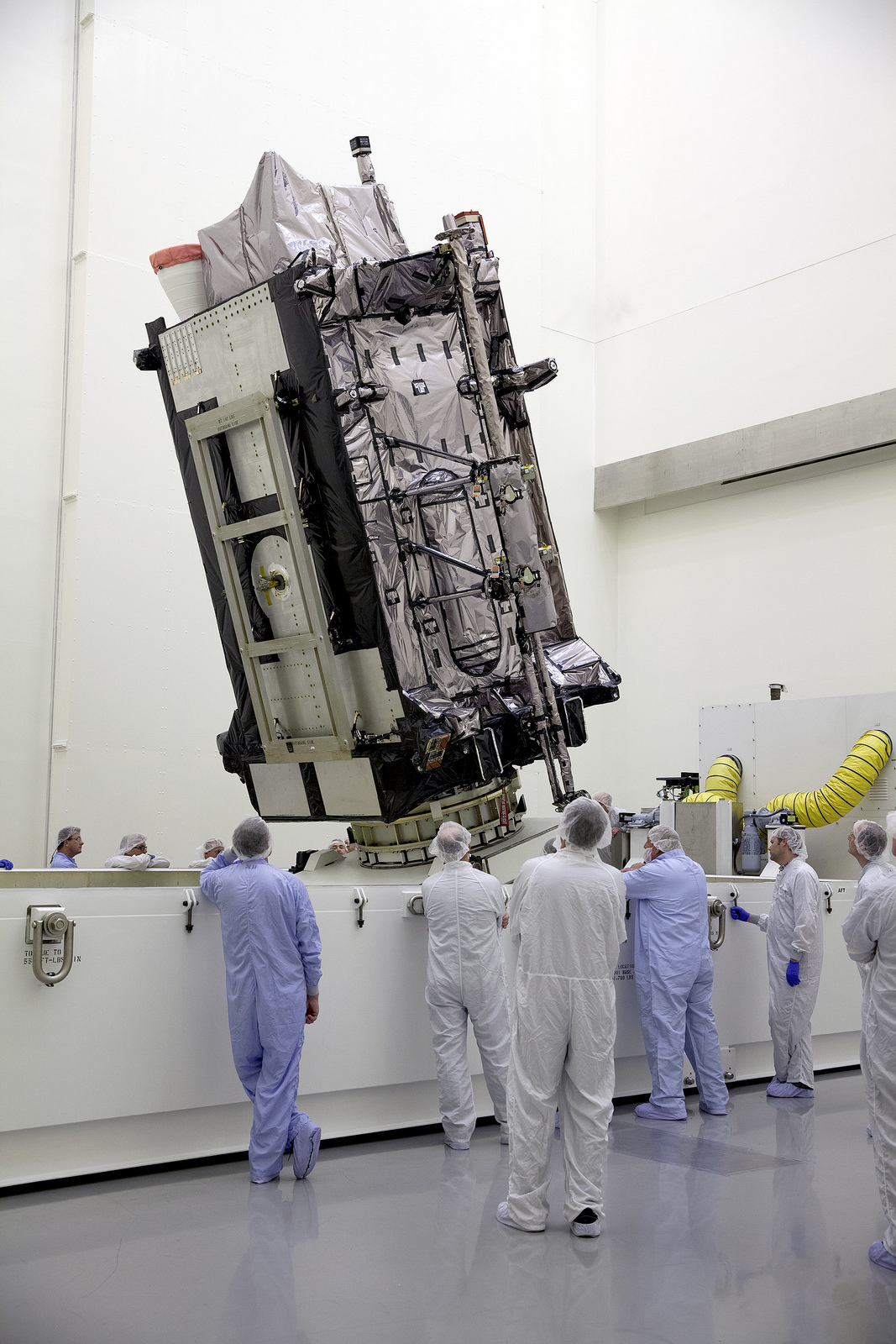
    The GNST arrives at Cape Canaveral Air Force Station, Florida, in July.
    The GNST arrives at Cape Canaveral Air Force Station, Florida, in July.

    The Lockheed Martin prototype of the next-generation GPS satellite, the GPS III, has proven that it is backwardly compatible with the existing GPS satellite constellation in orbit.

    During tests that concluded on October 17, Lockheed Martin’s GPS III testbed successfully communicated via cross-links to Air Force simulators of the current GPS constellation in orbit. The current GPS constellation includes GPS IIR, GPS IIR-M, and GPS IIF satellites.

    Testing also demonstrated the ability of an Air Force receiver to track navigation signals transmitted by the GPS III Nonflight Satellite Testbed (GNST). The GNST is a full-sized, functional satellite prototype at Cape Canaveral Air Force Station.

    “These tests represent the first time when the GNST’s flight-like hardware has communicated with flight-like hardware from the rest of the GPS constellation and with a navigation receiver,” explained Paul Miller, Lockheed Martin’s director for GPS III Development. “This provides early confidence in the GPS III’s design to bring advanced capabilities to our nation, while also being backward-compatible.”

    Lockheed Martin is under contract to produce the first four GPS III satellites (SV 01-04), and has received advanced procurement funding for long-lead components for the fifth, sixth, seventh, and eighth satellites (SV 05-08). The first flight-ready GPS III satellite is expected to arrive at Cape Canaveral in 2014, for launch by the Air Force in 2015.

    Testing took place with the GNST — a test version of the GPS III — at Cape Canaveral.
    Testing took place with the GNST — a test version of the GPS III — at Cape Canaveral.

    GPS III, a critically important program for the Air Force, will replace aging GPS satellites in orbit while improving capability to meet the evolving demands of military, commercial and civilian users. GPS III satellites will deliver three times better accuracy; provide up to eight times more powerful anti-jamming capabilities; and include enhancements to extend spacecraft life 25 percent further than the prior GPS block. It will be the first GPS satellite with a new L1C civil signal designed to make it interoperable with other international global navigation satellite systems.

    An innovative investment by the Air Force under the original GPS III development contract, the GNST has helped to identify and resolve development issues prior to integration and test of the first GPS III flight space vehicle (SV 01). Following the Air Force’s rigorous “back-to-basics” acquisition approach, the GNST has gone through the development, test, and production process for the GPS III program first, significantly reducing risk for the flight vehicles, improving production predictability, increasing mission assurance, and lowering overall program costs.

    The GNST arrived at the Cape on July 19 to test facilities and pre-launch processes in advance of the arrival of the first flight satellite. On August 30, the GNST successfully established remote connectivity and communicated with the GPS Next Generation Operational Control System (OCX), being developed by Raytheon.

    Before shipment to the Cape, the GNST completed a series of high-fidelity activities to pathfind the integration, test and environmental checkout that all production GPS III satellites undergo at Lockheed Martin’s GPS III Processing Facility (GPF) in Denver, Colo.

    The GPS III team is led by the Global Positioning Systems Directorate at the U.S. Air Force Space and Missile Systems Center. Lockheed Martin is the GPS III prime contractor, with teammates including ITT Exelis, General Dynamics, Infinity Systems Engineering, Honeywell, ATK, and other subcontractors. Air Force Space Command’s 2nd Space Operations Squadron, based at Schriever Air Force Base, Colo., manages and operates the GPS constellation for both civil and military users.

  • u-blox Launches EVA-7M Standalone GNSS Module

    u-blox Launches EVA-7M Standalone GNSS Module

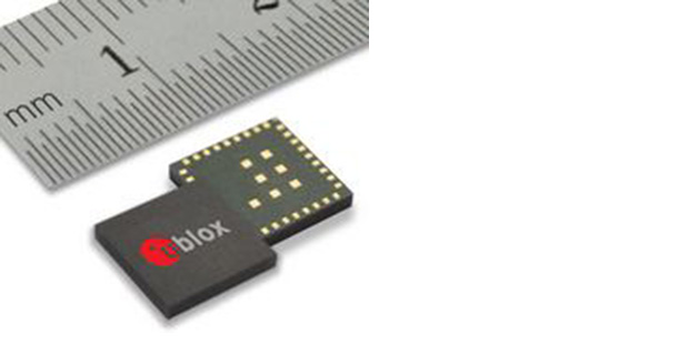
    u-blox EVA-7M.
    u-blox EVA-7M.

    Swiss-based u‑blox has introduced its smallest standalone GNSS positioning module, the EVA-7M. Designed for cost and space sensitive applications, the highly integrated 7 x 7 x 1.1 mm LGA module comprises all necessary components, including crystal and passives: only an  antenna is needed for global positioning capability.

    The module supports GPS, GLONASS, QZSS, and all SBAS augmentation systems. Based on u-blox’ advanced GNSS technology u‑blox 7, the module achieves -160 dBm sensitivity when tracking GPS satellites (-158 dBm with GLONASS satellites), fast acquisition time and the lowest power of any u-blox 7 module (16.5 mA at 3 V), thanks to an innovative high-efficiency power converter.

    The EVA-7M eases implementation in end-products because RF and digital domains are kept well separated, and the LGA pads are configured in single rows. EVA is a standalone GNSS receiver which provides a position without the need for host integration or extra RF components. It is optimized for keeping eBOM and system costs to an absolute minimum.

    “The EVA-7M brings embedded satellite positioning to the next level of portability. The module has been developed with ease-of-manufacturing as a high priority. Its QFN-like footprint with connections along four sides and high-level of component integration makes it a perfect solution for medium and high volume production runs. This ensures high first-pass production yield, crucial criteria especially for cost-sensitive, high-volume industrial and consumer applications,” said Thomas Nigg, VP Product Marketing at u-blox.

    A UART, USB, SPI and I2C interface provide flexible connections to a host processor. EVA-7M can also communicate directly with u‑blox’ SARA 2G, LISA 3G and TOBY LTE cellular modules to support advanced tracking and location-aware applications.

    The module is suitable for consumer, industrial, and after-market vehicle applications. First samples will be available in Q1 2014.

  • British Trade Delegation to Libya Taps Proteus for Mapping Expertise

    Proteus, a provider of satellite-derived bathymetric mapping and seabed classification services, represented the mapping industry in a British trade delegation to Tripoli organized by the Libya-British Business Council (LBBC). Proteus presented potential solutions to coastal mapping challenges faced by Libya during meetings with the National Oil Corporation, Ports and Maritime Transport Authority, University of Tripoli, and Libyan Center for Remote Sensing.

    “At every meeting, we were introduced to government ministers and business leaders who are eager to begin rebuilding Libya,” said Proteus CEO, David Critchley. “Libya recognizes that mapping will be the critical first step in rebuilding infrastructure across the country.”

    Invited to participate by Tilden International, Proteus was the sole mapping representative in the LBBC delegation, which included British companies involved in the energy, security and computing sectors. Held in late September 2013, the delegation mission was led by Sir Dominic Asquith, former British Ambassador to Libya.

    Since 2011, Proteus has been delivering offshore mapping projects for environmental, oil and gas, marine biology and other coastal zone applications in Europe, the Middle East and Caribbean, completed in a fraction of the time and cost of traditional methods. Proteus is currently engaged in a major offshore project in the Arabian Gulf, providing bathymetric and seabed classification services in the coastal zone using satellite imagery.

    “Whether exporting petroleum products from its shores or bringing tourists into the country, Libya sees development of its Mediterranean shipping ports as key to future economic success,” said Critchley. “Upgrading existing ports and building new ones will require mapping the seafloor several kilometers from the coast, and that’s why Proteus was invited to join the delegation.”

    Proteus uses commercially developed processes to derive bathymetric and seafloor classification information from high-resolution, 8-band multispectral imagery collected by DigitalGlobe Inc.’s WorldView-2 satellite and acquired by Proteus through its direct relationship with DigitalGlobe. Derived products have high accuracy, meeting the requirements of engineering, environmental monitoring and strategic geospatial planning applications.

    “Compared with maritime sonar and airborne LiDAR, satellite-derived bathymetric surveys are completed at a fraction of the time and cost,” said Critchley. “The ecological constraints, submerged reefs, and political issues that hamper traditional hydrographic mapping methods are of no hindrance to us.”

  • UrsaNav Accepts Delivery of First Production Nautel NL40 eLoran Transmitter

    UrsaNav’s President, Charles Schue, shown accepting the transmitter from Nautel’s President, Peter Conlon.
    UrsaNav’s President, Charles Schue, shown accepting the transmitter from Nautel’s President, Peter Conlon.

    After extensive Final Acceptance Testing at Nautel’s Hackett’s Cove, NS facility, UrsaNav has accepted delivery of the first production NL40 Loran-C and Enhanced Loran (eLoran) transmitter. This seventh-generation Loran transmitter technology is the culmination of more than six years of collaborative development between the two companies.

    The transmitter successfully met or exceeded all of the requirements of the U.S. Coast Guard “Specification of the Transmitted Loran-C Signal.” Testing was conducted into a simulated antenna matching the characteristics of a U.S. Coast Guard “standard” 625-foot top-loaded monopole. The NL-Series transmitters are capable of transmitting Loran-C, eLoran, Chayka, and eChayka in any combination at power levels exceeding one megawatt. They are qualified for today, and prepared for tomorrow, UrsaNav said.

    “Resilient PNT begins with complementary technologies, layered one upon the other in such a way that the user is ensured improved continuity of operations over a sole-source solution,” said UrsaNav President Charles Schue. “eLoran is the terrestrial co-primary complement to GNSS, and our technology makes eLoran the most economical, efficient, and wide-area alternative when GNSS is not available.”

  • Thursday’s Webinar Focuses on Explosive UAV Market Growth

    Explosive growth in the UAV market is the focus of a free GPS World webinar this Thursday. Most on-board navigation systems in UAVs — unmanned aerial vehicles (UAVs) — rely on GNSS or GNSS with inertial aiding.

    As military budgets decline, interest in civilian commercial applications is growing rapidly. The FAA recently awarded special type certification to two UAVs for commercial Arctic operations, and the industry is now poised for the opening of the regulation floodgates to address a growing commercial demand.

    In Thursday’s webcast, “Unmanned Aircraft Navigation,” participants will hear from industry leaders in GNSS-based navigation for UAVs, in both the military and civilian sectors: they will tell us what they are doing in UAV navigation and where they see this exciting market going.

    Webinar moderator Tony Murfin, editor of the Professional OEM newsletter, focused on the new FAA roadmap in his latest column.

    The webinar will be held Thursday, November 21, 10 a.m. PST / 1 p.m. EST / 6 p.m. GMT. Registration is free.

    Guest Speakers

    olivier-casabiancaOlivier Casabianca, Business Area Manager, Trimble GNSS OEM

    Casabianca works on the Trimble GNSS OEM portfolio which includes both the Trimble and Ashtech receiver module product lines. He joined Trimble in 2011 with the Ashtech acquisition where he was driving the Ashtech GNSS Technology roadmap and OEM portfolio. He has worked in the GNSS industry since 1997 and has held various positions in Engineering (RTK, GNSS Heading and Attitude firmware engineer, program management, engineering manager) and Marketing. He is located in Nantes area of France.

    HalAdams_125Hal Adams, Chief Operating Officer, Accord Technology

    Hal Adams is founder and Managing Director of AvValues LLC which partnered with Accord Software & Systems, Bangalore, India to form Accord Technology LLC of Phoenix, Arizona USA. Adams has more than 35 years of civil and military aerospace and avionics experience in the aerospace industry, including senior leadership positions in general management, product and business strategies, development activities with Northwest Airlines, Lockheed-Martin, Litton Aero Products (now Northrop Grumman), Rockwell Collins Avionics, Thales Avionics and Aviation Communications and Surveillance Systems (ACSS – an L-3 Communications and Thales Joint Venture). As a co-founder of Phoenix Aerospace Consulting Group, Adams’ oversight responsibility was leading the NexNav business area which provided the industry’s first certified GPS WAAS Beta-3 sensors to the commercial aviation marketplace.

    OLYMPUS DIGITAL CAMERANeil Gerein, Defense Product Manager, NovAtel

    Neil Gerein joined NovAtel Inc. as a GPS Software Engineer in 2001. Since 2009 he has worked as the Defense Product Manager for NovAtel. He is responsible for the navigation warfare product lines, including the GAJT GPS Anti-Jam antenna and OEM625S SAASM receiver used in unmanned vehicle systems. He holds B.Sc. and M.Sc. degrees in Electrical Engineering from the University of Saskatchewan, where he specialized in digital signal processing. Neil currently serves on the Council of the Institute of Navigation, as well as on the executive of the Alberta regional section of the Institute of Navigation.

    EricBrewer_125Eric Brewer, Senior Systems Engineer, Rockwell Collins
    Eric develops and tests guidance, navigation, and control algorithms for unmanned and optionally piloted aircraft. He was a key contributor to Rockwell Collins’ damage tolerance program, which successfully recovered a sub-scale F18 after simulated battle damage ejecting more than 75% of the right wing. As lead systems engineer, Eric spearheaded the successful integration of SAASM RTK on the STUAS program. He received a B.S. in Mechanical Engineering from Penn State in 2008, and an M.S. in Mechanical Engineering specializing in autonomous rotorcraft from Virginia Tech in 2009. When he’s not programming away in MATLAB, Eric enjoys hiking, rock climbing, and testing the damage tolerance capabilities of R/C airplanes and helicopters.

    Loewen_Howard01_125Howard William Loewen, President, MicroPilot Inc.
    Howard is the president of MicroPilot Inc. Howard has a degree in Electrical Engineering with an option in Computer Science and a Masters degree in Computer Science both from the University of Waterloo. Howard has been involved in the UAV industry since 1994 when he started MicroPilot. Under Howard’s leadership, MicroPilot was the first to introduce a single board, fully integrated UAV autopilot into the market, the first to introduce ultra lightweight autopilots, the first to introduce a triple redundant UAV autopilot among others. MicroPilot has continued this tradition of leadership with its recent introduction of XTENDERvalidate a requirements management tool designed specifically for UAV system integrators.

  • PCTEL to Showcase Antenna Products at MILCOM 2013

    PCTEL, Inc. will display its GPS, GNSS, mobile, and infrastructure communication antennas at the 2013 MILCOM Military Communications Conference. MILCOM is being held in the San Diego Convention Center, San Diego, California, November 18-20.

    PCTEL Connected Solutions provides advanced military antenna designs. Its high-precision, ruggedized antennas enable reliable communications, timing, and location services in the field, while its site solutions products aid deployments of communications equipment for outdoor and indoor applications, the company said.

    PCTEL’s precision GPS and GNSS antennas are used for munitions guidance, aviation, marine, tactical radio manpack, vehicle tracking, soldier, and asset tracking. Recently, PCTEL expanded its GNSS antenna line to include the GPS-LB12GL-MAG, a multiband GPS L1/2, L-Band, and GLONASS antenna. At MILCOM, PCTEL will be showcasing the GPS-L1L2-28MAG, a GPS L1/L2 antenna that has been approved for DAGR (Defense Advanced GPS Receiver) applications. Both of these antennas can be used as soldier-worn asset trackers, military vehicle trackers, and other military tracking applications.

    Reliable communications are critical to any field operation. PCTEL’s ruggedized, high performance antennas have been deployed and qualified for tactical mesh networking, which enables complex field communications. PCTEL designs both SISO and MIMO antennas that cover the NATO IV band, also known as the 4.4 GHz C band. For mesh networking and many other mission critical communications systems, accurate GPS timing information is essential. PCTEL has designed the GPS-TMG-HR-26N GPS timing antenna with high out-of-band rejection for reliable communications in high-interference environments.

    In addition to its high-performance antennas, PCTEL provides site solutions that enable indoor and outdoor deployments of communications systems for public safety and defense applications, including enclosure systems, coaxial cable assemblies, fiber jumpers, lightning protection, and mobile towers.

    “PCTEL designs products that users can count on to help deliver wireless solutions when it matters–and no situation matters more than military field operations,” said Jeff Miller, president of PCTEL Connected Solutions. “We continue to work closely with our customers to expand our portfolio of GPS, GNSS, and communications antennas and site solutions that address emerging needs,” added Miller.