Blog

  • Esri Updates Collector for ArcGIS Allowing Point, Polyline, Polygon Recording

    Esri’s releases new versions of Collector for ArcGIS and Operations Dashboard for ArcGIS include display, configuration, and workflow enhancements that improve field data collection and enterprise oversight. Both apps are  CollectorforArcGISavailable at no cost to Portal for ArcGIS customers and ArcGIS Online subscribers.

    According to the announcement, Collector for ArcGIS is a configurable field data collection app for iOS and Android. The new version of Collector includes support for iPad and Android tablets. Templates, selection results, directions, and more, can now be viewed alongside the map on mobile devices with larger screen real estate. The updated Collector app also expands the types of data that can be collected. It now allows the input of GIS features of all primary shape types (e.g., points, lines, and polygons). The app also gives you the ability to view and control GPS accuracy when capturing features so you can stream positions from the GPS as you move.

    Data capture often involves recording repetitive information at different locations and/or multiple features of different types at the same location. To reduce that manual repetition, Esri introduced a continuous collect mode that allows you to copy the location or attributes of the last collected feature.

    Esri reports that they also updated Operations Dashboard for ArcGIS, that provides a common operational picture for monitoring, tracking, and reporting events to people within your organization. The new version of Operations Dashboard improves the way you work with data. Because you can potentially use Operations Dashboard to view extensive lists of information, Esri added the ability to search within lists to quickly find what you need. You can now see charts, graphs, custom text, and photo attachments within the pop-up windows. You can also filter the map and all widgets using relative time, such as within the last hour or month, or after a specific date. This helps you monitor and analyze data that changes rapidly over time.

    Operations Dashboard for ArcGIS now fully supports Portal for ArcGIS as well as ArcGIS Online. A new configuration utility is available to Portal customers, making it easy to sign in and deploy the Operations Dashboard app on-premises.

    Collector for ArcGIS can be downloaded from the Apple App Store and Google Play. Operations Dashboard is available through ArcGIS Online. Portal for ArcGIS users can access the Operations Dashboard app from the Customer Care portal.
  • NovAtel Launches Correct OEM Positioning Solution

    NovAtel Launches Correct OEM Positioning Solution

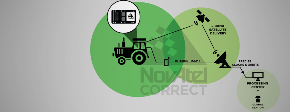
    NovAtel Correct.
    NovAtel Correct.

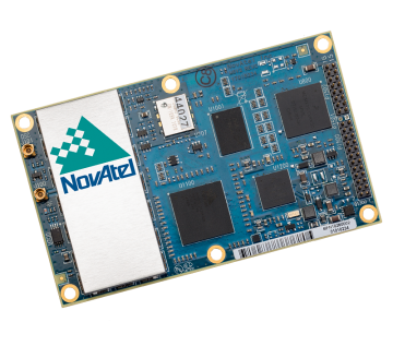
    NovAtel, Inc., OEM provider of high-precision GNSS positioning products, has launched its NovAtel Correct positioning technology. NovAtel Correct optimally combines data from multiple GNSS satellite constellations with corrections from a variety of sources, to deliver the best position solution possible.

    NovAtel Correct provides integrators with the opportunity to choose pricing and subscription options that best match their OEM business objectives. Delivery of correction data is available via satellite or Internet, depending on the requirements of the application. With NovAtel in control of the entire positioning solution, future innovation including seamless integration with all positioning modes and correction types is assured.

    Designed for NovAtel’s OEM6 high-precision receivers, the NovAtel Correct precise point positioning (PPP) solution delivers decimeter-level accuracy worldwide. L-band delivered PPP corrections from TerraStar are supported by NovAtel Correct without users having to add base-station infrastructure. Developers of land, airborne and near shore applications can purchase subscriptions to TerraStar’s correction service directly through NovAtel.

    “For a number of reasons, many of our customers have been eager for an end-to-end NovAtel OEM positioning service,” said Jason Hamilton, VP, Marketing for NovAtel. “NovAtel Correct rounds out our product and service offering and gives customers one-stop shopping for receivers, antennas and correction services.”

    Satellite and NTRIP-based solutions will be available for OEM6 products in Q1 2014 for all applications requiring decimetre-level positioning.

    NovAtel OEM628 triple-frequency +  L-Band GNSS receiver.
    NovAtel OEM628 triple-frequency + L-Band GNSS receiver.
  • FAA Releases Unmanned Aircraft Systems Integration Roadmap

    The U.S. Department of Transportation’s Federal Aviation Administration (FAA) released its first annual Roadmap outlining efforts needed to safely integrate unmanned aircraft systems (UAS) into the nation’s airspace. The Roadmap addresses current and future policies, regulations, technologies and procedures that will be required as demand moves the country from today’s limited accommodation of UAS operations to the extensive integration of UAS into the NextGen aviation system in the future.

    “Government and industry face significant challenges as unmanned aircraft move into the aviation mainstream,” said U.S. Transportation Secretary Anthony Foxx. “This Roadmap is an important step forward that will help stakeholders understand the operational goals and safety issues we need to consider when planning for the future of our airspace.”

    According to the announcement, the Roadmap outlines the FAA’s approach to ensuring that widespread UAS use is safe, from the perspective of accommodation, integration, and evolution.  The FAA’s main goal for integration is to establish requirements that UAS operators will have to meet in order to increase access to airspace over the next five to 10 years. The Roadmap discusses items such as new or revised regulations, policies, procedures, guidance material, training and understanding of systems and operations to support routine UAS operations.

    “The FAA is committed to safe, efficient and timely integration of UAS into our airspace,” said FAA Administrator Michael Huerta. “We are dedicated to moving this exciting new technology along as quickly and safely as possible.”

    The FAA reports that the Roadmap also addresses the evolution of UAS operations once all requirements and standards are in place and are routinely updated to support UAS operations as the National Airspace System evolves over time. The document stresses that the UAS community must understand the system is not static, and that many improvements are planned for the airspace system over the next 15 years.

    The FAA plans to select six UAS test sites to begin work on safely integrating UAS into the airspace.  These congressionally-mandated test sites will conduct critical research into how best to safely integrate UAS systems into the national airspace over the next several years and what certification and navigation requirements will need to be established.

    The use of UAS, both at the designated test sites and in the national airspace generally, raises the issue of privacy and protection of civil liberties. In February, the FAA asked for public comments specifically on the draft privacy requirements for the six test sites. Today, the agency sent a final privacy policy to the Federal Register that requires test site operators to comply with federal, state, and other laws on individual privacy protection, to have a publicly available privacy plan and a written plan for data use and retention, and to conduct an annual review of privacy practices that allows for public comment. Information about the test site selection process and final test site privacy policy is available at: http://www.faa.gov/about/initiatives/uas/

    For the next several years, the FAA will continue to use special mitigations and procedures to safely accommodate limited UAS access to the nation’s airspace on a case-by-case basis. The Roadmap notes that this case-by-case accommodation will decline significantly as integration begins and expands, but will continue to be a practical way to allow flights by some UAS operators in certain circumstances.

    In addition to the FAA’s Roadmap, as required in the 2012 FAA Reauthorization, the Joint Planning and Development Office (JPDO) has developed a comprehensive plan to safely accelerate the integration of civil UAS into the national airspace system.. That plan details a multi-agency approach to safe and timely UAS integration and coordination with the NextGen shift to satellite-based technologies and new procedures.

    The UAS Roadmap (PDF) and UAS Comprehensive Plan is available on the FAA website.

  • GPSTrackIt.com Adds Hard Turns to Driver Safety Alerts

    GPSTrackIt.com has introduced a new Driver Safety Alert that tracks hard turns. Driver Safety Alerts already track and report driving behaviors like rapid acceleration, hard braking, and seatbelt usage. GPSTrackIt engineers have now added the ability to identify “hard turns” to the alert list.

    Driver Safety Alerts are used by businesses across the country to help dispatchers and managers understand how drivers are doing in the field.  Businesses ranging from small-to-medium sized service companies to large transportation companies with fleets of hundreds of vehicles are able to help drivers understand the importance of safe driving behaviors.

    “Drivers represent their employers to the public,” said Eddie Bermudez, GPSTrackit.com’s product development manager.  “A vehicle that is driven badly or, more to the point, dangerously, does not reflect well on that employer.  These alerts notify managers and dispatchers via email or SMS text messages when their drivers are driving in a potentially aggressive manner.”

    Rapid acceleration and hard braking are indicators of bad driving behaviors that also impact a vehicle’s mileage.  Seat belt alerts indicate that the vehicle is moving while the driver’s seat belt is unfastened.  Statistics show that wearing a seatbelt dramatically reduces deaths and injuries from collisions.

    “Hard turns are another driving behavior that puts the driver and vehicle at additional risk,” continued Bermudez.  “It also puts additional wear on a vehicle.  We were able to utilize the accelerometer and gyroscope technologies built into the GPS tracking devices in a similar manner to the hard braking alert.”

    According to the National Transportation Highway Safety Administration’s 2008 report to Congress, “National Motor Vehicle Causation Crash Survey,” about 36 percent of vehicles involved in collisions were turning or crossing at intersections just prior to the crashes.

    “When we’re making a turn, we become more vulnerable,” added Bermudez. “Clearly in a left turn situation you’re putting your vehicle in the path of oncoming traffic.  But right turns can be hazardous as well to both pedestrians and drivers. Turn too soon and you clip the curb, which doesn’t do much for your wheel alignment.  Turn too late and you could end up making a wide turn.  If the device on the vehicle transmits a hard turn event, Fleet Manager checks if an alert is configured for that vehicle.  If so, it sends the time, date, and location information to the email and/or text recipients.”

  • Kinexon Wins 10th European Satellite Navigation Competition with Athlete Tracking Analysis

    Kinexon Wins 10th European Satellite Navigation Competition with Athlete Tracking Analysis

    Photo: Kinexon

    Online analysis of athletes’ tactical, technical, and physical capability is the focus of this year’s newly named Galileo Master, Kinexon GmbH.

    The 10th European Satellite Navigation Competition (ESNC) recognized the best products, services, and innovations that facilitate the use of satellite navigation in everyday life. At the 2013 awards ceremony, prizes worth a total of about EUR 1 million were presented in 32 categories. The ceremony helped kick off the European Space Solutions conference, which is taking place November 5-7 at Alte Kongresshalle München.

    ESNC 2013 gave participants from all around the world the chance to vie for any one of 25 regional prizes. In addition, topic-specific special prizes were sponsored by the following partners: the European GNSS Agency (GSA), the European Space Agency (ESA), the German Aerospace Center (DLR), and — for the first time this year — the European Patent Office (EPO) and Metaio GmbH. Students and research assistants were also encouraged to submit their ideas to the ESNC University Challenge.

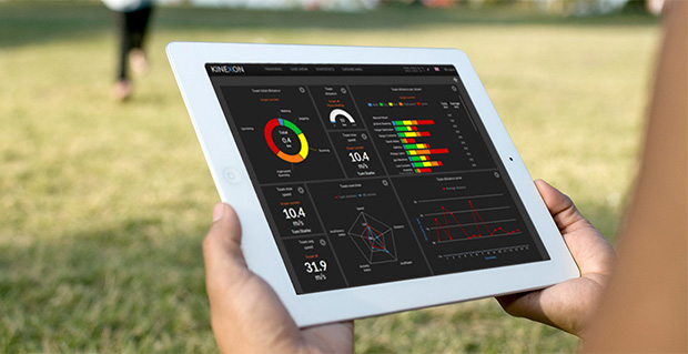
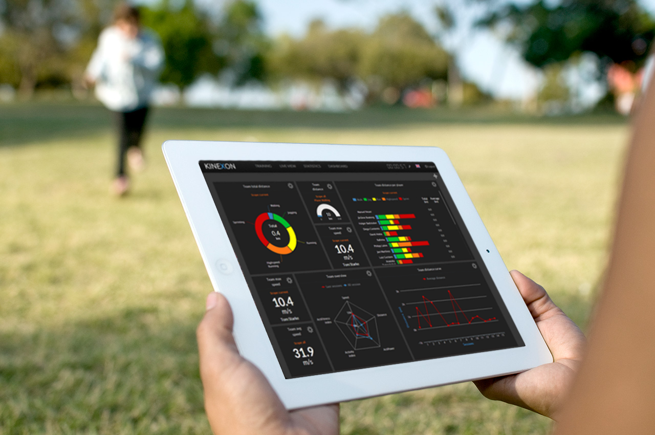
    Athletic analysis is playing an increasingly important role in modern sport training. The underlying idea — known as the Hawthorne effect — is simple: if you can measure your performance, you can also improve it. Following this principle, two research assistants from Technische Universität München (Germany) founded the company Kinexon GmbH at the ESA Business Incubation Centre Bavaria and developed a cloud-based solution for analyzing and visualizing training data on mobile devices.

    Kinexon’s solution kits athletes out with a small, portable location sensor and feeds the resulting data into the cloud by means of a stationary base antenna. This enables users to track and analyze performance parameters and tactical movements down to the centimeter in real time.

    In particular, however, it was the solution’s user-friendliness during training and relatively low cost (compared to the camera-based systems commonly seen today) that won over the international jury of experts in the European Satellite Navigation Competition. So far, the high price of such systems has limited their use to professional sport; Kinexon’s system will now give amateur clubs the chance to benefit from adding online analysis to their training activities, as well.

    Along with the sport sector, this flexible satellite-based localization system also exhibits huge potential in tapping into further markets, including healthcare, logistics, and unmanned aerial vehicles (UAVs). “We’re pleased to be supporting Kinexon at ESA BIC Bavaria,” affirms Thorsten Rudolph, CEO of Anwendungszentrum GmbH Oberpfaffenhofen. The Kinexon system, the first version of which is set for market launch in November 2013, managed to edge out more than 400 other ESNC entries from nearly 50 countries.

    Gerd Gruppe, member of the Executive Board, German Aerospace Center (DLR), conferred the EUR 20,000 grand prize on Kinexon GmbH founders Oliver Trinchera and Alexander Hüttenbrink.

    “DLR sets great store in technology transfer,” Gruppe said. “After all, innovations form the basis of economic success and hold considerable potential for society. The ESNC has developed into a driving force behind the innovative use of satellite navigation technologies and a starting point for numerous successful start-ups in Germany, Europe, and the rest of the world.”

    Winners of the 10th European Satellite Navigation Competition

    In addition to the overall winner, the Galileo Master, the 10th European Satellite Navigation Competition rewarded Special Prizes in seven different categories and 25 prizes to regional winners.

    Special Prize Winners 2013 
    GSA :: The most promising EGNOS application idea
    Jelle Reichert, JOHAN, The Netherlands :: JOHAN: the Digital Oracle for Field Sports, Including GNSS Player Tracking in Real Time
    Keywords: Mobile Location Based Services, sports,  real-time tracking, health
    ESA Innovation Prize & 2nd in Overall Ranking
    Jan Walter Schroeder and team, SenSovo, Germany :: Sensovo Navipal: A New Way to Feel Directions
    Keywords: tactile navigation, wearable technology, tourism, outdoor sports, visually impaired
    DLR :: Robust GNSS – Safety for Success
    Bastiaan Ober and John Wilde, Integricom, DW International, The Netherlands :: Galileo-Based Ionospheric and Interference Monitoring for Aviation
    Keywords: signal security, real-time monitoring, aviation,  interference
    EPO :: Best Patented Innovation
    Gaël Scot and team, CNES, France :: Two Patents for Improved Galileo System Performance
    Keywords: signal security, patents, high-end GNSS receivers
    Metaio :: The most innovative location-based Augmented Reality application
    Steve Lee and team, Stevenson Astrosat, United Kingdom :: WinterVision: Augmented Reality for Winter Road Safety
    Keywords: augmented reality, road safety, driver assistance system, emergency response
    University Challenge & Portugal
    Luis Gomes and Filipe Sousa, Outcapsa, Portugal :: GeoAgenda: Innovative Geo-located Agenda Concept
    Keywords: LBS, smart personal organiser, meeting tool
    GNSS Living LabPrize & North Rhine-Westphalia / Germany & 3rd in Overall Ranking
    Adalbert Rajca and Yasotharan Pakasathanan , ampido GmbH, Germany :: Ampido: The Car Park in Your Pocket
    Keywords: Location Based Services, smart city application, park-sharing, share economy


    Regional Prize Winners 2013
    Aquitaine/France
    Romain Desplats and team, CNES, France :: Physiotrack: Track Your Physical Progress
    Keywords: sports tracking, health, performance monitoring, physical exercise forecast
     Arab Middle East & North Africa (MENA)
    Hussain Saleh, Ghent University, Belgium :: A Generic GNSS Network for Disaster MonitoringKeywords: emergency management, disaster monitoring, big data, artificial intelligence
    Austria
    Dr Clemens Strauß and Gernot Hollinger, Strauß & Hollinger : GeoIT OG, Austria :: ENViGUARD: The App That Helps Keep Your City Clean
    Keywords: smart waste management, crowdsourcing, LBS, public health, pollution control, environmental protection
    Baden-Württemberg / Germany
    Erich Franke and team,  AFUSOFT Kommunikationstechnik GmbH, Germany :: SaltHawk: Innovative Winter Road Safety System
    Keywords:  road safety, environmental protection, road service management
    Bavaria / Germany & Overall Winner
    Dr Oliver Trinchera and Dr Alexander Hüttenbrink , KINEXON GmbH, Germany :: KINEXON: Precise Localisation and Sports Monitoring
    Keywords: precise tracking, wearable technology, sports, health, logistics
    Bulgaria
    Nikolay Staykov and team, Mobilly, Bulgaria :: Mobilly: A Next-Generation Travel Planner
    Keywords: LBS, travel planner, local discount campaigns, couponing
    Catalonia / Spain
    Rafael Olmedo and Carlos Barreto, GEKO NAVSAT, SpainNAVMATE: The Low-Cost Safety Solution for the Great Outdoors
    Keywords: wearable technology, emergency management, outdoor navigation, outdoor sports
    Czech Republic
    Jiří Mikoláš and team, Be interactive, Czech Republic :: Augmented Prague: The Innovative Sight Seeing App
    Keywords: Augmented Reality, AR, LBS, tourism, city guide


    Estonia
    Mari Loorman, Estonia :: LASIK: Optimising Children’s Physical Activity
    Keywords: children’s health, physical activity, computer addiction
    Flanders / Belgium
    Joeri Spitaels and team, QraQon, Belgium :: Winnetou: Improved Security for Freight Wagons
    Keywords: freight tracking, transport security, solar-powered
    Gipuzkoa / Spain
    Jon Sánchez Ugarte, OnSiteBIM, Spain :: BimOn! Making Building Smarter with AR
    Keywords: Augmented Reality, AR, construction sites, building models, LBS
    Hesse / Germany & 3rd in Overall Ranking
    Lukas Wagner and team, Notificatio UG, Germany:: AlarmApp: Location-based Emergency Notification System
    Keywords: emergency management, volunteer fire fighters, LBS
    Ireland
    Paula Kelleher and James Mannix, Geomanics Ltd, Ireland :: CarSafari: Every Trip an Adventure
    Keywords: in-car entertainment, tourism, education, location-based advertising
    Japan
    Hitomi Inaba and team, University of Tokyo, Japan :: TrustSync: Secure Time and Frequency Synchronisation
    Keywords: high precision, signal security, synchronisation, GNSS receivers, financial networks
    Lithuania
    Saulius Rudys and Mantautas Rudys, Lithuania :: Improved Indoor and Underground Navigation Accuracy
    Keywords: indoor navigation, GNSS repeater, precise navigation
    Lombardy / Italy
    Mirko Antonini and Alessandro Di Felice, SpaceEXE Srl, Italy :: COPPI: Monitoring and Tracking of Cyclists
    Keywords: professional cycling teams, sports tracking, health, real-time performance monitoring
    Mexico
    Victor Jose Gatica-Acevedo and team, National Polytechnic Institute, Mexico :: AMBER Alert: Recovering Lost Children Through GNSS Integration
    Keywords: seach and rescue, LBS, notification, tracking
    The Netherlands
    Willem Folkers, Folkline, The Netherlands :: The Anti-Spoofing GNSS Receiver
    Keywords: signal security, safety critical applications, Galileo PRS (public regulated service)
    Nice-Sophia Antipolis / France
    Yann Hervouet and team, Instant System, France :: Real-Time Solutions for Public Transport PassengersKeywords: real-time trip planner, smart public transport, real-time schedule information
    North Rhine-Westphalia / Germany & GNSS Living Lab Prize & 3rd in Overall Ranking
    Adalbert Rajca and Yasotharan Pakasathanan , ampido GmbH, Germany :: Ampido: The Car Park in Your Pocket
    Keywords: Location Based Services, smart city application, park-sharing, share economy
    NorwayHarald Skinnemoen and team, AnsuR, Norway :: GNSS-Enabled Do-It-Yourself Insurance Claims                 
    Keywords: LBS, insurance claims, geo-tagged images, crowdsourcing
    Øresund / Denmark & Sweden
    Andreas Ekengren and team, PingPal AB, Sweden :: Pingpal: Privacy-Protected Positioning for Your App
    Keywords: social networking, cloud solution, privacy protection
    Portugal & University Challenge
    Luis Gomes and Filipe Sousa, Outcapsa, Portugal :: GeoAgenda: Innovative Geo-located Agenda Concept
    Keywords: LBS, smart personal organiser, meeting tool
    Switzerland
    Che-Tsung Lin and team, Industrial Technology Research Institute, Taiwan :: See Through: Driving as You’ve Never Seen Before
    Keywords: driver assistance, V2V communication, road saftey
    United Kingdom
    Georgios Michalakidis and team, ManagePlaces Limited, United Kingdom :: ManagePlaces: Location-Based Project Management
    Keywords: field staff management, LBS, mobile workflow management, cloud solution


  • Altus Makes Available Juniper Archer 2 Field Computer with APS-3 Receiver

    Altus Makes Available Juniper Archer 2 Field Computer with APS-3 Receiver

    Archer-2

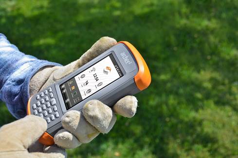
    Altus Positioning Systems has announced the availability of the new Juniper Archer 2 field computer packaged with Altus’ APS-3 GNSS RTK receiver.

    “When paired with the performance, portability and flexibility of the APS-3, the new Archer 2 provides an unbeatable value proposition,” said Neil Vancans, president of Altus Positioning Systems. “This dynamic duo will allow surveyors to improve productivity by capturing data faster and staying in the field longer.”

    The Archer 2 is a powerful handheld computer with an IP68 certification and MIL-STD-810G compliance, and operates between -30 to +60 degrees C. It features a 1.0 GHz processor, 512 MB RAM and 8 GB flash storage. This second-generation instrument introduces an impressive line-up of new features, including the exclusive IllumiView brilliant display that overpowers the brightest sunlight, custom Overtime Technology intelligent Li-Ion battery yielding over 20 hours service between charges, and a glove-friendly capacitive touchscreen and keypad. As a successor to the popular Archer Field PC, the Archer 2 builds upon a  reputation of quality, adding big improvements and new features, Altus Positioning said. Like Juniper Systems’ other rugged handhelds, the Archer 2 is made to take a beating.

    The APS-3 has won accolades from surveyors for its accuracy, reliability and ease of use in the field. The 136-channel GPS/GLONASS RTK receiver includes an integrated quad-band GSM/GPRS modem, digital 406-470 MHz UHF transceiver and wireless Bluetooth connectivity. The flexible architecture allows the same device to be used either as a rover or base station. A popular feature is the dual hot-swappable Li-Ion batteries that allow field work to continue without interruption to change batteries.

    “We are excited to get the Archer 2 into the hands of our customers,” said Julie Johns, Project Manager at Juniper Systems. “We have designed the Archer 2 according to our customers’ needs, and we are very happy with how the final product has turned out. It feels great to send another new product out the door that we can be proud of.”

  • Trimble’s GeoExplorer GNSS Data Collection Adds Remote Positioning Capability

    Trimble’s GeoExplorer GNSS Data Collection Adds Remote Positioning Capability

    Photo: Trimble

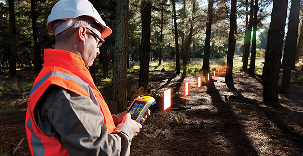
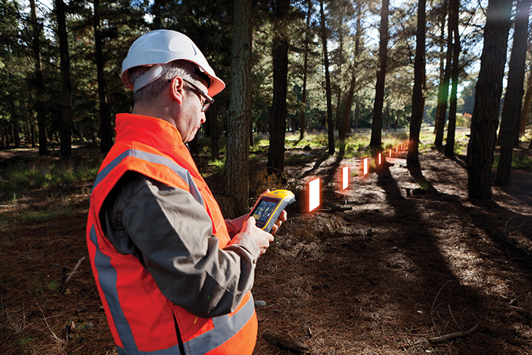
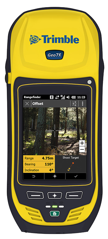
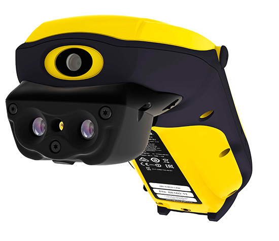
    Trimble has introduced the next generation of its Trimble GeoExplorer data collection solution. The new Geo 7X includes an integrated laser rangefinder module, extended GNSS capabilities and improved hardware performance. Together with robust field and office software, the new Trimble Geo 7X handheld can enhance productivity in difficult physical conditions and challenging GNSS environments.

    When faced with either obstructed satellites or inaccessible locations, GIS professionals now have the geospatial data collection tools they need in a single package, Trimble said. For times when occupying a position isn’t possible, users can take advantage of Trimble’s new Flightwave technology. With Flightwave technology, users can capture offset measurements from the Geo 7X’s rangefinder module for direct integration with Trimble data collection software. Users point and shoot to log the position, avoiding dangerous conditions or right-of-way challenges. In addition, Trimble’s field-proven Floodlight technology enhances field productivity when heavy overhead cover obstructs satellite signals.

    Photo: TrimbleThe Geo 7X is compatible with existing and planned GNSS satellite systems — including GPS, GLONASS, Galileo, QZSS and BeiDou — to maximize productivity with additional satellites and ranging signals.

    Featuring a new 1 GHz processor and 4 GB of memory running Microsoft Windows 6.5 Professional operating system, the Geo 7X offers enhanced computing performance. Other standard features include a 4.2 inch sunlight readable LED touch display and a 5 MP camera for geo-tagging assets. For wireless connectivity, the integrated modem allows users to send and receive data via GSM networks as well as Verizon’s CDMA network in the U.S. And with its IP65 rating, the rugged handheld GNSS receiver is sealed against water and dust.

    With the introduction of the Geo 7X, Trimble also delivers updates to its field and office software portfolio to extend Trimble’s end-to-end data collection solutions with new software workflows and compatibility. In addition to the field-proven Trimble TerraSync and Positions software, the Geo 7X now supports the customizable data collection workflows of Trimble TerraFlex software. Consisting of mobile software and Cloud services, TerraFlex offers a fast and efficient way to collect, process and manage data. Field data is automatically synced with a central server to streamline office operations and drive higher productivity.

    ”We believe that true productivity is being able to map assets — the first time, every time and anywhere. We’ve built upon our productivity-enabling Floodlight technology and pushed it forward several steps,” said Alain Samaha, business area director of GIS and geospatial software solutions for Trimble’s Geospatial Division. “Users now can position themselves in the optimal location and accurately measure assets remotely with a single, integrated device together with simple software workflows. The Trimble Geo 7X allows mobile GIS users to be productive wherever they need to work.”

    Photo: TrimbleThe Trimble Geo 7X and supporting software are expected to be available in fourth quarter of 2013 through Trimble’s authorized GIS Distribution Channel.

  • Sonata Advertising Platform Brings Online Customers  to Bricks-and-Mortar Stores

    Sonata Advertising Platform Brings Online Customers to Bricks-and-Mortar Stores

    Sonata
    Sonata is a self-service advertising platform for the retail world.

    Currently, 96 percent of world trade takes place through traditional brick and mortar stores. Add almost 1,000 million smartphones with integrated GPS to that retailing picture and a whole range of advertising opportunities, with high added value for advertisers and consumers, opens up. Sonata was begun l to drive foot traffic to local retailers’ point of sale via potential customers’ smartphones.

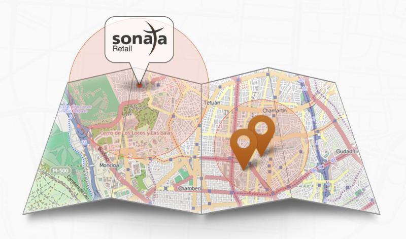
    Sonata divides the world into 90-square-metre plots. The plots are uploaded with local business adverts, which then appear on smartphones and tablets that come in range of the advertiser according to the smartphone’s geolocation. Sonata has been developed by TAPTAP Networks, a Spanish mobile advertising market leader based in Madrid.

    The process of uploading an advertising campaign is very simple for the retailer and takes no more than three minutes, according to Sonata. A retailer doesn’t need a website or even a mobile app; all that’s required is a minimum investment of £50. Advertisers follow three steps:

    1. registration using an email address;
    2. adding the store details (just one or a whole network);
    3. choosing the ad’s geographical area and the design of the ad from one of Sonata’s creative templates (or advertisers can create their own design).

    “Any local business, including those without technical know-how, can create an advertising campaign,” says Alvaro del Castillo, CEO of TAPTAP Networks and the developers of Sonata.

    “An added attraction of Sonata is that local businesses only pay for actual results-calls, registrations, clicks, purchases in the store… whatever form of contact a customer makes-and can choose how much to pay for them,” says del Castillo.

    “The Sonata platform is focused on meeting the need of the local small-business sector, which views the online world as a major threat with the ever-growing pressure it exerts from ‘showrooming’ and the selling of cost price goods by major e-commerce players,” explained de Castillo.

  • ABI Research: MEMS Sensors and Hands-Free Interfaces Will Revolutionize Mobile Devices

    ABI Research: MEMS Sensors and Hands-Free Interfaces Will Revolutionize Mobile Devices

    Photo: ABI Research

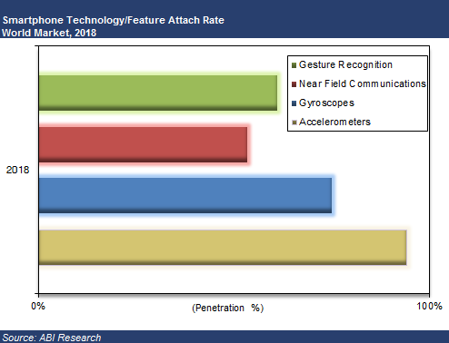
    Accelerometers, gyroscopes, near field communications (NFC), and gesture recognition are predicted to be the big winners in mobile devices. These mobile technologies are projected to make the greatest penetration gains over the coming years, according to a recent study by market intelligence firm ABI Research.

    “Hands-free operation or gesture recognition is soon going to become a key differentiator in high-end flagship smartphones, media tablets, and smart glasses,” says senior analyst Joshua Flood. “Samsung’s latest Galaxy S4 has already incorporated the technology within its handset and has received significant plaudits for its new innovative user experience. Furthermore, with a host of new smart glass products soon to be released, it is easy to imagine the usefulness of the interface with this product.” In 2013, almost 12% of smartphones shipped will have vision-based gesture recognition capabilities.

    Accelerometers and gyroscopes play a crucial role with today’s mobile devices, enabling devices to be more intuitive and take action without a user pressing a button. Simple actions like switching from portrait to landscape when a smartphone is tilted are made possible by including these components. Additionally, the fast growing mobile gaming market is highly dependent upon smartphones including gyroscopes, which enhance gaming experience. Nearly half of the smartphones shipped this year will include these MEMS sensor types.

    NFC has been one of the most talked about mobile technologies that has not quite taken off. The technology has primarily been focused around mobile payments; however, mobile OEMs have begun to see other potential capabilities for the technology such as photo-sharing and location information tag points that could open a huge market for advertising and marketing campaigns. Within three years, it is anticipated one in two smartphones shipped will include NFC and have gesture recognition capabilities. Furthermore, accelerometers and gyroscopes will be the “norm” with most smartphones.

    These findings are part of ABI Research’s Next Generation Mobile Devices and Mobile Handset Go-to-market Strategies Research Services.

  • Galileo Satellites Put to the Test

    Galileo Satellites Put to the Test

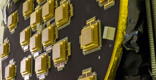
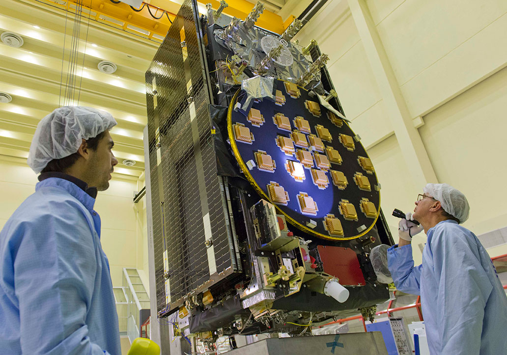
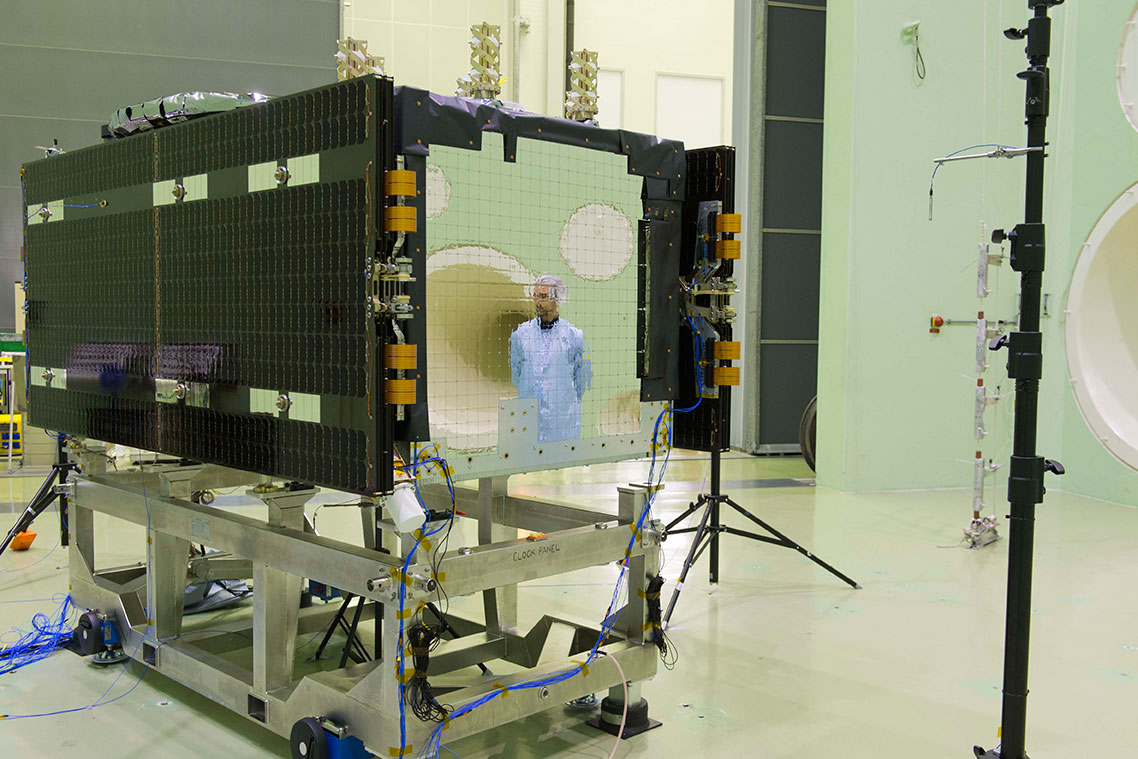
    The main antenna of the second Galileo Full Operational Capability (FOC) satellite being inspected with a flashlight in advance of mass property testing during August 2013.
    The main antenna of the second Galileo Full Operational Capability (FOC) satellite being inspected with a flashlight in advance of mass property testing during August 2013.

    Europe’s next pair of Galileo satellites have been the focus of a busy autumn at the European Space Agency’s (ESA’s) technical centre in the Netherlands, continuing a full-scale campaign to ensure their readiness for space.

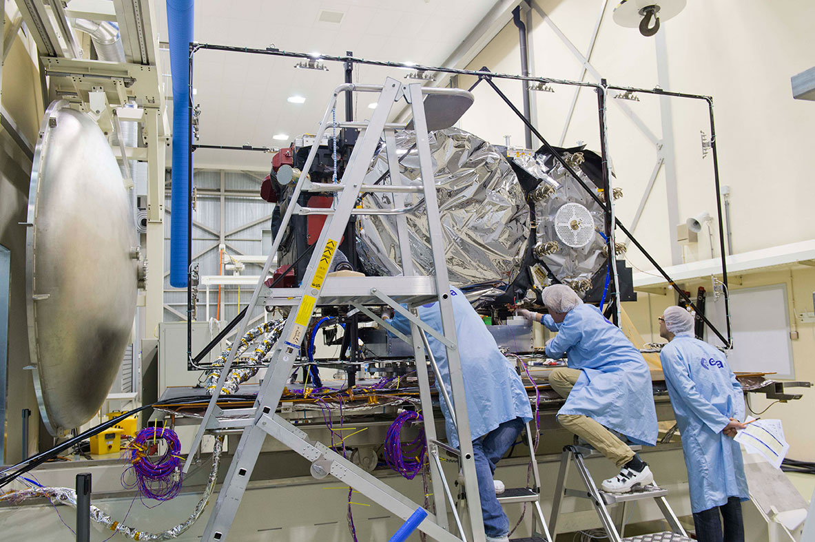
    The first Galileo Full Operational Capability (FOC) satellite, FM1, seen beside the Phenix test chamber being readied for its five-week long thermal vacuum testing in October 2013.
    The first Galileo Full Operational Capability (FOC) satellite, FM1, seen beside the Phenix test chamber being readied for its five-week long thermal vacuum testing in October 2013.

    With the first four Galileos already in orbit, these new versions are the first two of a total 22 Full Operational Capability (FOC) satellites being built by OHB in Germany with a payload from Surrey Satellite Technology Ltd. in the UK.

    The second satellite joined its predecessor in mid-August at ESA’s European Space Research and Technology Centre in Noordwijk. This is the largest spacecraft testing site in Europe, with a full range of space simulation facilities under a single roof in cleanroom conditions. A wide range of tests have been performed on the two satellites.

    The first of the two satellites is now midway through a five-week immersion in vacuum and temperature extremes that mimic the conditions it faces in space. This thermal-vacuum test takes place inside a 4.5-meter diameter stainless-steel vacuum chamber called Phenix. An inner box called the thermal tent has sides that are heated to simulate the Sun’s radiation or cooled down by liquid nitrogen to create the chill of Sunless space.

    Second Galileo Full Operational Capability (FOC) satellite being prepared for acoustic testing, simulating the noise of a rocket launch, inside the Large European Acoustic Facility, LEAF, of the ESTEC Test Centre in early September 2013.
    Second Galileo Full Operational Capability (FOC) satellite being prepared for acoustic testing, simulating the noise of a rocket launch, inside the Large European Acoustic Facility, LEAF, of the ESTEC Test Centre in early September 2013.

    The newly arrived satellite first underwent a mass property test — measured to check its center of gravity and mass are aligned within design specifications. The more precisely these are known, the more efficiently the satellite’s orientation can be controlled with thruster firings in orbit, potentially elongating their working life by conserving propellant.

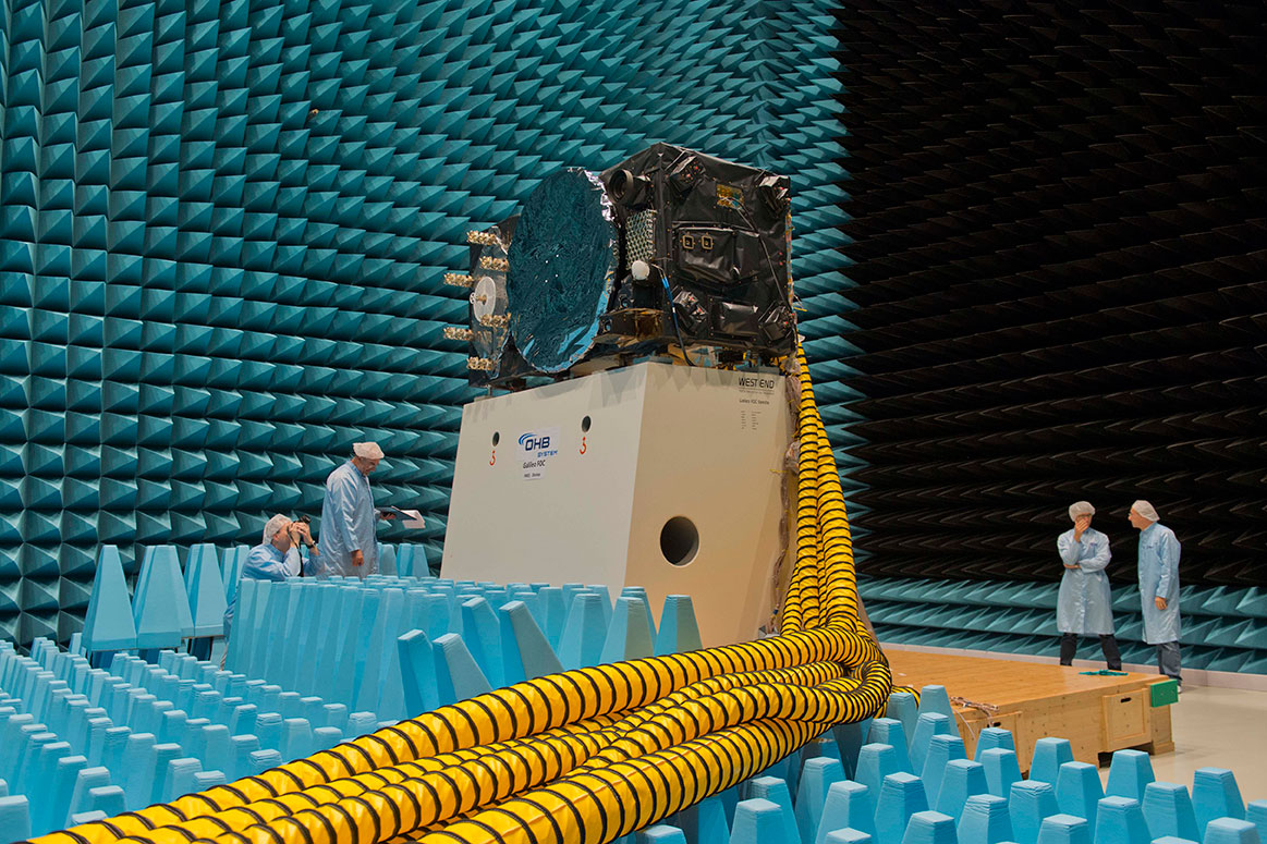
    Meanwhile, its predecessor left the wider universe behind in the Maxwell Test Chamber. Shielded walls blocking out all external electrical signals and spiky, radio-absorbing anechoic material lining the chamber enable electromagnetic compatibility testing. Isolated within the chamber as though floating in infinite space, the satellite could be switched on to check all its systems can operate together without interference.

    September saw the second satellite undergo acoustic testing in the Large European Acoustic Facility, LEAF, effectively the largest sound system in Europe. The first satellite submitted to this trial just a few weeks before. A quartet of noise horns are embedded in one wall of this 11-meter-wide, 9-meter-deep and 16.4-meter-high chamber, generating sound by passing nitrogen gas through the horns, surpassing 140 decibels.

    Galileo Full Operational Capability (FOC) satellite first flight model, FM1, being prepared for 'passive intermodulation testing' within the Maxwell electromagnetic test facility inside the ESTEC Test Centre at the end of August 2013.
    Galileo Full Operational Capability (FOC) satellite first flight model, FM1, being prepared for ‘passive intermodulation testing’ within the Maxwell electromagnetic test facility inside the ESTEC Test Centre at the end of August 2013.

    Accelerometers placed within the satellite checked for potentially hazardous internal vibration during this trial by sound. Then the spacecraft was vibrated on the shaker tables, simulating the violent forces of a rocket launch.

    Up-and-down vibration on the QUAD shaker followed by side-to-side shaking on the horizontal shaker, with data gathered across hundreds of channels.

    The satellite was then connected to the dispenser that will hold it during launch to simulate the separation at the end of its climb to orbit. This separation is triggered by firing a pyro device which then pushes the satellite away from the dispenser. This demonstration took place last month.

    “There will always be two Galileo satellites being tested at the ESTEC Test Centre for the next few years,” explains Giuliano Gatti, the head of the Galileo Space Segment Procurement Office.

    “As the Galileo constellation takes shape, ESTEC will remain an essential part of each satellite’s pathway to space, between the end of manufacturing in Germany and UK and the launch by Soyuz ST-B or Ariane-5 from Europe’s Spaceport in French Guiana.

    “Of course, the testing on these initial FOC satellites is especially rigorous because we are validating the overall design. The Galileo satellites to follow will undergo more streamlined ‘acceptance’ testing instead.”

    The next two satellites are in final assembly at OHB in Germany, scheduled to reach ESTEC early next year, as these first two satellites head off to French Guiana for launch.

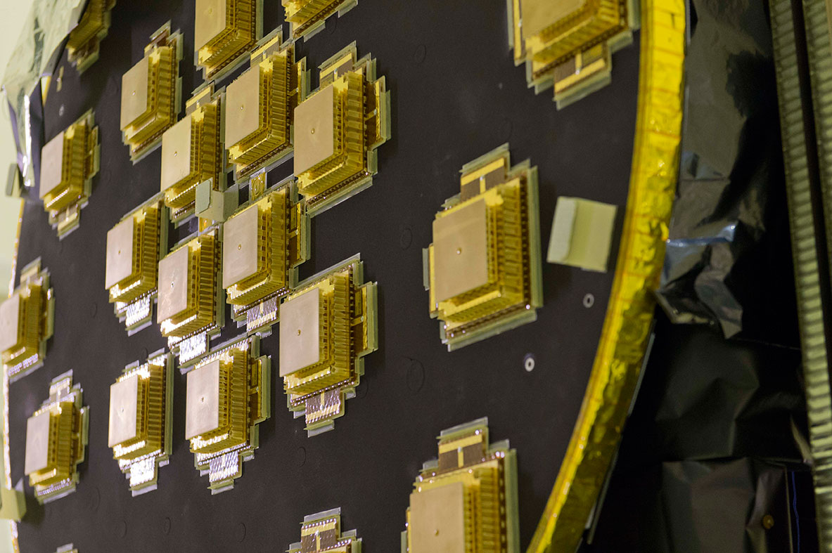
    Galileo Full Operational Capability Flight Model 2, FM2, satellite's main L-band antenna used for broadcasting navigation messages, seen during preparation for a mass property test at the ESTEC Test Centre at the end of August 2013.
    Galileo Full Operational Capability Flight Model 2, FM2, satellite’s main L-band antenna used for broadcasting navigation messages, seen during preparation for a mass property test at the ESTEC Test Centre at the end of August 2013.
  • Kipo, Tigo Enter Alliance to Offer GPS Location Software to Cell Phones

    Kipo, a GPS mobile location technology company targeting businesses and families, and Tigo Business Guatemala, a  telecommunications company, announced their partnership to launch Localizador Tigo. Localizador Tigo is a smart, user-friendly location platform that allows any type of mobile device to connect to the web and trigger actions by predetermined rules, the companies said.

    Triggers include location (arrival, exit, stay) and device events such as battery consumption and speed. Rules determine how the event will trigger and the action to take — send an email, post on social networks, mark a calendar, send an SMS, among others. For example, a company can create a rule that notifies a manager when his messenger delivers paperwork. Every time the messenger arrives to a specific location, the manager would receive an automatic email from the software. The sales manager could also create a rule to identify every time the sales team members have less than 10 percent battery. Once a device runs low on battery the manager would receive an automatic SMS to his mobile device.

    The technology also lets team members check in and leave comments when they arrive with clients, information that can be seen in real-time on the web alongside a complete suite of reports to make cell phone devices more useful than ever before. The product can work with any mobile device — smartphones will be able to access the service through native applications and feature phones will rely on cell-towers to report location.

    Localizador Tigo gives customers full ownership and control over their data and eliminating contracts, giving them the liberty to cancel service at any time. The product will be launched initially for corporate clients of Tigo Business and will be offered to individual customers on a later phase.

    “We believe GPS location technology should be smarter and easier to use. This alliance with Tigo Business makes real-time GPS technology accessible to millions of Tigo customers, which is great because we are allowing more people than ever before receive the benefits this technology provides,” said Rodrigo Blanco, founder and co-CEO of Kipo, Inc.

    “In Tigo Business we are always looking to provide our clients with the best and the most advanced tools so they can operate efficiently. We had been searching globally for the leading geolocation platform to incorporate to our mobile devices, and to our surprise we found it in a Guatemalan startup. The Kipo platform is functional, targets the needs of Tigo Business clients and is easy to use. The partnership with Kipo is a perfect next step to continue innovating and offering preeminent products to our clients,” said Hector Jimenez, category manager of Tigo Business Guatemala.

  • Esri Publishes Interactive Track Map of Typhoon Haiyan

    Esri published an interactive track map of Typhoon Haiyan, likely one of the strongest storms in recorded history.

    According to Esri, users can see the real-time effects of the storm via social media posts. To change the search terms, go to the Social menu, click the settings icon, and update the keyword.

    http://www.esri.com/services/disaster-response/hurricanes/latest-news-map
    Chart: Esri, http://www.esri.com/services/disaster-response/hurricanes/latest-news-map