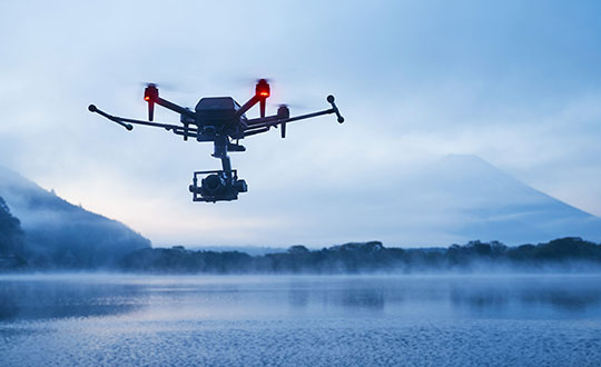
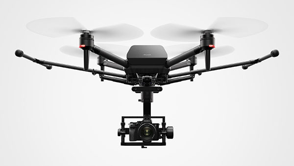
Inertial Labs and Sony have partnered to integrate lidar technology into Sony’s Airpeak UAV. The collaboration aims to improve the UAVs applications in surveying, mapping and cinematic videography, as well as provide high accuracy and detail to aerial data acquisition.
The partnership will incorporate Inertial Labs’ RESEPI lidar remote sensing payload instrument GEN-II into Sony’s UAV to enhance Airpeak’s ability to produce detailed aerial maps and 3D models.
Tailored for professionals, the lidar system integrated into Sony’s Airpeak drone UAVwill significantly enhance workflow efficiency and data accuracy, particularly in sectors such as construction, agriculture, and filmmaking, according to Inertial Labs. The system allows for extensive data handling and facilitates longer durations of data collection without frequent offloads.
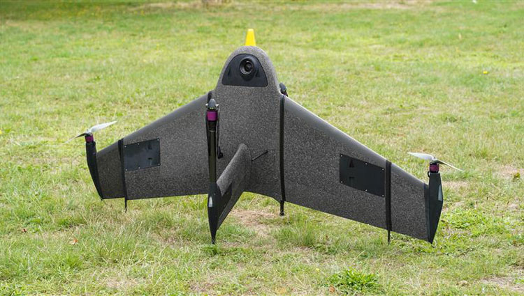
Atmos has integrated the new Sony a6100 Oblique camera into its vertical take-off and landing (VTOL) fixed-wing UAV, the Marlyn Cobalt. The device can be used by professionals in the geospatial mapping and surveying sectors.
The Sony a6100 Oblique camera is an innovative addition to the Marlyn Cobalt because it combines Sony’s 24MP a6100 with a Meike 12mm lens to provide users with a solution for lower-resolution surveying that produces 3D models for urban surveys.
With the integration, the Marlyn Cobalt boasts a 350-hectare coverage at 400 feet, reducing operational time and costs. The resulting ground sampling distance (GSD) of 4cm at that altitude ensures high-resolution data acquisition, delivering detailed images for precise analysis.
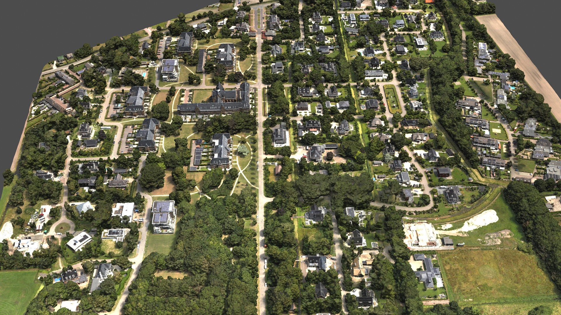
The map below (Figure 1) was surveyed by one of Atmos’ customers. The UAV enabled them to identify and inspect the built and natural environment through different processing ways for urban planning in the town of Sancta Maria in the Netherlands.
Figure 1: 3D reconstruction of the Sancta Maria urban area. (Image: Atmos)
To learn more about the integration, visit the Atmos website.
A roundup of recent products in the GNSS and inertial positioning industry from the March 2023 issue of GPS World magazine.
UAV
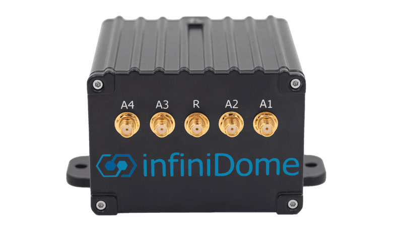
Image: InfiniDome
Anti-Jamming Device Provides protection from three directions of attack
The GPSdome 2 is tailored to defend small- to medium-sized tactical UAVs as well as manned and unmanned ground vehicles. With a small form factor (500 g, 87 mm x 91 mm x 61.55 mm) and minimal power consumption, GPSdome 2 is suitable for loitering munitions as well as UAVs. Fully retrofit and completely standalone, the system is compatible with almost any off-the-shelf GNSS receiver as well as standard active GNSS antennas, meaning that it can be integrated into existing GPS systems or into new product lines, manned or unmanned. With sophisticated algorithms and a proprietary RFIC, GPSdome 2 analyzes RF interference in the environment and combines multiple antenna patterns to create and dynamically steer three nulls in the direction of any hostile signal. GPSdome 2 provides simultaneous dual-frequency protection (GPS L1 + L2 or GPS L1 + GLONASS G1), creating up to three nulls, protecting from three jamming directions within each band in real time, making it suitable for PNT applications. The GPSdome 2 is a dual-use, non-ITAR device and comes with optional mil-spec compliance. InfiniDome, infinidome.com
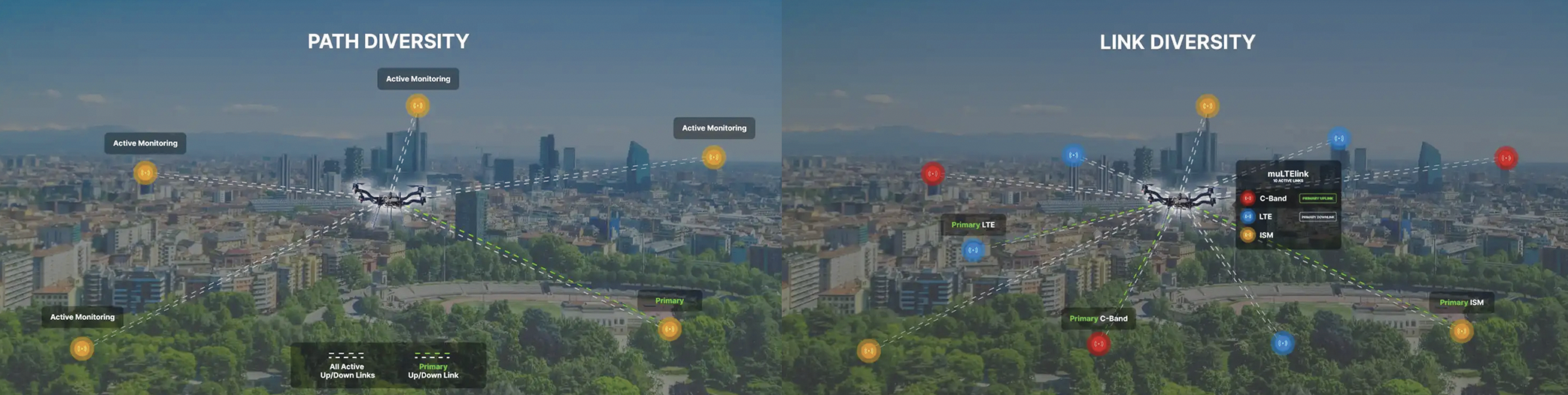
Image: uAvionix
Command and Control Designed for easy integration
The SkyLine C2 management platform and muLTElink airborne radio systems (ARS) are designed to integrate, which enables a self-healing command-and-control network capable of both path and link diversity. This eliminates lost-link possibilities over broad terrain and altitude ranges. MuLTElink ARS consists of two models — muLTElink915 and muLTElink5060, the core of the uAvionix C2 system. The muLTElink915 model combines globally licensed aviation LTE, enhanced with frequency hopping 902 MHz – 928 MHz industrial, scientific and medical frequencies capability. The muLTElink5060 model combines global LTE with aviation-protected 5,030 MHz – 5,091 MHz C-band. Each muLTElink model allows up to one external CNPC radio to be optionally connected to allow simultaneous use of all three frequency ranges, higher power C-band operation or future radio integrations. uAvionix, uAvionix.com
Image: Atmos
VTOL UAV With Sony a7R mark III and IV camera
Atmos has integrated the Sony a7R mark III and IV cameras into its vertical take-off and landing (VTOL) fixed-wing UAV, the Marlyn Cobalt. This will increase coverage and accuracy achieved in a single flight for surveyors. Both cameras have an ISO of 32,000, which is expandable to 102,400, and camera sensors with high megapixel count — 42,4 MP for the a7R III and 61 MP for the a7R IV. When combined with Zeiss’ 35 mm and 21 mm lenses, it enables UAV surveyors to achieve ground sample distance levels below one 1 cm. The integration of the two cameras enables Marlyn Cobalt users to map an area of 210 ha with centimeter-level accuracy in a single flight. Atmos, atmosuav.com
UAV and Lidar Systems Suitable for geospatial professionals
TrueView 535 consists of updated lidar sensors, adding a third return, increasing mapping abilities below canopy. An additional third nadir camera offers another point of view and improves photogrammetry quality. It also includes a longer, usable lidar range to increase flexibility. TrueView 720 is a fourth-generation Riegl VUX-120 with three laser beam orientations. It provides high-point density corridor mapping. Using the Riegl VUX-120 with three laser beam orientations (nadir, +10 degrees forward and –10 degrees backward) and three oblique/nadir cameras enables data collection from more surfaces in one flight path. One application of TrueView 720 is scanning power lines. Users can capture the poles vertically, front and back. The extreme range of this system means it can be integrated with UAVs, airplanes or helicopters. In addition to the two sensor payloads, GeoCue has launched its LP360 software add-on for processing and visualization — the 3D Accuracy and the Accuracy Star hardware.
GeoCue, geocue.com
OEM
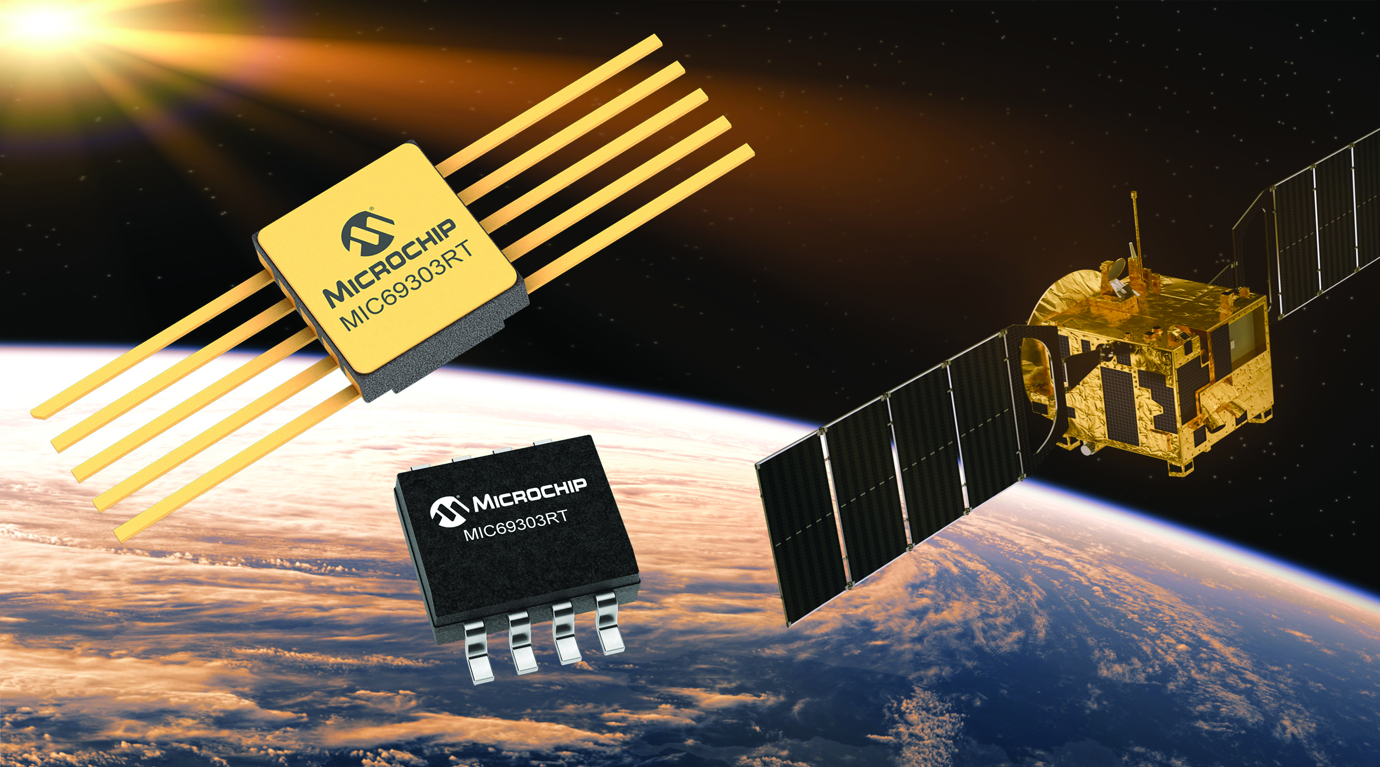
Image: Microchip
Voltage Regulator Device for LEO space application
The MIC69303RT is a radiation-tolerant power management device for space application developers. It is a high-current, low-voltage device targeting low-Earth orbit space applications. The MIC69303RT operates from a single low-voltage supply of 1.65 v to 5.5 v and can supply output voltages as low as 0.5 v at high currents. It offers high-precision and low dropout voltages of 500 mv under extreme conditions. The MIC69303RT is a companion power source solution for microcontrollers, such as the SAM71Q21RT and PolarFire field-programmable gate arrays. MIC69303RT is designed for harsh aerospace applications and remains operational in temperature ranges from -55 C to +125 C. Microchip Technology, microchip.com
Image: Spirent Communications
LEO Satellite Device Designed for GNSS/PNT lab testing
SimORBIT is a low-Earth-orbit (LEO) satellite solution software designed to aid developers in determining LEO orbits more accurately for GNSS/PNT lab testing. The software replicates LEO orbits so that simulations can provide the realistic environment of a LEO satellite, including gravitational and atmospheric impacts the satellite could encounter in space. Developers can create non-ICD signals via I/Q injection, or by the “Flex” feature, generating space-centered PNT signals to be developed in the lab as realistically as possible. Spirent Communications developed SimORBIT in partnership with SpacePNT. Spirent Communications, spirent.com
Image: Sony
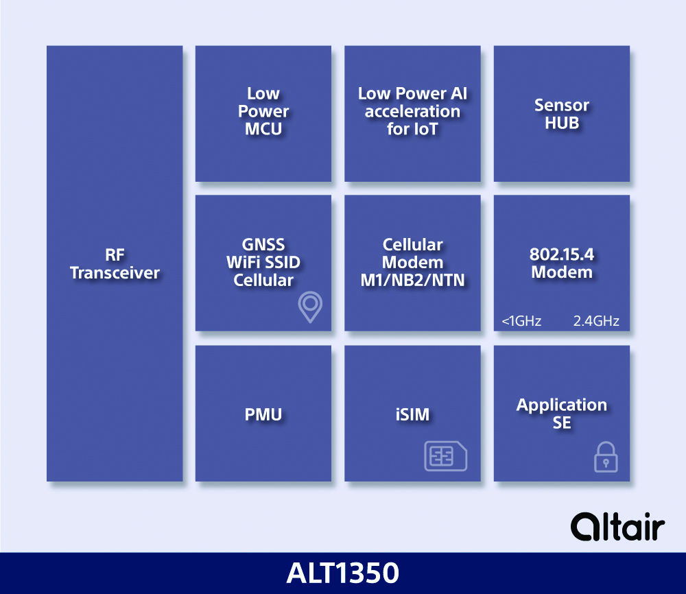
5G Chipset Includes GNSS
The ALT1350 implements GNSS, cellular and Wi-Fi-based location in a single chipset. The cellular LTE-M/NB-IoT chipset is designed to enable additional low-power, wide-area (LPWA) communication protocols; intermittent LTE and GNSS (GPS/GLONASS) navigation for low-cost applications; and concurrent LTE and L1/L5 GNSS for tracking applications. The ALT1350 incorporates a sensor hub to collect data from the sensors while maintaining ultra-low power consumption. It also provides cellular and Wi-Fi-based positioning and is tightly integrated to provide power-optimized concurrent LTE and GNSS to accommodate various tracking applications, which can be demanding with a single chip. The chip is designed to enable deployments for the internet of things (IoT), including location technologies. Sony, altair.sony-semicon.com
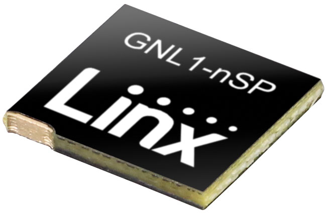
The ANT-GNL1-nSP is a surface-mount embedded GNSS antenna supporting GPS, Galileo, GLONASS, BeiDou and QZSS in the L1/E1/B1 bands. The ANT-GNL1-nSP antenna exhibits high performance in a compact size (10 mm x 8 mm x 1 mm) and features linear polarization and an omnidirectional radiation pattern. The antenna is available in tape and reel packaging and is designed for reflow-solder mounting directly to a printed circuit board for high-volume applications. Linx Technologies, linxtechnologies.com
Image: OriginGPS
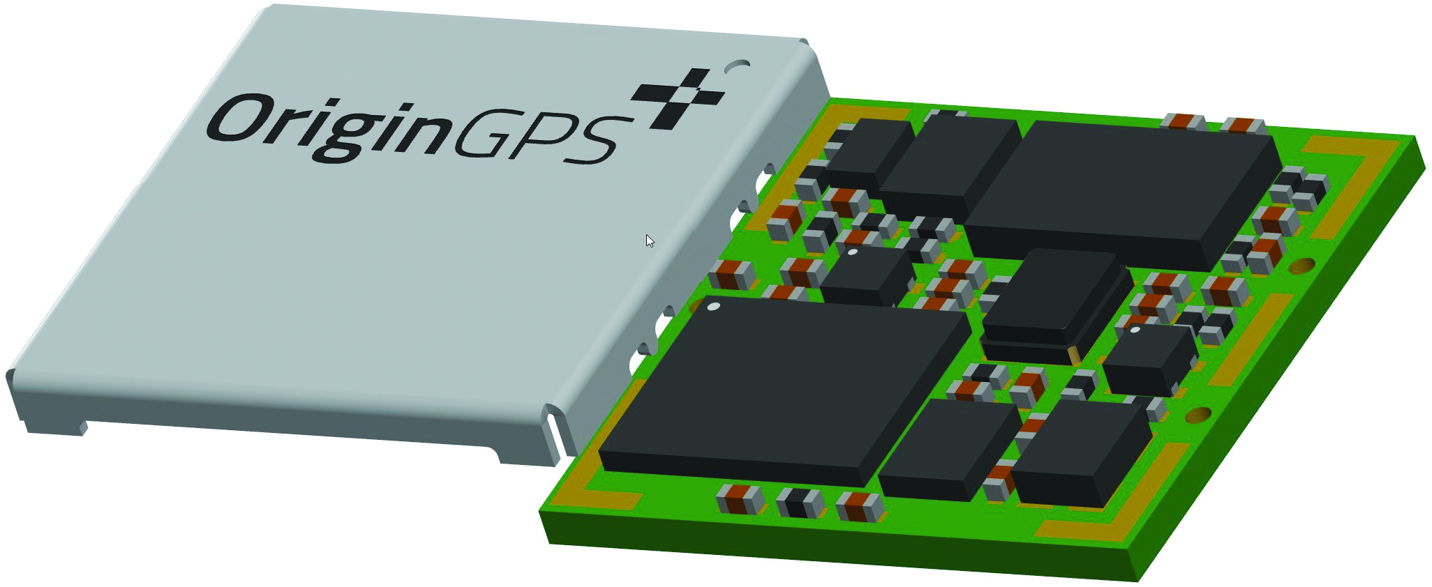
GNSS Module Based on a MediaTek chipset
The ORG4600-MK01 dual-frequency module provides higher precision than the company’s previous modules. It has sub-1 m precision at a cost lower than that of the company’s first L1+L5 module, the ORG4600-B01, which is based on Broadcom’s chipset. The 10 mm x 10 mm ORG4600-MK01 was designed for applications deployed in challenging environmental conditions. The solution also includes RTCM, a logger and accurate orbit prediction. OriginGPS, origingps.com
MAPPING
Image: Mapbox
Navigation Software Includes enhancements to existing software and more
Navigation software development kit version 2.9 provides pre-built applications compatible with Android and IOS. SDK v2.9 provides the primary navigation components across a workflow using lines of code instead of starting from square one. The drop-in user interface is customizable to reflect a developer’s brand, obviating the need to manually develop a full end-to-end application. Navigation SDK Copilot — a backend analytics tool for CX on navigation applications — collects trace files of navigation sessions and search analytics data from users. Developers can use this data to gather feedback and collective user data to create touch points with users and improve application experience based on their data-drawn conclusions. Matrix API has been updated to support scheduled departure times and provide optimal driving routes, creating a more accurate estimated time of arrival. Mapbox, mapbox.com
Image: Hexagon
Defense Platform For developing Android applications
LuciadCPillar is designed for the development of mobile applications for dismounted soldiers in the field. Developers can build applications with 2D and 3D views. It features military symbology and supports many geospatial data types including vector data, raster data, elevation data, point clouds and 3D meshes. It has the same capabilities found in desktops, in-vehicle and browser applications built with LuciadLightspeed, LuciadCPillar and LuciadRIA. The platform offers capabilities to match high-resolution screens, graphic processing units and multi-core processors including the ability to display 3D data in mobile applications. LuciadCPillar supports ARM processors and an application programming interface, which aligns with the Android developer experience. Impact, a French system integrator, partnered with Hexagon to test LuciadCPillar and will integrate it into its Delta Suite product, which is used by the French Special Operations Command. LuciadCPillar is part of Luciad 2022.1, which is available now globally. Hexagon, hexagon.com
Image: Golden Software
Surface Mapping Designed for 3D surface mapping
The Surfer package is designed for 3D surface mapping and provides robust subsurface visualization and modeling functionality by incorporating many true 3D gridding and visualization tools. With the enhanced functionality, users can now model an additional variable, a C variable, such as a contaminant or chemical concentration, along with the traditional X, Y, Z values. Surfer also includes the ability to create a 2D map of a slice-through 3D grid, which users can move up and down through the grid, illustrating how the C value changes with depth. Part of Surfer’s enhancements is isosurface creation, enabling visualization of the 3D grid in the 3D view as an isosurface, providing another way to see how C data varies with depth or elevation. The new 3D-rendered volume functionality also allows users to visualize the 3D grid in the 3D view as a solid body by assigning colors to different C values, highlighting variations in the data. Golden Software, goldensoftware.com
Sony’s first professional drone is small, but can be equipped with alpha mirrorless camera
Sony Electronics Inc. has announced its first professional drone, the Airpeak S1. An introductory model in the new Airpeak line, the S1 is a small drone that can be equipped with Sony’s full-size mirrorless interchangeable-lens Alpha camera.
The new drone uses a proprietary motor, propeller, control system and sensing technology, allowing it to fly at extremely high speeds with stable wind resistance.
The Airpeak S1 features an advanced remote controller that can support the production of high-quality aerial images and freely control the aircraft. It also includes obstacle detection, automatic flight control via sensing and increased safety via cloud management of the aircraft and flight information.
“Sony is excited to launch our new drone business with the Airpeak S1,” said Yang Cheng, Vice President, Imaging Solutions, Sony Electronics Inc. “Combining an extremely compact size with some of Sony’s most advanced imaging, sensing, AI and robotics technologies, the S1 will allow content creators, storytellers and commercial professionals to capture that which they’ve never been able to capture before.”
Advanced flight performance
The new Airpeak S1 offers dynamic flying capabilities, including a maximum speed of 55mph (90km/h), a maximum angular velocity of 180°/s, and a maximum tilt angle of 55°.
Propulsion technology using a combination of key devices developed by Sony provides wind resistance in strong wind speeds up to 44.7 mph (20 m/s).
In addition to the lightweight, highly efficient, sturdy and responsive proprietary 17″ propeller and brushless motor, the Airpeak S1 is equipped with an electric speed controller (ESC) for optimal control of these components. A unique, high-performance flight control system integrates the propulsion device and all sensor information to ensure stable flight and high maneuverability, Sony stated.
Stable flight by sensing
Stereo cameras equipped with Sony’s image sensors are installed in five locations (front, back, left, right, bottom) of the aircraft. Sony’s vision-sensing processor, which processes camera data at high speed and with low power consumption, and proprietary algorithms are used to accurately estimate the aircraft’s spatial position and orientation in real time, enabling stable flight even in environments where it may be hindered, such as indoors or under bridges.
The Airpeak S1 is also equipped with a unique high-performance flight-control system that integrates all sensor information such as inertial measurement unit (IMU), direction, barometric pressure and infrared ranging to optimize the propulsion device.
The Airpeak S1 uses multi-directional sensors to enable its obstacle braking function. The front, rear, left and right stereo cameras and the infrared range-finding sensor mounted on the top recognize obstacles in the vicinity of the aircraft, allowing the aircraft to automatically decelerate and stop according to its behavior and the surrounding conditions.
Photo: Sony
Camera and lens variations
Users have the flexibility to choose the right Alpha system for their desired application to expand their filmmaking horizons. The Airpeak S1 is compatible with a wide range of camera bodies including:
Alpha 7S series and FX3 for high descriptive capability with suppressed noise
Alpha 7R series for ultra-high definition
Alpha 9 series and others for distortion-free images
The Alpha 1, which can shoot footage in 8K, is also compatible.
The drone includes Airpeak Flight, an iOS- and iPadOS-compatible application that integrates the aircraft, transmitter, camera and gimbal, allowing the operator to monitor status information such as flight distance and remaining battery power, and change various operations and settings on the screen.
Airpeak S1 also includes a dual-operation mode so that one user can operate the drone while another user can operate the gimbal and camera simultaneously while checking the same image, even in complicated scenes. The first-person view camera, which can be tilt-operated from the remote controller, is mounted on the nose of the aircraft and is useful for the operator to check the direction of the aircraft and the direction of travel.
Photo: Sony
Airspeak Base
The new drone includes “Airpeak Base,” a web application that allows the operator to manage equipment, create flight plans, and manage flight logs. In the equipment management, information on the equipment used is automatically listed and managed based on the flight log. This allows the operator to check the condition of the aircraft before going to the field, minimizing on-set issues.
With Airpeak Base, the operator can create advanced flight plans and automatically fly the aircraft along the same course repeatedly, as if the drone were on rails installed in the air. It is able to set the position (latitude, longitude and altitude) and speed of the aircraft along the timeline, and specify the orientation of the gimbal and the timing of video or still image shooting. It can also draw smooth curves on the map. Reproduction flight is an automatic flight function that reproduces the flight route, gimbal, and camera movements based on the flight logs that have been flown in the past.
All aircraft information, including logs, can be uploaded to the cloud via the mobile app Airpeak Flight. Airpeak Base allows users to check the status of the aircraft and can provide notifications if necessary. Users can manage the status of all managed aircraft in one place before flight. Past flight logs can be viewed on the logbook screen, and details such as in-flight errors can also be reviewed.
Sony Group will be exhibiting Airpeak S1 at Japan Drone 2021, a drone exhibition to be held at Makuhari Messe in Chiba, Japan, June 14-16. In addition, Izumi Kawanishi, Senior Vice President, AI Robotics Business, Sony Group Corp. will provide the keynote speech on the morning of June 14.
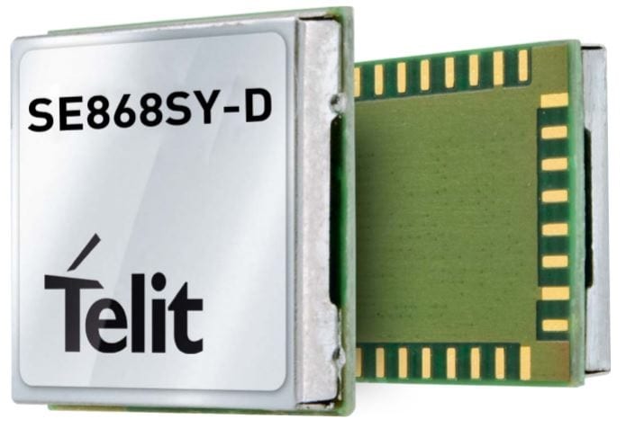
Telit has launched the SE868SY-D multi-frequency, high-precision GNSS receiver module for applications that require high accuracy, fast updates, multi-constellation support and multipath resistance.
At 11 x 11 mm, the SE868SY-D accommodates ultra-compact devices and IoT trackers.
Available now, the high-precision SE868SY-D module is Telit’s first multi-frequency, multi-constellation GNSS receiver module, featuring an ultra-sensitive -167 dBm (tracking) RF front end. By using both the L1 and L5 bands, the SE868SY-D supplies a significantly higher location accuracy than single-frequency devices — even in high-multipath environments such as urban canyons, Telit said.
This sub-1-meter precision is a major reason ABI Research expects more than 1 billion multi-frequency GNSS devices to ship annually by 2023.
The SE868SY-D is the first product from a new strategic collaboration between Sony and Telit, and features Sony’s next-generation CXD5610 GNSS receiver large-scale integrated circuit (LSI).
The Telit SE868SY-D is designed for battery-powered applications such as IoT trackers and wearables. With less than 45 mW in L1+L5 tracking mode, the module has low power consumption, despite using both L1 and L5 bands.
For high-dynamic applications, the SE868SY-D a high update rate of up to 25 Hz. Its high-accuracy, one-pulse-per-second signal also makes the module suitable for timing applications.
“With the new SE868SY-D, Telit is uniquely prepared to meet the burgeoning global demand for multi-frequency, multi-constellation GNSS receivers for IoT trackers, wearables and more,” said Eric Lagorce, Telit business development director. “The SE868SY-D also perfectly complements Telit’s two decades of GNSS expertise and its broad portfolio, and highlights the potential of our strategic collaboration with Sony.”
The Telit SE868SY-D provides pin-to-pin compatibility for applications based on Telit’s legacy GPS module JF2 and GNSS module SE868V3.
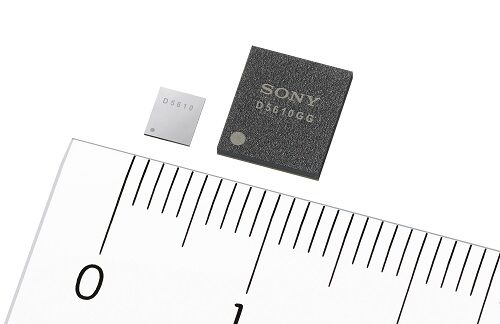
Sony GNSS receivers. (left) CXD5610GF, (right) CXD5610GG. (Image: Sony)
Sony Corporation plans to release a high-precision GNSS receiver for use in internet of things (IoT) and wearable devices. The new receivers have low power consumption for dual-band positioning operation — as little as 9 mW.
Increasing use of IoT and wearable devices that utilize location information has resulted in growing demand for GNSS receiver large-scale integrated circuits (LSIs). Precise positioning and reliable communications must be ensured to maintain proper operation of IoT and wearable devices, which are being used even in difficult communication environments and unstable conditions, such as multipath propagation situations caused by reflection off the ground or nearby buildings or the effects of the swinging of the arms when attached to a person’s wrist.
Additionally, device size constraints necessitate a compact battery, whereas satellite signal reception and positioning when using GNSS functionality typically consumes a lot of power, resulting in poor battery life.
The new LSIs support not only the conventional L1 band reception, but also L5 band reception, which is currently being expanded across GNSS constellations, thereby making them capable of dual-band positioning. Sony’s original algorithms enable stable, high-precision positioning even under the difficult conditions unique to wearable devices.
Also, the use of Sony’s original high-frequency analog circuit technology and digital processing technology delivers low power consumption during continuous positioning for dual-band reception operation.
The new LSIs will drive greater opportunities to develop new products and services such as smartwatches and other wearable devices that cannot use external power supplies, as well as IoT devices used for applications such as trackers. They also show promise in a wide variety of applications which require precise positioning and stable communications, such as automotive services.
High-precision, stable positioning via dual-band operation
Compared with the L1 band, the new signal method used in the L5 band employs signal units that are 10 times narrower to measure the range between the GNSS satellite and receiver, improving positioning precision and amplifying the transmission power from the satellite, resulting in high-precision, high-sensitivity positioning.
Quick, accurate GNSS signal reception via Sony’s original algorithms enables positioning that is more stable than conventional products even in changing reception environments, such as obstructing from buildings when on the move and acceleration of wearables due to swinging of the arms. This also leads to quick positioning time even from cold starts, which require more time.
Additionally, Sony’s original digital signal processing technology enables countermeasures against the performance degradation caused by radio interference from aircraft communications as well as spoofing attacks and other issues, thereby improving resistance to interference.
Low power consumption and high sensitivity are delivered by Sony’s original analog circuit technology, which enables low-voltage operation, as well as digital circuits and software algorithms that enable software processing via low clock frequencies. This innovative design keeps power consumption to only 9 mW, the lowest in the industry, when simultaneously receiving signals in both the L1 and L5 bands.
Built-in memory
The new LSI’s feature built-in non-volatile memory for storing firmware, etc. This design makes it possible to update the firmware without adding externally mounted memory and contributes to a more compact design for IoT and wearable devices by saving space. It also makes it possible to complete data-processing in the products, resulting in low power consumption and improved access speed.
Key specifications
Power Consumption
1.5 GHz/1.2 GHz simultaneous reception
9 mW
11 mW
1.5 GHz reception
6 mW
7 mW
1.2 GHz reception
7 mW
8 mW
Hot Start Sensitivity: –163dBm
Tracking Sensitivity: –167dBm
Hot Start Initial Positioning Calculation Time: Less than 1 second (at -130dBm)
User Interface: UART, I2C, SPI
Package: XFBGA 54 pin, LFBGA 72 pin
External Dimensions (LWH): 3.2×3.7×0.5 mm; 7.0×8.0×1.4 mm
Mobile World Congress (MWC) Barcelona will still take place Feb. 24-27, despite exhibitors dropping out because of the coronavirus. According to a statement by GSMA, some large exhibitors have decided not to come to the show this year because of the coronavirus, while others are still contemplating next steps. Despite this, the show is expected to boast more than 2,800 exhibitors.
According to Reuters, as of Feb. 9, there are two confirmed cases of coronavirus in Spain.
GSMA and its partners have implemented several safety measures for attendees, the organization said, including:
Increased cleaning and disinfection across all high-volume touch points, such as catering areas, surfaces, handrails, restrooms, entrances/exits and public touchscreens, along with the use of correct cleaning/sanitizing materials and products
Increased onsite medical support
Awareness campaign via online and onsite info-share and signage
Availability of sanitizing and disinfection materials for public use
Awareness and training to all staff on standard personal preventative measures, such as personal hygiene, frequent use of sanitizing/disinfection products, etc.
Advice to exhibitors on implementing effective cleaning and disinfection of stands and offices, along with guidance on personal hygiene measures and common preventive behavior
Public health guidelines and communication with Barcelona hotels, public and private transport, restaurants and catering outlets, retail, etc.
Installing new signage onsite reminding attendees of hygiene recommendations
Implementing a microphone disinfecting and change protocol for all speakers
Communicating advice to all attendees to adopt a “no-handshake policy”
A 24-hour telephone security and medical service for all attendees, available Feb. 12 to Feb. 29. This number will appear on the back of badge holders, in the event app and on signage around the venue.
Companies Back Out
Because of the coronavirus, several companies have backed out of attending MWC Barcelona. Several of these companies include Sony, Ericsson, LG, Nvidia and Amazon.
“Due to the outbreak and continued concerns about novel coronavirus, Amazon will withdraw from exhibiting and participating in Mobile World Congress 2020,” Amazon said in a statement. According to CNN Business, the company was due to host a dozen sessions covering topics such as 5G connectivity and artificial intelligence.
Other companies have expressed similar concerns.
“Sony has been closely monitoring the evolving situation following the novel coronavirus outbreak, which was declared a global emergency by the World Health Organization on January 30,” the company said in a statement. “As we place the utmost importance on the safety and wellbeing of our customers, partners, media and employees, we have taken the difficult decision to withdraw from exhibiting and participating at MWC 2020 in Barcelona, Spain.”
As an alternative, Sony’s press release will take place on Feb. 24 via a video through its official Xperia YouTube channel.
“We’ve informed GSMA, the organizers of MWC Barcelona, that we won’t be sending our employees to this year’s event,” Nvidia said in a statement. “Given public health risks around the coronavirus, ensuring the safety of our colleagues, partners and customers is our highest concern. We’ve been looking forward to sharing our work in AI, 5G and vRAN with the industry. We regret not attending, but believe this is the right decision.”
The importance of sensors, whether they be incorporated in cute dog robots or autonomous vehicles, is gaining more traction.
At September’s Custom Electronic Design and Installation Association (CEDIA) Expo, Sony Electronics President and COO Mike Fasulo told GPS World that its foundation sensors are going into autonomous vehicles, drones, agricultural solutions and other platforms.
“A lot of people also don’t know that more than half of the hardware in most smartphones is ours,” Fasulo said. “These sensors we are working on do things you and I can’t do. They can assess sunlight and darkness. They can put a safety cocoon around a vehicle.”
The Aibo robot dog uses artificial intelligence to mimic a real puppy’s behavior. (Photo: Kevin Dennehy)
At the conference, Sony displayed a nearly $3,000 Aibo dog robot, which has many of the same sensors that go into many of the company’s other products, including its venerable camera line. Aibo has facial recognition technology and uses artificial intelligence to mimic a real puppy’s behavior.
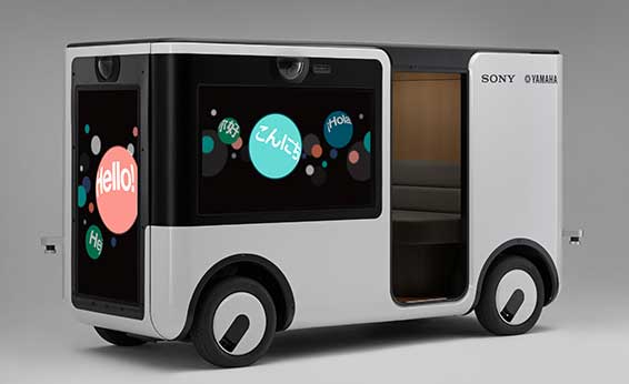
Sony sensors seem to be a cornerstone in several new announcements. Less than two months ago, Sony and Yamaha Motor Co. announced the joint development of the SC-1 Sociable Cart, a small autonomous vehicle that will be deployed to golf courses, amusement parks and commercial facilities, the company said.
The SC-1, which is not for sale, features five seats, replaceable batteries, front and rear scope of view thanks to image sensors, an innovative vehicle design, and other improvements over an original prototype vehicle.
In addition to the image sensors, the vehicle has ultrasonic sensors and a two-dimensional laser detection and ranging (lidar) system, the company said. These sensors allow the vehicle to gather cloud travel data for safe-driving analysis.
Sony is working with Japan’s NTT Docomo to test the vehicle’s 5G mobile technologies for remote-controlled functions, the company said.
Geotab leverages sensor data
Sony and Yamaha Motor plan to roll out the SC-1 later this year in Japan. (Photo: Sony/Yamaha Motor)
Canada-based Geotab has made big announcements this year, although the huge one is from the U.S. government to equip more than 200,000 vehicles with its telematics systems.
While that contract itself is massive, the company believes the more than 2 billion data points gathered each day, from millions of Geotab-equipped vehicles on the road, is the real valuable commodity.
The data gathered with the company’s connected-car technology can help companies and governments assess how their fleets are operating, said Mike Branch, Geotab vice president of data and analytics.
Branch, who leads a team of 40 employees, said the company uses the data to help cities assess road impediments — not only road quality. This includes analyzing ABS activation to look at black ice or other hazards. “While weather companies can only estimate conditions, we have sensors in vehicles that can give hyperlocal reports and ground truth,” he said. “People consistently slamming on their brakes in one area is an example [of aggregative data].”
Back in the day, which is less than 10 years ago, all that many companies expected from their fleet management systems was to let them know where their drivers were, by using GNSS and mapping technology. Today, the sensors — and data provided by them — allow managers to assess dangerous driving areas, save on fuel costs by rerouting trucks and compare routes throughout the United States, not just in big cities, Branch said.
In the smart cities space, Branch said that Geotab is working with municipalities for fuel intersection insight mapping. “This means if 20 vehicles, or even just two, are stopped at an intersection, our sensors can detect the wait times,” he said. “The big thing for us is looking at this smart-city deployment to leverage organic data in a private manner.”
Because of the nature of data procurement, privacy is big topic for the company, Branch said. “We treat it with high importance. Our view is that the data is owned by the customer,” he said. “They have full access to it. We will go through it, aggregately, so we can improve our customer’s experience.”
Keeping OBD port secure
The future of open on-board diagnostic (OBD) vehicles — and procuring secured and open data from them — is a concern for Geotab, Branch said.
“We have a full port safety committee with the goal of security and access to the port,” he said. “We believe in open access to this port. This gets to be a concern with mixed-fleet Fords, Mercedes, BMW and others as the data can slow down the port at any time.”
Branch said the company does not want to remove the entrepreneur, who is interested in working with the port in a safe manner. “We work with the OEMs on the future of telematics not just by pulling the data from our device, but pulling it from their feed,” he said.
Branch said that technology may make the port dongle obsolete in five to 10 years, but until then, the company has created an ecosystem to enable the use of the data. “There is going to be an aftermarket as cars are lasting an average of 11 years,” he said.
A roundup of recent products in the GNSS and inertial positioning industry from the August 2018 issue of GPS World magazine.
OEM
IP Solution
With multi-constellation GNSS for internet of things (IOT) devices
The Dragonfly NB2 is a highly integrated and modular IP (internet protocol) solution optimized for Cat-NB2 (3GPP Release 14 eNB-IoT) that can seamlessly be incorporated into chips and modules by the multitude of companies looking to address the large and fast-growing cellular IoT space. GNSS hardware package. For customers developing NB-IoT products that also require GNSS capabilities, Ceva-Dragonfly NB2 includes a new power-optimized GNSS hardware package, with GNSS RF receiver and multi-constellation digital front-end. The GNSS package speeds up both acquisition and tracking tasks by up to 8 times compared to Ceva-Dragonfly NB1, enabling a host of popular NB-IoT use cases, including people, livestock and asset tracking and geofencing.
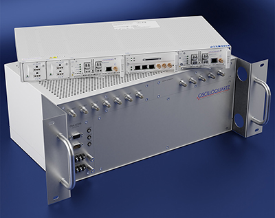
Provides timing accuracy and stability when GNSS signal is lost
Photo: Oscilloquartz
Oscilloquartz has launched its enhanced primary reference time clock (ePRTC) system to enable a high level of timing accuracy and stability, even when the GNSS signal is lost. The system provides a timing source for mission-critical transport systems, such as utility networks, government infrastructure and radio access networks, and provides the strict synchronization needed for LTE-A and 5G applications. Featuring the OSA 3230B ePRC atomic cesium clock connected to an Oscilloquartz clock combiner and grandmaster, the new solution offers the extremely stable frequency of a cesium clock with the UTC-traceable signal provided by GNSS. When combined with the OSA 5430, the OSA ePRTC system provides full hardware redundancy and multiple fan-out options including PTP over 10 Gbit/s.
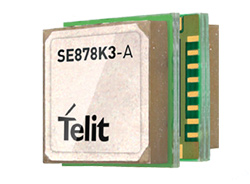
The SE878Kx-A series of GPS and GNSS integrated antenna receiver modules offer high performance, maximum reliability and low power consumption for consumer and business applications. The SE878K3-A and SE878K7-A are compatible with GPS, GLONASS, Beidou and Galileo and also enable device vendors to develop quickly and cost-effectively location-based IoT solutions for use in virtually any country worldwide. The SE878Kx-A series supports dual internal-external antennas to ensure connectivity when one is broken or compromised, along with a SAW filter to maximize jamming immunity. The modules are designed for mission-critical applications and other use cases where reliability is key, such as alarms, stolen cars or high-end asset tracking. The series also provides seamless integration with Telit’s cellular modules, including eCall/ERA-GLONASS compliant solutions.
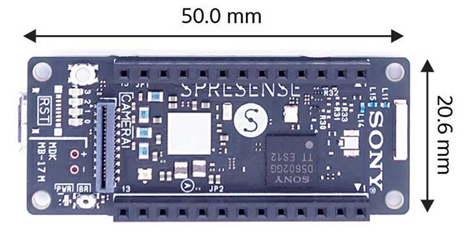
The Spresence main and extension boards are designed for internet of things (IoT) applications. The main board uses a multi-CPU structure equipped with Sony’s GNSS receiver (GPS+GLONASS) and high-resolution audio codec. A variety of systems for applications such as drones and other IoT devices can be built by combining the boards and developing the relevant applications. The boards’ software and hardware is available via open platform, allowing for a wide range of developmental possibilities. The main board can be used to control a drone using GPS positioning and a high-performance processor, voice-controlled smart speakers and low-power consumption sensing cameras. It also can be combined with sensors for use in systems that detect errors in production lines on the factory floor.
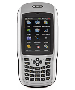
Designed for geopositioning, construction and mapping
Photo: Topcon
The T-18 handheld controller has a 3.7-inch sunlight-readable display, a 1-GHz processor and 1 GB of internal storage. For field data collection using Topcon’s MAGNET software, the T-18 offers a durable ergonomic solution with fast processing, excellent connectivity and a long (10-hour) battery life. It has a 3.5G cellular modem for connectivity with Topcon MAGNET solutions for sending and receiving data to the cloud company account. The modem also can be used for real-time kinematic (RTK) correction services. Other features include Bluetooth and an IP65 rating for dust and water protection in demanding job-site conditions.
The SXblue ToolBox is an Android application for SXblue GNSS receivers, enabling users to view and analyze the position data and metadata related to its location. The user can send commands that enable or disable some features, including systems in use, mask angle or differential angle, and constellation in use, including GPS, GLONASS, Galileo, BeiDou and SBAS. The SXblue ToolBox is also an NTRIP client capable of connecting to a NTRIP server for real-time kinematic (RTK) corrections, allowing the receiver to issue very accurate location information. The application can record, save and transfer raw data from the GNSS receiver, allowing post-processing on computers for surveying and geomatics professionals.The toolbox has been developed with special consideration for modern mobile devices and attention to user and dealer feedback. It includes a series of configurable audible and visual alarms for determining the thresholds of the information provided by the SXblue GNSS receiver.
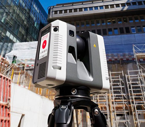
The Leica RTC360 laser scanner is equipped with edge computing technology to enable fast and accurate creation of 3D models in the field. It combines high-performance laser scanning, edge computing and mobile app technologies to preregister captured scans quickly and accurately. With the push of a button, two million points per second of high dynamic range imagery can be captured to create a full-dome scan in under two minutes. It features a visual inertial system that automatically tracks movements between setup positions. The scans captured can be combined and preregistered on a mobile device, where they can be viewed and augmented with information tags.
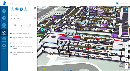
Location technology allows users to see rooms, gates and offices
Screenshot: Esri
ArcGIS Indoors is designed to enable interactive indoor mapping of corporate facilities, retail and commercial locations, airports, hospitals, event venues, universities and more. The solution applies the latest location technology to allow users to see and share where assets, rooms, departure gates and offices are located. It uses data streams, real-time processing and location intelligence tools to help businesses and other organizations understand how to better coordinate space and other resources with their facilities and campuses. Insights from sensor networks deliver real-time information to managers and executives through interactive dashboards, while visitors and employees can find useful information about the buildings they occupy. The solution also allows users to quickly access and explore critical business information, such as the location and status of fire extinguishers and their last inspection dates.
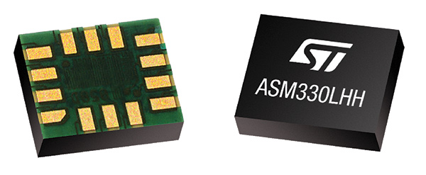
Meets demands for continuous, accurate vehicle location
The ASM330LHH module. (Photo: STMicroelectronics)
The automotive-grade ASM330LHH six-axis inertial sensor is designed for super-high-resolution motion tracking in advanced vehicle navigation and telematics applications. It lets advanced dead-reckoning algorithms calculate precise position from sensor data if satellite signals are blocked, such as in urban canyons, tunnels, covered roadways, parking garages or dense forests. Its advanced, low-noise, temperature-stable design enables dependable telematics services such as e-tolling, tele-diagnostics and e-Call assistance. Precision inertial data in six axes also meets the needs of advanced automated-driving systems. Automotive component manufacturer Magneti Marelli has selected the ASM330LHH for advanced telematics systems, to be fitted as original equipment by global automotive groups in upcoming vehicle ranges.
Esri and Waze smart cities partnership grows. (Image: Esri)
The free crowdsourced traffic and navigation app Waze is now fully supported by ArcGIS Online, where its live feed of mapped traffic alerts and other information, such as accidents, congestion and street damage, can be used in applications in minutes. Waze Live Alerts, available in ArcGIS Marketplace, is free to members of the Waze Connected Citizens Program. The program, a two-way sharing of publicly available traffic and road condition information, offers governments a stream of data, constantly updated in real time. This enables personnel to make data-driven infrastructure decisions and improves the efficiency of incident response.
Traffic engineers can use the data to analyze problems on the road and create targeted solutions.
Open-source platform for autonomous delivery and other iot
The AGL platform provides Mercedes-Benz Vans with the ability to create autonomous delivery robots. (Image: Daimler)
Automotive Grade Linux (AGL) is a collaborative cross-industry effort to develop an open platform for the connected car. Mercedes-Benz vans are using AGL as a foundation for a new onboard operating system for its commercial vehicles. The Mercedes-Benz “adVANce” initiative focuses on connectivity and internet of things (IoT) applications, innovative hardware solutions, new on-demand mobility and rental concepts, and fleet management solutions. The AGL platform provides Mercedes-Benz Vans with the flexibility to rapidly create tailored solutions for customers, including adding and connecting any kind of IoT component to the vehicle, such as sensors, automation controls and actuators. The new AGL-based operating system will debut on various Mercedes-Benz Vans prototype projects later this year.
eCyber is an integrated hardware-software product that protects vehicles against ransomware and other cyber-attacks. It can be installed in a vehicle by authorized parties, such as vehicle importers and fleet managers, in the aftermarket stage after the vehicle has left the factory, as well as by the OEM itself during manufacture. eCyber, a combined hardware and software solution in a compact box, is installed between the vehicle’s external communications device and the vehicle’s CAN (Controller Area Network) bus. It provides a secure gateway for outside communications to the CAN bus, allowing only communications with predefined parameters and values to go through. It blocks any unrecognized communications to and from the CAN bus, so no malicious digital communications can disrupt vehicle function.
Engineered for UAV-imaging missions, the iXM 100MP is a high-productivity metric camera with a range of high-resolution lenses. It is ready for integration with various UAV platforms, including Phase One’s DJI Matrice 600 Pro. The camera incorporates a medium-format sensor with backside-illumination technology, enabling high light sensitivity and extended dynamic range. Phase One also offers four new RSM lenses — with focal lengths ranging from 35mm to 150mm — to fit the new sensor’s 3.76 μm pixel size and 33 x 44 mm frame size. The lenses are available with either fixed-focus or motorized-focus functionality. The fixed-focus 35mm and 80mm lenses are especially suitable for surveying applications.
For quick approval of flights over controlled airspace
Screenshot: Skyward
Commercial drone operators in California and Hawaii — as well as a few areas in Nevada, Utah and Arizona — can get quickly authorized to fly in controlled airspace using the LAANC (Low Altitude Airspace Notification Capability) platform. Skyward is an FAA-approved airspace vendor. With Skyward, pilots with a Part 107 license can get permission to fly in regulated airspace in seconds compared to manual authorizations that can take months. This makes it significantly easier for businesses of all sizes, particularly in the construction and warehousing industries, to manage a fleet of drones to access valuable, cost-saving data. Skyward’s LAANC expansion includes airspace in the busy metro areas of Los Angeles, the Bay Area, San Diego, Las Vegas and more than 50 smaller air markets.
Sony Corporation has developed two new products, the Spresence main and extension boards for internet of things (IoT) applications, equipped with a smart-sensing processor.
The main board uses a multi-CPU structure equipped with Sony’s GNSS receiver (GPS+GLONASS) and high-res audio codec. A variety of systems for diverse applications — drones, smart speakers, sensing cameras and other IoT devices — can be built by combining the boards and developing the relevant applications.
Technological information about the products’ software and hardware is publicly available via open platform, allowing for a wide range of developmental possibilities and further expanding the market.
Positioning information and audio input/output functions are expected to become increasingly important in the expanding IoT market. The main board operates on low power and features a smart-sensing processor, with a built-in GNSS receiver and an audio codec that supports high-resolution audio sources. It employs a hexa-CPU, multi-core configuration that makes it easy for anyone to create high-performance, highly versatile applications.
For example, the new board can be used to control a drone using GPS positioning technology and a high-performance processor, voice-controlled smart speakers, low-power consumption sensing cameras and other IoT devices. It can also be combined with various sensors for use in systems that detect errors in production lines on the factory floor.
The IoT boards will be displayed at the Maker Faire Bay Area 2018 starting May 18 in San Mateo, California, and on Aug. 4-5 at the Maker Faire Tokyo 2018 in Tokyo, Japan.
ProDrone has announced its new Ultimate Flying Platform line featuring a static mount capable of lifting and integrating with several DLSR cameras. The company stated in a news release it will be demonstrating the new system at CES 2016 in booth No. 25417, held Jan. 6–9 in Las Vegas. The new mounts will be available for sale in Q2 2016, with new features and capabilities being added in Q3 2016.
“This marks the first time a consumer drone has been able to integrate with heavier DSLR cameras, increasing the ease and value of producing super high quality aerial photography,”ProDrone stated in the news release.
The ProDrone Byrd, best known for its unique ability to fold up to the size of an iPad for hyper portability, has now added another unique ability by introducing a static mount for DSLRs. The new mount is integrated with several Sony cameras — DSC-RX100M4, ILCE6000 and a7RII — and the RICOH GR2. The system is also available with limited operations for the Panasonic GH4, Blackmagic Micro Cinema Camera BMD and the Canon 5DIII. Full integration will be available for all these cameras by Q2 2016, the company says.
“With the drone market maturing, it becomes obvious that a flying platform that integrates with the world’s best cameras is the best option for the most people,” said Joseph Haagensen, community manager for ProDrone. “A lot of people have been asking for integration with the top cameras they already use for photography. This was the basis for our Ultimate Flying Platform line that we’ll continue to expand with more cameras and stabilized gimbals. At the end of the day, the ProDrone Byrd will be the only drone anyone will need to buy.”
With each of the Sony cameras, users may view footage via the ProFlight app. The DSC-RX100M4, ILCE6000, a7RII and GR2 have the ability to take photos and video via the ProDrone controller.
ProDrone also has a new partnership program, and is seeking to expand relationships with the world’s leading camera manufacturers to develop the best solutions and options for the drone market. Camera manufacturers interested in learning more about the partnership program can contact [email protected].
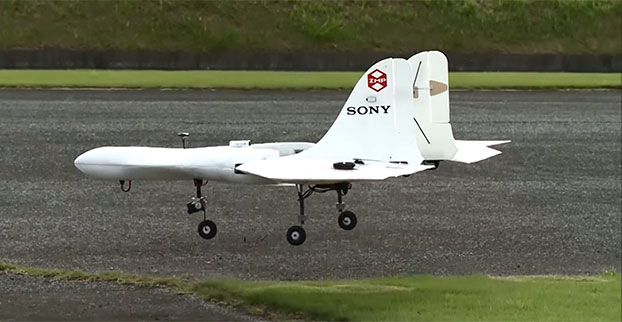
Sony is developing an unmanned aerial vehicle that lifts off and lands vertically like a helicopter (also known as a VTOL craft for vertical take-off and landing.) The VTOL drone is being developed with a Tokyo robotics firm under a collaborative company called Aerosense.
The drone can carry up to 22 pounds, fly continuously for two hours, and reach a speed of 106 miles per hour. Sony is developing it for business customers, who would use it for “measuring, surveying, observing and inspecting” as soon as next year, so it will likely carry different types of instruments, depending on the task a customer requires.
The video below shows a prototype flight on Monday.
Aerosense, created this month, is a joint venture between Sony and Tokyo-based startup ZMP Inc., which specializes in autopilot technology. The venture is part of Sony’s efforts to move beyond its core consumer products into enterprise markets. Aerosense will offer services such as inspecting aging infrastructure and surveying land that is difficult to access. The drones would be piloted automatically based on input from users about which areas they want surveyed.