Tag: Inertial Labs

  • Implementing assured PNT for static and dynamic applications

    Implementing assured PNT for static and dynamic applications

    Position, navigation and timing (PNT) services, derived primarily from GNSS constellations, have become a critical element underpinning the global economy, with a vast range of sectors depending on these signals.

    This includes coordinating financial transactions, stabilizing power grids as well as navigation, with supply chains set to become more reliant on the technology as autonomous vehicles become prevalent. However, GNSS is a vulnerable technology, with faint signals from medium-Earth orbit (MEO) satellites being susceptible to disruption.

    In this article we’ll look at how both static and dynamic applications can achieve resilient PNT, with strategies and sensor fusion techniques that allow operational capability when GNSS is denied.


    Seven hundred. That’s the number of GPS interference events such as jamming and spoofing that take place every single day, according to the U.S. government. And this number is increasing across North America and Western Europe, with it being especially prevalent in or near war zones.

    Indeed, in August, the navigation system of a plane carrying the EU President, Ursula von de Leyen, was reportedly targeted by a GPS jamming attack as it was due to land in Bulgaria — forcing pilots to rely on paper maps. And GPS interference has been linked to the crash of Azerbaijan Airlines flight J2-8243, which was shot down on Christmas Day, 2024.

    Relying on a single source for PNT is no longer a viable strategy and developing a resilient PNT ecosystem that can function in D3SOE (denied, degraded, and disrupted space operational environments) has become essential.

    While navigation is the most commonly understood application of PNT, the timing component is critical in so many of the static systems we rely on — not just finance and power (as listed above) but for AI data centers, asset tracking systems and communication networks — which require precise and stable time references to ensure data integrity, and need these to be synchronized across global networks.

    For such systems, the consequences of getting timing off by even the smallest amount can be seen in the 2016 decommissioning of the SVN23 GPS satellite. During this, a software error created a 13.7 microsecond anomaly across the entire constellation that, according to a UK government report caused issues with digital radio broadcasts and communication networks. The event is also seen by some as a warning for the financial sector and in particular for high-frequency trading (HFT), where trades take place in millionths and studies have suggested that a 1 ms advantage in trading applications could be worth $100 million a year to a major brokerage firm.

    By subtly altering timing signals used by trading systems, malicious actors can effectively see and use market data “from the future” and enact transfers worth billions of dollars.

    Similarly, a timing attack on the phasor measurement units (PMUs) used to measure real-time stress in power grids could trigger major blackouts. The effect of such an attack can be seen in 2003’s (pre-PMU) Northeast Blackout, in which a sagging power line touched tree and caused a series of cascading outages that affected 55 million people across the U.S. and Canada. 

    And further putting the importance of protecting PNT in context, in 2020 the U.S. defined 16 critical infrastructure sectors as part of its Executive Order 13905. Of these 14 (88%) of these are reliant on PNT for their safe operation. Going beyond the energy and finance examples above, this includes sectors like communications, transportation, and agriculture. In short, PNT resilience is essential across virtually the entire economy.

    Detecting a Compromised GNSS Signal

    Of course, the first stage in protecting a PNT signal is in the identification of an attack, and several techniques can be used to identify inconsistencies that point to jamming or spoofing.

    These range from the analysis of the signal’s Doppler shift (transmissions from nearby terrestrial spoofer will have a near-zero Doppler shift) to techniques like RAIM (receiver autonomous integrity monitoring), which continually recalculates position while excluding one satellite each time to see if the results are consistent.

    Cryptographic methods, such as Galileo’s Open Service Navigation Message Authentication (OSNMA), are also available to verify a satellite’s digital signature and confirm the data’s authenticity.

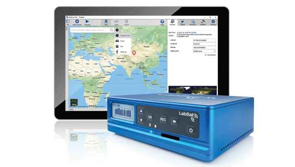
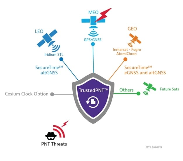
    However, relying on cryptographic authentication alone still comes with risks. Notably, authenticated signals are susceptible to meaconing attacks, where a legitimate signal is recorded and replayed later to mislead a receiver. It is, however, possible to counter these attacks using a secure, out-of-band verification layer for all GNSS constellations. This involves the independent delivery of authentication data with hash authentication transmitted via encrypted L-band correction signals from geostationary (GEO) satellites.

    This approach can also be retrofitted to older equipment using PNT by using an RSR transcoding device (see below).

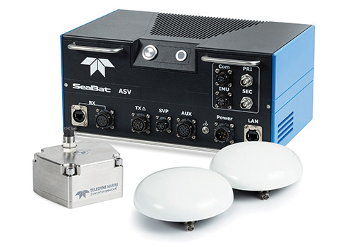
    For dynamic systems, an additional level of validation can be gained by inertial sensors, comparing their output against PNT data to detect both sudden large jumps in position and continual slight deviations that can be characteristic of a sophisticated spoofing attack.

    Timing in Static Applications

    The timing architecture of such systems must go beyond simply identifying a threat and validate incoming data. This requires the integration of alternative PNT sources through an intelligent sensor fusion framework. To achieve this level of resilience in a fixed location, a multi-source, zero-trust approach is necessary. This involves augmenting or replacing GNSS with a layered defense of terrestrial and alternative space-based signals that can be authenticated and trusted.

    Modern PTP grandmasters utilize the latest sub-microsecond accuracy Precision Time Protocol (PTP) and the more common millisecond-range Network Time Protocol (NTP) to ensure compatibility with nearly all standard IT equipment.

    High-speed 25G PTP Ethernet connections are also being implemented to support high-performance AI data centers and financial exchanges without creating data bottlenecks. To ensure continuous operation during extended GNSS outages, these systems can draw synchronization from terrestrial sources like a network PTP feed or an optional atomic caesium clock.

    Furthermore, it is also possible to use encrypted L-Band signals from geostationary (GEO) satellites, such as those from Inmarsat, which create an enhanced timing service with built-in GNSS authentication and anti-spoofing features to deliver timing accuracy of sub-5 ns.

    Figure 1: VIAVI’s Inertial Labs division has developed a Visual-Inertial Navigation System (VINS) that combines 3D vision aided mapping with inertial accelerometers to enable positioning in D3SOE environments – shown in prototyping stage
    Figure 1: VIAVI’s Inertial Labs division has developed a Visual-Inertial Navigation System (VINS) that combines 3D vision aided mapping with inertial accelerometers to enable positioning in D3SOE environments — shown in prototyping stage.

    Navigation Without a North Star

    While static applications can utilize fixed terrestrial infrastructure for backup, dynamic systems do not have this luxury.

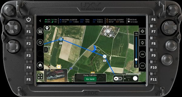
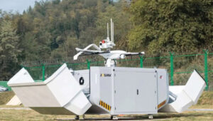
    The inherent weakness of RF signals makes them easy to overpower through deliberate jamming by hostile actors. As such, navigation systems onboard UAVs and autonomous vehicles, as well as manned commercial and military vehicles require self-contained navigation capabilities that can function reliably when GNSS signals are compromised. This has driven significant advances in inertial navigation.

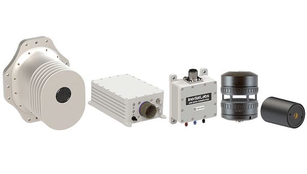
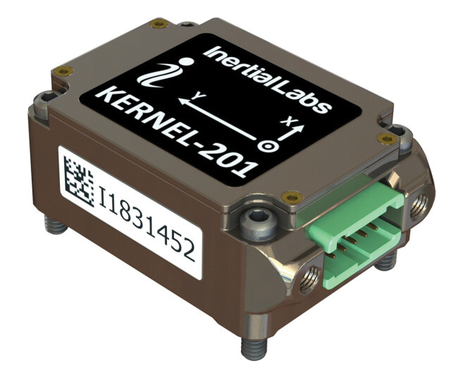
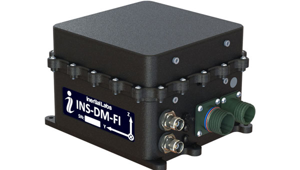
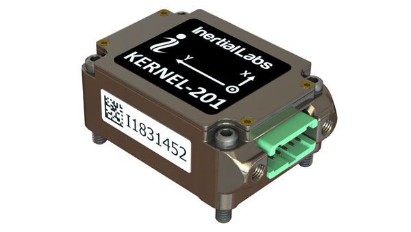
    Sensors like accelerometers and gyroscopes have become a critical source for orientation and direction data that remains available at all times. The development of micro-electromechanical systems (MEMS) has been crucial, enabling the integration of inertial navigation into even the smallest systems.

    These sensors aren’t an alternative to PNT satellites. By their very nature they will accumulate errors over time, with sensor bias causing drift and random-walk deviations allowing random noise in each measurement to accumulate. However, recent years have seen significant gains in their accuracy, allowing navigation to continue for short periods after GNSS data is compromised.

    Combining these inertial sensors with sensor fusion techniques also allows each element in a multi sensor system (using magnetometer; and accelerometers/ gyroscopes for roll, pitch and yaw…) to be continually verified by the others for further improvements in accuracy, reducing overall level of error. Data from these IMUs can also be fused with signals from alternative satellite constellations like those in LEO.

    LEO satellite signals are less accurate for timing than GNSS (around 80 ns vs. sub-15 ns) but are significantly stronger. For example, the Iridium LEO STL signal is c.1,000 times stronger than GNSS, making these signals both more resistant to jamming and harder to undertake a (successful) denial of service.

    More recently, techniques using downward-facing camera to track fixed identifiable landmarks have been developed as an alternative / additional data validation method for dynamic systems.

    These external sources provide absolute reference points that can be used to correct the inertial system’s calculations, dramatically improving accuracy and enabling reliable navigation for much longer periods.

    Figure 2: VIAVI’s SecureTime uses GEO and LEO constellations to provide positioning and timing signals that are resilient to attacks.
    Figure 2: VIAVI’s SecureTime uses GEO and LEO constellations to provide positioning and timing signals that are resilient to attacks.

    Sensor Fusion Gives Resilience

    The limitations of individual PNT sources — whether the vulnerability of GNSS or the inherent drift of inertial sensors — mean they cannot depend on a single technology. The most effective strategy is often a hybrid one, combining a high-accuracy inertial sensor unit with inputs from other sensors.

    As we touched on above, adding data sources improves the ability to detect and counter PNT attacks. For example, the EU has confirmed it will deploy additional LEO satellites to bolster its ability to detect GPS interference. And vision cameras can also be used as part of a Visual-Aided Inertial Navigation System (VINS), which provides a powerful method for maintaining an accurate position in the complete absence of GNSS signals.

    This technique was developed in 2025 by VIAVI’s Inertial Labs division, with VINS combining processing with multiple inertial sensors to maintain position. This is reinforced with, and calibrated by a 3D vision-based positioning algorithm that compares visual patterns captured by an onboard camera (either daylight or infrared) with pre-loaded, satellite-imagery-derived 3D maps to track against known landmarks. In a GNSS-denied environment, a VINS system can maintain a horizontal position within 35 m, a vertical position within 5 m, and a desired velocity within 0.9 m/s.

    Conclusion: Bridging the Legacy Gap

    While modern systems can be designed from the ground up with a multi-layered, sensor-fusion PNT architecture, there is still the problem of the huge number of legacy systems that are very much prone to attack.

    These legacy PNT systems are still widely used, including in military conflicts where D3SOE attacks are prevalent. To address this vulnerability, resilient signal retransmission technology has been developed to cost-effectively upgrade these older systems. This approach uses RSR transcoders (constellation simulators) to take a trusted PNT signal, derived from multiple assured inputs, and convert it into the standard GPS format that legacy equipment is designed to receive. This set up – in which the GNSS aerial is replaced with the input from the RSR transcoder – allows the existing systems to operate with state-of-the-art resilience without requiring replacement.

    But, as we’ve seen in the above, a single, invulnerable replacement for GPS is simply not possible, so integrating multiple trusted sources is therefore essential. The path to assured PNT relies on a multi-layered ecosystem of diverse signals and sensors and applying this approach to both modern designs and legacy-system upgrades ensures all assets can maintain uninterrupted PNT access.

    viavisolutions.com

  • JAVAD GNSS, Inertial Labs partner to deliver advanced GNSS+INS navigation platform

    JAVAD GNSS, Inertial Labs partner to deliver advanced GNSS+INS navigation platform

    JAVAD GNSS, a global provider of high-precision GNSS solutions, and Inertial Labs, a VIAVI Solutions Company, have entered a strategic partnership to integrate Inertial Labs’ IMU-P modules with JAVAD’s advanced OEM GNSS receivers. This collaboration introduces a new GNSS+INS platform designed to deliver accuracy, stability and resilience, even in environments where GNSS signals are weak or unavailable.

    Central to this advancement is the JAVAD TR-3Si receiver, engineered for compatibility with professional IMU modules. Combined with the advanced IMU-P units, the system is positioned to offer high levels of precision and reliability, supporting mission-critical requirements in aerospace, defense, autonomous vehicles, UAVs, robotics, precision agriculture and other demanding sectors.

    Inertial Labs’ IMU-P modules can perform in dynamic settings, providing continuous orientation and acceleration data for sensor fusion. The integration of this inertial technology with JAVAD’s established GNSS systems enhances navigation accuracy and efficiency in both GNSS-accessible and GNSS-denied environments.

    JAVAD GNSS is expanding its support for IMU modules and is expected to release further updates on this initiative.

  • Launchpad: dual-band antennas, mobile clocks, UAV upgrades and more

    Launchpad: dual-band antennas, mobile clocks, UAV upgrades and more

    Read a roundup of recent products in the GNSS and inertial positioning industry from the June 2025 issue of GPS World magazine.


    MOBILE

    Photo: SiTime

    Mobile Clock Generators
    With an integrated MEMS resonator

    SiTime’s Symphonic is a mobile clock generator built around the SiT30100, which integrates a MEMS resonator and a temperature sensor in a compact 2.22 mm² chip. Designed for 5G and GNSS chipsets, Symphonic delivers precise, resilient clock signals while supporting efficient power consumption in mobile and IoT devices, including smartphones, tablets, laptops and asset trackers.

    The integrated temperature sensor feeds data to compensation algorithms, providing frequency stability as low as ±0.5 parts per million to enhance GPS accuracy and shorten lock times, which is critical for reliable performance in challenging environments. The device operates across a -30°C to 90°C temperature range and is engineered for dynamic stability and power optimization, helping to mitigate electromagnetic interference. Symphonic features four configurable clock outputs, each capable of delivering 76.8 MHz, 38.4 MHz or 19.2 MHz, suitable for baseband, radio frequency and GNSS applications. The single-chip design eliminates the need for external resonators.

    SiTime, sitime.com

    Photo: Calian GNSS

    Dual-Band L1/L5 Antenna
    For critical positioning and timing applications

    The TW3885TL is a dual-band GNSS antenna engineered to deliver reliable, interference-free signal reception for critical positioning and timing applications. Supporting both L1 and L5 frequency bands, the antenna is compatible with a wide range of global navigation satellite systems, including GPS, QZSS, Galileo, BeiDou, GLONASS and NavIC, as well as regional satellite-based augmentation systems.
    The TW3885TL incorporates advanced filtering technology designed to reduce interference from crowded radio frequency environments. It features a low-noise preamplifier, with a typical noise figure of less than 2.5 dB, and offers high gain, typically around 40 dB. The antenna maintains a low axial ratio, under 2.0 dB, and exhibits tight phase center variation, which contributes to precise timing and superior signal quality. Constructed with a weatherproof enclosure rated to IP69K, the TW3885TL is suitable for permanent outdoor installations and can be mounted through-hole, with optional accessories available to support various mounting configurations.

    Calian GNSS, calian.com


    UAV

    Photo: AgEagle Aerial Systems

    Software Upgrades
    Enable positioning in GNSS-denied environments

    eBee VISION application software now includes a suite of updates for UAV navigation in environments where GNSS signals are compromised or unavailable. The latest software enables autonomous position updates with map referencing, allowing for precise navigation even when satellite signals are jammed, spoofed or blocked. This product is suitable for defense personnel, public safety agencies, and industrial teams working in high-stakes environments where GNSS signals are unavailable (densely populated urban areas, near critical infrastructure, or in contested zones with active interference). The update introduces optical flow stabilization for target lock, which uses visual cues to keep the camera centered on a point of interest during zoom-ins or drone movement. The software allows for adaptive behavior after GNSS recovery or visual repositioning. Additional enhancements include real-time mission duration and return-to-home estimates, optimized cruise speed in windy conditions, high-precision landings using lidar-based altitude calibration, a gimbal auto-recovery mechanism to clear obstructions mid-flight, and smart motor speed reduction to prevent overheating during extreme conditions.

    AgEagle Aerial Systems, ageagle.com

    Photo: Inertial Labs

    IMU
    For unmanned commercial and defense applications

    The IMU-H100 is a micro-electromechanical systems inertial measurement unit (IMU) designed to improve tactical guidance and navigation for UAVs, short-range missiles, precision-guided munitions, and a range of commercial applications.
    The tactical-grade unit features accelerometers and gyroscopes on all three axes. It offers a gyro bias of 1° per hour and an accelerometer bias of 1 mg. The unit measures 5 in³ and weighs 160 g. The IMU-H100 surpasses comparable products in data rate, measurement range, stability and repeatability, even under challenging conditions such as vibration, shock, high acceleration, spinning, temperature changes and acoustic noise.

    Inertial Labs, a VIAVI Solutions company, inertiallabs.com

  • Inertial Labs unveils visual-aided inertial navigation system for GPS-denied environments

    Inertial Labs unveils visual-aided inertial navigation system for GPS-denied environments

    Inertial Labs, a VIAVI Solutions company, has introduced its Visual-Aided Inertial Navigation System (VINS), designed to help aircraft maintain accurate flight paths in environments where GPS/GNSS signals are unreliable.

    The launch follows a report from the U.S. Department of Transportation noting a rise in GPS jamming and spoofing incidents across North America and much of Western Europe. These disruptions, which now reach up to 700 cases worldwide each day, impact both commercial and military operations. War zones have seen the highest concentration of interference, with Lithuanian airspace alone recording more than 800 cases in the last three months of 2024. Communications and emergency services, which depend on precise timing and geolocation, are also affected.

    VINS is engineered for unmanned aerial vehicles to complete long-range missions in GNSS-challenged environments. The system leverages Maxar Raptor 3D vision-based positioning software, which estimates a vehicle’s absolute 3D position by comparing onboard camera imagery — day or infrared —with Maxar Precision3D satellite-derived maps using Perspective and Point principles.

    In GNSS-denied conditions, VINS can maintain a horizontal position within 35 m, a vertical position within 5 m, and velocity within 0.9 m per second of true values. It also holds heading accuracy within 1° and pitch/roll within 0.1°. With GNSS enabled, the system achieves a horizontal position of 1 meter, vertical position under 2 m, velocity accuracy of 0.03 m per second, heading within 0.1 °, and pitch/roll within 0.03°.

    The modular system is designed for low-altitude operation and includes processing and sensor modules, a GNSS or CRPA antenna, an air-data computer, and a digital windspeed sensor for use with both fixed-wing and multi-rotor UAVs. Optional features include a commercial off-the-shelf radio for data and absolute positioning in GPS-denied environments, as well as Iridium low-earth orbit (LEO) GNSS and M-Code/SAASM GNSS receivers.

    Inertial Labs and VIAVI will demonstrate VINS and the second-generation RSR Transcoder with GPS full constellation simulator at the 2025 Joint Navigation Conference (JNC), held June 2-5 in the Greater Cincinnati area. The products will be on display at the Inertial Labs (booth 430) and VIAVI (booth 406) stands.

    VIAVI and its Inertial Labs division will also present three sessions at the conference:

    • “3D Vision-Based Positioning for Autonomous Aerial Platform Navigation and Human-in-the-Loop Reconnaissance Mission,” presented with Maxar, Monday, June 2 at 1:50 p.m. ET.
    • “Anti-Jam/Spoof Phased Array Antenna,” Wednesday, June 4 at 10:50 a.m. ET.
    • “Retrofitting At-Risk GPS Defense Equipment with a Multi-Orbit LEO and GEO Clock System for Resilient PNT Services,” Wednesday, June 4 at 11:30 a.m. ET.
  • Inertial Labs, a VIAVI Solutions company, launches tactical-grade MEMS IMU

    Inertial Labs, a VIAVI Solutions company, launches tactical-grade MEMS IMU

    Inertial Labs, a VIAVI Solutions company, has released the IMU-H100, a micro-electromechanical systems inertial measurement unit (IMU) designed to improve tactical guidance and navigation for UAVs, short-range missiles, precision-guided munitions and a range of commercial applications.

    As technology for unmanned vehicles advances and safety considerations take precedence, both military and commercial sectors are increasing their adoption of IMUs, which are critical for navigation and control systems. An IMU can track angular velocity and linear acceleration using MEMS gyroscopes and accelerometers. These devices are now considered essential for guidance, navigation, orientation and stabilization, especially in short- and medium-range flight control systems. Their applications extend to autonomous vehicles operating on land, at sea and in aerospace and defense sectors.

    The IMU-H100 is a tactical-grade unit that features accelerometers and gyroscopes on all three axes. It offers a gyro bias of 1° per hour and an accelerometer bias of 1 mg. The unit measures 5 cubic inches and weighs 160 g. According to the company, the IMU-H100 surpasses comparable products in data rate, measurement range, stability and repeatability, even under challenging conditions such as vibration, shock, high acceleration, spinning, temperature changes and acoustic noise.

  • Inertial Labs launches anti-jamming solution

    Inertial Labs launches anti-jamming solution

    Inertial Labs, a VIAVI Solutions Inc. Company, has introduced the M-AJ-QUATRO anti-jamming antenna system, designed to ensure assured positioning, navigation and timing (A-PNT) in GNSS-challenged environments. The system incorporates advanced Controlled Reception Pattern Antenna (CRPA) technology and digital processing capabilities, making it suitable for applications ranging from military operations to commercial aviation.

    PNT services are increasingly critical for various sectors, including transportation, telecommunications, artificial intelligence, hyperscale data centers, energy, finance and defense. As GNSS jamming and spoofing threats grow, government agencies and industry leaders are working to address these challenges. For instance, the Federal Aviation Administration and Naval Air Warfare Center Aircraft Division are expediting approval processes for CRPA technology to enhance aviation safety and counter GPS interference.

    The M-AJ-QUATRO supports the L1, L2, and L5 GNSS bands and offers robust interference suppression capabilities. Its adaptive digital nulling feature automatically mitigates jamming signals with over 34dB+ suppression in the export-free version and over 45dB+ suppression in the export-controlled version. Additionally, the system can identify and locate sources of interference through its jammer direction-finding capability, improving situational awareness.

    It is compatible with multiple GNSS constellations to provide comprehensive global coverage. It employs dual FPGA-based encryption and anti-spoofing technologies for secure signal processing and data integrity. Built to meet stringent military standards like MIL-STD-810G and MIL-STD-461F, the M-AJ-QUATRO is engineered to withstand extreme conditions, making it an ideal solution for defense and aerospace applications.

  • VIAVI strengthens portfolio with acquisition of Inertial Labs

    VIAVI strengthens portfolio with acquisition of Inertial Labs

    VIAVI Solutions has signed an agreement to acquire Inertial Labs for $150 million. The acquisition, subject to certain regulatory approvals and customary closing conditions, is expected to close in the third quarter of fiscal 2025 and has a potential for up to $175 million in contingent payments throughout the next four years. 

    This acquisition is expected to significantly boost VIAVI’s financial performance, with projections indicating an increase of approximately $50 million to the company’s Network and Service Enablement (NSE) annual revenue in 2025. Inertial Labs brings to VIAVI a comprehensive portfolio, including inertial measurement units (IMU), inertial navigation systems (INS), assured positioning navigation and timing (APNT), GNSS tracking, lidar scanning, alternative navigation (ALTNAV) and visual navigation solutions. These offerings complement VIAVI’s existing PNT and other aerospace and defense solutions.

    According to VIAVI Solutions, the acquisition is designed to open up new opportunities for VIAVI in emerging markets. Inertial Labs’ expertise in utility inspection through lidar and photogrammetry algorithms, as well as smart system navigation for airborne and autonomous ground vehicles, is expected to accelerate VIAVI’s entry into industrial and autonomous delivery and transportation end markets.

    “With a highly complementary product portfolio focused on alternate navigation solutions, this transaction supports VIAVI’s strategy to expand our presence in domestic and international aerospace and defense segments and accelerates our entry into autonomous air, land and sea systems in the military and industrial end markets,” said Oleg Khaykin, president and CEO of VIAVI.

    “We are excited that our expertise, precision solutions and resources provide expansion opportunities for VIAVI in high growth markets and applications such as drone-based lidar and camera systems,” said Jamie Marraccini, president and CEO of Inertial Labs.

  • Launchpad: New surveying and mapping products,  MEMS sensors and more

    Launchpad: New surveying and mapping products, MEMS sensors and more

    A roundup of recent products in the GNSS and inertial positioning industry from the December 2024 issue of GPS World magazine.


    Mapping

    Photo: SPH Engineering
    Photo: SPH Engineering

    GPR System
    For terrestrial and airborne applications 

    The Zond Aero 500 NG is a versatile ground penetrating radar (GPR) system designed for both terrestrial and drone-mounted surveys, suitable for applications such as utility scanning, sinkhole detection, glaciology and geological studies. It operates in dual mode, allowing for ground-based and airborne surveys, enhancing data collection flexibility. Key specifications include a center frequency of 500 MHz, an operating bandwidth of 200 MHz – 900 MHz, a sampling rate of 25,600 samples per second and a scan rate of 50 scans per second, with depth penetration up to 4 meters in average soil conditions. The system features advanced electronics for real-time data collection, which can significantly improve the signal-to-noise ratio. It is compatible with DJI Matrice 300/350 UAVs for airborne applications.

    SPH Engineering, sphengineering.com

    Photo: DeltaQuad
    Photo: DeltaQuad

    Streamlined Lidar Mapping
    YellowScan’s Surveyor Ultra integrated with DeltaQuad Evo

    Integrating YellowScan’s Surveyor Ultra with the DeltaQuad Evo platform allows users to collect high-precision, high-density data across 1,200 hectares in a single flight while simultaneously capturing lidar and RGB data.

    DeltaQuad Evo’s long-range flight capabilities and efficient vertical take-off and landing (VTOL) design, paired with the Surveyor Ultra’s lidar technology, allow users to streamline their workflows to reduce time spent in the air and on post-processing tasks, making it particularly beneficial for large infrastructure projects, forestry analysis and environmental monitoring. The system can be used for surveying, construction, forestry and environmental research.

    DeltaQuad, deltaquad.com

    Photo: RIEGL
    Photo: RIEGL

    Airborne Mapping System
    With a ‘cross-fire’ scan pattern

    The VQ-1560 III-S is a dual-channel laser scanning system designed for airborne mapping applications. Its “cross-fire” scan pattern allows for simultaneous forward and backward viewing at the edges of the swath, along with a nadir view in the center. This configuration optimizes point distribution for effective target sampling. With pulse repetition rates reaching up to 4.4 MHz, the VQ-1560 III-S can operate at altitudes of up to 1,600 m above ground level (AGL). At a lower pulse repetition rate of 560 kHz, it can function at altitudes as high as 3,900 m AGL.

    The system features inertial measurement unit (IMU) and GNSS integration, with the option to include one or two high-resolution RGB/NIR cameras. It is ideal for professionals in fields such as urban planning, forestry and environmental monitoring.

    RIEGL, riegl.com

    Photo: Teledyne Optech
    Photo: Teledyne Optech

    Coastal Mapping Solution
    Features a lidar sensor

    This bathymetric lidar system is designed for coastal and inland water mapping. It combines high-resolution topographic and bathymetric capabilities, allowing for seamless data collection across land and sea. It can be used for coastal zone management, environmental monitoring, infrastructure planning and more.

    Fathom delivers data quickly by leveraging real-time quality control with Onboard and scalable processing with a CARIS workflow. It also includes a built-in topographic lidar and a multispectral camera for coastal surveys at a coverage of 50 km2/hour.

    Teledyne Optech, teledyneoptech.com

    Photo: Juniper Systems
    Photo: Juniper Systems

    Mounting Accessory
    Designed for mobile mapping 

    The Geode Grip is a mounting accessory featuring a specialized bracket. It allows users to securely attach smartphones directly to Juniper’s Geode GNSS receivers, offering an integrated and streamlined data collection solution.

    The Geode Grip is a tool designed for professionals in surveying, mapping and geographic information systems (GIS) to enhance mobile data collection. It replaces the traditional survey pole with a handheld setup that aims to improve ergonomics. It is ideal for field projects that require precise location data and mobile data collection, such as environmental research, land surveying, agriculture and infrastructure engineering. 

    Juniper Systems, junipersys.com


    Mobile

    Photo: Quectel Wireless Solutions
    Photo: Quectel Wireless Solutions

    New Product Bundle  
    For high-accuracy GNSS applications  

    Quectel Wireless Solutions has unveiled a new product bundle designed to facilitate the development of high-accuracy GNSS applications. The bundle includes the LG290P GNSS module, which is a quad-band, multi-constellation device capable of receiving signals from various satellite systems, including GPS, GLONASS, Galileo, BDS, QZSS and NavIC. The LG290P is engineered for high precision and supports RTK positioning, allowing for centimeter-level accuracy even in challenging environments. It can be used in diverse applications, such as autonomous vehicles, precision agriculture and surveying.

    In addition to the LG290P module, the bundle includes options for either the YEGN103W8A geodetic antenna or the YEGD006U1A patch antenna. Both antennas are designed to operate within the same frequency bands as the GNSS module and are compliant with environmental regulations such as RoHS. This pre-integrated solution simplifies developers’ procurement and integration process by providing a one-stop solution that combines antennas with GNSS modules and RTK correction services.

    Quectel Wireless Solutions, quectel.com


    Surveying

    Photo: Inertial Labs
    Photo: Inertial Labs

    Lidar Camera Payload
    For surveying and mapping applications 

    The RESEPI Ultra LITE is a lightweight payload combining lidar and camera technology for advanced surveying and mapping applications. The system integrates the XT-32 lidar scanner to offer users advanced data accuracy and point density across various operational modes.

    It has a compact design with a 5MP colorization camera, making it ideal for small unmanned aerial systems (SUAS) with strict volume constraints. It can be used for aerial and ground-based applications, including utility mapping, construction volumetrics, precision agriculture, forestry, site surveying and mining. Designed for seamless integration, the system is compatible with a wide range of platforms such as Freefly, WISPR, DJI, Sony and mobile setups. Inertial Labs’ proprietary SnapFit adapters ensure quick and secure mounting to enhance the system’s adaptability.

    Inertial Labs, inertiallabs.com

    Photo: Leica Geosystems
    Photo: Leica Geosystems

    RTK Rover
    With tilt compensation 

    The Leica GS05 is a compact and lightweight GNSS smart antenna designed for surveying tasks, featuring calibration-free tilt compensation. This robust device allows for accurate measurements even when the survey pole is tilted up to 30°, enhancing data collection in challenging environments. Its integration with Leica Geosystems’ portfolio, including Leica Captivate software and total stations, seeks to maximize efficiency. The GS05 can function as both a base and an RTK rover, supporting single base stations and RTK networks such as Leica SmartNet.

    Leica Geosystems, leica-geosystems.com

    Photo: Teledyne Marine
    Photo: Teledyne Marine

    GNSS/INS
    For marine surveying applications 

    Intrepid is a GNSS/INS system integrated with the SeaBat T20-ASV processor and includes a compact IMU and two GNSS antennas, ensuring reliable and precise positioning.

    It can automatically stream data to third-party software. This eliminates the need for manual sensor interfacing and reduces downtime. The Intrepid GNSS/INS benefits users in marine surveying applications by providing the precise navigation necessary for operational efficiency. Its intuitive design allows for simple configuration.

    Teledyne Marine, teledynemarine.com


    OEM

    Photo: Inertial Labs
    Photo: Inertial Labs

    Miniature MEMS Sensor-Based IMU
    Can withstand high shock and vibrations

    The KERNEL-201 features three-axis MEMS accelerometers and gyroscopes that offer ultra-low noise, high bandwidth and minimal latency. These characteristics make it ideal for applications such as pointing, stabilization and navigation in systems where performance and size are critical. Its volume of 0.38 cubic inches offers a high dynamic range.

    Fully calibrated and temperature-compensated, the unit offers consistent, precise measurements even in challenging environments. It features an in-run bias stability of up to 0.7 deg/hr for gyroscopes and 0.005 mg for accelerometers, along with a low angular random walk (ARW) of 0.065°/√hr and velocity random walk (VRW) of 0.015 m/sec/√hr.

    The unit is designed to withstand high shock and vibration while maintaining peak performance, making it suitable for a wide range of challenging applications. The KERNEL-201 can be integrated into various high-level systems, such as motion reference units (MRUs), GPS-aided inertial navigation systems (INS) and attitude and heading reference systems (AHRS). It offers continuous built-in testing (BIT), customizable communication protocols and flexible power options.

    Inertial Labs, inertiallabs.com

    Photo: Calian GNSS
    Photo: Calian GNSS

    Smart Choke Antenna
    Offers comprehensive GNSS signal reception

    The VCS6000XF full band smart choke antenna is engineered for CORS applications. It combines Tallysman Verachoke antenna elements with Septentrio’s Mosaic X5 full-band receiver to offer an integrated solution for OEM CORS systems.

    The VCS6000XF offers comprehensive GNSS signal reception, including GPS/QZSS L1/L2/L5, GLONASS G1/G2/G3, Galileo E1/E5a/E5b/E6/E5 AltBoc, BeiDou B1/B2/B2a/B3, NavIC L5, SBAS and L-Band correction services.

    The antenna features a 0.5 mm phase center variation and utilizes Calian’s eXtended filtering for near-band signal interference mitigation. The integrated Septentrio Mosaic X5 receiver provides capabilities such as anti-jamming, anti-spoofing, scintillation mitigation and receiver integrity by combining the antenna and receiver in the choke ring antenna.

    Calian GNSS, calian.com

  • Inertial Labs launches GPS-aided INS with fiber optic gyroscope

    Inertial Labs launches GPS-aided INS with fiber optic gyroscope

    Inertial Labs has introduced its latest GPS-aided inertial navigation system (INS), the INS-DM-FI. Designed with tactical-grade fiber-optic gyroscope (FOG) technology, the system is engineered to meet the demanding requirements of land, marine and aerial platforms.

    The INS-DM-FI is a robust, IP68-rated system specifically developed for challenging environments. It offers comprehensive protection against electromagnetic interference and integrates multiple advanced capabilities, including an INS, attitude and heading reference system (AHRS), motion reference unit (MRU) and FOG IMU-based technology. An optional embedded air data computer (ADC) allows for precise determination of position, velocity and orientation for mounted platforms.

    The system can deliver precise measurements of horizontal and vertical displacements and absolute orientation (heading, pitch, and roll) in both static and dynamic conditions. The system’s IMU incorporates tactical-grade FOG and MEMS accelerometers for high-precision data collection. It supports multiple GNSS receivers, including NovAtel OEM7, u-blox F9 and Septentrio mosaic-H series, which can process signals from all GNSS satellites. 

    The INS-DM-FI includes an optional air data Computer supported by two barometers and is compatible with external systems like the Stand-Alone Magnetic Compass (SAMC). The system’s design incorporates the latest sensor fusion filter, anti-jamming and spoofing algorithms, navigation capabilities and comprehensive calibration software.

  • Inertial Labs reveals lidar camera payload

    Inertial Labs reveals lidar camera payload

    Inertial Labs has introduced the RESEPI Ultra LITE, a lightweight payload combining lidar and camera technology for advanced surveying and mapping applications. The system integrates the XT-32 lidar scanner to offer users advanced data accuracy and point density across various operational modes.

    The RESEPI Ultra LITE has a compact design with a 5MP colorization camera, making it ideal for small unmanned aerial systems (SUAS) with strict volume constraints. It can be used for aerial and ground-based applications, including utility mapping, construction volumetrics, precision agriculture, forestry, site surveying and mining.

    Designed for seamless integration, the system is compatible with a wide range of platforms such as Freefly, WISPR, DJI, Sony and mobile setups. Inertial Labs’ proprietary SnapFit adapters ensure quick and secure mounting to enhance the system’s adaptability.

  • Inertial Labs launches compact IMU

    Inertial Labs launches compact IMU

    Inertial Labs has unveiled the KERNEL-201, the latest addition to its line of miniature MEMS sensor-based inertial measurement units (IMUs).

    The KERNEL-201 features three-axis MEMS accelerometers and gyroscopes that offer ultra-low noise, high bandwidth and minimal latency. These characteristics make it ideal for applications such as pointing, stabilization and navigation in systems where performance and size are critical. Its volume of 0.38 cubic inches offers a high dynamic range, setting a new standard for miniature IMUs.

    Fully calibrated and temperature-compensated, the unit offers consistent, precise measurements even in challenging environments. It features a in-run bias stability up to 0.7 deg/hr for gyroscopes and 0.005 mg for accelerometers, along with a low angular random walk (ARW) of 0.065°/√hr and velocity random walk (VRW) of 0.015 m/sec/√hr.

    The unit is designed to withstand high shock and vibration while maintaining peak performance, making it suitable for a wide range of challenging applications. The KERNEL-201 can be integrated into various high-level systems, such as motion reference units (MRUs), GPS-aided inertial navigation systems (INS) and attitude and heading reference systems (AHRS). It offers continuous built-in testing (BIT), customizable communication protocols and flexible power options.

  • Launchpad: Tactical-grade IMUs, Spirent simulator upgrades, atomic clocks and more

    Launchpad: Tactical-grade IMUs, Spirent simulator upgrades, atomic clocks and more

    A roundup of recent products in the GNSS and inertial positioning industry from the July 2024 issue of GPS World magazine.


    MAPPING

    Photo:

    Mobile Mapping System
    With integrated inertial labs INS/lidar

    The Meridian mobile mapping system integrates the Mosaic X camera with Inertial Labs inertial navigation system (INS) and lidar to improve mapping accuracy.

    The Meridian system offers panoramas with a 74 MP native resolution and 13.5 K resolution using precisely synchronized camera modules. The design minimizes image overlap to offer clearer and more consistent panoramas. The integrated INS system has a vertical accuracy of 2 cm to 3 cm and a precision of 2 cm to 4 cm.

    It features seamless, out-of-the-box operations with fully integrated and calibrated components. The Meridian system is designed for ease of use and requires only minutes of training. In addition, it features a rugged design to ensure performance in challenging environments.

    Mosaic, mosaic51.com


    OEM

    Photo:

    INS
    Combines a GPS master clock with an INS

    The Geo-APNT serves applications requiring precise navigation data and an accurate time reference. The Geo-APNT combines a versatile GPS master clock with an INS to
    offer assured positioning, navigation and timing (PNT) under all circumstances, including temporary loss of GPS signal. It minimizes size, weight and power (SWaP) due to the integration of positioning and timing that are typically achieved by two independent subsystems.

    It can be easily integrated into existing systems and supports RTK and PPK positioning and offers support for MEMS, fiber optic gyro and ring laser gyro inertial measurement units (IMUs). The system also includes GPS antenna and cables.

    AEVEX Aerospace, aevex.com

    Photo:

    Tactical-Grade IMUs

    For unmanned applications

    This line of tactical-grade IMUs is engineered to address the evolving needs of unmanned applications and 2 space-based operations.

    The IMUs include Iconyx, a high-performance HRG-based IMU that significantly outperforms legacy technologies, the company says. It offers improved accuracy and reliability for demanding navigation needs. It also features a small tactical IMU (STIM) ideal for applications requiring lower size, weight and power (SWaP).

    The company is upgrading its Geonyx inertial navigation system (INS), which is based on HRG technology, to incorporate M-Code capability. The fully integrated solution can perform in GPS- denied or spoofing environments, offering reliable navigation in challenging environments.

    Safran Federal Systems, safranfederalsystems.com

    Photo:

    GPS-Aided INS
    For land, marine and aerial applications

    The INS-FI, a GPS-INS, is designed for enhanced performance and reliability across various platforms including land, marine and aerial applications.

    The INS-FI is built with tactical-grade fiber optic gyroscope (FOG) technology and an IP67 rating, indicating its robustness and resistance to electromagnetic and environmental interference. This system integrates an IMU that combines fiber optic gyroscopes and MEMS accelerometers, along with an all-constellations GNSS receiver supporting multiple bands.

    It offers horizontal and vertical positioning with approximately 0.1% error of distance traveled for land applications and a drift of five nautical miles per hour for aerospace applications without GNSS signal. INS-FI is fully compatible with Inertial Labs’ Air Data Computer (ADC), visual inertial navigation systems (VINS) and a stand-alone magnetic compass (SAMC).

    INS-FI incorporates sensor fusion filter technology, navigation and guidance algorithms and calibration software to ensure optimal performance and reliability. The system aims to provide precise horizontal and vertical positions, velocity, and absolute orientation (heading, pitch and roll) for any mounted device, maintaining high accuracy for both stationary and dynamic applications.

    Inertial Labs, inertiallabs.com


    TRANSPORTATION

    Photo:

    GNSS Receiver

    Rated IP67 for water and dust resistance

    The M100X GNSS receiver is built with the Quantum-III SoC Chip, designed to provide full-constellation and multi-frequency capabilities, specifically engineered for high-accuracy vehicular positioning and heading.

    The M100X features GNSS/INS integrated technology to provide real-time high- precision positioning, velocity and heading data, even in challenging environments.

    The receiver provides accurate positioning and heading information across various applications, including autonomous mining trucks, intelligent ports, mapping and autonomous buses. It is designed to safeguard vehicles as they pass through areas with poor signal reception, even in obstructed environments such as urban canyons, city overpasses, underground garages, tunnels and parks.

    The M100X has a data update rate of up to 100Hz, allowing it to perform well in
    very dynamic environments, such as vehicles traveling at high speeds. This rapid update capability enables continuous and real-time tracking of vehicle positions for reliable computation and instant updating of navigation information. It also facilitates quick responses to changes in vehicle dynamics during travel. These features are essential for maintaining seamless operation in high- speed environments and ensuring high levels of safety and performance.

    Constructed with aluminum alloy and rated IP67 for water and dust resistance, the receiver is built to withstand harsh operational environments. It also features a shock-resistant design, capable of surviving a drop from 1 m without damage. It can connect to 4G, LAN, Bluetooth and multiple I/O ports for seamless integration with various systems and networks.
    The M100X can be used with the Navigation Master software, an Android app for quick device configuration and effective remote management. Using Bluetooth connectivity, users can configure their M100X devices for optimal performance. Additionally, its cloud platform, NaviCloud, offers instant access to projects and data from any location.

    ComNav Technology, comnavtech.com


    SIMULATORS

    Photo:

    Spirent Simulator Upgrades

    Now implementing PULSAR

    Spirent has implemented Xona Space Systems’ PULSAR production signals for seamless integration into the existing SimXona product line. The PULSAR X1 production signal implementation has passed Xona certification and the PULSAR X5 signal verification process is currently underway. It is expected to pass certification during the summer of 2024. Spirent is now accepting orders for SimXona with production signals capability.

    Xona is developing PULSAR, a high-performance PNT service built on a backbone of low-Earth orbit (LEO) small satellites. Xona’s smallsat signals will improve PNT resilience and accuracy by augmenting GNSS while operating with an independent navigation and timing system architecture. Xona is fully funded to launch its production class satellite, the In-Orbit Validation mission, in 2025.

    Spirent is the leading provider of PNT test solutions and recently launched a sixth-generation simulation system, PNT X. Designed for navigation warfare (NAVWAR) testing, PNT X is an all-in-one solution with native implementation of SimXona.

    Spirent, spirent.com

    Photo:

    GNSS Simulator 

    Compatible with Satgen simulation software

    The LabSat 4 GNSS simulator is designed to meet the demands of modern GNSS signal testing. It is equipped with three radio frequency channels, each of which can be configured with up to 12-bit I&Q quantization and a bandwidth of up to 60 MHz. This allows users to precisely control recording parameters and optimize file sizes based on their specific testing requirements. Additionally, synchronized record and replay of external data sources such as CAN, CAN-FD, RS232 and digital event capture are designed to further enhance complex test scenarios.

    Users can save custom record settings for efficient setup and repeatability. Additionally, a user-friendly, web-based interface allows for easy configuration and management of the simulation environment.

    LabSat 4 offers file management capabilities with 7.6 TB internal storage and robust data transfer options via Gigabit Ethernet and USB 3.0. This technology accommodates the high- volume data needs of modern GNSS testing without sacrificing speed or performance.

    It is small, portable and cost-effective, making it suitable for use both in the field and in the laboratory. LabSat 4 is fully compatible with SatGen Simulation Software, which allows users to create GNSS RF I&Q scenario files based on custom trajectories. This integration enables the simulation of scenarios involving multi-stop routes, time zone transitions, leap seconds and more, using any specified time, date and location.

    LabSat, labsat.co.uk

    Photo:

    Warfare Simulator

    Tests military receivers

    BroadSim Duo is a dual-frequency GNSS simulator designed specifically for testing military receivers in an unclassified environment.

    BriadSim Duo integrates dual-frequency capabilities within a single compact GPS military signal testing unit. The simulator has dual-frequency capability, which is essential for testing P-Code and AES-M-Code. It features a new software-defined radio in an M.2 form factor, offering robust and reliable performance. It also seamlessly integrates with the Skydel simulation environment for improved versatility and functionality.

    Safran Federal Systems, safranfederalsystems.com


    TIMING

    Photo:

    Atomic Clocks

    For PNT services

    Adtran has released two optical cesium atomic clocks, the OSA 3300 Super High-Performance (OSA 3300 SHP) and the OSA 3350 Super Enhanced Primary Reference Clock+ (OSA 3350 SePRC+). The devices use optical pumping technology to meet evolving demands across applications from scientific research to critical PNT infrastructure.

    The OSA 3300 SHP offers stability and accuracy, making it a valuable tool for metrology institutes and scientific research facilities. The OSA 3350 SePRC+ is specifically designed to enhance holdover capabilities for PNT services.

    It maintains 100 days of 100-nanosecond precision, providing continuous and accurate timing even in environments where GNSS is compromised or unavailable. This makes it a crucial

    component for ensuring the integrity of mission-critical networks and supporting vital infrastructure and defense operations with reliable backup timing.

    Adtran, adtran.com


    MOBILE

    Photo:

    Smart Atenna

    For surveyors and construction professionals

    The Zenith60 Pro GNSS smart antenna is designed for surveyors and construction professionals. It is a real-time kinematics (RTK) rover that features calibrated free tilt compensation to measure otherwise inaccessible points. The antenna is suited for harsh climates, urban areas, dense canopy coverage or other challenging terrains.

    This multi-constellation, multi-frequency GNSS receiver features a GNSS board with more than 800 channels and IP68 protection against dust and water. It also connects with GeoMax total stations and X-PAD field software to create an efficient and flexible workflow.

    GeoMax Positioning, geomax-positioning.com

    Photo:

    Helical Atenna

    House or embedded

    The HC979XF antenna is designed to provide optimal support for the entire GNSS band, including GPS/QZSS L1/L2/L5 (QZSS L6), GLONASS G1/G2/G3, Galileo E1/E5a/b/E6, BeiDou B1/B2a/b/B3, NavIC L5 and L-Band corrections services.

    The key new feature of the HC979XF and HC979EXF antennas is the support for Galileo’s Global High Accuracy Service (HAS) and QZSS’s regional Centimeter Level Augmentation Service (CLAS). Both correction services are broadcast in the E6/L6 band (1258- 1300 MHz).
    The radio frequency spectrum has become congested worldwide due to the activation of many new LTE bands. Their signals or harmonic frequencies can affect GNSS antennas and receivers.

    In North America, the planned Ligado service, which will broadcast in the frequency range of 1526 to 1536 MHz, can affect GNSS antennas that receive space-based L-band correction service signals (1539 – 1559 MHz). New LTE signals in Europe [Band 32 (1452 – 1496 MHz)] and Japan [Bands 11 and 21 (1476 – 1511 MHz)] have also affected GNSS signals. Calian’s XF models are designed to mitigate the effects of these new signals.

    The Calian HC979XF housed helical antenna weighs 42 g and is enclosed in a military-grade IP69K plastic enclosure. The embedded HC979EXF helical antenna weighs 8 g. It is easily mounted with an optional embedded helical mounting ring, which traps the outer edge of the antenna circuit board to the host circuit board or any flat surface. An MCX connector is installed in the base of the antenna.

    Calian, calian.com


    UAV

    Photo:

    Mapping software

    Designed for UAVS

    WingtraCLOUD software is designed to simplify data collection and streamline the onboarding of surveyors and pilots.

    WingtraCLOUD offers a user-friendly flight planning experience, plus time-saving features including site-based file organization, advanced 3D planning, coordinate system by sites and improved connectivity via cloud syncing in a single environment.
    It aims to simplify and streamline site setup and team collaboration. WingtraCLOUD’s features accelerate planning and introduce anew level of transparency among stakeholders with enhanced wireless functionality. Users can now provide insights to regional and global site managers across projects.

    WingtraCLOUD allows users to maximize Wingtra aerial data and services, offering UAV program scaling and business advantages across a variety of industries.

    Wingtra, wingtra.com

    Photo:

    AI Computer

    For unmanned systems

    FLYC-300 is designed 2 for advanced applications in UAVs, unmanned ground vehicles (UGVs) and autonomous mobile robots. Weighing 297 g, the FLYC-300 features a low size,
    weight and power (SWaP) form factor and delivers 100 TOPS AI performance. It supports autonomous navigation, object detection, real-time inference, and SLAM capabilities.

    The FLYC-300 is suitable for industries such as inspection, logistics, rescue operations, security, agriculture and environmental monitoring. It supports a variety of sensors and cameras, accommodating RGB, infrared, hyperspectral, HDR and high-resolution cameras. It can seamlessly integrate with flight controllers, vehicles or robots.

    The computer can operate with a wide voltage input range from 4S to 14S battery packs or 12 V to 60 V DC input via the XT30 DC-IN connector, making it versatile for different unmanned systems. It also supports 5G or 4G modules for real-time transmission of images, videos and data. The computer is available in two configurations, with or without an enclosure, to meet varying application needs.

    Neousys Technology, neousys-tech.com

    Photo:

    VOTL UAV

    ‘Drone-in-a-box” solution

    The VTOL hangar drone combines the JOUAV JOS-C800 hangar with its new VTOL fixed-wing UAV, CW-15V.

    This “drone-in-a-box” solution isdesigned to offer amore efficient and versatile solution for businesses looking to optimize their routine operations through automated aerial technology.

    The JOS-C800 hangar system is composed of an automated hangar, a newly developed VTOL fixed-wing drone CW-15V, and the Jocloud management platform. This system enables complete management and monitoring of automated aerial missions through cloud-based remote operations.

    Its key features include autonomous takeoff and landing, intelligent flight planning, automatic charging, data management, intelligent data analysis and report generation, enabling fully automated drone operations without the need for on-site personnel.

    The JOS-C800 uses AI and AR algorithm integration to classify and identify potential hazards in the collected data, supporting the display and management of these hazards on Jocloud, and generating detailed hazard classification reports. The upgraded algorithms allow for real-time stitching and comparison of video data comparative analysis to identify new or changed hazards.

    It supports multi-UAV, multi-hangar operations with staggered takeoffs, allowing for hop-and-fly operations. The CW-15V UAVs can be paired with various payloads such as gimbal cameras, lidar and oblique cameras.

    JOUAV, jouav.com

    Air Traffic Surveillance Solution

    Supports BVOLS UAV operations

    INVOLI, a specialist in cooperative air traffic surveillance solutions, has partnered with MatrixSpace to create a comprehensive air traffic awareness solution through a unified platform.

    The partnership combines INVOLI’s cooperative detection technology with MatrixSpace’s advanced non-cooperative detection capabilities, facilitated by miniaturized primary radar technology. This integration allows for complete surveillance of both airborne and ground-based traffic, significantly enhancing UAV detection, counter unmanned aircraft system (CUAS) capabilities and safety for beyond visual line of sight (BVLOS) operations.

    The integrated solution is designed to be low in size, weight, power and cost (SWaP-C), and can be deployed quickly without the need for additional infrastructure or specialist training. This makes it suitable for a variety of applications, including surveillance of sensitive sites such as prisons and energy infrastructure, as well as supporting safe and efficient BVLOS UAV operations.

    INVOLI, involi.com


    DEFENSE

    Photo:

    Anti-Jamming Receiver

    Meets tight SWaP-C requirements

    NavStorm-M is a gun-hardened integrated anti-jamming GPS receiver for artillery, bombs, missiles and unmanned systems.

    It features a layered protection approach using beamforming, anti-spoofing, resiliency and software assurance. It is an assured positioning, navigation and timing (A-PNT) device featuring M-Code GPS technology. It offers GNSS protection of two bands (L1/E1+L2 or L1 + G1 or L1/E1 + L5) from up to three directions of jamming simultaneously.

    NavStorm-M is designed to meet the tight size, weight, power and cost (SWaP-C) requirements of unmanned aircraft systems, loitering munitions, hypersonic platforms and other weapons — especially in gun-hardened applications. NavStorm-M offers precise GPS navigation as a stand-alone system or integrated with an INS.

    BAE Systems, baesystems.com

    Photo:

    GNSS Receiver

    For manned and unmanned group vehicles 

    GPSdome2 is a high-end anti-jamming and fully retrofit solution tailored for defending manned and unmanned ground vehicles and UAVs from jamming attacks. It can be integrated with various GNSS off-the-shelf receivers. Using up to four off-the-shelf active antennas, with dual-band protection — GPS L1+L2 or GPS L1+Glonass G1 — it protects from up to three jamming directions simultaneously in each band. With optional mil-spec compliance, it can serve smaller and lighter platforms.

    infiniDome, infinidome.com

    Photo:

    Loitering Munition

    For air, land and sea

    Atlas is a Group II loitering munition with robust capabilities in air, land and sea tactical scenarios. With a flight duration of more than two hours and a striking distance comparable to larger Group III aircraft, Atlas delivers mission flexibility and performance.

    Designed for high-impact scenarios, it supports a range of operations such as intelligence, surveillance, and reconnaissance (ISR)/detect, identify, locate and report (DILR), electronic warfare and direct-action engagements. The munition’s payload includes options for fragmentation or penetration effects, further enhanced by optional ISR capabilities.

    AEVEX Aerospace, aevex.com

    Photo:

    Portable UAV 

    Serves ISR applications

    Zoe M4 is a portable and foldable quadcopter platform designed to rapidly deploy an overwatch capability for military personnel and units. It is easy to transport and set up, making it ideal for security, ISR (intelligence, surveillance, and reconnaissance), and emergency response applications.

    It is equipped with the NextVision Raptor X80, a military-grade EO/IR gimbal that offers stabilized daytime and night-time imagery with 80x zoom and thermal imaging in high resolution. The NDAA-compliant quadcopter features the same rugged capabilities as the base Acecore Zoe model, including a robust carbon fiber construction, an all-weather waterproof design and the ability to survive winds of up to 29 knots.

    The Zoe M4 is paired with Acecore’s Signav Ultra ground control station (GCS), a lightweight handheld device based upon the Panasonic FZ-M1 tablet and rated to MIL-STD-810G. It can be factory-configured for compatibility with existing military networks or frequency bands between 1625 to 2510 MHz.

    Acecore, acecoretechnologies.com