Author: Allison Kral

  • Kolmostar JEDI-200 GNSS module ready to sample

    Kolmostar JEDI-200 GNSS module ready to sample

    Photo: Kolmostar
    Photo: Kolmostar

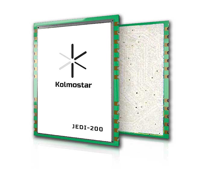
    Kolmostar’s ultra-low power, instant cold boot GNSS module JEDI-200 is now ready to sample. Specially designed for IoT applications such as pet and personal object tracking, livestock tracking, fixed and nomadic logistics, infrastructure tracking and shared economy, JEDI-200’s reduced level of power consumption and optimized efficiency with LPWAN solve IoT endpoint deployment’s pain-point of needing frequent recharges or a large battery.

    JEDI-200 specification highlights include:

    • Industry lowest energy consumption of 25 mJ/position fix
    • Shortest cold-boot TTFF of one second
    • 5.0 meter CEP positioning accuracy
    • Supports GPS and BeiDou constellations
    • 50 Byte/12-hour compressed ephemeris (EPH) for speedy download, enabling A-GPS via LPWAN while significantly reducing EPH download power consumption overhead
    • High-performance cloud computing for minimum end device power consumption and seamless integration with customers’ backend data analytics platforms and dashboard applications
    • Integrated SAW filter, stand-alone LNA and TCXO
    • 12mm x 16mm industry-proven standard form factor for easy wireless connectivity integration

    Purchase a JEDI-200 EVK here.


    Sponsored content provided by Kolmostar

  • Javad GNSS discusses jamming and spoofing technology at Intergeo 2019

    At Intergeo 2019, Javad GNSS President and CEO Javad Ashjaee shares how to identify and block spoofers using Javad GNSS technology.

  • ASPRS Annual Conference at Geo Week 2020 to go virtual because of COVID-19

    ASPRS Annual Conference at Geo Week 2020 to go virtual because of COVID-19

    Logo: ASPRS

    The American Society for Photogrammetry and Remote Sensing (ASPRS): The Imaging and Geospatial Information Society has withdrawn its ASPRS 2020 Annual Conference Virtual Technical Program from the Geo Week 2020 face-to-face event and will be going virtual because of COVID-19.

    Geo Week 2020 is currently scheduled to take place July 27-29 at the McCormick Center in Chicago.

    According to ASPRS, all presenters originally accepted for the March event in Washington, D.C., will have the opportunity to share their work in the ASPRS 2020 Annual Conference Virtual Technical Program, a series of online technical sessions taking place June 22-26.

    Because the ASPRS 2020 Annual Conference Virtual Technical Program is being hosted, organized and managed by ASPRS alone, there will be a new, separate registration process and fee for all presenters and attendees. Existing Geo Week 2020 conference registrations are not transferable to this new ASPRS event, ASPRS said. Registrants may contact [email protected] if they wish to request a refund for all or part of their Geo Week 2020 registration or transfer their 2020 registration to Geo Week 2021.

    Those who register for the ASPRS 2020 Annual Conference Virtual Technical Program will be given access to all of the online technical sessions, as well as live webinars and on-demand recordings, ASPRS said. The full program will e published on the conference website on June 8.

  • GEO Business 2020 postponed again because of COVID-19

    GEO Business 2020 postponed again because of COVID-19

    Logo: GEO Business

    GEO Business 2020 has been postponed again because of COVID-19. The show, originally rescheduled to take place Sept. 24-25, has been rescheduled to take place May 19-20, 2021. It will still take place at ExCeL London.

    According to organizers, the GEO Business show connects the data holders and processors with the people who benefit from the applications and insight which geospatial information provides.

    “We appreciate how important GEO Business is for you, your business and the whole profession,” GEO Business said in a statement. “And we’re very sorry to disappoint you and the thousands of others who were planning on visiting this year. However, the safety of our visitors, speakers and exhibitors remains our priority.”

    The 2021 event will now take place alongside Digital Construction Week, an event dedicated to digital construction, engineering, design, manufacturing and operation.

    “Whilst both will remain separate shows, they will in effect create one much larger technology event for the sector,” GEO Business added.


    Check out more COVID-19-related trade show and conference updates here.

  • Galileo-enabled receivers are increasing positioning

    Galileo-enabled receivers are increasing positioning

    Photo: Philipp Berezhnoy/iStock / Getty Images Plus/Getty Images
    Photo: Philipp Berezhnoy/iStock / Getty Images Plus/Getty Images

    Access to the Galileo signal in a multi-constellation environment is providing benefits and opportunities for businesses, thanks to the enhanced performance and increased accuracy on offer, said the European GNSS Agency (GSA).

    Swedish geographical information technology company SCIOR Geomanagement AB uses a variety of technology in its equipment, including drone aerial photography, terrestrial laser scanning, GNSS or combinations of these.

    SCIOR, a measurement technology producer, incorporates RTK processing techniques into its approach. The company also uses Galileo-enabled receivers to increase the positioning accuracy of its solutions.

    According to the company’s findings, which it presented at the 2019 Intergeo conference in Stuttgart, it has been achieving significantly enhanced performance and other benefits in its day-to-day activities from the use of Galileo-enabled equipment, GSA said.

    “Our experience with Galileo has shown an improvement in the density of the constellation of visible satellites, and thus an improvement in the time needed to obtain centimeter-level accuracy,” said Javier Corral, an engineer at SCIOR Geomanagement AB. “From my personal point of view, I would recommend using this constellation in combination with the other existing ones, since it provides you with a better and quicker performance.”

    According to GSA, the most significant performance improvements are observed at high latitudes and within forest environments. Even taking into account that better results can be obtained in open spaces, using multi-constellation GNSS with Galileo in the woods is sometimes the only way to obtain a satisfactory performance if there is no reference station close enough. performance will be even better in coming years as the number of Galileo satellites increases to reach full operation capability, allowing users to obtain their desired position accuracy and availability in a shorter period of time, GSA added.

  • Geoscience Australia seeks contractor for PNT capabilities

    Geoscience Australia seeks contractor for PNT capabilities

    Logo: Geoscience Australia

    Geoscience Australia is seeking a prime contractor for a new satellite-based augmentation system (SBAS) that Australia and New Zealand have committed to implement.

    The SBAS will improve position, navigation and timing (PNT) capabilities to end-users in Australia and New Zealand.

    The system, which will be called the Southern Positioning Augmentation Network, will augment standard positioning capability provided by GPS and Galileo across all of Australia and New Zealand, with expected user applications in agriculture, construction, resources, utilities and other industries; with decimeter accuracy.

    It will also support the aviation and road transport sectors, which have requirements for high-integrity positioning data with sub-meter level accuracy, Geoscience Australia said.

    Full operational capability will require a number of satellite payloads in geostationary orbit needed to broadcast data to users. These may be hosted payloads rather than dedicated SBAS satellites, Geoscience Australia added.

    This procurement process is administered by Geoscience Australia and is undertaken for the benefit of Geoscience Australia and its New Zealand counterpart, Land Information New Zealand.

  • Pointfuse and Leica Geosystems enter development agreement

    Pointfuse and Leica Geosystems enter development agreement

    Photo: Pointfuse
    Photo: Leica Geosystems

    Pointfuse and Leica Geosystems, a Hexagon company, have established a global cooperation and entered into a development agreement. According to the companies, the agreement aims to streamline the use of reality capture in established digital construction, space management and visualization workflows.

    This strategic cooperation demonstrates the shared focus of Pointfuse and Leica Geosystems to democratize technology and create intuitive and accessible reality capture tools that bring advanced project efficiencies to their users, the companies added.

    To launch the new cooperation, Pointfuse developed a new version of its Pointfuse software, powered by Jetstream, that provides Leica Geosystems users with a Scan-2-BIM workflow within the Leica Jetstream ecosystem. Pointfuse is configured with tailored profiles specifically for Leica Geosystems 3D laser scanners, including the Leica Geosystems LGS file format. The adoption of the LGS file format enables Pointfuse to extract data contained within the LGS file to assist in the classification of building information and substantially automate the workflow process. This centralized solution ensures a simple Scan-2-BIM workflow for space and facilities management as a companion solution to the new Leica BLK2GO handheld imaging laser scanner, the companies said.

    “With functionality and developments implemented specifically for Leica Geosystems users, Pointfuse, powered by Jetstream, harnesses the unique benefits of the Jetstream ecosystem with the power of Pointfuse to deliver a seamless capture-consume-collaborate workflow,” said Steve Salmon, general manager at Pointfuse. “This integrated solution overcomes many of the barriers associated with laser scanning and photogrammetry, through providing an optimised storage solution, instant data loading and production of intelligent outputs. This platform enables Leica Geosystems users to exploit the intelligence captured in the point cloud, easily share outputs, and produce deliverables that drive the advancement of workflows in the digital age.”

  • More than 1,500 jurisdictions using GeoComm GIS Data Hub

    More than 1,500 jurisdictions using GeoComm GIS Data Hub

    GeoComm’s GIS DatLogo: GeoComma Hub is being used by more than 1,500 jurisdictions across the country as a part of their public safety GIS data management processes. The GeoComm Data Hub allows users to measure progress toward development and maintaining public safety grade GIS.

    According to the company, the system quickly validates GIS data and related data against industry standards, as well as provides GIS data insights through quality control and reporting processes. The system allows GIS data organizers to work in their native data schemas and, upon submission, transform disparate GIS datasets into a common schema.

    In addition, it aggregates multiple GIS datasets into a seamless coverage area, prepares map packages for provisioning to 911 applications, and leverages and extends the current Esri GIS data environment.

    “GIS Data Hub is an integral part of our monthly processes,” said Vanessa Feagins, GIS supervisor, Denco Area 911 District. “It creates a central location for cities (with GIS departments) in our district to submit their GIS data which is then returned to our office as a single dataset. GIS Data Hub helps our office and our partner agencies identify possible errors in our datasets, which helps our district prepare for next generation 911 deployment. This would have been a difficult task without GIS Data Hub.”

    Founded in 1995, GeoComm provides county governments with turnkey emergency 911 development services.

  • Fortem Technologies enables safe drone delivery of medical supplies in North Carolina

    Fortem Technologies enables safe drone delivery of medical supplies in North Carolina

    Photo: Fortem Technologies
    Photo: Fortem Technologies

    Fortem Technologies has completed the first phase of the U.S. Department of Transportation’s Unmanned Aircraft Systems Integration Pilot Program (UAS IPP) in North Carolina.

    As part of the program, Fortem is conducting tests to monitor the airspace around WakeMed Hospital in Raleigh, tracking manned flights alongside the UPS Delivery Corridor, and delivering medical test samples via unmanned drones. Fortem has been using its TrueView radar and SkyDome software system to ensure UAS operations and drone deliveries do not interfere with medical helicopters flying in and out of the area, as well as alert drone operators of any potential non-cooperative aircraft in the vicinity.

    According to the company, it was able to accurately and consistently track incoming medical helicopter traffic, providing real-time alerts to Airmap, an unmanned service supplier.

    “By monitoring the airspace and creating a service that ensures the safe use of unmanned air vehicles, we will expand from these initial drone deliveries to greater geographical reach and more sophisticated roles for unmanned drones,” said Adam Robertson, CTO of Fortem Technologies. “With Fortem’s ability to offer real time data and analysis of airborne threats, we can start to see additional support for things like search and rescue operations, first responders, and increased shipments of critical supplies to remote locations. None of this can happen without the trust that our systems are effective and safe.”

    The North Carolina Department of Transportation (NCDOT) Division of Aviation partners, including WakeMed Hospital, are testing drone operations that will soon go beyond a pilot’s visual line of sight to provide efficient and safe drone operations with the ultimate goal of helping to improve healthcare access for all North Carolinians.

    “Ensuring the safety of manned aviation is paramount for unmanned flight operations, yet successful coordination of the two is not an easy task,” said Basil Yap, UAS program manager at NCDOT. “The phase one testing has shown promising results and we are hopeful the phase two operations will provide the information we need to receive a beyond-visual-line-of-sight waiver from the Federal Aviation Administration.”

    Fortem will continue to provide situational awareness and secure the airspace into the next phase of the program, the company said. NCDOT, as part of the USDOT UAS IPP, will continue to support its partners’ operations at WakeMed throughout the year until the program’s conclusion in October.

  • SDSN Trends releases gridded population data report

    Report cover: SDSN Trends
    Report cover: SDSN Trends

    The Sustainable Development Solutions Network’s (SDSN) Trends (Thematic Research Network on Data and Statistics) has released a new report, titled “Leaving No One Off the Map: A Guide for Gridded Population Data for Sustainable Development.”

    According to SDSN Trends, gridded population data have emerged as an important resource for delivering actionable data in challenging circumstances, including in disaster response and health and infectious disease monitoring. Gridded population maps distribute data using grid cells, combining census results with additional information, such as geospatial data from satellites.

    The report presents an overview, analysis and recommendations for the use of gridded population datasets in a wide range of application areas, from health an infectious disease monitoring and disaster response to determining sea-level rise and future water availability.

    The report compares seven gridded population datasets from the POPGRID Data Collaborative and presents an intercomparison assessment of the use of different datasets and their varying outputs. It also addresses misconceptions and offers nine guiding criteria to aid users in their selection process.

    Trends is an initiative of and is governed by SDSN. Trends collaborates closely with SDSN’s network, including by seeking opportunities to work with its regional and national networks on local data action solutions and other projects.

    Check out the full report here.

  • 5th annual FAA UAS Symposium goes virtual because of COVID-19

    5th annual FAA UAS Symposium goes virtual because of COVID-19

    Logo: FAA UAS SymposiumThe Federal Aviation Administration (FAA) and the Association for Unmanned Vehicle Systems International (AUVSI) will host the 5th annual FAA UAS Symposium virtually, rather than in-person in Baltimore. The event will take place June 16-18.

    This decision was made as a result of the ongoing concerns caused by the COVID-19 pandemic, the organizers said.

    The FAA and AUVSI also will be hosting a series of virtual events that will address the content already planned for this year’s program. The fist will take place in early summer and will focus on UTM and international UAS integration. The second will take place in late summer with a focus on updates to the Integration Pilot Program and public safety operations.

    According to organizers, those registered for the 5th annual FAA UAS Symposium will receive a separate message in the coming weeks to confirm options for participation in the virtual events.

    Those selected as speakers for the 5th annual FAA UAS Symposium will receive a separate message from AUVSI’s Industry Education Team to confirm participation, as well as any schedule changes.

  • NavVis launches VLX wearable mapping system

    NavVis launches VLX wearable mapping system

    The all-in-one reality capture capabilities of NavVis VLX include both survey-grade point clouds and high-resolution panoramas. (Photo: NavVis)
    The all-in-one reality capture capabilities of NavVis VLX include both survey-grade point clouds and high-resolution panoramas. (Photo: NavVis)

    NavVis has launched NavVis VLX, a wearable mapping system that captures high-quality data in built environments such as construction sites, staircases and small technical rooms.

    The all-in-one reality capture capabilities of NavVis VLX include both survey-grade point clouds and high-resolution panoramas. The combination of high-quality data capture and a compact, economical design will transform the way architecture, engineering and construction (AEC) projects are captured with fast, efficient scanning for BIM and CAD applications, while also extending the scope of projects to new deliverables such as web-based digital twins, the company said.

    NavVis VLX is equipped with two lidar sensors and captures survey-grade point clouds using the company’s SLAM technology, which was originally developed for the the NavVis M6 indoor mobile mapping system. NavVis VLX also captures high-resolution panorama images in a complete 360-degree field of view.

    According to the company, this wearable device gives the operator more control over where the sensors are scanning. It also allows the user to view and interact with the built-in screen that provides live feedback of what has been scanned and the quality of the data being captured.

    “We designed NavVis VLX to provide the AEC industry with a compact, versatile device that efficiently captures buildings and still delivers survey-grade point clouds,” said Georg Schroth, NavVis CTO. “Knowing that there is still an unmet need for high-quality mobile data capture in a wider range of building documentation applications, we set out to develop a more versatile device that can achieve what NavVis M6 does at a smaller scale and on a lower budget.”

    According to NavVis, the data captured by the VLX can be applied to a wide range of applications, including conventional building documentation such as CAD drawings and BIM models, as well as to innovative digital twin solutions, such as NavVis IndoorViewer.

    NavVis, headquartered in Munich, Germany, is a global provider of indoor spatial intelligence technology and solutions for enterprises. The company also has offices in New York and Shanghai.