Author: Alan Cameron

  • Galileo’s Two Giant Steps Back

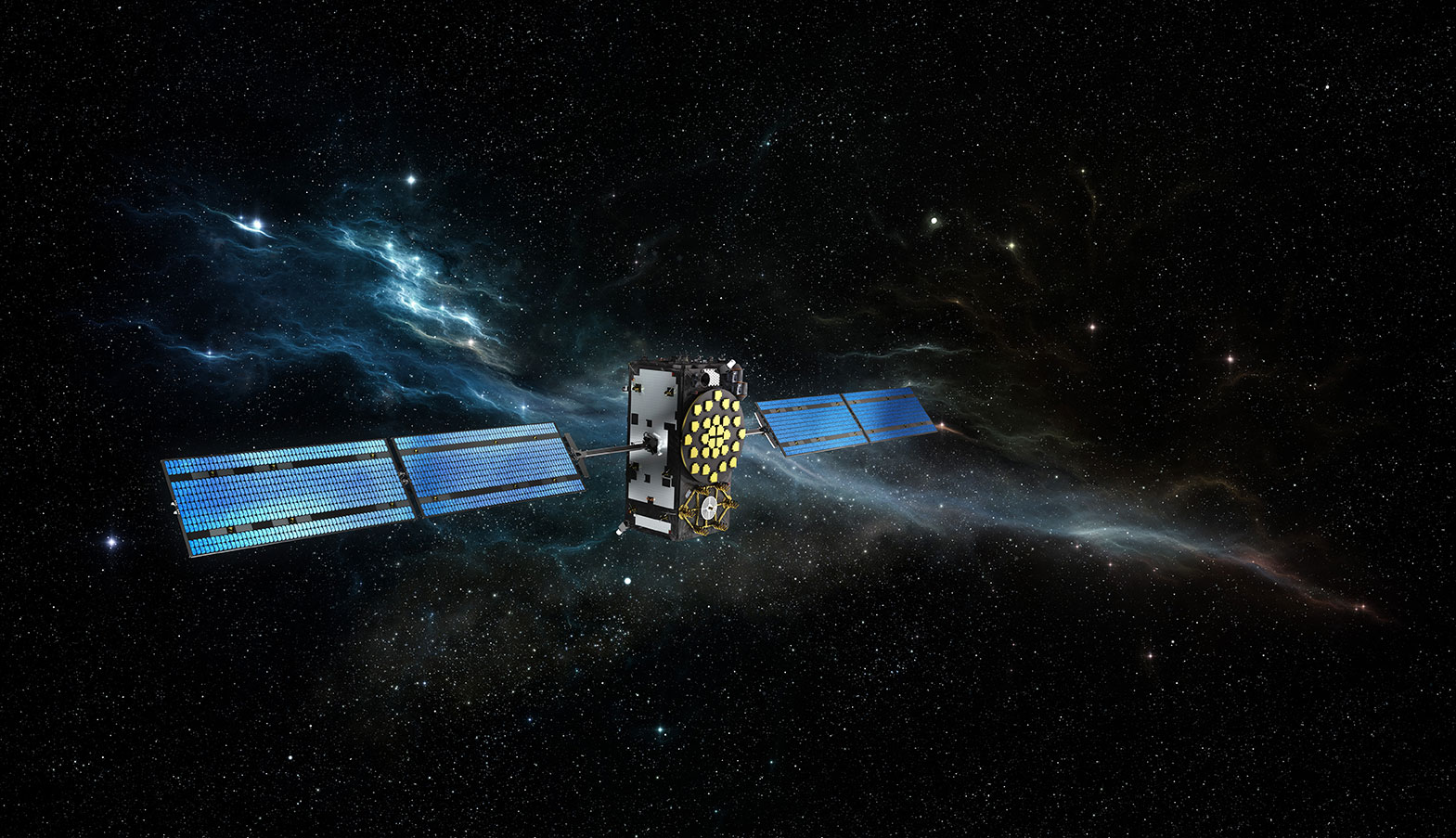
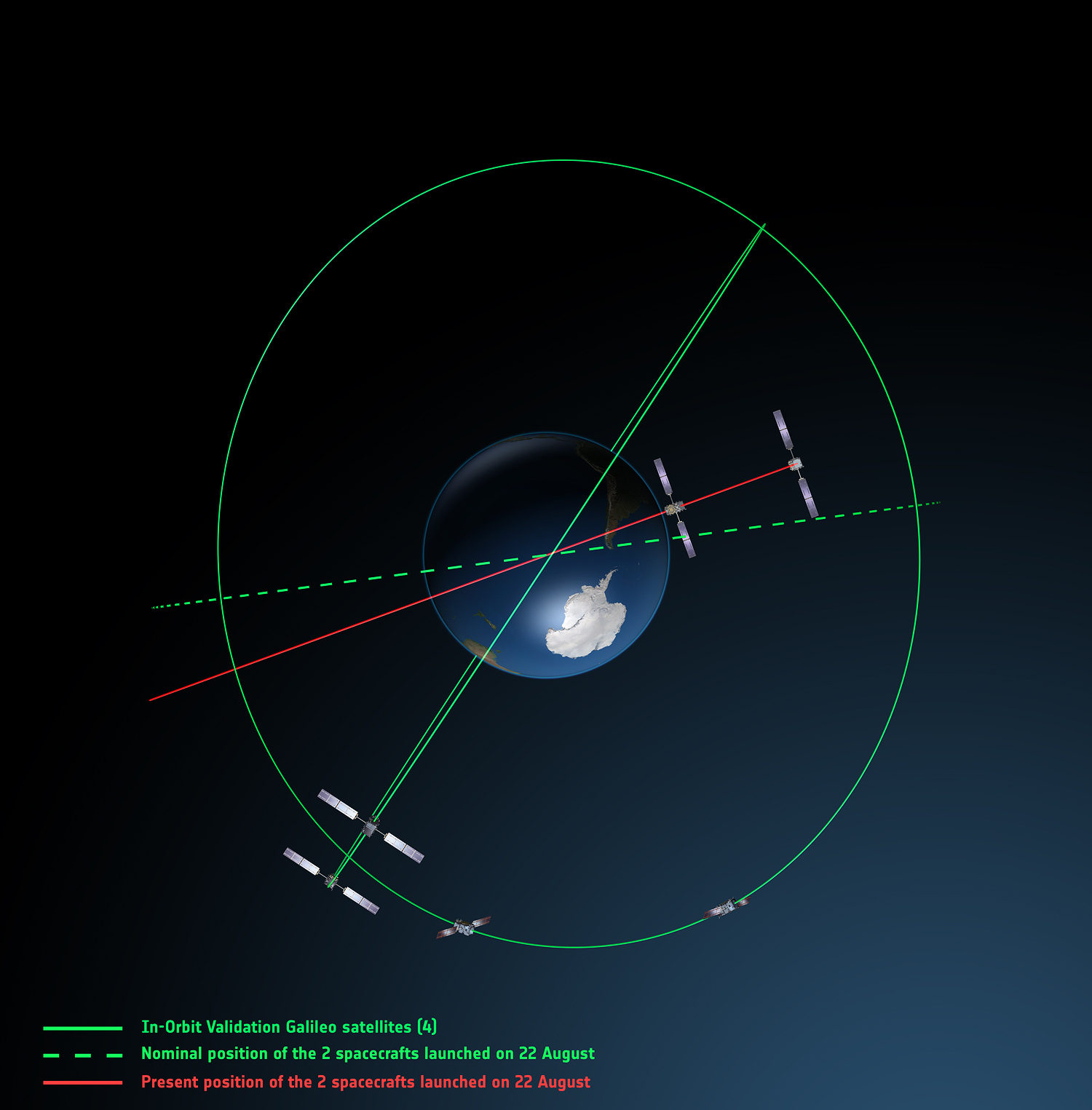
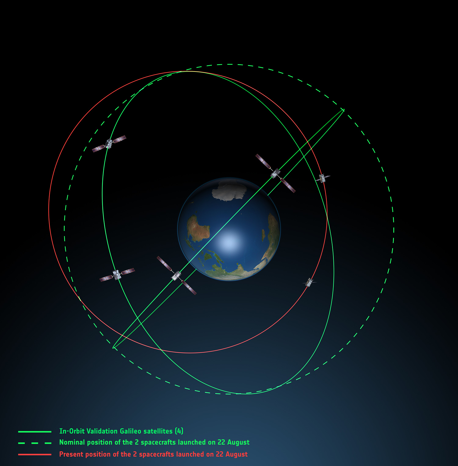
    Galileo’s first two full-operational capability (FOC) satellites have been in a safe state since August 28, under control from the European Space Agency’s (ESA’s) center in Darmstadt, Germany, despite having been released on August 22 into lower and elliptical orbits instead of the expected circular orbits.

    ESA continues investigating the possible exploitation of the out-of-position satellites to maximum advantage, despite their unplanned injection orbits and within the limited propulsion capabilities. ESA specialists, supported by industry and France’s CNES space agency, are analyzing different scenarios that would yield maximum value for the program, and safeguard — as much as possible — the original mission objectives.

    Galileo orbits viewed from above: Orbits of the fifth and sixth satellites in red, compared to their intended position in dashed green, and the position of the four satellites launched in 2011 and 2012 in solid green. This view looks down over the South Pole to illustrate how the inclination relative to the equator is less than intended. The satellites are in an elliptical rather than circular orbit, with a maximum altitude of about 25,900 km and a minimum altitude of about 13,700 km, compared to a planned circular orbit of 23,222 km altitude.
    Galileo orbits viewed from above: Orbits of the fifth and sixth satellites in red, compared to their intended position in dashed green, and the position of the four satellites launched in 2011 and 2012 in solid green. This view looks down over the South Pole to illustrate how the inclination relative to the equator is less than intended. The satellites are in an elliptical rather than circular orbit, with a maximum altitude of about 25,900 km and a minimum altitude of about 13,700 km, compared to a planned circular orbit of 23,222 km altitude.

    Experts representing the Galileo Program provided a frank and open update at the ION GNSS+ conference in Tampa on September 10, as reported by Richard Langley:

    • An inquiry board is looking into problem to find the root cause of the anomaly. The board has already met several times.
    • An intermediate report is due shortly; a final report and recommendations will come next month.
    • ESA is considering what can be done with the two satellites; ESA hopes to be able to use them operationally as much as possible.
    • ESA is also looking at the impact on the commercial Galileo service and the search-and-rescue service.
    • ESA is narrowing down the possible causes of the anomaly.
    • ESA is waiting for the enquiry board to report before deciding on when and how the next two satellites will be launched.
    • The payloads of the errant satellites are currently off.
    • ESA wants to try to raise the perigees of the satellites to get them out of the van Allan radiation belt as soon as possible to prevent damage to the satellites. Raising the perigrees will also to reduce the maximum Doppler frequency shift from 9.6 kHz to at least 6.8 kHz to allow receivers to easily acquire and track the satellites, but leave enough hydrazine for future station keeping.
    • ESA is looking at the almanac problem and whether unused bits in the Galileo navigation message might be able to support a special almanac for the satellites.
    • ESA is also looking at possible rephasing of the satellites to optimize their use with the other satellites in the constellation.
    Galileo orbits viewed side-on: The fifth and sixth Galileo satellites in red, compared to their intended position in dashed green, and the position of the four satellites launched in 2011 and 2012, in solid green. This view looks side on to the two satellites’ orbital plane, which is off-center relative to Earth. The targeted orbit was circular, inclined at 55º to the equator at an altitude of 23,222 km.They are in a safe state, correctly pointing towards the Sun, properly powered and fully under control of an ESA–CNES team.
    Galileo orbits viewed side-on: The fifth and sixth Galileo satellites in red, compared to their intended position in dashed green, and the position of the four satellites launched in 2011 and 2012, in solid green. This view looks side on to the two satellites’ orbital plane, which is off-center relative to Earth. The targeted orbit was circular, inclined at 55º to the equator at an altitude of 23,222 km.They are in a safe state, correctly pointing towards the Sun, properly powered and fully under control of an ESA–CNES team.

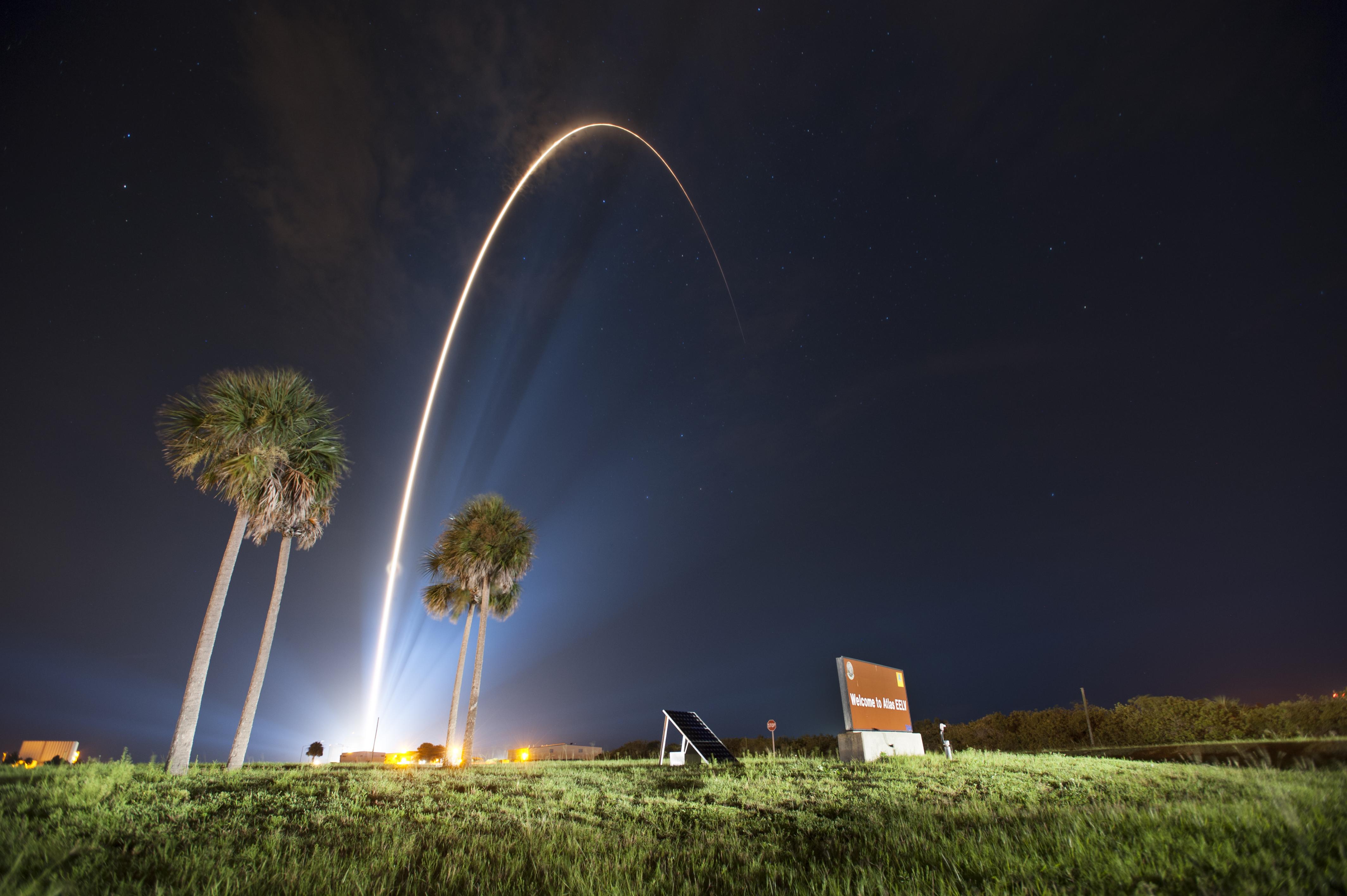
    Soyuz at Fault? On August 28, the Russian newspaper Izvestia reported that “The failure of the European Union’s Galileo satellites to reach their intended orbital position was likely caused by software errors in the Fregat-MT rocket’s upper stage.”

    “The nonstandard operation of the integrated management system was likely caused by an error in the embedded software. As a result, the upper stage received an incorrect flight assignment, and, operating in full accordance with the embedded software, it has delivered the units to the wrong destination,” an unnamed source from Russian space Agency Roscosmos was quoted as saying by the newspaper.

    An independent inquiry panel has been set up by Ariane and headed by former ESA Inspector General Peter Dubock. It started work on August 28. The panel includes a couple of academics and a majority of ESA and EC figures.

    The new EC commissioner in this area, Ferdinando Nelli Feroci, invited ESA and Arianespace to his study during the first week of September to present the initial results of the inquiry.

    The commissioner commented, “The problem with the launch of the two Galileo satellites is very unfortunate. The European Commission will participate in an inquiry with ESA to understand the causes of the incident and to verify the extent to which the two satellites could be used for the Galileo programme. I remain convinced of the strategic importance of Galileo, and I am confident that the deployment of the constellation of satellites will continue as planned.”

    The commissioner expects that the Galileo constellation will be fully deployed by the end of this decade. This may qualify as optimism because system planners had envisioned for six spares ­— and three are already blown.

    Ariane and ESA did not insure the satellites.

    According to back-of-the-envelope calculations, system operators are now one short of the minimum 24 needed for full 24/7 global coverage, as they have four in orbit validation satellites up (one broken) and 22 FOCs on order (two launched and now in what could be called a junk orbit), which makes a potential maximum 23 satellites that have actually been ordered ­­— one short of the target.

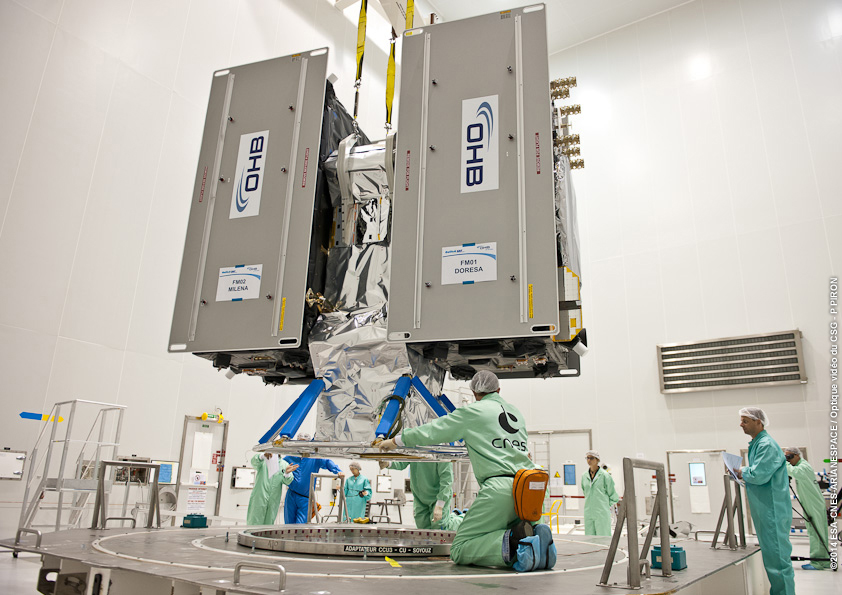
    The Satellites Are Alright. Satellite manufacturer OHB Systems of Bremen, Germany, issued a release stating that “Controllers at ESA’s ESOC control centre in Darmstadt, Germany, confirm the good health and the nominal behavior of both satellites. They are in a safe configuration, are thermally stable, have stable pointing to the sun and sufficient power production. All platform subsystems have been checked and they work properly. Also, the procedures to deploy the solar arrays are successfully performed and all solar arrays are properly unfolded.”

    Further, “The orbit anomaly has no impact on the production and delivery of the in total further 20 satellites. Two FOC satellites are currently at ESTEC test facilities in Noordwijk, the remaining are in various status of integration. ”

    Blogs Alive; BBQ Mode. The chairman of the Executive Board of the German Aerospace Center, Johann-Dietrich ‘Jan’ Wörner, writes an interesting blog. A recent installment opened with a quote from Elon Musk: “Rockets are tricky.”

    Wörner went on to say, “The Soyuz launcher lifted off from the European Spaceport in French Guiana. Initially, all of the measurements suggested a perfect mission; the launcher took off at the scheduled time, followed the prescribed trajectory, and the stage separation was carried out correctly. However, the first problem became apparent when the two satellites proved unable to deploy their solar arrays as intended. A more detailed analysis then revealed that the eccentricity, the altitude and the inclination of the satellites’ orbits with respect to Earth’s equator did not meet the specifications. The upper stage had also evidently failed to induce the planned rotation around the longitudinal axis of the spacecraft (known as ‘barbeque’ mode, designed to maintain favourable thermal conditions during exposure to the Sun).”

    Further discussion of the possible causes of the anomaly can be found on a Russian site, which focuses on the Fregat stage thrusters and indicates that the Russians think the barbeque maneuver was completed, and thus not the problem.

    The other big issue is how the telemetry didn’t pick up the issue straight away.

  • Out in Front: 25 Years Young

    Alan Cameron
    Alan Cameron

    When I was a young man, the moment seemed like all there was, all there needed to be. Why plan? Why reflect? The days were just packed.

    Once I turned 25 — or somewhere around there — intimations dawning of my own mortality, I began to look both forward and back. It seemed like a good idea, perhaps even an important one, to draw from my own history, good and bad, and use that perspective to start building a more informed, more mapped-out future.

    That’s what the Special Section accompanying this issue is all about. So much goes on at all times — the days are just packed — and we are so busy formulating solutions to the challenge of the moment, whether that be spoofing or indoor positioning or adjacent-band use, that we have little opportunity to reflect on how far we have come. To take the long view on just where we want to go in the next 25 years.

    In that vein, we are proud to present Brad Parkinson’s vision of the future. He brought you GPS in the past. He has his sights firmly fixed on “PTA” for the future: Protect, Toughen, and Augment GNSS to assure continuous delivery of solutions. 

    Brad is uniquely qualified to lay out these prescriptions for our collective future. Having been deep in the political and technical trenches, fighting to build a revolutionary new system decades ago, and in continuous engagement ever since, he knows both the vulnerabilities and the possibilities.

    No mention of the 25-year history of this magazine would be complete, or even remotely accurate, without giving prominence to two individuals who shaped it from the beginning.  Glen Gibbons was the founding editor and held down this chair for 16 years. He literally invented GNSS journalism. His confrère from those early days is still with us: Richard Langley logged his 200th Innovation column a couple of years ago, and it remains a cornerstone of every issue. Except August and December, when he helps us compile the GNSS Constellation Almanac.

    So, back to the young man, 25 years of age, who had a head full of impressions but not much, perhaps, in the way of concrete ideas. He has turned twice that number since then, and I hesitate to state how many more. The impressions, of course, have only continued to accumulate. The ideas have started to come. Plans have formed, been left by the wayside, new plans derived, and some of them even followed. Life, it has been said, is what happens while you are busy making plans.

    Take some time to wander through the back pages of GNSS industry history in the Special Section volume that accompanies this one. Read what the GPS Directorate is doing now to make things even better. Absorb the necessary strength and vision — Dr. Parkinson’s PTA prescription — we’ll need for the future.

    And then go out and do 25 more.

  • The System: One Step Back, Three Steps Forward

    The System: One Step Back, Three Steps Forward

    Galileo-MASTER-2014-W

    Galileo IOV Bird Mute; New Draft ICD; CS Proved; Late August Launch

    Orbiting in silence since an onboard power mishap on May 27, troubled E20 emitted cheeps from space on August 6, 7,  and 8, broadcasting on the L1 frequency. Nothing has been heard since. 

    Meanwhile, the European Commission (EC) published a new draft version of the Galileo Open Service Signal in Space Interface Control Document (OS SIS ICD), issue 1, revision 2, on June 30. It is available for download and comment, the latter period extending to September 22. The EC’s open public consultation process seeks  to ensure that any further development of the Galileo OS SIS ICD takes into account the views of key GNSS stakeholders. An online form for submitting comments is available.

    Galileo E20, also known as GSAT0104, the fourth in-orbit validation (IOV) satellite, has been set “unavailable until further notice” according to the European GNSS Service Centre because of a sudden, unexpected loss of power on May 27.

    Based on a selected set of IGS MGEX stations and all CONGO stations, the first signals were tracked at AREG, AUT0, LLAG, and UNB3 at 23:13:00. No E5 signals and no navigation messages are currently transmitted. Some JAVAD GNSS receivers report from time to time false E5a locks with zero or extremely small C/N0.

    Galileo’s Early Proof of Concept (EPOC) team has successfully tracked the encrypted Galileo E6-B and E6-C signals broadcast by Galileo satellites. As a result, the Commercial Service loop has been closed using both encrypted and non-encrypted signals.

    The completed dispenser unit is ready to be transferred from the S5 payload preparation facility for its integration atop Soyuz’ Fregat upper stage.
    The completed dispenser unit is ready to be transferred from the S5 payload preparation facility for its integration atop Soyuz’ Fregat upper stage.

    During a 10-day testing period, receivers in Tres Cantos, Spain and Poing, Germany, showed the successful tracking and data demodulation of the encrypted signals from the available Galileo satellites, with periods where all satellites transmitting E6 encrypted signals were tracked simultaneously. The tests verified the Galileo Commercial Service (CS) signal’s encryption functionalities, with the data received containing authentication and high accuracy information previously generated outside the Galileo system. This is an essential feature to ensuring Galileo’s high accuracy and authentication services.

    The Galileo Commercial Service will deliver a range of added-value features, including positioning accurate to decimeter level and an authentication element. The Galileo CS demonstrator began its proof of concept earlier this year, with early service expected to start in 2016.

    Once operational, the CS will provide access to two additional encrypted signals on the E6 band, delivering a higher data throughput rate and increased accuracy. The tests are the result of a collective effort involving teams and projects of AALECS (Authentication and Accurate Location Experimentation with the Commercial Service), supported by the European Commission, the GSA, the European Space Agency (ESA), and the Galileo operator Spaceopal.

    The AALECS project is building a platform to connect to the European GNSS Service Centre (GSC) and transmit real-time CS data through the Galileo satellites. This platform will be operational by 2015 and will demonstrate the real performance of future high-accuracy and authentication services of Galileo prior to early service availability.

    The European Commission launched AALECS in January 2014, and it was awarded to a consortium led by GMV including CGI, Qascom, IFEN, Veripos, and KU Leuven. 

    New Launch. At press time, the next Galileo satellites were set to launch on August 21, ushering in the system deployment phase and paving the way for the start of initial services. Galileo SATs 5 and 6 were scheduled to lift off from Europe’s Spaceport in French Guiana on top of a Soyuz rocket. They are expected to become operational, after initial in-orbit testing, in autumn.

    The two satellites will join the four Galileo in-orbit validation satellites already in space. Launched in pairs in October 2011 and October 2012, these four — the minimum required to obtain a position fix — demonstrated and validated the system’s space and ground segments.

    SATs 7 and 8 are scheduled to follow by end of year 2014.  Then the constellation will be gradually deployed with six to eight satellites launched per year, along with addition of remaining elements of the ground network.

    Adjacent-Band Compatibility Workshop Set for D.C.

    The U.S. Department of Transportation is holding a “GPS Adjacent Band Compatibility Assessment Workshop” on September 18, 10 a.m.–5 p.m. Eastern Daylight Time. Registration for the workshop is required, and closes September 4. The general public can either attend in person or via WebEx.

    The workshop is being held to discuss implementation of a GPS Adjacent Band Compatibility Assessment. Discussion will focus on the various implementation steps of the assessment, including development of GPS receiver use cases, identification of representative GPS receivers, and development of a test and analysis program. “In particular, emphasis will be placed on the information needed from GPS receiver and antenna manufacturers, and the logistics of procuring and handling that information to safeguard manufacturer proprietary data,” according to the Federal Register.

    The sponsoring agency is the Office of the Assistant Secretary for Research and Technology, Department of Transportation.

    To register, send the following information to [email protected]:

    • Name
    • Organization
    • Telephone number
    • Mailing and email addresses
    • Attendance method (WebEx or on site)
    • Country of citizenship

    The meeting will be held at the U.S. Department of Transportation, John A. Volpe National Transportation Systems Center, 55 Broadway, Cambridge, MA 02142. ID is required to enter the building. For details, see the Federal Register notice.

    av_gpsiif7_l282201473335AM63

    GPS IIF-7 Successfully Launched

    Last USAF Launch to Rely on Radar as GPS Tracking Takes Over

    A United Launch Alliance (ULA) Atlas V rocket carrying the seventh GPS IIF satellite for the U.S. Air Force launched at 11:23 p.m. EDT Friday, August 1 (03:23 UTC, August 2), from Space Launch Complex-41 at Cape Canaveral, Florida.The Boeing-built satellite has sent the signals to controllers that confirm it is currently operating properly within the constellation.

    Boeing and the Air Force will complete the full on-orbit checkout of the satellite in August. The GPS IIFs offer improved signal accuracy, better anti-jamming capability, longer design life and the new civilian L5 signal.

    “We are providing our Air Force partner and GPS users with a steady supply of advanced GPS IIFs,” said Craig Cooning, president of Boeing Network & Space Systems. “Our robust launch tempo requires vigilance and attention to detail, and mission success is our top priority. We continue to partner with the Air Force and ULA to effectively execute the launch schedule.”

    GPS IIF-7 is the seventh of 12 such satellites Boeing has built for the U.S. Air Force, and the third on-orbit delivery this year. GPS IIF-8, slated for launch during the fourth quarter, arrived at Cape Canaveral on July 16 to undergo final launch preparations. GPS IIF-7 will join a worldwide timing and navigation system utilizing 24 satellites in six different planes, with a minimum of four satellites per plane positioned in orbit approximately 11,000 miles above the Earth’s surface.

    “Congratulations to the U.S. Air Force and all of our mission partners on the successful launch of the Atlas V carrying the GPS IIF-7 satellite,” said Jim Sponnick, ULA vice president, Atlas and Delta Programs. “ULA launch vehicles have delivered all of the current generation of GPS satellites, which are providing ever-improving capabilities for users around the world.”

    This mission was launched aboard an Atlas V Evolved Expendable Launch Vehicle (EELV) 401 configuration vehicle, which includes a 4-meter-diameter payload fairing. The Atlas booster for this mission was powered by the RD AMROSS RD-180 engine, and the Centaur upper stage was powered by a single Aerojet Rocketdyne RL10A engine.

    The EELV program was established by the United States Air Force to provide assured access to space for Department of Defense and other government payloads. The commercially developed EELV program supports the full range of government mission requirements, while delivering on schedule and providing significant cost savings over the heritage launch systems.

    C-Band Radar. The launch August 1 marked the final time the Air Force is expected to rely on C-band radars to track rockets immediately following liftoff.

    Future Air Force launches, both from the Cape and from Vandenberg Air Force Base in California, will rely on GPS signals for post-liftoff tracking, service officials said. The Air Force and its primary launch services provider, ULA, have been working for years on the capability, which features rocket-mounted GPS receivers that transmit position-location data to controllers on the ground.  

    “It’s something that’s been a long time coming,” Walt Lauderdale, GPS IIF-7 mission director, said during a July 25 conference call with reporters. The new technique has been tested and proven at both at Cape Canaveral and Vandenberg over the last few years, he said.

  • Slung Low, Sweet Satellites: Galileo Anomaly Update

    Slung Low, Sweet Satellites: Galileo Anomaly Update

    Galileo mission logos have been applied to the payload fairing, which encapsulates the two-satellite payload and their dispenser system.
    The satellite payload fairing pre-launch.

    The wording is terse, the intent clear.

    “Following the failure on Friday August 22nd to inject Galileo satellites 5 and 6 into the correct orbit, the European Commission has requested Arianespace and the European Space Agency (ESA) to provide full details of the incident, together with a schedule and an action plan to rectify the problem.”

    This is the only official face showing, but extremely high levels of activity take place behind the curtain, studying what might have caused several million Euros of hardware to end up much lower above the Earth than desired. Meanwhile, active speculation in the satnav blogosphere provides glimpses of possible outcomes from the latest satellite disaster — not exclusive to Galileo, by any means — created in all likelihood by a malfunction aboard its Soyuz launcher and/or the Fregat upper stage thereof.

    The full official EC announcement is available here.

    The satellites are under the control of the European Space Operations Centre (ESOC), ESA’s main mission control center in Darmstadt, Germany. But they are far out off position — more than 3,500 kilometers of space away, so far as to make their eventual use as part of the Galileo constellation very unlikely. Discussions continue with ESA and Arianespace regarding whether or not the satellites are likely to be of use, but odds are against it.

    Their onboard fuel is not enough to compensate for the launch shortfall to reach higher orbits under their own power. ESA scientists are studying how they might still possibly  be used, far from their optimum position,s within the Galileo constellation.

    According to an Arianespace press release on August 23, the target orbit was circular, inclined at 55 degrees with a semi-major axis of 29,900 kilometers, but what they got was an elliptical orbit, eccentricity of 0.23, semi-major axis of 26,200 kilometers and inclined at 49.8 degrees.

    On August 28, the Russian newspaper Izvestia reported that “The failure of the European Union’s Galileo satellites to reach their intended orbital position was likely caused by software errors in the Fregat-MT rocket’s upper-stage.”

    “The nonstandard operation of the integrated management system was likely caused by an error in the embedded software. As a result, the upper stage received an incorrect flight assignment, and, operating in full accordance with the embedded software, it has delivered the units to the wrong destination,” an unnamed source from Russian space Agency Roscosmos was quoted as saying by the newspaper.

    An independent inquiry panel has been set up by Ariane. It is headed by former ESA Inspector General Peter Dubock. It starts work on August 28. The panel includes a couple of academics and a majority of ESA and EC figures.

    Ferdinando Nelli Feroci, the new EC Commissioner for Industry and Entrepreneurship.
    Ferdinando Nelli Feroci,
    the new EC Commissioner for Industry and Entrepreneurship.

    The new EC commissioner in this area, Ferdinando Nelli Feroci has invited ESA and Arianespace to his study during the first week of September to present the initial results of the inquiry.

    The commissioner commented, “The problem with the launch of the two Galileo satellites is very unfortunate. The European Commission will participate in an inquiry with ESA to understand the causes of the incident and to verify the extent to which the two satellites could be used for the Galileo programme. I remain convinced of the strategic importance of Galileo and I am confident that the deployment of the constellation of satellites will continue as planned.”

    The commissioner expects that the Galileo constellation will be fully deployed by the end of this decade. This may qualify as optimism because system planners had envisioned for six spares – and three are already blown.

    Ariane and ESA did not insure the satellites.

    According to back-of-the-envelope calculations, system operators are now one short of the minimum 24 needed for full 24/7 global coverage, as they have 4 IOVs up (1 broken) and 22 FOCs on order (2 launched and now in what could be called a junk orbit) which makes a potential maximum 23 sats that have actually been ordered – one short of the target.

    The Satellites Are Alright

    Satellite manufacturer OHB Systems of Bremen, Germany, issued a release stating that “Controllers at ESA’s ESOC control centre in Darmstadt, Germany, confirm the good health and the nominal behaviour of both satellites. They are in a safe configuration, are thermally stable, have stable pointing to the sun and sufficient power production. All platform subsystems have been checked and they work properly. Also the procedures to deploy the solar arrays are successfully performed and all solar arrays are properly unfolded.”

    Further, “The orbit anomaly has no impact on the production and delivery of the in total further 20 satellites. Two FOC*-satellites are currently at ESTEC test facilities in Noordwijk, the remaining are in various status of integration. ”

    Blogging the Boondoggle

    The chairman of the Executive Board of the German Aerospace Center, Johann-Dietrich ‘Jan’ Wörner, writes an interesting blog. The current installment opens with a quote from Elon Musk: “Rockets are tricky.”

    Wörner goes on to say, “The Soyuz launcher lifted off from the European Spaceport in French Guiana. Initially, all of the measurements suggested a perfect mission; the launcher took off at the scheduled time, followed the prescribed trajectory, and the stage separation was carried out correctly. However, the first problem became apparent when the two satellites proved unable to deploy their solar arrays as intended. A more detailed analysis then revealed that the eccentricity, the altitude and the inclination of the satellites’ orbits with respect to Earth’s equator did not meet the specifications. The upper stage had also evidently failed to induce the planned rotation around the longitudinal axis of the spacecraft (known as ‘barbeque’ mode, designed to maintain favourable thermal conditions during exposure to the Sun).”

    Further discussion of the possible causes of the anomaly can be found on a Russian site, which focuses on the Fregat stage thrusters and indicates that the Russians think the barbeque maneuver was completed, and thus not the problem.

    The other big issue is how the telemetry didn’t pick up the issue straight away.

    There is avid speculation and a number of interesting theories being aired on the Canadian Space Geodesy Forum. For subscriptions to this vital listserv, visit here.

  • Spoofer and Detector: Battle of the Titans at Sea

    Spoofer and Detector: Battle of the Titans at Sea

    Spoofer-sea-yacht-O

    Two satnav superpowers battled it out aboard a superyacht in the Mediterranean this summer, as a spoofing detector designed to differentiate between real and fake GPS signals came to grips with a spoofing device previously responsible for hijacking a sophisticated drone helicopter, deceiving it into landing when it was trying to hover, and for misdirecting the same luxury yacht in tests last summer.

    Mark Psiaki, Cornell University professor of mechanical and aerospace engineering, and graduate student Brady O’Hanlon spent a week aboard the White Rose of Drachs, a luxury superyacht, testing their second-generation spoofing detector as the boat cruised from Monaco around the boot of Italy to Venice at the head of the Adriatic Sea. Also on board was a researcher from assistant professor Todd Humphreys’ Radionavigation Laboratory at the University of Texas at Austin. Humphreys tested his latest spoofer aboard the same yacht last year; this year, Psiaki and O’Hanlon embarked for a follow-up experiment to see if they could outsmart the spoofer.

    Caption: The Cornell team's  spoofing detection system electronics quietly at work detecting evildoers on the bridge of the White Rose.
    The Cornell team’s spoofing detection system electronics quietly at work detecting evildoers on the bridge of the White Rose.

    Both researchers have published earlier versions of their work in GPS World magazine, Psiaki in “GNSS Spoofing Detection,” the Innovation column in the June 2013 issue, and Humphreys in “Drone Hack” in the August 2012 issue.

    The former story relates how Humphreys and Psiaki began their investigations as far back as 2008. “There was no intention to help bad actors deceive GNSS user equipment. Rather, our goal was to field a formidable ‘Red Team’ as part of a ‘Red Team/Blue Team’ (foe/friend) strategy for developing advanced ‘Blue Team’ spoofing defenses.”

    In international waters this summer, the Cornell and Texas teams could conduct their research unhindered; on land, it’s very difficult to get permission to hack a GPS signal, even for research purposes, Psiaki said.

    The Cornell  two-antenna system installed on the roof of the White Rose bridge next to the superyacht's GPS antenna.
    The Cornell two-antenna system installed on the roof of the White Rose bridge next to the superyacht’s GPS antenna.

    Aboard the White Rose, Humphreys’ team initiated an attack of the boat’s GPS receiver, overlaying a disguised false signal on top of the real one, and attempting to send the boat off-course without generating any obvious warning signs. Stationed in a different area of the boat, Psiaki and O’Hanlon’s device set itself to detect the false signals through real-time analysis of their properties, and to provide protection against any attack by issuing a definitive warning whenever false signal characteristics were identified.

    “We tested numerous spoofing scenarios,” recalled Psiaki. “We proved the efficacy of the new two-antenna version of one of our spoofing detection systems. It is the functional equivalent of our previous moving-antenna spoofing detection system.  With two antennas we can simulate the effects of antenna motion without any need for moving parts. The only problems we encountered were with the initial spoofing drag-off, at which point the true and spoofed signals interfere with each other, and signal tracking can be tricky.

    “We recorded wide-band data for all these cases. We think that we know how to enhance our defenses to hold on to the signals and recognizing spoofing during the initial drag-off. We also think that we know how to recover the true signals after an attack. The recorded wide-band data should enable us to develop and test these refinements in the lab, i.e., without the need to go back to sea — not that we would mind having to take another cruise on the White Rose of Drachs.”

    In one test, the yacht’s GPS receiver was spoofed into believing that it was veering off its course, set northwards to Venice, and heading south to Libya at a very high speed. The Cornell detector was able to warn the White Rose’s bridge crew about the attack before the yacht was 20 meters off course.

    The White Rose's GPS-driven chart showing it off the coast of Libya (black line) when it was actually in the Adriatic, cruising from Montenegro to Venice (blue line). The spoofing detector knew all along that this was a false reading.
    The White Rose’s GPS-driven chart showing it off the coast of Libya (black line) when it was actually in the Adriatic, cruising from Montenegro to Venice (blue line). The spoofing detector knew all along that this was a false reading.
    "This photo shows the White Rose' Litton GPS receiver with ridiculous speed and altitude readings -- we were in a hurry to get from the Adriatic to Libya and therefore spoofed a straight line route that took us across, actually beneath, Italy and Sicily, at speeds exceeding 900 kts in order to get there in 50 minutes. "
    “This photo shows the White Rose’ Litton GPS receiver with ridiculous speed and altitude readings — we were in a hurry to get from the Adriatic to Libya and therefore spoofed a straight line route that took us across, actually beneath, Italy and Sicily, at speeds exceeding 900 kts in order to get there in 50 minutes. “

    “We want to progress to the point where not only can we tell it’s a false signal, but we can also say, ‘Here is the true signal; here is the true position,’” Psiaki added.

    The owner of the White Rose of Drachs, an anonymous businessman, allows the boat to be used for scientific purposes during off seasons.

    The Cornell and White Rose team: (from left) Brady O'Hanlon, Cornell ECE Ph.D. student, Andrew Schofield, master of the White Rose of Drachs, and Mark Psiaki, Cornell Prof. of Mechanical & Aerospace Engineering.
    The Cornell and White Rose team: (from left) Brady O’Hanlon, Cornell ECE Ph.D. student, Andrew Schofield, master of the White Rose of Drachs, and Mark Psiaki, Cornell Prof. of Mechanical & Aerospace Engineering.

    Psiaki will present a paper on the superyacht experiments at the Institute of Navigation’s GNSS+ conference in September in Tampa, Florida, and GPS World will publish an article based on this paper in the November issue.


    This story draws on initial reporting by Anne Ju in the July 28 Cornell Chronicle, with additional material and photos supplied by Mark Psiaki.

  • Out in Front: The State of Our Union

    Out in Front: The State of Our Union

    JEFF FEHLBERG, winner of the drawing for a Trimble Juno T41, grand prize in the 2013 State of the Industry Survey. You, too, can be this lucky!
    JEFF FEHLBERG, winner of the drawing for a Trimble Juno T41, grand prize in the 2013 State of the Industry Survey. You, too, can be this lucky!

    Like Olympic athletes, doctors without borders, and magicians, members of the GNSS community constitute an informal international group that gathers periodically, in different centers around the world, to share knowledge and advance their craft. It is due and fitting, perhaps even necessary, that we also try to summarize or collect our views about ourselves, our field, and our future. The State of the Industry Survey is an effort to do just that.

    Last year’s Survey drew 893 responses from I lost count of how many countries; the results were published in the September issue. The questions for the 2014 Survey appear on the pages immediately following, and the online interactive Survey is now live, through the end of August. You can win cool stuff simply by answering 20 questions.

    Displayed here are last year’s top prize winners. Jeff Fehlberg, a mobile business analyst from Tritech Software Systems in Little Rock, Arkansas, garnered the rugged handheld Trimble.  

    John Zittere of Engility Corporation in Hollywood, Maryland, sent along a selfie with giftie, and a few comments: “I really do enjoy reading GPS World and I also suggest it to our new-hire engineers. Here are a few pics from our Automated Aerial Refueling tests in Niagara, New York (see below).”

    JOHN ZITTERE with his dinner ticket, the second raffle prize from the 2013 survey.
    JOHN ZITTERE with his dinner ticket, the second raffle prize from the 2013 survey.

    Also receiving gift cards for completing the 2013 Survey: Jinghui Wu of  Kensington, New South Wales, Australia; Dr. S.M.A. Rizvi from Aligarh, Uttar Pradesh, India; and Rui Barradas Pereira of GMV in Lisbon, Portugal.

    CALSPAN Lear Jet with the probe (non-functional but flight ready).
    CALSPAN Lear Jet with the probe (non-functional but flight ready).
    AAR016, view of the tanker drogue from the Lear Jet.
    AAR016, view of the tanker drogue from the Lear Jet.
  • A Long Look at Advanced Multisensor Navigation and Positioning

    A modern-day fable related by Steven Covey tells of a civil engineer leading a crew engaged in building a road through a dense jungle. Each day the engineer’s adept management, the crew’s motivation and energy, and the high-tech equipment at their disposal pushed the new road well beyond scheduled targets. Midway through the allotted month, the engineer decided to climb to the top of a tree to see if he could get a distant glimpse of the destination. After a few minutes, he called down to his crew, “Wrong jungle!”

    This comes to mind as we consider the well-known fact that the next generation of navigation and positioning systems must provide greater accuracy and reliability in a range of challenging environments, to meet the needs of a variety of mission-critical applications. It’s no secret that not a single navigation technology, among scores available to us, is robust enough to meet these requirements by itself. A multisensor solution is required.

    Although many new navigation and positioning methods have been developed in recent years, little has been done with all-encompassing vision to bring them together into a robust, reliable, and cost-effective integrated system. Almost all the solutions proposed — and I have conveyed many of them in the pages of GPS World, thanks to the expert engineers who designed and tested them — spring from the requirements of a particular situation, application, or industry sector. Their parameters are suitably specialized.

    What’s been lacking so far is an over-architecture for the entire field. Paul Groves of University College London has outlined such a structure in an article that will appear in the September issue of the magazine: “Four Key Challenges to Multisensor PNT.” This material was first presented at the IEEE/ION Position Location and Navigation Symposium (PLANS) in Monterey, California in May of this year.

    The magazine article will describe each challenge in turn. In each case, Groves explains the problem, proposes one or more solutions, and identifies the issues that must be resolved in order to implement those solutions. He also presents the results of some preliminary context-detection experiments and illustrates some of the problems using results from several UCL research projects. The discussion is illustrated with results from research into urban GNSS positioning, GNSS shadow matching, environmental feature matching, and context detection

    The four challenges: complexity, context, ambiguity, and environmental data handling.

    • Complexity – How to find the necessary expertise to integrate a diverse range of technologies, how to combine technologies from different organizations that wish to protect their intellectual property, how to incorporate new technologies and methods without having to redesign the whole system and how to share development effort over a range of different applications.
    • Context – How to ensure that the navigation system configuration is optimized for the operating environment and host vehicle (or pedestrian) behavior when both are subject to change.
    • Ambiguity – How to handle multiple hypotheses, including measurements of non-unique environmental features, pattern-matching fixes where the measurements match the database at multiple locations, and uncertain signal properties, such as whether reception is direct or non-line-of-sight (NLOS).
    • Environmental Data Handling – How to gather, distribute, and store the information needed to identify signals and environmental features and define their points of origin or spatial variation.

    As Groves relates in his article, many new positioning techniques have been investigated over the past fifteen years.

    • Wi-Fi positioning
    • Ultra-wideband (UWB) positioning
    • Positioning using phone signals
    • Positioning using television signals and other signals of opportunity (SOOP)
    • Bluetooth low energy positioning
    • Laser-based position fixing and dead
    • Pedestrian dead reckoning (PDR) using step detection
    • Pedestrian map matching Error! Reference source not found.
    • Magnetic anomaly matching
    • Activity-based map matching
    • GNSS shadow matching

    There have also been improvements to existing technologies.

    • Hardware required for visual navigation
    • Micro-electro-mechanical systems (MEMS) technology
    • Cold-atom technology and nuclear magnetic resonance (NMR) gyros offering aviation-grade performance with compact sensors
    • Legacy radio navigation systems, such as Distance Measuring Equipment (DME) and Loran (in Europe and South Korea) are being modernized
    • Doppler positioning is being reintroduced using Iridium communication satellites

    Finally, GNSS itself has been enhanced through multiple constellations in a continual state of upgrade and renewal, high-sensitivity receivers and network assistance, and augmentation by commercial pseudolite systems.

    Maybe it’s time for a high-level perspective on all these adjoining jungles, if we want to find our way out of them.

    Potential components of a car navigation system using commonly available equipment and other low-cost sensors.
    Potential components of a car navigation system using commonly available equipment and other low-cost sensors.
  • Power Loss Created Trouble Aboard Galileo Satellite

    Power Loss Created Trouble Aboard Galileo Satellite

    In an update to our July 2 story (recapped below), correspondent Peter de Selding wrote in Space News on July 3 that the trouble aboard the fourth in-orbit (IOV) Galileo satellite arose from a sudden, unexpected loss of power. The power outage flashed on May 27, shutting down the satellite’s E1 signal. The signal “re-established itself almost immediately. But as soon as it was back in service, the two other channels’ power dropped and did not recover. The full satellite then was shut down by ground teams,” reported de Selding.

    European Space Agency (ESA) officials stated on July 3 that they would power-on the satellite again sometime this week (July 7–11) to continue investigating the problem. That investigation has been ongoing since the shutdown but has not identified a cause; officials state they have established that it is not related to the onboard atomic clocks.

    The four IOV satellites currently aloft differ in both technology and manufacturer from the next phase of Galileo satellites to be launched. Two of these newer generation are at the Guyana spaceport awaiting a possible late August lift date.

    ________________________

    July 2 GPS World story:

    Galileo GSAT0104, the fourth in-orbit validation (IOV) satellite, has been set “unavailable until further notice” according to the European GNSS Service Centre. International observers (not associated with the European Space Agency, ESA) including those of the International GNSS Service tracking the satellite have not detected a signal from GSAT0104 since May 27. A constellation update appeared June 26 at www.gsc-europa.eu/system-status/Constellation-Information, and is reproduced here.

    Speculation by unofficial sources is mounting that something is wrong with the satellite, in particular with its passive hydrogen maser, used for timing the signal for synchronous transmission with other Galileo satellites. The hydrogen maser has “a known problem” according to one source. This is why the web site shows GSAT0104, also known as FM04 and E20, as currently using a rubidium atomic frequency standard.

    No statement has been made by the ESA.

    According to reports, the root cause of the outage is under investigation. Some unofficial sources have gone so far as to speculate that GSAT0104’s useful transmission life may be over.

    GalileoStatus-W2

    The setting of unavailability may be due to in-orbit validation testing, as the website implies may be the case, but no further official statement has appeared. On May 27, an active user notifications (NAGU) appeared at www.gsc-europa.eu/system-status/user-notifications regarding GSAT0104 stating ” Unavailable from 2014-05-27 until further notice.” On June 26, another NAGU appeared for “All” satellites and stating “potential performance degradation.” A footnote states “The Galileo system is undergoing its in-orbit validation campaign. During this campaign of tests, users may experience periods of signal degradation.”

    According to the ESA website, “The Galileo satellites carry two types of clocks: rubidium atomic frequency standards and passive hydrogen masers. The stability of the rubidium clock is so good that it would lose only three seconds in one million years, while the passive hydrogen maser is even more stable and it would lose only one second in three million years. However this kind of stability is really needed, since an error of only a few nanoseconds (billionths of a second) on the Galileo measurements would produce a positioning error of metres which would not be acceptable.”


    Tim Reynolds is director of Inta Communication Ltd. and a long-term Brussels observer writing on many aspects of European government policy and implementation for a range of clients and publications. He is the contributing editor for GPS World’s new quarterly e-newsletter, EAGER: the European GNSS and Earth Observation Report. Subscribe free at env-gpsworld-integration.kinsta.cloud/subscribe.


  • Out in Front: Epic Fail

    Sometimes the patient has to get sick in order to get better. The eruption of a malady leads to identification of an underlying condition; appropriate treatment can then be devised to cure the body of its ills. Sound like House, M.D.?

    As a variant on this plot line, the patient can know full well what is wrong deep down inside, but refuses to acknowledge or deal with it. As in, “I’ll stop smoking when I start coughing,” or “My drinking hasn’t gotten to the problem stage . . . yet.”

    Let us examine the patient GNSS. The April signal outage, system-wide on the GLONASS constellation, lasted less than 12 hours. That was long enough to cause consternation for end users around the world, and for several voices to renew their calls for multi-constellation GNSS and alternative PNT. The interruption was also short enough that it has now vanished from most rear-view mirrors. Everything is back to normal and everyone can go about their business.

    But the patient is still unhealthy, and vulnerable.

    It is easy enough to fault the system operators, who after all are only human, and to say, “That can’t happen here. We have enough safeguards in place. And our guys and gals are just that good.” In other words, we take enough antibiotics and are generally, you know, well, healthy. As healthy as anyone else.

    We have yet to see a full-scale jamming or spoofing attack on the order of cyber-security breaches in other targeted areas that have made off with millions or billions of dollars.

    We have yet to experience a truly major-league Sun event, when global circumstances would be in dire need of PNT help just when GNSS was least helpful.

    We have yet to encounter some other unknown, unexpected event or environment that will reveal in painful detail the vulnerabilities of GNSS.

    Which are well known to us at this writing.

    This month’s cover story on a new enhanced differential Loran technique represents one arm of geospatial-medical research. Notably, it evinces little concern for GLONASS, the area where the latest malady erupted. No, the Dutch harbor pilots are concerned about over-reliance on GPS, the Gold Standard. The Gold Standard! What could possibly be wrong with the Gold Standard? After all, it’s golden.

    GPS III Misses Delivery Date. The U.S. Air Force is shopping for alternative companies to make future GPS III satellites after the first eight birds come through. Current contractor Lockheed Martin Space Systems missed a 2014 delivery date because, although it has three satellites in the production barn and a satellite test-bed vehicle that has successfully passed system tests, it has received no payload from subcontractor Exelis to put aboard same.

    Delivery of the first GPS III satellite is now expected to slip from fiscal 2014 as far as fiscal 2016. Then there’s launch to consider, which brings to mind the launch budget and schedule, annually trimmed back by Congress. Then there’s OCX, needed to operate GPS III, also struggling to stand up.

    Even once established, GPS III will share the same vulnerabilities of current GNSS.

    The doctor looks worried.

  • Europe Weighs Mandate of Galileo Chips in Mobile Phones

    The European Commission is considering a requirement for mobile phones, and perhaps other portable devices such as tablets, to be equipped with Galileo receivers that would automatically send location data as part of any emergency call to 112.

    E112 is a location-enhanced version of the 112 universal European emergency services number via telephone, equivalent to 911 in the United States, in which the telecoms operator receiving the call for help transmits location information to the emergency dispatch center, which has further connection to police, firefighters, medical, and other emergency services.

    A European Union Directive on E112 requires all mobile phone networks to provide emergency services with available information on the location of the caller. Currently this data is the cell id, which is of limited use in localising a call as, for example, in rural areas where the mobile cell may have a radius of two to twenty kilometres — not very helpful for police or medical emergency crews in finding someone in distress.

    Whether the Commission (EC) should mandate Galileo, or take a different option, is currently the subject of consultation.  The EC convoked a public hearing  in Brussels in May to chew over the pros and cons.

    Legal Obligation

    The Commission has a legal obligation to look at potential activities that can maximise the societal benefits of Europe’s huge investment in satellite navigation technologies such as Galileo and EGNOS. It is also tasked to assess how these technologies could reinforce Europe’s economic infrastructure. To me, the E112 mandate is a low-hanging fruit ready to be picked, and the majority of stakeholders who voiced an opinion at the hearing evinced great enthusiasm for the proposal.

    Interestingly, the regulatory route to achieve a mandated use of Galileo for E112 would be via a delegated act; the relevant radio equipment and telecommunication directives are already effectively in place. This means that if the Commission decides to mandate, it can do so without the need for further regulation.

    Mandating a specific GNSS system for a regional service of this type is not a new idea. Russia and China have both done so. As Richard Catmur of Spirent Communications put it: “We are not seeing Galileo being pushed like GLONASS and Beidou in the market. We need input from this forum.”

    Justyna Redelkiewicz of the European GNSS Agency (GSA) outlined some technical reasons for mandating Galileo. Over and above (yet to be fully proved) improved accuracy, availability. and a faster time to first fix, the likely inclusion of signal authentification in the Galileo open service would reduce any impact of spoofing — a very useful characteristic in what is essentially a safety-critical system.

    Johannes Vallesverd, who chairs the group within the European Conference of Postal and Telecommunications Administrations, Electronic Communications Committee tasked with delivering harmonisation of the 112 number across Europe, was also very positive: “We need to talk about how we could be saving lives Europe.” He advocated a proactive and rapid decision.

    This was reinforced by Gary Machado, CEO of the European Emergency Number Association (EENA). He estimated the annual economic cost of the delays induced by inaccurate location data at more than €4 billion across Europe. In contrast, the cost of implementing a system to relay GNSS location from equipped smart phones was of the order of €250 million. Economically, it is a no-brainer.

    Bruno Gagnou from Thales Alenia also thought that GNSS — and specifically Galileo — gives the right answer for E112 positioning. “The technology is reliable and accurate,” he said, “with obvious benefits for society. Lives will be saved, the security of citizens enhanced due to quicker intervention, and European industry will be supported.” He noted that this was also the experience in the United States when the enhanced 911 regulation was introduced.

    Gagnou thought that Galileo should be mandated in order to ensure a harmonised approach across Europe and avoid an anarchic, non-compliant deployment of technologies for E112. “EU emergency services should rely on EU technology,” he concluded. “EU citizens deserve the best E112 emergency service.” Galileo should be favoured, all mobile devices should be addressed, but this will require mandating. It seems to me that the Commission will agree with him.

    Quantum Navigation: Ultra-Cold Alternative to GNSS?

    Some potential future tech! The Quantum Timing, Navigation and Sensing Showcase at the UK’s National Physical Laboratory (NPL) in mid-May highlighted the possible use of quantum technology for highly accurate timekeeping and advanced, GNSS-independent, navigation. This so-called second quantum revolution’\ could make a big impact on the field of Timing, Navigation and Sensing (TNS) through technology based on ultra-cold, laser-cooled atoms.

    The meeting was organised by the UK’s Defence Science and Technology Laboratory (DSTL). It presented a number of research projects including a table-top quantum accelerometer designed to provide ultra-precise, highly reliable positional data for submerged submarines.

    As we know, GNSS does not work well underwater, so submarines navigate using accelerometers to register every twist and turn of the submerged vessel relative to its last surface GNSS fix.

    “Today, if a submarine goes a day without a GPS fix, we’ll have a navigation drift of the order of a kilometre when it surfaces,” said Neil Stansfield of DSTL. “A quantum accelerometer will reduce that to just one metre.”

    Once chilled to an ultra-cold state, the rubidium atoms in the accelerometer achieve a quantum state that is easily perturbed by an outside force. Another laser can then be used to track these perturbations and calculate the size of the outside force, and therefore the relative position.

    At present, such devices are only found in the laboratory, but research is pushing past classical physical limits towards optimal performance, as scientists investigate miniaturisation and the potential use of new materials to reduce costs and increase the practicality of the devices. Following land trials in late 2015, it is anticipated that a sea-going version will be demonstrated in a British sub during 2016.

    ”The defence industry often acts as a pioneer in the development of new technologies. The potential benefits of a future in which we can navigate by inner space rather than outer space will impact both the military and civilian world,” commented Neil Stansfield.

    Bob Cockshott from NPL said: “Whilst the most immediate applications are in the defence field, future quantum navigation technologies could also have significant civilian applications across a wide variety of activities, covering high frequency trading, network synchronisation, robust and ubiquitous navigation, geo-surveying, and mineral prospecting. With the first applications potentially ready for market in five years, now is the critical moment time to consider the opportunities provided by quantum.”

    Cockshott points out that chip-scale atomic clocks using similar principles are here now from Microsemi in the United States —  indeed, they have been integrated with GPS in some U.S. military applications — and can provide low-power, low-cost hold-over for timing applications. He expects to see European designs on the market within five years and a steady improvement in capability thereafter.

    “Cold atom accelerometers may also appear in high-value (probably military) applications within five years. These could form the basis of a quantum compass,” he predicts .

    GPS-like progression. He envisages something like the progression seen in GPS receivers from expensive military equipment to high-value professional users and then mass-market. DSTL and the UK’s Technology Strategy Board are working hard to get industrial suppliers of support equipment and of quantum devices working as quickly as possible to get these technologies to market, and consumer devices are certainly the ultimate aim.

    “I would see these technologies as complements to GNSS, at least in the short and medium term, providing hold-over in poor GNSS environments (such as urban canyons etc) and capability where GNSS will never work — in tunnels, for example,” comments Cockshott.

    Of course companies like Google would like to guide city dwellers through urban underground metro systems, switching seamlessly to GNSS when they step out into the open air. “The quantum compass will not of course provide position fixes, only information about positional changes from a known starting point,” he points out.

    However, in the long term, such gravity sensors combined with detailed maps of the Earth’s gravitational field may be able to provide GNSS-free positioning and navigation. Militaries are interested in this option because there is no known physics that could jam or spoof such sensors. “But it’s hard to see them matching the precision available from GNSS,” he concludes.

    Galileo First Fixers

    The European Space Agency (ESA)  handed out certificates to the first 50 global citizens to determine their position using only the Galileo system. They got responses from around the world.

    While half the applications for certificates came from Galileo’s home continent, Europe, others first-fixers came from Australia to Canada, Egypt to Vietnam.

    The first positioning fix using only Europe’s civil-owned navigation system took place at ESA’s Navigation Laboratory in Noordwijk, the Netherlands, on March 12,2013.

    The Galileo team knew of fixes being performed on an informal basis, so to mark the anniversary of the first positioning fix they decided to issue commemorative certificates to groups who had picked up the signals to perform their own fixes. Teams were asked to include details of the receiver they used, the start and finish of the fixes in Universal Time Coordinated (UTC), and a plot of their latitude/longitude positioning overlaid on a map.

    Italy turned out to be the single best represented country in Europe, with six separate fixes, followed closely by Germany and the UK with five  each. Several groups had achieved fixes on the same day as ESA in 2013.

    Most of the employed receivers were software-based radio systems, with signal processing performed by software on a computer linked to a radio-frequency front end. Professional receivers were also customised for the job.

    “Most of the applications were obtained with static receivers and simple position fixes with Galileo’s Open Service signals,” explains Galileo engineer Gaetano Galluzzo.

    Belgium’s Royal Military Academy performed Galileo’s first position fix at sea, aboard Belgian frigate Leopold-I, while sailing along the Norwegian coast.

    A German telecom company made use of the satellite signals for timing and network synchronisation – one of the most important applications of Galileo will be as a nanosecond-scale time source, enabling the effective synching of financial, power and data networks around the globe.

    Finally

    Talking of fixes – has anyone heard anything from Galileo GSAT0104 recently? According to the European GNSS Service Centre, the fourth IOV satellite is “unavailable until further notice.” The setting of unavailability may be due to in-orbit validation testing, as the website implies may be the case, but no further official statement has appeared, nor active user notifications (NAGUs) at http://www.gsc-europa.eu/system-status/user-notifications.

    There have been a number of NAGUs over the past couple of months concerning outages and, at different times, one or more of the Galileo satellites have been off line while this extended period of testing takes place.

    A bientôt, as they say in these parts.

  • Occupy Media Space Now EGNOS and Galileo Mission

    By Peter de Selding

    The message to the recent European Space Solutions conference in Prague was simple enough: EGNOS is here, so let’s use it; Galileo is almost here, so let’s promote it.

    Neither task is straightforward.

    Take the European Geostationary Navigation Overlay Service (EGNOS), the European piece of a near-global network of terminals on geostationary satellites linked to networks of ground stations to verify GPS signal accuracy, primarily for aviation but with further applications as well. Other pieces of this global network are the Wide Area Augmentation System (WAAS) in the United States, the System for Differential Corrections and Monitoring (SDCM) in Russia,  GPS-aided GEO-augmented Navigation (GAGAN) in India, and Multi-functional Satellite Augmentation System (MSAS) in Japan.

    EGNOS is operational. It works. Once airports publish the required specificafions for localizer performance with vertical guidance (LPVs), aircraft with EGNOS terminals ultimately will be able to use EGNOS for flight terminations up to as low as 200 feet above the runway. Gone is the need for runway infrastructure, and welcome to the long-promised world of satellite-based augmentation systems. “It offers cheap solutions for precision approach,” said Fabio Gamba, chief executive of the European Business Aviation Association.

    In the United States, where business aviation is a bigger market than in Europe, some 3,400 LPVs have been published for 1,670 airports. In Europe, the equivalent figure is 108 LPVs at 77 airports.

    Why the sluggish response? Gamba cited a long list of issues, including some that appeared more political than technical. Part of the reason, some said, was that the EGNOS backers, including the company under contract to manage the system — European Satellite Services Provider (ESSP) of Toulouse, France — have not done enough to get the word out.

    After all, these observers said, EGNOS suffered multiple delays, and its bigger younger brother, Galileo, has had bad press for years as its business model, ownership, regulatory backing, and schedule took turns in making eyes roll in Europe.

    But that’s yesterday’s issue. Thierry Racaud, chief executive of ESSP, said EGNOS posted greater than 99 percent availability in May for its safety-of-life service, which is currently available on none of the other regional GPS augmentation systems except WAAS.

    Racaud promised that the 108 LPVs signed so far would grow to 180 by the end of this year, and that 200-foot level approaches would be certified by late 2015. He said he hoped all 28 member nations of the European Union would have concluded their EGNOS regulatory approvals by 2017 or 2018.

    “What we need now is more users,” Racaud said.

    If EGNOS is not well known on its home turf, imagine its status in Africa, where European companies are trying to sell its adoption. Abdel Nasser Saint’Anna, director of the EGNOS-Africa Joint Program Office, said Africa should be Exhibit A for an EGNOS success pitch. Of the 2,500 runways in Africa, he said, only 177 were equipped with instrument landing systems (ILS), the system EGNOS and Galileo ultimately would like to replace.

    Galileo, with Four, in Fourth

    Galileo, too, appears headed for a successful adoption in many areas around the world even if, once operational, it likely will be the fourth global GNSS system in place, after GPS, Russia’s GLONASS and China’s BeiDou — not counting the large regional Indian and Japanese systems now being developed.

    For those with scorecards, recall that four Galileo satellites, designed to validate the system’s performance, are in orbit. Carlos des Dorides, director of the European GNSS Agency (GSA) in Prague, said tests in May proved Galileo’s interoperability with GPS.

    More importantly, des Dorides said the tests demonstrated how much better it is for consumers when their terminals access GPS and Galileo together. That should be obvious. Less obvious: Results were much better than with terminals tracking both GPS and GLONASS, he said.

    The more satellites, the better? Yes, at least up to a point. Whether terminal manufacturers will see fit to incorporate all four global GNSS constellations, plus one or two of the regionals, in their hardware remains to be seen.

    But the pent-up demand for Galileo does now seem better than it was as little as a year ago, despite the fact that some Asian nations attending the conference said they need Galileo to demonstrate its vitality sooner rather than later. Some officials said signal-quality issues with Beidou, and the recent GLONASS outage, will more than make up for Galileo’s delays as long as deployment progress is visible.

    The fact remains that by 2020 there will be more than 100 GNSS satellites in medium-Earth orbit, in addition to the augmentation terminals on geostationary satellites.

    A graphic presented by SpaceTec Partners’ Rainer Horn, whose company has been charged with preparing the Asian market for Galileo, showed just how dense the Asian skies will be with GNSS assets at the end of the decade. India, China, Japan, Taiwan, and South Korea are SpaceTec’s current Asian targets.

    The message from these markets: Launch Galileo now. Drum up support. Occupy the media space.

    Did the European Commission get the message? Time will tell. The next opportunity to wave the Galileo flag comes in late August, when the first two of 22 full-operational-capability satelllites will be launched from Europe’s spaceport in South America. Two more are scheduled to follow late this year.

    Eight satellites in orbit by Christmas will not make an operational service, whatever the brochures say. But does that matter? Galileo now has secure funding, through 2020, for most — not all — of what it needs to launch a full constellation. Absent a new issue, by 2017 few will remember the delays.

    Paul Weissenberg of the European Commission, who has seen the Galileo wars up close, reminded the European Space Solutions audience in Prague that one future Galileo customer sits outside the commission’s offices, waiting for approval to use Galileo’s PRS encrypted service. The U.S. Defense Department’s desire for Galileo does not have an expiration date. Just launch it.

  • GPS Industry Breathes Sigh of Relief

    GPS Industry Breathes Sigh of Relief

    LightSquared-spectrum-W

    The U.S. Federal Communications Commission convened a June 20 workshop on “GPS Protection and Receiver Performance” whose bite turned out to be far less than its bark had led some in the GPS industry to fear. The hastily assembled workshop — three weeks notice was given — appeared at first notice to derive from the call for “GPS receiver performance standards” that was one of the outcomes of the LightSquared controversy of 2012. The FCC chief emphatically noted, however, before anyone else could say anything, that the meeting was “not about FCC-mandated receiver standards.” A nearly audible sigh came from the collected dignitaries.

    Perhaps the slotting of “GPS Protection” into first position within the workshop’s title might have given some clue. The meeting did turn out to be a less-than-alarming gathering of stakeholders, and in fact a reiteration of the need to emphasize and safeguard critical infrastructure and public safety — two key uses of GPS.

    Two weeks prior to the workshop, Brad Parkinson declared to the National Space-Based Positioning, Navigation, and Timing (PNT) Advisory Board that “A number of manufacturers are quite panicked over this because of the possibility of some superposition of, in essence, how you design a receiver for GPS. This could vastly affect the whole substance of what we are if carried to the point that someone dictates how you design a receiver. I think that’s kind of dangerous.”

    But the meeting, in the end, took a positive, protective, and conciliatory tone, even as the FCC continues beating the drum for more frequencies for mobile broadband, citing the need “get more out of the radio spectrum.”

    “Today is about federal and non-federal leaders coming together to discuss successful industry-driven collaborations and GPS receiver performance,” said FCC Chairman Tom Wheeler in his opening remarks. “These are not abstract issues. But let me also be specific about what today is not. It is not about FCC-mandated receiver standards. Rather it is about the best way to protect GPS operations in the context of evolving technology and adjacent spectrum activities.”

    The specter of adjacent spectrum use hovered intermittently throughout the day, appearing  fully in the presentation by LightSquared and one from the President’s representative. Otherwise, scant mention was made of the oft-expressed 2012 sentiment that GPS receivers needed to be modified in the way they work, to stop their alleged “peeking” into adjacent spectrum.

    Peekin’? We don’t need no steenkin’ peekin’!

    After further introductory remarks from the FCC’s head of Public Safety and Homeland Security Bureau, the audience heard a technology market update from the U.S. Consumer Electronics Association (CEA). The report relied almost entirely upon the European GNSS Agency’s (GSA’s) 2013 GNSS Market Report for its global statistics, while displaying some domestic charts of its own. Among the conclusions: GPS/GNSS is an enabling technology for innovation and disruption; and the consumer market, defined as road and location-based services (LBS), represents the biggest opportunity. The CEA presentation is available here.

    The morning’s first panel discussion focused on the importance of GPS for critical infrastructure and public safety users, with presentations by Qualcomm, Motorola, and AT&T in addition to various government agencies. Cormac Conroy, vice president at Qualcomm, emphasized the critical role of GPS in emergency calls from mobile phones (E-911) and what he called “enhanced location services”: vehicle and pedestrian navigation, location-based alerts and reminders, and location as context in mobile apps.

    Other speakers, including representatives from Ericsson, T-Mobile, Spirent, Garmin, NovAtel, and John Deere, covered GPS’s role in timing and thus controlling the nation’s power grid, the financial markets, the telecommunication network including cable TV, and the national breadbasket, precision agriculture. Paul Galyean of Deere said that “Certainty on the spectrum environment is needed. It’s difficult to design for the future without it.” And further, if GPS receivers had to filter out cellular activity, this “might impact sensitivity, involve excessive size or cost, and might cause distortion of GPS measurements.” The Deere presentation is available here.

    Chris Hegarty from the MITRE Corporation gave one of the day’s most compelling arguments for not overhauling GPS receiver methodology: the extremely long lead times for commercial passenger aircraft. “Until 2022 every new Boeing and Airbus is going to fly off with $250,000 worth of navigation equipment that has three $50,000 GPS receivers and antennas and everything else, and they are going to want to use that for 20 to 25 years. So, you have a timing issue. Even if we all decided today that we wanted to do that, some communities simply aren’t going to be able to get it into place until we’re all dead.”

    White House Espouses Adjacent Spectrum

    Tom Power, deputy chief technology officer for telecommunications, held up the banner for “efficient use of spectrum” and pronounced the Administration opposed to “listening in.” Ironic, given its other proclivities. He advocated against some technologies exerting undue elbow room on “nearby users who want to make a change.”

    Representing the latter contingent, LightSquared restricted its performance to showing, with reputed science, how other users such as cellular, Bluetooth, WiFi, and even laptop computers pour more power into the GPS band than does LightSquared.  The presentation of Geoffrey Stearn, vice president of spectrum development, is viewable here.