Author: Alan Cameron

  • Squeeze at the Launchpad for Galileo

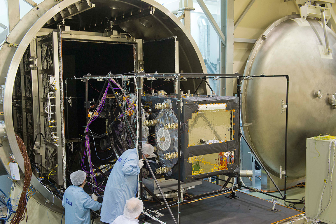
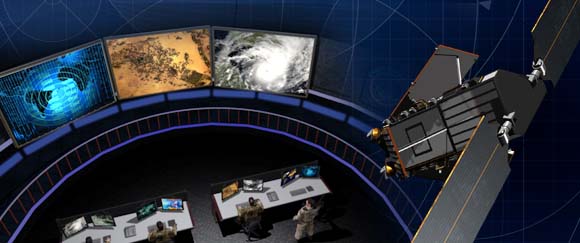
    With the first two full-operational-capability (FOC) Galileo satellites successfully through their thermal-vacuum tests, the program’s next hurdle is securing a firm launch date in June aboard a Europeanized Russian Soyuz rocket, operated from Europe’s spaceport on the northeast coast of South America.

    It will not be a walk in the park. Competing with the two Galileo FOC satellites for the same June Soyuz launch are four commercial broadband communications spacecraft owned by O3b Networks of Britain’s Channel Islands, a start-up that promises, if all goes well, to launch as many as 100 satellites.

    O3b and Galileo managers as of late March were rushing to complete final tests to be able to be first to ship their craft to the spaceport and thereby lay claim to priority rights aboard the June Soyuz. Both say they can be on a plane to the Guiana Space Center launch base in April. Should they arrive within days of each other, the already nightmarish dilemma confronting the Arianespace commercial launch consortium will only grow more complicated.

    Here’s the matchup.

    Powerful Backer. O3b, in addition to its plans to launch dozens of satellites if the business model proves out, is backed by SES of Luxembourg, the world’s second-largest satellite fleet operator and as such a big Arianespace customer.

    SES has already shown itself disinclined to maintain its loyalty to the heavy-lift Ariane 5 rocket operated by Arianespace by booking three less-expensive launches, one already completed, aboard the new Falcon 9 rocket operated by SpaceX of the United States. Arianespace can ill-afford to alienate SES, whose 50-satellite fleet requires 3-4 launches per year just to maintain its existing capacity.

    The four first O3b satellites in orbit all have a defect that could cause one or more of them to stop functioning at any time. Without at least four satellites — and preferably six — O3b does not have a business and its future is put into question.

    It would be, to say the least, a public relations calamity for the company if its initial commercial operations, which began in March, were to be suspended in the wake of a satellite failure while waiting for a second batch of four spacecraft. This explains the extraordinary pressure that SES is placing on Arianespace on behalf of a June Soyuz launch for O3b.

    Does it really matter, O3b backers say, if Galileo waits until the next Soyuz launch slot, tentatively set for August?

    Emphatic Politician. It matters to the European Commission, which owns Galileo. Commission Vice President Antonio Tajani has all but pounded the table, insisting that the European Space Agency, hired to oversee Galileo’s technical development, ensure three Galileo launches on Soyuz rockets in 2014.

    Four initial-operating-capability Galileo satellites are in orbit. Indications are that their performance exceeds specifications. Three Soyuz launches carrying two satellites at a time would bring the constellation to 10 spacecraft, enough to offer initial commercial services, according to the Commission.

    Tajani has made clear how much he wants that feather in his cap as he prepares to leave the EC this year, probably headed for a political career in Italy. Make no mistake: as is the case with many wounded animals, Tajani’s status as a lame duck has made him all the more fierce in his insistence that Galileo meet its three-launch schedule in 2014.

    Tajani has put very public pressure on the European Space Agency, which in turn is pressuring Arianespace, for Galileo launches.

    Ariane’s Quandary. Arianespace is already facing an exceptionally crowded launch manifest in 2014 as it coordinates the schedules of three vehicles: the small Vega rocket in addition to the medium-lift Soyuz and the heavy-lift Ariane 5. Because both O3b and Galileo are late, neither has an obvious claim of priority status at Arianespace, which is clearly hoping that the problem will solve itself when either O3b or Galileo arrives at least several weeks ahead of the other.

    At press time, the next Soyuz launch was scheduled for April 3, carrying a European Commission environment-monitoring satellite. Commission officials will attend the launch and no doubt use the occasion to press their case for Galileo.

    There is no telling how this will turn out. Satellites have been known to face last-minute problems even after arrival at the spaceport. This happened to O3b in 2013, as the in-orbit defect did not surface until just before its scheduled Soyuz launch.

    But if one were to hazard a guess, here is the most likely scenario: O3b arrives ready for launch several weeks ahead of Galileo and secures the June launch. Galileo moves to August and is promised a second launch in the autumn. O3b’s planned second launch in 2014 is moved to early 2015, as is the planned third launch of Galileo.

    The effect of these schedule slips on the cost of the Galileo program, which is about a year late — cost overruns that Tajani has vowed will not be paid by the Commission — is a subject for another day.

  • More Airports Across Europe Add EGNOS Approaches

    Flight operators can now use EGNOS approach procedures at airports in the Czech Republic, Austria, Finland, and Tunisia, all part of a growing list of airports across Europe that have implemented localizer performance with vertical guidance (LPV) procedures. The European Satellite Services Provider (ESSP), a Toulouse-based company which has the contract for EGNOS system operation and service provision, made this and several other announcements recently.

    In all, 17 EGNOS Working Agreements (EWA) with airports have been signed and 171 EGNOS-based approach procedures authorized for specific runways.

    The European GNSS Agency (GSA) is launching the implementation of the first LPV procedures in seven countries in 2014, as an exercise to gain the necessary competencies at national level, leading to a further plan for EGNOS adoption in the Perfromance-Based Navigation (PBN) plans.

    EGNOS provides a cost-effective alternative to ILS CAT I, offering similar performance, and increasing safety by allowing Instrument Flight Rules (IFR) approaches at difficult locations or under meteorological conditions where previously such approaches were not possible due to safety concerns. The use of EGNOS is free of charge.

  • GPS CNAV Debate, and GNSS Interoperability Moves Forward

    The opening plenary session of the Munich Satellite Navigation Summit is convening as this column goes to the electronic press for distribution. Coverage of these top-level system briefings before a select international GNSS audience in Munich will appear in two e-newsletters next week, The European GNSS and Earth Observation Report (EAGER), and in a shortened form via the Navigate! Weekly.

    If you do not already receive these email newsletters, subscriptions to both are free at env-gpsworld-integration.kinsta.cloud/subscribe.

    Until then, here’s an update on the CNAV debate in the United States and wider system-operator background from two recent meetings.

    CNAV So Far.  In the closing hours of 2013, a departing U.S. Cabinet under-secretary for Transportation dropped a verbal bomb on the Pentagon, in the form of a communiqué expressing concern about reliability of the new civil navigation message (CNAV) signal scheduled to emanate in April from select GPS satellites on orbit. Subsequent explosions were detected in halls from Washington to Colorado and Los Angeles.

    The Department of Transportation issued a call for back-up in the form of public comment via the Federal Register. That comment period closes on April 4.

    Meanwhile, one semi-public organization communicated to its members that it finds nothing disturbing about the plan, set to take effect sometime in the coming month.

    IGS Steps Forth on CNAV.  The International GNSS Service, a voluntary federation of more than 200 worldwide agencies that pool resources and permanent GPS and GLONASS station data to generate precise GPS and GLONASS products, issued a statement to its members and participating institutions in March. “We are confident that the IGS network is not at risk due to this change, and it is a welcomed step towards GPS modernization.”

    The communiqué from the Infrastructure Committee went on to say that “This event is considered innocuous to the stability of the receiver network since during a limited GPS CNAV test campaign in June 2013 the IGS network was not affected, only a very specific receiver problem was detected by the IGS Multi-GNSS Experiment, which was informed to the GPS ground segment and addressed.

    “Most modern receivers can track L2C and L5 and the CNAV messages, but the decoded messages should not be used by the receivers. The traditional L1 NAV messages (LNAV) will continue to be transmitted as usual and thus the receiver navigation files, birds, etc., will continue unaffected. Older receivers will be completely unaffected as they do not track L2C or L5.

    “In any case IGS Station Operators and Station Network Managers are advised to keep an eye on receivers and on their data outputs during the start of the CNAV activation. Just in case something strange is observed please stop data submission and notify the IGS (Network Coordinator, Infrastructure Committee) so that we may investigate the issues quickly. In case of doubt with your own equipment please contact the receiver manufacturer and inform the IGS.”

    PNT Advisory Board Airing. Prior to the appearance of the CNAV letter from the departing deputy secretary, the U.S. PNT Advisory Board heard a report in early December from Air Force Space Command on said implementation plan for the GPS CNAV message on L2C and L5. The minutes of that meeting were recently released.

    The minutes relay the gist of General Whelan’s CNAV remarks as: “CNAV has been under discussion for a considerable time. Currently, L2C and L5 signals are being transmitted, but without a navigation message. AFSPC is working hard to activate these messages as soon as possible. One of the reasons for the delay is that additional time was needed to complete testing prior to activation. Testing began in late summer 2013 and, based on initial test results, a way ahead has been plotted. . . . Current plans are to begin initial broadcasting in the spring of 2014. CNAV uploads will occur twice weekly. The signal will meet GPS Standard Positioning System (SPS) standards, but may not achieve current accuracy levels until full implementation in late 2014.

    “CNAV live-sky testing occurred in June [2013] and was conducted in cooperation with civil, industry, and international partners. The two-week test series included independent assessment and verification. The tests identified four errors that required action. The first, which was addressed in real time, related to implementation of the test series. The second required improvement to the tools suite, which should be totally integrated into the ground segment by December 2014. The third and fourth errors required patches to satellite software. All four issues are now regarded as closed.”

    A subsequent presentation to the PNT Advisory Board from a Department of Transportation spokesperson did not directly mention CNAV, according to the meeting minutes, but did include this reminder on civil signal monitoring:

    “DOT is responsible for performance monitoring of GPS civil signals. The International Committee on GNSS’s (ICG’s) transparency principle states that ‘Every GNSS provider should publish documentation that describes the signal and system information, the policies of provision, and the minimum levels of performance offered for its open service.’ Currently, this is only done on GPS L1 C/A signals. Performance standards for L2C and L5 have not yet been established. The crucial function of signal/service monitoring is to verify that commitments to GNSS performance are being met. Additionally, monitoring improves the situational awareness for GNSS operators, and provides assurance that any civil service failure is detected and resolved promptly.”

    Other Global Developments. The International Committee on GNSS (ICG) held a meeting of its Working Group A on Compatibility and Interoperability, in November 2013 in Dubai, United Arab Emirates. A brief summary of those proceedings is now available.

    The notes evidence steady, deliberate organizational and international progress on collaboration between system providers of GNSS signals.

    Among new presentations to the body came several from Russia. Viktor Kashenko, Russian Federation, presented on the “Prospects for Status and Development of GLONASS System Space Complex,” an update on the GLONASS space segment noting that there is a full constellation of GLONASS-M satellites. CDMA signals at L1 and L2 are expected to be available beginning around 2016 or 2017.

    Grigory Stupak, Russian Federation, followed with a presentation titled “SDCM Present Status and Future GLONASS Signals Development.” There are currently 22 SDCM ground stations around the world with a goal of creating seamless coverage throughout Russia with LPV-200 capability. The U.S. asked a question about whether SDCM provides corrections for other constellations in addition to GLONASS. The Russian Federation explained that SDCM currently augments both GLONASS and GPS, but additional constellations could be added in the future.

    Oleg Denissenko, Russian Federation, discussed the goals of the GNSS Monitoring and Assessment System being developed in Russia and identified a list of parameters to be monitored by the international systems.

    Xurong Dong from China gave the status of the International GNSS Monitoring & Assessment Service for OS (iGMAS). Initial operational capability (IOC) is expected in June 2014.  Ten tracking stations have been installed so far, and 25 additional stations are expected to be added in the future. A signal quality monitoring station has also been established in China and a new 40-meter antenna is expected to be installed in 2014.

    Jeffrey Auerbach from the U.S. State Department presented on outcomes of the second Interference Detection and Mitigation (IDM) April 2013 workshop. The European Union noted that they are conducting a survey of professional users in Europe about privacy concerns, and perceptions and understandings of interference and jamming.

    Stanislav Kizima, Russian Federation, provided an overview of the International IDM system concept and recommended the creation of an IDM system database server to be used for monitoring GNSS facilities. He suggested identifying formalized data exchange formats for IDM. A question was asked about whether something like this already exists in Russia. Kizima responded that Russia does have an active system  for  monitoring interference, but not  specifically for GNSS. There are some issues with the existing system because GNSS is not listed as source of interference and the technical facilities are not able to analyze parameters specific to GNSS. Hence the need for development of specific GNSS monitoring facilities. Tom Stansell from the U.S. responded that cell phones could be enabled to become individual detectors of GNSS interference, and the interference source location could be determined this way. This technique is known as crowdsourcing. Kizima noted that cell phones give information on signal power, but not measurement equipment.

    China continued the session on spectrum protection with a presentation by Weimin Zhen on a proposal to develop a template for GNSS interference detection and reporting. He suggested that a generic template specific to reporting GNSS interference be developed.

    Upcoming principal WG-A related meetings:

    • WG-A Inter-session Meeting, Geneva, Switzerland, possible dates July 16-18, 2014)
    • ICG-9, Prague, November 10-14, 2014.
  • Out in Front: Who’s Been Mining My Location?

    Out in Front: Who’s Been Mining My Location?

    Conventional wisdom holds that smartphone users will tolerate diluted privacy — specifically, privacy of their own location — in return for the many advantages delivered by the location-based services on their devices. This conventional wisdom, I put it to you, has been disseminated over the years by conventional wise men, that is, those selling the services and the devices. Users themselves have not, in the full awareness of their situation, been sounded or heard from. Now murmurs bubble to the surface.

    Five researchers at Rutgers University recently published a paper, “A Field Study of Run-Time Location Access Disclosures on Android Smartphones,” based on work supported by the National Science Foundation. The paper describes how they created an application to inform users which other apps are mining their GPS location data, and then asked users how they felt about this.

    Participants took various actions to manage their privacy. These included uninstalling apps, stopping the use of some apps, reducing the time using some apps, and searching through apps’ setups to disable location accesses.

    “[They] appreciated the transparency brought by our run-time disclosure method,” the researchers state. “They wanted to continue receiving the notifications after completing the study. Most participants reported having trade-offs between location privacy and the convenience of using their apps. We observed that some participants would rather give up the convenience to protect their location privacy.”

    First, the researchers had to figure out how to provide the information to project participants; in other words, how to let them know who was watching them and tracking their movements?

    “[Although] there is no obvious way for a normal Android app to monitor whether other apps are accessing location, we discovered we could exploit the method getLastKnownLocation available in the Android Location API for this purpose.”

    Participants — those in the know, at least — described the study as “an eye opener.” In one of the most telling details, delivered in the paper’s last sentence, we find out why. The study encompassed two groups: one was shown that other apps accessed their data, and the other group was only informed of this after the project was completed. “The No Disclosure group were generally not aware of what was happening on their own phones.”

    Caveat orator.

    Steve Copley, GPS World publisher.
    Steve Copley, GPS World publisher.

    In other news, I am happy and proud to announce that former associate publisher Steve Copley is now full-on publisher of this magazine. After a year in the traces (or should that be trenches?), Steve has ably reinvigorated business aspects of the operation, cleaned house, kicked buttstock, and taken names. It is due and fitting that he now tackle further challenges.

    As I shall also, in my new role of group publisher. While continuing to do what I do, my purlieu extends more fully over geographic information systems and Earth observation, as well as new initiatives in the European market. Specifically, the new EAGER newsletter, the EuropeAn GNSS and Earth Observation Report.

  • Europe’s Spring Season for GNSS

    Europe’s Spring Season for GNSS

    EUResidencePermit-WThe hounds of spring are on winter’s traces. As Galileo emerges from its long, cold slumber, the energy of a new constellation radiates through the skies to encourage blossoms across Europe. ESA’s recent declaration of in-orbit validation means the downstream satnav market can now truly get going.

    If a lot of demand has yet to be demonstrated, certainly a lot of pioneer applications have been developed, and the pent-up current is about to flow. Witness a plethora of GNSS and geospatial conferences in March, April, May, and June, from Munich to Rotterdam to Geneva to London, and on to Prague. The presentations at these gatherings no longer lean so heavily on academic and technical projections and predictions, but embody real-world applications and actual products. Long awaited, Europe’s GNSS spring has finally sprung.

    Brad Parkinson, the chief and original architect of GPS, fittingly kicked off the season this month in London, where he told a UK conference that GNSS needs to be made more robust to ensure worldwide availability of services to users. His concerns over signal availability relate to threats such as the loss of authorized frequency spectrum (implicitly creating licensed jammers), space weather due to hyperactive ionospheric conditions, and deliberate or inadvertent jamming of GNSS signals. Parkinson made his remarks as the keynote speech at GNSS Vulnerabilities and Resilient PNT 2014, hosted by the Royal Institute of Navigation.

    Coming up soon, Dr. Parkinson will also deliver the keynote address for the European Navigation Conference on April 15 in the Netherlands — but more on that anon.

    Munich Satellite Navigation Summit, Munich, March 25–27

    The scene now shifts southward to Bavaria, where the long-running Munich Summit gathers government, financial, industrial, and scientific dignitaries for high-level perspective on all GNSS, certainly with a Galileo emphasis but prominently featuring GPS, GLONASS, BeiDou, QZSS, IRNSS, and SBAS.

    The technical program of the Munich Satellite Navigation Summit includes a multitude of panel discussions involving invited speakers on further topics such as the legal issues of privacy devices and GNSS re-transmitters, achieving precise point positioning (PPP) on a global scale, the role of other autonomous sensors in future navigation, monitoring of climate and natural disasters, and integrated applications of GNSS and Earth observation.

    The summit will also officially open the European Satellite Navigation and provide a parallel track on Copernicus, the European Commission´s Earth observation program.

    GPS World’s contributing editor Tony Murfin will file a complete report on the Munich Summit in the inaugural issue of EAGER, the European GNSS and Earth Observation Report. Subscriptions are free to this new quarterly email newsletter at the preceding link.

    EAGER will feature news of European industry, agency, and scientific developments in satellite-based positioning, navigation, and timing; geospatial technology; Earth observation from space; digital mapping; and location-based services. EAGER focuses on the EU programs Galileo, EGNOS, and Copernicus along with their applications, but also encompasses European involvement in the other GNSSs and their geospatial applications of all kinds. Knowledgeable reporting from European sources, and interviews with and articles by European GNSS/geospatial community leaders. The latest technologies, launch schedules, applications, equipment, and industry and policy developments.

    ENC GNSS 2014, Rotterdam, April 14–17

    More than 120 technical papers will be presented at the European Navigation Conference (ENC 2014), under the thematic header Technology, Innovation, Business. As previously mentioned, Bradford Parkinson will deliver one of the two keynotes on “Assured PNT – Assured World Economic Benefits,” joined on the podium by Prof. Erik Theunissen of Delft Technical University, speaking on “So You Think You Are Safe.”

    The program continues with a Galileo session, in which ESA will present the latest results of Galileo IOV and future plans for FOC.

    Preliminary meetings will be held by the European Maritime Radionavigation Forum (EMRF), the Resilient PNT Forum, EUGIN, IAIN, and European Journal of Navigation. On Tuesday, another kick-off (!!) of the European Satellite Navigation Competition (ESNC) 2014 will take place.

    The Netherlands Institute of Navigation’s organizing committee chair Jac Spaans (also a long-time Editorial Advisory Board member of this magazine, and furthermore a knight in the Order of Orange-Nassau) is pleased to invite all satnav enthusiasts to the conference, taking place the week before Easter, allowing you to extend your stay and enjoy the tulip fields, the windmills, and other objects of interest in The Netherlands. Host-city Rotterdam, one of the biggest ports in the world, gives proof the Dutch saying, “In Rotterdam they do not sell shirts with long sleeves, because they roll them up anyway.”

    Another of GPS World’s contributing editors, Don Jewell, will attend and report on the conference, either in his Defense PNT newsletter in May or as a guest columnist in this GNSS Design & Test newsletter of that month. To be sure, his column will also appear prominently in the second (June) issue of EAGER, the European GNSS and Earth Observation Report. Subscriptions are free to this new quarterly email newsletter at the preceding link.

    Geospatial World Forum, Geneva, May 5–9

    Geo-World-ForumNow in its sixth edition, the Geospatial World Forum concentrates on geographic information systems (GIS) in mapping, remote sensing, satellite navigation as applied to the electricity sector and energy distribution; architecture, engineering, and construction; sustainable agricultural industrialization; smart cities, municipal management; disaster preparedness and coping, natural hazard monitoring; big data as a competitive business asset, business intelligence, and market analysis; multi-sensor integration for monitoring; geospatial’s role in healthcare; global peace and prosperity; and last but by no means least, in fact probably the most important in our long term, climate change.

    If I’m lucky, I’ll make it there myself. Did I mention that coverage will surely feature in EAGER, the European GNSS and Earth Observation Report? Subscriptions are free!

    GEO Business 2014, London, May 28–29

    Next up on our busy travel schedule — and nothing says an industry is growing like the launch of another new conference — comes GEO Business, primarily an exhibition but also conference featuring industrial training and demonstrations featuring the technology and services used by those working with spatial data.

    GEO Business boasts that it was born out of consultation with key industry leaders, and as a result the show is organized in collaboration with the Chartered Institution of Civil Engineering Surveyors (ICES), the Royal Institution of Chartered Surveyors (RICS), The Survey Association (TSA), and the Association for Geographic Information (AGI). This is a joint cooperative event involving major players, both organizational and industrial, in the geospatial community.

    Presentations will be given by Leica Geosystems (Mobile GIS), Esri UK, Carlson Software, Fugro (Advanced airborne survey), Trimble, GeoPlace (spatial addressing), Altus Positioning Systems (single- and dual-frequency data collection), Topcon (global-scope monitoring), Spectra Precision, Ordnance Survey (geospatial data management), iXBlue, and others.

    GPS World publisher Steve Copley will attend, and you can bet I will lean on him for reportage in the June issue of EAGER, the European GNSS and Earth Observation Report.

    By this point, I should start charging a subscription fee to anyone who has failed to sign up for EAGER.

    European Space Solutions 2014, Prague, June 11–13

    EuropeanSpaceSolutions
    photo: European Space Solutions

    Finally, the European Space Solutions conference in Prague has yet to be formally announced by the European GNSS Agency, but a pre-registration page is open.

    The 2013 generation of this conference featured sessions on indoor location-based services and solutions, environmental protection, emergency response and disaster management, mobile applications, sustainable energy, road and traffic management, and the future of the Galileo Public Regulated Service, an encrypted navigation service designed to be more resistant to jamming, involuntary interference and spoofing, designated for authorized users.

    Tim Reynolds, GPS World’s newest contributing editor, will likely report from Prague on this, as he will from several of the earlier spring shows. Based in Brussels for the last decade-plus, Tim will provide in-depth and up-close perspective on Galileo, Copernicus, and all things Europe connected with space and satellite navigation. His main public forum will be EAGER, the European GNSS and Earth Observation Report, but he will also furnish regular stories for the Navigate! e-newsletter and this one.

    Turn on and tune in!

    For winter’s rains and ruins are over,

    And all the season of snows and sins;

    The days dividing lover and lover,

    The light that loses, the night that wins;

    And time remember’d is grief forgotten,

    And frosts are slain and flowers begotten,

    And in green underwood and cover

    Blossom by blossom the spring begins.

     Algernon Charles Swinburne, 1837–1909

  • Who Carries the Gold Standard Now?

    Who Carries the Gold Standard Now?

    China’s BeiDou system claimed a user range error (URE) of 2.5 meters zero age of data (ZAOD) 95% recently.  The parallel GPS specifications commit to 6 meters 95% ZAOD and 7.8 meters 95% all AODs.  Does this mean that BeiDou is more accurate than GPS? Not so fast.

    In late December, director Ran Chengqi of China’s Satellite Navigation System Management Office announced the BeiDou Navigation Satellite System (BDS) Public (or Open) Service Performance Standard. The document details the public service performance parameters of the BeiDou system, including service area, accuracy, integrity, continuity, and availability. It is a basic commitment to customers from BDS providers, but also an important basis for customers to choose, use, and evaluate the system performance.

    A few important qualifications of BeiDou’s performance standard first:

    According to the foreword of the document, “This document specifies the BDS open service performance standard at the current stage.” This is as it should be.

    A paragraph on service volume, however, highlights the fact that BeiDou is as yet a regional service.

    “4.4 BDS OS Service Volume

    The BDS OS service volume is defined as the OS SIS coverage of the BDS satellites where both the BDS OS horizontal and vertical position accuracy are better than 10 meters (probability of 95%). At the current stage, the BDS regional service capability has been achieved, which can provide continuous OS to the area as shown in Figure 2 & Figure 3, including the most part of the region from 55°S to 55°N, 70°E to150°E.”

    The BDS Service Area.
    The BDS Service Area.

    This means that BeiDou commits to 2.5 meter accuracy in China, as well as neighboring countries — and importantly, trading partners — in Southeast Asia plus Australia.

    Does this mean that once BeiDou attains global status, it will provide 2.5 meter accuracy everywhere, on its basic single frequency, open service?  Hard to tell.  Much of its strength, its core strength, one might say, comes from 5 geostationary Earth orbit (GEO) satellites and 5 Inclined Geosynchronous Satellite Orbit (IGSO) satellites. The GEOs  hover over the Equator more or less permanently, south of but in the general longitude of  China’s sovereign national territory. The IGSOs move back and forth from the northern to the southern hemispheres in the same area.

    When BeiDou achieves its planned global reach, an event scheduled for 2020, the constellation will consist of 35 satellites: 5 GEOs, stationed at longitudes so their footprints cover China,  27 medium Earth orbit (MEO) satellites encircling the globe in continuous paths as do those of GPS, and 3 IGSOs over the East and Southeast Asian regions.

    Will globally available accuracy at that point match what is achievable in China?  It takes a better geometric mind than mine to fathom this.

    Even disregarding the geographic limit of the 2.5-meter claim, and ignoring for the moment the mathematical conundrum outlined above, there are reasons to scrutinize the BeiDou Performance Standard more closely, as John Lavrakas of Advanced Research Corporation has done.  His notes, and an illuminating table, follow below after a bit more introduction and background on the general topic.

    The publishing of the Public Service Performance Standard, a common practice among GNSS operators, is also a prerequisite for BeiDou system involvement in international civil aviation, international maritime, 3rd Generation Mobile [phone] System, and other international standard-setting organization activities.

    The document has Chinese and English versions. Because document download from the BDS government website can be difficult, Richard Langley has made them available at the University of New Brunswick website:

    http://www2.unb.ca/gge/Resources/beidou_open_service_performance_standard_ver1.0.pdf

    http://www2.unb.ca/gge/Resources/beidou_icd_english_ver2.0.pdf

    Analysis

    John Lavrakas of Advanced Research Corporation posted the following comment to the an earlier online article announcing the Performance Standard document.

    “I took a quick look at comparing the BeiDou Open Service Performance Standard with the GPS Standard Positioning Service Performance Standard and obtained mixed results.”

    Table 1. Coded to show green for the GNSS service committing to a more stringent standard over the other. Courtesy of Advanced Research Corporation.
    Table 1. Coded to show green for the GNSS service committing to a more stringent standard over the other. Courtesy of Advanced Research Corporation.

    “In some cases, the commitments from BeiDou were stronger (URE accuracy, vertical position), and in other cases the commitments from GPS were stronger (continuity of service, advance notice of outages).

    “The good news is that GNSS systems are documenting the service levels that users can expect. What we will need next is monitoring to verify these service levels are being met.

    “Here is a link to my quick look:

    http://oregonarc.com/2014/01/beidou-performance-standard-how-good-is-it/.”

    Thank you, John.

    A final note.  As the GPS stewards from the U.S. Air Force carefully and proudly remind us at each GNSS conference where they deliver a briefing, actual GPS performance has almost always bettered its specs over the last decade or two — often by a considerable margin.

    And with that, I think we may all return to our various pursuits, secure in the knowledge that while the gold standard may — repeat, may — at times pass in limited special circumstances or under particular conditions, from system to system, overall GNSS Things Are Getting Better All the Time.


  • The System: Two More Threes for Space

    Artist's concept of a GPS III satellite in orbit, courtesy of Lockheed Martin.
    Artist’s concept of a GPS III satellite in orbit, courtesy of Lockheed Martin.

    Air Force Orders GPS III Satellites 05 and 06 from Lockheed Martin

    A December 12 contract modification provided Air Force funding to Lockheed Martin to complete the fifth and sixth GPS III space vehicles (SV 05-06).  Lockheeed originally received funding to procure long-lead parts for satellites five through eight (SV 05-08) in February 2013.

    The $200,700,415 cost-plus-incentive-fee modification (P00276) on an existing contract (FA8807-08-C-0010) for GPS III space vehicles 05 and 06 means that work will be performed at Littleton. Colorado and Clifton, New Jersey, and is expected to be completed by Dec. 14, 2017 for space vehicle 05 and June 14, 2018 for space vehicle 06.  The Air Force Space and Missile Systems Center Contracting Directorate, Los Angeles Air Force Base, California, is the contracting activity.

    Galileo Achieves First Airborne Tracking

    The European Space Agency’s Galileo satellites have achieved their first aerial fix of longitude, latitude, and altitude, enabling the inflight tracking of a test aircraft.

    ESA’s four Galileo satellites in orbit have supported months of positioning tests on the ground across Europe since the first fix in March. Now the first aerial tracking using Galileo has taken place, determining the position of an aircraft using only its own independent navigation system.

    The milestone took place on a Fairchild Metro-II above Gilze-Rijen Air Force Base in the Netherlands on November 12. It was part of an aerial campaign overseen jointly by ESA and the National Aerospace Laboratory of the Netherlands, NLR, with the support of Eurocontrol, the European Organisation for the Safety of Air Navigation, and LVNL, the Dutch Air Navigation Service Provider.

    A pair of Galileo test receivers was used aboard the aircraft, the same kind employed for Galileo testing in the field and in labs across Europe. They were connected to an aeronautical-certified triple-frequency Galileo-ready antenna mounted on top of the aircraft.

    Tests were scheduled during periods when all four Galileo satellites were visible in the sky. The receivers fixed the plane’s position, as well as determining key variables such as the position, velocity, and timing accuracy; time to first fix; signal-to-noise ratio; range error; and range–rate error.

    Testing covered both Galileo’s publicly available Open Service and the more precise, encrypted Public Regulated Service, whose availability is limited to governmental entities.

    Flights covered all major phases: take off, straight and level flight with constant speed, orbit, straight and level flight with alternating speeds, turns with a maximum bank angle of 60 degrees, pull-ups and push-overs, approaches and landings.

    The flights also allowed positioning to be carried out during a wide variety of conditions, such as vibrations, speeds up to 456 km/h, accelerations up to 2 ghorizontal and 0.5–1.5 gvertical, and rapid jerks. The maximum altitude reached during the flights was 3,000 meters.

    GPS III Prototype Proves Constellation Compatibility

    The Lockheed Martin prototype of the next-generation GPS satellite, the GPS III, has proven that it is backwardly compatible with the existing GPS satellite constellation in orbit.

    During tests concluded on October 17, Lockheed Martin’s GPS III testbed successfully communicated via cross-links to Air Force simulators of the current GPS constellation in orbit. The current GPS constellation includes GPS IIR, GPS IIR-M, and GPS IIF satellites.

    Testing also demonstrated the ability of an Air Force receiver to track navigation signals transmitted by the GPS III Nonflight Satellite Testbed (GNST). The GNST is a full-sized, functional satellite prototype at Cape Canaveral Air Force Station.

    “These tests represent the first time when the GNST’s flight-like hardware has communicated with flight-like hardware from the rest of the GPS constellation and with a navigation receiver,” explained Paul Miller, Lockheed Martin’s director for GPS III Development. “This provides early confidence in the GPS III’s design to bring advanced capabilities to our nation, while also being backward-compatible.”

    The first flight-ready GPS III satellite is expected to arrive at Cape Canaveral in 2014, for launch by the Air Force in 2015.
    GPS III satellites will be the first GPS space vehicles with a new L1C civil signal designed to make it interoperable with other international global navigation satellite systems.

    The GNST has helped to identify and resolve development issues prior to integration and test of the first GPS III flight space vehicle (SV 01). It has gone through the development, test, and production process for the GPS III program first, significantly reducing risk for the flight vehicles, improving production predictability, increasing mission assurance, and lowering overall program costs.

    The GPS III team is led by the Global Positioning Systems Directorate at the U.S. Air Force Space and Missile Systems Center.

    Lockheed Martin is the GPS III prime contractor, with teammates including ITT Exelis, General Dynamics, Infinity Systems Engineering, Honeywell, ATK, and other subcontractors.

    Good News for Users and Manufacturers

    The U.S. Air Force is directing transmission of continuous CNAV message-populated L2C and L5 signals starting in April 2014. The move is designed to help development of user equipment compatible with the civil signals. Full text of the CNAV memo appears below.

    CNAV-header

    Galileo FOC Satellites Endure Simulated Space Tests

    The European Space Agency’s newest Galileo satellite has emerged from five weeks of simulated space conditions. On November 29, a hatch slid open to end its thermal-vacuum test, a milestone on the way to orbit.

    The satellite was placed in the 4.5-meter-diameter Phenix chamber in ESA’s ESTEC Test Centre in Noordwijk, the Netherlands, in late October. Once inside, the air was pumped out to create a space-quality vacuum. Temperature extremes were also reproduced, with the six copper walls of the thermal tent cooled by liquid nitrogen down to –180°C.

    A second Galileo vehicle has  been undergoing the same rigors at the site, along with a vibration and shock test to reproduce separation from the launcher. Thermal-vacuum testing on the second model will begin in early 2014. The two satellites will be launched on a Soyuz rocket from Europe’s Spaceport in French Guiana in mid-2014.

    The next satellite is expected to arrive at ESTEC in March, with further satellites following every seven weeks or so. A total of 22 FOC satellites are being built by OHB in Germany, with navigation payloads being delivered from Surrey Satellite Technology Ltd. in the UK.

    The first Galileo Full Operational Capability satellite emerges from the Phenix test chamber after five weeks of thermal–vacuum testing.
    The first Galileo Full Operational Capability satellite emerges from the Phenix test chamber after five weeks of thermal–vacuum testing.
  • Out in Front: Above All, Leadership

    Out in Front: Above All, Leadership

    GPS Summit 2002 award.
    GPS Summit 2002 award.

    Just took a stroll down memory lane, leafing through the pages of the December 2002 issue of this magazine. They contain predictive essays of that era — Directions 2003 — and a transcription of the panel discussion from the very first Leadership Dinner, then called the “GPS Summit.” I was there, running the door, riding the audio recorder, handing out bronze presenteaux (pictured here) to departing guests.

    We have carried on the tradition of that event, the brainchild of Glen Gibbons (whose December 2002 editorial headline I have repeated here) and Richard Fischer, nine times now. We carried the show, innovating as we go, from Long Beach to Fort Worth to Savannah, back to Portland and thence to Nashville. We shall convene again in Tampa next year. We’ve had spirited debates, campaigns and elections (the Satellite Party versus the Signal Party), a history of GPS origins from Brad Parkinson himself, a recognition of the pioneers from the early era who built the system from scratch, a Grand Game of GNSS negotiation and trading, horse racing, physics trivia, and this year, a spoofing simulation (see the back page of this magazine).

    Somehow amid the fun of each occasion, we managed to squeeze in a healthy dose of thought leadership. This year’s installments you will find on pages 28 to 49, including dinner remarks from the four recipients of this year’s Leadership Awards, and essays by upper-level if not the top-level executives at each of the four GNSSs.

    For added perspective, see these excerpts from the 2002 discussion high atop the Portland Hilton.

    Javad Ashjaee (then CEO and president of Javad Navigation Systems): “There is no end to the enhancement that we can do in signal processing, assuming that Intel and others will not stop giving us the tools that we need. As you see, the front line of this is microprocessors.”

    Kanwar Chadha (then founder and vice-president of marketing at SiRF Technology): “As far as the consumer is concerned, it comes down to what they are buying, and what’s the value proposition. I can tell you from personal experience, it’s not purely a technology decision.”

    Steve Moran (then director for civil space programs at Raytheon, where he still works as director, GPS mission solutions): “We manage a positioning and navigation system, rather than a positioning and timing service — and that’s a fundamental change that needs to come about in the way we look at GPS.”

    Bob Denaro (then vice-president and general manage at NavTeq): “One day soon we will have digital paper. A map with high-resolution addressable data on what looks and feels, and most importantly, costs like a sheet of paper. My position shows up as a bright spot moving along the paper as I move.”

  • A Glowing Report Doth Not a Golden Future Make

    The tech press and broad public media have both made much ado about a November market report from the European GNSS Agency (GSA). Most accounts have focused on a GSA prediction of an installed base of 7 billion GNSS-enabled devices worldwide by 2022, and nearly every account has replicated the GSA math to trumpet “almost one for every person on the planet.”

    Oh Hosanna.  We (will) have reached holy ground at last.

    Other than asserting that this bonanza “has the potential to deliver additional significant benefits, not measured in this report, especially in terms of time and fuel savings, as well as efficiency gains,” neither the GSA itself nor any pundit’s account of the report that I have seen ventures to speculate on how this might actually change daily human life. Hopefully ‘twill not be on the order of how cell phones have affected society, communication, and interaction; read tweeting and social-network stress. But knowing what little we do about human nature, this possibility is not at all to be discounted.

    Allow me to walk the plank out into left field long enough to quote from a 2009 NBC News Science report titled “Is Twitter evil?”  “Researchers probing the workings of the brain have found that it takes longer for feelings of social compassion and admiration to register on our neural circuits — and they worry that the rapid-fire effect of texting and tweeting could have ‘potentially negative consequences’ for our moral fiber.”

    Could total, global, continuous, pervasive location-awareness in the palm of everyone’s hand possibly lead down a similar path? I’m sure that cell-phone enthusiasts also promised vast, billionish-plus benefits, with absolutely no downside, three decades ago.

    If I can pry myself back from Nostradamus mutterings — and I am sure you are glad that I have now done so — the GNSS Market Report Issue 3 contains a great deal of data worth considering.

    Said document foresees compound annual growth rates (CAGRs) for “GNSS core” and “GNSS-enabled” revenues increasing by 9 percent through 2016 and 5 percent through 2020, to attain €350 billion ($478 billion) per year. Of the 2022 total, GNSS core revenues will comprise about €100 billion (US$137 billion).

    To further differentiate “core” and “enabled,” this from the report’s early Market Definitions section:

    “This market report primarily considers the core GNSS market. For multi-function devices, such as smartphones, the core market includes the value of GNSS functionality only (rather than the full device price) and service revenues directly attributable to GNSS functionality (e.g. data downloaded by smartphones to use Location-Based Services).

    “For multi-function devices, a correction factor is taken into account, for example:

    • GNSS-enabled smartphone: only the value of GNSS chipsets is counted, estimated at 1% of the price.

    • Personal Navigation Devices (PNDs): 100% of retail value since GNSS is the key enabler.

    • Aviation: the value of the GNSS receiver inside the Flight Management System is taken into account.

    • Precision agriculture system: the retail value of the GNSS receivers, maps, and navigation software is counted.

    “The Executive Summary also presents results for the enabled market. The enabled market represents the services and devices enabled by GNSS, and includes the core market. For the enabled market, the entire retail value of the smartphone is included.”

    The 72-page report breaks out market segments, focusing in turn on: location-based services (LBS), road, aviation, rail, maritime, agriculture, and surveying. The weight of the report, as you might guess by the necessity of reaching that 7 billion figure, falls primarily on LBS, a heading that for the GSA encompasses “smartphones, tablets, digital cameras, laptops, fitness and people-tracking devices, and mobile-data revenues.”

    What’s good for the mass market must surely be good for satellite makers and operators around the world, as they attempt the jump from one to many systems.  That’s the underlying but unstated premise of the report.  “Multi-constellation receivers become widely available on the market” trumpets the Executive Summary headline on page 8.  In what is certainly the money pitch for the Prague-based, European Union-funded agency, “Galileo is recognised as a valuable element in multi-constellation systems, and it is already present in more than 30% of receiver models, well ahead of its full operational capability.”

    Nevertheless, GLONASS is the second GNSS constellation choice of receiver manufacturers after GPS.

    For BeiDou, the researchers will only venture that “Several equipment manufacturers, particularly those based in Asia-Pacific, have started to offer BeiDou-enabled models.”

    More than 70 percent of models on the market are GPS-SBAS capable (SBAS comprising WAAS, EGNOS, and MSAS) and this penetration will grow further.

    In a final provocative note (neither final nor provocative from the GSA’s point of view, although I confess it causes me a vague unease), the four-fold increase in the number of GNSS devices will be “largely driven by increased penetration in regions outside Europe and North America.”

    Production of the report relied on “advanced forecasting techniques together with a validation process with market experts.”

    Lest you feel unfairly treated by my curmudgeonly take, here is some actual data generated by and taken from the report.

    Global GNSS Market Size, from GNSS Market Report 2013 Issue 3
    Global GNSS Market Size, from GNSS Market Report 2013 Issue 3
    Installed Base of GNSS Devices by Region, from GNSS Market Report 2013 Issue 3
    Installed Base of GNSS Devices by Region, from GNSS Market Report 2013 Issue 3
    GNSS capability in receivers, from GNSS Market Report 2013 Issue 3
    GNSS capability in receivers, from GNSS Market Report 2013 Issue 3


  • Out in Front: Tell the Truth, Now

    Here are a few things about your colleagues that perhaps you did not know: they are a quite colorful, varied, and shall we even say motley crew. Hidden backgrounds came to light during the magazine’s Leadership event in Nashville, during a game called “Guess Who’s Spoofing the Dinner?” One person at each table, secretly recruited in advance, lied freely in response to three questions, while everyone else was bound to tell the strict truth. The table then had to identify the spoofer in their midst.

    The truths turned out to be stranger than the fictions. As ever. This is what’s known, appropriately, as a truism.

    The questions posed:

    • What is the farthest from your birthplace that you have traveled?
    • What was the shortest time you ever held a job? What job?
    • Who is the most famous person you have met?

    One person had met Hillary Clinton, another the first lady of China, and two people had met the Queen.

    One met Janis Joplin (throwing that table into a total tizzy), another had an audience with two popes, Benedict and John Paul II (not simultaneously), while yet another had met John Paul II and Sophia Loren (again, presumably, not on the same occasion).

    But the most elevated encounter was described by a soft-spoken gentleman who taught the Dalai Lama to play frisbee. His Holiness had never done, and evinced some curiosity as to how it worked.

    Janis Joplin’s crony claimed his shortest employment was installing fire alarms at a Catholic home for girls in a delicate way in the early Sixties. His table declared him the spoofer. But they were wrong. They were wrong.

    The shortest employment for one engineer at the dinner was also his longest, not to mention his most current: 30 years. He has never held another job.

    One young researcher worked briefly as a shepherdess, until getting trampled by a flock of sheep. Imagine your lab-coated colleague in a long white frock, ruffled cap, and crook stick.

    In their travels, folks had reached Tierra del Fuego, Tasmania, Everest Base Camp, China (and conversely, Nashville from China by a select few), and Capetown, South Africa, but the furthest flung had landed on Antarctic ice in a Hercules C-130, on skis.

    Ironically, one travel tale was challenged not because of the furthest destination but the start point. A well known GNSS scientist vowed that he came from Texas, but a gentleman from the European Commission — the same who had met John Paul and Ms. Loren — doubted this severely, because the teller did not sport cowboy boots nor a big belt buckle. Worse, he could not recall what Sam Houston’s boys cried out as they went into the Battle of San Jacinto, winning glory and Texas independence.

    Italians, it seems, are quite well versed in Texan history.

    There is a lesson in this for all of us, though our scientist claims it’s all just an invention of  the movies.

    Remember the Alamo!

  • The System: Ground Control Readied for GPS III

    The System: Ground Control Readied for GPS III

    rtn_iis_gps-ocx_banner4.jpg

    Raytheon Company reached several milestones recently in its development of the GPS Next -Generation Operational Control System (GPS OCX). Lockheed Martin’s GPS III Non-flight Satellite Testbed (GNST) — a full-sized, functional satellite prototype currently residing at Cape Canaveral Air Force Station — successfully established remote connectivity and communicated with OCX during pre-flight tests.

    GNST proved that it could connect with and receive commands from Raytheon’s Launch and Check Out System (LCS), a part of OCX that supports the satellite and mitigates risks prior to launch. The GNST received commands from Lockheed Martin’s Launch and Checkout Capability (LCC) node in Newtown, Pennsylvania via the OCX servers at Raytheon’s facility in Aurora, Colorado; the system then returned satellite telemetry to the control station. The tests mirror launch and early orbit testing planned for all flight vehicles.

    “While we have connected OCX with ground-based simulators before, these tests were the first time that OCX and a GPS III satellite have actually communicated,” said Keoki Jackson, vice president for Lockheed Martin’s Navigation Systems mission area.

    Ahead of Schedule. Raytheon received Interim Authorization to Test (IATT) security certification from the U.S. Air Force for OCX LCS four months ahead of schedule. The company received a one-year certification with no liens, meaning the government does not require any changes.

    “Typically, IATT certification is given for six-month increments,” said Matthew Gilligan, Raytheon’s GPS OCX program manager and a vice president in Raytheon’s Intelligence, Information, and Services business. “The LCS one-year accreditation speaks to the quality of the information assurance design and threat protection.” The IATT not only includes the LCS, but also Lockheed Martin’s GPS III satellite support systems, Exercise and Rehearsal Training Tool, and Upload Generation Tool.

    OCX is being developed in two blocks. There are seven iterations in Block 1 and one in Block 2. LCS is the fifth Iteration of Block 1; it successfully completed Critical Design Review in June 2013.

    Early Orbit Exercises. Lockheed Martin and Raytheon also completed the third of five planned launch and early orbit exercises to demonstrate launch readiness of GPS III and OCX.

    Exercise 3 demonstrated space-ground communications; first acquisition and transfer orbit sequences; orbit-raising maneuver planning and execution; and basic anomaly detection and resolution capabilities. In addition, the industry and Air Force GPS Directorate teams jointly executed mission planning activities, such as orbit determination and the generation of upload command files.

    Two additional readiness exercises and six 24/7 launch rehearsals are planned before launch of the first GPS III satellite. The first flight GPS III space vehicle (SV-01) is expected to be available for launch in 2014, and launched by the U.S. Air Force in 2015.

    Exelis Encryptors. Exelis delivered the first three of a planned 14 ground-based encryptors to Raytheon Company for OCX. Designed to automatically code and decode GPS signals, encryptors facilitate the exchange of user information by securely transmitting navigation payload data between the OCX ground station and the orbiting constellation of satellites.

    Delivery followed successful thermal, electromagnetic interference and security verification testing. Exelis provides critical elements of software in the navigation processing subsystem that will enable controllers to better understand the exact position of GPS satellites. This helps ensure accurate navigation information is securely broadcast to users. In addition to encryptors, Exelis is building high-precision receivers for use in GPS ground monitoring stations and satellite signal simulators for testing purposes.

    Exelis is also on contract with Lockheed Martin to provide the payloads for the GPS III satellites.


    Fire_engine_galileoEurope Tests Galileo Public Regulated Service

    European Union member states began their independent testing of the Public Regulated Service (PRS) broadcast by the four Galileo navigation satellites in orbit. Transmitted on two frequency bands with enhanced protection, PRS offers a highly accurate positioning and timing service, with access strictly restricted to authorized users, such as government defense, security, and emergency services.

    PRS access was initially considered for Galileo’s Full Operational Capability phase, but it has been enabled in 2013 in response to the strong interest of member states in this service. To allow early access to PRS during the current phase, the European Commission and ESA began the joint project PRS Participants To IOV (PPTI) in July 2012.

    ESA ensured the availability of several tools developed under ESA contracts, including test receivers and other qualification equipment. ESA’s PRS Laboratory, based at the Agency’s ESTEC technical centre in Noordwijk, the Netherlands, provided training, demonstrations and sample data.

    “Belgium, France, Italy, and the UK have now performed independent PRS acquisition and positioning tests. In parallel, ESA, through collaboration with Dutch and Italian authorities, is conducting PRS fixed and mobile validation in several locations in the Netherlands and Italy,” said Miguel Manteiga Bautista, head of ESA’s Galileo Security Office.

    The PRS tests have demonstrated a current autonomous positioning accuracy of less than 10 meters when in the correct geometrical configuration. This is an impressive result considering the small number of Galileo satellites in orbit and the limited ground infrastructure so far deployed.

    Italy has developed its own PRS receiver, and tests have confirmed the feasibility of independent PRS receiver development and verification based on specifications provided by ESA.

    “The PPTI project is still ongoing to test more advanced functionalities this coming autumn and to run the first aeronautical PRS tests in collaboration with the Dutch authorities. Other member states have also expressed their willingness to join the IOV PRS experimentation campaigns soon,“ concluded Miguel Manteiga.

    The project is a first step to ensure use of the PRS as soon as it becomes operational. It will be complemented by PRS pilot projects, focused on PRS applications, which are currently under definition in a common effort between European agencies.

    The United States has submitted a request to be able to use Galileo’s PRS. Other non-EU countries have also expressed a desire to be associated with the program.


    System Briefs

    Way to Go GAO, Part II. The Air Force should come up with better cost estimates and options for new GPS satellites, according to a September 9 report from the U.S. Government Accountability Office (GAO). The GAO was responding to an Air Force study on lower-cost space solutions for GPS.

    “More information on key cost drivers and cost estimates, and broader input from stakeholders would help guide future investment decisions,” the GAO concluded. Specifically, the key cost drivers include dual-launch capability, navigation satellites (smaller GPS-type satellites yet to be developed), and a nuclear detection capability.”

    New Birds by Fall. Galileo satellite-builder OHB AG said it should know by late September whether tests of the first Full Operational Capability (FOC) Galileo satellites are proceeding well enough to permit their delivery later this year. The first FOC satellite began testing at ESA’s European Space Research and Technology Centre in May, and the second arrived August 9.

    The OHB satellites either “bear a strong resemblance” or “are identical” to the four in-orbit validation spacecraft now in medium-Earth orbit, depending on the source. However, the on-board power of the OHB spacecraft exceeds that of the validation satellites built by a different manufacturer. According to one source, Galileo managers made the modification in part to enable Galileo’s encrypted Public Regulated Service signal to overcome a signal frequency overlap issue with China’s BeiDou constellation.

  • Out in Front: Virtuosos

    Out in Front: Virtuosos

    Cover: Curiosity By Philip Ball
    Cover: Curiosity By Philip Ball

    An occasional reader of these pages forwarded a clipping from a summer Wall Street Journal, a book review of the new title, Curiosity: How Science Became Interested in Everything, by Philip Ball (University of Chicago Press, 465 pages, $35).

    The book covers scientific advances logged in the 1600s, a century that “began with an essentially medieval outlook and ended looking like the first draft of the modern age.” However, the book’s description by WSJ reviewer Timothy Ferris quickly called to my mind the current status of investigation — practiced with an overlay of capitalism and market advantage-seeking — by, guess who, the GNSS community.

    Not that I’m necessarily equating the scientists, engineers, and product managers who are responsible for most of the contents of this magazine with the “thousands of independent tinkerers, inventors, collectors and flat-out oddballs, the ‘virtuosos’ as they were called, [who] experimented with lenses, pumps, and biological specimens as much to satisfy their own inquisitiveness as to answer big questions.”

    Far from it. Perish the thought.

    And yet, and yet . . . .

    I sat in a Denver airport cafe on my way home from ION GNSS+, chatting with a couple of industry captains about the way forward. We joked about how our kids will look at us as old fogeys — heck, they already do — tentatively feeling our way to indoor navigation. This method, that method? This augmentation, that integration?

    The rising generations will simply take it for granted: indoor nav works everywhere, all the time, in the palm of your hand, or perhaps in the frame of your eyewear. How quaint were those early 21st-century inventors! Tinkering with different RF bands, trying to cobble together a solution.

    The smiles on the faces of these industry captains as they proudly showed each other their devices, running their latest prototypes, and curiously examined their competitors’ versions, betrayed an enthusiasm, not just for market share, but for intellectual stimulation, the thrill of the chase, the joy of solving a problem. In that way, they were not unlike the 16th century crew, an assemblage that included, among many minor and forgotten names, Galileo (!!!), Kepler, Newton, Descartes, and Leibniz.

    “The truth is that science works,” writes Philip Ball, “only because it can break its own rules, make mistakes, follow blind alleys, attempt too much — and because it draws upon the resources of the human mind, with its passions and foibles as well as its reason and invention.”