Photo: Space Surveillance Operations Center (COVE)
The Spanish Ministry of Defense has awarded a $2.9 million contract to GMV, for the development, deployment support and maintenance of the Space Situational Awareness and Control System (CCSE). The system will be used at the Spanish military Space Surveillance Operations Center (COVE).
Under the contract, GMV will conduct orbit calculation and propagation, build-up and maintenance of a space object catalog (both open and classified), prediction of atmospheric reentry, calculation of overflight events, planning of observation and sensor calibration campaigns, calculation of GNSS signal degradation and integration and processing of space weather data.
This system is expected to go into service at the end of 2024. To comply with this timeline, it will be based on GMV’s Ecosstm system, which is being used in other operational environments such as the German Armed Forces’ Space Domain Awareness Center (Weltraumlagezentrum), the civilian space surveillance systems of various other countries such as Greece and GMV’s commercial space surveillance center known as Focusoc.
The COVE, which is operated by the Ministry of Defense (MINISDEF) through its Space Command (MESPA) of the Spanish Air and Space Force (EA), was created in November 2019. The center reached its initial operational capability (IOC) in 2021.
GMV has been supporting the center and assisting its participation in the Global Sentinel exercises organized by the U.S. Space Command. As part of its support, GMV has supplied its operational orbit determination tool, Sstod, for processing data from the Spanish space surveillance radar located at the Morón Air Base, near Seville, Spain.
The NYPD will soon improve its crime-fighting efforts with the Drone as First Responder (DFR) pilot program. Announced by New York Police Department (NYPD) Deputy Commissioner of Operations Kaz Daughtry, the program will deploy UAVs in response to specific 911 calls for serious crimes in progress, such as shootings, robberies, and missing persons.
UAVs will launch from five precincts: the 48th Precinct in the Bronx, the 67th, 71st and 75th Precincts in Brooklyn, and Central Park, New York. The UAVs will provide real-time video and telemetry to officers to enhance situational awareness and safety.
“The information provided by DFR will be shared with responding officers. It will enhance officers’ situational awareness as they arrive on scene, promote officer safety, and help us deploy resources more effectively,” Daughtry said.
The NYPD uses 85 UAVs for various tasks, including monitoring major events and inspecting structural stability after accidents. Despite a 400% increase in UAV use last year, Daughtry emphasized they cannot be used for “warrantless surveillance” or “traffic enforcement.”
According to the NYPD, these UAVs will be deployed in response to 911 calls for service within the next few months. The program will start with four precincts in Brooklyn and the Bronx, chosen “based on recent crime trends.”
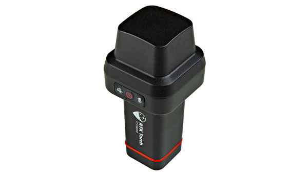
SparkFun Electronics has launched the RTK Torch, designed for high-precision geolocation and GIS needs. It has tri-band reception, tilt compensation and millimeter accuracy.
The RTK Torch can provide millimeter-grade measurements. Users can connect a phone to the device over Bluetooth and receive the NMEA output and work with most GIS software.
The RTK Torch features Zero-Touch RTK technology, which gives connected devices WiFi credentials for a hotspot or other WiFi network. The device will begin receiving corrections without any further setup, with no NTRIP credentials required. These corrections are obtained over WiFi from u-blox PointPerfect and are available in the United States, Europe and various parts of Australia, Canada, Brazil and Korea.
The system includes a one-month free subscription to PointPerfect. Additional subscriptions can be purchased if desired. If PointPerfect coverage is not available in the area, corrections from a local base station or service can be provided to the device over NTRIP, delivered via Bluetooth or WiFi.
It is housed in an IP67-rated enclosure. It is waterproof when submerged up to 1 m for up to 30 minutes when the USB cover is closed. Under the hood of the SparkFun RTK Torch is an ESP32, a UM980 L1/L2/L5 high precision GNSS receiver from Unicore, and an IM-19 for tilt compensation.
The addition of the L5 reception makes this portable GNSS device ideal for densely canopied areas where normal L1/L2 reception may have problems.
The device can be used for:
GNSS Positioning (~400mm accuracy) – also known as “Rover.”
GNSS Positioning with RTK (8mm accuracy) – using a local base station.
GNSS Positioning with PPP-RTK (14 to 60mm accuracy) – using PointPerfect corrections.
Swift Navigation has partnered with SK Telecom (SKT) to accelerate the deployment of AI-driven location-based products in South Korea.
Under the collaboration, SK Telecom and Swift Navigation are jointly operating a carrier-grade network to deliver Swift’s Skylark precise positioning service across South Korea, enhancing GNSS accuracy from meters to centimeters.
Skylark, a cloud-based solution, is designed to improve the accuracy of standard GNSS positioning, reducing it from meters to centimeters. This service plays a role in more than 8 million autonomous vehicles and devices, including ADAS-enabled cars, UAVs, vehicle tracking systems and robotic equipment.
Skylark is being used in more than 8 million autonomous and connected devices and will be introduced to SK Telecom’s customer base, including the Korea Forest Service. The partnership aims to improve positioning accuracy for various mobility platforms and is backed by stringent safety and cybersecurity standards.
A leading Canadian hydropower producer is using the Adtran Oscilloquartz grandmaster device combined with its optical cesium atomic clock to achieve new levels of precision, reliability and resilience in its power grid synchronization network.
The deployment addresses the urgent need to implement the highest standards of protection against GNSS disruptions — including jamming and spoofing cyberattacks — and helps bolster North America’s energy resilience. Featuring multi-source protection, the enhanced timing architecture offers a zero-trust approach to positioning, navigation and timing (PNT), ensuring robust and accurate synchronization. It also seamlessly supports existing services, which allows for a smooth transition from legacy timing to power grids with advanced PTP technology. For streamlined operations and assurance, the synchronization network is remotely managed through the Adtran Ensemble Controller with Sync Director.
By enhancing its timing framework with Adtran’s Oscilloquartz solution, the hydroelectric producer is designed to maintain the highest standards of cybersecurity and energy reliability in its critical infrastructure, the company said. The deployment aims to improve the stability and security of the energy supply across Canada and the United States.
The new solution includes Adtran’s OSA 3350 ePRC+ combined with the OSA 5422 to provide precision, stability and resilience against GNSS vulnerabilities. It has an all-digital design, which utilizes optical-pumping techniques, to guarantee timing accuracy and optimal stability for over a decade. This is twice the lifespan of conventional cesium clocks.
With the OSA 5422, the solution future-proofs the utility’s timing network and assures compliance with governmental regulations. It fortifies security and underscores the renewable energy utility’s commitment to maintaining a continuous, secure power supply.
The European Space Agency (ESA) has selected Syntony GNSS to supply user demonstration receivers for its low-Earth orbit positioning, navigation and timing (LEO-PNT) project.
Led by Thales Alenia Space and funded by ESA, the first European LEO-PNT project aims to enhance PNT services from LEO. This initiative is expected to improve the accuracy and reliability of navigation systems, serving a wide range of applications, from critical emergency services to everyday technologies.
Syntony will provide its ground receivers, compatible with the new LEO/PNT signals, as well as with GPS and Galileo systems. These receivers will initially assess the performance of signals from the constellation, which will start with fewer than 10 satellites. There will be 100 to 600 satellites when the constellation is complete, according to Syntony.
Although the receivers may not always be able to calculate position, velocity, and time (PVT) due to the lack of available satellites, they will be essential in evaluating signal performance when at least four satellites are visible. This allows for PVT calculations and performance comparisons with existing GNSS systems.
Syntony’s software-defined radio (SDR) receivers enable real-time adjustments to the receiver settings to evaluate the constellation’s performance. This can be achieved without any hardware changes, as the LEO-PNT constellation uses frequencies similar to those used by the medium-Earth orbit (MEO) GNSS systems.
Syntony’s Constellator GNSS Simulator will be updated to incorporate the constellation’s signals as soon as they are available. This process is similar to how the signals from Xona Space Systems’ PULSAR constellation were integrated as early as 2022.
The UK has successfully tested quantum-based navigation systems in flight. The commercial trial was led by Infleqtion, a quantum technology company, and is designed to improve resilience against GPS jamming and spoofing.
Although GPS jamming typically does not affect an aircraft’s flight path, quantum-based positioning, navigation and timing (PNT) systems aim to provide accurate and resilient navigation, complementing existing satellite systems and offering uninterrupted operations for global air traffic.
Infleqtion, in collaboration with aerospace companies BAE Systems and QinetiQ, conducted the trials at MoD Boscombe Down in Wiltshire. Science Minister Andrew Griffith participated in the final test flight on May 9. The project has received nearly £8 million in government funding as part of the National Quantum Strategy, which seeks to establish the UK as a leader in quantum technology.
The test flights included two key quantum technologies: the compact Tiqker optical atomic clock and an ultra-cold-atom-based quantum system, both tested aboard QinetiQ’s RJ100 Airborne Technology Demonstrator. These technologies are part of developing a quantum inertial navigation system (Q-INS), which aims to provide precise and resilient navigation independent of traditional GNSS.
The successful flight trials are a step towards deploying quantum navigation systems on aircraft by 2030 as part of the UK’s National Quantum Strategy. The demonstrated potential of quantum technology in enhancing navigation security is an important development for future aerospace applications.
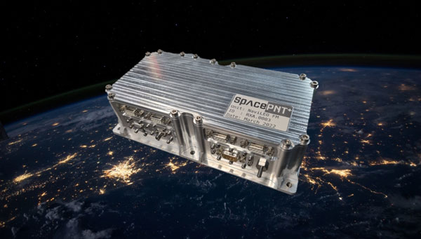
SpacePNT, a Swiss positioning, navigation and timing (PNT) solution provider for the new space satellite market, has completed in-orbit validation tests of its NaviLEO spaceborne GNSS receiver platform. The platform is designed to deliver decimeter-level positioning and nanosecond-level timing accuracy in low-Earth orbit (LEO) and signal reception sensitivity for GTO/GEO/moon missions. Using its unique and proprietary hardware and software technology, it can operate in real time.
After its successful deployment in LEO onboard its hosting orbital transfer vehicle, the D-Orbit ION OTV SCV-011 satellite, on June 13, 2023, Space PNT conducted a series of experiments to validate the key functionalities of the radiation-tolerant technology. This is done by demonstrating multiple modes of operation, including dual-antenna and full-in-flight reprogramming using FPGA image and application software.
Flight models have already been delivered to commercial and institutional partners for these missions, said SpacePNT co-founder and CEO, Cyril Botteron.
The upcoming second-generation hardware platform reuses the same key radiation-tolerant electronics components, designed for telecom constellations. It also implements new functions to serve additional markets such as software-defined radio platforms for telecom and radar applications.
The new space satellite market refers to companies such as SpacePNT, SpaceX and Blue Origin that are developing reusable rockets to drastically reduce the cost of access to space. The growth of satellite technology and new business models, such as satellite-based internet services, have created new opportunities for private companies.
The National Oceanic and Atmospheric Administration (NOAA) has entered into a three-year Cooperative Research and Development Agreement (CRADA) with Verizon Frontline to refine the use of uncrewed aircraft systems (UAS) for assessing storm damage. This initiative aims to provide rapid and accurate damage assessments following severe weather events such as tornadoes and hurricanes.
Verizon Frontline will deploy its UAV technology to capture high-resolution imagery of areas affected by storms, providing crucial data to NOAA’s National Weather Service (NWS) and the National Severe Storms Laboratory. This imagery will assist in post-storm damage assessments and contribute to research aimed at understanding tornado behavior and improving severe weather warnings.
“Following a crisis, the initial imagery available is often from satellites, which may not offer the best resolution. Our goal with NOAA is to provide high-resolution imagery much faster, enhancing the support to emergency management and public safety agencies,” said Verizon Frontline Crisis Response Team member, Chris Sanders.
The collaboration represents a step forward in integrating modern technology into traditional environmental and emergency management practices, aiming to improve outcomes after natural disasters.
MerlinTPS has partnered with Bluespec to address the need for GNSS augmentation and backup technology as satellites continue to face new challenges, including wartime contested space as well as increased costs to produce and maintain satellites.
Under the partnership, MerlinTPS will develop its platform to support the expansion of PNT security capabilities by using existing signals of opportunity on the ground designed to combat jamming and spoofing.
“With our verification and validation-centric RISC-V solutions, MerlinTPS can develop customized solutions in a matter of weeks, allowing it to deliver highly differentiated products with minimal project and schedule risk,” said Charlie Hauck, CEO of Bluespec.
By implementing Bluespec’s RISC-V processors in Field Programmable Gate Arrays (FPGAs), MerlinTPS can quickly modify, generate and load new code onto FPGAs. This allows for hardware reuse, avoiding the need to build custom hardware for each task.
However, MerlinTPS can easily make customizations to Bluespec’s RISC-V soft processor cores — adding custom instructions designed to accelerate specific workloads — when needed. MerlinTPS plans to add artificial intelligence (AI) capabilities to the platform.
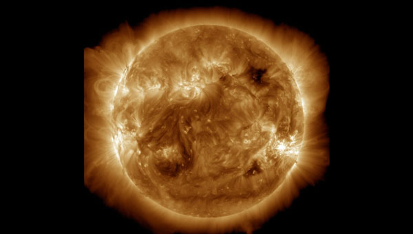
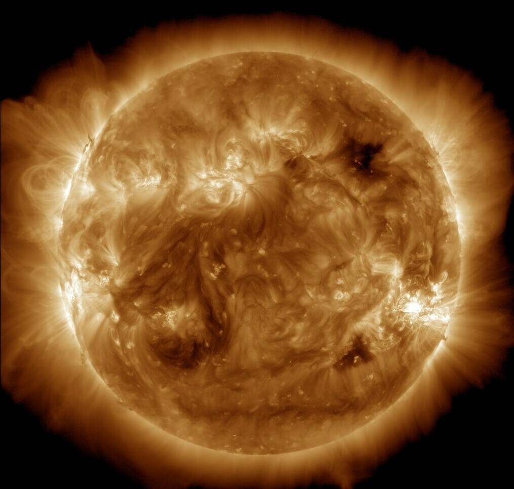
NASA’s Solar Dynamics Observatory captured this image of solar flares on May 11, 2024. The NOAA says there have been measurable effects and impacts from the geomagnetic storm. (Photo: Solar Dynamics Observatory)
Earth is experiencing a severe solar storm causing concern for those responsible for power grids, communication systems and satellites.
The National Oceanic and Atmospheric Administration (NOAA) has reported measurable effects and impacts from the geomagnetic storm that has been visible as aurora across vast swathes of the Northern Hemisphere. As of May 12, 2024, NOAA had seen no reports of major damage.
There has been some degradation and loss to communication systems that rely on high-frequency radio waves, NOAA told NPR, as well as some preliminary indications of irregularities in power systems.
“Simply put, the power grid operators have been busy since yesterday working to keep proper, regulated current flowing without disruption,” said Shawn Dahl, service coordinator for the Space Weather Prediction Center at NOAA.
“Satellite operators are also busy monitoring spacecraft health due to the S1-S2 storm taking place along with the severe-extreme geomagnetic storm that continues even now,” Dahl added, saying some GPS receivers have struggled to lock locations and offered incorrect positions.
As NOAA warned, the Earth has been experiencing a G5, or “extreme,” geomagnetic storm. It is the first G5 storm to hit the planet since 2003, when a similar event temporarily knocked out power in part of Sweden and damaged electrical transformers in South Africa.
As of May 13, NOAA’s Space Weather Prediction Center said that a G3, or “strong,” geomagnetic storm warning was in effect until 2 a.m. ET. While stronger storms are no longer likely and conditions are expected to “gradually wane” throughout the day, the center said in its forecast that moderate to strong geomagnetic storms are “likely” on May 13, as are minor storms on May 14.
The center also said that “solar activity is expected to be at high levels” with a possibility of more solar flares, or bursts of electromagnetic radiation from the sun.
The update came as another X-class solar flare was recorded. X-class flares are the strongest class of these solar bursts, and the latest was recorded as “moderate.”
Flares of this magnitude are not frequent,” the center said. “…Users of high frequency (HF) radio signals may experience temporary degradation or complete loss of signal on much of the sunlit side of Earth.”
Northern lights in unusual places
On May 12, people from all around the world shared photos of a dazzling display of the Northern Lights, which were visible in Russia, Scandinavia, the United Kingdom, continental Europe and some even reported seeing the aura as far south as Mallorca, Spain.
In the United States, the NOAA center shared that the storm-induced auroras were visible as far south as Northern California and Alabama.
The source of the solar storm is a cluster of sunspots on the sun’s surface that is 17 times the diameter of Earth. The spots are filled with tangled magnetic fields that can act as slingshots, throwing huge quantities of charged particles toward our planet. These events, known as coronal mass ejections, become more common during the peak of the Sun’s 11-year solar cycle.
While the storm has proven to be large, predicting the effects of such incidents can be difficult, Dahl said.
The world has grown more reliant on electronics and electrical systems. Depending on the orientation of the storm’s magnetic field, it could induce unexpected electrical currents in long-distance power lines. Those currents could cause safety systems to flip and trigger temporary power outages in some areas.
I took these photos near Ranfurly in Central Otago, New Zealand. Anyone can use them please spread far and wide. :-) https://t.co/NUWpLiqY2S
— Dr Andrew Dickson reform/ACC (@AndrewDickson13) May 10, 2024
The storm caused some navigational systems in tractors and other farming equipment to break down, suppliers and farmers told the New York Times.
Farmers have become dependent on equipment that utilizes GNSS and other navigation technology to help them plant more effectively — a practice known as precision agriculture. However, some of these operations in the Midwest, as well as in other parts of the United States and Canada, came to a temporary halt.
How it affects the ionosphere
The storm will also likely disrupt the ionosphere, a section of Earth’s atmosphere filled with charged particles. Some long-distance radio transmissions use the ionosphere to “bounce” signals around the globe, and those signals can be disrupted.
The particles may also refract and otherwise scramble GNSS signals, according to Rob Steenburgh, a space scientist with NOAA. Those effects can linger for a few days after the storm.
The storms can bring on ionospheric scintillation, which refers to rapid fluctuations in GNSS signal strength and phase due to localized irregularities in the electron density of the ionosphere resulting from solar activity. Scintillation adversely affects GNSS positioning, particularly around the geomagnetic equator after local sunset.
Similarly to Dahl, Steenburgh said that it is unclear just how bad the disruptions will be. While we still depend on GNSS, there are also more satellites in orbit. Moreover, the anomalies from the storm are constantly shifting through the ionosphere like ripples in a pool. “Outages, with any luck, should not be prolonged,” Steenburgh said.
Edge Autonomy has released significant upgrades to its VXE30 Stalker unmanned aerial system (UAS) through the new “Havoc” configuration, designed to double the system’s flight endurance and payload capacity.
With the Havoc upgrades, the VXE30 can now support the complex demands of both small tactical units and larger brigade-level operations without the need for extensive reconfiguration. The upgrades are designed to make the UAS more versatile across various military applications.
The VXE30 Stalker UAS has silent, vertical take-off and landing (VTOL) capabilities and is payload agnostic with the Havoc configuration. It supports easy integration of third-party payloads and subsystems through a Modular Open Systems Approach (MOSA), requiring no additional training for current operators.