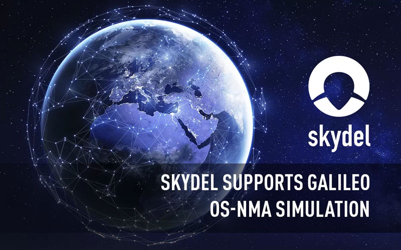
Orolia, a Safran Electronics and Defense company, announced its Skydel GNSS simulation engine will support Galileo Open Service Navigation Message Authentication (OSNMA) simulation in the form of two-phased and separate solutions. These solutions will be available to users who have purchased simulation access to the Galileo constellation, which will be available in the next few months.
OSNMA is an emerging authentication service that allows GNSS receivers to verify the authenticity of received data to protect against potential jamming or spoofing attacks that can result in service disruptions, denial incidents and more.
The first solution is well-suited for most receiver integrators that want to test the OSNMA capability of a GNSS receiver with the official test vectors from the European Union Agency for the Space Programme (EUSPA). This solution will support the available official test vectors sample data, which supports the verification of OSNMA functionality implementation.
The second option will provide full flexibility in the configuration of the scenario as well as the OSNMA authentication parameters. It will be suitable for advanced users that test receivers in a wide range of edge and corner cases.
Available later in 2023, this phase will include the following elements in Skydel: authentication of the Galileo E1 OS navigation message, a new Skydel engine supporting OSNMA SIS ICD 1.0, support for the timed efficient stream loss-tolerant authentication protocol, and useful crypto material for running user-programmable simulation test scenarios.
This feature will be ready for future software updates in accordance with the next phases recommended by EUPSA.
The Joint Counter-Small Unmanned Aircraft Systems office successfully tested BAE Systems’ APKWS laser-guidance kits in a counter-unmanned aircraft systems (C-UAS) mission.
During the Department of Defense-led exercise at Yuma Proving Ground, Arizona, the 70 mm APKWS-guided rockets demonstrated 100% effectiveness when fired against 25-to-50-pound UAVs traveling at more than 100 miles an hour. The APKWS C-UAS solution is platform agnostic, permitting multiple options to accelerate fielding.
APKWS transforms unguided rockets into smart munitions for precision strikes on soft and lightly armored targets. An updated proximity fuse for the standard M151 warhead enables laser-guidance kits to target Class-2 and Class-3 UAVs, which typically weigh less than 55 lbs. The fuse retains the legacy point denotation capability for flexibility of the weapon in the field.
APKWS now enables rockets to engage and destroy UAVs at a fraction of the cost of existing C-UAS systems with unprecedented precision.
The kits are available to all U.S. armed forces, as well as allies via foreign military sales.
Thales Alenia Space, along with Viettel and MKE, have been selected by Vinamarine to provide Vietnam with a MEOLUT Next ground station. MEOLUT Next will operate as a part of the COSPAS-SARSAT global medium orbit search-and-rescue (SAR) network.
The SAR solution will enable the detection and location of distress signals from COSPAS-SARSAT beacons on land, in the air, and at sea over a radius of 2,500 km around Haiphong, Vietnam, mainly using signals from Galileo.
Thales Alenia Space’s MEOLUT Next solution employs a phased array antenna and can track more than 30 satellites, which enhances distress beacon detection and expands coverage. The solution can detect and locate distress signals from more than 5,000 km away.
MEOLUT Next is used by other COSPAS-SARSAT users including Canada, the United States, France, the European Union, Togo and Thailand.
“Seen & Heard” is a monthly feature of GPS World, traveling the world to capture interesting and unusual news stories involving the GNSS/PNT industry.
Image: Reviver
Digital license plates gone wrong
A security research team has gained administrative access to Reviver, the only company in California that sells digital license plates, which has allowed them to track the physical location of all of Reviver’s customers. With this vulnerability, anyone could remotely update, track and delete someone’s Reviver plate. The access also enabled the researchers to change a section of the text at the bottom of the plate, designed for personalized messages, to anything they want, according to Vice.com. California launched the option to buy a digital license plate in October 2022, and Reviver has since addressed the license plates’ security vulnerability.
Image: David Peperkamp/iStock / Getty Images Plus/ Getty Images)
Bill makes secret tracking illegal
Indiana state legislators have filed a bill that would make tracking someone with a GPS-based device without their knowledge a crime, reported WTHR of Indianapolis. The bill is in response to the growing number of criminal cases involving Apple AirTags and other GPS-based tracking devices. Tracking someone secretly is not currently a crime in Indiana; however, laws vary from state to state. Under the proposed bill, the penalty would be increased from a Class C misdemeanor to a Class A misdemeanor if the person tracked is under a protective order. The penalty could be enhanced for someone convicted of using a tracking device when committing a felony. Similar incidents are on the rise around the United States involving the use of AirTags and other tracking devices for criminal purposes.
On New Year’s Day, six rockets were launched from a United States-made Himars rocket system at a vocational college in Ukraine, killing at least 89 Russian soldiers. Russia is blaming this on illegal cellphone usage by Russian soldiers, defying a ban. Ukrainian officials say 400 Russian soldiers were killed and another 300 were wounded, contradicting Russia’s report. However, this is the largest number of deaths Russia has acknowledged during the war. Russia says that the obvious cause of the attack was the use of mobile phones, as the enemy was able to locate and determine the troops’ coordinates for the strike. Two of the rockets were shot down before reaching Makiivka in the occupied Donetsk area of Ukraine.
Researchers at the Department of Marine Geology and Geophysics at the Cochin University of Science and Technology in Kochi, India, say that heavy rainfall can be detected more than six hours in advance using GPS signals, reported The Hindu. During rainy seasons, as GPS signals pass through the atmosphere, how much they are delayed depends on the amount of water vapor present. By using continuous GPS signals and rainfall data collected in Thiruvananthapuram, the study showed that any heavy rainfall could be detected using this delay.
Image: Air Force Staff Sgt. Rachel Simones/ Department of Defense.
BAE Systems and Lockheed Martin Skunk Works partnered to test the Skunk Works Stalker and Indago UAS on BAE Systems’ amphibious combat vehicle (ACV) command, control, communication and computers (C4)/UAS variant. The UAS will provide reconnaissance capabilities to support U.S. Marine Corps expeditionary warfare and battle management capabilities.
BAE Systems tested the Stalker and Indago UAS — in addition to other technology suppliers — as a part of contractor verification testing. With contractor verification testing complete, the USMC plans to conduct additional tests to evaluate whether the AVC C4/UAS is a solution for the Advanced Reconnaissance Vehicle program.
“By integrating Stalker and Indago on BAE Systems’ ACV platform, we are delivering greater mission flexibility in a small form factor that supports Marine Corps operations,” Jacob Johnson, Skunk Works UAS and attritable systems director, said.
The Skunk Works Stalker and Indago UAS provide a broad operating envelope and endurance, which enables diverse and demanding missions while maintaining a small operational footprint and crew requirement.
BAE Systems’ ACV C4/UAS vehicle is a mobile systems integration lab built to demonstrate the technology Marines need to conduct reconnaissance, surveillance and acquisition capabilities, including the ability to sense and communicate targets over the horizon using C4 systems.
OxTS has released its Georeferencer 2.5 with the anyNAV feature and eight lidar sensors from RoboSense. Georeferencer 2.5 featuring anyNAV software is suitable for survey applications.
Users of Georeferencer 2.5 with anyNAV feature enabled can boresight payloads and georeference lidar data using the user’s navigation data. The anyNAV software enables lidar surveyors to create accurate pointclouds quickly.
Georeferencer 2.5 now takes navigation data from third-party inertial navigation systems, which enables users to use that data to georeference raw lidar data from multiple sensor families. The resulting data can then be viewed in many pointcloud viewer software packages.
NAVKITE on board a vessel. (Image: Safran Electronics and Defense)
Safran Electronics and Defense and Fuscolab, the innovation lab for the French Marine Corps, released a resilient position, navigation, and timing (PNT) system, NAVKITE. It provides navigation integrity and performance over long periods of time and under demanding circumstances on land and at sea.
NAVKITE meets operational requirements for the French Navy Commandos and will be integrated in Embarcation Commando a Usage Multiple Embarquable (ECUME) — a transportable, multirole, semi-rigid boat purpose-designed for commandos and other special forces.
NAVKITE’s capabilities depend on the coupling of Safran’s Geonyx M inertial navigation system with the VersaSync time/frequency server. Together, they handle the transmission of PNT data to ensure mission continuity.
The first sea trials of the system, conducted by Fuscolab and the Ponchardier commando unit, demonstrated NAVKITE’s performance under operational conditions. It was then successfully deployed in February in the joint services exercise Hemex, during phase two of Orion, a large-scale operation for resilient, innovative and interoperable armed forces focused on high-intensity conflicts.
CMC Electronics has entered a multi-year contract with Sikorsky, a Lockheed Martin company, to supply its CMA-2082MC military flight management system (FMS) for several Sikorsky helicopter models, including the UH-60M, HH-60M, HH-60W, S-70i and the S-70M.
CMA-2082MC is a complete FMS with integrated radio management, which provides centralized control of navigation sensors, communication radios, mission avionics and more. It is also highly reliable while operating in harsh environments.
The helicopters complete with CMA-2082MC military FMS will be delivered to the U.S. Army and the U.S. Air Force, as well as several Black Hawk customers for use in a wide range of missions including search and rescue, troop transport, medical evacuation, disaster relief, aerial firefighting and border patrol.
Image: U.S. Department of Defense / Raytheon Technologies
Raytheon Technologies has delivered all 23 contracted Joint Precision Approach and Landing Systems (JPALS) low-rate production units to the U.S. Navy to ship to Japan. Raytheon announced the contract with the Navy back in February to provide JPALS to the Japan Maritime Self-Defense Force (JMSDF), which will be deployed on the JMSDF JS Izumo carrier in 2024.
JPALS is a software-based GPS navigation and precision approach landing system that guides aircraft onto carriers and amphibious assault ships regardless of sea state or weather conditions, bolstering safety and operational capability.
JPALS is deployed on all U.S. Navy aircraft carriers and amphibious assault ships, as well as all F-35 aircraft. In addition, JPALS are deployed on platforms from two countries: the UK Royal Navy’s HMS Queen Elizabeth, and the ITS Cavour, an Italian aircraft carrier, to support their F-35 squadrons.
Raytheon has also developed an expeditionary variant of JPALS called eJPALS, which is a smaller, portable system that could be packaged in ruggedized cases, mounted on small vehicles, and deployed in austere, remote locations for precision landings. The system could establish up to 50 different landing points within a 20-nautical-mile radius.
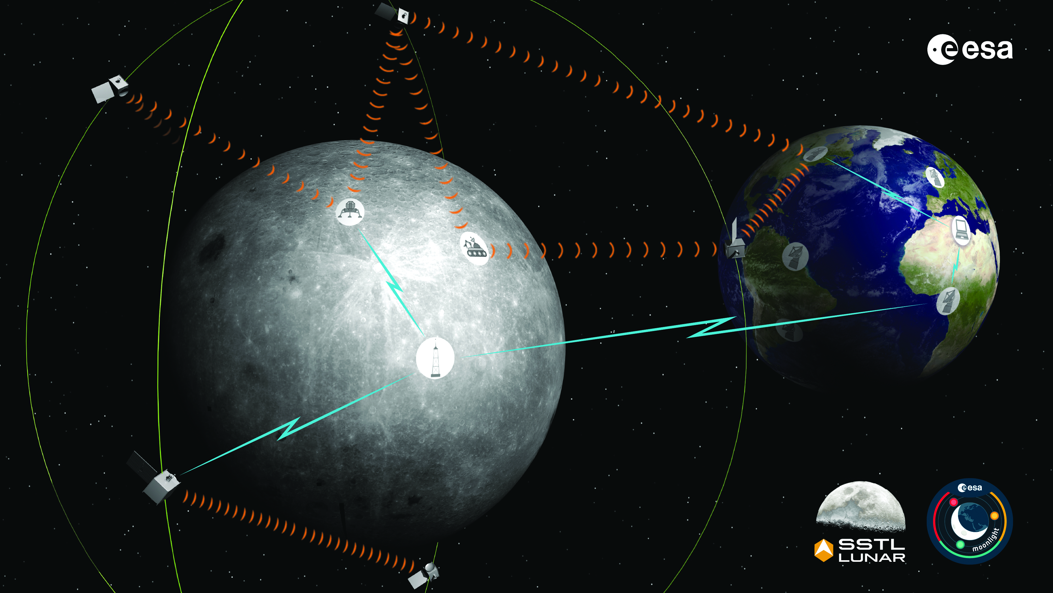
The Moonlight initiative will provide sustainable lunar data-relay services for communication and navigation around the Moon. (ESA Moonlight Study conceptual drawing.) (Image: SSTL/Airbus/ESA)
GNSS researchers presented hundreds of papers at the 2022 Institute of Navigation (ION) GNSS+ conference, which took place Sept. 19–23 in Denver, Colorado, and virtually. The following five papers focused on lunar and space applications. The papers are available now.
MTO Navigation Using Lunar Signals
The moon transfer orbit (MTO) is becoming increasingly important as several national space agencies are planning moon exploration soon, with projects such as NASA’s Artemis. In previous research, the GPS navigation accuracy on the MTO reached 200 m at the moon altitude by using GPS signals emitted from the far side of Earth. As accuracy on a low-Earth orbit (LEO) using GPS is a few meters, 200 m accuracy is not accurate enough to support lunar exploration. The deterioration of accuracy is due to the poor geometry of the GPS satellites that became visible from the MTO.
The authors want to achieve an accuracy of less than 100 m in MTO by using other navigation sources, including the lunar navigation satellite system (LNSS) to be deployed in the moon’s orbit. The LNSS signals will come from the far side of the moon, similar to the signals of GPS satellites coming from the opposite side of Earth. Its satellites will be pointed towards the moon to provide positioning, navigation and timing services on the moon surface, especially at the lunar South Pole region
The researchers have been conducting the simulation evaluation for the MTO navigation accuracy using signals coming from the moon and assume that these signals will be emitted from beacons on the moon surface or the LNSS.
Murata, Masaya; Kogure, Satoshi; “Moon Transfer Orbit Navigation Using Signals Coming from the Moon.”
Designing the Smallsat-Based LNCSS
There is growing interest in the use of a smallsat platform for the future lunar navigation and communication satellite system (LNCSS); however, many design considerations are not finalized for the smallsat-based LNCSS, such as choice of the satellite clock, satellite orbital parameters and the constellation size.
Using the Systems Tool Kit simulation software, the authors examined various LNCSS constellation case studies based in elliptical lunar frozen orbit and with a low-grade chip-scale atomic clock.
They evaluated case studies of navigation design considerations including position and timing accuracy, lunar user equivalent ranging error, and dilution of precision. As for case studies of communications design considerations, the authors examined daily data volume, availability and data rate. Finally, they examined smallsat factors including the cost, size, weight and power of the satellite payload.
The paper includes trade-off analysis in satisfying the preliminary design criteria outlined by international space agencies and commercial space companies.
Bhamidipati, Sriramya; Mina, Tara; Sanchez, Alana; Gao, Grace; “A Lunar Navigation and Communication Satellite System with Earth-GPS Time Transfer: Design and Performance Considerations.”
Developing an SDR for Space
A geostationary satellite (GEO) equipped with the satellite-based augmentation system (SBAS) function has a transmitter for GNSS correction signals at the L1 and L5 bands. This transmitter could interfere with the GNSS space service volume (SSV) receiver in the same satellite, so L1 and L5 signals cannot be used for the GEO SBAS satellite. However, the use of GPS L2C signals can be an alternative.
The authors of this paper present the development of a GPS L2C signal generator for the SSV in GEO simulation. They present the simulation process for GEO satellites and the structure of the GPS L2C signal generator.
In this study, a verification through the receiver test with a GNSS software-defined receiver is included to show the possibility of the designed signal simulator. The validation is performed by analyzing the programmable system device, the results of the acquisition, code/carrier tracking, and the C/N0 estimation.
Lee, Hak-beom; Choi, ByeongHyun; Song, Young-Jin; Won, Jong-Hoon; Kwon, Ki-Ho; “Development of GPS L2C Signal Generator for SSV in Geostationary Orbit Simulation.”
Differential Positioning on the Moon
This paper introduces a new concept of delivering the pseudorange correction calculated at a reference station on the lunar surface, as a part of the lunar navigation satellite system (LNSS) navigation message. The concept enables LNSS users to apply differential positioning using pseudorange correction without adding new hardware to their receivers.
The authors propose the differential positioning technique to reduce the signal-in-space range error of LNSS satellites and the coordinate transformation errors from Earth-centered fixed frame to lunar reference frame — the dominant errors in satellite positioning by LNSS.
The proposed reference station is equipped with instruments to externally estimate its own position relative to the lunar reference frame. The user on the lunar surface would then perform differential positioning using the station coordinate and pseudorange correction obtained at the reference station.
In this study, the simulation results using eight elliptical lunar frozen orbit satellites show that the real-mean-squared values for both horizontal and vertical positioning errors with differential correction are reduced to 1/10 of those without differential correction, even at 10 degrees latitude from the reference station at the lunar South Pole.
Akiyama, Kyohei; Murata, Masaya; Kogure, Satoshi; “Differential Positioning Performance on Lunar South Pole Region Using Lunar Navigation Satellite System.”
GEO Precise Orbit Determination
Using GPS in satellites in geostationary (GEO) orbits provides advantages by improving position, velocity and timing data, reducing operating costs and providing autonomous orbit control for station keeping. This paper presents the result of the onboard data evaluation and precise orbit determination of an optical data-relay satellite (ODRS) using GPS L1 C/A code and carrier-phase observations for 74 days.
As a result of precise orbit determination, the authors found that both code- and carrier-phase observations are affected by the ionospheric delay when signals pass through the plasmasphere located above the ionosphere.
Several methods were implemented during this research to reduce the effect of the plasmasphere, including setting a higher cut-off altitude, applying correction sequences generated from orbit determination residuals, and applying a new observation noise model depending on the GPS off-nadir angle. Results show that the correction sequences and the new noise model improve the internal orbit consistency. The authors also found that the orbit bias in radial direction due to negatively biased carrier-phase observations is mitigated from –51 cm to –17 cm by setting a higher cut-off altitude and applying correction sequences.
Matsumoto, Takehiro; Sakamoto, Takushi; Yoshikawa, Kazuhiro; Kasho, Sachiyo; Nakajima, Ayano; Nakamura, Shinichi; “GEO Precise Orbit Determination Using Onboard GPS Carrier Phase Observations of Optical Data Relay Satellite.”
On March 23, Shou Zi Chew, CEO of the popular app TikTok, testified before Congress that TikTok does not collect precise location data from its users.
During the hearing, which lasted for more than five hours, Chew assured committee members that the app does not collect nor distribute location data.
TikTok is under fire as a bipartisan Senate proposal is aimed at banning the social media app, arguing that it poses cybersecurity risks. The House Committee interrogated Chew regarding the app’s algorithmic feed, policies for young users and —given TikTok’s Chinese ownership — the amount of access the Chinese government has to user data.
ComNav Technology’s K8 series GNSS modules can use the Galileo High Accuracy Service (HAS) precise-point positioning (PPP). The PVT algorithm upgrade to the K8 series module supports Galileo HAS with an accuracy of 20 cm horizontally and 40 cm vertically.
Galileo HAS provides free access to information necessary to estimate accurate positioning using a PPP algorithm in real-time through the Galileo signal E6-B and an internet connection. Galileo HAS Initial Service was declared on January 24, enabling users within the service area to achieve improved positioning performance.
The improved performance capabilities provide a higher level of accuracy for industries such as UAV, autonomous driving, intelligent transportation, agriculture and GIS collection.