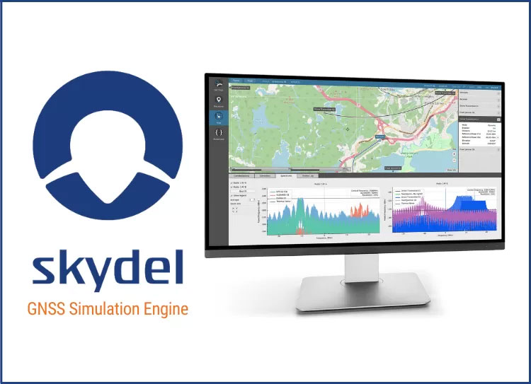
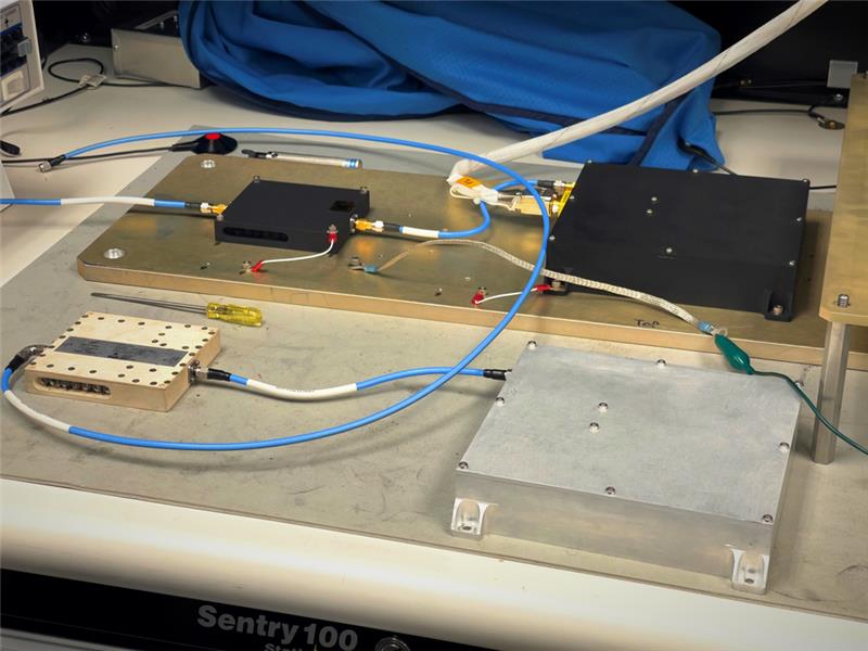
Orolia’s Skydel, its GNSS simulation software, can now generate more than 500 simulated satellite signals. This platform is suitable for GNSS users, experts and manufacturers, as well as users needing a low-Earth-orbit-capable simulation system.
Skydel contains a feature that includes multi-constellation and multi-frequency signal generation, remote control from user-defined scripts, and integrated interference generation.
“With more and more customers simulating multipath and jamming scenarios, and the need for more signals in more applications — even beyond traditional simulators — the need for high capacity has never been greater,” said Pierre-Marie Le Veel, Orolia’s simulation product director. “The Skydel engine opens the possibility for users to escalate to more than 1,000 signals and not be limited by hardware design.”
In addition to generating a high channel and satellite count, Skydel can also produce navigation warfare signals without any additional hardware.
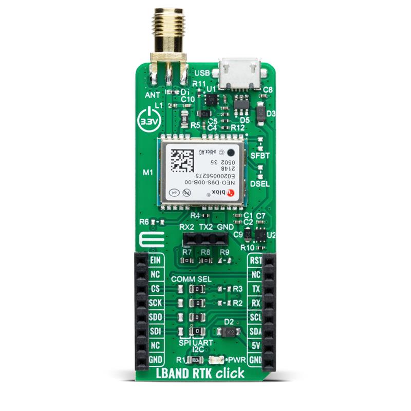
LBand RTK Click is a compact add-on board that provides access to L-band GNSS corrections. The board features the NEO-D9S-00B, a professional-grade, satellite data receiver for L-band corrections from u-blox.
Operating in a frequency range from 1,525 MHz to 1,559 MHz, the NEO-D9S-00B decodes the satellite transmission and outputs a correction stream. This enables a high-precision GNSS receiver to reach accuracies down to centimeter-level. An independent stream of correction data, delivered over L-band signals, ensures high availability of position output.
LBand RTK Click also uses several mikroBUS pins. The EIN pin routed to the AN pin of the mikroBUS socket is used as an external interrupt feature activated through a population of the R6 0Ω resistor.
In addition, LBand RTK Click contains an SMA antenna for connecting a Mikroe-brand antenna. This antenna easily allows positioning in space, supporting GNSS L-band frequencies.
LBand RTK Click implements advanced security features such as signature and anti-jamming mechanisms. It can also be integrated with other GNSS receivers from the u-blox F9 platform.
R&S EVSD1000 has been designed to provide a mounting adaptor for installation onto medium-size drone types. (Image: Rohde & Schwarz)
Rohde & Schwarz has launched its EVSD1000 VHF/UHF nav/drone analyzer at Airspace World 2023 in Geneva March 8-10. The analyzer provides highly accurate drone inspection of terrestrial navigation and communications systems.
The EVSD1000 VHF/UHF nav/drone analyzer is a signal-level and modulation analyzer for medium-sized drones. It features measurements of instrument landing systems, ground-based augmentation systems and VHF omnirange ground stations. The mechanical and electrical design is optimized for drone-based, real-time measurements of terrestrial navigation systems with up to 100 measurement data sets per second.
The analyzer provides high-precision signal analysis in the frequency range from 70 MHz to 410 MHz. This also includes the needed measurement repeatability to ensure results from drone measurements can be compared to flight and to ground inspections in line with ICAO standards.
The EVSD1000 VHF/UHF nav/drone analyzer reduces runway blocking times, provides necessary measurement repeatability and offers measurement precision and GNSS time and location stamps. While streaming measurement data during a drone flight via the data link to a PC on the ground, the analyzer can also buffer data internally to ensure no results are lost if the data link is lost.
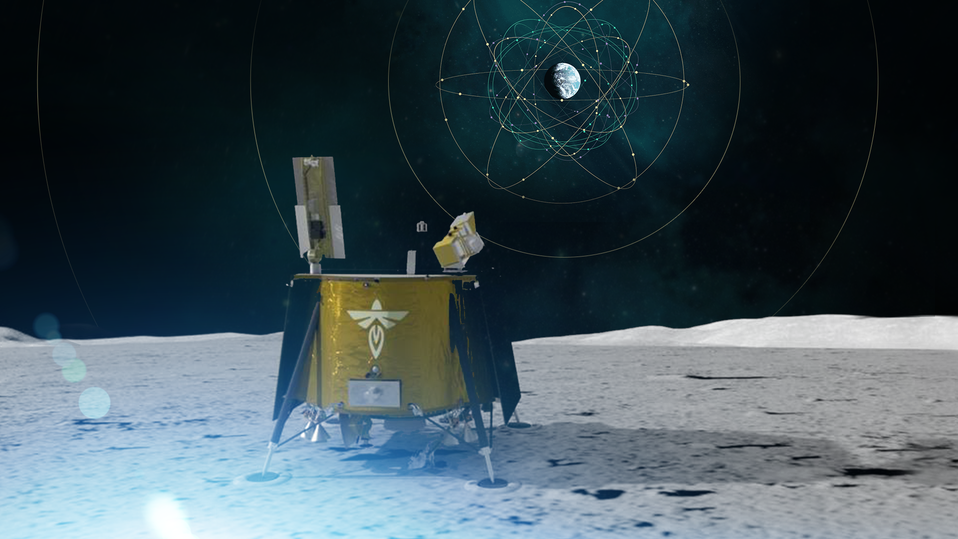
As a part of the NASA Commercial Lunar Payload Services initiative, Firefly Aerospace will land the Blue Ghost lander on the lunar surface in 2024. Onboard, the Lunar GNSS Receiver Experiment (LuGRE) payload will determine whether signals from two GNSS constellations can reach the lander and provide precise navigation on the moon for future missions.
During a 12-day mission in the moon’s Mare Crisium basin, LuGRE will obtain the first GNSS fix on the lunar surface and receive signals from both GPS and Galileo. The LuGRE payload is managed by NASA’s Space Communications and Navigation program office.
This payload is a collaborative effort between NASA and the Italian Space Agency to expand the capabilities of Earth-based navigation systems. Navigation engineers at NASA’s Goddard Space Flight Center in Greenbelt, Maryland, have been testing the payload’s GNSS receiver and low noise amplifier. The receiver was developed and built by the Italian company Qascom.
These components will be critical to LuGRE obtaining signals from the GPS and Galileo satellites. To prepare for operating on the moon, NASA engineers used a GNSS simulator to test and configure the payload to accurately receive and process the signals.
The LuGRE payload GNSS receiver and low noise amplifier. (Image: NASA/Dave Ryan)
The Goddard team delivered in February the flight hardware to Firefly Aerospace in Cedar Park, Texas, where it will be integrated into the Blue Ghost lander.
Astronauts and rovers traversing the lunar surface will need precise location and tracking data for their exploration endeavors. The data gathered from the LuGRE payload will be used to further develop GNSS-based navigation systems for future missions to the moon.
Trimble has partnered with Nissan Motor Company to use Trimble’ RTX network as the positioning source to enhance the capabilities of the ProPILOT Assist 2.0 driver assistance system in Nissan vehicles.
The Trimble RTX network is supported by a globally redundant and resilient infrastructure and is backed by a team of ISO 20,000 certified network engineers and IT specialists, which monitor operations to ensure optimal signal performance and reliability for drivers. Trimble’s RTX positioning technology can provide decimeter-level accuracy in seconds, making it suitable for autonomy applications, including automotive driving.
The ProPILOT 2.0 Assist system enables hands-off driving while cruising in a single lane and when the vehicle approaches a road divide. When the car is passing a slower vehicle, the system judges the appropriate timing of branching off or passing based on information from the navigation system and 360-degree sensing.
The ProPILOT 2.0 Assist system with Trimble’s RTX network will be initially available on the 2023 Nissan Ariya.
“Seen & Heard” is a monthly feature of GPS World magazine, traveling the world to capture interesting and unusual news stories involving the GNSS/PNT industry.
Image: BanksPhotos/E+/Getty Images
Dozens Stranded in Tundra
Several vehicles in Rock Springs, Wyoming, were stranded after being led by their map apps or vehicle navigation systems to an unmaintained county road in a blizzard. Several calls were made to the Sweetwater County Sheriff’s Office about stranded vehicles stuck after they were directed to the detour when Interstate 80 was closed due to winter conditions. Similar incidents were reported by other counties, resulting in discussions between the Wyoming Department of Transportation and the companies that develop navigation software.
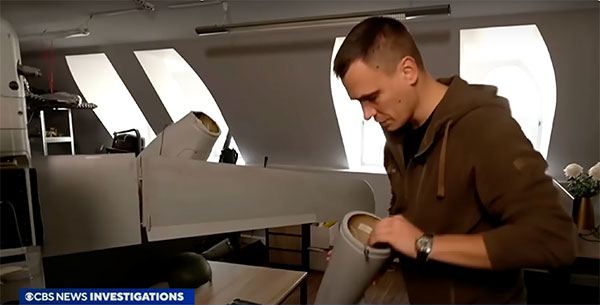
Screenshot: CBS video
UAVs contain Western Technology
A Ukrainian intelligence assessment obtained by CNN and CBS reported an Iranian UAV downed in Ukraine contained technology from companies in the United States and other western countries. The White House has since launched an investigation as to how the technology — including semiconductors, GPS modules and engines — were obtained by Iran. The components removed from an Iranian Shahed-136 UAV totaled 52, 40 of which were manufactured by 13 different U.S. companies. The remaining components were manufactured by other western companies and by companies based in Japan, Taiwan and China.
Researchers may now be able to monitor climate-induced natural hazards by combining satellite technology with machine learning. Researchers were able to use machine learning to study hurricanes that made landfall over the Gulf of Mexico in a series of recent experiments. C.K. Shum, the co-author of the study and a professor at the Byrd Polar Research Center, uses geodesy to study global climate change phenomena. Using geodetic data gathered from satellites, Shum tested whether a mix of remote sensing and machine learning analytics could accurately monitor weather phenomena. Accurate measurements could help improve hurricane forecasting.
Sailboat. (Image: valio84sl/iStock / Getty)
The power of TikTok is real
TikTok changed Jeff Foulk’s life when his daughter posted about his free marine navigation app, Argo, when they attended a boat show in Chicago. Foulk was promoting Argo with little success, until his daughter shared with the social media platform his struggle as the owner of a small business. Since then, the app has been downloaded more than 200,000 times and remains at the top of the charts for boat navigation apps. Argo was launched more than four years ago and, until now, had only 100,000 total downloads. Now that Argo is viral, Foulk wants to launch a premium subscription.
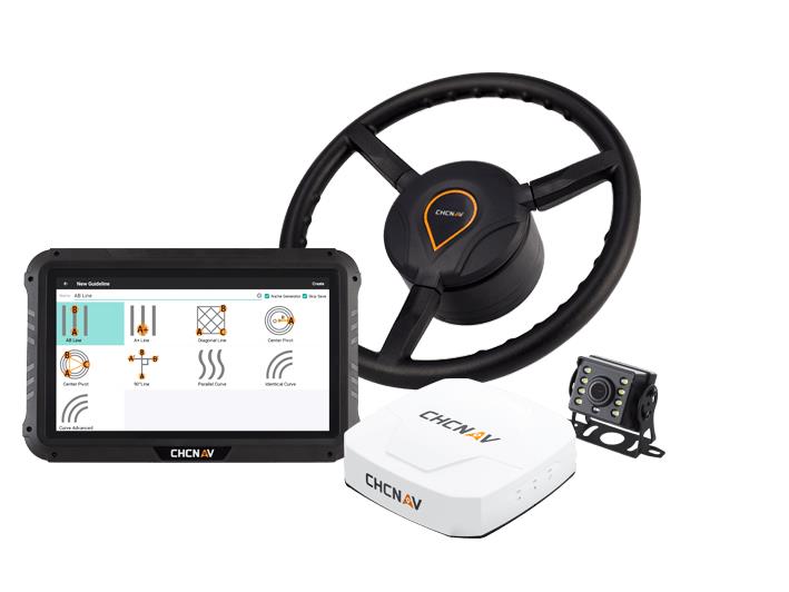
CHC Navigation has released the NX510 SE Auto-Steer, an automated steering system that retrofits several types of new and old farm tractors and other vehicles. It can be connected to local real-time kinematic (RTK) networks or GNSS RTK base stations.
NX510 SE is a guidance controller powered by multiple corrections sources and five satellite constellations: GPS, GLONASS, Galileo, BeiDou and QZSS. It has a built-in 4G and UHF modem that connects to all industry-standard differential GPS and RTK corrections to achieve centimeter-accuracy steering.
NX510 SE contains GNSS and inertial navigation system terrain compensation technology, which maintains high accuracy in challenging environments and terrain. This makes NX510 SE suitable for ditching, planting and harvesting applications.
In addition, AgNav multilingual software, operating on a 10.1 in industrial display, supports multiple guideline patterns that include AB line, A+ line, circle line, irregular curve and headland turn.
On Friday, March 3, Alex Murdaugh was convicted of killing his son Paul Murdaugh and wife Maggie Murdaugh on June 7, 2021. With limited evidence, the prosecution used a phone video and vehicle navigation data to prove Alex’s guilt.
During the trial, Alex claimed he was visiting his mother during the time the murders took place. However, General Motors OnStar data accessed by investigators from his Chevrolet Suburban contradicted the alibi, putting Alex at the scene of the crime during the time of the murders.
In addition to the navigation data, in a phone video taken by Paul on the night of the murders near the Murdaugh’s dog kennels at their Moselle property, Alex’s voice could be heard in the background. That video also placed Alex at the scene around the time Paul and Maggie were shot and killed.
After deliberating for less than three hours, the jury found Alex guilty of the double murders. The judge then sentenced him to life in prison without the possibility of parole.
Since the trial began, the South Carolina Law Enforcement Division has reopened several investigations connected to the Murdaugh family. This includes the case of Stephen Smith who was found dead on the side of the road in 2015 allegedly from a hit-and-run.
Tracy Cozzens has helped to run GPS World for more than 17 years—first as Managing Editor and then, since June 2019, as Senior Editor. She has covered everything under the sun pertaining to GNSS, always providing readers real-time and fascinating news. She has also maintained the website, helped with print magazine production, and performed many other tasks. Now, Tracy is retiring and handing the reigns over to our new Managing Editor, Maddie Saines. Tracy has worked diligently to pass on her knowledge and enthusiasm to ensure the ongoing success of this publication.
Her ideas, angles, journalistic experience and passion will be dearly missed. GPS World’s staff wishes Tracy a wonderful and relaxing retirement!
TRACY’S TOP 17
One of her recent stories with the greatest number of hits for each of her 17 years with GPS World:
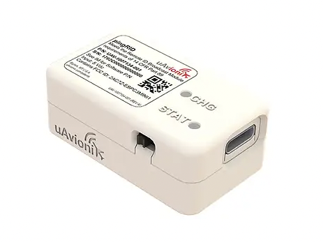
UAvionix has launched its remote ID broadcast module for UAVs, pingRID. The pingRID meets the Part 89 remote ID standards of the Federal Aviation Administration (FAA), which will become effective on Sept. 16, 2023, to keep operators safe and compliant throughout a flight.
The pingRID comes pre-configured and ready for use out of the box. After assigning the pingRID unique identification number to the aircraft’s registration with the FAA, operators can attach the battery-powered device to their UAV and prepare for flight.
A set of LED indicators provides status on the battery charge, device readiness for flight and inflight operations. The compact, lightweight design fits most aircraft without impacting performance. The module can also be quickly recharged via USB-C.
The FAA’s final rule on remote ID requires all UAV pilots to meet the operating requirements of Part 89. For most operators, this will require flying a UAV equipped with standard remote ID, a remote ID broadcast module such as the pingRID, or flying at a Federally Recognized Identification Area.
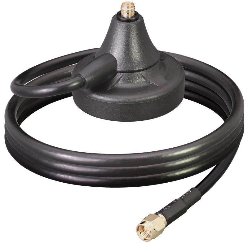
Linx Technologies has released the MAG Series SMA and RP-SMA magnetic antenna bases, which are suitable for GPS, Galileo and QZSS applications. The antennas are designed to combine a strong magnetic mount with typical connectors to create different mounting options for a variety of whip/blade-style connectorized antennas.
“This versatile mounting option provides the capability to extend the placement of the antenna to a remote location and allows the flexibility for the antenna to be used in a mobile application, making it especially well-suited for the growing internet of things (IoT) market,” said Tolga Latif, senior director of product management for IoT and micro-markets.
The MAG Series antenna bases are IP67 rated (connectors, base and coax) and are also suitable for LTE-M (Cat-M1), NB-IoT, 5G/4G LTE/3G/2G, LoRaWAN, Sigfox, Wi-Fi, HaLow (802.11 ah), Bluetooth and Zigbee, as well as GNSS applications.
The MAG Series antenna bases are available now via Linx Technologies’ distributor and manufacturer representative networks.
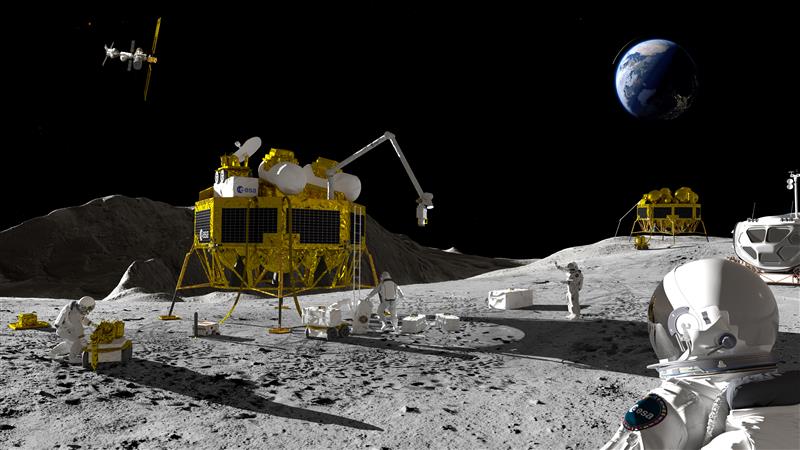
An artist’s impression of a Moon exploration scenario. (Image: ESA)
As there are several missions to the moon planned within the next decade, space agencies have started to consider how to keep time on the moon. To address time concerns, the LunaNet architecture, designed for lunar communications and navigation services, was introduced at the ESTEC technology center of the European Space Agency (ESA) in the Netherlands in November 2022.
“LunaNet is a framework of mutually agreed-upon standards, protocols and interface requirements allowing future lunar missions to work together, conceptually similar to what we did on Earth for joint use of GPS and Galileo,” said Javier Ventura-Trav
eset, ESA’s Moonlight navigation manager, coordinating ESA contributions to LunaNet. “Now, in the lunar context, we have the opportunity to agree on our interoperability approach from the very beginning, before the systems are actually implemented.”
“During this meeting at ESTEC, we agreed on the importance and urgency of defining a common lunar reference time, which is internationally accepted and towards which all lunar system and users may refer,” said Pietro Giordano, ESA navigation system engineer. “A joint international effort is now being launched towards achieving this.”
Each mission to the moon has operated on its own timescale from Earth. Deep space antennas have been used to keep onboard chronometers synchronized with terrestrial time at the same time to facilitate two-way communications. ESA stated that this way of working will not be sustainable in the coming lunar environment.
Time to think about time
Should a single organization be responsible for setting and maintaining lunar time? Also, should lunar time be set on an independent basis on the moon or kept synchronized with Earth? And what about time on other planets?
“Of course, the agreed time system will also have to be practical for astronauts,” said Bernhard Hufenbach, a member of the Moonlight Management Team from ESA’s Directorate of Human and Robotic Exploration. “This will be quite a challenge on a planetary surface where in the equatorial region each day is 29.5 Earth days long, including freezing fortnight-long lunar nights, with the whole of Earth just a small blue circle in the dark sky. However, having established a working time system for the moon, we can go on to do the same for other planetary destinations.”
To efficiently collaborate, the international community will have to settle on a common “selenocentric reference frame,” similar to the role played on Earth by the International Terrestrial Reference Frame, allowing the consistent measurement of precise distances between points across the planet.