Author: Tony Murfin

  • Integrity flies on Mars, while ‘certifiable’ drone level sought in the United States

    Integrity flies on Mars, while ‘certifiable’ drone level sought in the United States

    This month, the four-pound Integrity dual-rotor UAV on Mars continues to fly and may be moving into a scouting role. Plus, there are continuing efforts to move UAV electronics towards a “certifiable” level to support integration in regular airspace. Finally, a newly launched parcel delivery drone has increased carrying capacity.

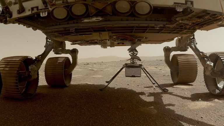
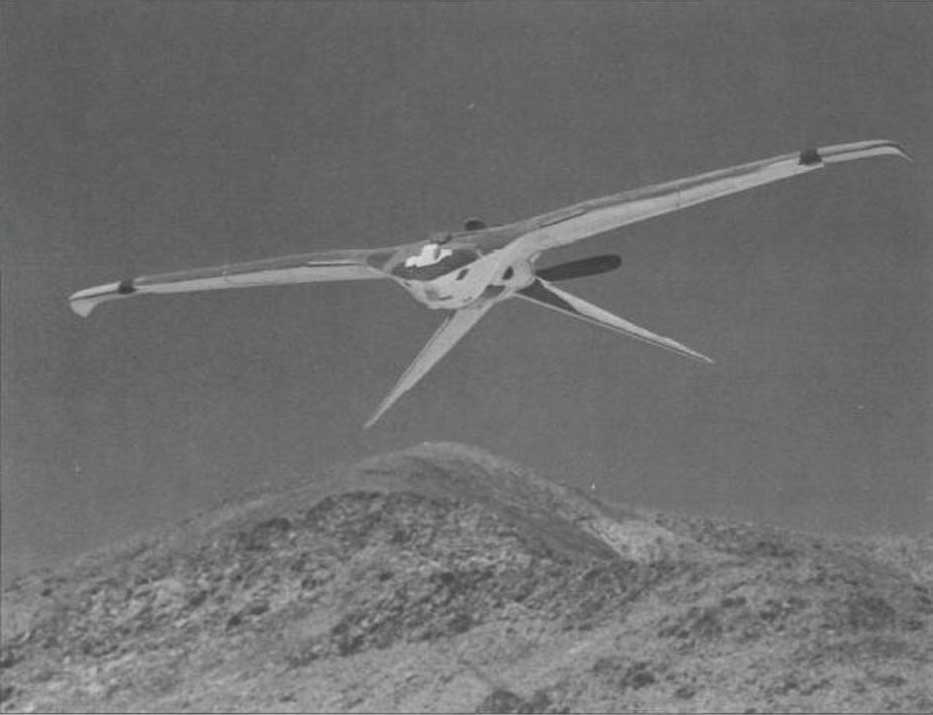
    The excitement around flying an unmanned helicopter on Mars is gradually dissipating as Ingenuity racks up more flights and the NASA team prepares for an elongated flight schedule following the initial 30-day flying experiment. Data from the Martian UAV passes back and forth through the Perseverance rover, which now has things of its own to do and places to go. An initial 30-foot crawl a couple of days ago signaled the beginning of the rover’s ground activities, which are the main focus of the mission.

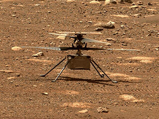
    However, the little UAV has achieved plenty and appears to have lots of life left to fly. We’re now up to five flights, with the latest taking Ingenuity more than 420 feet, flying at a height of 15 feet to a new landing spot, ahead of where the rover intends to travel.

    Before landing, NASA took the UAV up to 33 feet, where future flights should be able to better view features for the rover to investigate. Integrity’s role may now transition to scouting an advance path for rover exploration — one of the principle objectives for the little UAV.

    A tiny speck in the distance, NASA Ingenuity UAV flies on Mars looking for a new landing spot during its fourth flight. (Photo: NASA)
    A tiny speck in the distance, NASA’s Ingenuity UAV flies on Mars looking for a new landing spot during its fourth flight. (Photo: NASA)

    NASA is planning a few additional trips for Integrity in the next week or so — adequate power is being captured by the top-mounted solar cell to fly and keep the vehicle warm through the cold Mars nights, and the miniaturized avionics systems are holding up well. Hopefully, we will still hear of new accomplishments in weeks to come. Incidentally, Perseverance can now capture the sound of the UAV’s spinning blades and the background wind on the surface of Mars.

    FAA certification for drones

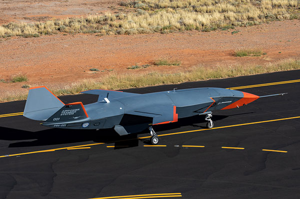
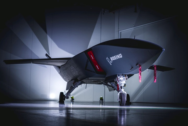
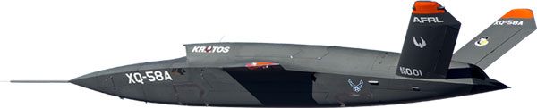
    News here on Earth is about much more capable unmanned vehicles, new innovations and new applications, and efforts seem to be gaining ground toward certifying UAS and their systems to recognized Federal Aviation Administration (FAA) standards, so integration into the National Airspace System (NAS) might roll out sooner than expected.

    When a manufacturer produces an electronic component and qualifies it to the necessary FAA standards, it does not automatically make it a certified product. It only becomes certified on a particular model of aircraft or UAV when the vehicle is certified for operational use by the FAA. There are similar standards and certification requirements in Europe and around the rest of the world.

    Enter George

    Photo: uAvionix
    Photo: uAvionix

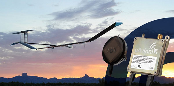
    uAvionics in Leesburg, Virginia, recently launched a new certifiable UAS autopilot — with the cute name of “George.” As older aviation enthusiasts might recall, this moniker was what the World War II pilots of long-range piston engine bombers sometimes called their rudimentary autopilots, which held wings level on long-endurance flights.

    With triplex gyros and accelerometers, dual processors and compasses, and a barometer, the unit is lightweight and low power, but has been developed to all the principal aviation requirements, including software and environmental standards.

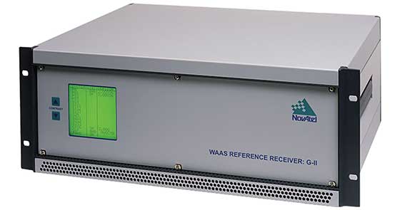
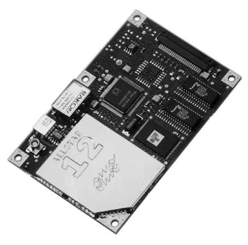
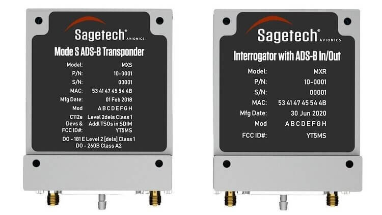
    George joins uAvionics’ line of other aviation qualified/certifiable hardware for UAVs. This includes the ping200X ADS-B for beyond-visual-line-of-sight (BVLOS) detect and avoid, and the trueFYX TSO-C145e certified GPS receiver.

    Seeking Certification

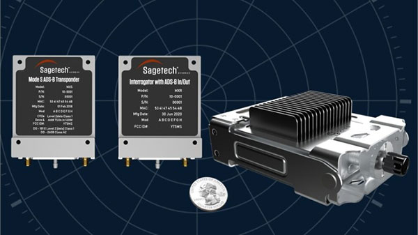
    Sagetech in White Salmon, Washington, is another supplier working hard toward certifiable equipment for unmanned aircraft. Sagetech’s detect-and-avoid (DAA) solution makes use of its ADS-B transponder, which can be paired with other airborne collision avoidance system (ACAS) components.

    Sagetech offers a design engineering service to enable UAV operators and manufacturers to come up with a certifiable solution while FAA standards are still being developed.

    Sagetech ADS-B certifiable transponder/Mode-S interrogator. (Photo: Sagetech)
    Sagetech ADS-B certifiable transponder/Mode-S interrogator. (Photo: Sagetech)

    Embention in Alicante, Spain, also advertises several certifiable autopilots, power and control components for unmanned aircraft. It manufactures a variety of Nmand-branded UAVs along with multi-rotor UAV solutions, including a drone recharging station.

    Three times the cargo

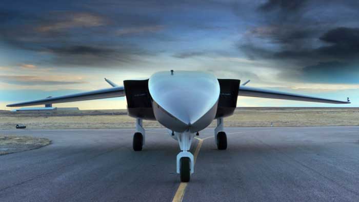
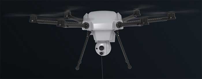
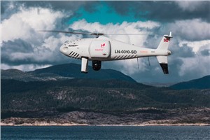
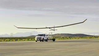
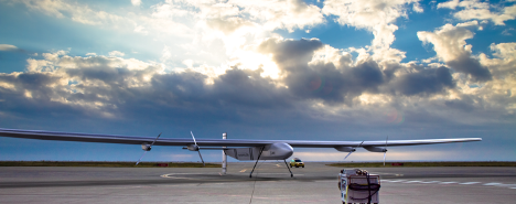
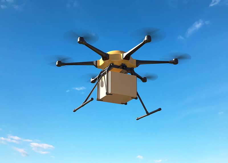
    Meanwhile, drone-delivery capability continues to advance with the recent introduction of the certifiable Wingcopter 198.

    The Wingcopter 198 drop-winch cargo drone. (Photo: Wingcopter)
    The Wingcopter 198 drop-winch cargo drone. (Photo: Wingcopter)

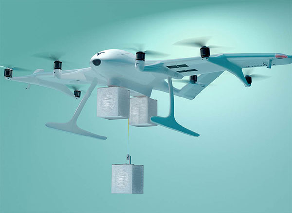
    The vertical-take-off-and-landing (VTOL) delivery drone has a triple-drop winch mechanism that allows for delivery of up to three packages per flight. The UAV takes off and lands vertically, thanks to its tilt-rotor design, and can carry a payload of up to 13 pounds. It can travel up to 47 miles on one electrical charge at up to 93 mph; with fewer packages, a range of up to 68 miles may be possible.

    The VTOL UAV has redundant design elements that position it to support FAA certification. It has eight redundant motors. Also, the autopilot, airspeed sensor and battery are dual redundant. Consequently, the Wingcopter 198 is undergoing FAA-type certification in the United States.

    The Wingcopter 198 also has artificially aided downward-looking cameras to support management of parcel delivery, as well as obstacle avoidance and landing.

    To sum up, life may not yet be over for the Integrity UAV on Mars as it moves into a route-scouting role for the rover. There is more progress toward certifiable configurations of equipment to support unmanned integration into the NAS. Finally, last-mile parcel deliveries could benefit from higher capacity certified drone carriers.

    Tony Murfin
    GNSS Aerospace

  • Ingenuity makes historic flight on Mars

    Ingenuity makes historic flight on Mars

    Only if you have been living under a rock will it be a surprise to hear that the unmanned helicopter called Ingenuity has arrived on Mars attached to the SUV-sized rover called Perseverance. Both have been on the Red Planet since they landed on Feb. 18.

    NASA has since then been in checkout and test mode for both rover and UAV, but Perseverance got a pretty clean bill of health and was commanded to motor over to a flat piece of adjacent Jexero crater — now referred to as the airfield or heliport. There, Ingenuity was detached from the underbelly of Perseverance. Then the little bird lost its power feed from mama rover. Now it has to rely on its own batteries and a small solar panel. The big SUV rover pulled away to a safe 215-foot distance ,and the folks at NASA set about preparing Ingenuity for flight.

    This article was written during the period when things were proceeding with some hesitancy and delay, so things in the article unfold in the same sequence as we all experienced them while we eagerly awaited Integrity’s maiden flight.


    The Ingenuity waits to take its first flight. (Photo: NASA)
    The Ingenuity waits to take its first flight. (Photo: NASA)

    Countdown to Flight

    At only 4 pounds (weighing 1.5 pounds on Mars), the Ingenuity UAV is small, but it’s packed with electronics that allow it to communicate via top-mounted antennas with the rover.

    It carries a lithium ion battery recharged by a small solar panel mounted on top (350 watts is required for a 90-second flight). The UAV also contains heaters to maintain the avionics through the cold of the Martian night. It carries two cameras — a black-and-white navigation camera and a high-density color imager — plus sensors for image processing, data collection and storage, navigation processing and vehicle control.

    One of the objectives for this first flight demonstration is the miniaturization and weight reduction of all these electronics. The NASA website is a little obscure about how the UAV navigates, but perhaps it uses some form of terrain matching/image processing in conjunction with an onboard inertial sensor and laser altimeter.

    Early Shutdown. The UAV had already survived a few nights on its own at around -117F when NASA began to spool up the two four-foot long blades to around 50 rpm during the checkout, and all seemed well until April 9, when a full-speed 2400 rpm spin-test began, and there was an early shut-down due to a watchdog timer — intended to shut things down if something wrong was detected prior to flight. None of this was learned in real time, as radio signal commands take more than 15 minutes to travel the 173-million-miles from Earth to Mars, with the same delay to send back data from what has already happened.

    The density of atmosphere on Mars is only 1% that of Earth, so getting Ingenuity off the ground is more complicated than on Earth. The four-foot-long composite carbon blades have much more surface area than here on Earth for a typical UAV. The two contra-rotating blades spin at around 2400 rpm — a drone on Earth would typically spin its rotors at around 450 rpm.

    Testing on Earth. NASA tested this configuration in a huge vacuum chamber with 1% air density, and Ingenuity flew just fine. The lower gravity on Mars — about 38% that of on Earth — will also help compensate for the lower level of lift available from the Martian atmosphere.

    Because of the radio link delay to and from Mars, Ingenuity can fly and land autonomously only once commands are received. Onboard sensors provide data to enable the vehicle to execute the stored flight profile. The navigation camera provides guidance, and the 13-megapixel color-imaging camera can record the scene. Data and video collected are sent back to the rover for transmission to Earth via the Mars Reconnaissance Orbiter, an Mars satellite that acts as a data relay.

    Ingenuity left the rover and rested on the surface of Mars, while NASA ran a slew of preflight checks. (Photo: NASA)
    Ingenuity left the rover and rested on the surface of Mars, while NASA ran a slew of preflight checks. (Photo: NASA)

    The First Hop. The first‘ hop  was planned to last only a few seconds, but subsequent flights promise to be 165-foot plus, at more than 16 feet above the surface. If things go well, NASA might get more adventurous for the planned fourth and fifth flights.

    All these flights are supposed to happen during the first month of Ingenuity’s flight activity; then Perseverance has to move on with its real task — searching for signs of ancient life on Mars. With no communications possible without the rover, the current plan is to abandon the little bird, even though it may still be fully functional.

    Working to Clear the Watchdog Timer. NASA worked to clear the watchdog-timer problem and give Ingenuity clearance to fly. Over the weekend of April 10–11, the Ingenuity team came up with a fix for flight software. which overcomes the watchdog-timer issue.

    However, before the new software could be uploaded to the ground station on Earth and sent to the Perseverance rover for onward transmission to Ingenuity, extensive testing and validation of the software change was necessary. The existing flight software had not been changed for more than two years, so it’s  understandable that NASA wanted to be sure before uplinking new software.

    Past the April 14 Date. The initially predicted flight date of April 14 came and went, and we still awaited news of the outcome of the next rotor spin-up test. Lift-off and autonomous flight and landing were still to come.

    Meanwhile, another team member came up with a fix to the sequencing of commands that would transition Ingenuity from ground to flight mode, the place in the sequence where things had previously hung up. The revised sequence was sent to Mars and on April 16. The subsequent spin test went off successfully with the contra-rotating blades turning at the anticipated flight speed of 2400 rpm. Apparently, the work on the new version of flight control software was still proceeding, but NASA had decided they have sufficient confidence to set a new flight date of April 19.

    Monday April 19 — The Integrity photographs its shadow while airborne. (Photo: NASA)
    Monday April 19 — The Integrity photographs its shadow while airborne. (Photo: NASA)

    Maiden Flight

    Then, while we all slept, on April 19 at 3:30 a.m. Eastern Time, Integrity executed the command. It  autonomously took off, hover edat a height of 10 feet for around 60 seconds, and then returned to its Martian airfield.

    Above is a picture Integrity took of its own shadow while airborne. it was around noon on Mars in bright sunlight, hence the clear, well-defined shadow. Data received some time later via Perseverance and the Mars Reconnaissance Orbiter contained laser altimeter readings that confirmed this first flight. The color video from Perseverance also shows the spinning rotors and the UAV taking off, hovering at 10ft, descending and landing.

    A small patch that Integrity carries is from the Wright Brothers’ flimsy, powered Wright Flyer, which flew for the very first time on Earth on Dec. 17, 1903. Now we have the very first powered flight on another planet. NASA has scheduled another four or five flights for Integrity, so we may soon even see moving panoramas of Mars from Integrity.

    So now we can chalk up the first powered flight on another planet as another major human achievement — discounting, of course, that maybe some other species has done it eons ago. But, nah, we all know Mars is a dead planet, now.

    Tony Murfin
    GNSS Aerospace

  • Search-and-rescue drone debuts, FAA issues remote ID rule

    Search-and-rescue drone debuts, FAA issues remote ID rule

    It’s hard to pick out an outstanding story or two this month from the dozens of new or related drone initiatives that bombard my inbox. But there’s always some that stand out, needing emphasis. This month, we look at these developments:

    • NEC Laboratories Europe introduces a potential drone solution for finding disaster victims
    • The FAA issues its remote ID rule, which also enables flight over people and nighttime operations
    • The Boeing Loyal Wingman succeeds with its maiden flight in Australia.

    Search-and-rescue drone

    Finding survivors is a primary task for first responders in disaster situations, so if a feasible approach using drones looks possible, its something we should prove out and implement quickly. Researchers at NEC Laboratories Europe, based in Germany, have come up with a drone shown to be able to locate a person’s cell phone — it works better in open situations, but takes longer and is less accurate when there are obstructions.

    The Search-and-Rescue Drone (SARDO).(Photo: NEC Labs/Antonio Albany)
    The Search-and-Rescue Drone (SARDO). (Photo: NEC Labs/Antonio Albany)

    The concept of the search-and-rescue drone (SARDO) is basically to hang cellphone-tower electronics on the drone, and then let it self-triangulate on the return signal from the victim’s phone. So if you know where you are and estimate distance by pinging the victim’s phone and measuring the transit time, then move a known distance and repeat, eventually you converge on the phone’s location.

    Putting all that into reliable flying algorithms is something; proving that your design works is significantly more tricky. Overcoming signal blockage due to debris brings another level of complexity, as does tracking the victim if he or she is moving.

    But this looks like a great initiative which should be developed further — a possible boon for finding people in earthquakes and other building-collapse situations.

    FAA Remote ID Rule issued

    Image: ConceptCafe/iStock/Getty Images Plus
    Image: ConceptCafe/iStock/Getty Images Plus

    On Jan. 15, the U.S. Federal Aviation Administration (FAA) finally issued its rules for remote ID: All UAVs greater than 0.55 pounds must transmit unique identifications. Although, it appears that even these lighter drones might also have to be capable of remote ID if operated commercially. The broadcast message has to include “identification, location, and performance information of the unmanned aircraft and its control station.”

    The good news is that there are now several potential suppliers of these broadcast modules. The rules allow for an implementation period that stretches out another 18 or 30 months — UAV manufacturers have 18 months to comply, while drone operators have 30 months.

    The rules also allow drone operators to fly their UAVs over people. There are four categories of drone, each with appropriate restrictions — all seemingly related to the injuries an out-of-control or falling drone could cause to a person. All such operations require that the FAA approve a written statement of compliance with these safety rules.

    The rules will certainly help with coverage of spectator sports such as the Super Bowl and regular outdoor events like PGA golf tournaments. It would appear that the Golf Channel and CBS have already begun to broadcast drone coverage of recent golf events. Such operations needing to verify their compliance now, rather than over the implementation period.

    And, of course, if you can fly over people, transiting over vehicles is now allowed. With an anti-collision light installed, night operations are also permitted once compliance is approved.

    Photo: Boeing Australia
    Photo: Boeing Australia

    Loyal Wingman’s first flight

    After three years of development, Boeing Australia got its Loyal Wingman unmanned aircraft off the ground on Feb. 27. The Loyal Wingman is sponsored by Boeing and the Australian RAAF.

    The UAV/UAS is also referred to as the Airpower Teaming System (ATS), and should likely be considered a contender for the U.S. Air Force Skyborg manned-unmanned teaming program. At least two other companies involved with the Skyborg program are already flying similar vehicles — Kratos Unmanned Aerial Systems and General Atomics Aeronautical Systems.

    Summary

    Anything that helps first responders find survivors in disasters is a good idea to take to users in the field as soon as possible, so the NEC Laboratories Europe initiatives is a welcome opportunity.

    After more than two years to get the final rules published, the FAA is finally coming online with its Remote ID rule — even though it entails significant work on operators’ parts over the next several months for them to implement. But the window now seems to be significantly wider for them to be able to take on more viable commercial business ventures.

    Finally, it’s good to see the Boeing ATS get into the air — the first aircraft in 50 years to be wholly built in Australia, with interest not only from the Australian RAAF, but also with potential participation in the USAF Skyborg program.

  • Skyborg UAV aims to join frontline US fighter aircraft

    Skyborg UAV aims to join frontline US fighter aircraft

    It’s only a few weeks into the new year, yet there’s plenty happening in “UAV land” already. I expect another year of innovations, novel developments and groundbreaking firsts in unmanned aircraft.

    This month’s question: What’s a Skyborg? The U.S. Air Force (USAF) has awarded contracts to Kratos, Boeing and General Atomics to prove their approaches to the UAV program.

    All three have fielded existing, company-developed drones which are intended to fly alongside and be controlled by the latest frontline U.S. fighter aircraft. The idea is to have expendable force-multiplier unmanned aircraft support the capabilities of high tech, hugely expensive aircraft in order to undertake perhaps more risky missions, with the potential improvement acceptable versus unacceptable losses.

    Flying alongside frontline fighter aircraft, these jet-powered unmanned aircraft could undertake more risky close support parts of the mission, where loss of the UAV might be more likely, while the manned aircraft remains outside the high-risk envelope. Hence the term attritable is now being applied to these unmanned accompanying vehicles, which are intended to have a reduced cost profile so that loss of the UAV might be more tolerable.

    The Air Force Life Cycle Management Center (AFLCMC) has awarded Skyborg Vanguard Program contract amounts to Boeing ($25.7 million), General Atomics ($14.3 million) and Kratos ($37.8 million) for initial prototyping. All appear to have Skyborg prototypes in development.

    Kratos has subsequently announced other contract modifications related to the U.S. Air Force Research Laboratory (AFRL) Low Cost Attritable Aircraft Technology (LCAAT) program.

    Boeing will offer a variant of the Airpower Teaming System (ATS) drone being developed in Australia for the Australian Air Force. Engine runs and initial taxi tests were recently completed, however the program went into a short hiatus at the end of 2020 because of high COVID-19 infection rates in and around Sydney.

    Boeing will offer a variant of the ATS drone being developed for the Australian Air Force. (Photo: Boeing)
    Boeing will offer a variant of the ATS drone being developed for the Australian Air Force. (Photo: Boeing)

    General Atomics Aeronautical Systems Inc. (GA-ASI) is in the process of modifying two company-owned Avenger UAVs to incorporate upgraded datalinks and the Skyborg System Design Agent (SDA) software. Flight trials will investigate Artificial Intelligence capability for autonomous control of the UAVs while operating alongside manned aircraft – with the object of demonstrating that “a mix of manned and unmanned aircraft can communicate, collaborate, and operate together,” said David R. Alexander, president of GA-ASI.

    General Atomics Avenger unmanned aircraft. (Photo: GA-ASI)
    General Atomics Avenger unmanned aircraft. (Photo: GA-ASI)

    The jet-powered Avenger aircraft has been under development and evaluation for more than 10 years so it is well characterized, and its performance as a UAV is already understood.

    The XQ-58A Valkyrie UAV has benefited from earlier generations of Kratos high-speed jet-powered target systems — something none of the other Skyborg competitors have in their bag of tricks. Kratos has been providing high-speed target drones to the military for a number of years, so jet powered drones are something they have been developing and fielding for a long time.

    Kratos aerial target drone. (Photo: Kratos)
    Kratos aerial target drone. (Photo: Kratos)
    XQ-58A Valkyrie UAV. (Photo: Kratos)
    XQ-58A Valkyrie UAV. (Photo: Kratos)

    The Valkyrie UAV was developed under the LCAAT program to demonstrate unmanned low-cost capabilities, and to fly as a stealthy companion to manned aircraft. It is intended to carry internal and wing mounted weapons. The turbine division of Kratos is also investigating lower cost jet engine options for attritable UAVs.

    Meanwhile, continuing developments in detect and avoid (DAA) are progressing, moving towards a solution for one of the main problems holding back integration of unmanned aircraft into controlled airspace.

    A number of these solutions are based on ADS-B or Automatic Dependent Surveillance Broadcast, whereby the UAV location – usually position provided by onboard GPS — is transmitted at a regular interval by an equipped UAV. So any similarly equipped manned or unmanned aircraft can receive the ADS-B signal, has knowledge of where such flying obstacles might be and is therefore able to avoid a potential collision.

    And for pseudo-satellite applications like the Airbus Zephyr which must transition between low-level airspace and the stratosphere, having on-board certified ADS-B is essential so that other aircraft and FAA air-traffic control have full visibility of such a delicate airframe which is lacking great maneuverability during climb-out, on station at altitude and during descent.

    Zephyr pseudo-satellite UAV with uAvionix ADS-B transponder and GPS. (Photo: uAvionics)
    Zephyr pseudo-satellite UAV with uAvionix ADS-B transponder and GPS. (Photo: uAvionics)

    Since Zephyr transitions through Class A airspace, the manufacturer Airbus decided that it should be equipped with an ADS-B transponder and GPS source which had undergone FAA recognized qualification testing and which meets known Technical Standard Order (TSO) requirements.

    The equipment also needed to be small and use little power — at 70 grams and using only 2 watts, the uAvionix ping 200X transponder and truFYX GPS provide high power (54 dBm), high integrity transmissions of ADS-B and transponder mode data to Air Traffic Control (ATC) and other suitably equipped aircraft.

    Zephyr is an all-electric vehicle, using sunlight to derive power from large photo-voltaic arrays which cover its upper surfaces. Batteries store surplus energy which is not consumed during daylight and provide power in order to maintain aircraft station through the night hours. From a perch at around 70,000ft, Zephyr is apparently focused on Earth-observation capability with payloads envisaged to include Electro Optical, Infrared, Hyper spectral, Passive Radio Frequency (RF) Radar, Synthetic Aperture Radar (SAR), plus Early Warning, Lidar and Automatic Identification System (AIS).

    The Hover DAA solution. (Photo: Sagetech)
    The Hover DAA solution. (Photo: Sagetech)

    “Sagetech is another DAA supplier which is currently working with both fixed and rotary wing UAS customers who are incorporating DAA systems in their design and type certification projects,” said Tom Furey, CEO of Sagetech. “Sagetech is providing regulatory guidance, transponders and interrogators, and system design to ensure these UAV systems in development will satisfy the anticipated certification requirements. Sagetech itself, through technology development and partnerships with companies including Hover Inc., expects to offer a complete DAA prototype system by the end of this year.”

    So, lots of progress towards Skyborg drone teaming systems with $78min awards by the Air Force Life Cycle Management Center from an anticipated budget of around $400m, while certified Detect and Avoid solutions help move commercial drones towards potential regular flight in controlled airspace.

  • UAV updates: Overcoming a navigation challenge, autonomous UAS rolls out

    UAV updates: Overcoming a navigation challenge, autonomous UAS rolls out

    The Boeing B-777 or “Triple-7” is a big airplane — at over 200 feet long, with a wingspan of more than 200 feet, it carries more than 300 people. But getting it from one airport to its destination, which could be up to 8,500 nautical miles away, presents a significant navigation challenge. Combined Air Data and Inertial Reference Unit(s) (ADIRU) and three GPS L1 receivers form the certified primary navigation sensor cluster for the B-777-200.

    Boeing has been undertaking its ecoDemonstraor program using various models of its aircraft, and in 2019 a B-777-200 was available for a number of technology demonstrations.

    Along with the basic objective of testing out new fuel efficient technologies, Collins Aerospace collaborated with Boeing to demo and test their new generation navigation system using dual frequency, multi-constellation GNSS receivers.

    Boeing B-777-200 ecoDemonstrator (Photo: Boeing)
    Boeing B-777-200 ecoDemonstrator (Photo: Boeing)

    The aircraft is normally equipped with buyer selected, certified GPS receivers which also track world-wide Satellite Based Augmentation System (SBAS) signals — not only improving accuracy but also improving (or reducing) the size of integrity bounds of the position solution. Currently, GPS/SBAS L1 is the only signal permitted under current FAA approved MOPS (Minimum Operational Performance Standards) for aircraft use in the US, but new MOPS standards are under development for the use of DFMC. Hence, this demonstration program would significantly aid towards validation of the new MOPS standards.

    For the demo program, the Collins Aerospace GLU-2100 Dual-Frequency Multi-Constellation (DFMC) enabled multi-mode receiver (MMR) was used as the primary position source. The three GLU-2100 MMRs fitted were loaded with modified software that enabled the tracking and use of GPS L1/L5 and Galileo E1/E5a for the navigation solution using multi-frequency GNSS antennas.

    The navigation mode and position integrity algorithms were also revised so the DFMC navigation outputs could be used as the primary navigation outputs for the Flight Management System and the transponder. The Collins GLU-2100 certified L1 position solution was computed in parallel and used to bound the integrity of the Collins DFMC position solution.

    The demo gathered stacks of data on this first use of a DFMC receiver as the primary position source on a civil air transport aircraft. The lessons learned will undoubtable support the effort towards the introduction of dual frequency multi constellation GNSS for regular use in civil aviation.

    Meanwhile, in the world of unmanned aircraft, several thing of note were recently reported, including:

    • Aveum Inc. rolled out its Ravn-X autonomous UAS, which is claimed to be a large, fully autonomous unmanned vehicle which can deliver satellites to low earth orbit.
    • General Atomics demonstrated its Avenger UAV with autonomous CODE (Collaborative Operations in Denied Environment) capability and completed static load testing of the MQ-9B SkyGuardian wing, part of the regular qualification program for civilian aircraft certification.
    • Airbus Zephyr High Altitude Platform Station (HAPS) UAV completed another phase of high-altitude flight testing in Arizona.

    The Ravn-X is a large UAV which apparently uses regular jet fuel, yet claims to be able to get to low-orbital altitudes. With a 60-foot wingspan, 80-f00t length and up to 55,000-pound take-off weight, this is certainly a large vehicle.

    There looks to be a long tubular belly protrusion which could be a rocket motor, or fuel tank, or even a payload bay — absent any explanation of how regular air-breathing engines could reach space, we’ll have to speculate — maybe a new type of engine? Nevertheless, burning jet fuel alone, gaining space access might be difficult. Apparently the US Space Force is a sponsor and future customer, so there should be credibility to these claims.

    Ravn-X new-gen space UAV (Photo: Aveum release)
    Ravn-X new-gen space UAV (Photo: Aveum)
    X-37B U.S. Spaceplane (Photo: U.S. Air Force)
    X-37B U.S. Spaceplane (Photo: U.S. Air Force)

    The object is to provide rapid access to space for small payloads with a reusable, autonomous, unmanned vehicle. The current vehicle is apparently 60% re-usable, soon to become up to 95%. And minimizing turn-round time is also a major target, with a claim of 3 hours being possible — quite an achievement. Of course, the U.S. already has the X-37B Orbital Test Vehicle spaceplane in operation, with a record 780 day stay in space already under its belt.

    During the recent two-hour test flight of the General Atomics Aeronautical Systems Inc. (GA-ASI) Avenger UAV, equipped with tactical radio/data links and targeting capability, independence between control and mission systems was demonstrated.

    The flight also tested a degree of autonomy related to the U.S. Air Force Skyborg (aircraft-UAV teaming) program. The USAF Collaborative Operations in Denied Environment (CODE) software controlled the flight for over two hours without regular ground operator inputs, and coordinated air-to-air search operations with one actual and 5 simulated aircraft.

    GA-ASI Avenger UAS (Photo: GA-ASI)
    GA-ASI Avenger UAS (Photo: GA-ASI)

    The Airbus Zephyr High Altitude Platform Station (HAPS) successfully completed another series of flight tests in Arizona in the first weeks of November. The UAV has undergone weight reductions and was equipped with revised control software which improved system robustness. The UAV is powered solely by sunlight, operates in the stratosphere and provides persistent services currently provided by satellite.

    Zephyr is prepared for flight-test (Photo: Airbus)
    Zephyr is prepared for flight-test (Photo: Airbus)

    Operational flexibility and aircraft maneuverability were demonstrated, particularly during lower altitude flying and during transition into the stratosphere. A new flight planning tool suite was put through its paces and a number of different operational concepts were tested by conducting many flights in quick succession.

    These tests again demonstrated Zephyr’s capability for take-off, climb, cruise, the performance of the upgraded flight control system, descent and successful landing. Day and night on-station performance of almost 26 days was previously demonstrated during July 2018 flight tests.

    It’s good to see demonstrated progress towards dual frequency GPS/Galileo civil aircraft operations through the Boeing ecoDemonstrator program, along with UAV initiatives in potential space-launch capability, autonomous aircraft-UAV teaming, and advances in the HAPS concept. All this, even with the work managed despite these interminable COVID-19 restrictions.

  • Drone developments: flying into a volcano, tethered drone advantages

    Drone developments: flying into a volcano, tethered drone advantages

    Just a couple of pieces of drone news this month — who would imagine flying a fixed-wing drone into the plume of a volcano? And some new advances in tethered drone capability.

    Global warming/climate change — a collection of words which can sometimes lead to disputes, disagreements and dismay. These words can fill people with enthusiasm for change and in others have them just shaking heads. I saw a video some time ago made by an eminent scientist who claimed that all the efforts made by humans to pollute over the centuries and the efforts being made now to help the atmosphere, were insignificant when all the junk kicked out on a daily basis by volcanoes around the world was taken into account.

    Nevertheless, it’s for sure that the climate is changing — by human hand or by nature — some people are still seeking a scientific basis to establish if it can somehow be remedied — a greener approach which could stop or limit our ability to go on polluting the only world we have, or at least some version of curbing what we are doing to make things worse.

    So it was exciting for me to see recent reports of an expedition from last year in Papua New Guinea where an international group used drones in an attempt to measure carbon dioxide, sulfur dioxide and hydrogen sulfide coming out of the active Manam volcano. The objective appeared to be direct sampling of the volcano plume to determine content, not just for measurement alone but perhaps also eventually maybe monitoring changes in gas content to forecast future eruptions.

    Manam volcano is located on the Northern coast of mainland Papua New Guinea. (Copyright © 2020 Wood K, et. al. BVLOS UAS Operations in Highly-Turbulent Volcanic Plumes. Frontiers in Robotics and AI. doi: https://doi.org/10.3389/frobt.2020.549716)
    Manam volcano is located on the Northern coast of mainland Papua New Guinea. (Copyright © 2020 Wood K, et. al. BVLOS UAS Operations in Highly-Turbulent Volcanic Plumes. Frontiers in Robotics and AI. doi: https://doi.org/10.3389/frobt.2020.549716)

    A series of significant eruptions last took place 2004-2006, and again in 2014, but since then Manam has continued to be explosively active all the way up to the present day. It’s possible to climb almost 6,000 feet to the upper dome, but for more efficient regular monitoring the expedition wanted to demonstrate that a fixed wing drone, operated from a village 2.7 miles away, almost at sea level, would work better. Satellite data on emissions is also available, but apparently no predictions of CO2 content has so far been possible, so land based survey and direct sampling might greatly improve understanding.

    Titan fixed wing UAV & gas sampling unit (Copyright © 2020 Wood K, et. al. BVLOS UAS Operations in Highly-Turbulent Volcanic Plumes. Frontiers in Robotics and AI. doi: https://doi.org/10.3389/frobt.2020.549716)
    Titan fixed wing UAV & gas sampling unit (Copyright © 2020 Wood K, et. al. BVLOS UAS Operations in Highly-Turbulent Volcanic Plumes. Frontiers in Robotics and AI. doi: https://doi.org/10.3389/frobt.2020.549716)

    Hand launched, with an internal parachute system for recovery, the Titan UAV, which can lift a payload of around 2 pounds to an altitude of 7,500 feet and has a range of more than six miles. For the trip to the volcano, two 4k cameras provided forward and rear views, oversized electric motors were installed to provide more thrust and onboard data capture allowed for subsequent analysis of the vehicle dynamics as well as the gas content of the environment. Live data was also transmitted real-time to the operator and monitoring crew and was also stored for later review. The autopilot on the drone is capable of automatic GPS waypoint navigation and manual flight mode may be engaged by the operator. The drone carries GNSS, barometric altitude, airspeed indication and IMU sensors.

    The automatically flown flight path up 5,300 feet to one of the two volcanic outlets on the mountain followed a zig-zag path to a point offset from the smoking caldera, and if the drone failed to then turn and intercept the plume automatically, it was manually maneuvered in level flight into the smoke column. Plume intercept was interpreted as a steep increase in sulphur dioxide concentration, and at the same time there were increases forces on the drone, at times up to 2.5 g, with roll deviations up to 25 degrees and significant uplift. Not unsurprising rock and roll given the energy being released by the volcano.

    After each plume intercept the drone then left the area and descended in a spiral to the launch site, being recovered by manual parachute release. Two flights were successful, yielding lots of data for analysis, but there was an upset while in the plume on the third flight and the vehicle was lost, thought to be related to pulsating increases in the velocity of gas released by magma in the crater and what looked like a 7-g increase in forces on the vehicle. The plume was figured to be between 1800 ft and 2,500 feet wide, using the length of time spent in the smoke column and the speed being flown.

    The flights were all conducted under Beyond Visual Line of Sight (BVLOS) conditions as agreed by the local air control agency and significant drone design improvements and flight techniques for subsequent ‘volcano operations’ were recommended. Gas emissions were measured at 3,450 to 4,360 tons/day CO2 and 4,840 to 5,880 tons/day SO2 — so lots of carbon pollution from one of the earth’s most active volcanos, one of around 500 worldwide.


    Accreditations: Copyright © 2020 Wood K, et. al. BVLOS UAS Operations in Highly-Turbulent Volcanic Plumes. Frontiers in Robotics and AI. doi: https://doi.org/10.3389/frobt.2020.549716


    Tethered drones offer advantages for some specific applications such as longer flight times for surveillance. Recent outings by Elistair tethered drone systems have included crowd monitoring and TV coverage for Super Bowl in Atlanta, Ryder Cup golf near Paris France, traffic monitoring in Lyon France, TV coverage for the Alpine World Ski Championships in Sweden, Paris Le Bourget airport approach light monitoring, Trinidad carnival crowd monitoring, Kentucky festival crowd monitoring and communications relay, fire control exercises in Greece, New Year’s crowd monitoring in Vienna and crowd monitoring at Madrid’s soccer stadium.

    The Orion 2 tethered drone (Photo: Elistair)
    The Orion 2 tethered drone (Photo: Elistair)

    But endurance is a key element for longer term surveillance, so Elistair has come out with Orion 2 which has extended the previous 8-12 hours operations envelop all the way out to 24 hours — and added IP54 dust and water rating, so weather shouldn’t interrupt service.

    The tether now extends up to 330 feet so the drone can see out further and it can now also lift a 4.5-pound payload such as a combined ISR (intelligence, surveillance and reconnaissance) and telecom platform. While streaming georeferenced electro-optical and infrared video, 4G/5G communications nodes may also be brought online at the same time.

    So an insight into what it takes to fly a drone into active volcano emissions to move us further towards understanding climate change, and improvements in tethered drone endurance. Doubt many of would expect a drone to survive the extreme turbulence created by the energy released from a volcano, or would even try to do so, but one group has been successful and found a new way to monitor activity and measure bad stuff being pumped into the atmosphere. And if we can hover a multi-rotor drone in the air for 24 hours at about 300 feet, who knows what new applications will soon come out of it.

  • How drones are helping with COVID-19, first response applications

    How drones are helping with COVID-19, first response applications

    A solution for these COVID-19 days, getting to injured people really fast, and potentially even faster first response applications are all new drone applications featured in this month’s UAV summary.

    As people welcome back football this fall — although playing in empty stadiums – most people are staying home to watch the game on TV. Even though some sports teams like the MLB Dodgers resorted to cardboard cut-outs of fans, maybe to encourage players, nothing beats having real people stamping and cheering in the stands.

    So its not surprising that when the Atlanta Falcons play the Carolina Panthers this month at Atlanta’s Mercedes-Benz Stadium, they are planning on having a limited number of real live fans at the game to cheer on the teams. Even in these pandemic days of social distancing and masks, it would seem that a reduced number of fans might space out well in the huge 71,000 seat capacity stadium.

    But the drone angle comes with the clean-up afterwards — 71,000 seats, handrails and partitions take a lot of manual wiping down – so the Atlanta Falcons are bringing on disinfecting drones to do the job, potentially with only 5% of the effort it normally takes.

    There are two D1 drones being used in Atlanta supplied by Lucid, each equipped with a 2.5-gallon tank filled with nontoxic disinfecting chemicals. The sanitation solution is distributed by specially designed ‘electrostatic nozzles’ which spray evenly and mist the area as the drone passes over.

    Disinfecting drones have been used before in places which include several locations in China, the city of Dubai, and company EagleHawk in New York offers drone sanitizing for stadiums and other large public facilities. If this approach works we’ll probably see it in many more stadiums in an effort to safely bring back the fans.


    Not sure how this next item fits into the unmanned category for this month’s article — because its certainly manned. But what the heck, its certainly interesting and worth a whirl.

    Jet packs have been around for a while, but the U.K. company Gravity has come up with a configuration that appears to be reliable and works well. They recently pitched their system for search and rescue in the Lake District — a mountainous area in the North West of England which is extremely popular for hiking, walking and climbing. So visitors will sometimes get hurt falling off a ledge or a high path on the side of a mountain, or just tripping while walking and injuring an ankle, leg or knee. The rocky hilltops, mountains and many lakes of the Lake District attract around 15 million visitors each year, so there is plenty of opportunity for injuries.

    With five miniature jet engines and carrying around 35 liters of jet fuel, the Gravity system range/endurance isn’t that great, but boy is it quick if you want to run up the side of a mountain to find an injured hiker. So more rapid response rather than search — provided you already know where the person is located.

    The system is powered by a double jet-engine held at the end of each arm and a single engine with equivalent thrust housed in the actual backpack. Altogether, over a 1000 horse power, which is apparently enough to pick a person up and keep them suspended at around 10 feet off the ground. Guess you would need quite some strength to hold onto the arm units, supporting one-third of your weight on each arm, but apparently you get some level of stability assistance from a flight control system in the backpack.

    A recent demonstration test in the Lake District with the Great North Air Ambulance Service certainly showed off the suit’s capability to go from the foot of a mountain up to near the crest of the hill in no time flat. Then a regular air-rescue helicopter was immediately called in to take the victim to hospital. However, the current system apparently costs somewhere around $400,000, so its doubtful it will show up for anything but special appearances and demos until there has been significant engineering cost reduction.


    The "Recruit" hi-speed drone is aimed at rapid first response users (Photo: Sonin)
    The “Recruit” hi-speed drone is aimed at rapid first response users (Photo: Sonin)

    Sonin Hybrid has taken another angle to building a drone by developing a hybrid gas powered propulsion system which charges the vehicle’s batteries while in flight, uses a lightweight carbon-fiber frame with folding landing-legs, and is able to fly at up to 140 mph when pressed to do so. Nominal cruise flight is at 60mph, and flight endurance is claimed to be up to 3 hours – over 5 times that of similar competitor drones.

    The Recruit’s options include a stabilized 4k camera, a night vision/IR camera, 30x optical/12x digital zoom camera, a 6k lumen spotlight and a loudspeaker/siren.

    With several trials currently underway with first responders, Sonin is eager to establish the requirements for police, fire and military applications. Let’s hope that the trials all involve getting eyes on a location as quickly as possible so hi-speed drone capabilities are needed. Otherwise all the drone racers will probably scoop up these 140mph puppies.


    So to enable people to perhaps return to watching sports in person during the ongoing pandemic we have drones pumping disinfecting spray all over sports stadiums which can potentially save huge amounts of manual cleaning effort, provided they can adequately sanitize the target areas — specialized spray nozzles help. Then we have a jet-pack system which was demonstrated getting to injured people as quickly as possible to administer immediate care, followed up by helicopter air rescue. And finally if you want a hi-speed, lightweight drone with good payload capability, Sonin has launched the 140mph Recruit aimed at first responders who need a very quick first response.

    These are all completely different applications, all with completely different solutions.

  • Offshore deliveries, carrying people are new UAV developments

    Offshore deliveries, carrying people are new UAV developments

    A new offshore service opportunity for an already proven mini-helicopter UAV, a possible alternative to flying cars, and bulking up UAVs to carry cargo – just a few of this month’s new developments in unmanned aircraft.

    Oil Services UAV?

    S-100 Camcopter. (Photo: Schiebel)
    S-100 Camcopter. (Photo: Schiebel)

    If you’ve ever gotten close to the Schiebel Camcopter S-100, such as at a trade show, or if you’ve worked with one, you’ve probably noticed that it’s a rugged, weather-hardened vertical take-off UAV.

    It would seem that both military and maritime operations would be natural applications — so it’s not surprising that the United Arab Emirates (UAE) Army and German Navy have both bought S-100s.

    The U.S. Air Force Research Laboratory (AFRL) also investigated use of the S-100 for detection of improvised explosive devices (IED).

    The S-100 is a vertical take-off and landing, unmanned mini-helicopter with a top speed of around 138 mph, a range of just over 100 miles, with two payload bays, an electronics bay, and the ability to carry underslung loads — the all-up payload is 110 pounds. Sensors include an electro-optical/infrared (EO/IR) camera, an electronic support measures (ESM) system for detection and identification of electronic signatures, and synthetic-aperture radar (SAR).

    So it’s no surprise that a recent trial demonstrated the S-100’s long-range, high-speed capabilities to deliver parts to a Norwegian offshore oil rig.

    Nordic Unmanned and Schiebel flew a demonstration S-100 for rapid delivery of a 3D-printed replacement part from Mongstad out 55 miles to the gas production platform Troll A in the North Sea. This is said to be the first full-scale offshore UAV delivery from shore to an active oil and gas installation.

    The demonstration simulated an urgent requirement for a nozzle holder for injecting diesel fuel into the platform’s lifeboat engine. Maintaining safety regulations and production flow from these offshore platforms is essential, but both ship and helicopter emergency trips out to platforms can be risky and downright dangerous in bad North Sea stormy weather — so the UAV option may save lives, time and cost.

    Before flying back to base on the mainland, the S-100 also demonstrated its ability to closely inspect the operational platform, and even carried out a simulated search and rescue, locating a dummy in the water and providing live video and location data from its L3 Harris EO/IR camera and an Automatic Identification System (AIS).

    Do we really need flying cars?

    Where are we with people-carrying drone taxis and cars? To get them in the air for demonstration flights is tricky — there are a lot of  i’s to dot and T’s to cross before agencies like the U.S. Federal Aviation Administration (FAA) allow them to fly. There are also plenty of restrictions on where they can fly — certainly not over populated areas. It will undoubtedly happen eventually, but time is money, and regulations will likely outlast the financial supply for most start-ups.

    Because of this, one outfit with significant credentials has taken another tack — automating aircraft that have already earned their certified wings.

    The original Cessna 172 Skyhawk test flights and certifications successfully culminated in June 1955. The Cessna 208 Caravan gained FAA approval in October 1984. Both General Aviation aircraft have flown since then with established safety and reliability records. The FAA knows what makes a safe airframe, power plant and aircraft flight controls — what’s needed to qualify a remotely piloted, automated flight control system is surely a lot less than the complete aircraft and its existing systems.

    FedEx Cessna 208 Caravan. (Photo: Reliable Robotics)
    FedEx Cessna 208 Caravan. (Photo: Reliable Robotics)
    Cessna 172 Skyhawk. (Photo: Cessna)
    Cessna 172 Skyhawk. (Photo: Cessna)

    Ex-SpaceX software systems director Robert Rose decided that getting his autoflight system past FAA scrutiny would actually be an easier job. He started Reliable Robotics to get drone aircraft flying sooner.

    The company has now developed an autonomous platform that can be retrofitted into virtually any fixed-wing aircraft. The system comprises avionics, flight control software, a mechanical hook-up, and a communications system which enables remote command and control, along with a reversionary backup system.

    The autonomous system was integrated into a four-passenger Cessna 172 Skyhawk, and was used in an automated, unmanned gate-to-gate demonstration flight. The system underwent a full system safety analysis and test and the unmanned test flight included automatic taxiing, takeoff and landing.

    The Skyhawk was flown without a pilot on board over a populated area, which was an essential part of qualifying the Reliable Robotics platform for safe civil use on an already certified passenger aircraft.

    For the next test flight of a larger 14-passenger Cessna 208 Caravan, the integrated system again demonstrated full automatic remote landing of the aircraft. Reliable Robotics hopes that continuing certification efforts with the FAA will soon enable them to sell their automation system for certified unmanned passenger aircraft operations.

    Cargo UAV

    The majority of unmanned aircraft have been small. There’s even a category called small unmanned aircraft systems (sUAS) — so hanging a pizza on one for delivery by suppertime is about the most cargo you might imagine these things could carry.

    V20 and V300 cargo UAVs. (Artist's concept: Pipistrel)
    V20 and V300 cargo UAVs. (Artist’s concept: Pipistrel)

    One way to overcome this limitation — as we just saw — is to hook up a sophisticated auto-flight system to a passenger aircraft. Another way could be to build a large cargo-carrying UAV — like the Pipistrel (Slovinia) Nuuva V300, which is claimed to be able to carry up to 1000-pounds of cargo over impressive distances.

    The vehicle has eight identical electric motors for vertical take-off and landing, and a gas engine powers a pusher propeller for cruise. The vertical lift electric motor has apparently been certified for airborne use by the European Aviation Safety Agency (EASA).

    If the V300 cargo is reduced to 110lb, it looks feasible for it to fly over 1500 miles at up to 8,000ft. Pipistrel claims this operational cargo envelope to be 10 times more efficient than for an equivalent helicopter. Pipistrel has also launched a smaller V20 cargo version with the same offset wing set up and smaller electric lift and cruise propulsion — aimed at last-mile deliveries.

    Seems the V20 is available fairly soon, but the V300 still has work to do — presumably certification effort – and won’t be available till 2023.

    Until next time

    So potential oil-platform service deliveries for the S-100 Camcopter, turning already certified aircraft into passenger carrying unmanned vehicles, and UAVs coming for cargo carrying — all are new, promising and different UAV exploits. Let’s hope they all become commonplace in the coming years.

  • Random recollections of GPS/GNSS

    Random recollections of GPS/GNSS

    2000: An Allstar OEM receiver. (Photo: NovAtel)
    2000: An Allstar OEM receiver. (Photo: NovAtel)

    GPS had been around for about five years before first launch in February 1978 and Full Operational Capability (FOC) was eventually declared in April 1995. It takes time to develop, field and prove something as complex as the world’s first satellite navigation system. But we’re now well into a third generation of the venerable GPS, with GLONASS, Galileo, BeiDou and IRNSS/NavIC and QZSS around the world and in geographic locales. So, putting aside Transit or anything else, this would make GPS about 47 years old — heading into middle age.

    Therefore, it would seem that Glen Gibbons waited until “this GPS thingy” looked like it might actually work — circa 1990 — to launch GPS World, since the magazine is now 30 years old and is also into its third-generation of editor-custodians! Alan Cameron bravely carried the flag after Glen and nurtured the magazine for a good number of years and brought me into the fold as a contributor. We shared ION GNSS conventions and GPS World Leadership dinners and he was able to cajole monthly articles out of me for many years. Now Marty Whitford has his hand firmly on the tiller as publisher, with Tracy Cozzens as senior editor.

    So what went down during these decades of technological advancement and for many of the people in the satnav industry? It would be impossible to answer within my word-limit, so I’ll take on an extremely small subset and recount a few things I can still remember.

    µGPS. I got into GPS around 1990 in an OEM board-level product spin-off program from a certified GPS airborne receiver at CMC in Montreal — we initally called that L1 receiver µGPS because then it was a small GPS board. Later it became known as the AllStar receiver. We found pretty neat applications for the early ’90s — golf-course systems, vehicle tracking, airport vehicle tracking, the start of vehicle nav systems and such.

    At NovAtel in Calgary in the early ’90s, we watched things develop through L1/L2 dual frequency, began RTK market applications in survey, geographic information systems (GIS), agriculture, mining and all multitudes of attempts to get new companies off the ground.

    2013: NovAtel’s WAAS G-II reference receiver. (Photo: NovAtel)
    2013: NovAtel’s WAAS G-II reference receiver. (Photo: NovAtel)

    WAAS. Eventually the U.S. Wide-Area Augmentation System (WAAS) program came and swallowed us up through three different prime contractors. Once that Federal Aviation Administration program was running well, we were into programs in Europe, Japan, India and China, and that led into Galileo ground reference receivers. The software qualification work we did on Galileo positioned us to take on mil-spec receiver work, and even anti-jam products.

    Then CMC bought NovAtel, and we also joined with CMC to develop a certified airborne receiver. In 2003, NovAtel bought the AllStar OEM product line from CMC — funny how things work out! The joint certified receiver program eventually resulted in a new generation of high-accuracy airborne sensors. We again changed hands in 2007 when Hexagon bought us, and then NovAtel began working closely with Hexagon subsidiary Leica on survey applications. Many new and interesting developments are still going on there.

    Nowadays, my interests lie with assisted GNSS and with Rx Networks in Vancouver, which I support and advise. Assisted GNSS comes in many forms, has many avenues in the marketplace, and presents its own unique challenges.

    As GPS has evolved into GNSS and into so many, many applications, companies have come and gone but the core of people who drive the industry has grown and acquired new and specialized skills, developing ever more capable technology and products. Even after 47 years of the industry and 30 years of GPS World, we aren’t anywhere close to done.

  • 1960s CIA drone-bird project a predecessor to NASA Global Hawk

    1960s CIA drone-bird project a predecessor to NASA Global Hawk

    A recently unclassified CIA drone program provides us with perspective on UAS development. Also, U.S. high-altitude surveillance capabilities are being tested, another record has been achieved, and an award for the U.S. Air Force space plane.

    1960s CIA Bird-Drone

    Back when the U.S. was flying U2 spy planes over the Soviet Union and Gary Powers was on Russian TV after being shot down, the CIA got to thinking of another approach for gathering airborne intelligence.

    Project Aquiline was an early drone project aimed at making overflight much less conspicuous — because the drone was built to resemble a bird.

    Project Aquiline was contracted to McDonnell Douglas, which produced five prototypes. (Photo: CIA Archives)
    Project Aquiline was contracted to McDonnell Douglas, which produced five prototypes. (Photo: CIA Archives)
    The Project Aquiline bird drone in flight.(Photo: CIA Archives)
    The Project Aquiline bird drone in flight. (Photo: CIA Archives)

    With a two-stroke engine driving a pusher-propeller and an 8-foot wingspan, five prototypes were built and tested through 1967-68. The concept was to fly at lower altitudes than the U2, carrying equivalent camera and electronic surveillance equipment, but to be very difficult to observe from the ground.

    Although a two-stroke engine might have been somewhat noisier than a large bird, later phases of the program envisaged a miniature nuclear power source which presumably would have been much quieter with a relatively huge range.

    The project began in 1966, and prototypes began operational testing in 1968. The prototypes established a range of around 130 miles, took high-resolution images and successfully returned to the control site.

    However, with many stages of development still to go (the cost to complete was maybe too high), the project was canned in November 1971.

    Maybe this initial “bird” concept is where the name of today’s high-altitude, long-endurance Global Hawk drone originated — who knows?

    NASA High-Altitude Long-Endurance (HALE) UAVs

    But the U.S. government seems to have other objectives than just high-altitude reconnaissance. NASA has operated the Global Hawk drone for science missions for a number of years, alongside the U-2 and ER-2 high-altitude manned aircraft.

    Armstrong Flight Research Center operates two Global Hawks with support from Northrop Grumman out of Edwards Air Force Base.

    Global Hawk is flown with a pre-loaded mission profile at upwards of 60,000 feet, sometimes for as long as 24 hours and more than 8,000 miles. Nevertheless, the aircraft is monitored over both satellite and terrestrial links, with direct sensor payload access throughout.

    The Global Hawk. (Photo: NASA)
    The Global Hawk. (Photo: NASA)

    Global Hawk is powered by a Rolls-Royce AE3007H turbofan engine. It has a wingspan exceeding 116 feet, measures 44 feet from nose to tail, has a gross takeoff weight of 25,250 pounds and carries a 1,500-pound payload.

    But this aircraft is massive compared to another recent high-flying project that NASA funded through a Phase I and II Small Business Innovation Research/Technology Transfer (SBIR/SBTT) program.

    The Swift HALE unmanned aircraft system (Photo: Swift Engineering/NASA)
    The Swift HALE unmanned aircraft system (Photo: Swift Engineering/NASA)

    With the help of NASA’s Ames Research Center, Swift Engineering in San Clemente, California, completed a two-hour flight test on July 7 of its High-Altitude Long-Endurance (HALE) UAS, aiming to join the group of companies already in the high-altitude UAV club.

    The 72-foot wingspan, solar-powered HALE weighs <180 pounds, carries a 10-15-pound payload and is destined to fly at up to 70,000 feet for more than 30 days.

    This HALE aircraft is expected to complement existing NASA observation platforms and provide unique material alongside existing satellite data. Swift Engineering has been working with NASA Ames since 2016 on a proof-of-concept solar-powered UAS aimed at sustained flight for a month or more.


    Swift researched solar panels and high-power, multiple-cycle rechargeable battery technologies to develop a system that could survive harsh temperatures as well as the radiation encountered at high altitude.

    During the first of a series of flight tests at Spaceport America in New Mexico on July 7, operations at low altitude were completed to verify systems, aerodynamic control and power-system models. The July 7 flight was the first in a series to collect data and further validate the design.

    With NASA, Swift has developed a UAS to not only meet observation objectives, but also one that aligns with the Federal Aviation Administration’s view of HALE deployment and maintenance during extended flights. For the test flight, the vehicle carried a NASA FluidCam for science missions, with a focus on mapping coastal reef systems.

    NASA teams are exploring how aircraft such as Swift’s could perform as pseudo-satellites for air-quality monitoring, image coastal zones, map landslides and geologically active regions, and for real-time forestry and agricultural monitoring.

    The next step in the development is expected to be a Phase III series of scientific observations at high altitude for days and even weeks.

    Boeing X-37B Team Wins Collier Trophy

    The Air Force/Boeing X-37B autonomous space plane has won the Collier Trophy for best in U.S. aeronautics/astronautics performance and safety in 2019.

    The X-37B set a new 780-day on-orbit record and descended through the controlled U..S National Airspace System (NAS) to land at NASA’s Kennedy Space Center.

    Initially launched in 2010, the reliable, reusable and unmanned X-37B has provided space access and subsequent analysis for a large number of key experiments.

    The Air Force/Boeing X-37B autonomous space plane has won the Collier Trophy. (Photo: USAF/Boeing)
    The Air Force/Boeing X-37B autonomous space plane has won the Collier Trophy. (Photo: USAF/Boeing)

    The space plane has now broken its previous on-orbit record of 718 days and has orbited for 2,865 days and more than 1 billion miles in total. Originally designed for only 270 days in space, the X-37B has established endurance records in every one of its last five flights.

    Since 1911, recipients of the Collier Trophy have included Orville Wright, the Apollo 11 lunar landing team, the International Space Station team, the U.S. Navy F/A-18E/F Super Hornet team and the Boeing 787, 777 and 747 passenger aircraft teams.

    Intelligence Gathering

    News about the 1960 CIA drone developments, aimed at gathering unobserved photo reconnaissance intelligence, provide new perspective on NASA’s current-day use of high-altitude observation assets. These are the same types of assets that the U.S. currently uses for intelligence gathering, despite being recently intercepted by Russian jets off the coast of Alaska. It makes for interesting aspects of drone history, along with new aspects of (very) high-altitude unmanned capabilities.

  • Substitute satellites, a better Reaper and drone deliveries top UAV news

    Substitute satellites, a better Reaper and drone deliveries top UAV news

    UAV developments are taking flight across the globe.

    In one development, older technology might enable new capabilities for a pseudo-satellite UAV. Meanwhile, new technology adds significant landing capability to an Air Force drone. Finally, further trials are expected to help develop drone operational procedures and regulations in India.

    Spain’s Skydweller moves to Oklahoma

    An unmanned aircraft builder from Spain — Skydweller — is setting up operations in Oklahoma. This latest outfit to relocate is establishing its headquarters in Oklahoma City to develop a pseudo-satellite vehicle with a large payload capability.

    For anyone who has kept tabs on the Airbus Zephyr, the UAVOS ApusDuo, The Aurora/Boeing Odysseus, or the Softbank/AeroVironment Hawk30 high-flying drone programs, you might have noticed that the stratospheric pseudo-satellite business is not easy. None have yet made it to true operational status — loitering for months at +60,000 feet and living off only sunlight, while carrying significant payloads to provide communications services. That said, some trials to date have apparently been quite successful.

    All those existing UAVs are huge, flimsy, flex-wing aircraft that take an inordinate amount of care to handle in the difficult phases of take-off and landing. Airbus’ second prototype crashed in Australia in October 2019, and several other companies’ earlier prototypes have crumpled somewhat when they inadvertently contacted the ground.

    Now enter Skydweller. Skydweller is designed to carry a relatively large payload and fly persistently in the stratosphere.

    Photo: Skydweller
    Skydweller prototype pseudosatellite UAV. (Photo: Skydweller)

    The payload includes one or more communications relays: 4G/5G cellular, day/night full-motion video, satellite communication, and imaging radar. This looks like it could be one capable vehicle. The makers hope to capture business in commercial and government telecommunication, geospatial, meteorological and emergency operations. Skydweller has apparently been around since 2017 and has a lot of capability, so let’s see how they do with their new venture in Oklahoma.

    If you were wondering where this technology came from, it is today’s carry-over of the famous around-the-world flight by the Solar Impulse aircraft from 2016, which circled the globe without fuel, using electrical power generated by solar cells on its wings.

    GA Makes Improvements with Reaper

    In another life, I was quite attuned to what it took to “automatically” land a passenger jet, so a recent release from General Atomics (GA) about improving the auto-landing system on Reapers (new-generation Predators) caught my eye. GA has a U.S. Air Force contract to update these unmanned reconnaissance/attack drones with the latest and greatest, so making a working system better is one of those improvements.

    Actually, GA made three changes. The first enables the drone to divert to an alternate landing zone if the planned landing area is compromised — another word to express the possibility that hostile action or weather forced home base to send the vehicle elsewhere. Quite clever, in that the alternate site might not have a ground control station, along with someone who can fly the aircraft.

    MQ-9A Reaper drone, (Photo: USAF)
    MQ-9A Reaper drone, (Photo: USAF)

    The ground pilot at home base has to either enter coordinates for the new alternate landing zone and the aircraft flies there and lands itself, or he needs to overfly the landing zone so that the Reaper can collect its own waypoint with which it can automatically align and land.

    The second improvement has increased the speed limit of the cross wind in which the drone can land

    The third enhancement allows the drone to land heavier than previously — both essential elements of being able to divert in an emergency, when weather may be poor and the aircraft could be carrying unused ordnance and fuel.

    All this is a far cry from landing civilian air transports with GPS-based guidance, which is much more restrictive and with a whole mess of mathematical probabilities of the unlikeliness/likeliness of failure. Not so much for a Reaper drone on a mission during a “time of unrest.”

    Home Deliveries in India

    For those of you eagerly waiting for Amazon to start speedy deliveries of your online orders by drone, or Grubhub to drop in with an order of curry in a package dangling from a friendly unmanned air vehicle in your yard, there may be hope… especially if you live in India.

    Following our earlier report of anticipated food deliveries by drone in India, more trials are leading to regulations and control systems. Altitude Angel from the United Kingdom has teamed with Indian Sagar Defence Engineering for a series of beyond-visual-line-of-sight (BVLOS) drone trials.

    Altitude Angel’s GuardianUTM platform will be used to monitor and control these flights through real-life scenarios. Scenarios include medical and cargo transport, surveillance operations, survey and mapping, and search-and-rescue operations. Sagar will operate the cargo carrying drones; feedback from the GuardianUTM system will enable the BVLOS flights.

    While the Indian government has begun to grant permission for some commercial UAV undertakings, the intent is apparently to use the output from the Sagar/Altitude Angel BVLOS trials, taking place August through October, to help develop regulations for safe operation of drones over increasingly longer distances in Indian airspace.

    To sum up, intellectual property from an around-the-world photo-voltaic airplane may become a substitute for low-cost satellite TV and Wi-Fi, while auto-land is old hat for a Predator cousin and the Air Force has gained even greater landing flexibility for a principle recon/attack drone.

    Finally, we can expect at least one continent to get to regulations that allow drone deliveries to become a reality at last. As usual, there is a lot cooking in drone-land….

  • Unmanned fighter drones, medical delivery drones take center stage

    Unmanned fighter drones, medical delivery drones take center stage

    A drone-versus-piloted attack aircraft, deliveries of medical supplies in North Carolina, unmanned meal deliveries in India and anti-drone protection for the Kennedy Space Complex are just a small sample of unmanned air vehicle news this month.

    Even the U.K. BBC TV network picked up the news over the weekend that the U.S. Air Force (USAF) plans to pit an unmanned drone against a manned fighter aircraft, maybe even as early as July next year. The candidate fighter drone is thought to come from the USAF’s “Skyborg” research program — a wide ranging initiative aimed at incorporating artificial intelligence (AI) into unmanned vehicles which can out-think and out-fight the opposition.

    The logic seems to be that if you could somehow ‘can’ all the experience of today’s pilots – somehow distill all their knowledge and stuff it into electronic memory and have AI use this data-base – then an unmanned fighter drone would somehow do better in combat against a hostile, manned aircraft. Probably a good idea, but how could it be made to work?

    The Loyal Wingman in its first test flight. (Photo: U.S. Air Force 88th Air Wing Public Affairs)
    The Loyal Wingman in its first test flight. (Photo: U.S. Air Force 88th Air Wing Public Affairs)

    And the prime candidate to try all this is out could be the “Loyal Wingman” which was recently rolled out by its manufacturer Kratos. With a target price-tag of only $2 million each (for qty 100), USAF apparently foresees a future with lots of these “disposable’”guys accompanying the manned F-18, F-35, F-22 and future fighters into battle. Perhaps the airborne pilot could even coach his unmanned colleagues through an upcoming dogfight, augmenting the onboard knowledge carried by the drone? Seriously Si-Fi sounding stuff, but its apparently already well on its way.

    And would current day autonomous drone operations count as using AI? Well such a drone uses a GNSS nav system and an operator pre-programs a route prior to launch, which the drone then refers to when airborne — even dropping off a package on cue when it arrives at destination, and turning round to fly the same route back home. So referring to an on-board waypoint data-base and executing a beyond visual line of sight (BVLOS) flight on its own — its somewhat limited AI, but the drone is independently doing a task once instructed.

    Which brings us to the recent pandemic-related operations that operator Zipline has just begun running out of Kannapolis, North Carolina – from a vacant lot near a Novant Health logistics center — to the Huntersville Medical Center. With only regular capability to operate in accordance with Part 107 regulations, Zipline applied for a waiver to not only fly around population centers, but also to fly beyond visual line of sight (BVLOS). The Federal Aviation Administration (FAA) granted emergency authorization for Zipline to support Novant’s hospital and clinic COVID-19 response.

    Photo: sarawuth702/iStock / Getty Images Plus/Getty Images
    Photo: sarawuth702/iStock / Getty Images Plus/Getty Images

    Fortunately, Zipline is coming off over four years of proven medical drone delivery operations in Rwanda and Ghana, so they have very credible capability to perform similar deliveries in North Caroline. Its possible that FAA took this excellent operational record into account in granting this Zipline waiver.

    Nevertheless, Novant and Zipline plan to continue with their efforts to gain full FAA Part 135 authorization to regularly operate this medical package delivery service to Hospitals and Clinics in North Carolina. Meanwhile, this first of a kind long-range BVLOS service in the U.S. will continue to gather more airborne miles each day and demonstrate good confidence in safety and reliability. With over 1.8 million miles already flown during their African medical delivery service, Zipline is apparently coming from an established baseline capability.

    In India — a country which has been testing drone services for the express deliveries of food to people’s homes — looks like they are ready to see if drones can be given the OK to operate all the time. The Directorate General of Civil Aviation (DGCA) has authorized a consortium of 13 companies to test drones flying BVLOS over longer distances to complete deliveries. DGCA apparently may have also been motivated to speed up shipments during the COVID-19 pandemic and SpiceXpress, one of the consortium members, will initially focus on delivering medical emergency/essential supplies after the trials are complete.

    But overall, the objective for most consortium members is to get approval for meal deliveries by drone to become common practice in India. This will depend on the reports which the trial participants are required to submit to Airport Authority of India by September 30, 2020 from at least 100 hours of flight operations — hopefully without any serious incidents.


    Not sure if everyone watched the SpaceX/NASA Demo-2 launch of the manned Dragon capsule on May 30, but I was glued to the NASA TV broadcast throughout. A truly significant event with not only a manned launch to the ISS by a commercial company, but a launch from Kennedy Space Center pad 39A — the first in nine years from U.S. soil.

    Turns out we managed to get a ‘drone’ angle into the launch — or actually an absence of pesky drone interlopers at the launch site. Kennedy has been operating an anti-drone system for several previous launches — detecting and alerting any drone activity within the restricted airspace volume around pads 39A &B.

    A mobile, all-weather Moog “Gauntlet” detection/alert system has been deployed for some time at Kennedy, watching for anything drone like within the confines of the launch area. The system is apparently visual, records evidence and provides alert indications over a secure VPN network, presumably to launch control and Kennedy security.

    So this month we have news of a potential UAV-manned aircraft showdown, long-range drone deliveries of medical supplies in the U.S., Indian delivery drone qualification, and a drone detection system in use to protect the recent SpaceX crewed launch to the ISS. There is a lot going on, with high levels of complexity and good news in the fight against the pandemic for at least one hospital group in North Carolina.