Author: Tony Murfin

  • Paris Air Show and kamikaze UAVs

    Paris Air Show and kamikaze UAVs

    Air Mobility Event Illustration. (Image: Paris Air Show)
    Air Mobility Event Illustration. (Image: Paris Air Show)

    The Paris Air Show

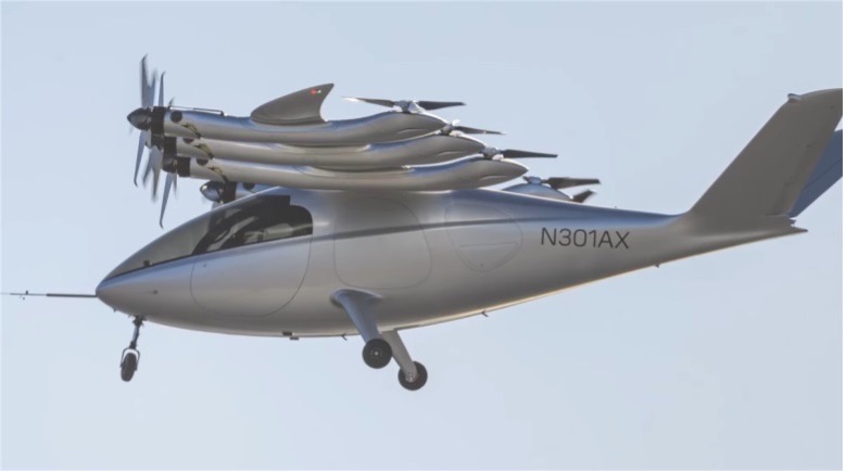
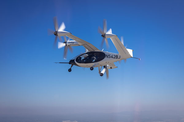
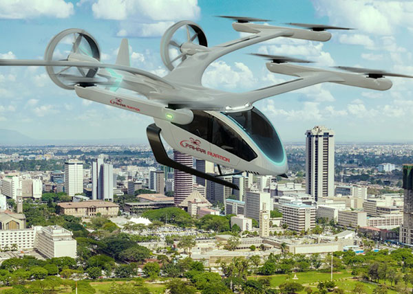
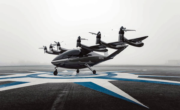
    The Paris Air Show rolls out this week, accompanied this year by several urban air mobility (UAM) companies, including Eve Air Mobility with a cabin mock-up of its eVTOL, and demonstrations of its UAM software.

    Eve also announced ahead of the show that United Airlines, its major partner, is moving forward with route and infrastructure planning in San Francisco — where such factors as the size of the city and high traffic volume cry out for mobility alternatives.

    Eve UAM. (Image: Eve press release)
    Eve UAM. (Image: Eve press release)

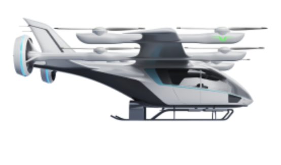
    Emerging as a start-up from within the Brazilian aircraft company Embraer, Eve was eventually floated in 2022 through an initial public offering on the New York Stock Exchange. Given the relationship with Embraer, Eve (in particular, United and other Eve customers) stand to gain access to the worldwide maintenance, support, parts and repair organization that Embraer has developed to support its own passenger fleet of thousands of aircraft. An enviable solution for any current or future purchaser of Eve vehicles — this probably has something to do with their huge order backlog for 2,770 vehicles. All that is required now is the full-scale assembly, ground and flight test, verification and certification of the Eve air mobility aircraft — currently forecast to enable a 2026 entry into service.

    Additionally, other UAM companies will be present in a special show exhibit, the “Air Mobility Event,” in Hall 5 in Paris.

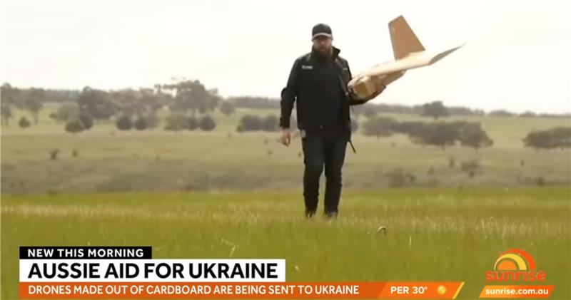
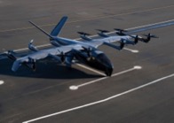
    Is Ukraine winning the UAV war with Russia?

    This is not at all clear, as both sides throw at each other many different UAVs in various configurations with different missions. We tend to only see the Ukraine side of the picture, given that Russia does not generally document its successes in the media.

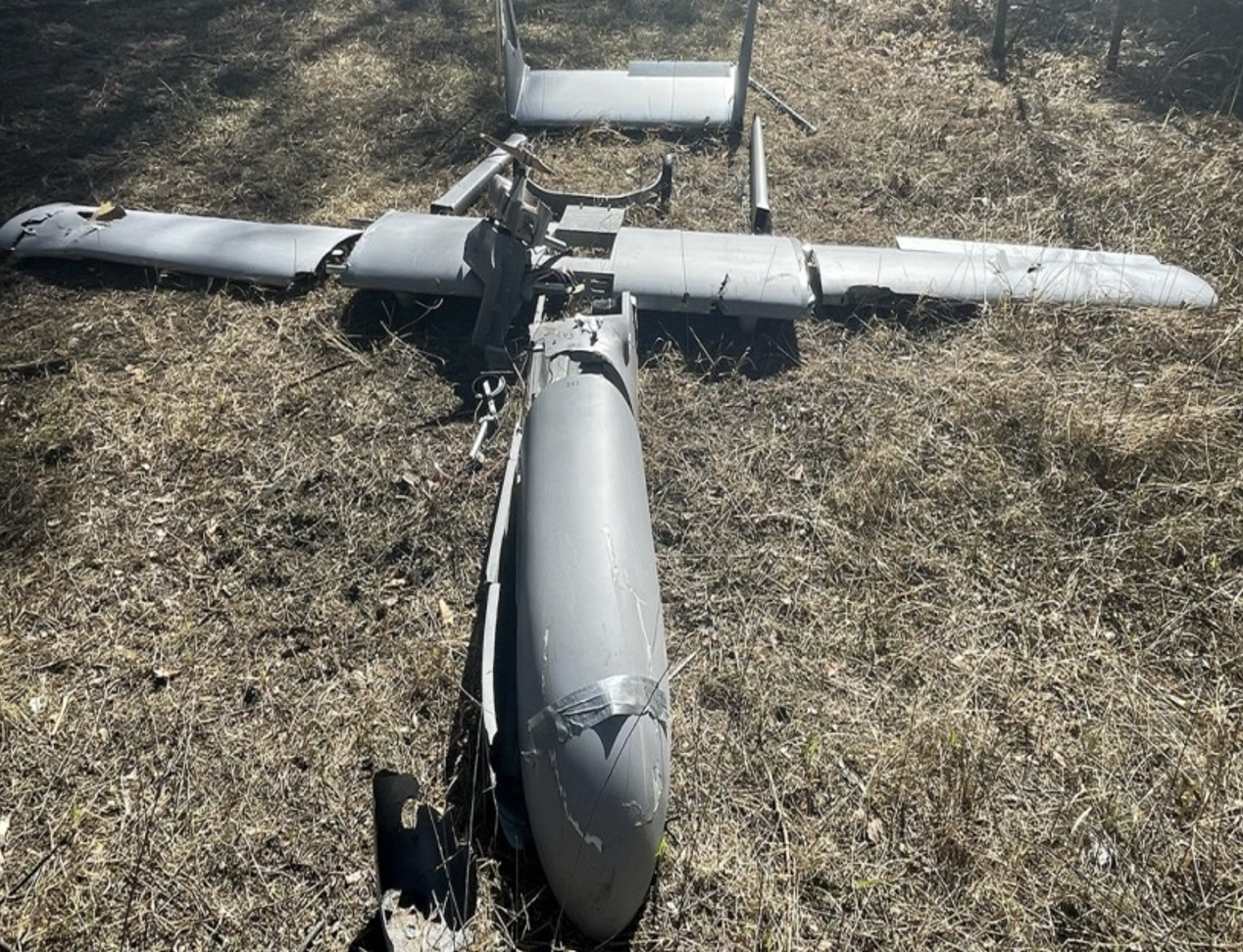
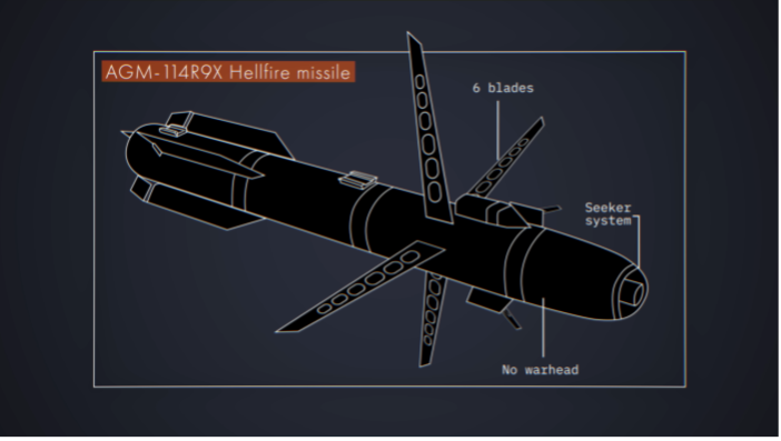
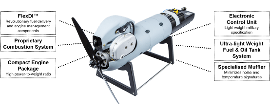
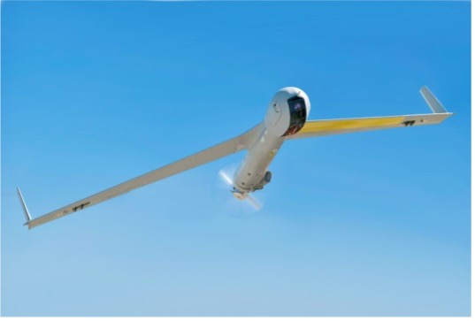
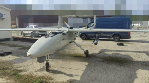
    However, recent news indicates that Moscow is importing Iranian UAV technology to bare in its war with Ukraine. It seems that Iran has been supplying complete kamikaze attack UAVs and may also be assisting with materials to set up an assembly plant near Moscow. Potential one-way attack UAVs include the HESA Shahed 136/Geran-2, the new MERAJ-523 which can carry a 50 kg warhead, and the Mohajer-6 reconnaissance/attack drone.

    Last week, Russia unleashed a volley of about 44 UAVs on the capital Kyiv, thought to be Shahed 136 kamikaze UAVs. Ukrainian defenses brought down the majority, but there were still a number of casualties. These attacks on the center of Kyiv are said to have intensified during the last two months — the UAVs are cheap, long range, and carry significant ordinance.

    Mohajer-6. (Image: courtesy of the Ministry of Defense of Ukraine)
    Mohajer-6. (Image: courtesy of the Ministry of Defense of Ukraine)

    The UK is reported to have called Iran’s actions in support of Russia contrary to the nuclear agreements reached between Iran and the European Union in October 2022, which prohibit the supply of any military aid to Russia by Iran.

    Not to be left behind, India has brought its own kamikaze UAV online

    The ALS-50 loitering munition, built by the Mumbai Tata group, was recently inducted into the Indian Air Force (IAF) for use against targets on the ground (i.e., missile batteries) and on the sea (i.e., ships).

    With an apparent range of 1,000 km (62 miles) and a payload of 25 kg (55 lb), the Indian-produced UAV will replace more expensive UAVs, which India has imported from Poland and elsewhere.

    With the war in Ukraine on the mind of all countries near the conflict, it is clear that many may take on defense strategies similar to those that have been used by both Russia and Ukraine.

    UAV news summed up

    So, as the International Paris Air Show, previously a major military exhibition and air show, begins to welcome and feature the coming age of UAM, it is good to see that there are several independent programs that plan to show their wares. Air-taxi services are still some way off from being a reality, as there are still heavy, lengthy investments to be made in building and qualifying these unmanned/manned aircraft for passenger use. Hopefully, however, several of the contenders will make it to the finish line and fulfill the promises made for UAM.

    Meanwhile, as the war in Ukraine plods along, taking lives and destroying property, it is good that both sides have decided that UAVs should be the way to proceed. UAVs, after all, are relatively small and the degree of destruction they can cause is limited. Still, this is not very comforting for people on both sides as they run from the sound of two-stroke and four-stroke engines descending from on high, carrying explosive charges that will kill and maim. Additionally, as the West arms Ukraine with defensive materials, it’s not surprising that Russia is seeking weapons from allies, wherever it can find them.

  • Spooky UAVs

    Spooky UAVs

    Photo:
    Image: georgealmanza/iStock/Getty Images Plus/Getty Images

    This month’s column is an irresistible departure from sensible, autonomous UAVs and artificial intelligence (AI) news. We’re taking a small leap into who knows where.

    How many of GPS World’s readers have interest in sci-fi, or at least are somewhat interested in the weird and wonderful stuff that shows up on some TV “reality” shows? Or maybe have a passing interest in the U.S. Navy’s Unidentified Aerial Phenomena Task Force, the U.S. Congress’s interest in unidentified flying objects (UFOs) and now the Airborne Object Identification and Management Synchronization Group (AOIMSG) of the Department of Defense (DOD)?

    Yes, this a short meandering around what we now apparently call unidentified aerial phenomena (UAP), but mostly because one of those reality shows made use of UAVs in an effort to find out how or why UAPs may be concentrated in a particular location. That’s a location in northeastern Utah where Robert Bigelow may have previously spent millions of dollars of the Pentagon’s money conducting a study on UFOs. You may have heard of Bigelow Aerospace and their efforts to build inflatable orbital space stations. Bigelow was apparently intent on finding a logical answer to the UFO phenomenon and may have been involved for a while in the gathering of UFO sighting data on behalf of the Federal Aviation Administration (FAA).

    The UFO/UAP flame has apparently been carried since around 2020 by a “scientific team” that puts out a regular TV program called “The Secret of Skinwalker Ranch,” which is broadcast on the History channel. There is a side of this program that also tries to deal with apparent paranormal “giant-red-eyed-wolf” activity at this location, but for today’s story, we are focusing on slightly more plausible, significant scientific efforts to identify UAP phenomena, not the less likely investigation of worm-holes at a site on the ranch (there goes all credibility, but please keep reading).

    The cast of this show includes lead investigator, actor/scientist, Dr. Travis Taylor, who has two doctorates and three master’s degrees in engineering, physics and astronomy. He’s been involved with and has authored several articles in scientific journals, as well as nonfiction books and novels, appeared in TV presentations and worked for NASA and DOD on various programs.

    The instruments of choice for this effort include forward-looking infra-red (FLIR), hand-held and UAV-mounted thermal and HD video cameras, wide-band frequency synthesizers and monitors, lidar scanners, and a data acquisition and display system that collects and analyzes all of the outputs of these systems, and GPS data. So, somewhat serious tech.

    There are two areas on the ranch where UAP activity has been observed and has even been apparently stimulated by launching short-range rockets: a triangular intersection of three pathways or roads — referred to not surprisingly as the “Triangle” — and a field some distance off to the east, both at the foot of a mesa or flat-topped, raised area of land. As a side investigation, there were earlier efforts to determine what might lay buried inside the mesa, via video poked inside small caves, and then a horizontal drilling rig that apparently turned up exotic material similar to heat-shield re-entry coatings on spacecraft. This may be another diversion from the true search for UAPs, but then again maybe not.

    Finally, some UAV involvement — a UAV aerial survey of the whole 512 acres of the Skinwalker site was carried out collecting data over a seven day period by VCTO Labs in Washington state with GPS RTK, acquiring the necessary 1 cm accuracy for a 3D model created by PIX4Dmatic processing.


    Photo:
    DJI M300 embarks on Skinwalker aerial survey.
    Image: Pete Kelsey

    About 32,000 images were captured and the resulting 3D model is now used as the geolocation truth model for the site. Nevertheless, surveying efforts over the last three years may have been hampered by the loss of three UAVs, thought to be due to some form of electromagnetic interference that brought them down.

    When the team focused on the Triangle, there seemed to be one “anomaly” of some description at the center of the area at about 2,500 ft. So, to stimulate the anomaly or to create some sort of reaction, high density lasers were located at the corners and focused at about 2,500 ft. With these beams highlighting the suspect area, a large rocket was fired straight up toward the focus point. After a launchpad explosion that destroyed the first rocket, another was hustled into position, and launched successfully. At about 1,000 ft, the rocket was diverted some 30° off to the side, with no apparent high-level winds or other apparent influence, perhaps from some sort of guidance error.

    As a follow-up and to gain more insight into another anomaly found flying a hand-held lidar in a helicopter at 300 ft above the triangle, it was decided to bring in a UAV lightshow by Sky Elements Drone Shows — an outfit based in Fort Worth, Texas, associated with SPH Engineering in Riga, Latvia. They run a heap of UAV shows in the United States and ran a recent 600-UAV show for the coronation in the United Kingdom and claim to have worked in 75 countries around the world. The object of the UAV show at Skinwalker was to see whether any “anomalies” would affect UAV guidance, and obviously many lighted UAVs in formation at altitude would make for good TV. The show uses a GPS RTK set-up, and the drones are guided by u-blox M8P GPS/GLONASS GNSS receivers.

    So, with a rocket launched and the 1.6 GHz signal detected — it may have also been rebroadcast — the Sky Elements UAVs were powered up, lit up, lifted off and flown to altitude above the Triangle. All seemed well with all 200 lighted UAVs hovering in the night sky until a couple of UAVs “disconnected” — presumably from the 5 GHz Wi-Fi control channel, which has a secondary 915 MHz back-up. Then pandemonium erupted as the whole UAV display collapsed from the middle section, and the UAVs returned to the ground. To be sure, the 200 lighted UAVs were spun up again, flown up to altitude, and after a few minutes, the drop-out happened again as the fleet of UAVs returned to the ground.

    The UAV show was moved to the notorious East Field and everything was repeated. However, other than what looked like a timing error as one UAV left early and was joined at altitude by the rest of the two hundred UAVs, no anomalies disturbed the formation.

    The Skinwalker research team had instrumented the four corner UAVs of the display with a separate GPS receiver (and radio link?), so that their recorded position data could be used for subsequent analysis. Therefore, when the team huddled round the replay of the Triangle show in their control room, they had access to the UAVs’ location data from all the UAVs and the GPS location information from the four corners. Unfortunately (for our purposes) or fortunately (for the team), as the video/data analysis ran, a UAP was noticed flying over the proceedings. The image was clear enough for Travis Taylor to come up with a drawing of it, similar to a foreshortened dumb-bell.

    Other than noting that the GPS altitude data for the UAVs that landed had been recorded as negative, or below the surface of the ground, the drone show analysis was put aside for extensive review of the UAP video — after all, the whole effort is prioritized to stimulate and analyze UAP anomalies, right?

    So, what could we make of all this? Certainly, for me, the presence of the 1.6 GHz signal seems to be an indication that the UAVs’ GPS receivers and the GPS RTK reference receiver may have been jammed at L1. However, for the UAVs to return to their ground location, they may be programmed to do so when GPS guidance is lost.

    So, why didn’t they behave the same at the East Field? Perhaps the jamming signal was localized at or near the Triangle? So, the next step would be to determine where this 1.6 GHZ signal originates. If it is re-broadcast by the team it might be a good idea not to do so. The u-blox M8P receiver includes GLONASS, but it doesn’t sound like there was associated RTK for GLONASS, so when GPS RTK was lost, GLONASS positioning alone may not have been able to meet the requirements of formation flight. So, the UAVs probably default to return-to-base logic, even though they may dead-recon back to the ground?

    I asked my friends in Latvia whether they could confirm this layman’s hypothesis, but they needed the logs stored on the UAVs from those shows, and they were not apparently downloaded. It seems like there might be an opportunity for a re-run with post-show access to the individual UAV logs.

    What about the analysis of the apparent UAP? Now, I must go watch more Skinwalker Ranch shows.

  • UAV and AI update

    UAV and AI update

    A couple of stories about unmanned air vehicles in the war in Ukraine and a response to the recent Open Letter by the “Future of Life Institute” with more than 200,000 signatures on advanced AI, which urged a six-month moratorium to allow the development of seemingly much needed AI regulations.


    The war in Ukraine

    It has been reported that Ukrainian forces were operating the commercially available Chinese Mugin 5 UAV, presumably for surveillance of Russian forces inside Russian-occupied territory. The Mugin 5 can be bought commercially for $10-15,000 and is manufactured by Mugin, which is based in the port city of Xiamen, on China’s eastern coast. In a previous statement posted on the company’s website on March 2, Mugin Limited said that it “condemns” the use of its products during warfare and that it ceased selling products to Russia or Ukraine at the start of the war. However, Russian forces claimed in January 2023 that it had actually shot down one of these Chinese-made UAVs being flown by Ukrainian forces over their territory.

    Then, just this week, Ukrainian forces apparently were able to track a low level, slow-moving air vehicle coming at them from Russian occupied territory. After some time, they were able to intercept the UAV, which carried a flashing navigation light, from the ground, and were able to bring it down using small arms. The remains of the crashed UAV were found in a clearing in the forest; a single 44 lb bomb was removed from the wreckage and safely exploded by the Ukrainian team.

    Weaponized Mugin 5 following crash in Ukraine forest. (Image: Screenshot from video from Kanal13 Youtube)
    Weaponized Mugin 5 following crash in Ukraine forest. (Image: Screenshot from video from Kanal13 Youtube)

    Somewhat worse for wear, the Mugin 5 UAV appears to have been held together in places by duct tape and other patches. Is it possible that having shot down a Ukrainian surveillance UAV the Russians recovered these remains and crudely restored the unit to flying and navigating capability, then sent it back to Ukraine owners carrying a bomb? Anything is possible in this conflict.

    Staying with this conflict and the use of UAVs by both sides, its seems that Australia has come up with a low-cost surveillance UAV that is virtually undetectable and it’s proving quite popular with the Ukrainians. Most defensive detection involves some form of radar scanning, which relies on radar returns bouncing off a flying target. The Australian company SYPAC in Melbourne has developed the Corvo Precision Payload Delivery System (PPDS). It is a wax-coated cardboard UAV, held together with elastic bands and glue, but carrying sophisticated guidance and control electronics.

    Image: Screenshot of video posted by 7 News Australia 
    (Image: Screenshot of video posted by 7 News Australia)

    SYPAQ has developed the CORVO UAV under an AU $1.1 m government contract with the objective of creating a low-cost, disposable UAV to deliver urgent needs — such as medical supplies or to resupply small arms ammunition to the Australian military. CORVO is autonomous once launched, using GNSS guidance, or dead reckoning if GNSS signal is lost or jammed. Apparently, hundreds of these disposable UAVs have already been shipped to Ukraine.

    While a surveillance role was originally envisaged in Ukraine, it is reported that, “They have been very good at inflicting lots of damage on the enemy,” according to Ukraine’s ambassador to Australia. So, CORVO UAVs may well have already been weaponized.

    Open Letter on AI development

    Following a recent open letter supported by Elon Musk and Steve Wozniak that proposes a six-month halt on advanced AI development, I was recently approached on behalf of Professor Ioannis Pitas, director of the Artificial Intelligence and Information Analysis (AIIA) lab at the Aristotle University of Thessaloniki (AUTH) and management board chair of the AI Doctoral Academy (AIDA) with somewhat different views.

    In order to further the on-going discussion, I thought it would be appropriate to give some space to an alternate view on AI development. So here are some paraphrased comments approved by Pitas:

    Could AI research be stopped even for a short time? It is doubtful. Further AI progress is necessary for us to transition from an information society to a knowledge society.

    Maybe we have reached the limits of AI research carried out primarily by Big Tech, which appears to treat powerful AI systems as black boxes whose functionality may be poorly understood.

    It seems that the open letter reflects welcome and genuine concerns on social and financial risk management. Are expensive lawsuits in an unregulated and unlegislated environment inevitable as a consequence of ill-advised AI pronouncements?

    However, it is doubtful whether the proposal for a six-month ban on large-scale experiments is the solution. It’s impractical for competitive commercial and geopolitical reasons, with very few benefits.

    Of course, AI research can and should become more open, democratic and scientific.

    Here are a number of suggested options:

    • Should elected parliaments and governments make the important decisions on AI rather than corporations or individual scientists?
    • Every effort should be made to facilitate the positive aspects of AI social and financial progress and to minimize any negative aspects.
    • The positive impact of AI systems can greatly outweigh their negative aspects if proper regulatory measures are taken.
    • It is possible that the biggest threat is that AI systems could deceive too many people who have little related knowledge. This can be extremely dangerous.
    • We should counter the big threat coming from the use of AI in illegal activities — cheating on university exams is a rather benign use — while the possibility of criminal exploitation may be very much worse.
    • The impact of AI on labor and markets will be very positive in the medium to long term.
    • AI systems should be required by international law to be a) registered in an ‘AI global register’, and b) users should be notified when they converse with or use the results of an AI system.
    • As AI systems have a huge impact on society, and in order to maximize their benefit and socio-economic progress, it is recommended that:
      o advanced key AI system technologies should become mostly open
      o AI-related data should be at least partially open.
    • However, strong financial compensation schemes should be established now for AI technology developers to compensate them for any component that becomes open source.

    Well, this is a bit of a departure from our nominal UAV/AI report, but there does seem to be a growing number of voices calling for some form of AI regulation and more extensive discussion might well help this movement come to a conclusion. And it would seem that the U.S. administration is listening, as the U.S. Commerce Department has announced that it is seeking inputs from interested parties for methods to test the safety of AI systems — to ensure that they are “legal, effective, ethical, safe and otherwise trustworthy.” In order to enforce these standards, the department is investigating whether audits and inspections to certify AI systems should be required before their release on the unsuspecting public.

    The U.S. Commerce Department is apparently not alone in these concerns, as China is also looking to ensure that systems such as Alibaba Cloud’s Tongyi Qianwen, a competitor to OpenAI’s ChatGPT, are socially beneficial. Meanwhile, following the release of ChatGPT and similar products from Microsoft and Google, awareness has grown of the capabilities of the latest AI tools that generate human-like text passages, and even new images and video. The UK Department for Science, Innovation and Technology and the Office for Artificial Intelligence on the other hand, seem to be looking for an approach to regulation that will not restrict AI innovation.

  • UAVs doing the dirty work in war and nuclear inspections

    UAVs doing the dirty work in war and nuclear inspections

    Now that balloon-season appears to be ending, unmanned aerial vehicles (UAV) are seeing more use in the war in Ukraine. With the delivery of an updated fast transport craft to the U.S. Navy, autonomous ship operations are expected to be tested extensively. In addition, use of collision-protected UAV is demonstrating high returns for nuclear facility inspections.

    UAVs used in Russia-Ukraine war

    UAV attacks on Moscow seem to be escalating. A Ukrainian UJ-22 UAV allegedly crashed March 2 near the village of Gubastovo, about 60 miles from Moscow. It’s not clear what the intended target was, or whether the UAV was armed, but an undamaged Gazprom gas plant is close to where the UAV crashed.

    The UJ-22 UAV has a maximum range of about 500 miles. Therefore, to maximize its range, it’s unlikely that a big payload was onboard. It may have been just an attempt to assess how far the UAV could penetrate Russian airspace and which targets are in range from Ukraine’s border.

    In an earlier apparent UAV attack, the Krasnodar oil facility about 500 miles from the Ukraine border was damaged. A group of Belarusian partisans announced that it attacked and damaged a Beriev A-50 Airborne Warning and Control aircraft (called Mainstay by NATO) using UAVs at the Machulishchy airfield near Minsk, escaping back into Belarus without incident.

    The peaceful use of UAVs for the good of humanity seems to be taking a backseat in the escalating Russian-Ukraine conflict, where armed UAVs are enabling previously unheard-of incursions. Russia will likely respond, hopefully limiting action to legitimate military targets as Ukraine has done. However, the existing Russian stock of Iranian-made Shahed 136 “loitering munition” and the Mohajer-6 reconnaissance UAV might be running low. Ukraine has shot down at least 24 Shahed 136 UAVs through January and February and Russia has recently reduced its UAV attacks on Ukraine.

    US Navy relies on autonomous capabilities

    The U.S. Navy is making great strides in its efforts to incorporate ships with autonomous capability into its fleet. Several developments initiated in 2008 have led to the creation of a fleet of 12 Spearhead EPF Expeditionary Fast Transport ships built by Austal USA. The latest ship, the USNS Apalachicola EPF-13, has been outfitted during build with complete autonomy and has just joined the fleet. The EPF fleet is designed for the rapid deployment of troops, tanks/armaments and heavy equipment. The latest EPF-13 — built by Austal USA, L3Harris and General Dynamics Mission Systems — has a range of 1,200 miles, can accommodate the V-22 Osprey tilt-rotor aircraft, and clocks in at a maximum speed of 40 knots.

    Image: Austal USA
    Image: Austal USA

    The earlier ships incorporated automation of hull, electrical and mechanical/power systems, which are all now accessible on the bridge. The latest EPF-13 has added automated maintenance, health monitoring and mission readiness. The EPF 13 Apalachicola comes with the ability to run independent unmannered operations for up to 30 days. At 337 feet long and displacing 362 tons, the EPF can carry up to 600 tons of weapons and equipment, while running a draft of less than 15 ft. Alternatively, EPFs have sufficient capacity to transport 312 soldiers over short distances, plus a crew of 41 when fully manned.

    Inspecting nuclear facilities with UAVs

    Clean-up operations at nuclear waste facilities are continuing to use UAVs for inspection and assessment of locations that are difficult to access and potentially contaminated. Flyability intends to add a Miron RDS-32 radiation sensor to its Elios-3 UAV family to gather in-situ radiation measurements while inspecting complex confined spaces at nuclear sites.

    In recent activity at a nuclear plant, an annual inspection of three tank rooms and collection of detailed visual video of a suspected leaking valve were readily accomplished in two UAV inspection sessions of a few minutes each.

    The previous manual inspection process required the plant output to be reduced to 20% of normal capacity over a six-hour cooldown. When radiation levels became low enough, two inspectors dressed in protective gear climbed down into the first tank room where radiation levels exposed each person to around 250 millirem (2,500 µSv or about 10% of the allowed annual exposure). They took a few still pictures and measured radiation levels, then exited each hot area before repeating the process for the other two tank rooms. The whole time, the productive output of the plant was significantly reduced. Another six hours was required afterwards to restore the plant back to full output, never mind that personnel were exposed to a bunch of radiation.

    Flyability’s solution is to fly an Elios UAV down into each tank room, take high-resolution video of the entire area in 1-2 minutes and repeat the process for each of the other tank rooms, without reducing plant output power. For detailed inspection of the suspected valve, the UAV was flown deeper into the reaction vessel. Detailed video was collected and the UAV was extracted — all within about 10 minutes.

    The bottom line is that generation of around 4.8 GW of power, worth maybe $456,000, was saved using the Elios UAV inspection approach. No one was exposed to the higher radiation levels inside the facility, and significant time was saved for both the annual and suspected valve inspections. Incidentally, the valve in questions was cleared of any potential leaks.

    Conclusion

    In summary, developments in autonomy include use in the Ukraine-Russian war, more ship automation for the U.S. Navy, and more efficient inspection of nuclear facilities.

  • Balloon sparks intrigue

    Balloon sparks intrigue

    Feb. 4 saw the news networks alive with sometimes wild reports about UFOs, UAVs and then a balloon. Balloons are used for weather forecasting on a regular basis, launched daily into the stratosphere with payloads gathering wind speed and direction, temperature, humidity, pressure and, of course, position.

    Synchronized twice a day at about 900 locations around the world, balloons are released into the stratosphere gathering essential atmospheric data to feed our weather forecasts. Reaching altitudes of 20 miles, these balloons often drift on winds as far as 125 miles from the release point, broadcasting measurements from their onboard sensors.

    At first, maybe North American Aerospace Defense Command (NORAD) thought the balloon crossing into Alaska’s airspace was just one of these high-altitude weather prediction vehicles. Aircraft were apparently scrambled, and initially it was decided there was no threat, so the balloon was allowed to continue and enter Alaskan airspace. It was detected and subsequently tracked by both the United States and Canada for some time as it continued to drift on the jet stream over the border into the lower 48. Then, people in and around Billings Montana (home to one of the nation’s three nuclear missile silo fields at Malmstrom Air Force Base) started to send in reports of a very large balloon high overhead — according to one observer with a high-resolution camera, it even seemed to be stationary for 35 minutes.

    Apparently, by the time the good folks in Montana were looking up, the Pentagon had decided the balloon was a Chinese surveillance vehicle. To get this detail, one or more U-2 high altitude reconnaissance aircraft had been dispatched to investigate. The collected U-2 information spotted markings of a Chinese manufacturer on the 200-foot-tall balloon. A payload the size of a small passenger jet dangled some 20 feet below the balloon canopy. It had several antennas of various configurations. A huge solar panel was attached — presumably to power its suite of surveillance sensors.

    The Federal Aviation Administration (FAA) ordered a ground stop for all aircraft traffic at the Billings airport while decisions were made about downing the balloon or allowing it to proceed.

    Meanwhile, it may seem obvious that both the United States and China have developed, launched and make use of surveillance satellites. I imagined that a couple of dozen of these space vehicles would be buzzing over not only each other’s landmass, but also surveilling dozens of other countries as they orbit the whole planet.

    What I found was a report that China had at least 260 such orbital observation platforms in 2022, and the United States has even more. Isn’t that enough without resorting to lower-tech balloons?

    It’s possible that some electronic transmissions are short range and would not be detected by surveillance satellites operating in geosynchronous orbit (22,000 miles out), or even at 300 miles where the International Space Station (ISS) and most surveillance satellites hang out. So, a slow-moving balloon at 20 miles up might be ideal to “sniff” ground transmissions from sensitive military installations, and if you could control the balloon to hover, all the better to pick up radio signals. Could the gathering of transmission data somehow be used to geo-locate the source? It’s something the U.S. military may be working on, too, as it is reportedly also building a fleet of autonomous dirigibles and balloons.

    According to press reports, the United States decided not to immediately take down the balloon, even though it subsequently discovered its surveillance capabilities. Not only was there concern over debris falling on populated areas but allowing the balloon to continue its flight over the United States provided an opportunity to observe its behavior and gather useful information. U.S. bases along its path apparently shut down all communications in sequence, as the balloon passed overhead.

    The balloon was apparently found to be transmitting – presumably reporting on where it was and what it had detected. But, at some time transmissions ceased, possibly when U.S. Air Force activity was detected nearby.

    The take-down off Myrtle Beach

    An F-22 flew to almost the same altitude as the balloon and fired an AIM-9X Sidewinder missile into it, leaving the payload to tumble from 60,000 feet into the shallow (50-foot deep) Atlantic Ocean off Myrtle Beach, South Carolina. Recovery boats were already on hand to pick up the collapsed canopy, and to begin locating the electronics payload on the seabed. At time of writing, the U.S. recovery effort has yet to inform us on finding the key electronic payload, which would go a long way to confirming the intended mission for the balloon.

    Image: Screenshot of CNN news coverage
    Image: Screenshot of CNN news coverage

    Strange, but a couple of days later over Canada, F-22s were again in action to take down a “cylindrical object” detected at 40,000 feet — an altitude posing a danger to airline traffic. Little has been released on what this object might have been — could it possibly be a re-entering piece of space debris? Again, debris recovery and analysis is underway, and we patiently wait for a public report about what this was all about.

    What have we learned?

    Both China and the United States operate huge fleets of surveillance satellites gathering intelligence daily about each other’s capabilities and those of other countries. Both China and United States have also invested in surveillance balloons, but China is the only country to send one over U.S. territory.

    There may have been earlier balloon incursions, which are only now being reported. The U.S. response was initially to determine the configuration of the balloon and its payload, then to allow its journey along the jet stream to continue. The United States has said the balloon did not uncover anything already available by other means, but recovery and analysis of the payload would presumably confirm this announcement.

    China is not happy about the U.S. takedown of a harmless, stray weather balloon. And what the heck were F-22s shooting at in Canada?

    We’ll tell you more when we learn more….

    Tony Murfin

    GNSS Aerospace

    Editor’s Note: Since the initial instance of an unidentified object floating across U.S. airspace — later identified as a Chinese surveillance balloon — three additional unidentified aerial objects were spotted in North American airspace. One was spotted in Alaska, one in northern Canada and one over the Great Lakes region. All three were shot down by U.S. fighter jets out of caution.

  • Unmanned and autonomous news

    Unmanned and autonomous news

    Browsing through the news from the Consumer Electronics Show (CES) in Las Vegas last week, there seems to have been the regular number and variety of ‘robots’ demonstrating various capabilities from basic movement to almost complete human-like animation and speech. There were also a few more demos related to navigation and autonomy that could be of more interest to our readership. In particular, the case was made for more extensive use of drones for deliveries and in agriculture.

    Apparently, the FAA was at the show – promoting the use of unmanned aerial vehicles (UAV) for ‘last mile’ deliveries. The gist of one presentation was that UAV deliveries could possibly reduce the need for people to drive to a store for a pick-up. If we drive, we periodically have accidents – probably someone has estimated the probability that anyone getting into a vehicle will have an accident and suffer varying degrees of damage to property, life or limb.

    So, if drone and automated ground vehicle deliveries were to be universally accepted and implemented, lives would be saved, people’s lives wouldn’t be as disrupted and costs for hospital care and vehicle repairs would be reduced. All good, right? However, people are still not sold on UAV flying over their neighborhoods because they might fall out of the sky and hurt someone or damage property, make lots of noise and disturb their peace and quiet or use the opportunity to invade their privacy. Therefore, delivery start-ups are still struggling through FAA and local red-tape to get airborne — which at this stage is probably not a bad thing — as we get safety objectives straight, and train people well enough to reduce error rates to below acceptable limits.

    Another example used by the FAA at CES was the health risks for pilots of crop spraying aircraft, which are largely used on medium to large scale farms in the United States. The health hazard of the pesticide spray and aircraft accidents during aircraft crop dusting — rapidly, repeated ‘swoop’ to low over the field, low level overflight to spray, then rapid climb and turn maneuver — could be largely avoided by UAV spraying systems, which have already been implemented in many countries around the world. The problem, however, is that the adoption of UAV spraying has perhaps been slower than anticipated.

    Photo:
    A UAV delivering groceries. Image: Walmart
    Photo:
    Crop dusting. Image: Stefan Krause


    Crop dusting aircraft can apparently treat about 600 acres/day on larger farms, while drones are only able to carry much smaller spray tanks, with a capacity of about 8 gallons, which enables spraying of 30 acres-per-hour. In addition, batteries on UAV need to be exchanged regularly, hopefully at the same time as spray tanks are refilled. While one pilot flies a crop duster aircraft, a UAV operation not only requires a skilled pilot to fly the UAV, but also a line-of-sight observer under FAA regulations. So, labor costs are higher, somewhat offsetting the lower operational costs of a UAV.

     Nevertheless, the limited number of crop dusters requires scheduling out days, several weeks even in the busy seasons. Whereas, if you own an agricultural UAV only the weather determines when you can treat your own crops.

    So why is it taking time for this alternative approach to take off?

    Let’s say you buy your own small UAV — one capable of 1-2 gallons-per-acre for a small farm. You would first need to take an operator’s course and qualify for a pilot’s license, then you would have to work city hall to obtain an aerial applicator’s license and a state pesticide applicator’s license. Then you would have to pass an FAA physical, and maybe obtain an exemption to fly a UAV over the standard 55 lb weight. If you wanted to fly after dark, you would also need a night operator’s license. If you wanted to fly several UAV simultaneously (a swarm) to get the job done quickly, you would need to train and become qualified. These things are a significant barrier to entry for individual farmers. Therefore, companies are springing up that will charge equivalent prices for turn-key UAV crop applications as for aerial crop dusting – say between $11 -14 per acre.

    Photo:
    Autonomous AG-116 crop-spraying drone. Image: Hilio

    UAV do have a place in the business of agriculture for crop spaying, even alongside conventional crop-dusting aircraft, and costs seem to be competitive if a farmer were to buy turn-key spraying. The obstacles to overcome for someone to start a UAV spraying business seem somewhat prohibitive, but companies are taking on the challenge and offering services. Farm owners who want to manage their own regular pesticide and fertilizer applications using their own UAV have a steep learning curve to climb.

  • UAVs evolving into air taxis

    UAVs evolving into air taxis

    One of several derivative branches from unmanned air vehicles and their technologies is electric aircraft and air taxis. Referred to as eVTOL (electric Vertical Take-Off and Landing), a class of manned and unmanned aircraft is being developed and certified for short-hop passenger transit from down-town ‘Verti-Ports’ to classic airports, aimed at improving the economics and reducing the noise footprint of current helicopter services. Urban air transport is undergoing significant change as organizations such as United Airlines, Delta, American Airlines and others plow money into electric aircraft and the development of manned and unmanned air axis.

    Archer Aviation is developing two such aircraft, with ‘Maker’ being the first cut flying test-bed, and ‘Midnight’ its so called ‘first production version.’ The vehicle design is similar in that they both have wings and are powered by six lift propellers and six tilting props that rotate vertically to lift for take-off and landing, then transition to horizontal for forward flight.

    Photo:
    Image: Maker in forward flight/Archer
    Photo:
    Image: Midnight/Archer

    In the past, Archer has been somewhat secretive about its air-taxi program, but with the introduction of Midnight on Nov. 17, and with Maker achieving transition from hover to forward flight on Nov. 20, they released some useful information. Lift to forward transition is a big step for eVTOL, with the potential for a major set-back, almost like an irrecoverable stall for a fixed wing aircraft.

    There are six battery ‘packs’ mounted in the wing near the engines – batteries, engines and FAA certification are key focal areas in their program, with fault tolerance and endurance being key considerations. An existing lithium battery has been selected following extensive testing, with a design objective of 10,000 average 20 mile trips, each trip with a 10 minute recharge cycle.  Two similar electric motor types are used, with 95% commonality, and flight can allegedly be maintained through one complete engine or propeller failure. Each engine has redundant elements allowing one side to fail while still maintaining full operation. All these redundancies support the Archer plan for FAA certification which has now progressed through ‘Certification Basis’ and ‘Conceptual Design’ to ‘Preliminary Design’. There are many steps still to complete, with certification not anticipated until at least the second half of 2024.

    Meanwhile, Joby Aviation has been making significant progress with its flying prototype and pre-production aircraft, with the objective of developing a flying rideshare platform. With space for four passengers and a pilot, the Joby aircraft is smaller than the Archer vehicle, however smaller size means less weight and complexity and requires fewer lift props. The Joby vehicle has six large props that all transition from vertical for take-off and landing to horizontal for full forward flight.

    Photo:
    Image: Courtesy of Joby
    Aviation. (c) Joby Aero, Inc.

    Joby developed its own lithium-iron batteries and dual redundant electric motors and while developing flying prototype and pre-production aircraft, has also focused on teaming with key industrial partners who are assisted in key areas:

    • NASA has undertaken a study with Joby on 5 potential route configurations at Dallas/Fort-Worth airport for eVTOL traffic.
    • The US Department of Defence has provided flight range and facilities to enable airborne testing of the Joby prototypes. This contract has just been modified so that US Marine Corps personnel may flight test Joby’s eVTOL to evaluate DoD use-cases for the aircraft.
    • The company ‘Uber Elevate’ was purchased by Joby and is now integrated as the future provider of trip access for customers.
    • Toyota has not only invested in Joby, but is providing essential production facility knowledge and guidance as Joby begins its initial build out of volume manufacturing.
    • Delta has invested an initial $60 million, which could increase to $200 million provided progress towards certification and service entry meets certain milestones

    Other eVTOL notable companies entering this market include Jaunt Air Mobility in Dallas, Texas; Velocopter in Bruschal, Germany; Lilium in Munich, Germany; Kittyhawk in California; Wisk in California and New Zealand; Airbus in Toulouse, France; Ehang in Guangzhow, China; Vertical Aerospace in Bristol, England; Urban Aeronautics in Tel Aviv, Israel; and Eve Mobility in Melbourne Florida.

    So, just a small taste of two of many eVTOL hopefuls – but two with the backing of mainline commercial airlines – who knows who will actually make it through the arduous and expensive aviation certification process before the cash runs out? However, there are many significant investors who are currently standing by their selected hopefuls and others continue to jump in – let’s hope that by 2025 we’ll begin to see home-airport air-taxi services underway.

  • Drones key to Hurricane Ian response

    Drones key to Hurricane Ian response

    A photo taken in the aftermath of Hurricane Ian shows the massive destruction on Fort Myers Beach. (Photo: felixmizioznikov/iStock/Getty Images Plus/Getty Images)
    A photo taken in the aftermath of Hurricane Ian shows the massive destruction on Fort Myers beach. (Photo: felixmizioznikov/iStock/Getty Images Plus/Getty Images)

    Not to harp on an event that’s already passed out of the headlines and national coverage, but Hurricane Ian — a Category 4 storm that hit Florida in September — was full of destructive winds and caused major damage that could be with us for years before things get fixed. One source also indicated that so far we have lost 157 people, mostly from drowning — nothing will ever fix those losses.

    So harp on I will, especially about the role drones and drone pilots played in rescuing survivors, and determining and mitigating effects of the storm.

    The place that took the hurricane hardest was Fort Myers on the southwest Florida coast. The following video is from a security camera.

    While Hurricane Ian was making a mess of Cuba and crawling over the Caribbean and into the Gulf of Mexico, drones were already flying over areas where the storm could cross from the Gulf onto land — initially forecast around Tampa. But the forecast landfall continued to drift south, over where I live in Venice and 150 miles south of Tampa to Fort Myers.

    Before landfall, drone operators in Fort Myers were gathering video/geolocation information on buildings and streets in the path that the forecast 14-foot storm surge might take. They identified areas of potential damage and places people might need rescue.

    Map plotting the storm's track and intensity using data from the National Hurricane Center and a NASA image. (Image: public domain/FleurDeOdile/Wikipedia)/
    Map plotting the storm’s track and intensity using data from the National Hurricane Center and a NASA image. (Image: public domain/FleurDeOdile/Wikipedia)/

    After the storm hit, first responders began searching more than 400 destroyed houses in Fort Myers, some using the pre-storm drone video to rescue any trapped survivors.

    The need was not only for access in difficult conditions, but also for communications. AT&T reportedly got cell coverage up quickly in a couple of areas, and Verizon flew tethered drones (capable of flying for up to 1,000 hours) to restore phone coverage over a circular radius area of five to seven miles. Verizon also hooked up generators and engaged satellite internet coverage for local use, and took a portable cell-site on a barge out to Sanabel Island, which had been cut off from the mainland. T-Mobile put generators at cell-sites that lost power and deployed satellite and ground-based portable cell coverage.

    Photo: Verizon
    Verizon tethered drones provided cellular service for first responders. (Photo: Verizon)

    Powerful Drone

    Loss of power was another issue. Florida Power and Light (FPL) flew its recently acquired fixed-wing FPLAir One drone to assess damage to its power distribution infrastructure, which supplies about 12 million people on Florida’s west coast.

    FPL drone used in power loss assessment (Photo: FPL)
    FPL drone used in power loss assessment. (Photo: FPL)

    Using the drone in damage assessment efforts enabled FPL to get suitable crews to the right places early in the recovery effort.

    FPLAir One is a group 4/5 large UAV. It appears to be a Navmar Applied Sciences Corporation (NASC)/Sonex Aerospace TEROS unmanned aircraft, which is based on an earlier Sonex-powered glider design introduced in 2003. Because of this heritage and its rugged airframe, the TEROS is ideally suited for flights in high wind conditions — great for FPL’s long-range pre- and post-storm assessment application using FLIR and video cameras.

    The drone’s extensive prior airframe proving is assisting NASC/Sonex in its quest for certification of TEROS by the Federal Aviation Administration (FAA). FAA certification will ultimately support its integration into the National Airspace System (NAS) and allow operators to move on from the individual FAA approvals required for each operational drone scenario.

    Drones to the Rescue

    The principal application for hundreds of drone flights by several organizations was search and rescue for missing residents, mostly in the flooded area in and around Fort Myers. Drones also helped rescue people in North Port, where floodwater was as high as four feet, collapsing roofs and trapping people in their homes.

    Skydio provided drones for several search-and-rescue programs by police and other agencies, as well as coaching personnel who might lack experience in flying them. More than 500 drone flights were accomplished in the first days after the storm, a large number using autonomous flight capability, greatly assisting rescue efforts to locate trapped people. First responders were also able to determine whether access was possible, or what steps were initially needed to even enable access.

    Insurance companies are also using drone assessment video, determining the level of damage to homes and vehicles, in an effort to put assistance where it was most needed early on. Using artificial intelligence to align food-stamp users with badly damaged homes identified on satellite images in Lee, Collier and Charlotte counties, GiveDirectly offered immediate $700-assistance to many survivors. If all these offers were accepted, the cost could be as much as $2.4 million in no-strings-attached immediate aid for those worst hit.

    In the aftermath of the largest, most damaging hurricane to hit the United States since 1935, volunteers, first responders, drone pilots, aid agencies, and power, communication and insurance companies all made use of drones. These agencies and companies are still helping many thousands of people to survive and start the long task of picking up the pieces of their lives.

  • Estonia confiscates drones for Russia, sends them to Ukraine

    Estonia confiscates drones for Russia, sends them to Ukraine

    Plus: Visual AI radar aids drone searches, and a drone is released into Hurricane Ian

    Just when you imagine there couldn’t be any more twists and turns to the war in Ukraine, another one turns up. Some may recall that Estonian security forces caught an Estonian/Russian man trying to send drones to Russia. The Estonian government confiscated the shipment of DJI drones.

    Now Estonia has donated those drones to Ukraine for use against Russia in the ongoing war.

    Some might say that this is an example of, “What comes around goes around.” Nevertheless, everyone respects Russia’s nuclear options…

    Making Drones Smart

    It’s all well and good that we have all shapes and sizes of battery- and gas-powered drones, ones that take off and land vertically (eVTOL) or horizontally (generally, fixed-wing). But how do we make them smart enough to complete tasks on their own?

    Artificial intelligence (AI) could be the answer. Take the Boeing Loyal Wingman drone. It is being developed to fly autonomously alongside high-end fighters, and  perhaps to control other drones flying nearby. Those tasks require AI, which is being incorporated into the capabilities of drone systems.

    We also have immediate needs, such as search and rescue, security patrol and inspection (for commercial and military facilities, border and crowd control) and military intelligence, surveillance, target acquisition and reconnaissance (ISR/ISTAR). Along comes Sentient Vision Systems of Australia with a passive, software-based “visual radar” solution.

    Sentient Vision Systems uses its digital AI processing with existing visual and infrared sensors. This combination can apparently surpass human and conventional radar capability to detect and track small moving objects.

    Search and rescue at sea can be a really difficult task for people. It’s not surprising that a lot of lengthy searches end up with zilch. During a search, an aircraft flies from 20,000 feet down to 500 feet over the waves. If you have seen cabin video of air-sea searches in progress, with a searcher gazing out of the aircraft’s window for hours, straining to see something small bobbing in the sea below, it does seem like a herculean task.

    As an alternative, take a long-range (>55 nautical miles) drone, such as a Boeing/Insitu ScanEagle. Hook up the scanning search camera and high-resolution nose turret to the vidar (visual detection and ranging) processing.

    Boeing/Insitu ScanEagle UAV with vidar pod. (Photo: Insitu)
    Boeing/Insitu ScanEagle UAV with vidar pod. (Photo: Insitu)

    As a result, you have an autonomous airborne system that can find a person in the water from a distance of about 1.7 nautical miles, and spot a ferry deck from ~30 nautical miles. Insitu claims that conventional radar systems cannot do this. In 12 hours it can search an area of about 13,400 square nautical miles.

    Sentient's AI-enabled Vidar Surface sensor. (Photo: Sentient)
    Sentient’s AI-enabled Vidar Surface sensor. (Photo: Sentient)

    Several such sorties might just have found an early trace of Malaysian Airlines Flight MH370 in 2014. The Boeing 777 with 239 people on board disappeared over the South China Sea 38 minutes after takeoff on a flight to Beijing. Over three years, long-range patrol aircraft covered 46,000 square miles before the search was abandoned.

    During 2015 and 2016, pieces of the airplane began washing up on the shores of countries on the Western Indian Ocean. The search would probably not have been easy even for a fleet of ScanEagles, considering the logistics and the available range of the unmanned aircraft, but major incidents might find success with vidar-equipped UAVs.

    Into the Eye of the Hurricane

    The devastation that Hurricane Ian wrought in Southwest Florida has been terrible. A shark swimming up a street in Fort Meyers illustrates the degree of flooding left from landfall of the category 4-5 hurricane.

    Ian was the strongest hurricane to make landfall in the United States in decades, with extremely high winds and strong storm surge. I sat through the storm 75 miles to the North, and it was one scary hurricane even there. I can’t sympathize enough with the residents of Lee County, who only received a warning to evacuate one day before it hit them.

    Nevertheless, the National Oceanic and Atmospheric Administration (NOAA) had its Hurricane Hunter Orion aircraft up to investigate on Sep. 28 as the storm came in from the Caribbean. Despite bad turbulence, the P-3 aircraft flew into the upper regions of the Hurricane and launched an Altus-600 27-pound drone into the eye at 4,500 feet. With a 275-mile range at up to 100 mph, the aircraft crew controlled the small drone, using it to collect data on wind speed, pressure, temperature and humidity.

    The Orion P-3D Hurricane Hunter aircraft and the Altus-600 drone. (Photo: NOAA)
    The Orion P-3D Hurricane Hunter aircraft and the Altus-600 drone. (Photo: NOAA)

    During the two-hour mission, the Altus drone flew into the eye wall, where winds of 187 mph were detected at altitudes between 2,300 and 200 feet. It’s not exactly clear whether the drone survived.

    This radar image of Hurricane Ian shows the Altus release point. (Image: NOAA)
    This radar image of Hurricane Ian shows the Altus release point. (Image: NOAA)

    While information gathered may have assisted with the immediate forecasting for us Florida folks on the ground, the real scientific value comes from feeding the data into National Hurricane Center models for storm detection and analysis to keep us safer in the future.

    Wrap up

    To sum up, this month we saw drones destined for Russia sent to Ukrainian forces. Vidar artificial intelligence on Insitu ScanEagle drones promises huge gains for search and rescue. And, once again, a NOAA crew flew directly into the eye of a hurricane, this time releasing a drone to aid in gathering essential storm data.

    Tony Murfin
    GNSS Aerospace

  • New UAV uses: Flying air taxis and detecting landmines

    New UAV uses: Flying air taxis and detecting landmines

    Funding continues to flow into companies developing and testing electric vertical-takeoff-and-landing (eVTOL) drones — both piloted and unpiloted. Plus, the potential for clearing landmines using drones is being investigated by a team at Oklahoma State University.

    Air taxis advance with funding

    In early September, United Airlines committed to a $15 million investment in Eve Air Mobility, giving the air taxi industry another shot in the arm. The deal includes a conditional purchase of 200 and an additional 200 in options for Eve’s semi-autonomous four-passenger eVTOL aircraft. The investment is one of United’s efforts toward its goal of net zero carbon emissions by 2050.

    Eve Air Mobility is partnered with Embraer, the Brazilian aircraft manufacturer guiding Eve’s path to first eVTOL aircraft certification under the National Civil Aviation Agency of Brazil (ANAC). Subsequent approval by the U.S. Federal Aviation Administration (FAA) and the European Union Aviation Safety Agency (EASA) would then be based on the Brazilian ANAC certification program, following in the path of U.S. and European approvals of the Embraer EMB/ERJ series of passenger aircraft.

    The Eve eVTOL air taxi. (Image: Eve Air Mobility)
    The Eve eVTOL air taxi. (Image: Eve Air Mobility)

    Eve and parent Embraer also have announced a deal with BAE Systems to design an eVTOL aircraft for military and security applications. The technical details of the UAV/aircraft have been kept carefully under wraps, save for the visible use of eight lift rotors and two ducted fans for forward flight. Flight management computers, guidance, air-data, altitude sensors and high-integrity communications would likely be included in the avionics suite.

    Meanwhile, United’s prior investment in Archer Aviation and its Maker eVTOL appears to be supporting the Maker’s progress along the road to civil certification. Maker flight tests so far have apparently been limited to vertical flight; its multiple lift and tilt-rotor design has yet to be tested in transition to forward flight.

    The Maker eVTOL air taxi. (Image: Archer Aviation)
    The Maker eVTOL air taxi. (Image: Archer Aviation)

    Nevertheless, more information appears to be available on the configuration of the Maker eVTOL.  The company’s approach is to demonstrate early on that safety is a major driver for the design, with significant redundancy in the vehicle’s systems. The Maker has four flight-control computers, plus redundant control and navigation with inertial navigation, GNSS and above-ground-level (AGL) sensors, both radar and laser altimeters. Redundant communication links between sensors, flight-control computers and actuators combine to provide another level of design safety. The vehicle has six lift rotors at the back of the wing, plus an additional six main tilt-rotor lift and thrust rotors — another significant contribution to redundancy.

    In January 2021, Archer said that United Airlines ordered 200 Maker aircraft for $1 billion with an option for more aircraft worth $500 million. Archer also just got another healthy financial injection in August with United’s pre-delivery commitment of $10 million for 100 Maker-type aircraft.

    There are numerous eVTOL builders around the world. Several of note include Boeing/Wisk (U.S. and New Zealand), Joby (U.S.), Vertical Aerospace (UK), Ehang (China), Airbus (France), Lilium and Velocopter (both Germany) and Beta (U.S.).


    Drones help detect landmines

    Its difficult to imagine the extent of the problem, but there are many, many areas of the world where landmines are a major hazard to civilian life. Eventually, wars move on or die out, with not only towns and infrastructure destroyed, but significant left-over hazards to reclaiming territory once occupied by the aggressors.

    Landmines come in many flavors, but most are deadly and most kill or maim innocent people coming across them. Unexploded bombs, mortar shells and the like also can kill and hurt people, especially children. Apparently, 50 to 60 countries around the world have areas where landmines or unexploded ordnance pose a threat to civilians.

    The good news is that several organizations around the world have been using drones to survey areas suspected of being mined. The organizations send drones equipped with magnetic detection sensors a few inches above the ground. The drones geotag mine locations, and those locations go into an area database. Then another drone is sent to drop a detonator on the mine location, with the mine later exploded from a distance.

    An investigative team at Oklahoma State University is making an effort to train a drone-based machine-learning system to recognize various types of landmines and explosive ordinance. While the system isn’t aimed at detecting mines without human participation, it’s expected that drone recognition of mines could greatly improve current efforts to remove landmines, and quicken the pace at which the world can get rid of this plague of hidden explosives.

    A drone flies over a grid showing 50 types of ordinance. (Photo: Oklahoma State University)
    A drone flies over a grid showing 50 types of ordinance. (Photo: Oklahoma State University)

    The research team is working in an area they have set up with inert mines of many types to train the drones to recognize the specific type of device and geotag the location. This isn’t artificial intelligence as such; it’s using drones to find an object and geotag it, while the network to which the drone is connected recognizes from the sensor data what type of mine the drone has found.

    In the research phase, the team is feeding data into the network on lots of different types of mines and munitions,  providing the network with a model for each type of ordinance and eventually enabling device recognition in the field.

    _________________________________________________________________________

    To sum up, the rush for air taxis to become a ubiquitous resource for city travel still wends its way through the civilian twists and turns leading to civilian certification for use, with many outfits working hard to build flying testbeds and investors funding their efforts.

    Finding novel drone-assisted ways to clear the millions of landmines left over in wartorn countries is becoming a higher priority — notwithstanding Princess Diana’s efforts to draw attention to the suffering and death from landmines several decades ago. Let’s hope this goes somewhere soon.

    Tony Murfin
    GNSS Aerospace

  • Contrasting the use of drones on Mars and in Afghanistan

    Contrasting the use of drones on Mars and in Afghanistan

    NASA and the European Space Agency (ESA) have been cooking up a way to get some of Mars back to Earth, so that samples can be analyzed in detail — just like the rocks the astronauts brought back during the Apollo missions, which gave us a deeper understanding of our Moon.

    The Perseverance rover already on Mars has been seeking promising areas to investigate that might provide evidence of ancient past life, with the help of the Ingenuity helicopter drone. Recently, the two worked together to drive the rover to an old river delta, expected to be a prime location where such samples could be found.

    The rover has been drilling and saving rock and dirt samples in onboard storage tubes. The difficulty is that getting them back to Earth requires another major undertaking.

    Returning the Samples

    Termed the “Sample Return Mission,” the two space agencies have been discussing for months how best to bring the samples back, and have now refined an approach. Given that Perseverance has been so good at the job it was given, the NASA/ESA team has decided that the rover should be used for the return mission in 2030 when things would be in operation on Mars. (We’re not sure if the warranty sticker on Perseverance will still be valid in 2030, but if past performance is an indication, all the rovers have significantly outlived their initial design lives.)

    Its partner Ingenuity has graduated from proving it can fly in the thin Martian air to actually scouting routes for the large rover. Because Ingenuity has proven reliable and capable of traveling significant distances, NASA and ESA have decided that two new helicopter drones will become part of the return mission. They will be based on the successful Ingenuity design, but will be fitted with wheels, one on each of the four landing legs, to enable movement on the ground.

    They will also be fitted with a device which is capable of picking up and carrying a sample tube. Since the prototype drone helicopter was designed to be as light as possible, this infers  a substantial increase in lift capacity will be required. The original mission included a sample-collection rover, but this task will now be assigned to Perseverance, with the two sample-carrying helicopters acting as backup, if needed.

    An earlier concept had the rover dropping sample canisters behind it as it progressed around the surface for subsequent pick up. This concept appears to have been shelved for the moment. Keeping the canisters onboard the rover throughout perhaps simplifies transfer to the return lander.

    NASA Return Sample concept illustration includes wheeled helicopters. (Image: NASA)
    This NASA return sample concept illustration includes wheeled helicopters. (Image: NASA/JPL-Caltech)

    The Mars Ascent Vehicle would then carry the samples into orbit, to a waiting Earth Return Obiter, where the samples would be transferred to a return system for onward transit and atmospheric re-entry to Earth. Some of these details are a little sketchy, but there sure are a lot of moving (autonomous, robotic?) parts. This, of course, means a lot of opportunities for something to go wrong. No doubt continuing refinement of the mission will reduce the risks. The Jet Propulsion Lab (JPL) and AeroVironment designed and built Ingenuity — they may face some challenges developing the successor helicopter drones.

    Meanwhile, Here on Earth…

    Drones led the news Aug. 1, when President Biden announced the killing of Ayman al-Zawahiri in Kabul, Afghanistan. Al-Zawahiri topped the U.S. 9/11 wanted list, and his removal was all about the offensive use of drones. Presumably fired from a General Atomics Reaper variant drone at quite some altitude, two Hellfire AGM-114R9X “knife bomb”missiles took out al-Zawahiri as he stood alone on the balcony of a home in Kabul.

    This means that video/infrared from high altitude was sufficiently clear to determine that the man was alone on the balcony, presumably confirming information on the ground that his family was elsewhere. So long-distance, high-level authorization was then granted to fire on him in a foreign country now run by the Taliban.

    Suspected damaged al-Zawahiri house in Kabul (Photo: Secunder Kermani/BBC News)
    Suspected damage at the al-Zawahiri house in Kabul. (Photo: Secunder Kermani/BBC News)

    To minimize inadvertent casualties, the Hellfire R9X missile was used, which lacks explosive armaments. The weapon is a nasty piece of work, weighing ~100 lb with an inert payload, and fitted with six long knives that deploy before impact. This missile has previously been used in perhaps 11 other instances to take out terrorist individuals and minimize collateral damage.

    Bladed R9X missle lacks warhead (Image: Newsy/Bellingcat)
    Bladed R9X missile lacks a warhead (Image: Newsy/Bellingcat)

    This is another instance of how the U.S. use of military drones has become less devastating, but is still very deadly to the specific target.

    To Sum Up

    We’ve taken a quick glimpse at how NASA and ESA are planning more drones for the surface of Mars, and a much more aggressive use of drones here on Earth.

  • UK powers drones, Greece bristles, UAV tiff

    UK powers drones, Greece bristles, UAV tiff

    Industry, defense and commercial UAS news

    This month, we have developments across the globe, with drones inspecting power distribution systems and nuclear waste disposal in the United Kingdom, counter UAS (C-UAS ) systems deployed in Greece, and news of cutbacks in the UAV industry affecting two major suppliers.

    UK Turns to Drone Power

    The UK has reduced coal power generation significantly since 2013 by increasing use of natural gas, nuclear power and renewable sources. Power is distributed throughout the UK by the National Grid Electricity Transmission (NGET) via 4,000 miles of overhead high-voltage lines carried on 21,900 steel pylons. With another 330 substations to also look after, the infrastructure for power distribution in UK always has required a huge maintenance effort. This picture is likely reflected in the power distribution networks of most countries around the world.

    Helicopters have carried a large portion of the workload to enable inspection of cables and insulators, with additional necessary manual inspections taking significant effort to gain access and analyze data. Helicopter time is expensive, and manual inspection processes and data analysis are tedious and time consuming.

    Drones are being used for power-line inspection — flown manually by onsite operators — by many organizations in several countries around the world, including by FPL in Florida. But the real reduction in time and effort comes from automating the whole process, and gathering data that provides the detail necessary to assure defects are detected and operational integrity is maintained. The automation of data analysis and generation of useful reports is another area which could yield major savings, and bring rapid focus to areas needing immediate corrective action.

    A Pylon inspection automation. (Photo: NGET)
    A pylon inspection automation. (Photo: NGET)

    Hence, a 12-month trial is being undertaken involving ultimate approval by the UK Civil Aviation Authority (CAA) for beyond-visual-line-of-sight (BVLOS) multiple drone operations. Artificial intelligent (AI) analysis tools are being developed to determine critical changes in collected visual, lidar and positioning inspection data that might herald deterioration in pylon or other infrastructure components.

    During an initial test in Nottingham, an autonomous drone was dispatched with minimal instructions. It was able to find its inspection target and complete the programmed inspection in a few minutes. A manual inspection could take up to an hour for the same task. If things go well, it is not impossible to be able to project multiple drones operating with minimal human control, taking on huge swaths of pylons, cabling, insulators and other elements during regular inspections, saving a lot of time and money.

    The trials so far have also included remote inspection of the Sellafield nuclear waste decommissioning site, rail infrastructure and a telecommunications network along with investigations towards transport of medical supplies.

    Sellafield is where spent fuel ends up from the UK’s 31 nuclear power plants. Also, nuclear waste from reactors in neighboring European countries is reprocessed here. Nuclear waste is processed into 50-ton concrete blocks and spent fuel is “vitrified” into huge chunks of glass, which are encased in an outside metal jacket. Both processes minimize any emitted radiation and allow the contents to safely  cool over long term. The staff uses robots inside the facility to remotely dismantle contaminated areas and load material into 55-gallon drums, which might be further processed by robot crushing machines. No one has any real idea how all this nuclear waste could be permanently disposed of, but it’s possible most will ultimately be buried in the ground.

    This type of power might seem a “green” boon for humanity, but in a somewhat countrified area on the West Coast of England and in other similar sites around the world, nuclear waste disposal is costly and very, very long-term. The half-life of uranium is between 159,200 years and 4.5 billion years. Monitoring the waste could be a long-term task for drones, such as those now used to detect radiation inside the Fukushima nuclear plant. Certainly, there’s plenty of time to evolve improved drone detection capability for radiation monitoring.

    Greece Employs Counter-UAS against Turkish Incursions

    On a defense-related note, apparently the long-running rivalry between Turkey and Greece is, unfortunately, continuing. It seems that Turkey has been repeatedly flying its Baykar-TB2 surveillance drone over Greek islands, perhaps to monitor the movements of Greek warships or island defense installations. And Greece is a little bit more than peeved.

    Bayraktar - TB2 surveillance/attack drone (Photo: Baykartech)
    Bayraktar TB2 surveillance/attack drone (Photo: Baykartech)

    Having established a defense-related relationship with Israel in 2021, Greece has brought Israeli drone defense systems to the Greek islands, installing a “veritable umbrella against enemy unmanned aerial vehicles.” The Israeli system has a number of moving parts: detect and identify; generate related alerts; a directional jamming system that can disable drones in flight (presumably by jamming GPS or the control link); and a laser that can lock onto a small target and, if manually fired, can apparently destroy an intruder drone.

    Drone-Dome elements (Photo: Rafael Advanced Defense Systems)
    DroneDome elements (Photo: Rafael Advanced Defense Systems)

    Because of the directional, narrow beamwidth of the jammer, Rafael claims that the system can be activated within crowded civilian airspace without affecting the navigation of other users. Good news for Greece and their popular, attractive Greek island tourist destinations.

    UAV Defense Contractors Struggle — with Each Other

    Meanwhile, current economic uncertainty is apparently impacting at least a couple of UAV defense contractors: Boeing/Insitu and Orbital UAV. The two made news when Orbital, as an Australian public company (ASX symbol OEC), had to halt trading. The company was then able to reinstate trading largely because of news of cancellation of a development/production agreement with Insitu.

    Apparently, Orbital has previously been delivering two-engine versions to Insitu and was contracted to develop and deliver a third derivative engine. However, Insitu had to scale back Orbital’s work in February, given its sales of the popular ScanEagle and other UAVs may have fallen off in recent months.

    Orbital UAV Propulsion System (Photo: Orbital)
    Orbital UAV Propulsion System (Photo: Orbital)

    This has affected Orbital’s revenue forecast for the year. The company now expects to lose AUD $7 million for the year. It has subsequently prepared a claim under the supply agreement for Insitu’s Termination for Convenience of AUD $1.8 million in costs incurred in the development of the third engine program, which Insitu/Boeing disputes. There will obviously be some wrangling, but hopefully both parties will settle things amicably so as not to damage their ongoing relationship for supply of the existing two engine types.

     ScanEagle UAV (Photo: US Navy)
    ScanEagle UAV (Photo: U.S. Navy)

    To sum up, for this month we have a trial in the UK which will hopefully lead to significant savings in effort and costs for ongoing power infrastructure inspections, along with some background on UK nuclear waste disposal. Greece is bristling and defending against unwanted Turkish drone overflight using Israeli C-UAS systems. Finally, there’s somewhat negative news for the Orbital UAV engine and Insitu ScanEagle relationship — apparently, not everything in the UAV garden is roses.