Category: Machine Control / Agriculture

  • Eos Positioning announces RTK NTRIP app for Android

    Eos Positioning Systems has introduced a comprehensive RTK NTRIP app for Android that works with its Arrow line of RTK GNSS receivers. An Arrow GNSS receiver combined with the NTRIP app turns an Android smartphone or tablet into a powerful data collector capable of recording 1-centimeter accurate GIS data in real-time.

    “We designed Eos Tools Pro for the RTK user,” said Chief Technology Officer Jean-Yves Lauture. “It is, by far, the most comprehensive NTRIP app for Android on the market today, turning smartphones and inexpensive Android tablets into powerful high-precision GNSS data collection devices.“

    The app, named Eos Tools Pro, has user-configurable audible and visual alarms to alert the user of high PDOP, lost RTK correction, unacceptable correction age and several other important metrics. It supports all current and future constellations (GPS, GLONASS, Galileo and Beidou).

    To eliminate any confusion as to which GPS/GNSS device the user’s app is using, Eos Tools Pro features a dropdown menu so the user may select any receiver the Android device has been paired with.

    “The Eos Tools Pro app enables Android devices running Esri’s Collector app on Android smartphones and tablets to collect data as accurate as 1cm when connected to an Arrow GNSS receiver,” said Esri Product Manager Jeff Shaner. “It’s a big leap forward to enable Collector to serve the high-precision GNSS user.”

    Google Maps is tightly integrated with the app to display the user’s location anywhere in the world. Detailed satellite information such as a skyplot that plots each visible satellite, whether it’s being used or not, and signal strength bar graphs from each constellation are also displayed. Finally, a Terminal screen displays the NMEA data flowing and allows the user to send commands to the receiver.

    Eos Tools Pro and Arrow receivers are targeted at high-accuracy applications like GIS; environmental; agriculture; electric, gas, water utilities; surveying; machine control; and federal, state, and local government.

  • HarvestMaster releases field applicator for improved efficiency

    Harvestmaster-W

    HarvestMaster, provider of agricultural data collection solutions, has introduced a new field applicator that applies various treatments to specific field plots. The field applicator is easily controlled from within HarvestMaster’s Mirus field data-collection software using a software plugin.

    Using the Mirus field applicator plugin, users can select which treatments to apply to individual plots from within the Mirus dashboard, and can choose to control the field applicator either manually or automatically, based on GPS location. The system significantly reduces error in treatment applications and improves productivity by streamlining the application process in the field, according to Juniper Systems, parent company of HarvestMaster.

    Compatible with a wide range of research spray systems, the Mirus field applicator plugin eliminates the usual bulky and often confusing toggle switch boxes that are typically used to control field applicators. The user imports a file that specifies which formulation is to be applied to each plot, then selects whether to control the applicator either manually or through GPS positioning data, and the system is ready to go.

  • Self-driving: Old hat for tractors

    Self-driving: Old hat for tractors

    Google and the big automakers might get the lion’s share of attention when it comes to autonomous road vehicles, but John Deere has been making self-driving tractors for more than 15 years.

    Among them is the 9RX tractor, which can steer itself, freeing the farmer to focus on business. The 9RX, introduced in August, features an articulated steering system and an optional Active Command Steering (ACS), which improves maneuverability in the field and line-holding ability at transport speeds.

    Hands-free driving: Ag companies take the wheel. (Photo: John Deere).
    Hands-free driving: Ag companies take the wheel. (Photo: John Deere).

    Farmers don’t need to navigate other traffic, just make optimal use of fields. Before farmers began using GPS to plan routes, a few feet would get reworked in every row. With GPS-based auto-driving accurate down to the inch, missed spots and repetition are avoided, saving farmers time, fuel and money.

    With a tractor the only moving object in a vast acreage, collisions are highly unlikely. Still, a driver still needs to be at the tractor’s wheel. Unlike consumer vehicles being developed for autonomous operation on public roads, the tractors don’t have external sensors on all sides to prevent collisions. A fully autonomous tractor, which doesn’t require a driver, probably won’t hit the market before 2025, according to John Deere.

    Inside the cab, farmers can equip their tractors with a variety of modular systems that allow computers control over operations, starting with a basic satellite guidance system and a touchscreen interface. From there, an add-on lets the tractor make precise turns autonomously, and another uses radio base stations set up around fields to supplement navigational accuracy. Besides the high-tech features, cabs of the 9RX have luxury touches such as an integrated refrigerator and high-quality sound.

    Laser Navigation

    Other companies that offer auto-steering include Case IH and Autonomous Tractor Corporation.

    Case IH offers guidance and steering for use on tractors, such as its Magnum 340 Tractor. (Photo: Case IH)
    Case IH offers guidance and steering for use on tractors, such as its Magnum 340 Tractor. (Photo: Case IH)

    Case IH provides steering and guidance tools for tractors, combines and sprayers. Its AFS AccuGuide auto guidance enables repeatable accuracy down to sub-inch levels. AFS RowGuide works with AFS AccuGuide to provide accurate, hands-off steering for corn harvests. Two mechanical touch sensors mounted on the corn-head dividers sense row position and provide guidance input in concert with GPS.

    Autonomous Tractor bills itself as a non-GPS system without dead spots or signal interference. Instead, it uses a proprietary laser-radio navigation system (LRNS) for sub-inch positioning data, along with its own FieldSmart software that allows farmers to “train” the tractor without programming.

    Sonar systems provide full perimeter safety, and pan-tilt cameras communicate via cellular to allow the farmer to monitor progress and remotely resolve issues.

  • Trimble’s Beijing airport construction contract extended with machine control

    Trimble’s Beijing airport construction contract extended with machine control

    Artist's concept of the new Beijing Airport terminal. (image © Zaha Hadid Architects)
    Artist’s concept of the new Beijing Airport terminal. (image © Zaha Hadid Architects)

    Trimble has received a contract extension for Beijing’s new airport project. In April, Trimble won the initial bid to supply the project with a construction information management system. Based on the success of the solution to date, the contract has been extended to include additional machine control systems for soil stabilization.

    Beijing’s new airport is projected to handle 72 million travelers, 2 million tons of shipping and 620,000 flights by the year 2025. It is a massive construction project with an unprecedented amount of civil aviation investment by the Chinese government. In order to construct the airport in a safer, more efficient manner, achieve transparent management, and maximize construction quality, the Beijing new airport project is using construction technology from Trimble to integrate construction and operations.

    Artist's depiction of the inside of the new Beijing Airport terminal. (image:  Zaha Hadid Architects)
    Artist’s depiction of the inside of the new Beijing Airport terminal. (image: Zaha Hadid Architects)

    Trimble was chosen to implement a browser-based, locally hosted digital construction information management system for tracking and monitoring construction operations in real time. The Trimble solution allows users to create 3D constructible models, perform soil stabilization, automate construction processes and effectively manage information. Based on the successful soil stabilization results using Trimble machine control over the past four months, another 15 systems have been ordered.

    “The research results for dynamic compaction have been extremely promising,” said Li Qiang, chief engineer of the Beijing New Airport Construction Office. “As a result, the project is pushing forward with a larger scale deployment to further the research into creating new methods and standards for airfield construction.”

    “The Beijing new airport project is a significant win for Trimble, and we are very excited about the success of the project,” said Steve Berglund, president and CEO of Trimble. “The contract extension validates Trimble’s ability to provide innovative solutions that transform work processes by maximizing management capability, ensuring construction quality and improving productivity.”

    Trimble’s machine control solutions leverage a variety of technologies, including GPS, construction lasers, total stations, wireless data communications, the Internet and application software. As part of the Trimble Connected Site strategy, these solutions provide a high level of process and workflow integration from the design phase through to the finished project, delivering significant improvements in productivity throughout the construction lifecycle, the company said.

    Terminal construction: The technology used allows creation of 3D constructible models and automated construction processes. (Photo: Trimble)
    Terminal construction: The technology used allows creation of 3D constructible models and automated construction processes. (Photo: Trimble)
  • DJI launches company’s first agriculture drone

    DJI launches company’s first agriculture drone

    Unmanned aerial vehicle maker DJI has launched of a smart, crop-spraying agricultural drone. The DJI Agras MG-1 is dustproof, water-resistant and made of anti-corrosive materials. It can be rinsed clean and folded up for easy transport and storage after use.

    The eight-rotor Agras can load more than 10 kilograms of liquid for crop-spraying and can cover between seven and 10 acres per hour. It is more than 40 times more-efficient than manual spraying, according to DJI. The drone can fly up to eight meters per second and adjusts spraying intensity to flying speed to ensure even coverage.

    The Agras features DJI’s flight-control system and microwave radar to ensure centimeter-level accuracy. During flight, the drone scans the terrain below in real time, automatically maintaining its height and distance from plants to ensure application of an optimal amount of liquid. DJI’s real-time Lightbridge 2 transmission system is also onboard.

    DJI-ag-drone-1
    The DJI Agras MG-1.

    Users can select automatic, semi-automatic or manual operation modes, depending on terrain, with uniform spraying carried out via the drone’s nozzles. The drone has four replaceable, ceramic nozzles, each powered by a motor. The included nozzles can be used for thousands of hours of spraying. Downward airflow generated by the rotors increases spraying velocity and ensures the agent will reach plant stems and leaves near the soil.

    The Agras MG-1’s body is sealed, and features an integrated centrifugal cooling system designed to extend motor life by up to three times. Triple-filtration cuts off intake of mist, dust and large particulates to reduce wear from impurities. As the drone flies, air enters the aircraft body via the front inlet. It is then filtered and passes through each of the aircraft’s arms to the motors, capturing heat from all components and the entire structure. Heat is then dissipated by venting into the surrounding air.

    DJI-ag-drone-2
    The DJI Agras MG-1 is designed for crop spraying.

    The drone’s intelligent memory function means after the Agras MG-1 is brought back to base for refill or recharge, it will return to its last memory point to pick up spraying where it left off.

    Users control the Agras with a custom DJI remote. Its low-energy display panel gives real-time flight information and lasts for extended periods on a single charge.

    The Agras MG-1 will initially be available in China and Korea and later in other markets.

  • Dredging replenishes Australia’s Sorrento Beach

    Dredging replenishes Australia’s Sorrento Beach

    Shifting sands in Australia’s Port Phillip Bay left a popular beach without enough sand this past holiday season. As summer approached, the Mornington Peninsula Shire and Australian Department of Environment and Primary Industries (DEPI) decided to replenish Sorrento beach by dredging a nearby sandbank.

    DEPI awarded the contract to Sandpiper Dredging because of its history of minimizing environmental impact. Sandpiper has a decade of dredging experience and builds its own precision dredgers in Tweed Heads, New South Wales.

    Sandpiper-2-Sorrento-W
    Erosion of Sorrento Beach required high-tech repairs. (Photo: Trimble)

    The contract specified the dredge ground extent and the minimum Australian Height Datum (AHD) height Sandpiper could dredge. To obtain precise 3D positions from the GPS receiver, GPS corrections were streamed in via cellular Internet from the Victorian government’s Continually Operating Reference System (CORS). Position and heading from the SPS461 receiver were interfaced into construction software to display dredge position. The inclinometer mounted on the dredge frame also interfaced with the software and allowed the AHD height of the cutter head to be displayed.

    The dredge position displayed in the software allowed operators to stay within the dredge grounds and ensure no over-dredging occurred. The software was the central hub in the wheelhouse displaying and logging dredge positions and the AHD height of the dredge head.

    Machine-control positioning enabled Sandpiper to precisely place in 3D the cutter suction head on the dredge frame in real time.
    Machine-control positioning enabled Sandpiper to precisely place in 3D the cutter suction head on the dredge frame in real time. (Photo: Trimble)

    The software also allowed the dredge operator to focus on controlling the dredge rather than trying to determine where to dredge. Using GPS and AUSGeoid09 removed the need for considering tide data because the software displayed the AHD height. The logged data could be delivered to the client as an as-built drawing.

    The beach was replenished within budget and on time for the holiday season, and the community is now enjoying the restored beach.

    Hydrographic Tech

    To achieve the job specifications and efficient operation of their dredge, Sandpiper needed hydrographic survey technology on board. SITECH Construction Systems, a Trimble distributor, provided the company with:

    • Trimble SPS461 GPS heading and positioning receiver
    • Inclinometer to measure the angle of the cutter head frame
    • Trimble HYDROpro dredge software to display and log seabed levels. The software can be configured for a wide range of dredgers.

    “After speaking about the challenges we had been facing, SITECH came back with the solution of the Trimble HYDROpro system, which meant we could dredge in exactly the right place and maintain coverage, all the while protecting the environment of the beach,” said Daniel Fristch, owner of Sandpiper.

    Sandpiper-3-Sorrento-W
    HYDROPro at work on the Sorrento Beach project. (Photo Trimble)
  • John Deere to acquire Monsanto subsidiary Precision Planting

    Deere & Company and The Climate Corporation, a subsidiary of Monsanto, have signed definitive agreements for Deere to acquire Monsanto’s Precision Planting LLC equipment business and to enable near real-time data connectivity between John Deere farm equipment and the Climate FieldView platform.

    This news comes after a Nov. 2 announcement that the company had acquired Monosem, a European precision planting company. John Deere said it will work with Monosem’s existing engineers to further develop its precision planting technology.

    The agreements represent the industry’s first and only near real-time in-cab wireless connection to John Deere equipment by a third party.

    “To maximize the value of digital agriculture, farmers need solutions for simple and seamless collection of in-field agronomic data,” said Mike Stern, president and chief operating officer for The Climate Corporation. “As a result of these milestone agreements, farmers will experience the fastest, most frequent and highest resolution third-party connectivity between John Deere’s equipment and the Climate FieldView platform.”

    “The agreements we are announcing allow John Deere to extend the range of retrofit options available from Precision Planting to many more products and into new geographies,” said John May, president, agricultural solutions and chief information officer at Deere. John Deere strengthens its position as the most open platform in the industry both in our equipment and the cloud-based data management solution known as the John Deere Operations Center.”

    Under the terms of the agreements, Deere will purchase Precision Planting while Climate will retain the digital agriculture portfolio that has been integrated into the Climate FieldView platform. The acquisition is subject to customary closing conditions, including the approval of the relevant antitrust authorities to the extent required.

    Stern said, “Our agreements enable farmers to combine the industry-leading technology of John Deere equipment with Climate FieldView, the platform that offers farmers the broadest equipment connectivity in the industry backed by data science. This connectivity allows farmers to collect and directly share data to the Climate cloud, enables data visualization in the cab and supports the development of customized data science-driven insights.”

    “This strategic acquisition expands the John Deere precision agriculture business and accelerates our momentum as a market leader,” May said. “Strategic use of information is an important factor in successful agriculture. Today’s actions demonstrate John Deere’s ongoing investments to enhance the product and service solutions we offer our customers.”

    The companies said customers will have the option to share their current and historical agronomic data between the John Deere Operations Center and the Climate FieldView platform and seamlessly execute agronomic prescriptions with John Deere equipment.

  • Carlson Mining supports haul trucks


    Carlson Mining 2016 has improvements and added support for AutoCAD 2016 and the new IntelliCAD 8.1. The improvements span the four mining modules: Basic Mining, Geology, Surface Mining, and Underground Mining.

    An upgrade to the Haul Truck Cycle Analysis command now accounts for mixed fleets, delay points and 3D playback of trucks along the haul route.

    In the Underground Mining module, support has been added for multi-level mining with the addition of level labels, allowing the processing of overlapping mine panels with ease.

  • Trimble to Acquire AGRI-TREND to Aid Crop Advisors

    Trimble will acquire the assets of privately held AGRI-TREND of Red Deer, Alberta, Canada, which operates the largest network of independent agricultural consultants in North America. The acquisition will enable Trimble to provide agronomists and other crop advisors with a stronger set of brand-agnostic tools they can use to advise growers on how to better manage their operations, Trimble said in a news release.

    The acquisition is expected to close in November 2015. Financial terms were not disclosed.

    AGRI-TREND’s network of more than 200 specialists spread throughout the U.S. and Canada includes 110 independent “coaches” specializing in agronomy, precision farming, crop marketing and farm business management. Coaches are supported by a team of science specialists comprised of 30 Ph.D.s and M.Sc.s providing in-house research, training and insight support for both the coaching network and the AGRI-DATA Solution platform — a proprietary farm data-management solution. As a result, AGRI-TREND’s solutions enable growers to make informed business decisions that better allocate scarce resources to produce safe and environmentally sustainable food.

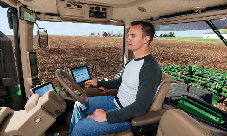
    “Trimble’s acquisition of AGRI-TREND is another step towards total farm management for the grower. Together with Connected Farm, we will provide growers and their trusted advisors with a combined offering that is unique in the marketplace today,” said Joe Denniston, vice president for Trimble’s Agriculture Division. “AGRI-TREND is a leader in providing expert advice and decision support for growing crops, marketing commodities and managing a farm’s finances. Trimble is a leader in precision agriculture technology that precisely applies those decisions whether it is seed, nutrients or water. Together, Trimble and AGRI-TREND will enable the integration of decisions and execution to give greater control over the outcome, resulting in maximized productivity for the grower.”

    “AGRI-TREND has been working side by side with farmers for over 17 years. With the strength that Trimble provides, we aim to help even more farmers as the move to precision agriculture continues to gain momentum globally,” said Rob Saik, founder of AGRI-TREND. “The combination of our advanced agricultural technical expertise and Trimble’s exceptional precision agriculture tools provides us with a platform that will support production practices that are sustainable both from an environmental and financial perspective for today’s farmers. We’re excited to be a part of the future of agriculture, and we’re pleased to work with the great people at Trimble.”

    Full Farm Support

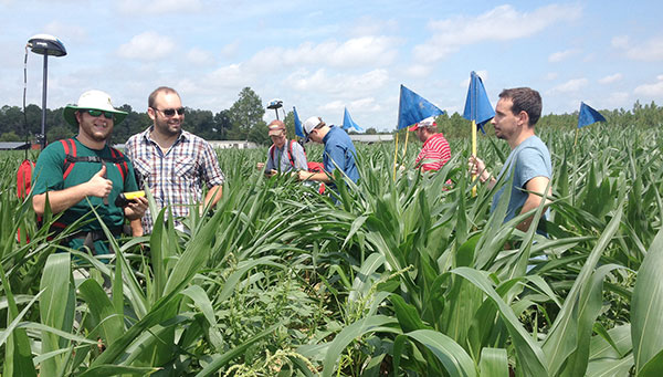
    Grow the Crop: To assist in optimizing crop growth, AGRI-TREND has a network of experienced agronomists who serve as a personal Agri-Coach to help farm customers assess the performance of every acre on a yearly basis. Agri-Coaches work on the analytics, looking at the cost of production as well as nitrogen and water use efficiency, interpreting the data and making customized recommendations for each field. Recommendations are then followed up with field scouting and performance tracking to ensure farm goals are met.

    Sell the Crop: To maximize crop sales, AGRI-TREND creates a Strategic Marketing Plan that includes business analysis, operational strategy, risk management and a harvest review. This customized plan is developed by an AGRI-TREND Market-Coach who works closely with each farm client to understand the unique situation of their farm and the cost of production for each field. The AGRI-TREND Market-Coach then provides advice on how to best achieve better selling prices, risk mitigation and optimal cash flow for their farm customers.

    Manage the Money: In order to enable farmers to better manage their money, AGRI-TREND provides a network of business-coach professionals, which consists of experts in specialized areas such as accounting, banking, corporate finance and insurance. The business-coach starts by gaining an understanding of the farm business including strengths and weaknesses, measuring the farm’s performance against benchmarks, creating the Strategic Farm Business Plan and then implementing the farmer’s long-term growth plan.

    The AGRI-DATA Solution

    The AGRI-DATA Solution is a complete farm management platform that focuses on the unique agronomic challenges that farmers face every year as they work to maximize yields and profits. This platform is the foundation for AGRI-TREND advisors as they work on crop planning, crop input tracking, soil sampling, tissue testing, manure analysis, fertilizer blending, field scouting, harvest data tracking and more. The platform supports over 75,000,000 legacy acres with over eight million acres added in 2015. Farmers have also adopted the AGRI-DATA mobile applications for both Android™ and iOS devices, preferring to work with their information on the go.

    Trimble Connected Farm Advisor

    Trimble Connected Farm Advisor — a field data management tool for the farmer’s trusted advisor — will be integrated with the AGRI-DATA platform to empower AGRI-TREND coaches with a greater toolset to deliver more services to their growers.

    If you would like to learn how to become an AGRI-TREND coach, visit w3.agritrend.com/join-agritrend. Growers interested in finding an AGRI-TREND coach to work with can visit www.agritrend.com/contact-us/find-a-coach-professional.


  • Trimble adds apps to TMX-2050 display for precision ag

    photo: Trimble

    Trimble has added several new third-party apps to its Android-based Trimble TMX-2050 display for precision agriculture.

    The new apps fall into several categories, including:

    • Diagnostic tools to identify and address implement error codes.
    • Fertilizer calibration charts for various brands of spreaders.
    • Identification of nutrient deficiencies.
    • Planter adjustment recommendations for various planter brands.
    • PDF reader.
    • Work order and documentation-based software applications for agriculture.

    The apps are available for download from App Central marketplace on the TMX-2050 display. App Central provides farmers with enhanced flexibility to install apps, view descriptions and images, report issues, connect with developer partners and stay current with on-demand updates, Trimble says in a news release. Users can search and find the apps most useful to their farm operations, language and regional compliance requirements.

    “As we continue to add third-party apps on our TMX-2050 display, we are providing farmers with more localized choices so they can select the tools that best fit their machines, applications and regional needs,” said Pierre-Andre Rebeyrat, marketing director for Trimble’s agriculture division. “These apps can enable farmers to obtain needed information more easily and quickly, leading to more efficient management of their farm operations.”

    Every new TMX-2050 display solution includes wireless connectivity allowing farmers to view ongoing field activities, real-time commodity prices, real-time weather conditions to guide irrigation and field deployment decisions, and other valuable task information in the Connected Farm dashboard. It also enables wireless data transfer of as-applied maps and other field activities such as planting, spraying or harvesting, simplifying the overall management and transfer of farm data files.

  • University of Georgia Teaches Precision Ag with Corn Maze

    University of Georgia Teaches Precision Ag with Corn Maze

    Vellidis' precision agriculture class helped develop the maze using GPS technology. (Photo courtesy University of Georgia)
    Vellidis’ precision agriculture class helped develop the maze using GPS technology. (Photo courtesy University of Georgia)

    University of Georgia precision agriculture students used GPS to design a corn maze in honor of football coach Mark Richt.

    George Vellidis, a UGA crop and soil sciences professor, gave his precision ag students the opportunity to experience GPS technology firsthand by having them develop a corn maze at a nearby farm.

    “I’ve been teaching precision agriculture at the UGA Tifton Campus since 2003. We’ve been teaching GPS from day one because GPS is a critical part of precision agriculture. Everything we do with precision agriculture has coordinates, so we can collect our data through GPS,” Vellidis told the newspaper. “It’s a great experience for the students to go out and help with the corn maze. They get to do a fun activity while learning how to use GPS.”

    Covering 6.1 acres, the maze is the biggest ever constructed at Rutland Farms, and received national coverage on ESPN.

    Students have been impressed by how easy GPS technology is to use and how beneficial it can be to farmers. “I’ve used it to go back after we’ve already installed moisture sensors earlier in the season and I’ve used it to find the sensors much later in the season,” Sydni Barwick, Vellidis’ student and student worker in irrigation for UGA Cooperative Extension.

    “When, for example, a corn crop is eight feet high, you can’t see across that field, so there’s no way to find the sensors without GPS. Using the (GPS) system is great for things like that because it has an accuracy of about 3 feet,” she said.

    Learn more about the project here.

    Students in George Vellidis' precision agriculture class helped develop the corn maze at Rutland Farms.
    Students in George Vellidis’ precision agriculture class helped develop the corn maze at Rutland Farms. (Photo courtesy University of Georgia)
  • Topcon YieldTrakk Monitors Yields

    Topcon YieldTrakk Monitors Yields

    Photo: Topcon Precision Agriculture

    Topcon Precision Agriculture has expanded its precision agriculture line of solutions to include a new yield monitoring system — YieldTrakk.

    YieldTrakk is an optical sensing, volumetric solution designed to provide operators with the real-time data collection needed to make intelligent business decisions in the combine cab and afterward. It includes monitoring and mapping of yield (in bushels or tonnes), moisture and cut rate, as well as the total weight of crop during harvest.

    “YieldTrakk provides an excellent solution for data collection, mapping and analysis that ultimately allows operators to reduce input costs and operate more efficiently,” said Brian Sorbe, Topcon Precision Agriculture director of sales, Americas. “The addition of yield monitoring expands the scope of Topcon precision agriculture solutions to meet the full-season productivity demands of modern farming.”

    Photo: Topcon Precision Agriculture

    YieldTrakk works by using non-contact optical sensors installed in the clean grain elevator to calculate accurate live yield data. The ECU (electronic control unit) converts the measurement into a weight for the crop harvested. When the crop travels up to the bubble up auger, a second set of sensors measure crop moisture level and incorporates that into the data along with the yield output. To help optimize accuracy, the ECU also measures slope variations and corrects the signal for any fluctuation in machine angle.

    The system is a universal solution designed to fit nearly every brand of combine on today’s market. It includes retrofit solutions for most combines, a plug-and-play application for CLAAS combines, and a connection using ISO in AGCO Fieldstar II-ready combines.

    The new yield monitor system is integrated with the Topcon Horizon software on the Topcon X30 touchscreen console — displaying the yield and moisture levels in separate sets of data to provide the operator a more complete understanding of field and crop conditions.

    YieldTrakk is compatible with most software packages in the industry for further analysis by utilizing industry standard ISOXML and shape file format for data export instead of the proprietary data formats used by most competitors. This information can be used to trace inputs and outputs by precise location and ultimately allows the user to vary seed, fertilizer, chemical or other inputs as-applied.

    “This is a great example of how we’re able to leverage synergies with our recent acquisition of Wachnendorff Elektronik, Digi-Star, RDS Technologies and NORAC to further provide combine owners and our OEMs with the high accuracy precision tools they need,” said Michael Gomes, Topcon Precision Agriculture vice president of business development.