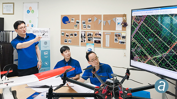
SimActive Inc., a developer of photogrammetry software, has enabled the first government drone mapping project in South Korea.
Asia Aero Survey (AAS), a SimActive regional partner, used Correlator3D for the public survey delivered to the Korean National Geographic Information Institute (NGII) and the Korean Association of Spatial Information, Surveying & Mapping.
While such projects were previously conducted using manned aircraft, a drone was preferred because of the difficulty in accessing the area of interest through traditional aerial and ground surveying methods.
The NGII officially published guidelines for public surveying and mapping with drones in March 2018, with the AAS project being the first delivered and accepted as adhering to the new guidelines.
AAS is also deploying UAV solutions with hyperspectral and lidar for other projects in conjunction with SimActive software.
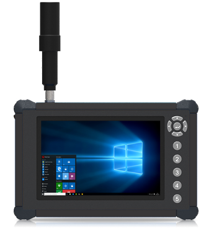
DT Research has launched the DT372AP-TR rugged real-time kinematic (RTK) tablet, a lightweight military-grade tablet that offers RTK to enhance the precision of position data derived from satellite-based positioning systems.
The tablet enables 3D point cloud creation with centimeter-level accuracy to meet the high standards required for scientific-grade evidence in court, the company said.
The DT372AP-TR RTK tablet is military-grade with an IP65 rating, yet lightweight — offering the versatility to be used in the field, office and vehicles.
A dual-frequency GNSS module is built into the tablet, which uses real-time reference points within 1- to 2-centimeter accuracy to position 3D point clouds created from aerial photogrammetry, using GPS, GLONASS and Galileo satellites. Users can measure with the RTK GNSS positioning directly using an external antenna for better survey-grade precision.
“We designed a more compact tablet that still offers all the functionality of a rugged RTK tablet, to give ultra-mobility to law enforcement and first responders who are already weighed down with heavy equipment,” said Daw Tsai Sc.D., president of DT Research. “With programmable side buttons and directional pad, this tablet combines ease of use with a small form factor and centimeter level accuracy, there is nothing in the market now in the same category that can offer this combination.”
The DT372AP-TR RTK tablet is compatible with existing survey and GIS software for mapping applications and brings together an advanced workflow for data capture, accurate positioning and data transmitting.
The tablet can be used in a variety of scenarios, including:
Forensic mapping. Public safety teams, investigators and crash reconstructionists can use the DT372AP-TR to accurately collect measurements that are scientifically and legally defensible by using the real-time centimeter reference points to position 3D point clouds created from aerial photogrammetry or take stand-alone measurements. By using the tablet with a drone for crime and crash scene investigation, cost goes down while accuracy and speed improve, helping to clear areas faster, thereby improving overall public safety.
Land surveying. Surveyors can use the DT372AP-TR RTK tablet to measure the altitudes, angles and distances on the land surface so that they can be accurately plotted on a map to determine property boundaries, construction layout and mapmaking.
E-construction. Construction workers can manage the collection, review, approval and distribution of highway construction contract documents in a paperless environment using the DT372AP-TR RTK tablet.
The tablet has been purpose-built for precision mapping in a variety of environments and includes the following features and capabilities:
Dual-frequency GNSS module. GNSS L1 and L2 RTK that receives GPS, GLONASS, Galileo, BeiDou and QZSS signals up to 372 channels
High-performance CPU and Windows OS. Intel Pentium processor with Microsoft Windows 10 IoT Enterprise with 8 GB of RAM.
Brilliant sunlight-readable display. A 7-inch LED-backlight, high-brightness (800 nits) sunlight-readable screen with capacitive touch and 1280 x 800 resolution.
Superior wireless connectivity. Long-range Class 1 Bluetooth option powers connectivity up to 1,000 feet.
Mobile broadband option. For best field connectivity, there is an option for 4G mobile broadband for LTE, HESPA+, GMS/GPRS/EDGE, EV-DO, Rev A and 1xRTT.
Military standards. For use in harsh environments, the tablet is fully ruggedized to meet the highest durability standards with an IP65 rating, MIL-STD-810G for vibration and shock resistance and MIL-STD-461F for EMI and EMC tolerance.
High-capacity hot-swappable battery pack. Delivers 60 or 90 watts for up to 15 hours of continuous mobile communications.
Camera option. The optional back camera offers 5 megapixels, CMOS sensor and auto focus to capture project progress or record crash and crime scene details.
Accessories. External antennas, pole mount cradles, battery charging kits and digital pens.
Galileo and BeiDou observation data are now included with Trimble VRS Now subscriptions in North America.
Photo: Trimble
The addition of the Galileo and BeiDou constellations allow users to make use of more satellites, enabling more robust performance when working in harsh GNSS environments such as in urban canyons and under canopy, the company said.
Trimble VRS Now in North America fully supports GPS, GLONASS, QZSS and now, Galileo and BeiDou satellite systems.
The service is powered by the Trimble Pivot Platform GNSS real-time network software, Trimble said. As a true five-constellation solution, it delivers improved real-time positioning performance for customers in North America.
VRS Now is designed for surveying, mapping and GIS, construction and agriculture professionals who require high-accuracy positioning in their workflows.
Adding Galileo and BeiDou observation data provides significant benefits by enabling users to:
Operate in environments where traditional GPS + GLONASS systems’ performances are limited
Improve accuracy and reliability of GNSS solutions
Minimize the effects of multipath and interference
“By including Galileo and BeiDou data, customers can achieve greater accuracy and positioning performance than ever before,” said Patricia Boothe, vice president of Trimble’s Advanced Positioning Division.
With the addition of North America, Trimble VRS Now networks worldwide now support all five GNSS constellations. Besides North America, coverage is available throughout Europe, Australia and New Zealand when using a compatible GNSS receiver or display.
Subscriptions are available through Trimble’s Authorized Business Partners or Trimble’s online store at tpsstore.trimble.com.
VRS Now provides positioning professionals with instant access to real-time kinematic (RTK) and post-processing (PP) corrections using a network of permanent (fixed) continuously operating reference stations (CORS). Professional management and monitoring 24/7 by a global operations team provides peak performance and high reliability, Trimble said.
By Sam Pullen, Stanford University; Jim Kilfeather, Jim Goddard, Tom Nowitzky, Brinda Shah, Wen Doong, David Kagan, and Kerry Greer, Globalstar. To be presented at ION-GNSS+ 2018.
Globalstar is developing a connected car program for continuous, worldwide service to vehicles via satellite and terrestrial communications links.
This combines PPP corrections provided globally by the second-generation Globalstar low-Earth orbit (LEO) constellation with local-area corrections via LTE cellular signals in urban areas for connectivity anytime, anywhere. Both signals are broadcast at 2.4 GHz and include pilot channels used for ranging, augmenting GNSS ranging and providing robustness against jamming and spoofing.
The program provides enhanced navigation via continuous augmentation of GNSS with data derived from ground-based reference networks for sub-meter accuracy and integrity bounds on navigation errors to probabilities as low as 10-9 per operation. When this is combined with other on-board sensors and data such as lidar, radar, optics and IMUs, it will be possible to operate autonomously under almost all conditions with a very high degree of safety.
The key is combined use of PPP corrections globally and local-area CDGNSS/RTK corrections in high-density urban regions where it is economically beneficial. Both sets of augmentations are made available to vehicles. The global approach on the left side of the figure is primary, given its near-worldwide coverage based on the LEO satellite network broadcasting corrections within its licensed communications spectrum at 2.4 GHz. The P/N-modulated pilot component of the Globalstar satellite signals will be used for ranging to augment GNSS and provide additional robustness to RF interference or spoofing at GNSS frequencies.
The toolset is a rapid-prototyping platform that lets product designers test and optimize the position accuracy and power consumption of wireless location tracking applications that use LTE-M and NB-IoT cellular networks, as well as GNSS technology. The toolset targets product engineers working on battery powered applications such as sport, people and asset trackers.
An increasing number of battery powered consumer and industrial products feature integrated GNSS receivers. These products include virtual reality headsets, smart watches, and devices to track elderly people, containers or parcels.
With the ongoing roll-out of low power wide-area cellular networks (LPWAN) such as LTE-M and NB-IoT technologies around the world and the extremely low power consumption they enable, the range of use cases for wireless location trackers is expected to expand further.
Screenshot: u-blox
“With today’s technology, product designers can now include optimized battery life in their applications,” said Florian Bousquet, product manager, Product Center Positioning, at u-blox.
“We developed this toolset to give customers a quick and easy way to test the accuracy and the power consumption of their product ideas using the latest generation of our technology,” he said. “In many cases, they can replicate their applications and start testing the performance of different device configurations in under 15 minutes.”
“The toolset offers access to the very latest technologies, from LTE-M and NB-IoT cellular communication to our proprietary Super-E mode(see video below) that delivers the best balance between power consumption and GNSS positioning performance,” he added.
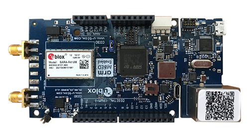
The u-track software runs from embedded firmware on the new u-blox C030-R410M application board. The board, specifically designed to rapidly prototype applications for the internet of things (IoT), includes an ultra-small, low-power u-blox ZOE-M8B GNSS receiver and a size-optimized SARA-R410M LTE-M/NB-IoT cellular communication module.
Additionally, u-track includes a PC software application. Its user-friendly dashboard lets users log, retrieve, and visualize power consumption, accuracy, and other important values, such as the time it takes the GNSS receiver to calculate a position (time-to-first-fix, TTFF).
The u-track and C030-R410M toolset will be showcased on Sept. 12-14 at Mobile World Congress Americas, u-blox Booth no S.2702.
Galileo, BeiDou, QZSS, IRNSS, and more join GPS and GLONASS to bring you wider, broader, greater, more accessible and above all more accurate PNT. How to get all that’s coming at you?
Multi-GNSS paves the way for complete exploitation of new signals and constellations in navigation, surveying, geodesy and remote sensing.
The free 1-hour webinar, which will take place at 1 p.m. Eastern [10 a.m. Pacific, 7 p.m. (1900h) Central European Time] on Thursday, Sept. 20, will review advantages of using multi-GNSS for the end-user and challenges in obtaining maximum efficiency when combining multiple constellations and signals. It will also discuss different approaches of testing GNSS receivers against jamming and spoofing attacks.
You will learn:
Advantages of using multi-GNSS
Challenges when combining multiple constellations
Robustness of multi-GNSS receivers to jamming and spoofing
Test solutions for GNSS receivers.
The webinar presents sponsored content by Skydel and Talen-X. Register for it here.
The U.S. Defense Advanced Research Projects Agency (DARPA) Microsystems Technology Office is soliciting research proposals for the development of a new class of atom-based systems using integrated photonics and trapped atoms to enable high-performance, robust, portable clocks and gyroscopes.
The military researchers are asking industry to develop relatively simple portable photonic integrated circuits (PICs) for high-performance position, navigation and timing (PNT) devices as an alternative to GPS for when satnav signals are not available.
A PIC or integrated optical circuit, similar to an electronic integrated circuit, integrates multiple photonic (having to do with light) functions, providing capabilities for information signals imposed on optical wavelengths, typically in the visible spectrum or near-infrared, 850–1650 nanometers.
A-PhI Program
The Atomic-Photonic Integration (A-PhI) program seeks to develop trapped-atom based, high-performance PNT devices, reducing the complexity of these atomic systems by using PICs. According to the DARPA document, the PICs will replace the optical assembly behind devices such as sensitive and accurate angle sensors and clocks, while still enabling the necessary trapping, cooling, manipulation and interrogation of atoms.
A-PhI aims to demonstrate that compact PICs can replace the optical bench of conventional free-space optics for high-performance trapped-atom gyroscopes and trapped-atom clocks without degrading the performance of the underlying physics package.
Physics
Atomic systems using trapped atoms have the potential to be made portable while maintaining their accuracy due to the atomic trap’s small size and the inherent isolation a trap offers an atomic system from the environment, especially from acceleration.
Currently, these systems are bulky, heavy, and not notably portable, because of the complexity of the optical systems used to create the trap.
In the past, efforts to miniaturize the hundreds to thousands of optical components in such benchtop systems have relied on removing optical elements, miniaturizing the remaining elements, and tightly integrating them in a small package.
The products deliver degraded performance with the need to maintain very tight optical alignment, causing both poor environmental robustness and poor tolerance to design errors. Effective miniaturized atomic systems cannot be achieved at a reasonable cost with this approach.
Recent developments in PIC research suggest that on-chip optical frequency combs based on microresonators, optical frequency synthesis, novel on-/off-chip coupling, wavelength demultiplexers, and on-chip phased arrays for dynamic manipulation of light fields can replace optical systems with readily manufacturable, low-cost chips without the alignment sensitivity of conventional free-space optics.
Gyroscopes
A-PhI also seeks to develop proof-of-concept trapped atom gyroscopes, a matter-wave analog of the interferometric fiberoptic gyroscope. Such a miniaturization effort could generate an order of magnitude improvement in angular sensitivity and dynamic range over current free-space products.
A-PhI hopes to develop portable, high-performance, navigation and timing systems: the miniaturization of the optics of atomic systems without a decrease in performance.
Subsequent work, the RFP asserts, will be required to incorporate the necessary compact and robust lasers and electronics to achieve a fully functioning, high-performance, portable PNT system.
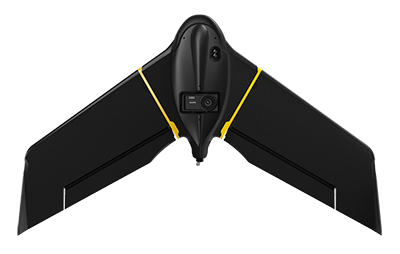
SenseFly, provider of fixed-wing drones, has launched the eBee X for mapping.
The eBee X, part of the Parrot Business Solutions portfolio, is designed to boost the quality, efficiency and safety of an operator’s geospatial data collection.
The eBee X. (Photo: senseFly)
It offers a camera to suit every job, the accuracy and coverage capabilities to meet the requirements of demanding projects, and is durable enough to work virtually every site, the company said.
“The eBee X is a giant leap forward for mapping technology and underscores senseFly’s position as the leader in the fixed-wing drone market,” said Gilles Labossière, executive vice president and COO of Parrot Group and senseFly CEO. “No matter what type of project a professional is undertaking, the eBee X has the coverage, data and accuracy capabilities needed to get the job done.”
The eBee X includes a range of cameras for jobs ranging from land surveying and topographic mapping to urban planning, crop mapping, thermal mapping, environmental monitoring and more. Cameras include:
The senseFly S.O.D.A. 3D: a unique drone photogrammetry camera with a one-inch sensor, which changes orientation during flight to capture three images (two oblique, one nadir) every time, instead of just one, for a much wider field of view. The result is stunning digital 3D reconstructions in vertically-focused environments—such as urban areas, open pit mines and coastlines—over larger areas than quadcopter drones can achieve. senseFly S.O.D.A. 3D is optimised for quick, robust image processing with Pix4Dmapper software.
The senseFly Aeria X: a compact drone photogrammetry camera with APS-C sensor. This rugged innovation offers an ideal blend of size, weight and DSLR-like image quality. Thanks in part to its built-in Smart Exposure technology, it provides outstanding image detail and clarity, in virtually all light conditions, allowing operators to map for more hours per day than ever before.
The senseFly Duet T: a dual-camera thermal mapping rig, which lets mapping professionals create geo-accurate thermal maps and digital surface models quickly and easily. The Duet T includes both a high-resolution (640 x 512 px) thermal infrared camera and a senseFly S.O.D.A. RGB camera with one-inch sensor. Both image sources can be accessed as required, while the rig’s built-in Camera Position Synchronisation feature works in sync with Pix4Dmapper photogrammetry software (optional) to simplify the map reconstruction process.
The eBee X is also compatible with the Parrot Sequoia+ multispectral camera for agriculture, the senseFly S.O.D.A. drone photogrammetry camera and senseFly Corridor for simple linear mapping.
The eBee X can meet the exacting requirements of every project. Its unique Endurance Extension option unlocks a flight time of up to 90 minutes (versus a maximum endurance of 59 minutes by default).
With this capability activated, the drone is able to achieve vast single-flight coverage of up to 500 hectares (1,235 acres) at 122 meters (400 feet), while the eBee X’s built-in High-Precision on Demand (RTK/PPK) function helps operators to achieve absolute accuracy of down to 3 centimeters (1.2 inch) — without ground control points.
According to senseFly, the eBee X allows users to work virtually every site, no matter how demanding, thanks to the drone’s built-in Steep Landing technology, ultra-robust design, live air traffic data and more, all backed by senseFly’s professional, localized support.
The eBee X is ideally suited to the varied and evolving needs of mapping professionals. These include: surveying and construction companies, quarry and mine operators, agronomists and forestry engineers, professional drone service providers, aerial imagery companies, environmental researchers and more, the company added.
The eBee X is supplied with senseFly’s eMotion flight planning and data management software.
A roundup of recent products in the GNSS and inertial positioning industry from the September 2018 issue of GPS World magazine.
OEM
Reference receiver
For real-time networks (RTN)
Photo: Trimble
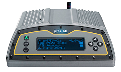
The Trimble Alloy GNSS reference receiver is designed for continuously operating reference stations (CORS). It offers 672 channels and constellation tracking of GPS, GLONASS, BeiDou, Galileo, QZSS, IRNSS and SBAS for robust and reliable reference data. With an IP68 rating for protection against dust and moisture, the Alloy performs in rugged environments to meet the demands of professionals in earth science, surveying, construction, mapping and agriculture. The Alloy allows RTN owners and operators to track and log all current and planned GNSS and deliver absolute position monitoring, as well as centimeter-level accuracy in real time with Trimble RTX precise point positioning technology. Featuring a four-line OLED screen, the receiver displays key information without the need to scroll through multiple menus. Other features include dual hot-swappable batteries, multiple power inputs and serial ports, Wi-Fi connectivity and remote access options.
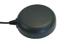
The TW7875 magnetic-mount GNSS antenna is designed for precision dual-frequency positioning. It is capable of receiving GPS L1/L5, GLONASS G1, BeiDou B1, Galileo E1/E5a and NavIC L5. It employs Tallysman’s Accutenna technology, which provides superior multipath signal rejection due to its low axial ratio across the full bandwidth. It also provides a linear phase response and tight phase-center variation. It is designed for precision agriculture, autonomous vehicles and other precision applications. The TW7875 is housed in a magnetic-mount IP67-rated housing, but can also be mounted with screws or adhesive tape. The embedded version, Model TW3875, has a wide selection of connectors and custom cable lengths, and can be custom tuned by Tallysman to ensure optimum performance within the customer’s enclosure.
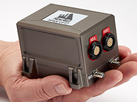
The SPAN CPT7 provides tightly coupled GNSS+INS navigation technology in a rugged, compact unit. Commercially exportable and designed for integration into a wide variety of applications, it delivers assured positioning anywhere. SPAN technology tightly couples GNSS and inertial navigation system (INS) measurements. The system enables continuous, robust positioning and fast reacquisition in challenging navigation environments where GNSS signals may be unreliable or unavailable for short periods. Dual antennas deliver instant alignment. NovAtel’s OEM7 Interference Toolkit (ITK) provides interference detection and mitigation, with the spectrum analysis function allowing integrators to identify interference within the GNSS frequency bands and implement digital filters to eliminate the problem.
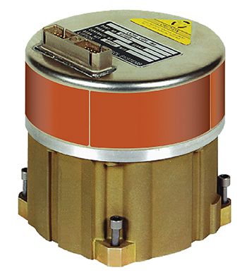
The commercial-off-the-shelf (COTS) LN-200C is a compact and lightweight six-degrees-of-freedom inertial measurement unit (IMU) that can be used for instrument stabilization, motion compensation and navigation in commercial, aerospace and industrial applications. Based on fiber-optic gyro (FOG) technology, the LN-200C IMU’s hermetic seal and lack of moving parts help to ensure low noise and extended operational life. The LN-200C can serve as a drop-in replacement for applications that don’t require the full operational range of the original LN-200 and that can benefit from the expedited licensing and global ease of use offered by the LN-200C.
Global Certification Forum (GCF) protocol conformance tests available
Photo: Rohde & Schwarz
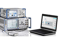
The Rohde & Schwarz CMW500 wideband radio communication tester and SMBV100A GNSS simulator have been expanded to support Global Certification Forum (GCF) protocol conformance tests for C-V2X device certification. Utilizing the Qualcomm 9150 C-V2X chipset from Qualcomm Technologies, the R&S CMW500 acting as an LTE network simulator allows automakers to test C-V2X direct communications (PC5) according to GCF Work Item 281. The new R&S CMW-KK550 test package includes the 3GPP Protocol Conformance tests from LTE-V2V GCF Work Item 281 and LTE-V2X GCF Work Item 282. The R&S CMW-KU514 C-V2X software package on the R&S CMW500 is used to verify data transmission and reception over the PC5 interface in ideal, faded and congested channel conditions. Together, both packages enable Rohde & Schwarz to support C-V2X device testing through all protocol layers.
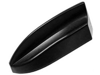
The Multimax FV family is available in a range of configurations, supporting multi-constellation GNSS. The antennas also support up to dual MIMO LTE (including Band 14 for the FirstNet public safety network), 3×3 MIMO Wi-Fi or 2×2 MIMO Wi-Fi. With a small footprint and a strong, bolt-mount aluminum base, the Multimax FV family provides protection against natural hazards threatening vehicles, including vibration, ice, salt, car washes and tree sweeps. The high-gain antennas deliver a large cellular footprint alongside high-rejection GNSS technology (GPS, GLONASS, Galileo and BeiDou).
For Beyond Visual Line-of-Sight (BVLOS) flight operations
Arctic UAV has adopted Kongsberg Geospatial’s IRIS UAS Airspace Awareness application for BVLOS operations within Canada’s Arctic. IRIS provides simultaneous monitoring of multiple drones. It offers real-time calculation of aircraft separation and communications line-of-sight, real-time visualization of track and weather data.
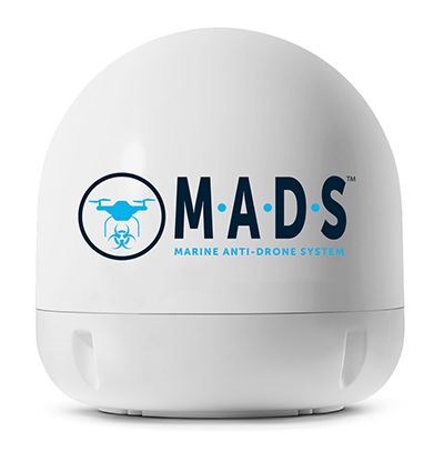
M.A.D.S detects and identifies commercial drones within a 5+ kilometer range, providing GPS positioning of both drone and pilot together with the drone’s speed and heading. Once a drone threat is established, the system enables a 500-meter electronic exclusion zone to be created around the yacht. Should the drone approach this exclusion zone, its control/video signal is blocked, initiating a fail-safe mode and forcing a landing or return to operator.
Operates on the Wave Relay mobile ad hoc network (MANET)
The Auto-Tracking Antenna System is a portable ground-to-air antenna for tracking aircraft, including drones. Defense customers can use it for better airborne communications relay and full-motion video camera/sensor data transmission. It can be assembled and deployed in less than 15 minutes.
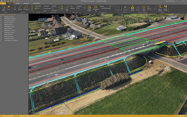
Version 6 of Virtual Surveyor drone surveying software offers a faster, more efficient workflow and better user experience in a more stable platform than previous versions. Along with new capabilities is an improved licensing system and an extended free application. The software generates an interactive onscreen environment through orthophotos and digital surface models generated from a UAV, where the surveyor selects survey points and breaklines to define the topography. It enables land surveyors to complement traditional fieldwork with UAV imagery to generate highly accurate topographic products.
Foresights is a risk management and geospatial analytics platform designed to help clients manage forestry assets quickly, effectively and accurately. Foresights identifies areas of new or potential risk, and delivers operations tracking and forest damage management services. It combines satellite imagery, topography maps, soil maps, meteorological data and near real-time ground input from operational teams to deliver optimized insights. It can detect damage as small as 0.1 hectare (0.25 acre) from pests, disease and drought.
EOS Platform provides a powerful toolset for geospatial analysts — offering search, analysis, storing and visualization of large amounts of geospatial data. Image data obtained from LandViewer or uploaded from a user’s computer is stored in cloud-based EOS Storage and is instantly available for remote-sensing analysis or image processing. EOS Processing offers 16 workflows that run online, including raster tools, remote sensing analytics, photogrammetry and proprietary feature extraction algorithms designed by EOS engineers and data scientists to address the main challenges of agriculture, forestry, oil, gas, retail, city planning, defense and other industries.
The Esri book GIS for Surface Water: Using the National Hydrography Dataset by Jeff Simley details how to use geographic information system (GIS) technology to visualize and analyze data sets. Simley is an award-winning cartographer and the former lead of the hydrography program at the United States Geological Survey (USGS). The book examines the complexities of surface water systems and shows readers how to use the Esri ArcGIS software with government water data sets to better study and manage the United States’ vast water system.
EOMAP has opened a commercial online store for global shallow-water bathymetry derived from satellite data. At the store, EOStore Bathymetry, customers can search for and request high-quality data. Satellite-derived bathymetry (SDB) is a valuable tool for the surveying, planning and management of coastal and offshore sites. SDB can provide shallow-water bathymetric data worldwide without the need for a physical presence in the area of interest. EOMAP developed the bathymetry store in response to industry feedback. EOStore Bathymetry offers different horizontal spatial resolutions of the bathymetric grid of 2 to 15 meters, making the data suitable for surveying as well as planning and modeling purposes.
The solution, which will incorporate oneM2M’s current TTA-run certification program, recognizes the critical importance of mobile technologies in IoT-enabled M2M solutions — a trend that is set to accelerate with the advent of 5G.
oneM2M certification through GCF will be key to ensuring proper functionality and compliance with industry standards for fast, efficient, and secure IoT solutions in the connected world, GCF said.
Technologies which comply with oneM2M standards will ensure seamless connectivity and interoperability with back-end networks, as well as allowing for safe and secure transactions. TTA’s mission is to support global oneM2M certification services and will significantly benefit the IoT and M2M industry.
Image: GCF
“This development underlines GCF’s expertise in developing certification programmes for advanced mobile technologies in industry verticals,” said Lars Nielsen, general manager at GCF. “It complements our strategy of expansion from core telecoms technologies into IoT applications to service the emerging 5G ecosystem. GCF is collaborating with world class organisations such as oneM2M and TTA to enable the growth and proliferation of the IoT connected devices ecosystem.”
oneM2M is a global organization which creates technical specifications, common use cases and architectural principles to ensure that machine-to-machine communications can operate effectively on a worldwide scale. oneM2M architecture is based on a common M2M service layer, which can be readily embedded within vendors’ hardware and software solutions, ensuring interoperability between the myriad of IoT devices in the field and M2M application servers worldwide.
“GCF’s work with TTA highlights the growing global momentum for tested interoperability in IoT devices and applications,” said Patrick Van de Wille, marcom chair at oneM2M. “Our membership numbers are steadily increasing as organisations recognise the benefits of reducing the complexity through a global standard. All stakeholders will reap the rewards from improved productivity and reduced costs, which will ensure the sustained growth of the IoT transformation.”
TTA has been the at the fore of oneM2M certification since 2014 and is the official oneM2M testing and certification organization.
The announcement is the culmination of work TTA has carried out to expand the testing and certification service, keeping up-to-date with oneM2M standards and providing feedback on the standards by collaborating with overseas testing institutes.
“We are extremely pleased to have this partnership with GCF that supports the increasing importance of oneM2M standardisation in the global IoT market,” said Park-Jae-Moon, president of TTA. “This is a critical milestone in our journey from setting up the very first oneM2M certification solution for Korea, to meet regional needs. Now we can offer this on a global level to ensure interoperability and set a benchmark for quality that will enable a successful future for IoT connectivity.”
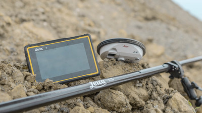
Leica Geosystems has selected Getac’s fully rugged ZX70 Android tablet for the new Leica Zeno GG04 Plus Tablet package, designed for utilities, public services, transportation and construction.
The new partnership will allow Leica Geosystems to bring comprehensive geospatial data-collection capabilities to its customers in all terrains and weather conditions, according to a Getac news release.
Leica Geosystems selects Getac’s ZX70 tablet To power its new Zeno GG04 Plus Tablet solution. (PRNewsfoto/Getac)
The Zeno Mobile data collection app and Zeno GG04 plus smart antenna are designed to help customers capture highly accurate geospatial data quickly and effectively in the field.
By combining these products with Getac’s ZX70 Android tablet, Leica Geosystems has created a solution that offers measurement accuracy, connectivity and durability in a single, comprehensive package, Getac said.
Compact and powerful, the Getac ZX70 is comfortable to use with one hand, making it suitable for demanding field surveying work.
Its Android operating system supports Leica’s Zeno Mobile software, allowing for high-accuracy GNSS positions to be utilized and rich attribute data to be collected easily in the field.
Any authorized Android app can also be installed on the device, depending on the required workflow or back office systems used, bringing a high level of usability and familiarity out of the box, Getac said.
Additional key features include the 7-inch IPS display, which is easy to read in all environments, including direct sunlight. The LumiBond 2.0 touchscreen allows for full operation of the tablet in the rain and with gloves on, essential for outdoor surveying work.
The Getac ZX70’s integrated 4G modem can transmit large data files quickly and easily, even from remote locations.
The fast, stable and reliable data connection allows users to effectively utilize Hexagon Geosystems’ HxGN SmartNet correction service, enabling accurate GNSS measurement to within one centimeter.
The ZX70 offers durability, connectivity and usability, and has been designed to withstand shocks, drops, rain and vibration, the company added.
The tools connect directly to TomTom Maps APIs (Application Programming Interfaces) for location, tracking and mapping data services, accelerating product development, and reducing time-to-market and development costs for developers, the companies said.
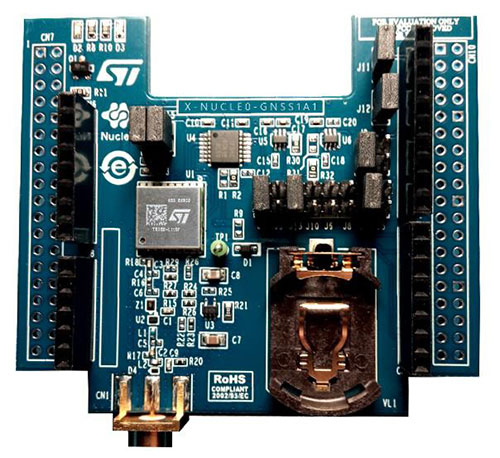
The X-NUCLEO-GNSS1A1 expansion board is based on the Teseo-LIV3F tiny GNSS module. (Photo: STMicroelectronics)
The development package consists of an STM32 Discovery host board for 2G/3G cellular-to-cloud connectivity, a GNSS expansion board based on ST’s Teseo satellite navigation technology, and a software Function Pack that connects an internet-of-things (IoT) node via a cellular network to a range of TomTom Maps APIs.
With this hardware and software package and a TomTom developer account, developers can quickly add location-based services to their IoT and smart city applications.
Among these services are the translation of GPS coordinates into a street address inside a map (Reverse Geocoding), retrieval of nearby point of interests, and the production of accurate navigation directions.
“We have combined TomTom’s industry-leading location-based and mapmaking technologies with ST’s unrivaled combination of silicon and system expertise to create a unique offering that provides easy access to TomTom’s Maps APIs to empower developers to create groundbreaking, location-aware applications faster and more efficiently,” said Anders Truelsen, managing director of TomTom’s Enterprise Business Unit.
“Supporting our efforts to facilitate location-based product development, our collaboration with TomTom has built on each company’s strengths to assemble a tailored package of hardware and software tools that is already fully integrated with TomTom cloud services, around the popular STM32 development ecosystem,” said Alessandro Cremonesi, group vice president at STMicroelectronics. “These tools enable native STM32-based location services to accelerate application development of Geo-IoT solutions for fleet management, item tracking, and many other services that depend on fast, accurate location detection.”
In addition to the STM32 family of Arm Cortex-M core microcontrollers, the development tools leverage ST’s market-proven multi-constellation Teseo positioning-receiver technology to perform all positioning operations including tracking, acquisition, navigation and data output.