Category: Applications

  • Esri releases Survey123 for ArcGIS with new Spike integration

    Esri releases Survey123 for ArcGIS with new Spike integration

    The new software release of Survey123 for the ArcGIS mobile application now has Spike, a laser measurement solution by ikeGPS.

    The paired technology dramatically accelerates field data capture and asset inspection activities.

    Spike allows users to measure hard-to-reach objects from a distance by taking a photo with their smartphone or tablet. Users can then capture real-time measurements from that image, including areas, elevations, distances between two points, and GPS/GNSS location.

    Use of the Survey123 integration with Spike will be of interest to organizations that use mobile workflows for asset and facilities management, field asset inventories and inspections, damage assessments, and tactical operations including disaster response.

    Using Spike with Survey123 relieves fieldworkers of the burden of carrying paper maps to find the object of interest and lugging multiple pieces of specialized, expensive measuring equipment. Instead, with a single mobile device, fieldworkers can locate the correct asset, record measurement data, and report accurate data directly back to the office.

    “The new Spike integration with Survey123 is a game changer for many field data collection and inspection workflows where the dimension of physical objects needs to be captured. Spike and Survey123 provide quick return on investment,” said Ismael Chivite, Esri product management lead. “The simplicity of the solution enables it to be quickly deployed and with little training. Customers are very enthused about this low-cost solution that will streamline many of their critical workflows.”

    The ability to capture accurate measurements in the field is particularly useful when working in areas that don’t lend themselves to hands-on or close-up measurement. Spike’s laser can be used in ranges from 6 to 650 feet, with the option to select units of measurement in inches, feet, meters or centimeters. With it, a single fieldworker is able to more quickly and safely accomplish what may otherwise have taken multiple field staff and costly equipment.

    The Spike laser device mounts to smartphones and tablets and connects via Bluetooth with the mobile device’s camera.

    Survey123 with Spike runs on Apple iOS and Google Android smartphones and tablets.
  • Omnitracs partners with Peloton on driver-assistive truck platooning

    Fleet management company Omnitracs LLC has partnered with Peloton Technology, a developer of connected and automated vehicle systems for U.S. and global freight carriers. Omnitracs and Peloton will collaborate to bring Peloton’s truck platooning technology to Omnitracs customers.

    The partners will also develop joint solutions that combine each company’s safety, efficiency and fleet management capabilities.

    Peloton will begin filling pre-orders of its flagship platooning product for Class 8 trucks in 2017. The technology synchronizes braking and acceleration between pairs of trucks through the integration of vehicle-to-vehicle (V2V) communications with radar-based collision avoidance systems, enabling the trucks to travel safely at aerodynamic following distances.

    The Peloton system generates 4.5 percent fuel savings for the lead truck and 10 percent for the follow truck in a two-truck platoon, according to independent testing by the North American Council for Freight Efficiency.

    Image: Omnitracs
    Image: Omnitracs

    For the driver of the follow truck, the Peloton system works similarly to adaptive cruise control with the added safety feature of V2V communications to enable automated braking within 0.1 second of braking by the lead truck. The driver of each truck controls steering while the platooning system coordinates speed and distance between the trucks,  meeting the definition of SAE Level 1 automated driving.

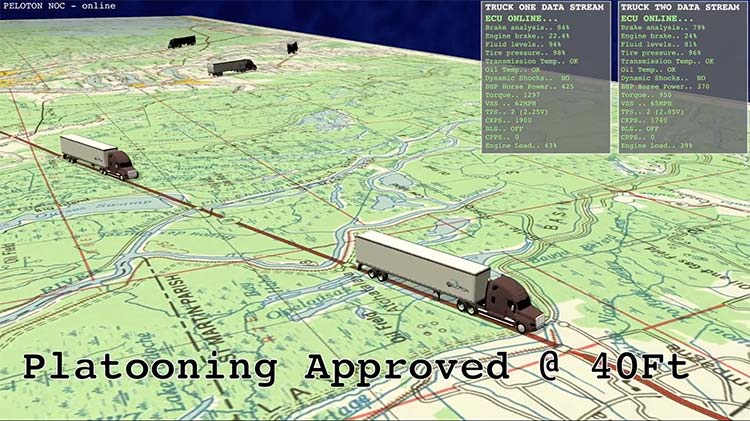
    Platoons are managed continuously by a cloud-based Network Operations Center that connects to trucks through cellular and Wi-Fi communications. Cloud-based supervision limits operation of platoons to specified roads in safe driving conditions.

    Here is a video explaining Peloton platooning.

    Peloton will help to roll out practical, cost-saving automated vehicle technology featuring leading-edge cybersecurity to Omnitracs customers, beginning with two-truck platooning. Omnitracs has a large customer base in the long-haul trucking segment which stands to benefit significantly from platooning.

    “Peloton has developed technology that is on the cutting edge of advanced driver assistance systems and the automated vehicle movement,” said John Graham, CEO of Omnitracs. “Its emphasis on spatial awareness is a crucial and foundational component of improving truck safety and fuel efficiency.”

    “We are excited to be part of the first partnership of a commercial platooning system supplier with a leading fleet management provider,” said Joshua Switkes, founder and CEO of Peloton Technology. “We will offer expanded opportunities for platooning across the broad customer base that Omnitracs has attracted by focusing on cost advantages for fleets.”

    A key operational benefit of the partnership for fleet customers will be optimized matching opportunities for inter-fleet platooning, leveraging Omnitracs’ routing and dynamic dispatch applications to provide navigation assistance and clear savings calculations for scheduled and ad-hoc platoons of trucks from different fleets.

    “This partnership will offer benefits to fleets of all sizes,” said Butch Winters, Peloton’s vice president of products, sales and business development. “In addition to helping fleets find more opportunities for platooning, we’re working with Omnitracs on new product features to enhance safety and efficiency for fleets and drivers.”

    Co-developed solutions from the partnership may include integrated cloud-based fleet management services and hardware.

  • Trimble’s GNSS positioning guides GM’s hands-free Super Cruise

    General Motors (GM) is using Trimble RTX (real-time eXtended) technology as the high-accuracy GNSS/GPS correction source to deliver absolute positioning to vehicles equipped with GM’s Super Cruise hands-free highway driving system, now available on the 2018 Cadillac CT6.

    GM customers using Super Cruise featuring Trimble RTX technology can have peace of mind on the road knowing that RTX plays an important role in maintaining lane position for hands-free driving on divided highways.

    https://youtu.be/_rxW68ADldI

    Super Cruise also uses precision lidar mapping data, a state-of-the-art driver attention system, and a network of camera and radar sensors.

    Trimble RTX technology provides real-time, multi-constellation GNSS positioning capable of achieving better than 1.5 inches accuracy. Standard GPS signals can drift up to 25 feet, which could cause incorrect lane identification.

    The 2018 Cadillac CT6 features Super Cruise hands-free driving technology for the highway. (Photo: GM)

    Lane-level accuracy is a critical enabler in advanced driver assistance systems increasingly being used on highways. When used in conjunction with high-definition maps, cameras, radar and inertial sensors, Trimble RTX improves lane-level positioning performance for semi-autonomous and autonomous vehicles.

    Trimble has a long history of pioneering automation and vehicle autonomy to improve productivity — from providing positioning solutions for some of the earliest robotic applications in the 1990s to delivering automated steering for farm tractors, automated blade control for earthmoving equipment and providing advanced positioning technology for fully autonomous trucks.

    Trimble is now enabling semi-autonomous operations for passenger vehicles with Trimble RTX technology, delivering high-accuracy GNSS corrections via a global network to support absolute vehicle positioning in combination with other sensors and inertial dead-reckoning.

    Trimble’s RTX technology uses signals captured by more than 100 Trimble GNSS reference stations around the globe. Trimble RTX corrects the signals for atmospheric conditions, satellite orbit and time synchronization errors and then sends those signals to GM vehicles with Super Cruise via OnStar 4G LTE cellular.

    The Trimble network is supported by redundant servers that are monitored 24/7 by a team of network engineers and IT specialists ensuring optimal signal performance and reliability for drivers who will depend on it.

    “Through our collaboration, the combined technologies of GM and Trimble will transform the way the world drives,” said Patricia Boothe, vice president of Trimble’s Advanced Positioning Division. “Trimble RTX is now influencing how we interact with our vehicles and the environment around them — helping to minimize driver fatigue and improve the assisted driving experience.”

  • Qinertia post-processing software now available

    After years of development and an intensive beta testing phase with key partners, Qinertia post-processing kinematic software is now being offered by SBG Systems.

    Qinertia has been designed to help surveyors get the most of their surveys, according to SBG Systems.

    After the mission, Qinertia gives access to offline real-time kinematic (RTK) corrections from more than 7,000 base stations in 164 countries — and always up-to-date. By creating a virtual base station near a project, the software delivers the highest level of accuracy without having to set up your own base station.

    An advanced tight coupling algorithm has been designed by SBG Systems to deliver the highest accuracy and maximize RTK availability. Trajectory and orientation are greatly improved by processing inertial data and raw GNSS observables in forward and backward directions, especially in GNSS challenging environments (urban canyons, forest, etc.).

    With advanced quality control indicators such as standard deviation, separations and GNSS quality feedback, Qinertia provides full understanding of a survey. With Qinertia, surveyors can quickly identify and solve issues such as mechanical installations or sensor alignment.

    Qinertia has been designed to be easily integrated in a production workflow. It supports RINEX industry standard, and Septentrio, Novatel and Trimble native binary format.

    A powerful ASCII export feature allows seamless integration with any third-party software. SBET and Google Earth are also supported for improved interoperability.

  • GEO Business expands for 2018, registration now open

    GEO Business expands for 2018, registration now open

    GEO Business, the United Kingdom’s largest geospatial exhibition and conference, has announced that registration is now open.

    The GEO Business show has grown every year since its inception, and the 2018 show looks set to be the most successful show to date with more exhibition space and a brand new seminar program. The event will return to the Business Design Centre, in London, UK, May 22-23.

    Since its record-breaking 2017 event last year, which welcomed 2,386 geomatics and geospatial professionals from around the world (a 48 percent increase since the launch in 2014), the exhibition has expanded onto the upper level. Exhibitors span the entire geospatial industry, showcasing cutting-edge technology and solutions that will mold the future of the industry.

    The 2018 GEO Business show will expand to the second level of the Business Design Center. (Photo: GEO Business)
    The 2018 GEO Business show will expand to the second level of the Business Design Center. (Photo: GEO Business)

    Confirmed exhibitors for 2018 include Survey Solutions Scotland, Land Registry, GAP Group, Phase One, Viametris, Surphaser/ MD3D, DHF Satellite and Ordnance Survey Ireland.

    New for 2018 is a free-to-attend seminar program designed to demonstrate the remarkable impact geospatial technologies and solutions on the global environment. The program will feature case studies from companies demonstrating how they are reducing costs and risk while increasing productivity.

    The 2017 GEO Business exhibit. (Photo: GEO Business)
    The 2017 GEO Business exhibit. (Photo: GEO Business)

    The latest in augmented reality, building information management (BIM), geospatial information systems (GIS) and big data, laser scanning, mobile mapping, remote sensing and satellites, smart cities, surveying, UAVs, virtual reality and visualization will feature within the fields of architecture and construction, commercial property, environmental, equipment theft, floods, forestry, heritage, highways, hydrography, mining, rail and tunneling.

    With geospatial technology now impacting on more and more industries, GEO Business is attracting visitors from a wider range of industry sectors than ever before.

    “The geospatial industry is experiencing a huge transformation, everywhere you look at the moment you bare witness to the term ‘geospatial,’” Show Director Caroline Hobden said. “Innovative technology is steadily making its presence known in everyday life, whether it is through the revolutionary capabilities of augmented/virtual reality or the extraordinary data recorded by drones to name just a few, the world is sitting up and taking notice.

    “Even the U.K. government budget made mention of geospatial at the end of last year and as a result we excitedly await further announcements about the Geospatial Commission whose focus will be on location aware technologies revolutionising the digital economy.”

    The exhibition and seminar program will run alongside a strategic senior-level conference of invited speakers presenting and debating the role of geospatial in powering the Fourth Industrial Revolution, said GEO Business. The Fourth Industrial Revolution is changing how we live, work and communicate. It is reshaping government, education, healthcare and commerce — almost every aspect of life. The conference will celebrate, challenge and develop the role that geospatial has to play in maximizing the digital economy as part of this revolution.

    Visitors will also have the unique opportunity to attend the well-established commercial workshop program hosted by exhibitors demonstrating their latest products and services and a full line-up of innovative social activities designed for informal networking with colleagues old and new.

    The exhibition, workshops and seminars are free to attend. There is a fee-to-attend the conference with an early-bird discounted rate for registrations before April 16. Public sector, association members and student discounts are also available. Visitors are encouraged to register online in advance to beat the queues onsite.

    For more information on stand sales or visitor registration, contact Caroline Hobden at [email protected] or call +44 (0)1453 836363.

  • PNT Roundup: Positioning integral to system design of 5G cellular networks

    PNT Roundup: Positioning integral to system design of 5G cellular networks

    The cellular 5G standard targets latencies under 1 millisecond, data rates of up to 10 gigabits per second, extremely high network reliability and better accuracy in positioning. With location awareness becoming an essential feature in many new markets, positioning is considered as an integral part of the system design of upcoming 5G mobile networks.

    The cellular industry is currently implementing Long-Term Evolution (LTE)-Advanced, which might be called “4G” mobile broadband. Simultaneously, the industry is preparing the next step, a fifth-generation (5G) system. It will process communication 10 times faster than 4G, according to experts. 5G rollout will be complete in many international metropolitan areas by 2020.

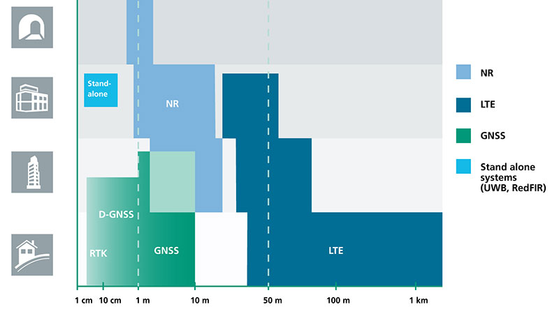
    Positioning Performance for 5G NR and other technologies in different environments. (Image: Fraunhofer IIS)
    Positioning Performance for 5G NR and other technologies in different environments. (Image: Fraunhofer IIS)

    Adaptive array antennas

    In addition to the precise positioning it will afford, 5G shares another characteristic with GPS/GNSS: adaptive array antennas for digital beamforming (DBF). Adaptive arrays have many advantages for PNT, primarily in mitigation for multipath, jamming and spoofing.

    Adaptive antenna arrays with DBF are becoming increasingly important for PNT in challenging signal environments. DBF combines multiple antenna inputs to generate gain in arrival direction of the desired satellite signal and to create spatial nulls in the direction of jamming. (See the January 2017 Innovation column “Correlator beamforming for low-cost multipath mitigation” and the February follow-up, “Mitigating interference with a dual-polarized antenna array in a real environment.”)

    Picocells

    Emerging applications of DBF in 5G involve dense networks of picocells, small cellular base stations that typically cover a small indoor area. Picocells extend coverage where outdoor signals do not reach well, and add network capacity in areas with very dense phone usage. 5G architectures will use adaptive array technology to achieve high data rates, spectrum reuse and communications robustness.

    The implications for PNT are that 5G will require improved (relative) PNT to operate effectively, and picocells will be a source of PNT information in constrained environments.

    5G involves massive directional communications via multiple-input, multiple-output (MIMO), enabling high-bandwidth communications in fading (multipath) channels by using multiple antenna inputs to adapt to channels. It can do this without knowledge of user location, but it adds to the processing complexity. The directional capability can enable multiple users to be serviced in a picocell at different frequencies, while permitting spectrum re-use by nearby picocells through narrow beamwidth and the limited range of millimeter-wave (mmWave) frequencies.

    The PNT implications of 5G architectures, according to Gary McGraw of Rockwell Collins, are that 5G picocells will be synergistic with PNT in challenged environments — naturally, indoor and dense urban. They will necessitate development of distributed, networked PNT processing and infrastructure.

    Fraunhofer

    The 5G positioning framework will integrate a multitude of sensors into a hybrid positioning scheme, according to the Fraunhofer Institute for Integrated Circuits (IIS) in Germany. Fraunhofer IIS is currently prototyping low-latency and high-precision positioning systems for legacy LTE and future 5G New Radio (5G NR).

    5G NR enables positioning by providing high bandwidths for precise timing, new frequency bands at mmWave, massive MIMO for accurate angle-of-arrival estimation and new architectural options that support positioning. Improved accuracy, robustness and latency can be achieved, according to the institute.
    5G provides fast and reliable access to moving objects to achieve time-critical process control and optimization in industrial environments. Increased contextual awareness of goods, parts, machines and workers will enable new interaction and collaboration, the institute said.

  • ADS-B system for helicopters gets boost from Becker Avionics

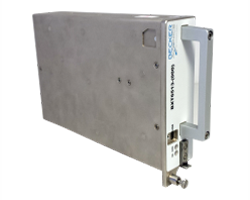
    Becker Avionics Diversity Mode S Transponder with ADS-B certified.

    Avionics technology provider Becker Avionics has received certification for the company’s BXT6500 family Mode S transponder, designed for the rigorous flying environment characteristic of helicopter operations.

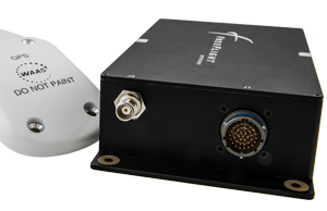
    Paired with a FreeFlight Systems’ 1203C SBAS/GNSS sensor, the remote-mounted solutions provide helicopter operators a complete and cost-effective way to equip with ADS-B Out for the upcoming Jan. 1, 2020, mandate.

    The Becker BXT6500 family Mode S transponder is diversity-capable and available for installation on non-TCAS equipped aircraft. A non-diversity option is also available.

    The FreeFlight SBAS/GNSS (WAAS/GPS) 1203C sensor.

    In addition to providing clients with ADS-B compliance, the system features enhanced privacy settings that can disable both ADS-B and Mode S transmissions — a feature unique to the BXT6500 family.

    “We are pleased to announce this new milestone in our transponder product line,” said Forrest Colliver, managing director. “This new system showcases how we tailor our compact, robust and durable avionics to our clients’ requirements in order to provide the best solution for where and how they fly.”

    The system is a part of the company’s robust BXT6500 line of ADS-B Mode S transponders. Manufactured with a standard ARINC 429/743 output, this transponder easily integrates with the FreeFlight Systems Model 1203C SBAS/GNSS sensor for complete ADS-B Out compliance, and can be installed either as dual installation for primary transponder interrogations or as single install for a dedicated ADS-B transmission.

    For more information, visit with Becker Avionics at booth C4935 and FreeFlight Systems at booth C1137 during HAI’s Heli-Expo happening this week in Las Vegas, Nevada.

  • STMicroelectronics multi-band GNSS receiver provides autonomous safety compliance

    Assisting safer autonomous driving, STMicroelectronics has introduced a multi-frequency GNSS receiver chipset suitable for safety-critical automotive applications and high-accuracy positioning at the decimeter and centimeter-level for precise point positioning (PPP) and real-time kinematic (RTK) applications.

    Traditional in-car navigation systems help drivers reach their destinations using receivers and commercial satellite services that allow positioning accurate to within a few meters.

    With increasing use of autonomous systems such as lane-departure warning (LDW), adaptive cruise control (ACC), valet parking and auto-pilot, greater accuracy is needed to ensure safety and reliability, in combination with proximity sensors such as cameras, radar, lidar and others, to monitor the driving environment automatically. Fully self-driving vehicles of the future will also demand high-accuracy positioning.

    By tracking satellites of all GNSS constellations simultaneously on at least two of the frequencies used by each system, ST’s automotive-quality Teseo APP (automotive precise positioning) receiver provides high-quality raw GNSS data for PPP and RTK algorithms, which allows accurate positioning and rapid convergence time worldwide.

    In addition to its high accuracy, the receiver monitors the integrity of the satellite data to alert the system if accuracy is degraded for any reason. This permits Tier-1 manufacturers to certify safety-critical systems in accordance with the automotive industry functional-safety standard, ISO 26262, up to the highest Automotive Safety Integrity Level (ASIL).

    Teseo APP also integrates a secure microcontroller for secure system boot and data-output authentication to keep sensitive data safe from attack.

    Launched alongside Teseo APP, ST’s Teseo V chip provides equivalent multi-frequency precise positioning in a simplified device for non-safety-critical applications where integrity assurance is not required.

    “High-accuracy satellite positioning makes autonomous driving safer, smoother, and more reliable,” said Antonio Radaelli, director, Infotainment Business Unit, STMicroelectronics. “Our newest Teseo APP GNSS chip combines extreme accuracy and precision with industry-unique integrity assurance for use in safety-critical applications.”

    Teseo APP eliminates errors by tracking all available GNSS signals in multiple frequency bands, such as the GPS and GLONASS, Galielo, BeiDou, QZSS, and IRNSS L1, L2, and L5 frequency bands, and the Galileo E6 signal that contains PPP correction data to allow worldwide decimeter-level accuracy.

    Other techniques for enhancing accuracy have included differential systems reliant on a combination of ground base-station signals as well as satellite signals, or techniques such as RTK, which generally require a denser reference station network.

    The new Teseo chips make high-accuracy affordable for autonomous driving through a combination of tracking up to three constellations simultaneously over two frequency domains. These multi-frequency combinations bring reliable GNSS ionospheric and multipath modeling in most environments, allowing accurate positioning with faster convergence time for automotive applications, where timing is critical.

    ST is now supplying product samples to lead customers who are developing autonomous-driving systems expected to appear first in high-end vehicles launched in 2020/2021.

    Visitors to Mobile World Congress 2018 in Barcelona, Feb. 26 to March 1, can see Teseo APP at the ST booth, Hall 7, Stand 7A61.

  • Septentrio to supply GNSS boards for WingtraOne mapping drone

    Septentrio to supply GNSS boards for WingtraOne mapping drone

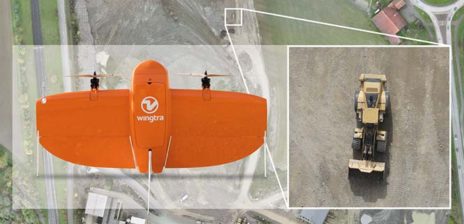
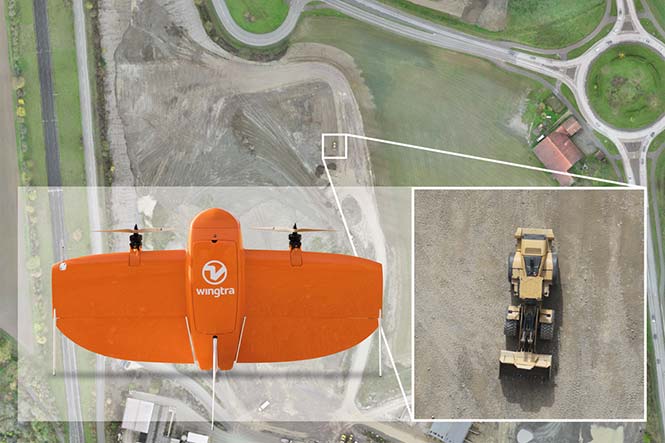
    Belgian GNSS receiver manufacturer Septentrio was selected by Swiss drone manufacturer Wingtra to supply GNSS OEM receiver boards and PPK processing software for the recently-launched WingtraOne PPK drone.

    The combination of vertical take-off and landing (VTOL) technology and a high-spec post-process kinematics (PPK) brings wide-area coverage at ultra-high precision.

    Following a flight, the GNSS data of the WingtraOne is processed offline using Septentrio’s PPK software. This combines the drone data with correction data from a nearby reference receiver to get accurate cm-level geolocations for every photograph.

    The on-board high-resolution Sony RX1RII camera, AsteRx-m2 UAS receiver board combined with Septentrio’s PPK library, and Pix4D photogrammetry processing software are together able to produce ground precisions of 1.3 centimeter (cm) horizontal and 2.3 cm vertical.

    Image: Wingtra
    Image: Wingtra

    “With the WingtraOne PPK, we can offer a world first in drone photogrammetry — wide coverage at ultra-high precision,” said Armin Ambühl, CTO of Wingtra. “In a single one-hour flight, the WingtraOne can cover 130 ha (320 acres) delivering mapping with GSDs [ground sample distance] below 1 cm/pixel with absolute accuracy down to 1.27 cm.”

    He continued, “WingtraOne’s advantage is twofold: it combines VTOL with the latest PPK technology from Septentrio. With VTOL we can offer the best of both worlds: multirotors and fixed-wings. Vertical take-off and landing means hands-free operation and a smoother ride for the on-board camera payload. Secondly, efficient flying in fixed-wing mode means far greater coverage than any comparable multirotor.”

    “We are proud and excited to be part of this innovative project with Wingtra pushing the boundaries of aerial photogrammetry,” said Gustavo Lopez, product manager at Septentrio. “The WingtraOne incorporates our AsteRx-m2 UAS OEM board and, photogrammetry applications requiring high-precision, low-latency positioning are what it does best. The board is specifically designed for quick and easy integration and, with Septentrio’s world-first, multi-frequency PPK, cm-level precision can now reach the parts dual-constellation solutions feared to tread.”

  • Orolia GPS/GNSS passive anti-jam antenna offers horizon blocking

    Orolia GPS/GNSS passive anti-jam antenna offers horizon blocking

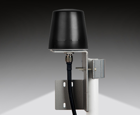
    Model 8230AJ antenna from Spectracom

    Designed primarily for applications such as homeland security, Spectracom’s 8230AJ antenna provides protection in high-interference environments where additional resilience is needed, such as communications networks, financial systems and power grids, the company said.

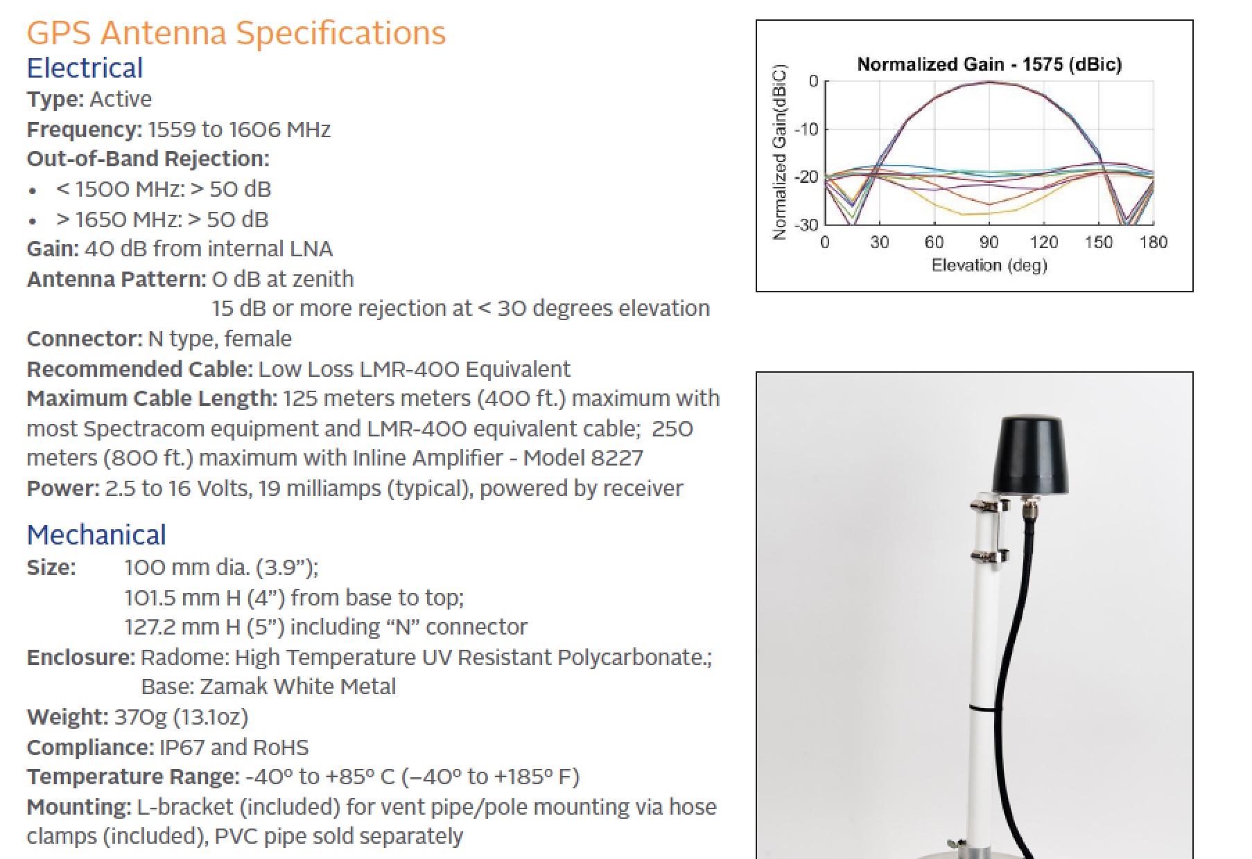
    Orolia, through its Spectracom brand, said the antenna, Model 8230AJ, is a drop-in replacement for the company’s Model 8230. Its conical antenna pattern rejects interference from the horizon and is simple to mount using the same pipe supports, without new cabling. All that is required is a new bracket.

    “Model 8230AJ is a high gain (40 dB) GNSS outdoor antenna covering GPS L1, GLONASS L1, BeiDou B1, Galileo E1, and QZSS L1,” said David Sohn, product manager at Spectracom. “It uses a three-stage low noise amplifier, a mid-section SAW, and a tight pre-filter to protect against saturation by high level sub-harmonics and L-band signals. It is designed especially for harsh environments, is IP67 rated, and improves resilience and protects against jamming and spoofing.”

    According to the company, the AJ antenna rejects signals for the lower elevation angles – where most interference comes from – and only receives signals from the higher elevation angles where the satellites are. While this reduces the number of satellites the receiver will see, for timing applications only a few satellites are needed. Moreover, with multi-constellation receivers, an increasing number of satellites are available.

    With the increasing prevalence of jamming and spoofing, industries with critical infrastructure must take measures against interference.  GPS and GNSS in general have well-known vulnerabilities and limitations that require protection and mitigation: the signals are easily disrupted by unintentional interference from radio transmitters, they are extremely weak, cannot penetrate buildings and can easily be jammed, and civilian signals are not encrypted and can easily be spoofed.

    The new anti-jam outdoor antenna is appropriate for anyone who uses a time server, including Spectracom customers who own a SecureSync, VersaSync or Netclock, according to the company.

    Image: Spectracom
    Image: Spectracom
  • OriginGPS releases LTE-M system for low-power IoT products

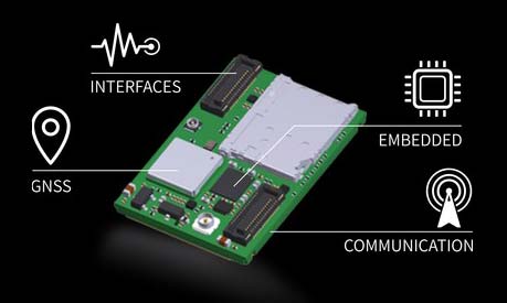
    OriginGPS has chosen Gemalto’s Cinterion LTE-M wireless module to build its latest miniature OriginIoT system. Gemalto, a digital security company, designed the module for low-power applications requiring high security.

    OriginIoT systems are generic cellular internet of things (IoT) systems that simplify IoT product development and slash development resources.

    The systems include communication hardware, a GNSS module, embedded software and a novel interface to OriginIoT add-ons that accommodate multiple sensors and other peripheral devices.

    OriginGPS signal-to-noise technology is leveraged to deliver superior GNSS and cellular matching, facilitating excellent performance in noisy environments, while the OriginSmart software enables cloud-based programming, relieving developers from writing embedded code.

    The OriginIoT LTE-M system (ORG2101) has a 15 percent smaller footprint than the previous 2G and 3G models, and will be pre-certified with selected operators.

    The low-power, wide-area Cinterion LTE-M module supports more than 10 frequency bands from a single hardware device, eliminating the need for multiple variants. The module protocols can run on the same hardware, thus providing a future-proof path for additional OriginIoT models.

    “To save resources and stay competitive, such easy to develop low power solutions are essential for today’s IoT products,” said Andreas Haegele, senior vice president of IoT products for Gemalto. “We are glad to see that OriginGPS is expanding the market by offering accessible, affordable IoT products that are backed by Gemalto reliability and high quality,”

    “We designed the OriginIoT LTE-M system to address market pains, and so our new offering includes low power consumption, superb GNSS/cellular matching, interfaces to multiple connectors, and software to enable developing from the convenience of the cloud,” said Robert van Tilburg, VP Global Sales and Business Development of OriginGPS. “These features serve to simplify and shorten IoT projects. Gemalto’s Cinterion IoT module enables OriginGPS products to retain their world’s smallest footprint, while enhancing their security and extending end-product life.”

    OriginGPS will be showcasing its GNSS modules and OriginIoT systems at Embedded World, Feb. 27 – Mar. 1, in Hall 3, Booth 121.

  • Fugro’s GNSS rig positioning chosen for Norway’s Statoil

    Fugro has won a long-term contract to provide GNSS-based rig positioning services to Statoil Petroleum AS.

    The contract includes positioning of all the Statoil operated rigs on the Norwegian continental shelf and associated Statoil vessels.

    Fugro’s specialized satellite positioning systems, utilizing all available navigation satellites (GPS, GLONASS, Beidou and Galileo), will be permanently installed on the Statoil-operated rigs and vessels.

    The robustness and accuracy (better than 3 centimeters) of these satellite systems, in conjunction with Fugro’s latest navigation software and technology developments, will ensure the best possible service for Statoil, Fugro said.

    Developments in technology will bring two significant benefits to Statoil: by remotely configuring the offshore systems from Fugro’s onshore bases, mobilization time will be reduced and fast-track operations will be enabled.

    Fugro will providing GNSS positioning services to Statoil Petroleum’s oil rigs and vessels. (Photo: Fugro)

    Berit Sagatun, commercial manager for Fugro, cited the company’s track record in the delivery of innovative rig positioning systems.

    “For decades Fugro has been at the forefront of the rig positioning market in Norway,” Sagatun said. “Our knowledgeable and responsive project management team, combined with our highly skilled and experienced offshore personnel, ensures safe and efficient operations for Statoil.”