Septentrio has launched its next-generation GNSS receiver for precise scientific and geodetic applications — the PolaRx5. This new receiver in the PolaRx product line is developed specifically to support the most demanding applications for the Earth science community offering a select range of advanced features that enable maximum accuracy and functionality.
Powered by Septentrio’s next generation multi-frequency engine, the PolaRx5 offers 544 hardware channels for robust and high-quality GNSS tracking. The receiver supports all major satellite signals including GPS, GLONASS, Galileo and BeiDou, as well as regional satellite systems including QZSS and IRSS.
Septentrio’s Advanced Interference Mitigation (AIM+) technology enables the PolaRx5 to filter out both intentional and unintentional sources of radio interference, from narrowband signals over high-powered pulsed signals to chirp jammers and Irridium interferers. Furthermore, Septentrio’s patented APME+ multipath mitigation technology — which eliminates short delay multipath without introduction of bias — guarantees superior measurement quality. If needed, the user has the ability to activate or deactivate APME+ to obtain completely unmodified measurements.
Various independent tests have shown PolaRx5 consistently ranks high among GNSS receivers in many areas of measurement quality, including fewest number of cycle slips and lowest power consumption well below 2W.
PolaRx5 also introduces a new standard in ease-of-use. Thanks to Septentrio’s comprehensive web interface and the built-in Wi-Fi and Bluetooth interface, users have complete control and visibility of the receiver. The user’s web browser provides secure access to all receiver settings and status, data storage and firmware upgrades, as well as advanced monitoring such as a built-in spectrum analyzer.
“With PolaRx5, Septentrio has developed an advanced GNSS reference receiver to meet the advanced needs of our customers,” said Jan Leyssens, PolaRx5 product manager. “The selection of PolaRx by UNAVCO for their reference receiver needs illustrates the strengths of Septentrio’s robust technology and PolaRx’s innovative features such as its interference robustness, spectrum analyzer and web interface to make the PolaRx5 the leading GNSS reference receiver on the market today.”
This release of ArcGIS, planned for 2016, expands the existing native integration with SAP HANA and allows customers to run SAP Business Suite and ArcGIS applications within an architecture based on SAP HANA. The companies said they will further enhance the SAP HANA platform by more deeply integrating advanced ArcGIS geospatial capabilities and content across SAP’s broader application portfolio.
The collaboration between SAP and Esri is expected to provide the ability to run both GIS workloads and advanced spatial analytics on a single SAP HANA geodatabase. The companies stated that customers will be able to apply sophisticated business rules and relationships to spatial data directly in SAP HANA, define advanced georelational models such as topologies and networks, and permit both GIS and enterprise business users to work within the same multiuser access and editing environment.
“We’re very excited about the enterprise geodatabase support for SAP HANA,” said Jack Dangermond, Esri’s president. “It will bring our customers speed, simplicity and better integration with their enterprise information. For SAP customers, it delivers a complete platform for mapping and geospatial intelligence. By synchronizing our platforms, our respective customers will benefit across the enterprise. We’re doing the work to make sure that GIS and mapping is available to all — not just traditional mapping experts.”
SAP and Esri have been technology partners for a number of years, providing integration of their respective platforms, SAP HANA and Esri ArcGIS. Companies invested in Esri and SAP can immediately create maps populated with data from SAP HANA and instantly access those maps anywhere on any ArcGIS client, as well as in SAP or custom applications. Today users of SAP HANA can access ArcGIS for geospatial data and geoservices and perform analytics, while Esri users can similarly access, analyze and query both spatial and nonspatial data directly in SAP HANA. Esri supports deployments of SAP HANA with query layers and features services for customers that want to dramatically increase spatial query performance by running SAP HANA side by side with ArcGIS.
“Our customers represent a new generation of data stewards requiring an in-memory computing platform that performs at scales unseen before — including large-scale geography,” said Daniel Schneiss, senior vice president and global head, SAP HANA Platform and Databases, SAP. “As we enter a world of exponential data growth and the Internet of Things, the need to geospatially analyze Big Data will only increase from this point forward. We look forward to teaming with Esri to address this need by integrating the full power of ArcGIS technology with SAP HANA.”
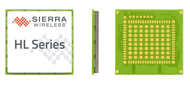
Maestro Wireless Solutions Limited, a provider of tracking devices for Internet of Things (IoT) applications globally, has announced its first LTE Cat-1 tracker based on the AirPrime HL Series from Sierra Wireless.
Maestro’s newest tracker, the ruggedized MT-44, provides fleet and asset tracking capabilities in harsh mobile environments using the LTE Cat-1 module with maximum data rates of 10 Mbps downlink and 5 Mbps uplink.
The Maestro MT-40 Series is a compact range of rugged micro-trackers for the vehicle tracking market.
“We have been integrating Sierra Wireless modules into our products for more than 15 years and we have always trusted the company to deliver on leading edge cellular technologies that improve product performance,” said Xavier Dupont, chief executive officer of Maestro. “The HL Series provides us with a single footprint for 2G and 3G global coverage and the LTE Cat-1 module is utilizing the same compact design in our newest tracker.”
“Today, we are seeing strong interest in our LTE Cat-1 embedded modules optimized for lower bandwidth and power requirements,” said Dan Schieler, senior vice president, OEM Solutions for Sierra Wireless. “We are pleased to have Maestro deploying our latest LTE technology in their tracking devices. The HL Series Cat-1 module provides the next step in the evolution for our customers, as service providers are continuing to transition their networks to LTE technology.”
The HL Series uses the CF3 form factor from Sierra Wireless that is footprint-compatible across product lines and network technologies, and is fully interchangeable with future versions of the modules, including LTE-M variants when they become available.
LTE-M is a Low-Power Wide Area (LPWA) technology that will provide a highly efficient cellular option with lower radio-frequency complexity, significantly reduced power consumption (up to 10 years of service on a single AA battery), better in-building signal penetration and lower costs. Sierra Wireless is an active contributor to the LTE-M standard definition process within the 3GPP and has committed to launching compatible modules timed with network deployments, expected to begin in 2017.
The LTE Cat-1 modules from Sierra Wireless will be commercially available in January 2016 on the HL Series.
Lockheed Martin has demonstrated its ability to integrate unmanned aircraft system (UAS) operations into the National Airspace System (NAS) using its prototype UAS Traffic Management (UTM) capabilities.
During the demonstration on Nov. 18, the Stalker XE UAS provided data and a precise geolocation to the unmanned K-MAX cargo helicopter, which conducted water drops to extinguish a fire, while the UTM tracked the UAS operations and communicated with Air Traffic Control in real time.
The Stalker UAS directs the unmanned K-MAX cargo helicopter to conduct water drops at a precise location to extinguish a fire. (Photo: Lockheed Martin)
“This demonstration represents the path forward for flying UAS in the NAS using Flight Service-based UTM capabilities to extend the technology and systems that air traffic controllers know and understand,” said Paul Engola, vice president, Transportation & Financial Solutions. “We were able to successfully modify the existing K-MAX and Stalker XE ground control software to connect to the UTM services and conduct the firefighting mission.”
For more than 80 years, manned aircraft have supported firefighting missions during daylight hours. Because unmanned K-MAX can fly day and night, in all weather, its insertion into firefighting operations offers the potential to triple the amount of time ground firefighters can receive aerial support.
The Stalker XE UAS worked in tandem with K-MAX to identify hot spots and fire intensity with its electro-optical, infrared camera. Its stable, high-definition imaging capabilities enable day and night operations. Powered by a ruggedized solid oxide fuel cell, Stalker XE achieves more than eight hours of flight endurance.
The Stalker and K-MAX operated in collaboration with a prototype UAS Traffic Management (UTM) system, which provides essential capabilities to enable safe UAS operations. (Photo: Lockheed Martin)
Huawei has licensed the InvenSense Positioning Library (IPL) software sensor-assisted positioning technology for incorporation into the Kirin 950 mobile application processor platforms by HiSilicon.
InvenSense is a provider of micro-electro-mechanical (MEMS) sensor platforms. The recently launched Huawei Mate 8 smartphone is the first model to incorporate the HiSilicon and IPL technology.
IPL improves smartphone GNSS-only implementations by providing more continuous and accurate navigation in areas with poor GNSS signal quality. The IPL solution delivers sensor-enhanced positioning providing a high-availability, high-accuracy turn-by-turn navigation user experience to HiSilicon mobile platforms and mobile application developers.
Through this collaboration, InvenSense and HiSilicon will make continuous improvements to IPL and the overall location subsystem to provide the best possible navigation experience to Huawei’s customers.
The Huawei Mate 8 smartphone is the first model to incorporate Invensense MEMS technology.
The combination of sensor positioning with GNSS enhances navigation user experience by eliminating “GPS Signal Lost” warnings and unnecessary re-routings in map applications due to GNSS multipath errors. IPL uses complex algorithms that take sensor data from the mobile device gyroscope, accelerometer, magnetometer and barometric pressure sensors to generate an inertial navigation system (INS) that tracks the position change of a vehicle or pedestrian.
IPL then combines the INS with GNSS to provide always-available and more accurate location data when GNSS is inaccurate or unavailable, such as in deep urban canyons with tall buildings or in tunnels and parking garages. IPL operates in any physical orientation allowing the user to freely move the phone in the vehicle during active navigation sessions.
“Today’s consumers are increasingly using smartphones for turn-by-turn navigation in vehicles, creating a strong need for a higher quality user experience that decreases the occurrence of confusing or stressful re-routes and GPS lost signal messages,” said Eitan Medina, vice president marketing and product management at InvenSense. “We are pleased that HiSilicon, a market leader in end-to-end chipsets and solutions, has chosen our IPL technology for integration into its mobile platforms.”
IPL is available now for smartphones using Android, iOS, Windows and general Linux operating systems.
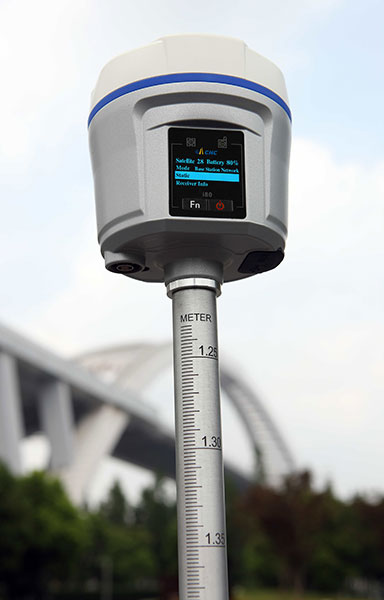
CHC Navigation has announced in a news release the availability of its new GNSS receiver, the i80.
The i80 receiver for surveyors and contractors is able to compute a true triple frequency RTK tilted pole sub-centimeter solution using all four worldwide and multiple regional constellations.
“Over two years of R&D and testing went into the creation of our Linux OS i80 platform,” said George Zhao, CEO of CHC.
The i80’s LCD GUI allows for common workflow operations, such as Static Logging, AutoBase, AutoRover, and UHF channel selection to be easily performed without the need of a data collector or computer. The CHC i80 is the smallest receiver on the market with dual hot-swappable batteries, CHC says. The receiver contains a full array of sensors and modules: multiple MEMS, Internal Tx/Rx UHF, multi-band cellular modem, Wi-Fi, Bluetooth, Serial, USB and more.
“This innovative design will allow us to add new functionality [with over the air updates] for years by combining the sensors and modules in new ways — this is illustrated by our LCD supported work modes, and our MEMS enabled unleveled pole surveying added in the last couple months during product rollout,” Zhao said. “We are bringing GNSS in to a new era of productivity and ergonomics in a low-cost open platform allowing for unrestricted third-party integration via our i80 API.”
“The geoDVR is a purpose-built geospatial DVR for the airborne utility and pipeline patrol industry and it shows” said Nathan Kayes, managing member of Due North Aviation. “Being able to record all three HD and SD video channels to a single drive, along with the Live Moving Maps and Waypoint Keyword modules, offers significant advantages both in the air and for the final inspection deliverables we provide our clients.”
The geoDVR Gen2 is an advanced mil-spec DVR for recording multiple channels of geo-referenced high-definition full motion video in airborne and mobile mapping environments. It is ideally suited for professional utility/pipeline inspection, electronic news gathering and airborne law enforcement applications that utilize multi-sensor gyro-stabilized gimbal video cameras, Remote Geo says.
The geoDVR monitor and interface with optional Live Moving Maps module were installed.
Due North Aviation will use the geoDVR with their SWESystem 300 gimbal to perform helicopter-based electric utility inspections with HD color, infrared and corona (UV) video. Using LineVision software, Due North will combine the geoDVR videos as well as high-resolution oblique still photos to create geoProjects for their clients.
Videos, photos, points of interest and audio notes collected with the geoDVR are compatible with Remote GeoSystems’ LineVision suite of GIS project mapping and reporting software. LineVision allows for simple desktop and browser-based playback, analysis and project reporting utilizing the Esri ArcGIS for Desktop, Server and Cloud platforms, as well as Bing Maps and PLS-CADD.
Hexagon AB has entered a strategic partnership with Huawei, an information and communications technology (ICT) company, to deliver smart city solutions.
With most of the world’s population living in cities, safety and infrastructure challenges are at an all-time high. Hexagon and Huawei are working together to meet this global challenge by integrating Huawei’s communications hardware with Hexagon’s safety and infrastructure software solutions.
The combined solution improves inter-agency collaboration and leverages big data analytics to better predict, prepare for, and respond to urban area challenges.
Safety is a primary focus of the combined solution, offering cities connected command centers with integrated systems that maximize efficiencies in all preparedness and response areas. Huawei’s contributions include technologies from its Safe City portfolio such as high-definition video surveillance, broadband trunking and IP-based conference calling systems. Hexagon’s emergency response, utilities management and transportation software solution portfolio, which includes computer-aided dispatch, will provide the visibility and decision-support backbone to enable customers to think and act more nimbly.
“Huawei’s technologies, expertise and global coverage, especially in emerging market areas, nicely complement our ability to deliver smart city solutions to law enforcement, government, security personnel and other public service agencies around the world,” said Ola Rollén, Hexagon president and CEO.
“Safety, including efficient response to crisis management, will continue to be a key challenge for urban management, especially in developing economies that are stimulating population movement into these areas,” said Yan Lida, president of Huawei Enterprise Business Group. “Together with Hexagon, the global authority on safety and infrastructure solutions, our extensive ICT technologies that help architect safe city infrastructure will help make societies safer.”
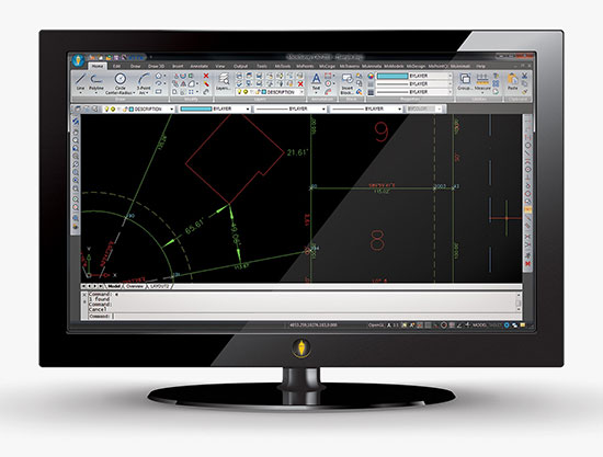
MicroSurvey Software has released MicroSurvey CAD 2016, the newest generation of its desktop survey and design program for land surveyors and civil engineers. Powered by a new IntelliCAD 8.1a engine and enhanced with a suite of new point-cloud management tools, the software makes high-impact drafting and design fast and intuitive, the company said.
Users on multi-core computers will experience up to 300 percent faster performance compared to previous versions, which substantially improves productivity. Navigation has been enhanced through a new ribbon interface with high-resolution icons that provide easy access to frequently used tools. The newest version of the software is also able to open and export DGN files, handle annotation scaling, and publish drawings as DWF/DWFX, PNG and JPG files.
Point Clouds. The new release includes significant enhancements for working with point clouds. The Ultimate and Studio versions of the software are now powered by the same point-cloud engine that drives Leica Cyclone and CloudWorx software, making it possible to directly import Leica Cyclone and Leica JetStream databases using Cyclone dialogs.
Users can view panoramic photographs captured by the laser scanner and snap to points directly from the photographs in a TruSpace window. Point-cloud data is now displayed directly within the CAD model space, and users can snap to the point-cloud points using standard CAD tools.
MicroSurvey CAD is compatible with field data from all major total stations and data collectors and is fully compatible with AutoCAD. It includes complete survey drafting, COGO, DTM, traversing, volumes, contouring, point-cloud manipulation and data-collection interfacing. No plug-ins or modules are necessary. Both a 64-bit version and a 32-bit version of the software are available.
The late, great, oft-quoted Yogi Berra, in an interview shortly before his passing, was quoted as saying “I never said most of the things I said.” For our purposes, let’s concentrate on one of his most famous quotes: “When you come to a fork in the road, take it.”
On to GPS. I use the term GPS in a ubiquitous PNT (position, navigation and timing) sense for simplicity, because most people today use the term in a universal sense, similar to how we say “Google It” no matter which search engine we’re actually using.
Today, GPS is indeed at a crossroads, and there are multiple paths or avenues to follow — or Courses of Action (COA), as the government likes to say. Fortunately, most of you reading this fully realize GPS is so much more than just an atomic reference system in MEO, or Medium Earth Orbit. Let’s review the various GPS programs and see how they’re faring.
GPS III
Let’s be conventional and start with the hardware, the actual satellite bus (vehicle) being built by Lockheed Martin Space Systems in its Waterton facility in the beautiful foothills of the Rocky Mountains in Littleton just west of Denver, Colorado.
In an October 2015 speech before the International Astronautical Congress in Jerusalem, Israel, LMCO Chairman, President and CEO Marillyn Hewson stated the following in a marvelous speech entitled “There are No Borders in Space: International Cooperation Will Drive the New Space Age:”
“We must focus on three priorities for the future of space. The first is space as an instrument to create global industrial partnership. Second is space as a driver of economic growth. And third is space as an opportunity to inspire the next generation of innovators.”
Chairman Hewson concentrated on the future of space, as are we, and probably due to her venue, she naturally chose to focus on international cooperation. She went on to say this about GPS specifically:
“GPS III, the next-generation of the U.S. Air Force’s Global Positioning System, will share a new, common civil signal with other international navigation satellites like Galileo and GLONASS. That means people around the world will have more accurate and reliable positioning data and connectivity from a truly global positioning constellation.”
Speaking about space capabilities and opportunities in general, she said:
“Space-based technologies are ubiquitous today. Want to find an address? Find out the weather forecast? Talk to someone on the other side of the world? The fact is, space is already an enabler of economic growth. And with today’s innovations combined with the power of international partnerships, it has the potential to drive magnitudes more.
“Today, the space sector represents about 1 percent of global economic activity. Yet, I could argue that without space, the other 99 percent wouldn’t be nearly as effective or efficient. Partners are developing commercial satellites that connect people around the world, enable distance learning and fuel job growth in many sectors of the global economy.”
You really can’t fault any of Chairman Hewson’s statements about space and GPS in particular. Indeed, it is an excellent presentation as it embodies the essence of motherhood and apple pie for space-faring nations.
However, she has glossed over one of the most pressing problems, not only for GPS III, but for all potential U.S. space-based assets still to be launched: access to space. How are we going to actually lift the satellites into orbit? Where are the launch vehicles?
United Launch Alliance
ULA launch. (Courtesy of United Launch Alliance)
Many of you may have seen the latest GPS III launch services announcement by United Launch Alliance (ULA), a consortium of Boeing and LMCO launch companies taking advantage of the synergies each company brings to the launch arena. Officially, ULA is described as a 50-50 joint venture between Lockheed Martin and The Boeing Company, formed in 2006 to provide reliable, cost-efficient access to space for U.S. government missions.
Just a few weeks ago, ULA — the consortium that has launched all GPS satellites since 2006 with more than 90 consecutive government launches without a single failure, a world record — made what many consider to be a startling, albeit carefully worded, announcement regarding the latest and what many consider to be unduly restrictive government GPS III RFP (Request For Proposal) for launch services.
“ULA wants nothing more than to compete, but unfortunately we are unable to submit a compliant bid for GPS III-X launch services. The RFP requires ULA to certify that funds from other government contracts will not benefit the GPS III launch mission. ULA does not have the accounting systems in place to make that certification, and therefore cannot submit a compliant proposal.
“In addition, the RFP’s Lowest Price Technically Acceptable (LPTA) structure allows for no ability to differentiate between competitors on the basis of critical factors such as reliability, schedule certainty, technical capability and past performance.
“Further, under the restrictions imposed by the 2015 National Defense Authorization Act (NDAA), ULA does not currently have any Atlas engines available to bid and therefore is unable to submit a timely proposal.
“ULA remains fully committed to supporting America’s national security missions with world-class launch services. We look forward to working with the Air Force to address the obstacles to ULA’s participation in future launch competitions to enable a full and fair competition.”
A separate ULA press release states ULA will continue with development of its Vulcan launch vehicle, which they bill as a next-generation launch system. So it appears that it is merely the restrictions and caveats that pose a problem for ULA and GPS III launches, not technology or timelines.
“With the introduction of the Vulcan, ULA’s next-generation launch system (NGLS), ULA is transforming the future of space launch — making it more affordable, accessible and commercialized — and innovating to develop solutions to the nation’s most critical need: reliable access to space,” ULA said.
The Falcon .9 (Courtesy of SpaceX)
SpaceX
With ULA out of the picture, at least temporarily, for GPS III launches, this leaves the door open for Elon Musk, recently of Big Bang Theory fame, and his Space Exploration Technologies Corporation better known as SpaceX to step in and fill the void presumably with a variation of their heavy lift Falcon 9 rocket.
SpaceX promotes itself as the largest private producer of rocket engines worldwide, and no doubt that is true. SpaceX has demonstrated the capability for both successful launches and spectacular failures. That is almost to be expected for a new rocket engine and a new company, which only came about in 2002. However, where human lives are concerned, failure is not an acceptable option.
SpaceX is very much aware that a launch failure resulting in lives lost might well spell the end of SpaceX. With that as a given, SpaceX recently delivered its 100th Merlin 1D engine, nine of which form the basis for the first stage of the Falcon 9 launch vehicle. Indeed, SpaceX touts unparalleled redundancy — with nine Merlin 1D engines on the first stage, it could actually overcome a failure of any one of the Merlin engines and still have a successful launch.
Merlin ID engines all in a row. (Courtesy of SpaceX)
Only time will tell, however, and this scenario leaves the U.S. government with very few options as long as the current guidelines regarding the Russian RD-180 core are in place. Other companies such as Moog, Orbital Sciences, Aerojet Rocketdyne, Blue Origins and ATK, to name a few potential contenders, could separately or as a team bid on the next-generation launch vehicle for GPS III.
However, that would mean storing the GPS III satellites and payloads for inordinately long periods of time, which is both expensive and risky. Expensive in dollars, since each GPS III space vehicle (SV) would cost approximately $1 million per year — not an official figure, but a best guess from several sources, to store, and expensive and risky from an operational point of view in that the federal government and LMCO would have no idea if the GPS III SVs and payloads really worked as advertised.
They would have no idea if there were any major flaws or anomalies, and once the production line at LMCO space systems was shut down, it would be prohibitively expensive to restart, if that were even possible. Remember, three GPS III SVs are being constructed currently, and today there are only eight confirmed orders for GPS III SVs.
As for major anomalies, just think back to the GPS IIF launches where the first four each revealed a major and separate anomaly for IIF SVs that had to be corrected on all future SVs and payloads before further launches occurred.
My sources at LMCO in Littleton assure me the first GPS III SV with a complete payload, built by Harris nee Exelis, nee ITT, will be ready for delivery to the government in mid-2016, possibly earlier. With a 90-day checkout the first GPS III SV could be ready for launch as early as late fall 2016.
The problem at that point becomes — and actually is a problem right here and now — there is no evidence that the government currently has a viable certified program to launch, control or maintain the GPS III satellites and payloads. But that is another story with many twists and turns.
The Road Less Taken
Apparently, there are numerous options for the government where GPS programs are concerned, and for a change many of those options, while being considered outside the box, actually appear to be the smarter choice.
As that great American poet Robert Frost once famously wrote:
“I shall be telling this with a sigh
Somewhere ages and ages hence:
Two roads diverged in a wood, and I—
I took the one less traveled by,
And that has made all the difference.”
Until next time, Happy Holidays, Happy New Year and Happy Navigating on that road less traveled by.
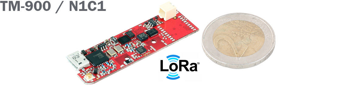
KCS BV has extended its TraceME product line with a low-budget track-and-trace module based on LoRa technology.
The TM-900/N1C1 is a variant of the TraceME GPS track-and-trace product line targeted for tracking and tracing a variety of objects, including livestock, and for personal use.
The full version module is equipped with different technologies for traceability — such as GPS, LoRa, Bluetooth LE, ANT/ANT+ and proprietary RF — which can be combined depending on the application. Traditional national telecom costs are eliminated because of the absence of GPRS/SMS.
Applications include:
Object protection, up to 10 years of standby on a single lithium AAA-battery.
Logistics, M2M.
Animal tracking, asset monitoring.
Security and surveillance.
Remote control and diagnostics.
Anti-theft.
The combined LoRa and 2.4 GHz. RF technologies offer tracing over a wide area up to 10 km. The rough tracing from 10 km down to 300 meters is done by LoRa, while the short-range tracing is done by the proprietary RF-technique, which offers excellent indoor and outdoor tracing with an accuracy up to 1.5 meters.
Unique features include its small size at 49.6 by 15 by 7.5 millimeters, its weight at 3.4 grams and a standby battery lifespan of more than 10 years. Temperature, humidity and acceleration sensors — as well as solar power functionality — enable the integration of TraceME into a variety of custom specific machine-to-machine applications.
Trimble has received a contract extension for Beijing’s new airport project. In April, Trimble won the initial bid to supply the project with a construction information management system. Based on the success of the solution to date, the contract has been extended to include additional machine control systems for soil stabilization.
Beijing’s new airport is projected to handle 72 million travelers, 2 million tons of shipping and 620,000 flights by the year 2025. It is a massive construction project with an unprecedented amount of civil aviation investment by the Chinese government. In order to construct the airport in a safer, more efficient manner, achieve transparent management, and maximize construction quality, the Beijing new airport project is using construction technology from Trimble to integrate construction and operations.
Artist’s depiction of the inside of the new Beijing Airport terminal. (image: Zaha Hadid Architects)
Trimble was chosen to implement a browser-based, locally hosted digital construction information management system for tracking and monitoring construction operations in real time. The Trimble solution allows users to create 3D constructible models, perform soil stabilization, automate construction processes and effectively manage information. Based on the successful soil stabilization results using Trimble machine control over the past four months, another 15 systems have been ordered.
“The research results for dynamic compaction have been extremely promising,” said Li Qiang, chief engineer of the Beijing New Airport Construction Office. “As a result, the project is pushing forward with a larger scale deployment to further the research into creating new methods and standards for airfield construction.”
“The Beijing new airport project is a significant win for Trimble, and we are very excited about the success of the project,” said Steve Berglund, president and CEO of Trimble. “The contract extension validates Trimble’s ability to provide innovative solutions that transform work processes by maximizing management capability, ensuring construction quality and improving productivity.”
Trimble’s machine control solutions leverage a variety of technologies, including GPS, construction lasers, total stations, wireless data communications, the Internet and application software. As part of the Trimble Connected Site strategy, these solutions provide a high level of process and workflow integration from the design phase through to the finished project, delivering significant improvements in productivity throughout the construction lifecycle, the company said.
Terminal construction: The technology used allows creation of 3D constructible models and automated construction processes. (Photo: Trimble)
 Septentrio has launched its next-generation GNSS receiver for precise scientific and geodetic applications — the PolaRx5. This new receiver in the PolaRx product line is developed specifically to support the most demanding applications for the Earth science community offering a select range of advanced features that enable maximum accuracy and functionality.