Category: Applications

  • Field Technology Conference: The forest and the fish

    PORTLAND, Ore. — Two weeks ago, I attended (and hosted) the Field Technology Conference here in Portland, Oregon. This is the fifth year of the conference. In years past, it’s had a forestry emphasis primary because the Western Forestry and Conservation Association has been a major partner in organizing it.

    This year, the Pacific States Marine Fisheries Commission and Pacific Northwest Aquatic Monitoring Partnership joined the organizing committee. The result was a 50-percent increase in attendance and a more diverse audience.

    Another newcomer to the conference was a Civil GPS Service Interface Committee (CGSIC) U.S. State and Local Government Subcommittee meeting, which was co-located with the Field Technology Conference, offering a direct connection between civil GPS users and U.S. government representatives who are involved in GPS.

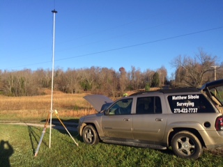
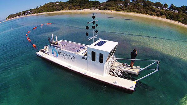
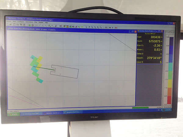
    The conference was a two-day event comprised of three technology tracks: a track for general field technology and two tracks for industry-specific (forestry and fisheries) subjects, hands-on technology demonstrations and a field trip. Although forestry and fisheries professionals were the featured user groups, nearly all of the subject matters — GPS, UAVs, smartphones, tablets, laser rangefinders, lidar, photogrammetry, and field data-collection software — is applicable for a wide range of natural resource users involved with GIS (geographic information systems) technology.

    As one of the hosts of the conference, I started out moderating the general session with all of the attendees in one room. This year, my general session topics include geospatial awareness and growth, GPS/GNSS technology, mobile devices (smartphones and tablets) and UAVs.

    Something new I tried this year, which worked out really well, was using audience response “clickers.” These small handheld devices were given to each audience member and allowed them to answer multiple choice questions that I posed in my Powerpoint presentation. I’ve always been a fan of audience input, and started polling the audience during webinars I conducted many years ago. For this conference, I used an audience polling system from Turning Technologies. I’d like to share with you the questions I asked the audience and the responses that I received.

    Question #1: Are you here?


    Comment: This was a test question to see if the audience response system was working properly. I’m still not sure if the audience just had a great sense of humor or a technical problem. I think the former was true. ☺

    Question #2: Have you attended this conference before?


    Comment: This was great news that the conference is attracting new attendees. It’s an annual event held in November, so keep your eyes on it for next year!

    Question #3: After a brief discussion about the availability of higher accuracy geospatial data (eg. GNSS, UAVs, etc.), I was curious about the level of accuracy the audience required in their typical tasks.

    What geospatial data accuracy do your typical tasks require?

    Microsoft PowerPoint - FTCGeneralPlenary2015 [Compatibility Mode

    Comment: I wasn’t sure what to expect with this question, but since I’ve polled a fisheries audience before, I had a feeling accuracy requirements would vary, and they did. Previously, a fisheries audience had told me that they were satisfied with 5-meter accuracy.

    Question #4: The last question leads to this one. I wondered if the audience accuracy requirement was driven by requirement or by availability.

    Are you satisfied with the accuracy of the geospatial data you use?

    Microsoft PowerPoint - FTCGeneralPlenary2015 [Compatibility Mode


    Comment: The answer is clear that, generally speaking, the audience would use higher accuracy geospatial data if it was available.

    Question #5: The next question was a pure technology one. In the day of BYOD (Bring Your Own Device), I’ve been very interested in monitoring the trends in mobile devices. The question about operating systems is relevant because it determines which data collection software you can use. For example, if a specific data-collection software is written only for Windows, it will not run on an Android or Apple (iOS) device.

    Which operating system do you use on your mobile device(s)?

    Microsoft PowerPoint - FTCGeneralPlenary2015 [Compatibility Mode

    Comment: These responses surprised me a bit. They certainly don’t match the global market share figures that I’ve read. Following are the latest mobile device operating system market share numbers reported by IDC and Statista.

    Microsoft PowerPoint - FTCGeneralPlenary2015 [Compatibility Mode


    Microsoft PowerPoint - FTCGeneralPlenary2015 [Compatibility Mode

    Question #6: The next part of my presentation discussed unmanned aerial vehicle (UAV, also known as UAS or drone) technology. UAVs were a significant part of the conference this year. We had many presentations and some static demonstrations on UAV technology. On this subject, I had several questions for the audience.

    Do you currently use a UAS?

    Microsoft PowerPoint - FTCGeneralPlenary2015 [Compatibility Mode

    Comment: These answers were not surprising. Flying UAVs commercially in the U.S. requires a special permission from the Federal Aviation Administration (FAA). To date, the FAA has only issued about 2,000 such exemptions.

    Question #7: Do you anticipate using a UAS?

    Microsoft PowerPoint - FTCGeneralPlenary2015 [Compatibility Mode

    Comment: These answers surprised me a bit. I had no idea the audience would be so interested in personally flying a UAV. This has me thinking about this the same way I think about GPS receivers — just another tool in the toolbox.

    Question #8: How much are you willing to spend on a UAS?

    Microsoft PowerPoint - FTCGeneralPlenary2015 [Compatibility Mode

    Comment: These responses don’t surprise me, although I polled another audience at a different venue that was more engineering-oriented, and the answers were a bit different. The engineering-oriented audience was willing to spend more for a UAV.

    Furthermore, in speaking with various attendees during the conference, there was quite a bit of interest in attaching different sensors to UAVs for various requirements. For example, lidar, multi-spectral and thermal (temperature) sensors were commonly mentioned as payloads they would like to see. The challenge is that the cost of a UAV rises sharply when these types of payloads are accommodated, and conflicts with the audience’s response about how much they are willing to pay for a UAV.

    UAV-tablet-W

    In next month’s column, I’ll post links to the papers presented at the Field Technology Conference as well as videos of papers presented by the CGSIC folks.

    See you next month.

    Follow me on Twitter at https://twitter.com/GPSGIS_Eric

    Source: FTC

  • Proteus Strengthens Satellite Imagery Procurement Service

    Proteus, a provider of satellite derived mapping, bathymetry and geospatial products, said it has strengthened its Professional Satellite Imagery Procurement Service by signing up as a reseller with international satellite imagery provider Airbus Defence and Space. Proteus is now an official reseller of Airbus’s satellite imagery data and value-added products.

    “We are very excited to formalise our relationship with Airbus Defence and Space,” said Proteus CEO David Critchley. “We are currently providing our clients with a successful Satellite Imagery Procurement Service, adding the large product portfolio of Airbus Defence and Space to our current catalogue of data provides our customers with even more choice of high quality product and satellite tasking services.”

    Proteus has been delivering geospatial solutions for mapping and classification projects using multispectral satellite imagery since 2011 and their experienced staff have all been working in the geospatial industry for over 15 years. Proteus’s satellite imagery projects have been delivered for environmental consultancies, oil and gas, engineering and other coastal zone applications in Europe, USA, the Middle East and Caribbean.

  • SkyTracker Launched to Thwart Drone Threats in Protected Airspace

    CACI International has released SkyTracker, a precision system to protect high-value assets and support public safety against the escalating threat posed by the inadvertent or unlawful misuse of unmanned aircraft systems (UAS).

    SkyTracker’s UAS detection, identification, and tracking system uses the drone’s radio links to precisely identify and locate UAS flying in banned or protected airspace, and has the unique capability to locate UAS ground operators. This proprietary CACI technology has been demonstrated to address a variety of UAS threat scenarios. The system is widely applicable, from protecting airports to safeguarding critical infrastructure or events — anywhere UAS pose a potential risk to people or assets.

    On Oct. 7, the FAA announced a Pathfinder agreement with CACI to test SkyTracker in the airport environment to ensure successful operation without disruption of airport communications.

    SkyTracker accurately detects, identifies, and tracks UAS threats. The system’s mitigation capability provides responders with precise information in a defined geographic location in order to initiate countermeasures that, unlike other technologies, do not interfere with legitimate electronics or communications systems in the area, or with UAS that are being operated responsibly as determined by the U.S. government.

    SkyTracker_sensors_900pxThe SkyTracker system design is modular and scalable for application in different environments. It can protect high-value assets in geographically compact locations such as government buildings, embassies and stadiums, as well as provide wide-area defense of airports, military bases and areas under temporary flight bans such as locations experiencing forest fires. SkyTracker provides continuous, automated monitoring, day or night, in any weather condition.

    “CACI’s SkyTracker system provides our customers with the unique capability to precisely locate unmanned aircraft systems and their ground operators. Our system has been demonstrated to address a variety of UAS threat scenarios,” John Mengucci, CACI’s chief operating officer and president of U.S. Operations, said. “In addition to the protection of airports, an effort undertaken in our recently announced research and development agreement with the federal government, SkyTracker has broad applications in the protection of critical infrastructure, stadiums, events, or anywhere drones pose a potential risk to people or assets.”

    “CACI is proud to advance our SkyTracker solution to address the rapidly escalating threat posed by the misuse of unmanned aircraft systems,” said CACI President and CEO Ken Asbury. “The development of innovative technological solutions in response to complex security threats is in our DNA. We built SkyTracker to address one of the most complex challenges facing those responsible for protecting critical infrastructure.”

    CACI provides information solutions and services in support of national security missions and government transformation for intelligence, defense, and federal civilian customers. A Fortune magazine World’s Most Admired Company in the IT Services industry, CACI is a member of the Fortune 1000 Largest Companies, the Russell 2000 Index, and the S&P SmallCap600 Index. CACI provides dynamic careers for over 16,300 employees in 120 offices worldwide.

  • Adjusting RTK base station coordinates with the JAVAD TRIUMPH-LS

    Adjusting RTK base station coordinates with the JAVAD TRIUMPH-LS

    By Matt Johnson

    When a GNSS RTK base station is started by assuming an autonomous position, it is necessary and good practice to later adjust and correct the coordinates with a solution referenced from known coordinates. JAVAD’s field software for the TRIUMPH-LS, J-Field, has the ability to adjust the RTK base station coordinates and RTK points surveyed using corrections from that base station.

    Three methods can be used to accomplish this.

    Manually Entering New Base Station Coordinates

    Base station coordinates can be updated manually by entering new coordinates for the base station. These new coordinates can obtained through post-processing the base station data with OPUS or JAVAD’s DPOS web interface. Follow these steps to apply the corrected coordinate to the base station and adjust all the points from this base station through J-Field:

    1. Select an RTK or base station point in the Points screen.
    2. Tap on the blue screen displayed on the right side of this screen to view the Base Rover Statistics screen.
    3. Tap the Base button and you will be prompted to enter the corrected coordinates for the base station.
    4. Enter the new coordinates and tap OK.

    J-Field will then search for all the points contained in the current project with the same original matching base station coordinates and apply offsets to adjust all these coordinates into the known coordinate system. The adjusted coordinates along with the original base station and surveyed origin coordinates will still remain stored in the database for documentation purposes and so that adjustments can be undone or modified if necessary.

    Base rover statistics screen.
    Base Rover Statistics screen.

    DPOS

    When a Javad base station is started with J-Field using Base/Rover Setup, the raw GNSS data is automatically saved in the base station receiver. When the base station is then stopped with Base/Rover Setup, the data is downloaded into J-Field so that it will be available for post processing DPOS. To post-process the data, open the DPOS tool found in the CoGo menu and select the base file you wish to process. With the TRIUMPH-LS connected to the Internet, tap the DPOS button to upload the file to DPOS. This automated process will then update the base station and RTK surveyed points using the same algorithm described above.

    Shift Mode

    The newest feature of J-Field, Shift Mode, allows real-time corrections to be applied to receive base station corrections. A base station can be started with an autonomous position and then corrected by surveying a point with known coordinates. The known point could be a point previously surveyed with a base station setup in a different location. This feature is useful for several scenarios:

    • You need to move or “leapfrog” your base station to extend the radio range into a new area.
    • Your original base station point has been lost.
    • You wish to save time by starting the base station with it mounted to the top of your vehicle. Setting the base station and radio up on the top of vehicle by mounting it a roof rack or using a magnet mount saves time by eliminating the need to set up tripods and can help protect the base station from disturbances or theft in undesirable locations. For the best performance, the base station should be mounted in a level position so that phase center variations and antenna offsets are correctly applied. If you are parked on a sloped surface, it may be necessary to use a tribrach to level the receiver on the top of your car.

    The Real-time Position Shift function can be accessed from the Setup menu under Advanced. In this screen, select a point you have collected RTK coordinates from with an autonomous base station, and then the known coordinates of this point. Check the Apply Shift and the shift will be applied to all the RTK surveyed points found in the current project collected from this base station. This shift will continue to be applied to all the points surveyed from this base station.

    Position shift screen.
    Position Shift screen.

    Real-time Position Shift can also be accessed from the Collect Action screen by clicking the button below the Start button and changing the collection mode to Shift. In this mode, select the Known Point and then press Start from the action screen so that the offset can be calculated. After it has been calculated, you can apply the shift.

    Position Shift screen from the Collect Action screen.
    Position Shift screen from the Collect Action screen.
    The Collect Action screen in shift collection mode displaying the Accept/Reject Prompt for the shift.
    The Collect Action screen in shift collection mode displaying the Accept/Reject Prompt for the shift.
  • Using Reverse-Shift in J-Field

    By Matt Sibole

    One of the newest developments in J-Field, JAVAD GNSS’s onboard data collection software, is the Reverse-Shift. This feature will allow you to mount a base on a magnetic mount to the top of your vehicle, instead of putting your base on a tripod.

    This is a good idea for several reasons. First, you won’t have to worry about your tripod sinking in hot asphalt. Second, you will not have to worry about your tripod fading on frozen ground that begins to thaw.

    Figure 1. My TRIUMPH 2 base mounted above my driver-side door on the roof, with my 35-watt radio and antenna just to the left.
    Figure 1. My TRIUMPH 2 base mounted above my driver-side door on the roof, with my 35-watt radio and antenna just to the left.

    The way Reverse-Shift works is by starting your base on an autonomous position. Once your base has started transmitting, you can then go into your collect screen and change the point tab to shift. You then have the ability to select a known point (a previously surveyed or calculated point). After you have selected this known point, you can go and survey that known point.

    Figure 2. The shift screen showing the known point (previously surveyed point).
    Figure 2. The shift screen showing the known point (previously surveyed point).

    When you hit OK as shown in Figure 2, this will take you back to the collect screen, and then it will allow you to survey that point. It will give you an warning screen that states, “You are in Base Shift Calculation Mode, Do you wish to continue?” You will then be able to collect a surveyed point on the previously surveyed or calculated point. It will then give you the position shift information.

    Figure 3. The adjustment parameters for the base.
    Figure 3. The adjustment parameters for the base.

    Hit Accept, and this will adjust your base position by the stated difference, allowing you to continue to work on the known coordinate system without setting your base on a known point.

    Figure 4. Staking back out to the (known point) after the Reverse-Shift has been completed. Notice the DTT (Distance To Target) is 0.006. degrees.
    Figure 4. Staking back out to the (known point) after the Reverse-Shift has been completed. Notice the DTT (Distance To Target) is 0.006. degrees.

    At the end of the day, when you go back to your base, hit “Stop Base”. This will download the static data out of your base into your TRIUMPH-LS rover.

    The next morning when the CORS data has been uploaded, you can then post-process your base data using DPOS (JAVAD’s Data Processing Online Service). With DPOS you can then adjust your base to the TRUE state plane coordinate of where your base was actually sitting. It will also adjust all surveyed points that were collected from that base position.

    For more information on JAVAD’s J-Field software, the TRIUMPH-LS or other JAVAD GNSS solutions, please feel free to visit www.javad.com, email [email protected], or call 1-888-550-5301 or 1-408-770-1770.

  • Detroit and Silicon Valley Tech showcased at LA Auto Show

    Detroit and Silicon Valley Tech showcased at LA Auto Show

    Janice Partyka at the LA Auto Show with a car representing the GENIVI Alliance, a non-profit automotive industry alliance committed to driving the broad adoption of an in-vehicle Infotainment open-source development platform. (Photo: courtesy of Janice Partyka)
    Janice Partyka at the LA Auto Show with a car representing the GENIVI Alliance, a non-profit automotive industry alliance committed to driving the broad adoption of an in-vehicle Infotainment open-source development platform. (Photo: courtesy of Janice Partyka)

    LOS ANGELES — The Los Angeles Auto Show’s Connected Car Expo, held Nov. 18-19, puts LA at the intersection of Detroit and Silicon Valley. Cybersecurity garnered attention, as did the impact of the sharing economy on connected features. Caution was urged that these new technologies be carefully vetted for safety and reliability, as failures will impede market acceptance. And research shows safety to be one of consumers’ highest valued attributes that connected vehicles can offer.

    Call to action on automotive cybersecurity. Safeguarding the vehicle with its hugely complex supply chain is an enormous challenge. Sensors can be spoofed, wireless sensors and radar can be forged, and cameras can be blocked, warned Andre Wiemerskirch of the University of Michigan Transportation Research Institute. A greater following distance between cars would allow other systems to kick in, should some sensors be hacked. Wiemerskirch appealed for a delay on all connected vehicle features that make a vehicle too vulnerable to hacking until there are better cyber security solutions. He proposed confidence levels for determining the integrity of information coming back from sensors. And he called for a resilient architecture to be created with mature security solutions, such as those used in iPhone security.

    A dependable car hacker? Faith in vehicle reliability is one thing; faith that the vehicle won’t be hacked is another. I was looking forward to Chris Valasek’s appearance once again at the Connected Vehicle Show. He is a skilled automotive hacker, who has helped the industry become more secure. You may have read the account by Andy Greenberg in Wired magazine of how Valesek and a cohort hacked Greenberg’s Jeep (with permission) while he was traveling on a freeway. This included disabling its brakes, accelerator and other core functionality. Valasek didn’t show up for his scheduled talk, which, perhaps, can’t be seen as unexpected.

    How well do they perform? Connected vehicles struggle with performance in certain environments, warned Thomas Form of Volkswagen. More testing and work are needed for automated cars to handle bad weather, particularly conditions in which visibility is obscured, like fog or sandstorms. Unusual objects, such as tumbleweed skittering across the highway, can cause an automated vehicle to make an emergency stop. What would happen when a traffic light is red, but a police officer points to a driver to go, or indicates she needs to stop at a green light? Form exhorted attendees to test all scenarios, even the unlikely ones.

    Will driver skills erode? One attendee asked panelists if with automation, drivers’ skills will become rusty from disuse and be less able to handle manual driving, pointing to the airplane disasters of Asiana in San Francisco and Aeroflot in China. Both flights crashed due to pilots’ confusion with autopilot. The U.S. Federal Aviation Administration (FAA) claims two thirds of pilots make mistakes because of their reliance on technology. A common error is not recognizing that the autopilot has been disconnected. A report from the FAA reads, “pilots sometimes rely too much on automated systems and may be reluctant to intervene.”

    Industry worried about sharing. The exponential growth in the sharing economy and declining interest among young people in owning a vehicle was one theme of the conference. If this becomes a massive disruptive trend in mobility, do we know its influence on the uptake of connective technology? The young are most ready to embrace new technology, yet teenage driver license rates peaked in 1982 and have fallen ever since.

    New mobility options. Millennials, those born after 1980, are showing less enthusiasm for car ownership and driving than their predecessors. Less than 70 percent of those aged 16-24 have a driver’s license. John Zimmer of Lyft reported that 60 percent of their rides in San Francisco and 50 percent of those in New York City are with Lyft Line, a service in which strangers heading in the same direction share Lyft rides. Not only are riders accepting an unknown person to drive them in a personal car, they don’t mind sitting shoulder-to-shoulder with strangers in the intimate confines of a vehicle. Zimmer reported that Lyft is now looking to offer themed cars, such as those showing sports or other types of entertainment on video screens to create new market “verticals.”

    Transforming a personal car into rental vehicle. Cars are vastly under-utilized with the average U.S. household using its cars just four percent of the time with only 1.7 seats occupied on average. This has been duly noted by some car owners, who have created an economy of renting out their vehicles with the help of services like RelayRides. Automakers are taking stock of how Airbnb sliced into the hotel market and are looking at ways to own shared mobility. Ford is one of the OEMs experimenting in the sharing market. Alicia Agius of Ford described Go!Drive, which offers access to a fleet of cars for flexible and affordable one-way journeys throughout London. It also serves to introduce drivers to the Ford brand and build a loyal base among those who become car buyers.

    How are we doing? The intersection of tech and automotive is going remarkably well, and the OEMs are proud of how they have cut long development cycles and become more open to new ways of thinking. Tech has prided itself as the innovators, but a speaker from Google humbly remarked, “The automotive industry has been thinking about the future longer than those of us living in Silicon Valley and working at Google.” A nice tip of the hat.

  • Uber’s recent deals expand its autonomous vehicle strategy

    Uber’s recent deals expand its autonomous vehicle strategy

    Uber has made big moves implementing location technology by signing a deal with TomTom, buying Microsoft’s mapping technology, and outright purchasing deCarta this year. The company is working with Carnegie Mellon University in Pittsburg to develop autonomous vehicle technology. In other location news, distinct technology is cropping up in the indoor location market to make widespread implementation possible.

    Kevin Dennehy
    Kevin Dennehy

    Uber is becoming a big player in the location industry with its announcement this month that it will use TomTom’s maps and traffic data for its ride-hailing service. The deal’s financial terms were not disclosed.

    While Uber unsuccessfully made a $3 billion bid for Nokia’s mapping business, it also acquired Microsoft’s mapping technology and the key personnel that came with it. The San Francisco-based company, currently operating in 300 cities worldwide, also acquired veteran location industry deCarta earlier this year.

    The mapping data will be key in Uber’s strategy to be a major force in autonomous vehicle development. To research driverless cars, Uber has leased a 53,000-square-foot facility in Pittsburgh.

    The question is, what market segment will be first for major autonomous vehicle rollout? At least one executive believes such technology companies as Uber have the advantage. “Because the continued success of [Uber’s] business depends on it, and they have the money to spend on it to gain a competitive advantage,” explained Scott Frank, Airbiquity vice president of marketing. “If ride share companies can reduce the variability and expense of physical drivers, they can reduce the cost of their services — even while improving their margins, and compete more effectively for market share versus private ride services, like taxis/limousines and public transportation, which is more limiting in terms of availability and comfort.”

    Frank says his company sees the market differently than others when it comes to autonomous vehicle development and rollout. “Google has been clear since the beginning about their automotive end goal, which takes a very long-range view — produce fully autonomous vehicles connected to public infrastructure with everything connected by Android and enabled by Google computing, data management, service delivery and advertising capability,” he said.

    Apple and Tesla’s ambitions are more in close and short-term, in that they want to produce electric vehicles that are better than what the traditional automakers are able to churn out, Frank said.

    “Uber is a recent entry into the fray, so it’s a bit premature to put them in the ‘build a vehicle platform’ class, although it’s becoming evident that they are very interested in developing underlying technologies that autonomous cars will certainly rely on,” he said. “In the last couple of months we’ve seen public statements from large traditional automakers referencing their autonomous vehicle ambitions, so they are definitely going to step up and not simply concede the autonomous opportunity to Google — or any another automotive industry newcomers.”

    Frank believes there are distinct areas in the United States where autonomous vehicle rollouts make sense. “[Companies are looking at] transportation pain points that autonomous will solve like urban traffic and lack of easy and affordable parking, public transportation infrastructure that can more easily accommodate the necessary changes to integrate and support autonomous, and metro sizes that aren’t so large that it would impossible and/or too costly to get anything done,” he said. “So cities like Portland, Minneapolis, Austin, Raleigh and [such areas as] Silicon Valley come to mind, to name just a few.”

    Either way, autonomous vehicles will present huge societal and business changes and such questions as will the public trust the new technology and get them where they need to go, safely and reliably, Frank said. “As with all new technologies there will be an adoption curve at play here with early adaptors taking the lead ahead of the mainstream,” he said. “We saw the same thing with horseless carriages, by the way. People placed more trust in their horses before they began to understand and allow themselves to realize the benefits of motorized transportation.”

    In other autonomous vehicle news, Ford said last week it was ramping up its driverless car efforts by being the first automaker to test its self-driving cars at Mcity, a 32-acre prototype town with private roads in Ann Arbor, Mich.

    Indoor Location Market Finds Low-Cost Technology

    Recent advancements in chip-based indoor location position technology are allowing developers to find a low-cost way to get the capability into multiple devices, said Bruce Krulwich, Grizzly Analytics founder.

    “The most exciting aspect of recent advances in chip-based indoor location positioning technologies is that indoor positioning is being added to the next generations of chipsets already being used in today’s smartphones,” said Krulwich, who recently released a new study, Chip-Based Indoor Location Technologies, which profiles GPS, Wi-Fi and sensor processing chips. “This means that the chips that device makers already include in their designs will soon include indoor location capabilities.”

    The biggest advantage of chip-based approaches is that they can integrate data from GPS, Wi-Fi and MEMS motion sensors at a very low level, using data direct from the chips, without requiring work by the CPU to enable more efficient and continuous location positioning, Krulwich said.

    “While there are many approaches being taken by the chip makers, the one that I’m most excited about is the combination of motion sensing with GPS. In this approach, the same chips that process GPS signals also use data from MEMS sensors, such as accelerometers, gyroscopes and magnetometers, to track locations when GPS signals are unavailable,” he said. “Motion-sensing approaches don’t work forever, since errors in the sensors accumulate over time, but should be able to give reasonable location estimates for 10-15 minutes after a person walks inside. This should be long enough to be a very valuable source of location positioning in between GPS or Wi-Fi signals.

    Krulwich said this positioning approach can work anywhere, without Wi-Fi hotspots, BLE beacons or even maps of the site. “This is the closest to ubiquitous location positioning that I’ve seen,” he said.

    Krulwich believes the new chip technology will allow the first large-scale incorporation of location technologies into electronic devices, appliances, wearables, Internet of Things (IoT) and others. “A cool example is a camera that tracks an athlete’s location automatically as they run around the basketball court.”

    In other location news:

    A new agenda is out for Driverless, which will be March 22-23, 2016, at the Crowne Plaza Hotel, San Francisco Airport. The autonomous vehicle conference will feature more than 30 speakers and 15 exhibitors. Go to www.driverlessmarket.com for more information.


  • FieldLogix releases ‘Goose’ fleet management app

    News ImageFieldLogix, a fleet management service company, has released its newest mobile application for iPhones, Goose.

    Goose allows dispatchers to optimize drivers’ routes and remain in direct communication. “It ensures that drivers have optimized routes, job details and navigation all on their iPhone,” the company said in a news release. “Goose simultaneously notifies the company’s clients of the driver’s ETA to ensure they are ready for the driver’s impending arrival via text messaging. Goose even accounts for Google’s real-time traffic speeds in its ETA calculations.”

    “Goose provides an Uber-like experience for the clients of delivery and service companies.” said Yukon Palmer, FieldLogix’s founder and CEO. “Rather than waiting around for a four-hour time window, a company’s clients now have more accurate ETA’s for driver arrival times. Plus, drivers will be much more efficient with their time on the road, allowing them to get home to their families in a timely manner. Dispatchers also benefit by properly planning their drivers’ workdays and staying on top of their statuses. Goose is a significant step into the future of GPS fleet management.”

    Goose provides ETA notifications via text message.

  • Leica adds to GeoMo geodetic monitoring solution

    Leica adds to GeoMo geodetic monitoring solution


    Photo: Leica Geosystems

    Leica Geosystems has introduced two new additions to its Leica GeoMo deformation monitoring solution: Leica GeoMoS AnyData and GeoMoS API.

    Users of the system can now create comprehensible visualizations and customizable reports, which enables powerful sensor data fusion for applications, such as air or water quality monitoring and construction or building management.

    With GeoMoS AnyData and GeoMoS API, multiple open interface standards are accessible to provide even more information to projects than just classic geodetic monitoring applications, according to a news release from Leica. The open solution offers flexibility; it is capable of automatically acquiring, processing and distributing intelligent information locally or via the Internet in real time.

    Leica GeoMoS integrates, processes and distributes all project data within one software program.

    “Monitoring professionals are confronted daily with vast amounts of data collected and provided by a variety of sensors,” said Michael Rutschmann, senior product manager of Structural Monitoring at Leica Geosystems, in the news release. “With these additions to Leica GeoMoS, all information is now easily accessible via web-based visualisation. This is absolutely the most efficient way to convert raw data streams into intelligent information for any user.”

  • USGS completes triennial update to US Topo maps

    This graphic represents the planned US Topo map production schedule for the next three- year revision cycle. The US Topo project repackages data from national GIS (geographic Information system) databases as traditional maps, primarily for the benefit of non-GIS users. Unlike traditional topographic maps, US Topo maps are mass-produced from secondary sources, on a programmed refresh cycle, using the best available data at the time of production.
    This graphic represents the planned US Topo map production schedule for the next three- year revision cycle. The US Topo project repackages data from national GIS (geographic Information system) databases as traditional maps, primarily for the benefit of non-GIS users. Unlike traditional topographic maps, US Topo maps are mass-produced from secondary sources, on a programmed refresh cycle, using the best available data at the time of production.

    With the release of new US Topo maps for Illinois and South Dakota, the USGS has completed the second, three-year cycle of revising and updating electronic US Topo quadrangles. Since the project’s inception in late 2009, the USGS has updated nearly every map in the conterminous U.S. twice.

    “The USGS and NGP are proud of our history and legacy of topographic mapping in the U.S.,” said Mike Tischler, director of the USGS National Geospatial Program. “This latest cycle of US Topo production is a testament to the professionalism and capability of our staff and keeps that legacy alive. We’ve revised more than 110,000 maps in the last six years to include higher quality data across the country, and have been able to deliver those maps in an easy to use format to suit the diverse needs of our users. While reaching the end of the second cycle is an important achievement, we look forward to the next cycle of US Topo production, and investigating emerging technologies to better serve the needs of the country.”

    In the past year the production staff of the NGP has updated, revised and uploaded 18,767 US Topo quads covering 18 states, most recently for Illinois and South Dakota. Its staff created more than 635 new 1:24,000-scale maps for Alaska as part of the Alaska Mapping Initiative. All of the new US Topo maps are digital and offered for free download, as the USGS no longer prints topographic maps using traditional printing technologies.

    Other improvements to the state maps in the second cycle include the inclusion of National Scenic Trails, “crowdsourced” trail data from the International Mountain Bike Association, increased parcel land data (PLSS) and trail data from the U.S. Forest Service.

    The complete new map sets for Illinois and South Dakota join Maine, Alabama, Arizona, Nebraska, Nevada, Missouri, California, Louisiana, Mississippi, New Hampshire, Vermont, Connecticut, Massachusetts, Rhode Island, Wyoming and Florida as revised states for fiscal year 2015.

    All of these new US Topo maps replace the first edition US Topo maps and are available for download from The National Map, the USGS Map Locator & Downloader website and several other USGS applications.

    The first three-year production cycle ended in September 2012, and the second cycle ended in September 2015.

    To compare change over time scans of legacy USGS topo maps, some dating back to the late 1800s, can be downloaded from the USGS Historical Topographic Map Collection.

  • Dredging replenishes Australia’s Sorrento Beach

    Dredging replenishes Australia’s Sorrento Beach

    Shifting sands in Australia’s Port Phillip Bay left a popular beach without enough sand this past holiday season. As summer approached, the Mornington Peninsula Shire and Australian Department of Environment and Primary Industries (DEPI) decided to replenish Sorrento beach by dredging a nearby sandbank.

    DEPI awarded the contract to Sandpiper Dredging because of its history of minimizing environmental impact. Sandpiper has a decade of dredging experience and builds its own precision dredgers in Tweed Heads, New South Wales.

    Sandpiper-2-Sorrento-W
    Erosion of Sorrento Beach required high-tech repairs. (Photo: Trimble)

    The contract specified the dredge ground extent and the minimum Australian Height Datum (AHD) height Sandpiper could dredge. To obtain precise 3D positions from the GPS receiver, GPS corrections were streamed in via cellular Internet from the Victorian government’s Continually Operating Reference System (CORS). Position and heading from the SPS461 receiver were interfaced into construction software to display dredge position. The inclinometer mounted on the dredge frame also interfaced with the software and allowed the AHD height of the cutter head to be displayed.

    The dredge position displayed in the software allowed operators to stay within the dredge grounds and ensure no over-dredging occurred. The software was the central hub in the wheelhouse displaying and logging dredge positions and the AHD height of the dredge head.

    Machine-control positioning enabled Sandpiper to precisely place in 3D the cutter suction head on the dredge frame in real time.
    Machine-control positioning enabled Sandpiper to precisely place in 3D the cutter suction head on the dredge frame in real time. (Photo: Trimble)

    The software also allowed the dredge operator to focus on controlling the dredge rather than trying to determine where to dredge. Using GPS and AUSGeoid09 removed the need for considering tide data because the software displayed the AHD height. The logged data could be delivered to the client as an as-built drawing.

    The beach was replenished within budget and on time for the holiday season, and the community is now enjoying the restored beach.

    Hydrographic Tech

    To achieve the job specifications and efficient operation of their dredge, Sandpiper needed hydrographic survey technology on board. SITECH Construction Systems, a Trimble distributor, provided the company with:

    • Trimble SPS461 GPS heading and positioning receiver
    • Inclinometer to measure the angle of the cutter head frame
    • Trimble HYDROpro dredge software to display and log seabed levels. The software can be configured for a wide range of dredgers.

    “After speaking about the challenges we had been facing, SITECH came back with the solution of the Trimble HYDROpro system, which meant we could dredge in exactly the right place and maintain coverage, all the while protecting the environment of the beach,” said Daniel Fristch, owner of Sandpiper.

    Sandpiper-3-Sorrento-W
    HYDROPro at work on the Sorrento Beach project. (Photo Trimble)
  • John Deere to acquire Monsanto subsidiary Precision Planting

    Deere & Company and The Climate Corporation, a subsidiary of Monsanto, have signed definitive agreements for Deere to acquire Monsanto’s Precision Planting LLC equipment business and to enable near real-time data connectivity between John Deere farm equipment and the Climate FieldView platform.

    This news comes after a Nov. 2 announcement that the company had acquired Monosem, a European precision planting company. John Deere said it will work with Monosem’s existing engineers to further develop its precision planting technology.

    The agreements represent the industry’s first and only near real-time in-cab wireless connection to John Deere equipment by a third party.

    “To maximize the value of digital agriculture, farmers need solutions for simple and seamless collection of in-field agronomic data,” said Mike Stern, president and chief operating officer for The Climate Corporation. “As a result of these milestone agreements, farmers will experience the fastest, most frequent and highest resolution third-party connectivity between John Deere’s equipment and the Climate FieldView platform.”

    “The agreements we are announcing allow John Deere to extend the range of retrofit options available from Precision Planting to many more products and into new geographies,” said John May, president, agricultural solutions and chief information officer at Deere. John Deere strengthens its position as the most open platform in the industry both in our equipment and the cloud-based data management solution known as the John Deere Operations Center.”

    Under the terms of the agreements, Deere will purchase Precision Planting while Climate will retain the digital agriculture portfolio that has been integrated into the Climate FieldView platform. The acquisition is subject to customary closing conditions, including the approval of the relevant antitrust authorities to the extent required.

    Stern said, “Our agreements enable farmers to combine the industry-leading technology of John Deere equipment with Climate FieldView, the platform that offers farmers the broadest equipment connectivity in the industry backed by data science. This connectivity allows farmers to collect and directly share data to the Climate cloud, enables data visualization in the cab and supports the development of customized data science-driven insights.”

    “This strategic acquisition expands the John Deere precision agriculture business and accelerates our momentum as a market leader,” May said. “Strategic use of information is an important factor in successful agriculture. Today’s actions demonstrate John Deere’s ongoing investments to enhance the product and service solutions we offer our customers.”

    The companies said customers will have the option to share their current and historical agronomic data between the John Deere Operations Center and the Climate FieldView platform and seamlessly execute agronomic prescriptions with John Deere equipment.