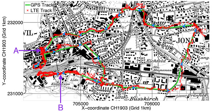
Rover positions obtained with 2D LTE versus GPS track.
Positioning with LTE Signals
An alternative to GNSS in urban canyons can be provided by signals from cellular base stations, particularly new signals from long-term evolution (LTE) networks, since LTE coverage will be high in cities. Wide LTE downlink bandwidth provides good resolution of multipath components, which also assists positioning.
A test used a universal software radio peripheral N210 synchronized to a GPS-locked Rubidium frequency standard. A personal computer stored LTE data samples together with GNSS sentences from a u-blox LEA-6T module. A Matlab-algorithm did the complete post-processing, extracting pseudoranges for the LTE base station and calculating the position solution.
Results of a car driven on an urban route show root-mean-square value of the absolute error using LTE compared to GPS position is 43 meters.
Positioning Using LTE Signals, by Fabian Knutti, Mischa Sabathy, Marco Driusso, Heinz Mathis, and Chris Marshall. Presented at the European Navigation Conference 2015.
Seamless Indoors
Sensor Augmented Indoor Navigation and Positioning, by M. Gemelli and Keith Nicholson, Bosch Sensortec. An overview of technologies that guide us indoors in a seamless and reliable manner, highlighting key requirements for motion and pressure sensing, low-power processing, efficient code design, wireless beaconing and map matching. Fusion software needs new data sources: Bluetooth low-energy, Wi-Fi fingerprinting, magnetic fingerprinting, ultrasound. Presented at ION GNSS+ 2015.
Disturbed Ionosphere
Mitigating satellite motion in GPS monitoring of traveling ionospheric disturbances (TIDs), by R.W. Penney and N.K. Jackson-Booth. Discusses the impact of satellite motion on the use of compact arrays of GPS receivers for estimating the velocity of travelling ionospheric disturbances (TIDs). It is shown that satellite motion has subtle effects upon standard techniques of waveform cross-correlation, or time-difference of arrival (TDOA), which can easily lead to spurious TID velocity estimates. In Radio Science, an AGU journal.
Chip simplifies integration of GNSS into low-cost products
The Broadcom BCM47748 chip for the Internet of Things and wearables enables devices such as fitness bands to deliver pinpoint location while consuming minimal power and in some cases can eliminate the need for a separate microcontroller. The BCM47748 removes a bulk of the signal processing from the device MCU by calculating position, velocity and time on-chip, delivering significant system power savings. The chip uses intelligent firmware to extend battery life while maintaining accuracy in speed, distance and position. By absorbing location computations on-chip, Broadcom not only reduces power consumption but can also dramatically lower costs for OEMs by replacing the device MCU and reducing board space. Firmware inside the BCM47748 automatically adapts to user activity and context, whether biking, walking or running, to provide precise location results to the user, enabling performance that is not sacrificed for power savings.
Simulation through real-time generation of GNSS signals
The upgraded ReGen DIF simulator is a high-end, low-cost 24-channel GNSS multi-frequency RF simulation solution for academia and research and development. The Replicator provides users with GNSS simulation through real-time generation of GNSS signals; the recording and playback of dual-frequency GNSS RF signals; and GNSS RF signal analysis with the JAXA COSMODE ionospheric scintillation monitor. Features of the replicator support various combinations of GPS L1, L2; GLONASS L1,L2,L3; BeiDou B1, B2; and Galileo E1 signals, and include ANSI C API for user access to customizable signal propagation, orbital, multipath, spatially correlated, scintillation and other error models.
Designed for unmanned aerial systems and mobile platforms
The S2525F8-BD-RTK is a low-power, single-frequency RTK receiver with centimeter-level position accuracy. It supports GPS, BDS, QZSS and SBAS, simultaneously tracking up to 28 satellites. With its 25 x 25 millimeter form factor, 300-mW power consumption and 3 gram weight, it is designed for any outdoor applications requiring high-precision RTK positioning. S2525F8-BD-RTK supports both base station and rover modes. As a rover, it receives RTCM 3.0 or 3.1 data from a base station, or raw measurements from another S2525F8-BD-RTK receiver serving as base station, and performs carrier phase RTK processing to achieve relative positioning with 1 cm + 1 ppm position accuracy within 10-Km baseline.
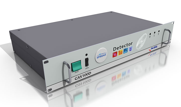
Spirent robust framework evaluates threats to GNSS
The GSS100D Detector is key to a robust PNT test framework to evaluate GPS and GNSS security vulnerabilities for position, navigation and timing systems. The framework will be used by technology, system and application developers where PNT is critical. The framework enables threats to be detected in the field, taken into the lab, and re-synthesized along with GPS and other GNSS signals. Spirent’s threat intelligence library of actual and typical threats provides a wide range of GNSS segment errors and spoofing attacks, as well as space weather and other vulnerabilities for preventive troubleshooting. Developed in collaboration with Nottingham Scientific Ltd., the GSS100D Detector enables detection, characterization and analysis of real GNSS threats.
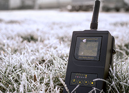
Priate radio data system for measurement applications
Compact-Proof is a UHF radio modem for wireless data transfer with a rechargeable battery, providing a compact and flexible solution for a wide range of applications, including land surveying under varying weather conditions. It supports the radio protocols of Pacific Crest, Trimble and other GNSS providers. It has a temperature range of -30°C to +65°C and frequency ranges of 330 MHz…420 MHz and 403 MHz…473 MHz. Its casing and connectors are rated IP67, making it waterproof and secured against dust. With transmitting power of 1,000 mW, it can be operated fully autonomously for more than 15 hours as a repeater station in the field.
Base station or rover survey receiver with 864 channels
The all-in-one TRIUMPH-LS combines a high-performance 864-channel GNSS receiver, all-frequency GNSS antenna, and a modern featured handheld. The 864 all-in-view channels include Galileo E1/E5A/E5B, GPS L1/L2/L5, GLONASS L1/L2/L3, QZSS L1/L2/L5, BeiDou B1/B2 and SBAS L1/L5. The TRIUMPH-LS offers GUIDE data collection, Visual Stake Out (VSO), navigation, six parallel RTK engines, more than 3,000 coordinate conversions, advanced CoGo features, and rich attribute tagging on a high-resolution, bright, 800 x 460 bright display. Two 3-megapixel cameras enable recording of images along with GNSS data.More than 100 channels are dedicated to continuous interference monitoring. The Triumph-LS monitors and reports interference graphically and numerically with patent-pending interference protection. Interference awareness allows safe GNSS operation in city, airport and military environments. The unit can serve as base or rover. It has a GSM modem, UHF transmit and receive, and an internal high-performance geodetic antenna. The TRIUMPH-LS automatically updates all firmware when connected to a Wi-Fi Internet connection.
The Trimble Indoor Mobile Mapping Solution (TIMMS) produces fast and accurate maps of difficult-to-navigate indoor spaces and translates them directly into 2D and 3D models of structured interiors. TIMMS 2 is a fusion of technologies for capturing spatial data of indoor and other GNSS denied areas, providing both lidar and spherical video and enabling the creation of accurate, real-life representations of interior spaces and all of their contents. The maps are geo-located; the real world positions of each area of the building and its contents are known and can be easily placed and oriented in a wide area model. Small and lightweight, TIMMS 2 can negotiate tight corners, closets and catwalks, and can be carried up and down staircases where no elevator is available for travel between building levels.
The new Leica Geosystems Pegasus backpack wearable mobile mapping solution.
Wearable reality capture
Portable backpack allows mapping while walking
The Leica Pegasus:Backpack is a wearable reality-capture technology that combines five high-dynamic cameras and two LiDAR profilers within an ultra-light and ergonomic carbon-fiber chassis. The ergonomic mobile mapper creates a 3D view indoors or outdoors for engineering or professional documentation while using SLAM (simultaneous localization and mapping) to determine position in GNSS-denied areas. With its fast and efficient capture, calibrated images and point clouds are quickly generated for applications as diverse as BIM 6D to industrial training and disaster analysis.
The YellowScan is a lightweight lidar designed for fixed or rotary-wing UAVs. It has an embedded Ellipse-E, a miniature inertial navigation system from SBG Systems, which helps obtaining a clear and accurate point cloud. YellowScan is operational at up to 75 meters and delivers a highly dense point cloud. It includes a lidar with a ±50 degree angle that measures 40,000 points per second, an Ellipse-E inertial navigation system coupled with a centimeter-level RTK GPS, an on-board computer and an integrated battery. LED lights provide useful information, such as whether the GPS is receiving RTK corrections.
The DJI GO app is an upgrade to the previous DJI Pilot app with a redesigned user interface to make it easier to capture and share images with DJI’s Phantom 3, Inspire 1 and Matrice 100 UAVs. The app includes expanded in-app editing tools to make it easier to adjust photos and videos before uploading to social networks. DJI Director, which automatically edits the best moments from flights into short videos, has also been upgraded to include video speed control, additional templates and background music options.
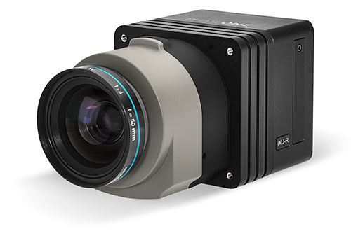
Lightweight with the resolution of a medium format system
The iXU-R camera series for UAVs is available in 80 MP, 60 MP and 60 MP achromatic versions. The cameras feature dedicated interchangeable 40-mm, 50-mm and 70-mm Phase One Rodenstock lenses equipped with central leaf shutters that can be quickly changed in the field, offering flexibility in aerial applications. The Phase One iXU-R systems have been designed to address the aerial data acquisition market’s needs with high-performance optics, flexibility to fit into small places and Phase One’s fastest 80 MP platform. Phase One aerial cameras offer direct communication with GPS/IMU systems and the ability to write data to the image files.
The Aeryon SkyRanger introduces a new airframe and integrated system design to its Aeryon sUAS (small UAS) platform, based on thousands of hours of flight time and successful customer exercises and missions around the world. The SkyRanger is suited for both land and maritime applications, and is designed to military and government specifications for immediate aerial intelligence gathering. Vertical Take-Off and Landing (VTOL) enables continuous eyes-on-target, operations in confined or hard-to-reach environments, and low-risk launch and retrieval without peripheral equipment. Features include up to 50-minute flight time, single operator transport and deployment with no launch or recovery equipment, reliable flight performance in demanding environments such as high winds, and an intuitive touchscreen interface. Microsoft has chosen the SkyRanger to demonstrate aerial image and data capture for its new Microsoft Advanced Patrol Platform (MAPP) vehicle.
Trimble has acquired privately held Telog Instruments Inc., based in Victor, New York. Telog is a wireless water infrastructure monitoring and management company. The acquisition extends Trimble’s smart water strategy by adding advanced water management technology and productivity solutions to the company’s portfolio. Financial terms were not disclosed.
Telog, founded in 1984, manufactures a suite of wireless remote monitoring, analytics and data acquisition systems that are used by thousands of water, wastewater and stormwater management utilities and private contractors throughout North America. Its Telogers family of battery-powered, environmentally rugged wireless monitors provide an automated means of collecting, archiving, presenting and sharing data from a wide variety of remote assets such as flowmeters, rain gauges, surcharge sensors, pre-treatment water quality sensors, lift stations and pressure sensors.
Applications for Telog solutions include remote monitoring of flow rates, reservoir and tank levels, water quality, well and groundwater levels, pump station performance, hydrant and valve pressure and sewer overflows. The solutions can also be combined with automated metering infrastructure to provide smart water networks that improve sustainability and water conservation and reduce leakage and non-revenue water. Customers can benefit through improved drinking water quality, lower water loss and leakage, reduced wastewater and stormwater overflows and spills, and enhanced regulatory compliance.
“Trimble remains focused on offering industry leading technology solutions for the water industry,” said Marcus McCarthy, general manager for Trimble’s Water Division. “The acquisition of Telog enables us to expand our portfolio of hardware and software products with industry leading real-time wireless sensors and monitoring solutions. The management of data in real time will provide value to customers facing a growing number of water supply, environmental and regulatory challenges.”
“We are very excited to join Trimble,” said Barry Ceci, founder, president and CEO of Telog. “In addition to the continued focus on supporting our current customers and our core North American market, the acquisition will enable us to grow Telog’s suite of products and expand our global footprint. This is an exciting time for Telog and our customers, who can also benefit from Trimble’s comprehensive portfolio of smart water management solutions.”
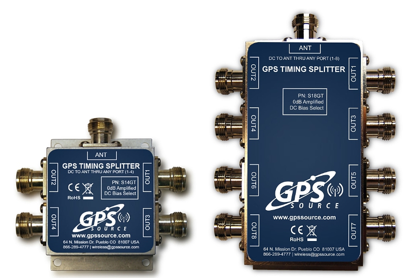
GPS Soure is offering the S14GT & S18GT splitters for small cell networks and distributed antenna systems (PRNewsFoto/GPS Source, Inc.)
GPS Source has released of a line of GPS/GNSS splitters created for the small-cell wireless and distributed antenna system markets. Specifically designed for the L-band frequency, they can eliminate the cost of multiple antennas and long cable runs in wireless installations.
With four or eight outputs, the new line of GPS/GNSS splitters make it possible to use a single GPS referencing antenna and cable arrangement for multiple synchronized systems. The splitters are available at a low price point and include features such as DC bias select and amplification.
GPS Source RF signal splitters typically operate in conjunction with an active GPS antenna (a GPS antenna that includes an integrated low noise amplifier). Consequently, a GPS RF signal splitter must have provisions for managing the DC voltage to the active GPS antenna. The S14GT and S18GT will power an external GPS antenna from any of the RF outputs. A “hunt-and-pick” circuit is used to select only one DC input for power should more than one source be connected. Designed for redundancy, if the selected DC bias input should fail, the DC bias will automatically switch to another DC input to ensure an uninterrupted power supply to the active antenna.
“Distributed antenna systems allow for easy system growth in size and scope of application, whether the system needs to scale to reach new service areas or add bandwidth and capacity,” said Robert Horton of GPS Source. ” This growth has led to a strong demand for cost effective solutions that support GPS synchronization, an area where we are specialists. GPS Source brings leading-edge technologies and addresses major GPS/GNSS challenges faced by carriers and system integrators.”
The S14GT and S18GT are in production and will be available January 2016. A CE Mark approval from the European Notified Body for these two devices will be available afterward.
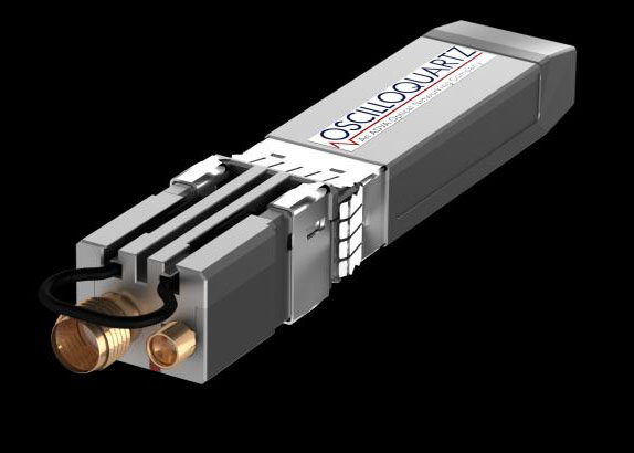
Oscilloquartz, an ADVA Optical Networking company, has launched its OSA 5401 Syncplug, an accurate and efficient small-form-factor pluggable grandmaster clock and GNSS receiver.
The device has a small footprint and compact design. It complements the existing portfolio of Oscilloquartz products, driving precise IEEE 1588v2 Precision Time Protocol (PTP) frequency and phase synchronization as well as Synchronous Ethernet deeper into access networks, including radio access and small cell networks.
With its miniature form factor and low-touch provisioning, the new synchronization solution can be deployed in space-restrictive environments. It operates at low cost, consumes minimal energy and requires no additional power source or real estate, Oscilloquartz said.
The OSA 5401 Syncplug supports the creation of a new time distribution architecture to meet the stringent phase-synchronization requirements of today’s access networks, the company said.
“In terms of efficiency, precision and density of design, our OSA 5401 Syncplug miniature grandmaster is a major development for our industry,” said Kenneth Hann, senior director, R&D, Oscilloquartz. “It’s possibly the world’s smallest grandmaster clock and yet it generates phenomenally precise PTP frequency and phase synchronization for radio access and small cell networks. Now network operators have a cost-effective migration path for deploying robust phase and frequency synchronization deeper into access networks. Our OSA 5401 Syncplug integrates with existing network elements and its small form factor and rich feature set enable a versatile range of deployment options for enhanced synchronization network performance. Its timing-optimized, dual-frequency GNSS receiver achieves excellent performance even in urban canyons where small-cell deployments are often made and it can also work with a single satellite.”
The OSA 5401 Syncplug is the first new product to be jointly engineered by Oscilloquartz and members of the recently acquired Time4 Systems. It easily conforms to all relevant PTP telecom profiles and, when locked to global navigation systems, meets the stringent requirements of G.8272 and G.811 specifications. The device functions as a Synchronous Ethernet source, GNSS receiver and a grandmaster clock. It can support both Layer 2 and Layer 3 PTP transport and is capable of unicasting and multicasting simultaneously. Advanced design and network redundancy techniques provide resiliency against local GNSS jamming. It also boasts an impressively wide operational temperature range of -40 to 85 Celsius. But the key benefits that the OSA 5401 Syncplug provides are space and energy efficiency for significant savings in installation and engineering costs. It also fully complies with multi-source agreements for total interoperability.
“An enormous amount of expertise and passion has gone into designing this device. It’s been driven by our strategic understanding of what’s most needed in the synchronization space,” said Gil Biran, general manager, Oscilloquartz.
“This first member of our miniature sync product family has already won great feedback from major mobile operators. What makes our ultra-compact OSA 5401 Syncplug so special is that it combines small size with high performance,” Biran said. “Make no mistake, there’s a vast amount of advanced functionality squeezed into this device. That’s what enables it to deliver highly accurate timing distribution with the smallest available footprint. This level of agility and efficiency creates a new range of solutions for service providers to deploy phase synchronization even in the most difficult network scenarios. There’s no doubt that this is an exciting time for network synchronization technology and this new product will extend our position in the market as a one-stop shop for all synchronization solutions. The new generation of mobile networks demands more small cells and a higher density of radio heads and we’re addressing this challenge in the most energy-efficient and cost-effective way possible.”
Watch ADVA Optical Networking’s latest video on assisted partial timing support for more information.
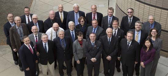
That is, in the People’s Republic of Boulder, Colorado. To those of us who live in Colorado, Boulder is known by this seemingly timeless but absolutely accurate appellation. This stunningly beautiful city located in the foothills of the Rocky Mountains, known as the Flatirons, is where the National Space-Based Positioning, Navigation and Timing Advisory Board (PNTAB), which provides independent advice to the National Executive Committee on Space-Based PNT (EXCOM) from outside the U.S. government, chose to meet in the waning days of October 2015. Ironically, they chose the same week as a Republican presidential candidates debate, which took place at the University of Colorado just a couple of miles away. The PNTAB was also concomitant with the ICG, the Tenth Meeting of the International Committee on GNSS (ICG-10), held Nov. 2-5, 2015. Both the PNTAB and ICG were held at the Boulder NCAR/UCAR facility, University Corporation for Atmospheric Research Center Green Conference facility.
PNTAB
The PNTAB serves a vital purpose. Board memberse advise the highest levels of the U.S. government (USG) concerning all matters relating to PNT. This open-ended charter covers a multitude of sins, and as the new PNTAB Chairman John Stenbit, stated clearly, it is important to focus on the doable, even if it seems difficult, but not to tilt at windmills. I have known and worked with John Stenbit for more than 25 years, especially during his two stints in the Pentagon, and I find him to be extremely knowledgeable and ethical. He is certainly well-spoken and gregarious, but he does not suffer fools, and is known to be resolute, which is a pseudonym for stubborn and hardheaded, but in a good way. I look forward to his chairmanship.
PNTAB Members at 16th Meeting in Boulder. New Chairman John Stenbit is center of last row. (Courtesy of gps.gov)
You can view the PNTAB presentations at the www.gps.gov website. While there, you will note there were more than 25 presentations, and most were excellent. Only a couple required the audience to consume copious amounts of caffeine to remain coherent.
In the end, the PNTAB adopted courses of action (COA) on which to formulate recommendations for the EXCOM. For our purposes, the pertinent COAs centered around two main subject areas: Spectrum protection and eLoran. The spectrum protection issues are fraught with equal parts litigious danger and tedium. Not coincidently, the World Radiocommunication Conference 2015 (WRC-15) kicked off in Geneva, Switzerland, on Nov. 2, just two days after the end of the PNTAB. Several of the PNTAB members attended the closing Saturday night PNTAB dinner and flew from Denver direct to Geneva Sunday morning, just in time for some minor jet lag adjustments, and then attended the opening ceremonies of WRC 2015 in snowy Switzerland.
I have had the dubious privilege of observing several International Telecommunication Union (ITU)-sponsored WRC sessions in the past, and it is certainly a critical spectrum decision-making body. (Seriously, folks, 26 days of talking and wrangling about spectrum? Praise the Lord the Swiss know how to brew strong coffee.) WRC 2015 wraps up on Nov. 27. In this regard, Ann Ciganer, who serves as an official PNTAB representative and the executive director of policy for the GPS Innovation Alliance (GPSIA, formerly the U.S. GPS Industry Council), is my hero. She has been working spectrum issues for more than 20 years. She has the fortitude of FDR and the patience of Job.
Since the spectrum and spectrum-protection issues are still being coldly debated in Geneva, let’s take a look at the PNTAB’s second major topic, eLoran. While eLoran was discussed ad nauseam, there was one definitive standout presentation given by my old friend and colleague Professor David Last. David is Professor Emeritus at the University of Wales (Bangor) and former president of the Royal Institute of Navigation (RIN). As he is wont to do, David held forth, with that wonderful, attention-arresting British public school accent, on eLoran matters before an appreciative audience. David presented his topic with equal parts passion and credibility. You can view his presentation material in its entirety (the PowerPoint slides, anyway) at www.gps.gov, but you will not have the wonderful experience of having him present it personally with all the attendant persuasion, and dry British humor and wit.
eLoran European Style
David immediately makes the point early on in the historical portion of his presentation that the U.S. first committed to Loran-C more than 75 years ago, and as recently as 2010 upgraded a majority of the sites to eLoran status only to have the current administration shut down Loran just after officially assuring the United Kingdom the U.S. would keep Loran up and running. Now the U.S. is in the position of looking for a backup and major terrestrial augmentation to GPS (GNSS) and is once again considering eLoran.
Professor David Last at 16th PNTAB
Professor David Last at the 16th PNTAB meeting. (Photo: Don Jewell)
Professor Last explained the difference between our viewpoints. “I see it from a British perspective, and a European perspective. I watch administrations in other parts of the world grappling with the same decisions the U.S. faces. The U.S., of course, is in a unique position: it is the source of GPS, the world standard in satellite navigation. And over the nearly 40 years since the first satellite was launched, the U.S. has taken the lead in learning to understand the role of GPS, from its military-only origins, through when it was a novelty with its first civil applications, through a period of hubris in which it was to replace every other means of navigation on land, sea and air, to its present role, so deeply embedded in your national life as to form a critical component of national infrastructure. The U.S. was first to recognize the vulnerabilities of GPS, to understand the threat they posed to your nation and to seek ways of mitigating them. That topic came to dominate technical conferences first in the U.S. and now around the world. And it has led to a policy debate of quite exceptional difficulty, one that is shared by all governments.”
The Message
What David did not come right out and say, although I maintain it was implied by his tone of voice and body language, is that this discussion is at times both energized and denigrated by those that refuse to acknowledge GPS or GNSS vulnerabilities and those that would be happy to see it revert to a military-only system — the proverbial ostrich syndrome. David made it clear that GPS vulnerability discussions must take place publicly in the U.S. because they are, in fact, global discussions. “All space-based PNT systems today are similar to GPS in concept and technology, and referred to by most users as GPS,” he said. “Very few bother or even know about Galileo, GLONASS and BeiDou. To them, it is all simply GPS.”
David went on to make his point by describing the ubiquity and pervasiveness of GPS and GNSS. “Now there is no area of transportation, commerce, industry or telecommunications in your country or mine that does not employ satellite navigation.”
Indeed, David described how other GNSS systems came about due to national pride, and yet they had no choice but to mimic GPS both technically and officially, since they must for safety-of-life concerns reside in the same regimes and crowded radio bands.
David stated, “Soon, these new GNSS became invested with immense national pride. Their vast cost had to be justified by claims of technical superiority. In reality, engineers know that their designers had no choice but to make them compatible with GPS, since GPS was decades ahead and the world standard. These new systems also had to squeeze alongside GPS in the narrow radio bands allocated internationally to navigation. Not surprisingly, indeed happily, all our new GNSS turned out to look very like GPS: versions of the same technology — with just a hint of garlic here, a whiff of curry there. This similarity is obvious to engineers and to navigators, though rarely to politicians.”
DOT Volpe GPS Jamming Report
Professor Last referred to the U.S. provider and user communities as groups that, prior to the important 2001 Volpe Report, failed to acknowledge that GPS had any serious vulnerabilities. That report was a watershed event for the future of GPS, and for me as a journalist. Among other jamming incidents around the country, a major jamming occurrence in San Diego harbor affected GPS-dependent systems (mostly those dependent on accurate timing) and users for miles around. It became a wakeup call for GPS and GNSS users globally; I wrote a Defense PNT column on it in this space in 2007.
David put it in perspective. “To understand the perceptions of those governments, wind back the U.S. story to before the Volpe Report on GPS vulnerability with its recommendations that led to your [PNT Advisory] Board’s policy of ‘Protect, Toughen, and Augment’. Despite the growth of jamming and even attacks by one sovereign nation on its neighbor, despite the appearance of low-cost spoofing, there has never been a Volpe Report anywhere outside the United States. The pre-Volpe culture of the denial of vulnerability is alive and well and living in Europe.”
“Thirty-seven years after the launch of the first GPS satellite, there is still little recognition by the world’s governments of how essential resilient position, navigation and timing have become to the critical infrastructure of their nations,” Last said.
After the Volpe Report came an industry report chaired by the Father of GPS, Professor Bradford Parkinson (Col, USAF, Ret), describing eLoran as the only cost-effective method of backup to GPS. The report was published globally, and then the United States completely failed to implement the transition from Loran-C to eLoran. At the time it failed politically, the Loran-C to eLoran conversion was 85 percent complete and only needed a small amount of funding for the future. Luddites within the U.S. OMB (Office of Management and Budget) managed to kill the program just short of completion. Unfortunately, the message to the world of GPS users was the U.S. had categorically rejected eLoran as a complimentary PNT system.
David presented the European point of view: “The Volpe Report, an FAA study, proposed and demonstrated Enhanced Loran (eLoran). GPS-like digital techniques were applied to the obsolete Loran-C low-frequency system. The result were astounding: it met the accuracy, integrity, availability and continuity standards of certain aircraft instrument approaches plus the very demanding port-entrance requirements of shipping, and it delivered precise timing to support telecomms. Brad Parkinson’s high-level study group of industry leaders said this was the only cost-effective GPS substitute for U.S. needs.
“The world outside the U.S. watched the Department of Homeland Security announce eLoran as the U.S. national backup to GPS and then completely fail to implement it! That message, that the U.S. does not need a complementary system and has rejected eLoran, is the current understanding of U.S. policy in many countries.”
Professor Last maintains the same eLoran drama is now being played out in Europe in real time. The UK developed its own eLoran system from the North of Norway to the South of France which, while it only officially achieved initial operational capability on Oct 31, 2014, has in fact been running flawlessly 24/7 for three years.
The message to the world, especially Europe, should be that the eLoran concept proposed by the U.S. FAA (Federal Aviation Administration) really works and is easy to implement. It has been, in fact, implemented and maintained in the UK by a mere handful of personnel.
However, according to David, the European eLoran system may never reach FOC (full operational capability) because currently Western Europe lacks any coordinated plan to respond to the vulnerabilities of GPS and all other PNT systems. Many have yet to embrace or even recognize the Volpe Report.
Indeed, several European countries are planning to shut down their eLoran systems supposedly since that is what we (the U.S.) did and it seems to be working for us.
David explains that “this [proven] system may never reach Full Operational Capability. Western Europe lacks any coordinated plan to respond to the vulnerability of GPS — why, who needs that when Europe has Galileo and EGNOS! The governments who control the Loran stations in Norway and France, observing that mariners no longer want Loran-C, plan to close down the transmissions just nine weeks from now, and demolish the infrastructure. After all, they say, that is what the U.S. did.”
Service Alternative
To paraphrase Winston Churchill, this was indeed not our finest hour. However David maintains there is a realistic commercial alternative: provide eLoran as a service. This is exactly what some in the United Kingdom and Europe are considering. It is a totally viable alternative, but David asserts that what would really help “is a positive signal from the United States.”
Continuing in the same vein, David posits “all is not lost. Responding to the future — indeed, the present — needs of the telecomms and broadcasting industries, and driven from the U.S., there is a commercial plan to take over and operate that European Loran infrastructure and sell its services to government and industrial users. If governments struggle to seize the initiative in this area, let the market — and good old greed — provide the mechanism for realizing the multiple benefits, paying the costs and making a profit. But I believe that this initiative will only succeed in Europe, if there is a positive signal from the U.S. The world listens to signals from the U.S., from the EXCOM, from this board.”
Unique Organizations
Historically, relationships between multi-GNSS systems are confrontational at best; however, David states clearly that Europeans realize the PNTAB and EXCOM are unique and unprecedented around the world. “These official government entities recognize and advocate for resilient PNT that is of major importance to critical infrastructures of the U.S. and other nations as well.”
In actuality, the U.S. has faced up to these vulnerabilities thanks to the PNTAB and EXCOM, two truly unique organizations. Undeniably, there is an incalculable polyphonic argument to be made concerning the vulnerabilities of space-based PNT systems such as GPS and how to mitigate them, but globally beyond the PNTAB and EXCOM, no one is officially having these critical discussions.
In the end, according to Professor Last, over the next nine weeks the immediate future of PNT really comes down to one critical question: “Will global PNT with eLoran be a global system or a nationally unique system?”
David supports his cogent argument for eLoran by giving excellent examples of GPS and multi-GNSS jamming supporting his insightful adage, “Space-based PNT systems live and die together.” They are all subject to the same vulnerabilities.
Wrapping up his refreshingly insightful presentation, Professor Last posed two questions to the PNTAB:
Does the U.S. see a role for eLoran as a complement to resilient GPS?
Does the U.S. recognize and encourage the move to GNSS receivers that take advantage of multiple constellations?
As one PNTAB pundit opined, “The critical issue for the U.S. government is we have to break the mold. The current administration is too often technologically controlled by Luddites and held hostage by low-level bureaucrats within OMB.”
Professor Last appropriately has the last word: “The bottom line for the PNTAB, EXCOM and USG is that the United Kingdom, nee Europe, is asking for support on eLoran.”
Until next time, happy navigating and don’t forget your GPS when you head over the bridge and through the woods to Grandma’s house. Happy Thanksgiving!
Omnitracs Roadnet Technologies has made available Roadnet Anywhere v3.8, the newest version of its SaaS vehicle routing, tracking, mobile workforce, telematics and fleet management platform. The updated software now delivers improved performance tracking with the Insight data visualization application and advanced capabilities to analyze Service Patterns in order to support strategic analysis, says the company.
“In the past, fleets were forced to analyze multiple data points across various disparate systems, making it difficult to conduct cross-metric analysis across such things as driver safety, miles driven and customer commitments met,” said Kevin Haugh, general manager of Omnitracs Roadnet Technologies. “By rolling out the newest update to the Roadnet Anywhere platform, Omnitracs is reinforcing its commitment to its comprehensive, cloud-based platform. As the company continues to rapidly deploy new features to its SaaS fleet management platform — integrating routing, dispatching, telematics, customer notifications and analytics in a single, web-based tool — fleets can better monitor and reduce risk, promote safety and secure savings.”
New to Roadnet Anywhere, Service Pattern Analyzer evaluates planned and/or actual deliveries and automates the information needed to create strategic plans. The tool saves fleets time and labor costs and streamlines the once-cumbersome process of manually collecting and collating data from several systems, says Omnitracs.
The Insight tool now gives users the ability to easily define metric oriented rules as well as create and view multiple measures as part of one form of data visualization. Available metrics through Insight span the complete range of information from Roadnet routing, dispatching, proof of delivery and telematics products.
“The Omnitracs Roadnet Anywhere platform is on a constant path to evolve. By continuing to update the Roadnet Anywhere SaaS platform, we’re able to provide customers with actionable control and insights in real time,” said Cyndi Brandt, senior director of product marketing and alliances for Omnitracs Roadnet. “With these enhancements, Omnitracs is empowering fleets to operate more efficiently without compromising service or profits.”
GPSTrackIt.com has enhanced Fleet Manager, its vehicle tracking and fleet management system, with new features that control how vehicles are displayed. Fleet Manager can now provide simultaneous playback of multiple vehicle trails as well as controls to turn on and off the display of landmark clusters on the map.
The playback of multiple vehicle trails makes it possible for fleet managers to visually assess their routes to determine if there are overlaps where one driver’s route is encroaching on another’s. Routes can then be modified to increase operational efficiency.
If a single vehicle is driven by multiple drivers during the course of a day this feature can display each shift by using different colors.
“This was another suggestion from one of our customers,” said Eddie Bermudez, GPSTrackIt’s product development manager, in a news release. “We thought it was a great idea and immediately put it into development.”
Another suggested enhancement from a customer was the ability to turn on and off the display of landmark clusters on the map.
“We pride ourselves in being responsive to requests for enhancements from customers,” Bermudez said. “This just gives our customers that much more flexibility in configuring how objects on the map are displayed.
Sentera LLC, a designer of sensors, software, and unmanned aerial vehicles (UAVs), has been granted a Section 333 exemption from the Federal Aviation Administration (FAA) to operate multiple types of commercially available UAVs. Applications for these systems include crop survey, infrastructure inspection, geospatial mapping and other aerial imaging missions.
“We are excited to receive the exemption,” said Sentera CEO, Eric Taipale. “While most exemption holders focus on providing revenue-generating flight services, Sentera flies primarily to demonstrate our products to customers and to gather and analyze aerial data which helps us enhance our OnTop Platform, a data management system designed specifically to support the thousands of images collected during a typical UAV flight.”
Sentera’s exemption for both fixed-wing and quadcopter UAVs ensures the company can capture a wide range of data types that are relevant to customer applications, including very high-resolution visual, multispectral, and thermal imagery, as well as specialized non-image information. Customers use Sentera input data to perform many tasks, such as developing planting and crop management advice for growers, building 3D models of buildings, structures, and terrain for asset owners, and monitoring environmental regulatory compliance for public agencies.
Comprehensive data management solutions are crucial to successful UAV inspections, asset audits, safety inspections, agriculture data collections, and point-cloud collection activities.
“Clients use a myriad of UAV-captured data types to increase safety, assess crop health, and boost ROI (return on investment),” explained Taipale. “Sentera already provides some of the most precise sensors and leading UAV solutions in the industry. Our Section 333 exemption allows us advance our OnTop Platform more rapidly, which ultimately helps our customers manage all of this data most efficiently.”
The FAA authorization allows Sentera to fly UAV platforms built by Lockheed Martin, DJI and Sentera.
Trimble will acquire the assets of privately held AGRI-TREND of Red Deer, Alberta, Canada, which operates the largest network of independent agricultural consultants in North America. The acquisition will enable Trimble to provide agronomists and other crop advisors with a stronger set of brand-agnostic tools they can use to advise growers on how to better manage their operations, Trimble said in a news release.
The acquisition is expected to close in November 2015. Financial terms were not disclosed.
AGRI-TREND’s network of more than 200 specialists spread throughout the U.S. and Canada includes 110 independent “coaches” specializing in agronomy, precision farming, crop marketing and farm business management. Coaches are supported by a team of science specialists comprised of 30 Ph.D.s and M.Sc.s providing in-house research, training and insight support for both the coaching network and the AGRI-DATA Solution platform — a proprietary farm data-management solution. As a result, AGRI-TREND’s solutions enable growers to make informed business decisions that better allocate scarce resources to produce safe and environmentally sustainable food.
“Trimble’s acquisition of AGRI-TREND is another step towards total farm management for the grower. Together with Connected Farm, we will provide growers and their trusted advisors with a combined offering that is unique in the marketplace today,” said Joe Denniston, vice president for Trimble’s Agriculture Division. “AGRI-TREND is a leader in providing expert advice and decision support for growing crops, marketing commodities and managing a farm’s finances. Trimble is a leader in precision agriculture technology that precisely applies those decisions whether it is seed, nutrients or water. Together, Trimble and AGRI-TREND will enable the integration of decisions and execution to give greater control over the outcome, resulting in maximized productivity for the grower.”
“AGRI-TREND has been working side by side with farmers for over 17 years. With the strength that Trimble provides, we aim to help even more farmers as the move to precision agriculture continues to gain momentum globally,” said Rob Saik, founder of AGRI-TREND. “The combination of our advanced agricultural technical expertise and Trimble’s exceptional precision agriculture tools provides us with a platform that will support production practices that are sustainable both from an environmental and financial perspective for today’s farmers. We’re excited to be a part of the future of agriculture, and we’re pleased to work with the great people at Trimble.”
Full Farm Support
Grow the Crop: To assist in optimizing crop growth, AGRI-TREND has a network of experienced agronomists who serve as a personal Agri-Coach to help farm customers assess the performance of every acre on a yearly basis. Agri-Coaches work on the analytics, looking at the cost of production as well as nitrogen and water use efficiency, interpreting the data and making customized recommendations for each field. Recommendations are then followed up with field scouting and performance tracking to ensure farm goals are met.
Sell the Crop: To maximize crop sales, AGRI-TREND creates a Strategic Marketing Plan that includes business analysis, operational strategy, risk management and a harvest review. This customized plan is developed by an AGRI-TREND Market-Coach who works closely with each farm client to understand the unique situation of their farm and the cost of production for each field. The AGRI-TREND Market-Coach then provides advice on how to best achieve better selling prices, risk mitigation and optimal cash flow for their farm customers.
Manage the Money: In order to enable farmers to better manage their money, AGRI-TREND provides a network of business-coach professionals, which consists of experts in specialized areas such as accounting, banking, corporate finance and insurance. The business-coach starts by gaining an understanding of the farm business including strengths and weaknesses, measuring the farm’s performance against benchmarks, creating the Strategic Farm Business Plan and then implementing the farmer’s long-term growth plan.
The AGRI-DATA Solution
The AGRI-DATA Solution is a complete farm management platform that focuses on the unique agronomic challenges that farmers face every year as they work to maximize yields and profits. This platform is the foundation for AGRI-TREND advisors as they work on crop planning, crop input tracking, soil sampling, tissue testing, manure analysis, fertilizer blending, field scouting, harvest data tracking and more. The platform supports over 75,000,000 legacy acres with over eight million acres added in 2015. Farmers have also adopted the AGRI-DATA mobile applications for both Android™ and iOS devices, preferring to work with their information on the go.
Trimble Connected Farm Advisor
Trimble Connected Farm Advisor — a field data management tool for the farmer’s trusted advisor — will be integrated with the AGRI-DATA platform to empower AGRI-TREND coaches with a greater toolset to deliver more services to their growers.
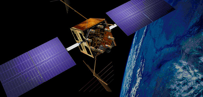
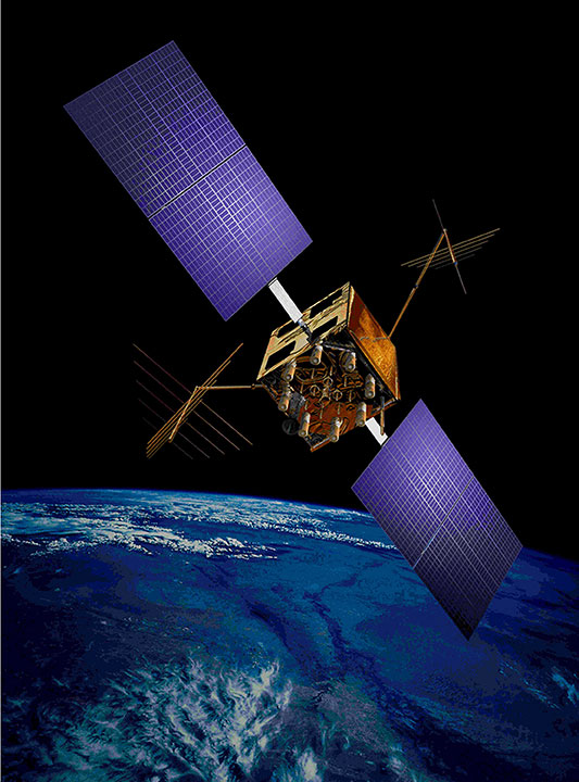
An artist’s concept of a GPS IIR-M satellite in orbit (courtesy of Lockheed Martin).
Security upgrades developed by Lockheed Martin for the GPS ground control system are now fully operational to safeguard data and ensure satellite availability.
The GPS Intrusion Protection Reinforcement (GIPR) technology refresh is part of the Air Force’s strategy to modernize the current GPS system and to ensure the availability of its services for more than one billion global military, civilian and commercial users daily. GIPR advances the Operational Control Segment’s ability to protect data and infrastructure, enhance the sustainability of the system, and meet future GPS operational requirements. Infusing advanced hardware and software solutions for information assurance provides improved protection against today’s rapidly changing cyber threats, Lockheed Martin said in a news release.
“The GPS Control Segment Sustainment (GCS) contract is vitally important to the sustainment of positioning, navigation and timing services for our military, government officials and citizens,” said Vinny Sica, vice president of Lockheed Martin’s Space Ground Solutions. “A system this large requires continued security focus and that’s where Lockheed Martin’s information security capabilities are on the cutting edge.”
Beyond data protection, GIPR resolves many equipment obsolescence issues and increases system maintainability with modern vendor-supported hardware and operating systems. This is the second major technology refresh on the GPS command and control system since the GCS Sustainment contract was awarded.
The Air Force awarded Lockheed Martin the GIPR engineering modification in 2013, and the system is now fully deployed into the GPS Master Control Station and the Alternate Master Control Station. The project included system design, hardware procurement, software development, network configuration design and technical documentation.
The Global Positioning Systems Directorate at the U.S. Air Force Space and Missile Systems Center contracted the GIPR upgrade. Air Force Space Command’s 2nd Space Operations Squadron (2SOPS), based at Schriever Air Force Base, Colo., manages and operates the GPS constellation for both civil and military users.
The U.S. Geological Survey has made part of a huge national repository of geographically referenced USGS field photographs publicly available. USGS geographers developed a mapping portal called the Land Cover Trends Field Photo Map.
The entire collection contains more than 33,000 geo-referenced field photos with associated keywords describing the land-use and land-cover change processes taking place. Initially, nearly 13,000 photos from across the continental U.S. will be available to the public, yet the online collection will grow as more processed photos become available.
“This is a treasure trove of royalty and copyright-free photography collected using consistent procedures,” said Chris Soulard, project leader and USGS research geographer. “We envision that these photos will captivate general audiences and fulfill a myriad of scientific needs.”
Sharing these field photos provides a resource for the scientific community with potential to develop future research, such as future repeat photography projects or applications where photos may validate remote sensing classifications.
“The benefit of these photos being hosted by the USGS is equal access to all without copyright concerns and quality control,” said Jason Sherba, USGS geographer and project web developer.
The photography was collected as part the USGS National Land Cover Trends Project, a research effort that spanned over ten years and represented one of USGS’ largest cross-center research efforts. The project employed Landsat imagery between 1973-2000 to derive rates, causes and consequences of contemporary land-use and land-cover change. Photos were collected between 1999 and 2007.
The map viewer was developed to present photographs within a land use/land cover change mapping context, yet photos may also be found on the USGS Earth Explorer website.