Category: Applications

  • USGS releases geo-referenced field photos to public

    landcover_USGS_screenshot

    The U.S. Geological Survey has made part of a huge national repository of geographically referenced USGS field photographs publicly available. USGS geographers developed a mapping portal called the Land Cover Trends Field Photo Map.

    The entire collection contains more than 33,000 geo-referenced field photos with associated keywords describing the land-use and land-cover change processes taking place. Initially, nearly 13,000 photos from across the continental U.S. will be available to the public, yet the online collection will grow as more processed photos become available.

    “This is a treasure trove of royalty and copyright-free photography collected using consistent procedures,” said Chris Soulard, project leader and USGS research geographer. “We envision that these photos will captivate general audiences and fulfill a myriad of scientific needs.”

    Sharing these field photos provides a resource for the scientific community with potential to develop future research, such as future repeat photography projects or applications where photos may validate remote sensing classifications.

    “The benefit of these photos being hosted by the USGS is equal access to all without copyright concerns and quality control,” said Jason Sherba, USGS geographer and project web developer.

    The photography was collected as part the USGS National Land Cover Trends Project, a research effort that spanned over ten years and represented one of USGS’ largest cross-center research efforts. The project employed Landsat imagery between 1973-2000 to derive rates, causes and consequences of contemporary land-use and land-cover change. Photos were collected between 1999 and 2007.

    The map viewer was developed to present photographs within a land use/land cover change mapping context, yet photos may also be found on the USGS Earth Explorer website.

  • Sanborn gathers drone imagery of Denver golf courses

    The City of Denver has contracted with the Sanborn Map Company Inc. to collect high-resolution, full-motion video imagery of the city’s seven public golf courses and its Aqua Golf facility.

    Sanborn employs a commercial-grade unmanned aircraft system (UAS) from Denver-based Leptron Unmanned Aircraft Systems. The UAS is capable of producing unprecedented accuracy and resolution, including high-quality, engineering-grade digital terrain models exceeding 2-inch accuracy; multispectral frame imagery at sub-centimeter resolution; and crisp, vibration-free video. Earlier this year, the Federal Aviation Administration granted Sanborn a Section 333 Exemption, which permits the firm to offer commercial UAS services nationwide.

    “We launched our new golf website earlier this year and now we look forward to adding the Sanborn imagery,” said Leslie Wright, Denver Golf director of marketing. “Our course locations range from densely populated urban areas to mountainous terrain with elevations above 7,000 feet. We also had a very tight window in which to perform the work. Considering these diverse challenges, Sanborn has approached the project with a high degree of professionalism and has been great to work with.”

    The city will use the images for marketing, as well as to give golfers a bird’s-eye view of every hole with realistic fly-overs down each fairway from the tee box to the green. The city’s Overland Park Golf Course is the oldest operating course west of the Mississippi River, according to a news release from Sanborn.

    “Sanborn’s UAS technology is a great fit for a host of customers,” said Sanchit Agarwal, director of mapping operations. “Among them are police and fire departments, agricultural operations, utilities, oil and gas concerns, emergency response managers, local government, mine operators and the media.”

    Sanborn acquired this bird’s-eye view video of the 17th hole at Denver’s Evergreen Golf Course with its commercial-grade UAV.

  • Trimble adds apps to TMX-2050 display for precision ag

    photo: Trimble

    Trimble has added several new third-party apps to its Android-based Trimble TMX-2050 display for precision agriculture.

    The new apps fall into several categories, including:

    • Diagnostic tools to identify and address implement error codes.
    • Fertilizer calibration charts for various brands of spreaders.
    • Identification of nutrient deficiencies.
    • Planter adjustment recommendations for various planter brands.
    • PDF reader.
    • Work order and documentation-based software applications for agriculture.

    The apps are available for download from App Central marketplace on the TMX-2050 display. App Central provides farmers with enhanced flexibility to install apps, view descriptions and images, report issues, connect with developer partners and stay current with on-demand updates, Trimble says in a news release. Users can search and find the apps most useful to their farm operations, language and regional compliance requirements.

    “As we continue to add third-party apps on our TMX-2050 display, we are providing farmers with more localized choices so they can select the tools that best fit their machines, applications and regional needs,” said Pierre-Andre Rebeyrat, marketing director for Trimble’s agriculture division. “These apps can enable farmers to obtain needed information more easily and quickly, leading to more efficient management of their farm operations.”

    Every new TMX-2050 display solution includes wireless connectivity allowing farmers to view ongoing field activities, real-time commodity prices, real-time weather conditions to guide irrigation and field deployment decisions, and other valuable task information in the Connected Farm dashboard. It also enables wireless data transfer of as-applied maps and other field activities such as planting, spraying or harvesting, simplifying the overall management and transfer of farm data files.

  • Trimble Thunderbolt PTP Grandmaster Clock Designed for Next-Generation Networks

    Trimble has introduced a new grandmaster clock to address the synchronization needs of the fast growing next-generation LTE-Advanced and small cell network market. The Thunderbolt PTP Grandmaster Clock (GC), coming in the first quarter of 2016, was introduced at the ITSF 2015 Time and Synchronization in Telecoms Conference, held in Edinburgh, UK, Nov. 2-5.

    Trimble said it value-engineered the industry-standard grandmaster clock, focusing on the features required in next-generation networks, including dual gigabit Ethernet ports and a small form-factor pluggable module port for optical connections. Its low price point enables network architects to move the timing source from the core to the edge of the network, enabling higher phase and frequency precision at the Precision Time Protocol (PTP) clients.

    “Trimble entered this market to expand on our success in GNSS timing solutions for telecom networks,” said Karen Guldan, general manager of Trimble’s Time & Frequency Division. “The design and development of the GC focused on creating an optimized solution for network providers — at a price point of less than $2,000, it is intended to be a game-changer in small-cell network design. The GC’s features provide superior value to service providers.”

    With flexible network interface protocols and easy integration, Trimble optimized the GC to deliver precise frequency and phase synchronization signals for LTE-Advanced and small cell networks supporting IEEE 1588 PTP, Network Time Protocol (NTP) and Synchronous Ethernet simultaneously. The GC supports up to 250 simultaneous PTP clients and 5,000 NTP transactions per second, and is designed for small- and medium-scale deployment.

    With a small form factor of half rack 1RU, users may deploy the Trimble GC either indoors or outdoors. In a server room, the Trimble GC deploys in a side-by-side configuration to provide timing redundancy. For outdoor applications, the Trimble GMC also features an extended operating temperature range for use in non-typical networking environments such as a telecom cabinet. The Trimble GC configures for AC and DC power.

    The GC was designed to provide continuous availability of traceable time. The GC includes an embedded, multi-GNSS (GPS, GLONASS, BeiDou and Galileo-ready) receiver to generate precise 10MHz and pulse per second outputs. Utilizing the latest in GNSS technology combined with a precision oscillator, the GC provides better than 3 microsecond phase holdover over a 24-hour period.

    The Trimble Thunderbolt PTP Grandmaster Clock is expected to be available in the first quarter of 2016.

  • KVH Awarded TACNAV and Field Service Support Contracts Totaling $2.7M

    KVH Awarded TACNAV and Field Service Support Contracts Totaling $2.7M

    (Photo: KVH Industries)
    With the new contracts, KVH’s tactical navigation (TACNAV) products will be used on more armored vehicles. (Photo: KVH Industries)

    KVH Industries’ guidance and stabilization business has been awarded two contracts totaling $2.7 million:

    • a $1.3 million contract to provide field service representative (FSR) support to an allied country in the Middle East related to KVH’s tactical navigation (TACNAV) systems installed on military vehicles; and
    • a $1.4 million contract for the delivery of TACNAV systems for use by an international military customer in an armored vehicle application.

    KVH’s FSR support will include installation, operations and maintenance of KVH tactical navigation devices purchased by the customer, and full-time technical support throughout the customer’s territory. The $1.3 million contract covers two years of support beginning immediately, with an extension option for three more years and an additional $2.2 million.

    For the $1.4 million contract, KVH will deliver a tactical navigation system designed to help military vehicle crews maintain 100 percent situational awareness with or without GPS; the system is a variant of KVH’s TACNAV TLS and TACNAV Light. The hardware shipments for this order are expected to take place in the fourth quarter of 2015.

    “KVH’s TACNAV solution serves as a crucial resource for navigation and battle management, keeping soldiers safe and out of harm’s way wherever they travel,” said Dan Conway, executive vice president of KVH’s guidance and stabilization group. “This new order reaffirms the value of KVH’s TACNAV products as an important tool for U.S. and allied warfighters, providing precision navigation as well as coordination of vehicles in critical situations, and adds to our backlog for the year.”

    All of KVH’s TACNAV military vehicle navigation systems provide unjammable precision navigation, heading and pointing data for vehicle drivers, crews and commanders. TACNAV can also serve as a heading and position source for situational awareness. The TACNAV system ordered in the new contracts features a compact design, continuous heading and pointing data output, and a flexible architecture that allows it to function as either a standalone navigation module or as the heart of an expanded, multifunctional TACNAV system. The system is designed to integrate with Battle Management Systems (BMS) and is a vital component for effective battlefield management.

    TACNAV systems are currently in use by the U.S. Army and Marine Corps, as well as many allied customers including Canada, Sweden, Great Britain, France, Germany, Spain, Egypt, Botswana, Australia, New Zealand, Saudi Arabia, Taiwan, Romania, Poland, Turkey, Malaysia, Switzerland, South Korea, Singapore, Brazil and Italy.

  • Bentley Announces Winners of 2015 Be Inspired Awards

    Bentley Systems, a global provider of software solutions for infrastructure, has announced the winners of the 2015 Be Inspired Awards at its Year in Infrastructure 2015 Conference. The awards honor the extraordinary work of Bentley users improving the world’s infrastructure.

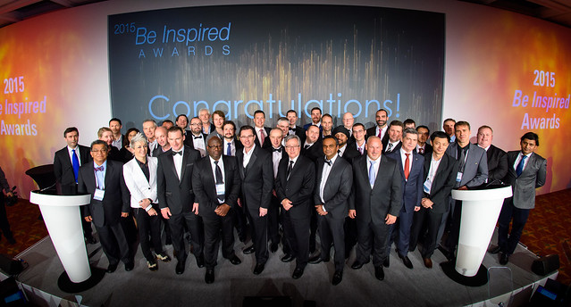
    At a ceremony and gala held Nov. 4 in London, 18 Be Inspired Awards winners and five Be Inspired Special Recognition Awards winners were presented. In addition, Bentley’s Lifetime Achievement Award was awarded to J.P. (Peter) Blake, director, Project Delivery Group for Hatch. Blake was recognized for his exceptional vision, numerous career achievements, leadership, and effectiveness as a change agent, having tirelessly advocated throughout his career for improving infrastructure workflows through the better application of advanced technologies. Equally important, he was honored as a great friend and mentor to the infrastructure community at large.

    The Year in Infrastructure Conference is a global gathering of executives in the world of infrastructure design, construction and operations. It features presentations and interactive sessions exploring the intersection of technology and business drivers, and how they are shaping the future of infrastructure delivery and investment returns. The 2015 event was also attended by more than 100 members of the media from publications around the globe who met with Bentley executives on Monday for the company’s annual Media Briefing. The agenda also included presentations by finalists in the Be Inspired Awards program, culminating in the selection of the winning projects.

    This year, 10 independent panels of jurors, comprising distinguished industry experts, selected the 18 Be Inspired Awards winners from 54 project finalists. These finalists had been previously chosen from 360 submissions by organizations in 66 countries.

    Candidates for Bentley’s Be Inspired Special Recognition Awards were selected by the jurors from the top finalist projects as well as other exemplary nominations. This selection was based on the projects’ uniquely innovative and visionary achievements that transcend the narrower focus of the standing Be Inspired Awards categories. The nominees were then reviewed by a panel of Bentley executives, who evaluated them based on the criteria established for each award.

    “This has been a year of major achievements for Bentley Systems that include the introduction of our CONNECT Edition infrastructure engineering software, providing a common environment for comprehensive project delivery,” Bentley Systems CEO Greg Bentley said. “But the achievements that my colleagues and I are most proud of are those of our users. For while our goal at Bentley is advancing infrastructure, we can only accomplish it through the vision, talent, and dedication of the architects, engineers, constructors, and operations professionals who creatively apply our technology in pursuit of effective strategies for achieving new levels of project and/or infrastructure asset performance.

    “Such achievements are exemplified by the extraordinary Be Inspired Award-winning projects we celebrated last night. I heartily congratulate the organizations that were instrumental in the delivery or operations of these truly inspiring projects. Moreover, I applaud all of the project nominees in this year’s awards program for their contributions to improving quality of life around the globe.”

    2015 Be Inspired Award Winners

    2015 Be Inspired Special Recognition Awards

    Advancing Collaborative BIM

    Morphosis Architects – Bill & Melinda Gates Hall – (Ithaca, New York, United States)

    Advancing Comprehensive BIM “Playbooks”

    Hatch Ltd – Keeyask Hydroelectric Generating Station Project – (Nelson River, Manitoba, Canada)

    Advancing Construction Modeling

    Jacobs – NAG Project – (Baytown, Texas, United States)

    Advancing Information Mobility in Operations

    Western Power Distribution – EMU for iPad – (Exeter, United Kingdom)

    Advancing Integrated Projects

    HDR – Union Station to Oak Cliff Streetcar TIGER Design-Build Project – (Dallas, Texas, United States)

    2015 Be Inspired Awards

    Innovation in Asset Performance Management

    SA Water – Predictive and Operational Analytics Tools, Adelaide Metro Water Distribution Network – (Adelaide, South Australia, Australia)

    Innovation in Bridges

    LCW Consult – The Ceira River Bridge – (Coimbra, Coimbra District, Portugal)

    Innovation in Building

    Robin Partington and Partners – One Merchant Square – (London, United Kingdom)

    Innovation in Construction

    Vic’s Crane & Heavy Haul, Inc. – Unit 25 Project – (Rosemount, Minnesota, United States)

    Innovation in Government

    Singapore Land Authority – Mapping Singapore in 3D – (Singapore)

    Innovation in Land Development

    Tata Consulting Engineers Ltd. – Detailed Design of Utility Infrastructure – (Dharampur, Gujarat, India)

    Innovation in Megaprojects

    AECOM – E4 Stockholm Bypass FSK02 Rock Tunnels Design Contract – (Stockholm, Sweden)

    Innovation in Mining

    Tetra Tech Proteus – Kvanefjeld Rare Earth: Uranium Project – (Narsaq, Kujalleq, Greenland)

    Innovation in Offshore

    Keystone Engineering Inc. – Block Island Wind Farm – (Block Island, Rhode Island, United States)

    Innovation in Power Generation

    MWH Global – Tyseley Resource Recovery Centre – (Birmingham, West Midland, United Kingdom)

    Innovation in Process Manufacturing

    Giprotyumenneftegaz – Preliminary Water Removal Unit: North Vankor Field – (Igarka, Krasnoyarsk Territory, Russia)

    Innovation in Project Delivery

    AECOM – Global Project Collaboration in a Design-build-finance-operate (DBFO) World – (Global)

    Innovation in Rail and Transit

    London Underground Ltd – Bond Street to Baker Street Tunnel Remediation Project – (London, United Kingdom)

    Innovation in Roads

    Grontmij – A6 to Manchester Relief Road – (Stockport, Manchester and Cheshire, United Kingdom)

    Innovation in Structures

    Stanley D. Lindsey and Associates, Ltd. – SkyHouse Apartments – (Denver, Colorado; Atlanta, Georgia; Orlando and Tampa, Florida; Charlotte and Raleigh, North Carolina; Nashville, Tennessee; Austin, Houston, and Dallas, Texas, United States)

    Innovation in Utilities and Communications

    Pacific Gas and Electric Company – Engineering Contractor Collaboration Solution Using ProjectWise and Bentley Substation – (San Ramon, California, United States)

    Innovation in Water Network Analysis

    Prolagos/Aegea – Water Master Plan for the Região dos Lagos – (Região dos Lagos, Rio de Janeiro, Brazil)

    Innovation in Water Treatment Plants

    Aqua+ – Complex Scheduling and Automatic Water Quality Monitoring of Groundwater – (Khabarovsk, Far East Federal District, Russia)

    Bentley Systems has posted highlights of this year’s winning projects on its website. It will include more detailed descriptions of all nominated projects in the print and digital versions of its 2015 Infrastructure Yearbook, which will be published after the first of the year. To review the past 11 editions of this publication, which together feature more than 2,500 world-class projects recognized in the Be Inspired Awards program since 2004, access Bentley’s Infrastructure Yearbooks.

  • A3 Edge maps wildlife in Africa

    Elephants are highlighted in yellow.
    Elephants are highlighted in yellow.

    VisionMap’s A3 Edge Digital Mapping System was recently used to map wildlife in an African national park. A3 Edge provides an efficient solution for detecting, tracking and estimating wildlife populations, according to maker VisionMap.

    The A3 Edge camera surveyed the park from an altitude of 4,000 ft. above ground level (AGL), capturing 3.5 cm resolution imagery at a rate of 225 km2/ hour. A3 Edge uses a “sweep” capture technology that provides quick, high-resolution coverage of vast areas.

    Among the animals identified in the images were antelopes, elephants, hippopotamuses and giraffes. The animals’ locations are clearly visible in the aerial images, and the automatic object recognition capability available with VisionMap systems makes it easy to calculate the number of animals in a particular area.

    VisionMap’s LightSpeed processing system automatically processes VisionMap images, producing aerial triangulation, orthophoto, digital surface model (DSM), 3D models, and georeferenced vertical and oblique images. The system’s fast turnaround time makes it possible to regularly survey the area, and collect useful information about the animals’ behaviors and trends, VisionMap said.

    Antelopes are highlighted in red.
    Antelopes are highlighted in red.

    Watch a video about the A3 Edge:

  • GPS-powered advertising geo-targets moving vehicles

    GPS-powered advertising geo-targets moving vehicles

    MediaSignage-GPS-LBS
    With the service, media players display a content loop with information specific to the vicinity of the vehicle.

    MediaSignage has released GPS-powered, location-based services (LBS) for digital signage. The tool provides specific geo-targeting of advertising campaigns based on the location of the screen.

    The GPS-enabled location targeting works well for buses, taxis and trains, because advertisers can more easily target their digital signage content based on a targeted geographic radius, MediaSignage said in a press release.

    For instance, a taxicab may provide digital signage behind the headrest and allow local advertisers to target messages to patrons that ride within the cab. When a moving car, bus or train enters the desired radius (such as close to a specific restaurant or local venue), the installed media player displays a new content loop with information specific to the vicinity. Once the media player moves out of that vicinity, the original content loop resumes.

    MediaSignage has designed the tool to be simple and affordable, enabling any business owner to have their message presented in a matter of a few minutes. Users can log in to StudioLite, set the radius on a map, and set the priority duration for each content resource that is to be displayed. Users can set radius location information for several desired areas within a geographic footprint.

    When users combine the power of GPS tracking into moving digital signage, the ability to target for advertising purposes becomes extremely powerful, MediaSignage said. Placing local advertisements in taxi, bus, train and even Uber cars provides a powerful tool for selling ads and targeting customers.

    “We are extremely pleased and excited by this latest feature implementation within our system,” said MediaSignage president Nate Nead. “It provides an additional value-adding tool for digital signage business owners and operators, allowing them to better monetize their display screens in a host of different and non-traditional environments. We hope our users will take full advantage of the new features and that the features will provide a profit-enhancing tool for their businesses.”

  • Filtronic Offers Cellular + GPS Splitter/Combiner

    Filtronic Offers Cellular + GPS Splitter/Combiner

    The PXC021-V2 by Filtronic.
    The PXC021-V2 by Filtronic.

    The new PXC021-V2 by Filtronic is a wideband cellular + GPS low-loss splitter/combiner.

    Designed for repeater/DAS applications, the PXC021-V2 provides GPS L1 and L2 frequency coverage and wideband cellular frequency coverage (618-960 MHz and 1695-2690 MHz). It has low loss (≤ 0.30 dB Cellular and ≤ 0.70 dB GPS) and excellent cellular to GPS isolation (≥ 55 dB).

    The L1/L2 Channel Absolute Group Delay is 20 nS maximum (17 nS typical), and the variation is 4 nS p-p maximum over the L1/L2 bandwidth. The

    The PXC021-V2 is IP67-rated for outdoor use.

  • Technology adoption slow in small towns

    Tim Burch
    Tim Burch

    I was born in a small town and I live in a small town. I’ll probably die in a small town, but only if you want to call a blue-collar city of 75,000 people small. My friends are small town and my parents still live here in this same small town. It was here in this small town that I started my career as a surveyor and circled back for an opportunity to be near family and friends.

    There are many towns, villages and cities in the Midwest that fit this description — mostly because of the agricultural background, but also because of the labor-intensive industries that provide most of the local jobs. Like those who prefer the large city hustle-bustle lifestyle, the small town attitude is the same, but in the opposite direction.

    My career as a surveyor has provided me with opportunities to work in both small and heavily populated areas. I have seen the definite distinction between the two environments, and have seen many of the technological advancements of the past few decades. Having worked in both the large urban multi-discipline engineering firm and the small town surveying firm, I see much disparity between how surveying is done today from varying firms. The biggest difference I see today is how surveyors are using GPS technology for their field operations.

    For the modern surveyor, GPS has become an everyday tool for measuring and data collection, but it wasn’t always that way. I began my career in the early 1980s working for a seven-person engineering firm in my small town, so GPS was never in our budget. Like most surveyors, I read about GPS use in technical publications, and was amazed what these magical boxes could do. The first generations of static receivers produced were very complicated and expensive. With long occupation times and even longer processing times, only the few companies who could afford the high-priced equipment and software were buying these units. Our small-town market could not justify this purchase, so we made do with conventional equipment as the norm.

    Today’s environment requires the working knowledge of handheld data collectors that are more powerful than the computer on the Apollo moon mission, laser scanners that collect millions of points per second, and GPS receivers that talk through cell phones to get sub-centimeter accuracy. Around the corner is wider use of lidar data collection as well as the unlimited use and application of UAVs with cameras and scanners, so there is no end in sight for technology and the surveyor.

    Most of the larger urban firms have established equipment and training budgets stay current with technology and not lose ground with the competition. Because of these strategic and spending plans, fee structures have increased over the years, and thus the cost of surveying has increased accordingly. This has also afforded those who stay up-to-date with current technology to push the limits of the equipment, and to continue to find new and useful ways to perform our work and provide newer services.

    By keeping their costs down, small-town and rural surveyors have kept their fees down as well, but to the detriment of the profession. In fact, the cost of a typical land survey in a small town has come nowhere close to inflation for the past 40 years in most places.

    In comparison, however, many industry partners of the surveyor have spent a great deal of money and time staying current with technology and production methods. Excavators and earth movers now have GPS-based computers controlling their movement and placement of material, as well as utilizing robotic instruments and GPS for layout of improvements and utilities. Architects and structural engineers are utilizing scanners for building and piping as-builts for existing and future improvements. Almost all farmers have tractors equipped with GPS-based control systems to help them plant and harvest with pinpoint accuracy, as well as apply herbicides or pesticides based upon high-tech mapping performed by crop analysts. Many land-management companies are gearing up with UAV technology to assist future operations with the information gathered by these flying wonders. Everyone around us is tech savvy, but the small surveyor seems to lag behind.

    I wanted to be exposed to new technology when I moved from a small town to a large urban city in 1998. The big improvement for the surveying community was the introduction of real-time kinematic (RTK) methods. The firm I worked for during the late 1990s and early 2000s had been using RTK systems since their introduction. Being able to collect points “on the fly” both manually and with ATVs greatly increased our productivity as well as accuracy.

    By the mid-2000s, almost every big-city firm utilized this technology as standard equipment for their crews. The only drawback to the RTK system was the need to leave a base-station receiver, so the introduction of the real-time network via cellphones in large market areas was another step in solidifying GPS use for everyday work.

    Another benefit of extensive GPS use in the large city area is that most of the firms keep their surveys on state plane coordinate systems, so exchange and verification of data is a much easier process. These larger urban firms also continue to upgrade to newer equipment as more satellite systems are introduced. The addition of GLONASS has increased our precision and coverage levels, with future systems including Galileo, IRNSS and BeiDou set to raise that bar even higher.

    On the contrary, many firms in small-town and rural areas have not progressed into new technologies because of cost and lack of cellular coverage needed for RTN systems. I moved back to my small town several years ago and have experienced this slip in technology firsthand. The big cellular carriers say they have 3G and 4G service in most places, but I can tell you from my travels that there are many places I have not been able to use our RTN receiver because of lack of cell signal. Most of the surveyors in our area still utilize an RTK system and will establish a position through OPUS or will assume a local coordinate system. Not many have upgraded their equipment to take advantage of GLONASS, so there are several steps they will need to take in the future to catch up to the industry. We also must travel greater lengths to recover NGS monuments for our positional verification, which will become more important as static monuments become a thing of the past.

    So with my apologies to Mr. Mellencamp, my job as a surveyor has not been just small town, and has provided me with many big-city opportunities. Our crews face challenges here every day that many take for granted while in the big city market, including RTN coverage, GLONASS constellation usage and many more NGS monuments for QA/QC. Having more of these items could greatly help our productivity, especially when stronger cellular coverage is expanded to more of our rural areas.

    I look forward to these improvements but will continue to work with our existing systems until that time. So look for us, surveying on in our small towns and locating all those little pink houses.


    This column introduces Tim Burch, GPS World’s new co-contributing editor for survey. Tim will alternate with Dave Zilkoski in contributing monthly columns to the Survey Scene e-newsletter. Tim is survey department manager for Chastain & Associates LLC in the Decatur, Ill., area. He has been working as a professional land surveyor since 1985, and is the secretary, Board of Directors, National Society of Professional Surveyors.

    For his next column in January, Tim plans to write about farmers and their technology in his area, focusing of course on GPS use. His article will compare surveyors’ processes with those used by farmers. (For Dave Zilkoski’s last column in October, see Establishing Orthometric Heights Using GNSS — Part 3.)

    Contact Tim via [email protected].

  • Topcon offers control box for excavator systems

    Topcon offers control box for excavator systems

    Topcon's GX-55
    Topcon’s GX-55 control box for machine-controlled excavation.

    Topcon Positioning’s  GX-55 control box for machine-controlled excavation is now available in the Americas. With the release of the GX-55, Topcon adds three new 2D and 3D systems to its line of excavation solutions — the X-52 as well as the X-53 and X-53i. In any solution, the GX-55 is designed to provide users with new visual and audible features to achieve grade safely and efficiently for 2D or 3D excavating tasks.

    “The bright and robust GX-55 delivers the highest quality graphical experience for modern machine control,” said Kris Maas, director of construction product management. “Today operators use Sitelink3D to instantly communicate entire job activities to managers on-the-go.  The GX-55 delivers this real-time project information faster than ever.”

    “Whether you want to take advantage of Topcon 2D, 3D or 3D indicate machine controlled excavation systems, the new GX-55 is delivered in a lightweight package for easy machine transfer, storage, and quick cable attachment,” Maas said.

    The large 6.5-inch sunlight-viewable and color LCD touchscreen is surrounded by integrated LED light bars for a continuous grade reference of the bucket’s teeth. Additional features include customizable audible tones for grade reference, integrated virus protection, and easy-access USB ports for saving and downloading job files, Topcon said.

  • Will Military Take the Autonomous Vehicle Lead?

    Will Military Take the Autonomous Vehicle Lead?

    At Unmanned Systems Defense, warfighters had the opportunity to learn about new technologies from government contractors and see demos in the exhibition hall. (PRNewsFoto/AUVSI)
    At Unmanned Systems Defense, warfighters had the opportunity to learn about new technologies from government contractors and see demos in the exhibition hall. (PRNewsFoto/AUVSI)

    ARLINGTON, Va. — Despite shrinking defense budgets, existing and emerging worldwide threats will make robotic and autonomous systems’ development important for decades, said officials at the Unmanned Systems Defense 2015 conference held here Oct. 27-29.

    Because America has been at war for more than 14 years, unmanned technology has been developing at a rapid rate, perhaps even faster than emerging autonomous commercial systems. The replacement of even manned aircraft has some in the military establishment wary, but others know it’s only a matter of time before most vehicles, surface ships and aircraft are unmanned.

    Navy Secretary Ray Mabus said that the F-35, which has been controversial because of its cost and capabilities, may be the last manned fighter aircraft.

    Mabus acknowledged the rise in autonomous vehicles not only in the military, but in the civilian world. “Our grandchildren may never have to drive a car. I can’t wait for driverless cars,” he said.

    The Navy is so high on unmanned systems that it recently named retired Marine Brig. Gen. Frank Kelley as deputy assistant secretary of the Navy for unmanned systems.

    Like the other services, the Navy is experimenting with aviation systems that are inexpensive and small. It is developing swarming drones that are designed to overwhelm a target. Mabus said one of the cool drones that the Navy is developing is called Kraken, which operates underwater, then explodes past the surface to operate in the air.

    A V-Bat UAV from Martin UAV. Applications include aerial mapping, border patrol, shipboard operations and others.
    A V-Bat UAV from Martin UAV. Applications include aerial mapping, border patrol, shipboard operations and others.

    The Air Force also is developing small drones that can be launched and recovered by a larger aircraft after a mission is complete.

    While the meeting was filled with government bureaucrats with the requisite PowerPoint slides detailing how long programs will take, they did say that the services are plowing ahead with autonomous technology that many of their civilian counterparts say are decades away.

    Convoy Operations

    An Army initiative called Leader Follower includes rudimentary autonomous convoy operations capability with GPS and base mapping systems, autonomous steering and braking. Army program managers say the program is in staffing, but should be approved in a few months.

    The follow on to Leader Follower is a full-blown Automated Convoy Operations capability that would allow any manned system, including tanks and mobile artillery, to operate autonomously. Automated Convoy Operations are at least two-to-three years behind the Leader Follower program, Army officials said.

    Other Army programs include route clearance systems to defeat underground improvised explosive devices and caches and mine rollers.

    With all the new autonomous technology, at least one speaker said the first question should be why an unmanned system is needed at all, given its high cost and long lead times for rollout. “Does the technology enable a [service member] to fight better, or does it just get in the way?” said Lt. Col. Hank Lutz, U.S. Marine Corps joint staff.

    Plans to Replace Aging Unmanned Systems

    Lt. Gen. Michael Williamson, U.S. Army deputy to the assistant secretary of defense for acquisition, said the service is divesting its aging robotics and drone systems, which means future contracts for defense companies. “In 14 years of war, we have rode this equipment pretty hard,” he said. “We believe in modernization, but also looking to buy new systems, which is a new shift in order to gain a competitive advantage over our enemies, who are leveraging unmanned systems.”

    Jeff Smith, president and CEO of Riptide Autonomous Solutions, holds an unmanned undersea vehicle that has GPS sensors and antenna.
    Jeff Smith, president and CEO of Riptide Autonomous Solutions, holds an unmanned undersea vehicle that has GPS sensors and antenna.

    The big mantra from the military program managers and senior officials is having an “open architecture” that includes a control segment that works with both manned and unmanned systems. Williamson also echoed the need for standardization, but went further by saying the services should have a list of standards and one place, a facility, to ensure components actually work together.

    While the “we want an open architecture” theme was in virtually every speaker’s presentation, one said that there needs to be a balance between the time a product is ready and its interoperability. “The Taliban’s [Program Objective Memorandum] cycle is a lot shorter. Don’t tell me that [your product] is plug and play,” said John Coglianese, U.S. Special Operations Command director, unmanned aerial systems.

    DoD Reaches Out to Smaller Businesses, Silicon Valley

    Realizing a need to assess new technologies and partner with innovative companies, the Defense Department recently established the Defense Innovation Unit, which is based in the San Francisco Bay area. The office is small with only a few personnel, said George Duchak, who was recently named director.

    Duchak acknowledged that some companies suffer from government fatigue in that they see the same presentations over and over.  By being out in the Silicon Valley, Duchak’s personnel can be more receptive and listen, rather than talk at companies. His office is made up of people who seek out new technology and vendors, serve as a conduit to local labs and assess companies who want work with the government, among other activities.

    “We are kind of in a honeymoon period [with private companies]. It has been interesting finding companies where their patriotism aligns with whether or not they are going to make money,” Duchak said. “Google has been pretty receptive, not so much with Apple.”

    Another group, the National Advanced Mobility Consortium, looks to match technology to defense needs for smaller companies looking to do business with the government. “We are trying to show how to engage nontraditional companies,” said Bill Thomasmeyer, National Advanced Mobility Consortium consultant. Thomasmeyer said it’s tough for a small company or individual entrepreneur to go through the complex government procurement cycle. “They are used to Silicon Valley, which has a 90-day cycle. The Federal Acquisition Regulation is 4,000 pages,” he said.

    Currently, NAMC has 274 members, a third of which are not defense companies, Thomasmeyer said.

    Future of GPS and Location Technology for Unmanned Systems

    Virtually all unmanned systems, from drones to autonomous vehicles, use GPS location technology and advanced mapping. As systems evolve, and enemy threats become more sophisticated, new requirements are emerging.

    “All of our systems use GPS, but we need to operate in a GPS-denied environment,” said Capt. Aaron Peters, U.S. Navy program manager for expeditionary missions.

    Other program managers said what’s also needed is GPS units that feature 3-D navigation for autonomous systems.

    In addition to basic positioning and navigation of drones and autonomous vehicles, the Air Force is using location technology to geo-locate damage from shell holes at airfields they use in war zones.