By 50th Space Wing Public Affairs, Schriever Air Force Base
Throughout the years, GPS has achieved historic milestones and garnered recognition for its contributions to the betterment of humanity.
2015 was no different.
Photo: 50th Space Wing Public Affairs, Schriever Air Force Base
GPS, operated by the dedicated men and women of the 2nd and 19th Space Operations Squadrons at Schriever Air Force Base, Colorado, is also the world’s largest military satellite constellation. Uses of GPS include precise timing for financial transactions, search and rescue, communications, farming, recreation and both military and commercial aviation.
The 2 and 19 SOPS, referred to as Team Black Jack, hosted GPS Week Feb. 15-20 to honor their heritage and interact directly with the Colorado Springs community. The week included a community geo-caching event, GPS/base tours for dozens of middle and high school students, 2 SOPS educational outreach events at local schools and culminated with a GPS heritage celebration.
“We wanted to touch the different facets of our community and that’s why we planned these events,” said Tech. Sgt. Abifarin Scott, 2 SOPS GPS maintenance flight chief.
GPS received historic recognition from the city of Colorado Springs a few months later.
Colorado Springs City Council members presented a proclamation declaring July 17, 2015, GPS Day during a ceremony July 15.
“It’s a great time, a significant milestone that [GPS] has been active this long,” said Andy Pico, Colorado Springs City Council member. “GPS has grown to be such a tremendous part of everybody’s lives, it runs everything…it’s so much into the fabric of everybody’s life.”
The proclamation came as the Air Force celebrated GPS’s 20 years of full operational capability, confirmed July 17, 1995. During the last 20 years, GPS has become an integral part of technology that affects the lives of billions of people around the world.
The men and women of GPS stayed busy supporting many operations throughout the year.
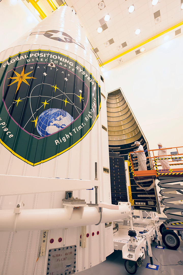
GPS IIF-10. (Photo: ULA)
The Air Force and the 45th Space Wing supported the successful launch of a United Launch Alliance Delta IV rocket that roared to life March 25, carrying the Air Force’s ninth Block IIF-09 navigation satellite for the GPS.
2 and 19 SOPS accepted satellite control authority of GPS IIF-9 Satellite Vehicle Number-71 April 3.
2 SOPS successfully completed a transfer operation of GPS satellite control authority to the Alternate Master Control Site at a backup location on June 6.
2 and 19 SOPS accepted command and control of the 10th GPS Block IIF satellite July 24.
After 15 years of launch operations for the GPS, 19 SOPS completed their 26th launch as a squadron Oct. 31, performing checkout operations on the 11th GPS IIF satellite.
On Nov. 6, Team Black Jack accepted SCA just six days after the Halloween launch of satellite vehicle number-73 – in record time. Members of Team Black Jack prepped for the launch and subsequent SCA acceptance of SVN-73 for approximately three months.
The Command’s GPS operations were showcased in multiple venues this year, engaging with communities and making the mission known all over the world.
CBS featured the 50th Space Wing and GPS on an episode of 60 Minutes, and BLUE, the Air Force’s flagship TV show, also featured GPS — both of which displayed the capabilities it offers to humanity.
Beyond its essential capability for the military, GPS is a worldwide utility that provides the highest accuracy data available to people all around the world and enables such vital activities as weather forecasting, transportation, global commerce and farming/agriculture.
“2 SOPS’s continuing objective is to ensure GPS remains the gold standard for global space-based navigation and timing by providing highly reliable and accurate GPS signals to users around the world,” said Lt. Col. Todd Benson, 2 SOPS Commander. “We look forward to continuing to provide our mission partners and global users with the most accurate position, navigation and timing signal available in the history of GPS.”
Ten years ago saw the launch of Europe’s very first navigation satellite. A decade of hard work later, more than a third of the Galileo constellation has followed it into orbit and a ground network sharpening the satnav system’s accuracy encompasses the globe.
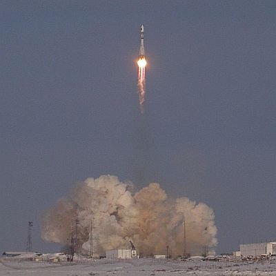
Galileo’s GIOVE-A retired in June 2012. (Photo: ESA)
GIOVE-A, short for Galileo In-Orbit Validation Element-A, was launched by Soyuz from Baikonur cosmodrome in Kazakhstan on Dec. 28, 2005.
“Much work had already taken place on the ground, but GIOVE-A marked the first time that Galileo hardware went into orbit,” recalls Didier Faivre, heading ESA’s navigation directorate.
“It had a crucial role: to claim operating frequencies that had been set aside for Galileo by the International Telecommunications Union, to demonstrate essential technologies such as Galileo’s rubidium atomic clock, and to gather data on the radiation-rich environment of medium-altitude orbit, which was a relatively unknown region for Europe.
Didier Faivre (Photo: ESA)
“So GIOVE-A opened the way to all that followed — the follow-up GIOVE-B in 2008, and then the launches of the Galileo satellites proper — a total of six double-satellite launches from 2011 to earlier this month, with 12 satellites placed in orbit so far, on the way to the full 30-satellite constellation.
“Our three launches this year doubled the number of satellites in orbit, and the pace of progress is set to increase further in 2016, when we will see Ariane 5 called on to launch Galileo for the first time, doubling the number of satellites released on each flight.”
Progress in space has been mirrored on Earth, with the establishment of Galileo’s ground segment: two control centers in Fucino, Italy, and Oberpfaffenhofen, Germany, sit at the heart of a worldwide network of ground stations.
The Soyuz launcher carrying GIOVE-A climbs into the sky above Kazakhstan on Dec. 28, 2005. (Photo: ESA)
This ground segment, as one of the most complex infrastructures ever overseen by ESA, has the task of keeping all the satellites healthy and their navigation signals synched — the timing system accurate to a few billionths of a second that provides the submetre precision.
Sensor stations to monitor Galileo signals and return data to the control centers are required all across the vast footprint of the system. Their locations range from the Arctic to Antarctic to lonely mid-ocean islands, all connected back to Europe via satellite.
Initial Galileo services are set to be available during next year. New generations of commercial satnav receivers are already Galileo-ready, having received extensive technical checks from ESA’s Navigation Laboratory.
GIOVE-A in a clean room at ESA’s ESTEC technical centre in the Netherlands, having instrumentation sensors installed in advance of testing in 2005. (Photo: ESA)
And national governments are already preparing to make use of Galileo’s Public Regulated Service — PRS, the most secure and precise class of service, restricted to authorized users. Belgium, France, Italy and the UK have all performed their own PRS acquisitions and positioning testing.
As for GIOVE-A, the satellite that started it all, its ESA mission concluded in 2012, once the first four Galileo satellites followed it to orbit. Remarkably, it is still operational, controlled by builder Surrey Satellite Technology Ltd in the UK.
In the past it has carried out tests of high-altitude satnav detection. Its radiation monitor continues monitoring the medium-altitude orbit environment, helping to forecast the future long-term performance of its Galileo descendants.
The European Commission has published a new release 1.2 of the Galileo Open Service Signal In Space Interface Control Document (OS SIS ICD v1.2). The document provides the information needed by receiver and chipset manufacturers, application developers and service providers to process and make use of the open signals generated by the Galileo satellites.
The OS SIS ICD contains the publicly available information on the Galileo Open Service Signal In Space, specifying the interface between the Galileo space and user segments. The Galileo user segment is of particular interest to the European GNSS Agency (GSA), which has been delegated responsibility for the program’s service provision by the European Commission.
In fulfillment of this role, the GSA is developing the European GNSS Service Centre (GSC), which provides the single interface for information and help to users of the Galileo Open Service (OS).
Once fully developed, the GSC will operate on a 24/7 basis and offer a range of services, including hosting the Galileo User Helpdesk, providing the interfaces between the Galileo System and OS users, and hosting a center of expertise for OS service aspects.
The OS SIS ICD is a key document that provides the information required by receiver and chipset manufacturers, application developers and service providers to be able to process the Open Service signals generated by the Galileo satellites. In particular, the document specifies:
Galileo signal characteristics
Characteristics of Galileo spreading codes
Galileo message structure
Message data contents
The latest version is based on feedback from receiver manufacturers and other stakeholders received during an extensive public consultation in 2014.
The GSA further highlights the importance of this document for the development of receiver technology, which is the key enabler for translating Galileo signals into useful services. Over the past several years, the GSA has been engaged in open dialogue with chipset and receiver manufacturers, paving the way for Galileo to be fully integrated into a new generation of receivers and ensuring its signals will provide a wide array of new applications and services that directly benefit European citizens.
In addition to a number of minor editorial improvements including corrections and clarifications, an annex with numerical examples of FEC coding and interleaving has been added and the license agreement has been revised and simplified.
The document now refers to a companion document, “Ionospheric Correction Algorithm for Galileo Single Frequency Users,” containing details on the ionospheric model used for Galileo. The E1-B, E1-C and E5 Primary Codes in Annex C are no longer included in the paper version, but are available in the electronic version of the ICD.
The Smart Energy Catalyst. The project showcased how a smart home, smart electric vehicle and smart energy system can work together in an IoT ecosystem with location as a key interaction point.
Geospatial technology company Esri was honored at the TM Forum Catalyst InFocus event for the company’s contributions to developing solutions for a more connected world. TM Forum, a global industry association for digital business, presented Esri and partners with the Most Innovative Catalyst Award.
“We’re driving toward the ultimate Internet of Things (IoT) ecosystem where you can bring different applications together that are going to make our lives safer, more energy efficient, and much better in the future,” said Randy Frantz, telecommunications solutions director at Esri.
Esri’s telecommunications team collaborated with Orange and BearingPoint on the award-winning proof-of-concept project called the Smart Energy Catalyst. The project showcased how a smart home, smart electric vehicle and smart energy system can work together in an IoT ecosystem with location as a key interaction point.
The multiphase project examined the infrastructure necessary to support a smart energy ecosystem. With the latest iteration of the Catalyst, the project team demonstrated how geofencing in homes and cars can work with Esri’s geographic information system (GIS) technology. When the consumer leaves home or work, mobile devices trigger the GIS to initiate a series of notifications and actions. For example, lights in homes automatically turn off, security systems are enabled, and users are notified that their electric vehicle needs charging.
“Location provides context to the IoT network. It transforms raw sensor data into useful, actionable information,” Frantz said.
TM Forum’s Strategy Committee gave the award to the Smart Energy Catalyst team based on several criteria, including having a compelling and inspiring demonstration; growth potential and business value; and potential for humanitarian or other positive effects on society.
Nearly 200 industry leaders attended the Catalyst InFocus conference, where they explored the organization’s 11 project demonstrations.
TM Forum’s Catalyst program connects diverse companies from across industries, facilitating collaboration and fostering the cocreation of innovative solutions to pressing telecommunications business challenges. Catalysts are member-led projects and demonstrations that both inform and leverage TM Forum best practices and standards including TM Forum Frameworx.
The organization announces Catalyst Awards biannually. Winning teams leverage proven technologies, competencies, and investments. Teams have six months to develop proofs of concept that outline digital solutions.
In addition to his work on the Smart Energy Catalyst, Frantz accepted a position earlier this year as colead of TM Forum’s IoT work stream. The endeavor explores how location, advanced sensor and device data, and powerful industrial and consumer solutions can change social norms and bring business into the modern technology framework.
TM Forum includes more than 900 member organizations and 85,000 individual members.
“GNSS — Creating a Global Village” is the theme of the 2016 Munich Satellite Navigation Summit, taking place on March 1 – 3, 2016, at the famous Munich Residenz.
The Munich Satellite Navigation Summit is a conference with global impact dealing with satellite navigation now and in the future. The one-of-a-kind convention of high-ranking worldwide speakers from industry, science and governments provides the participants with a broad overview and different perspectives on the latest developments in the field of GNSS. The historical location — the Residenz Muenchen — contributes to the unique character of this 3-day conference.
The organizing Institute of Space Technology and Space Applications (ISTA) of the Universitaet der Bundeswehr Muenchen will invite experts from all over the world to talk about the impact of satellite navigation on global developments and different areas of life.
The conference starts on March 1 with the Exhibition Opening and Champagne Reception at 16:30, followed by the Opening Plenary Panel at 17:15. Afterward, a reception will provide opportunities for high-level networking with experts from industry, science and government.
The technical program of the Munich Satellite Navigation Summit includes plenary discussions and presents a concise update on the main activities in worldwide satellite navigation systems, in particular:
Implementation of the European satellite navigation system Galileo
Modernization of the US Global Positioning System (GPS IIF, GPS III)
Status and modernization of the Russian System GLONASS
Status of the Chinese System BeiDou
Update of regional and augmentation systems such as the Japanese QZSS and the Indian IRNSS
GNSS in the Southern Hemisphere and Equatorial Regions
Galileo Public Regulated Service (PRS)
Legal aspects in GNSS based timing
GNSS based agriculture and forestry
Autonomous driving
GNSS Authentication
Knowledge transfer and coordination between education, research and industry
GNSS and Sciences for Life
Trends and signal stability in the Multi-GNSS Hotspot East Asia The Summit is part of the efforts of the Bavarian government and the cluster on aerospace and satellite navigation to stimulate applications and services in this high-tech field.
The summit is part of the efforts of the Bavarian government and the cluster on aerospace and satellite navigation to stimulate applications and services in this high-tech field.
Just what every satnav engineer wanted for the holidays: a new Interface Control Document to unwrap under the tree. On Nov. 30, the European Commission (EC) published version 1.2 of the Galileo Open Service Signal In Space Interface Control Document (OS SIS ICD v1.2). The document provides the information for receiver and chipset manufacturers, application developers and service providers to process and make use of the open signals generated by the Galileo satellites. This most recent iteration incorporates feedback from receiver manufacturers and other stakeholders.
The Galileo OS SIS ICD v1.2 specifies:
Galileo signal characteristics.
Characteristics of Galileo spreading codes.
Galileo message structure.
Message data contents.
Key new features in version 1.2 include:
An annex with numerical examples of FEC coding and interleaving.
A revised and simplified license agreement.
Cross-reference to a companion document, “Ionospheric Correction Algorithm for Galileo Single Frequency Users,” containing details on the ionospheric model used for Galileo.
In addition, a number of minor editorial improvements including corrections and clarifications have been made.
The Galileo OS SIS ICD v1.2 document can be downloaded here.
The Ionospheric Correction Algorithm for Galileo Single Frequency Users document can be downloaded here.
Twelve Birds for December
Also timely for end-of-year celebrations, Galileo satellites 11 and 12 lifted off together on Dec. 17 atop a Soyuz rocket, and successfully deployed in space four hours later. The pair effectively doubles the number of Galileo satellites in space over the last nine months.
Five satellites are now set operational to the user. Once 9 and 10 (launched in September 2015) as well as 11 and 12 are set operational, a total of nine usable satellites will be in orbit. Satellites 5 and 6 may be partially usable at some point.
“Along with the ground stations put in place around the globe, this brings Galileo’s completion within reach,” said Jan Woerner, director general of the European Space Agency.
“Production, testing and launch of the remaining satellites are now proceeding on a steady basis according to plan,” added Didier Faivre, ESA’s director of Galileo and navigation-related activities.
Starting with launches in the third quarter of 2016, four satellites at a time will rise into orbit on all except one date, which remains at two. This accelerated deployment should bring 30 satellites on line — 24 operational and six orbit spares — by 2020 for full operational capability of the European GNSS. Initial operating capability is foreseen by the end of 2016.
Service Centre and Help Desk
The European GNSS Agency (GSA), responsible for Galileo service provision as directed by the EC, is developing the European GNSS Service Centre (GSC), which provides the single interface for information and help to users of the Galileo Open Service (OS). The GSC will eventually operate on a 24/7 basis and offer a range of services, including hosting the Galileo User Helpdesk, providing the interfaces between the Galileo System and OS users and hosting a centre of expertise for OS service aspects.
Question: What is the optimum number of GNSS signals to include/process in a consumer-grade PNT device?
Philip Mattos Receiver Designer Consultant
A: A chip should support four signals, being GPS/GLONASS/Galileo/Beidou, but only process two of them — choice depending on region, geopolitical sensitivity, constellation availability — dropping to one to save power when satellite availability is good. Two constellations give enough satellites for accuracy and availability in obstructed environments. Which two depends on needs regarding cost, power and so on, GPS and Galileo being better in the future for less power, but GPS and GLONASS being better today.
Greg Turetzky
Principal Engineer
Intel
A: The receiver should be capable of processing sufficient signals to provide optimum performance in all expected use cases. This means it should be able to support all GNSS and augmentation systems to provide maximum robustness to blockages and interference. The management of receiver resources to accomplish that is highly dynamic on individual epochs and should be invisible to the user in consumer-grade devices. Optimizing tradeoff between performance, power and cost is where the secret sauce lies.
Ruslan Budnik CEO SPIRIT Navigation
A: Two constellations give reliable, fast cold start even after long overseas flights. There is room for improvement in challenging conditions, so application of three constellations is the saturation point. Choose the best combination in different parts of the globe. In Russia that should be GLONASS + 2, in China BeiDou + 2, in Europe Galileo plus two, GPS + QZSS + another one in Japan, and so on. Navigation chipmakers should support all operating satnav systems to offer the best combination, taking into account battery drain.
GPS-guided cruise control is now in production for new models of Kenworth long-haul trucks that have the Paccar MX-13 engine.
By anticipating the terrain ahead using GPS, Kenworth Predictive Cruise Control delivers optimal fuel economy by ensuring the engine and transmission are in the most efficient operating mode.
The system is available as a factory-installed option.
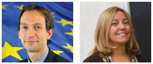
Jeremie Godet, Galileo Implementation Head of Sector, European Commission (left); Fiammetta Diani, deputy head of Market Development, European GNSS Agency.
By Jérémie Godet and Fiammetta Diani
The Galileo programme is currently in its deployment phase, which is due for completion in 2020. Following declaration of initial services in 2016, an exploitation phase will start and aim at delivering a fully operational system by the end of 2020. The deployment and the exploitation are entirely financed through the budget of the European Union, while two non-EU members, Norway and Switzerland, contribute through international agreements.
The aim of the Galileo programme is to establish and operate the first global satellite navigation system under the control of the European Union, thus contributing, amongst other things, to the strategic autonomy of the Union. This is the first time that the EU has developed, owned and been responsible for such a large-scale infrastructure.
While independence is the main political objective, ensuring compatibility and interoperability with other existing and future systems is also critical. Indeed, frequency compatibility has been achieved with GPS, IRNSS, QZSS and COMPASS with a range of coordinations achieved in the last two years under the framework of the International Telecommunication Union (ITU). A wider international agreement was previously reached in 2004 between the U.S and the EU, achieving the compatibility and interoperability of their respective systems and resulting in a common modulation for both systems’ state-of-the-art open signals. A positive outcome of this for all GNSS users is that similar signals have been adopted by other global or regional systems, in particular the MBOC modulation jointly defined by the U.S. and the EU (Galileo, GPS, COMPASS, QZSS), the ALTBOC modulation adopted by COMPASS and a common signal in E6 adopted by QZSS.
The Galileo programme will provide unique services, functionalities and performance levels that have never, or not yet, been provided by other satellites navigation providers.
What Will Users Get, and When?
These services, defined in consultation with user communities and EU Member States, will be offered by the system:
An Open Service (OS): With positioning accurate to around 1 meter using up to three different frequencies (E5a, E5b and L1), free of charge to the user and providing positioning and synchronization information intended mainly for high-volume satellite navigation applications;
A Public Regulated Service (PRS): Restricted to government-authorized users, for sensitive applications which require a high level of service continuity. It will use strong encrypted signals. This service is intended for security-related use for the EU Member States, the European Council, the European Commission, the European External Action Service and duly authorized Union agencies. It may be accessed by non-EU states and international organizations subject to bilateral agreements.
A contribution to the Search and Rescue Service (SAR) of the COSPAS-SARSAT system: Galileo’s worldwide search-and-rescue service will help to forward distress signals to a rescue coordination center by detecting emergency signals from beacons and relaying messages to them in near real time.
A contribution to integrity monitoring services by means of Galileo OS signals, in cooperation with other satellite navigation systems, aimed at users of safety-of-life applications in compliance with international standards;
A Commercial Service (CS): Encrypted for authentication purposes and offering very high accuracy to the sub-decimeter level, it will target applications for professional or commercial use owing to improved performance and data with greater added value than that obtained through the open service.
As of 2016, Galileo will progressively offer initial services for the open service, search-and-rescue service and the public regulated service. Those initial services will be gradually improved, and the other two services will be gradually implemented, with the aim of reaching full operational capability by end 2020.
The performance improvements of the services expected between 2016 and 2020 are linked to completion of the constellation deployment. In 2018, this will reach 24 satellites, the number required to achieve Galileo’s positioning performance targets, and the completed constellation with up to 30 satellites will be in place by the end of 2020 to provide the necessary spares to ensure performance commitments.
On top of this, a number of additional capabilities are planned to be added to the core services, including:
An improvement of the OS nav message with full backward compatibility to enhance both the time-to-first-fix and the ability to perform signal acquisition and tracking for users in lower visibility conditions (INAV improvement);
An authentication of the OS navigation message allowing users to verify that a certain number of broadcast parameters are the actual Galileo data — aimed at applications requiring trusted position and timing information for commercial purposes;
An improvement of the PRS;
A new functionality within SAR that provides, via the navigation message, a Return Link Message to distress beacons acknowledging that a rescue center has received their distress signal.
Constellation Status
The current Galileo constellation is composed of two different families of satellites: the In-Orbit-Validation (IOV) satellites procured before 2010 and the Full-Operational-Capability (FOC) satellites procured after 2010. Since the last Galileo launch on Sept. 10, there are four IOV satellites and six FOC satellites in orbit. The FOC satellites have improved capabilities regarding signal transmission compared to the IOV satellites, despite a similar mass and size. The FOC satellites carry a SAR payload; two IOV satellites have this capability. While this initial deployment faced a number of difficulties, these are now well behind us.
Sixteen more FOC satellites are being built. The next launch of two FOC satellites is scheduled for Dec. 17, and four more launches (three Ariane 5 and one Soyuz) are foreseen from 2016 to mid-2018. This implies four to six satellites launched per year, and this is judged perfectly realistic as demonstrated already in 2015.
An additional series of satellites will be procured in 2016 for deployment starting in late 2019/early 2020.
Preparing to Use and Benefit
The ultimate objective of the Galileo program is for its signals to be translated into valuable and reliable services for users across the globe. Europe aims to generate the return on investments in terms of public benefits for citizens and businesses, and for this reason the users are at center of the program.
This is the focus of the European GNSS Agency (GSA), which is in constant dialog with user communities via a wide range of activities.
For example, cooperation with chipset and receiver manufacturers aims to ensure that all products are Galileo-ready. This process involved a successful testing campaign done in cooperation with ESA and the EC’s Joint Research Centre (JRC). Equally important is to work closely with large user communities, such as road, maritime and rail, to support them in updating their systems so that they are ready to use Galileo. This is accomplished by dedicated market and technical support, via cost-benefit analyses, testing campaigns, initiation of standards and certification processes, user satisfaction surveys and more. These actions are part of tailored adoption roadmaps built with each user community. Periodic user fora are also organised to get feedback on current services and collect ideas for the evolution of the European GNSS systems.
EU R&D programmes, such as Horizon 2020 for the development of Galileo applications as well as the recently launched Fundamental Elements program that focuses on funding European GNSS chipset and receiver technologies, are essential tools for preparing users and supporting EU competitiveness in the downstream sector.
The GSA leverages these EU R&D programmes as a tool for adoption with large user communities and receiver manufacturers fully involved. The projects are managed by experienced staff specialised in different markets and application areas. In the case of PRS, the core user equipment technology is being designed and tested. This work is already paying off; today, a growing number of receivers available on the global market are Galileo-enabled, while almost 70 percent of the models have EGNOS.
Among others, Europe’s ST Microelectronics in the automotive sector, and the U.S.’s Broadcom and the Taiwanese Mediatek in smartphones, have already announced their Galileo-ready chipsets. Many other chipset manufacturers are ready and tested for Galileo. It is expected that, with recent successful launches and the deployment schedule, most of them will bring their Galileo products to market in 2016.
Galileo on the Horizon
Despite its particularly challenging complexity, involving extensive technical and security requirements, Galileo deployment is now progressing well and services will be provided starting in 2016, to reach their full operational capability in 2020. One early benefit of interoperability with GPS is that even before the Galileo constellation is completed, the number of L5/E5a signals in space will allow meaningful use of that frequency for the first time. Galileo will deliver real advances in precision, availability, coverage and additional features unprecedented in any other satellite navigation systems to date: while GPS is today’s de facto standard, Galileo is aiming to be the world’s second GNSS reference system by 2020.
Governance Set-up
The European Commission (EC) has overall programme supervision and budget responsibilities. The EC delegates system design and infrastructure procurement to the European Space Agency (ESA) and service preparation, delivery and operations to the European GNSS Agency (GSA). ESA is one of founders of the Galileo system and has been responsible for the development phase, co-financed by the Member States of ESA and the EU. ESA is the procurement agent of core infrastructure and in charge of the overall system integration since 2007.
The GSA’s role will grow considerably in the exploitation phase as it becomes the day-to-day interface with ESA in several areas, including infrastructure roll-out and maintenance. The GSA will procure main operations of the system from 2017 and will operate key services facilities such as the Galileo Security Monitoring Centre in France and the UK, the European GNSS Service Centre in Spain, and the Galileo Reference Centre in the Netherlands. The GSA also supports the enabling of receivers and chipsets for Galileo use and the development of applications in downstream segments, in close cooperation with the major user communities.
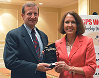
GPS World‘s Leadership Awards were presented during a sponsored ceremony and dinner at ION GNSS+ 2015 in September in Tampa. The awards recognize significant recent achievement in four fields of position, navigation and timing: satellites, signals, services and products.
Nominations came from a group of industry executives and the magazine’s Editorial Advisory Board. Votes were cast by a slightly larger group of added VIPs from the community.
The Leadership Dinner was sponsored by Lockheed Martin, Harris, Raytheon and Braxton Technologies.
Satellites category winner
Marco Falcone, Galileo System manager, European Space Agency
Falcone led the Galileo program through a very difficult time, following the faulty orbital injection of the first two operational Galileo satellites in August 2014. He gave detailed descriptions of the anomalous launch, the planned activities to salvage what was possible from the event, and the likely impact of this event on the program. His mission control team worked around the clock to ensure that the satellites were configured so that final orbits would provide some utility to the Galileo program.
Remarks delivered by Daniel Blonski, system performance engineer at ESA, on behalf of Marco Falcone:
Marco Falcone, Galileo System manager, European Space Agency, winner of the 2015 Leadership Award for Satellites.
I would like to thank GPS World and the GNSS Community.
The recovery of satellites 5 and 6 of the Galileo constellation following the August 2014 launch wrong-orbit injection demonstrates the multidisciplinary capability of the European Space Agency and its industry. In fact, this recovery involved around 300 experts from our mission analysis and flight-control teams, system engineering signal and user receiver teams, space segment engineering teams, ground control and mission segment teams, as well as security operations. This award goes first of all to them for having believed in this recovery from the very first moment.
I apologise for not having been able to join this event in person due to the Launch and Early Operations Phase of the 5th Galileo Launch, which occurred Sept. 10. Galileo has now 10 (I repeat, 10) Satellites in orbit and operations are running smoothly. I count on GNSS chipset manufacturers to introduce Galileo constellation in their chipsets and eventually have Galileo-enabled devices as of next year.
In addition, the European Space Agency is also preparing for the future. In fact, we need already now to plan those system improvements that are necessary to replenish the constellation after 2020. These improvements go into the direction of higher positioning and timing accuracy, long-term validity ephemeris and faster time to first fix, improved interoperability with other GNSS and contribution to space users service volume, additional spoofing/jamming protection through authentication, enhanced online monitoring and signal-in-space flagging functionalities, as well as flexible digital signal generation to cope with the rapid time to market required for new services evolution.
Again, I thank you for recognizing the efforts of our teams at ESA and in industry. This award gives us even more energy.
Serving over A billion users every day
The most powerful GPS satellite ever is on its way
Remarks delivered by John Frye, program manager, Navigation Systems Advanced Programs, Lockheed Martin:
John Frye, program manager, Navigation Systems Advanced Programs, Lockheed Martin.
I would like to thank GPS World for the opportunity to speak briefly at this year’s GNSS Leadership Awards.
At Lockheed Martin, we are proud to continue our support of the U.S. Air Force’s GPS program. We applaud the Air Force on this year’s 20th anniversary of the GPS constellation reaching full operational capability.
This is a tremendous milestone in the history of positioning, navigation and timing, as well as global navigation satellite systems. In addition, I’d like to recognize tomorrow’s 68-year anniversary of the establishment of the Air Force.
Lockheed Martin is honored to have contributed to the GPS milestone. Right now, 19 of our GPS IIR and IIR-M satellites make up about 60 percent of the current GPS constellation. It is a real privilege to be serving more than a billion military, commercial and civilian users every day. But our commitment doesn’t end there. If you had the opportunity to see the pictures in our booth, you know that Lockheed Martin will soon be introducing the world to GPS III — the most powerful GPS satellite ever developed — and GPS III will be the first GPS satellite to field the internationally compatible L1C signal, offering a new level of GNSS compatibility.
So, thank you. It has been an honor to speak before you, the international PNT community. Thank you for all that you do, and congratulations to all of tonight’s honorees.
New messages: Any SBAS, any GNSS
Signals category winner
Todd Walter, senior research engineer, Stanford University
This past year, Todd completed the message design for dual-frequency, multi-constellation SBAS, a huge step forward for aviation and other multi-constellation users. It means that SBAS will be able to provide corrections and integrity data for all constellations, leading to better accuracy and availability.
Remarks delivered by Todd Walter:
Todd Walter, senior research engineer, Stanford University, and Ellen Mitchell, senior communications manager, Space and Intelligence Systems, Harris Corporation.
I ’d like to thank GPS World for this award. In reality, the work on the dual-frequency, multi-constellation SBAS messages has been a long ongoing group effort. Numerous people at Stanford, the FAA, Zeta, MITRE, ESA, CNES, RTCA, EUROCAE and others have contributed to the development of the planned messages on L5. ESA and CNES in particular have been handling the document management and comment resolution.
I would also like to especially thank my colleagues at Stanford University for their hard work and support.
The new messages now planned for L5 will allow any SBAS to correct any constellation that it chooses. Rather than only supporting L1-only signals on GPS, as the current systems do, SBASs will be able to support the use of two frequencies, using as many constellations and satellites as they choose to monitor.
We will no longer need to suffer availability outages due to limited satellite geometries. Furthermore, we will not suffer availability limitations due to ionospheric disturbances. Dual-frequency operation will allow precise vertical guidance throughout the globe, and in particular in equatorial regions.
The original L1 SBAS specification took more than 20 years of development. The new dual-frequency multi-constellation specifications are even more complicated and will require a similarly long development time. Our latest effort started many years ago when the GPS L5 was initially planned to be fully operational in 2018. Since that time, the GPS L5 date has moved back to 2024.
And in the mean time, the other constellations have progressed in their development. Our original efforts changed from a dual-frequency update to the SBAS messages into a truly multi-constellation concept.
In order to utilize new constellations and new signals for aviation, it is essential that the designs of these signals be stable and clearly documented. Furthermore, we require performance commitments from the constellation providers so that we can know what to expect.
To date, GPS leads the way in both of these requirements. Its signal designs have been stable and well described for many years, and it has published performance standards documenting the level of performance we can count on. There is widespread expectation that the other constellations will be very similar to GPS. However, this will not necessarily be the case.
We need to be prepared to deal with constellation-specific behaviors. Already we recognize differences in how GPS and GLONASS operate. We can only expect to uncover additional differences as we further utilize these constellations. Also, as we field new satellites and a new control segment on GPS, we can expect to see behavior that might be different from some of our fundamental assumptions.
It is important to plan for the future in order to incorporate new signals and new constellations; however, we must remain flexible with our planning to incorporate the reality of what we actually get.
— Postscript added in November: Thanks again for the award, it looks very nice on my desk!
All about the signal
Remarks delivered by Ellen Mitchell, senior communications manager, Space and Intelligence Systems, Harris Corporation:
On behalf of the Harris Corporation and its more than 22,000 employees, I congratulate the award recipients this evening. It is particularly fitting that Harris has the honor of presenting the Signals award. As the GPS navigation payload provider, we create and deliver the GPS signal. Furthermore, our products help our customers better utilize the GPS signal and detect and prevent jamming of the GPS signal. We’re all about the signal.
This is our first year at this dinner as Harris employees. As a result of Harris Corp. acquiring Exelis on May 29, there now are 9,000 engineers and scientists in the new company. Many Harris colleagues have expertise in areas directly applicable to cutting-edge GPS payload development, for example. Current and future customers will benefit from working with this larger and even more capable new team.
We believe the combination of Exelis’ heritage of proven, assured GPS navigation payloads joined with Harris’ skill in the RF spectrum, satellite communications and reprogrammable payloads gives the new company a unique and innovative edge to support the next generation of GPS satellites.
We look forward to telling you more about our progress at next year’s Leadership Dinner. But this year, now, without further ado, I’d like to call Todd Walter to the dais to receive the Leadership Award for significant recent achievement in the area of Signals. Thank you for this opportunity.
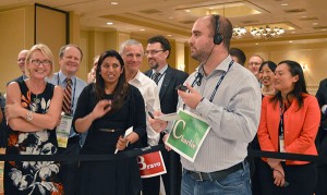
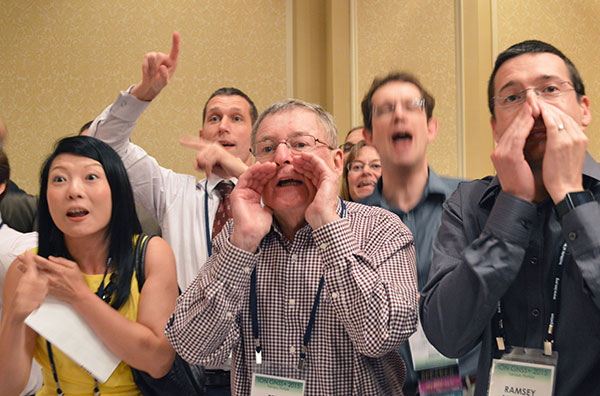
After the awards ceremony and dinner, attendees played the Interference Event, competing to see which team could generate the strongest, most accurate signal, conveying critical information in a GNSS trivia game.
Unprecedented opportunities
Services category winner
Jade Morton, professor, Colorado State University
For her work on advanced GNSS receiver algorithms for accurate and reliable operations in challenging environments; studies of the atmosphere using radar and satellite signals; and development of new applications using satellite navigation technologies. Her research has contributed to understanding of space weather phenomena and their effect on GNSS signals.
Remarks delivered by Morton:
Jade Morton, professor, Colorado State University
Thank you for a wonderful evening, and for offering the GPS World Leadership award to me. I am humbled!
Over the past decade, we have witnessed rapid progress in the development of multiple constellations of GNSS. While much of the focus has been on improvements in the availability, integrity, continuity, and inter-operability of multi-GNSS for PNT applications, a real winner as far as scientific discovery is concerned is in the use of GNSS in atmospheric and space weather studies. With a large and growing number of free open signals across a wide range of frequencies in the L-band, multi-GNSS will be able to provide distributed, low-cost, passive remote sensing of the atmosphere on a global scale. It is fair to say that there is no other technology that offers comparable potentials, coverage and cost-effectiveness.
In the coming decade, multi-GNSS will offer unprecedented opportunities for researchers to measure atmospheric and ionospheric parameters with high spatial and temporal resolution, and monitor atmospheric responses to solar, geomagnetic and other natural and man-made events.
This is an exciting time for multi-GNSS technological development and atmospheric research. I am fortunate to have the opportunity be a part of it and to explore and contribute to the interesting intersection between GNSS and the atmosphere.
Securing GPS against attack
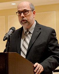
Remarks delivered by Steve Moran, business development director, Raytheon:
Steve Moran, business development director, Raytheon
It’s great to be here with colleagues who understand the importance of a modernized GPS infrastructure.
I was asked to speak tonight because Raytheon is partnered with the Air Force in modernizing the GPS ground segment, which is at the core of the Air Force’s GPS modernization initiative. We like to call OCX the brains of GPS.
Over the past 30 years, GPS has ensured the safety and effectiveness of our nation’s warfighters and has become an integral component of global and national telecommunication, commerce and transportation infrastructures.
The GPS modernization initiative is essential to protecting our economy and the homeland, as GPS is an ingrained part of our nation and our world’s infrastructure. As critical as GPS is to so many key functions of daily life, it must be secured against cyber attacks.
The emergence of growing cyber threats creates daily headlines and drives an urgent need for GPS modernization. GPS has been recognized as an enabler of nearly all U.S. critical national infrastructure, such as the power grid or the water supply, and is a global utility that must be ready for emerging cyber threats.
OCX is a pathfinding program that answers that need and will deliver many other benefits to GPS users across the globe. Some of the new capabilities include enabling new civil and military signals; improving system accuracy and integrity; providing flexibility and evolvability to meet future mission needs; setting the bar for information assurance at an unprecedented level; and securely sharing information with net-connected users.
Raytheon’s OCX represents new approaches to emerging and even unimaginable changes and threats. We are confident that we have the right technology, team and resources in place to deliver the OCX program. It is critical we do so.
Thank you for inviting me here tonight, and I offer a sincere congratulations to all of the GPS World Leadership Award winners.
Novel GPS/GNSS uses just keep coming
Products category winner
Larry E. Young, GPS systems group supervisor, Jet Propulsion Laboratory
For many years he has been key in the development of radiometric technology. Specific areas of research include the development of GPS science receivers, multipath mitigation, sub-nanosecond clock synchronization, and sub-centimeter formation flying. He has been instrumental in developing the TriG multi-Global Navigation Satellite System receiver used in radio occultation to measure physical properties of the atmosphere, and key to NASA’s efforts to protect radionavigation satellite services from interference.
Remarks delivered on behalf of Larry E. Young by James J. Miller, deputy director, Policy and Strategic Communications, Space Communications and Navigation, NASA:
James J. Miller, NASA
I would like to thank GPS World and the GNSS community.
I greatly appreciate the honor conveyed by this award. We all know that most advances in technology are made by a team of smart, enthusiastic and hard working scientists and engineers. JPL’s advanced GNSS receivers are a true example of teamwork.
In particular, Don Spitzmesser was a prolific inventor who could quickly conceive of, build and test novel circuits and antennas. I do not think he ever passed kitchen utensils without thinking of antennas. There are actually “heli-wok” antennas in space. The original helix was wound onto a glass, glued onto a wok backplane.
Lyle Skjerve was a highly skilled experimentalist. His previous job was detecting incoming ground-to-air missiles from the backseat of a Marine jet, and conducting electronic countermeasures to steer the oncoming missile off course. In addition to being smart, he was quick to debug problems during an experiment, and never gave up.
NASA headquarters has provided great support to GNSS technology, continuing the program Jim Miller leads today. I especially thank John LaBrecque, who provided critical early support for our speculative development of the “all-digital” receivers that produced 0.1-millimeter baseline precision.
I have been very happy to be able to work on GPS, and I am most thankful for the great group of colleagues I’ve had the fortune to work with at JPL and from other NASA centers.
My training was in experimental nuclear physics, where I was excited to measure the anomalous orbital magnetic moment of a neutron orbiting inside a superconducting magnet on the beam line of a tandem Van deGraff accelerator. I always enjoyed building measurement systems for first-time measurements.
After graduation, I got an opportunity to shift from nuclear scales too small to see (femptometer) to those too large to imagine (109 lightyears), characteristic of the distances to quasars. In all, that was a change of 40 orders of magnitude! The Jet Propulsion Laboratory hired me to help develop Very Long Baseline Interferometry to measure tectonic plate drifts in real time, and oh yes, to precisely navigate NASA’s interplanetary spacecraft.
Larry e. Young, GPS Systems group supervisor, Jet Propulsion Laboratory
From VLBI, it was a short step to GPS. Even though quasars produce the greatest power levels known to man, the power per square meter is much higher from nearby GPS satellites. Scientists and engineers at JPL and elsewhere quickly realized that GPS would provide precision geodesy as soon as the first satellites were launched circa 1978.
During a 1984 receiver shootout among JPL’s SERIES and SERIES-X receivers, the MIT Macrometer, and Texas Instrument’s TI4100, we set up for the night’s experiment near an old Bilby tower in the desert. These were used in the old days to provide line-of-sight optical surveys. Now that we had GPS, those days were gone, and we (the shootout adversaries) teamed together and pulled down the tower, burning it to ward off the pre-dawn cold. It seemed quite symbolic. Remember, back then the only time four satellites were mutually visible in the winter was during early morning.
The current set of JPL’s receiver developments started when Tom Yunck realized we could use radio occultation, developed for interplanetary spacecraft, as a very useful means to probe the Earth’s atmosphere.
Novel uses for GPS/GNSS just seem to go on and on, as smart innovative people around the world continue to find productive new applications. Some of the older ideas we are working on include using non-GNSS signals for navigation and remote sensing, using GNSS signals as sources for bistatic radar measurements, and applying the GPS receiver’s precise phase shifters to form dynamic multiple high-gain antenna beams.
As always, advances in computers and chips will help drive applications. Our receivers have always been software driven and flexible, and the exponentially growing throughput of digital devices shows no signs of slowing. We are at a point where the number of GNSS satellites is exploding. Other signal sources are available to aid navigation and remote sensing. I do not want to call the exact shot, but I am confidant that at least one person reading this magazine today is already thinking of a new GNSS breakthrough, which will delight the world with its applications!
Commercialization and competition
Remarks delivered by Edward Baron, director, Braxton Technologies:
Edward Baron, director, Braxton Technologies
I would like to thank the GPS World team for organizing another wonderful awards dinner. As a commercial product company, Braxton is honored to help sponsor this event recognizing tonight’s Product Award innovator.
I’ve heard a few requests for innovation from the government this week. If they’re interested in innovation, I would like to make an argument for commercialization and competition as a key driver for it.
Within the navigation world, the receiver and application markets are excellent examples where innovation is driven by daily competition in a commercial market. It’s amazing to see the accelerating global pace of innovation these highly competitive markets drive — creating new and better products, along with their economic and social benefits.
We are also seeing competition between the constellations themselves, as they compete to increase their global market share.
If commercialization and competition drive innovation, and could benefit the performance of a constellation, who will take steps to commercialize other segments to improve their performance?
Galileo has already taken steps to commercialize their ground operations, and the U.S. is starting to talk about it.
It’s not possible to predict, but maybe in the future, GPS World will recognize someone for an innovation from a commercially operated GNSS system.
Shuren Guo, deputy director of China Satellite Navigation Project Center.
By Shuren Guo
In line with its three-step development plan, the BeiDou Navigation Satellite System (BDS) will constitute a complete space constellation by around 2020, when it will be comprised of five geosynchronous orbit (GEO) satellites and 30 non-GEO satellites, providing services for global users. The year 2015 is of particular significance for the BDS establishment, which has witnessed stable operation of regional services and formal deployment of new-generation satellites. These satellites possess higher performance and better compatibility and interoperability with other navigation satellite systems.
In March 2015, the first new-generation BDS satellite, or 17th BDS satellite overall, was launched at the Xichang Satellite Launch Center, and kicked off the deployment of the BDS global constellation. Launched and directly inserted into an inclined geo-synchronous orbit (IGSO) by a Long March launch vehicle with a newly designed upper stage, the satellite is equipped with a new bus system, as well as a payload system carrying inter-satellite links and new navigation signals.
In July 2015, two mid-Earth orbit (MEO) BDS satellites, the 18th and 19th overall, were launched into their scheduled orbits precisely with one single launch vehicle. More new types of payloads are on board, and the satellite performance is dramatically improved. After the in-orbit-delivery, these two satellites are able to interconnect with other existing BDS satellites, and jointly carry out the experiment and verification of the global network deployment process.
In September 2015, another BDS satellite was successfully launched into IGSO, and became the 20th of the BDS space constellation. Different from pervious launches, this satellite reached its designed orbit by using its built-in autonomous orbit maneuver mechanism. For the first time, the satellite also carries a Chinese-made hydrogen atomic clock, which provides enhanced time and frequency reference capacities.
Currently, these last four launched satellites are in normal working mode. The ongoing in-orbit tests show that these satellites satisfy the desired requirements. At present, tests and validations for the new navigation signal system, inter-satellite links, and the new atomic clock are being conducted. Once the tests and validations are completed, these satellites will be included in the network, and start to provide services for global users.
In 2016, BDS will keep improving its service performance. Three BDS satellites will be launched to boost up the deployment of global constellation. The construction of the BDS augmentation systems will be accelerated. Meanwhile, international cooperation activities will be further promoted, and the application development process will be attached with much importance, to broaden the fields and domains of BDS/GNSS applications.
“To serve the world and benefit Mankind” is not only the purpose of BDS, but also its commitment to the world. On the basis of maintaining stable services, BDS will make all efforts to enhance the performance, to speed up the deployment of global constellation, and to provide better services for global users.
Shuren Guo is the deputy director of China Satellite Navigation Project Center. He received his bachelor’s degree in electromagnetic theory and microwave engineering from Xi’an Jiaotong University, and his master’s in electronics and communication engineering from Beihang University. As a researcher, he has long been engaged in the design, research and development of the BeiDou Navigation Satellite System.
On Nov. 25, 2015, President Obama signed the National Defense Authorization Act (NDAA) for Fiscal Year 2016, after vetoing a previous version. The enacted NDAA complies with the two-year budget agreement, which called for a reduction in defense spending.
The act reduces the GPS IIF line item by $2 million, citing “unjustified support growth” from the U.S. House of Representatives Committee on Appropriations, but otherwise recommends full funding for the Air Force GPS program ($936.775 million).
The NDAA also includes three GPS-related policy provisions: Reporting Requirement (Section 1621), Oversight Council (Section 1603), and M-Code Equipage (Section 1605).
New Space Law Mentions PNT Coordination Office
On Nov. 25, the president also signed the U.S. Commercial Space Launch Competitiveness Act. Title III of the act codifies the support that the Department of Commerce (DOC) provides to the National Coordination Office for Space-Based PNT.
Specifically, it tasks DOC’s Office of Space Commerce “to provide support to federal government organizations working on Space-Based Positioning, Navigation, and Timing policy, including the National Coordination Office for Space-Based Position, Navigation, and Timing.”
Senator Franken Reintroduces GPS Data Privacy Bill
On Nov. 10, Sen. Al Franken (D-MN) reintroduced the Location Privacy Protection Act, which he also introduced during the 112th and 113th Congresses. According to the Senator, “The Location Privacy Protection Act of 2015 closes legal loopholes that allow stalking applications to exist on smartphones.
Sen. Franken’s bill fixes this problem by requiring companies to get customers’ permission before collecting their location data or sharing it with third parties.” The bill joins several others in the 114th Congress that address geolocation privacy issues, including the Geolocation Privacy and Surveillance Act (“GPS Act”) and the Online Communications and Geolocation Protection Act.
The summaries here are from the GPS Bulletin, which is available through the gps.gov website.