Category: GNSS

  • Directions 2016: GPS — dedicated to excellence

    Directions 2016: GPS — dedicated to excellence

    Col. Steve Whitney, director, Space and Missile Systems Center’s Global Positioning Systems Directorate.
    Col. Steve Whitney, director, Space and Missile Systems Center’s Global Positioning Systems Directorate.

    By Col. Steve Whitney

    The year 2015 was an exciting one to assume leadership of the Global Positioning Systems Directorate. I’ve witnessed the men and women of our team accomplish some amazing things, across all of our efforts to modernize the constellation, and would like to take a moment to share our progress over the past year and set the vision for 2016 as we remain dedicated to excellence.

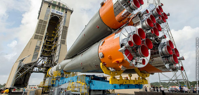
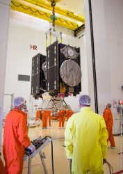
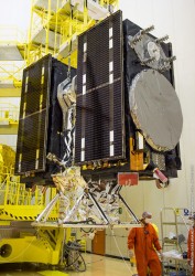
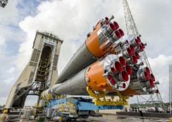
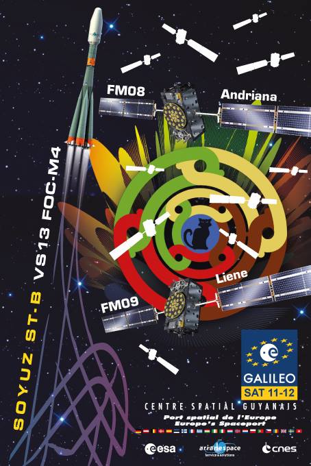
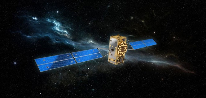
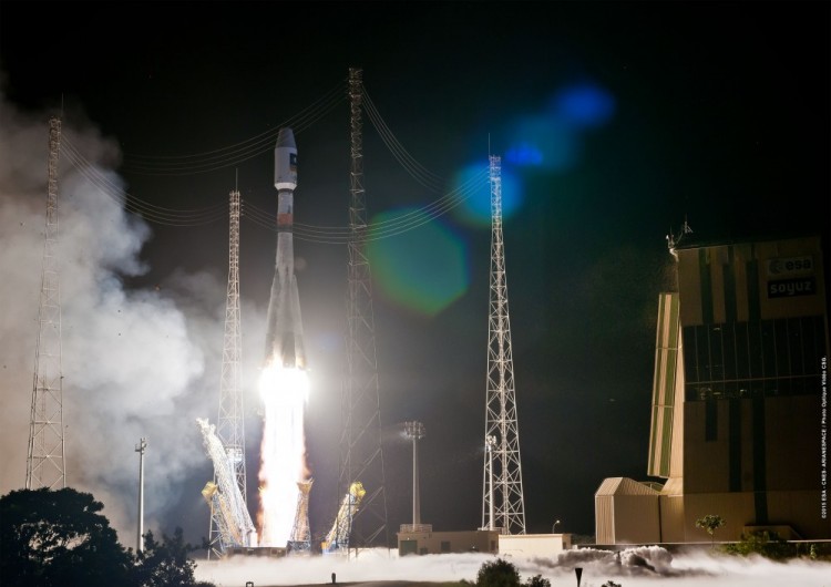
    The past year has been another outstanding one in terms of delivering capability on-orbit. We’ve continued the pace from last year, placing another three new satellites into space, most recently including the launch of our 11th GPS IIF satellite, built by Boeing. This launch marks the 18th satellite to broadcast the Military Code (M-code) and second civil signals (L2C). Each time the dedicated professionals from government and industry, representing many, many organizations, have come together to show the world the gold standard.

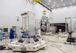
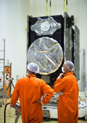
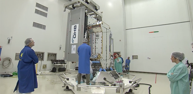
    GPS III. In the development of our next generation of satellites, the GPS team continues to make progress. In September, we completed flight qualification of the navigation payload and its software — many of you recall that this area has been a challenge for us over the years, and I wanted to share this success. Additionally, the first GPS III satellite entered into thermal vacuum testing at prime contractor Lockheed Martin’s facility in Waterton, Colorado, in October.

    Thermal vacuum testing, or TVAC, is one of the last major events in the assembly and integration flow of the satellite and will prove out the hard work of the team. This first GPS III satellite is scheduled to be available for launch by the end of 2016. Lastly, we aren’t losing focus on the rest of the development units, as the second GPS III space vehicle is over 95 percent delivered and integrated at the GPS III processing facility.

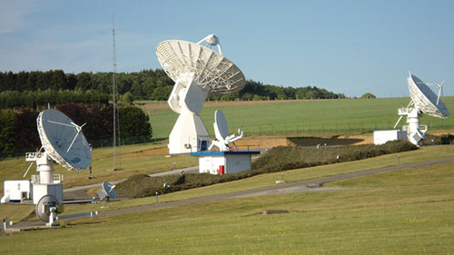
    OCX. Over in the development of the ground segment, it’s no secret we’ve had very significant cost and schedule challenges in the development of the GPS next-generation system, OCX. Right now, we are engaging with both our industry partner, Raytheon, and the Department of Defense leadership to plot a way forward to deliver these much-needed capabilities. This effort is intended to improve both Positioning, Navigation, and Timing (PNT) capabilities and cyber-security posture in increasingly contested, congested and competitive space and cyber domains.

    User Equipment. The third area of our modernization efforts is our work on user equipment. Our military user equipment division continued to make acquisition history by pursuing a commercially driven strategy with all three contractors: L-3 Interstate Electronics Corporation, Rockwell Collins and Raytheon Space and Airborne Systems. They started the year by taking prototype cards to field exercises such as RED FLAG and are currently in full developmental testing of the functioning receiver cards. 2015 was an exciting year, and I’m proud to say 2016 will be no different.

    As we enter 2016, I’d like to reemphasize a challenge my predecessor Brig. Gen. Bill Cooley laid out in his 2015 Directions article, “What It Takes to Make a Gold Standard.” A challenge that GPS manufacturers worldwide innovate and build products that utilize modernized civil signals and the improved PNT capabilities brought by the Civil Navigation message. After all, in February 2016 we will launch the 19th satellite to broadcast M-code and L2C signals as well as the 12th satellite to broadcast the third civil signal, L5. With 19 satellites providing global coverage of L2C, it’s now up to industry to take advantage of these capabilities and pave the way towards modernized civil navigation.

    New Capabilities. For the first time in history, civil users will have access to what has been available to military users since the inception of GPS, full use of dual-signal frequency accuracy. This, combined with other advances, translates into increased PNT accuracy and resiliency for users worldwide. It’s time for the civil community to develop receivers that take advantage of these capabilities and usher in an era of more robust civil navigation.

    The February 2016 launch also marks the end of an era. It is the 12th and final GPS IIF satellite to launch, presenting a finale to one of the most aggressive launch campaigns in recent history: seven GPS IIF satellites in 21 months! This satellite is the last GPS satellite considered “second generation,” a generation that began operations in 1989.

    In total, Generation II GPS launches will have spanned over 28 years comprised of 61 space vehicles amongst five different blocks: II, IIA, IIR, IIR-M and IIF. Over these years, characteristics such as User Range Error (URE) have continuously improved, hallmarking the success of the GPS developers and operators past and present. In fact, from 2001 to 2014, URE was nearly cut in half, going from an annual average of 1.6 meters to just 0.7 meters for the civil user. These improvements will continue as we launch the next-generation GPS III satellites.

    In preparation for continued success into the future, 2016 will also be the year the GPS Directorate begins acquisition of GPS III space vehicles 11+. On July 3, 2015, the Office of the Secretary of Defense for Acquisition, Technology and Logistics approved the acquisition strategy for the GPS III space vehicles 11+ Production Readiness Feasibility Assessment to verify if capable GPS III production designs exist beyond the current GPS III contractor. The results of the GPS III Production Readiness Feasibility Assessment will shape and inform a GPS III space vehicles 11+ follow-on production acquisition strategy in the FY17 timeframe.

    Service. Also in 2016, the GPS Directorate will reaffirm our commitment to excellence and providing unparalleled service and capability. Challenges remain ahead, but the GPS Directorate is dedicated to delivering a ground system necessary for command and control of both today and tomorrow’s GPS enterprise. This includes the GPS Directorate’s pursuit of aggressive and innovative strategies to meet interim and future needs such as increasing the resiliency of the current ground system and investigating means for launching GPS III satellites as soon as possible so they are ready for operation at full capability with the completion of a modernized ground segment.

    Just this past year, we successfully accomplished several “hardening” efforts of the current ground system, adding to its robustness against the threats of today and tomorrow. Another endeavor we are working on is providing options to higher headquarters for the early use of M-code.

    The modernized GPS user equipment (MGUE) program will continue to pursue an innovative and aggressive acquisition strategy in 2016. Next year will kick off integrating receiver cards into service nominated lead platforms, which include the Defense Advanced GPS Receiver Distributed Device or D3, Joint Light Tactical Vehicle, Arleigh Burke-class Destroyer’s navigation system, and the B-2 Spirit. These efforts culminate with operational testing and eventually allow services to procure receiver cards directly. Over the next 12 months, the GPS Directorate also plans to begin work on a modernized GPS handheld, ensuring airmen, marines, soldiers and sailors have access to portable, accurate, and resilient position, navigation and timing powered by M-code. As MGUE is integrated into a myriad of DoD systems over the coming years, our users will continue to have the assured PNT needed to win today and tomorrow’s fight.

    Team. Finally, you can count on the professionals of GPS Directorate’s team to continue to exhibit acquisition excellence. It’s been six months since I assumed leadership of the GPS Directorate, and I am amazed every day with the passion and accomplishments of our people — which includes military, civilian, support contractors, federally funded research and development center partners and our industry partners. I feel privileged to work with each and every one of them on daily basis and look forward to what 2016 has in store for us all.

    A final thanks to you, the GPS user. With over 4 billion users and an ever growing-economic impact, you motivate us to continue to improve and assure this vital mission.

  • Galileos in the zone for Thursday’s launch

    Galileos in the zone for Thursday’s launch

    Galileo satellites 11 and 12 are mated with their dispenser. (Photo: ESA)
    Galileo satellites 11 and 12 are mated with their dispenser. (Photo: ESA)

    News from the European Space Agency

    Galileos 11 and 12 are on the launch pad, attached to the top of their Soyuz rocket in readiness for this week’s launch. Europe’s next navigation satellites are due for launch at 11:51 GMT (12:51 CET, 08:51 local time) on Thursday, Dec. 17, from Europe’s Spaceport in French Guiana.

    On Dec. 10, the two satellites, already attached to their carrier, were fixed to the Fregat upper stage before the halves of the protective Soyuz fairing were closed around them on Friday. This marked the completion of the ‘upper composite’ — the combination of Galileo satellites, dispenser and the upper stage that will fly them the bulk of the way up to their medium-altitude orbit.

    Meanwhile, the first three stages of the Soyuz were assembled horizontally, rolled out to the pad, and raised to the vertical. The upper composite was moved to the pad on Sunday afternoon, hoisted to the top of the tower and then then carefully attached to Soyuz.

    The Dec. 14 Launch Readiness Review opened the way to Soyuz fueling and finally launch.

    Galileos 11 and 12 are on the launch pad, attached to the top of their Soyuz rocket in readiness for this week’s launch. (Photo: ESA)
    Galileos 11 and 12 are on the launch pad, attached to the top of their Soyuz rocket in readiness for this week’s launch. (Photo: ESA)

    This latest Galileo campaign began with the arrival of the satellites in French Guiana on Oct. 30. This is the sixth Galileo launch overall, and the third launch of 2015, and will bring the number of Galileo satellites in space to 12. It takes place just 11 days before the 10th anniversary of the liftoff of Europe’s very first navigation satellite.

    The experimental GIOVE-A took off on Dec. 28, 2005, to reserve operational frequencies, test key hardware and gather data on the orbital environment for the Galileo constellation to follow. GIOVE-B followed in April 2008.

    Since then, not only has the first third of the Galileo constellation reached orbit, but a network of Galileo ground stations has been erected across the globe.

    In future, the number of satellites that can be inserted into orbit with a single launch will double from two to four, when a customized Ariane 5 rocket becomes available to complement Soyuz.

    Follow the launch activity at www.arianespace.com.

  • CHC Navigation unveils i80 GNSS receiver

    Photo: CHC Navigation CHC Navigation has announced in a news release the availability of its new GNSS receiver, the i80.

    The i80 receiver for surveyors and contractors is able to compute a true triple frequency RTK tilted pole sub-centimeter solution using all four worldwide and multiple regional constellations.

    “Over two years of R&D and testing went into the creation of our Linux OS i80 platform,” said George Zhao, CEO of CHC.

    The i80’s LCD GUI allows for common workflow operations, such as Static Logging, AutoBase, AutoRover, and UHF channel selection to be easily performed without the need of a data collector or computer. The CHC i80 is the smallest receiver on the market with dual hot-swappable batteries, CHC says. The receiver contains a full array of sensors and modules: multiple MEMS, Internal Tx/Rx UHF, multi-band cellular modem, Wi-Fi, Bluetooth, Serial, USB and more.

    “This innovative design will allow us to add new functionality [with over the air updates] for years by combining the sensors and modules in new ways — this is illustrated by our LCD supported work modes, and our MEMS enabled unleveled pole surveying added in the last couple months during product rollout,” Zhao said. “We are bringing GNSS in to a new era of productivity and ergonomics in a low-cost open platform allowing for unrestricted third-party integration via our i80 API.”

  • Seen & Heard: GNSS and PNT in the news

    Seen & Heard: GNSS and PNT in the news

    A snapshot of interesting stories involving GNSS and position, navigation and timing (PNT) technology from around the world

    Hover over a map, then the dots, to view the stories.
    (Map: iStock.com/nadla)

    2015 2016 2017 2018 2019

    April 2019

    Map: iStock.com/nadla
    View the April Seen & Heard — which covers global quantum communication, pigeon scientists and more — here.

    March 2019

    Map: iStock.com/nadla
    View the March Seen & Heard — which covers using GNSS to signals to obtain rain information, a Galileo constellation mobile app and more — here.

    February 2019

    January 2019


    December 2018

    November 2018

    October 2018

    September 2018

    August 2018

    July 2018

    May 2018

    April 2018

    March 2018

    February 2018

    January 2018


    December 2017

    November 2017

    October 2017

    September 2017

    August 2017

    July 2017

    June 2017

    May 2017

    April 2017

    March 2017

    February 2017

    January 2017


    December 2016

    November 2016

    October 2016

    September 2016

    May 2016

    April 2016

    March 2016

    February 2016

    January 2016


    December 2015

    November 2015

  • Research Online: HF beacon navigation, inertial sensors and GNSS-INS integration

    Photo: HF Beacon NavigationHF Beacon Navigation

    Navigation using High-Frequency Ground Beacons and Ionosphere Model Corrections, by Yoav Baumgarten and Mark L. Psiaki, Cornell University.

    A new navigation concept relies on passive one-way ranging using pseudorange measurements of high-frequency (HF) beacon signals reflected off the ionosphere.

    This is being developed as a possible alternative to GNSS positioning and timing services, with benefits in costs and system redundancy. The HF signals are transmitted from ground-based beacons, traveling from known locations to the unknown user equipment (UE) location along ray paths that reflect off the Earth and the ionosphere. If a set of beacon signals reaches the UE receiver with sufficient geometric diversity, then the three-dimensional position and the clock offset of the receiver can be determined.

    Presented at ION GNSS+ 2015.

    Inertial Sensors

    Dynamic Stochastic Modeling of Inertial Sensors for INS/GNSS Navigation, by M. Wis, Deimos Space, Spain; Ismael Colomina, GeoNumerics, Spain.

    Researchers performed a series of experiments with a low-cost inertial device rigidly attached to a navigation-grade reference IMU and found a direct relationship between the low-cost IMU errors and the high-order dynamics. Preliminary results suggest an approach of low-cost sensor modeling that might help reduce some of the errors inherent to the dynamics applied to the sensors.

    Presented at ION GNSS+ 2015.

    GNSS-INS Integration

    Quasi-Tightly-Coupled GNSS-INS Integration with a GNSS Kalman Filter, by Bruno Scherzinger, Applanix Corporation, Canada.

    This method, intended for integration of an existing GNSS navigation engine into a GNSS-INS closed-loop configuration with little/no modification of the navigation engine, uses a range measurement model matrix typically used to compute dilutions of precision (DOP) to identify the observable subspace in the time-space frame generated by the available satellites and project the loosely coupled INS-GNSS Kalman filter position measurement into this subspace.

    Presented at ION GNSS+ 2015.

  • Galileo satellites 11 and 12 integrated for Arianespace’s year-end mission

    Galileo satellites 11 and 12 integrated for Arianespace’s year-end mission

    Galileo-launch-11-12
    Launch poster for the upcoming launch of Adriana and Liene, also known as Galileo 11 and 12.

    The two spacecraft for Arianespace’s latest Soyuz launch at the service of Europe’s Galileo satellite-based navigation system — and the company’s record 12th mission overall in 2015 — have been integrated at the French Guiana Spaceport in preparation for their Dec. 17 liftoff.

    The launch of Galileo satellites 11 and 12 — dubbed Adriana and Liene — will conclude a year when the number of Galileo satellites in orbit will have doubled.

    With this launch, ten years after the launch of GIOVE A, on Dec. 28, 2005, the Galileo constellation will become a reality.

    During activity in the Spaceport’s S3B clean-room facility, the spacecraft pair was mated with their dispenser, which will deploy the satellites by firing a pyrotechnic system for separation in opposite directions at the orbital insertion point.

    The satellite/dispenser combination is ready for integration on Soyuz launcher’s Fregat upper stage, followed by the payload fairing encapsulation. This will create the “upper composite,” which is to be installed atop Soyuz once the vehicle has been moved to its Spaceport launch site.

    Arianespace’s Dec. 17 mission, designated Flight VS13 in the company’s launcher family numbering system, will orbit two Galileo FOC (Full Operational Capability) satellites, further augmenting the European constellation of navigation spacecraft.  The satellites are built by prime contractor OHB System in Bremen, Germany, with their onboard payloads supplied by UK-based Surrey Satellite Technology Ltd (SSTL), which is 99 percent owned by Airbus Defence & Space.

    Galileo-11-12-cleanroom
    Galileo 11 and 12 are prepared for launch in the clean room. (Video capture: ESA)

    The Galileo system is designed to provide high-quality positioning, navigation and timing services under civilian control. Its Full Operational Capability phase is managed and funded by the European Commission, with the European Space Agency (ESA) delegated as the design and procurement agent on the Commission’s behalf.

    Flight VS13 will close out a busy year — complementing the 11 previous missions in 2015, which were composed of two other launches with the medium-lift Soyuz, three using the light-lift Vega and six with the heavy-lift Ariane 5.

    Below is an ESA video about the upcoming launch.

    Follow Arianespace’s launch activity at www.arianespace.com.

  • Out in Front: GLAC issues BeiDou market projections


    Alan Cameron
    Alan Cameron

    We have grown accustomed to seeing market projections for some GNSS, notably Galileo. European GNSS Agency economists have done a remarkable job analyzing and predicting the global market over the past five years. Business intelligence firms in the U.S. periodically report on the power of GPS driving, or participating in, significant portions of the U.S. economy. Figures from Russia are scant but do occasionally emerge, even if they are difficult to integrate into a meaningful global picture.

    Now the Global Navigation Satellite System and Location-based Services Association of China (GLAC) has issued a report asserting some lofty, often staggering, and occasionally surprising statistics and projections.

    • China’s satnav system is helping generate $31.3 billion for the country this year. That benefit is expected to double in five years.
    • 70 percent of China’s population uses smartphones. That’s 980 million people who may be sending location requests at any given time. This constitutes the biggest growth sector found by the GLAC.
    • China’s installed base of navigation devices in private vehicles lags behind the United States, at less than 500,000, or 5 percent of cars, but 20 percent of 1 million commercial vehicles in China use products that access BeiDou technology.

    “Sky’s the Limit for BeiDou’s Clients,” crowed China Daily. Meanwhile, halfway round the world in Prague, the Czech Republic, Jing Li of the China Transport Telecommunication & Information Center, reported to a conference of the International Association of Institutes of Navigation that a BeiDou global service will be provided by 2020. The National Differential BeiDou Ground-Based Augmentation System will have 175 reference stations, with more than 1,000 network stations and a space-based augmentation system to boot. So far, the system has hit every benchmark.

    Some market projection figures strike one as wildly optimistic, while others have proved true. Some GNSS appear to grow or modernize in fits and starts. But BeiDou appears steadily ascendant.

  • Galileo 11 and 12 mission to launch Dec. 17

    Galileo satellites 11 and 12 will be launched atop of the legendary Soyuz rocket on Dec. 17 from Europe’s Spaceport in French Guiana. Ten years after the launch of GIOVE A, on Dec. 28, 2005, Galileo is now a reality.

  • GLONASS system passes tests for Russian Defense Ministry

    GLONASS-chip-defense
    Photo: ITAR-TASS

    Russian Space Systems (RCC) has completed work on the GLONASS navigation system, passing its final tests for the customer, the Russian Ministry of Defense, reports the TASS news agency.

    The system has not yet been formally adopted by the Ministry of Defense, and remains in the research and development phase, RCC CEO Andrew PKC Tyulin the told the Izvestia newspaper.

    “We presented the system to the customer for final tests, which are coming now,” Tyulin said. “During the tests, the customer gave us some comments, which we addressed, and Nov. 5 tests were resumed.”

    He said every effort is being made to complete the work. “We hope that the results of the test system will be put into operation. ”

  • ESA declares Galileo 7 and 8 fully operational

    ESA declares Galileo 7 and 8 fully operational

    News from the European Space Agency

    Having completed their rigorous checks in space, two more of Europe’s Galileo satellites are now fully operational, broadcasting navigation signals and relaying search and rescue messages from across the globe.

    Galileo 7 and 8 were launched on March 27 from Europe’s Spaceport in French Guiana. Once the satellites were nursed to life in orbit, their navigation payloads underwent a lengthy test campaign.

    This involved assessing that the satellites themselves were performing as planned and meshing with the worldwide Galileo ground network.

    Galileo's 20-m IOT L-band antenna is the largest dish at ESA's Redu ground station.
    Galileo’s 20-m IOT L-band antenna is the largest dish at ESA’s Redu ground station.

    The satellites’ secondary search and rescue payloads were also put to the test, picking up and relaying UHF signals from distress beacons as part of the international Cospas–Sarsat system.

    Radio-frequency measurements were made from ESA’s Redu centre in Belgium. The site boasts a 20 m-diameter dish to analyse Galileo signals in great detail. Last but not least, security testing has ensured that Galileo’s Public Regulated Service – a maximum precision service restricted to authorised users – is as secure as required.

    “These latest two operational Galileos are the third and the fourth Full Operational Capability satellites,” said David Sanchez-Cabezudo, ESA’s Galileo In-Orbit Test Manager.

    “These are the versions that will make up the bulk of the Galileo constellation in space, with 16 satellites still to be launched.

    “The checks carried out from the Galileo Control Centres in Oberpfaffenhofen in Germany and Fucino in Italy, as well as from Redu, prove the performance of these two satellites is excellent for navigation purposes.

    “New onboard features such as seamlessly swapping between the different atomic clocks – a unique feature in global satnav systems – has been verified, which translates into more robust navigation services.”

    Soyuz launches Galileo 9 and 10 into orbit on Sept.10. (Credit: Arianespace)
    Liftoff of Soyuz ST-B flight VS11 carrying Galileo satellites 7 and 8, March 27 at 22:46 GMT, from Europe’s Spaceport in French Guiana.

    The first pair of full satellites was placed in incorrect orbits in 2014 by a malfunction of their Soyuz launcher’s upper stage, but the elongated orbits have since been modified so that the navigation payloads can perform as planned. The European Commission is set to make a decision on whether they will be employed as part of the Galileo constellation.

    The second pair, launched in March, was inserted into the correct orbits. September’s third pair, also in the correct orbits and undergoing payload testing, should enter service early next year.

    The latest twins have arrived in French Guiana, aiming for a Soyuz launch on Dec. 17. The intention is to have those satellites ready to enter the operational constellation by next spring.

  • BeiDou’s Newest Trio of Satellites Pass Tests

    The three BeiDou satellites launched this year are sending twice as many signals as their predecessors, reports the Economic Times, following tests of the orbits and key technology.

    The 18th and 19th satellites for the Beidou Navigation Satellite System (BDS) were launched on July 26, and the 20th satellite was launched on Sept. 30.

    The 18th and 19th satellites are the first BeiDou satellites that can communicate with each other, helping with distance measurements, said Wang Ping, chief engineer on the project.

    After the tests, they are working as intended and in all weather, according to a newsletter from the China Academy of Space Technology.

  • Experienced leader returns to Galileo helm, now within ESA

    The European Space Agency (ESA) has unexpectedly announced a new leadership team. The naming of eight senior leaders to the heads of various departments brings back one figure very well-versed in Galileo matters to head the Galileo program and navigation-related activities: Paul Verhoef. Verhoef was the European Commission coordinator for Galileo activities from 2005 to 2011.

    In a rare weekend session of the ESA Council, termed “an extraordinary meeting” held “in restricted session” in the agency’s own official release, the agency announced new managers for several key agency positions, two each in the areas of space applications, science exploration, space and technology operations and administration. The reorganization apparently comes at the behest of ESA’s new director-general, Johann-Dietrich Woerner, who assumed his post in July 2015.

    The new leadership team is expected to start work in early 2016.

    The structure groups together separate directorates into themes, while not reducing the overall number of directors at the 22-nation agency. In ESA’s area of Space Applications, Paul Verhoef is named as Director of Galileo Programme and Navigation-Related Activities (D/NAV). It is not known currently where Didier Faivre, heretofore ESA’s Director of Galileo and navigation-related activities (since 2011), is headed.

    Verhoef has a master’s degree in electrical engineering from the Technical University of Eindhoven, the Netherlands. After working in the commercial sector as an engineer, lastly at Eutelsat in the ground segment procurement section for EUTELSAT-II satellites, he has held various posts at the European Commission, with a 1.5-year interlude as a vice president at ICANN, a not-for-profit public-benefit corporation dedicated to keeping the Internet secure, stable and interoperable.

    From 2005 to 2011 he was the EC’s Programme Manager for EU satellite navigation programmes. During the very turbulent and ultimately abortive public-private partnership (PPP) negotiation period for Galileo, he kept a level head and all communication avenues open between industry and government.

    Since that time he has served as the EC’s Head of Unit – Research and Innovative Transport Systems, DG MOVE, where he set up a new research and innovation unit in the transport field, and as Head of Unit – Renewable Energy Sources, DG RTD, in charge of research and innovation programming and policy development in the renewable energy technology and market take-up area.

    Verhoef will be working or at least corresponding to some extent with Jeremie Godet, the EC’s head of sector, Galileo Implementation. Godet is also new in his position, since August 2015. Previously, he held various Galileo-related posts in the EC, and had a two-year stint with the European GNSS Agency (GSA) as head of the Security Department. The December issue of GPS World will carry an article on Galileo’s future co-authored by Godet.

    Verhoef last appeared in the pages of the magazine in November 2010, giving a lengthy interview addressing aspects of interoperability with GPS and prospects for further development in that area, the need for an ongoing political commitment by the EU to Galileo, the challenges of financing, the prospects for an 18-satellite constellation (which he dismissed at the time as unrealistic), military considerations for both Galileo and GPS, and uncertainty around Galileo’s Public Regulated Service. See Galileo, View from the Top.

    The changes at ESA constitute the latest episode of an ongoing, and perhaps as-yet unresolved discussion (which can be a polite term for “power struggle”) regarding what role ESA, the EC and the European GNSS Agency (GSA) each have in the direction of the space-navigation program. The current shuffler, Johann-Dietrich Wörner, was previously chairman of the Executive Board of Germany’s space agency (DLR), and at least once when in that position publicly expressed his impatience with such long-running deliberations.