Category: GNSS

  • Air Force successfully launches GPS IIF-12 satellite

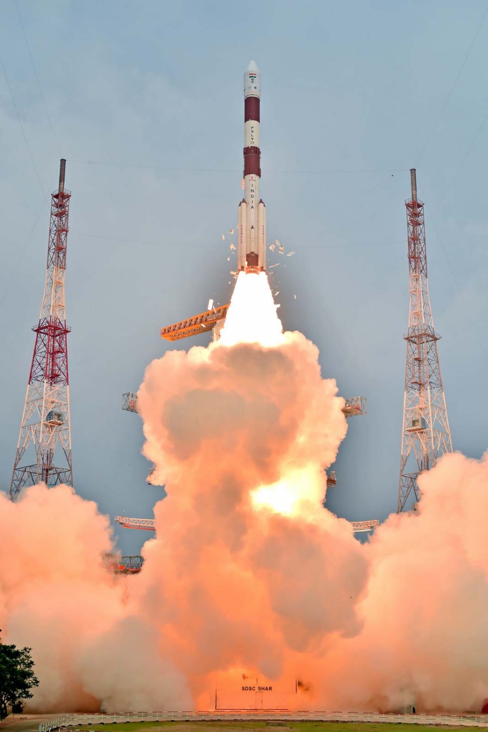
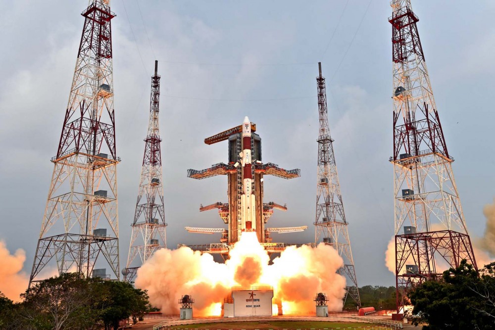
    The U.S. Air Force successfully launched the 12th Boeing-built GPS IIF satellite aboard a United Launch Alliance Atlas V Evolved Expendable Launch Vehicle from Space Launch Complex 41, Cape Canaveral Air Force Station, Fla., at 8:38 a.m. EST (5:38 a.m. PST) on Feb. 5.

    “Today’s launch is a significant achievement in the history of GPS, as we launch the last of the GPS IIF satellites to be delivered on-orbit,” said Lt. Gen. Samuel Greaves, Space and Missile Systems Center commander and Air Force program executive officer for space. “The GPS IIF satellite performance has been exceptional and is expected to be operational for years to come.”

    “This milestone is the result of the remarkable relationship between SMC, our operators within the 14th Air Force and our ULA/Boeing industry partners. Their continued tenacity and dedication to mission success ensures we continue to maintain a robust satellite constellation with modernized, more resilient GPS capabilities,” said Greaves. “A job ‘Well Done!’”

    According to Greaves, this mission demonstrates the Air Force’s continued intent to deliver pre-eminent space-based positioning, navigation and timing service to users around the globe.  GPS IIF is critical to U.S. national security and to sustainment of the GPS constellation for civil, commercial, and military users. GPS IIF satellites play an integral part in the modernization efforts vigorously being pursued across space, ground and user equipment to provide stronger signals and improved resiliency in the GPS constellation.

    “Today’s launch marks a momentous milestone in the history of the Global Positioning System. It is the twelfth and last GPS IIF satellite and closes out nearly 27 years of launches for the GPS Block II family of satellites,” said Col. Shawn Fairhurst, 45th Space Wing vice commander, who served as the Launch Decision Authority. “As the nation’s premier gateway to space, we are proud to be part of the team providing GPS and its capabilities to the world and look forward to the future as we begin preparation for the next generation of GPS III satellites. Together with the Space and Missile Systems Center and our industry partners, we make up one team delivering assured space launch and combat capabilities for the nation.”

    An Airmen-led processing team at CCAFS has processed every satellite of the series since GPS IIF-1 launched here in May 2010.

    The Boeing-built GPS IIF satellites provides improved accuracy through advanced atomic clocks, a longer design life than previous GPS satellites, and a new operational third civil signal (L5) that benefits commercial aviation and safety-of-life applications. It also continues to deploy the modernized capabilities that began with the GPS IIR-M satellites, including a more robust military signal.

    GPS is the United States Department of Defense’s largest satellite constellation with 31-operational satellites on orbit.

    Operated by Air Force Space Command’s 50th Space Wing at Schriever Air Force Base, located east of Colorado Springs, Colo., the GPS constellation provides precise positioning, navigation and timing services worldwide as a free service provided by the Air Force, seven days a week, 24-hours a day.

    Space and Missile Systems Center, located at Los Angeles Air Force Base in El Segundo, Calif., is the U.S. Air Force’s center for acquiring and developing military space systems. Its portfolio includes GPS, military satellite communications, defense meteorological satellites, space launch and range systems, satellite control networks, space-based infrared systems and space situational awareness capabilities.

  • GPS III navigation payload to be all digital

    The first GPS III satellite in accoustic testing. (Photo: Lockheed Martin)
    The first GPS III satellite in accoustic testing. (Photo: Lockheed Martin)

    Harris Corporation will offer an all-digital navigation payload for GPS III Space Vehicles (SV) 11 and beyond.

    According to Harris, the fully digital navigation payload will provide enhanced performance and enable on-orbit reprogramming. The all-digital payload expands on the advanced features of the current 70-percent digital payload that Harris provides for Lockheed Martin’s GPS III SV 1-8 satellites.

    The features provide greater flexibility, affordability and accuracy compared to existing satellites and include an advanced modular design, atomic clock timing systems, radiation-hardened computers and powerful transmitters.

    The new payload combines innovative digital capabilities developed by Harris and Exelis, now a part of Harris. In 2013, Exelis successfully demonstrated digital navigation signal capability in a formal preliminary design review conducted by the Air Force.

    The payload also leverages the mature Technology Readiness Level 9 legacy Harris reconfigurable payload that is flying on the International Space Station and is incorporated on hosted payloads for the Iridium NEXT satellite.

    Harris has more than 500 digital processors on-orbit and another 150 awaiting launch. Harris navigation payloads have been on all of the 80-plus U.S. GPS satellites launched since the 1970s, with more than 750 years of on-orbit life without a payload-related failure. Harris has delivered more than 100 digital payloads, which have performed flawlessly on-orbit, the company said.

    Harris will provide a fully digital payload for GPS III satellites beginning with SV11. Shown is SV1 in testing. (Photo: Lockheed Martin)
    Harris will provide a fully digital payload for GPS III satellites beginning with SV11. Shown is SV1 in testing. (Photo: Lockheed Martin)
  • Galileo 9 and 10 now broadcasting navigation messages

    News from the European Space Agency

    Europe’s ninth and tenth Galileo satellites have started broadcasting working navigation messages. The two satellites were launched together on Sept. 11, 2015.

    Once safely in orbit and their systems activated, their navigation payloads and search and rescue transponders were subjected to a rigorous process of in-orbit testing, to ensure their performance reached the necessary specifications to become part of the Galileo system.

    Radio-frequency measurements of the Galileo signals were made from ESA’s Redu centre in Belgium. The site boasts a 20 m-diameter dish to analyze their signal shape in high resolution.

    Along with assessing that the satellites themselves were functioning as planned, the test campaign also confirmed they could mesh properly with the worldwide Galileo ground network.

    The testing was coordinated from the Galileo Control Centres in Oberpfaffenhofen in Germany – performing the command and control of the satellites — and Fucino in Italy — overseeing the provision of navigation messages to users.

    Source: GPS world staff
    An artist’s depiction of four Galileo satellites sending navigation signals. (ESA)

    “This is the first recurrent launch of Galileo Full Operational Capability satellites from an in-orbit test point of view,” comments Christian Lezy, supervising the measurement campaign in Redu.

    “All tests were conducted in a seamless manner in parallel with the ongoing routine operations of the rest of the fleet.”

    The operations team, successfully led by SpaceOpal GmbH, completed the testing campaign few days ahead of schedule, with the satellites beginning to broadcast valid navigation signals on Jan. 29.

    The following two Galileos — satellites 11 and 12, launched on Dec. 17, 2015 — are undergoing their own in-orbit test campaign. Once their initial Launch and Early Operations Phase was completed at the Toulouse facility of France’s CNES space agency, both spacecraft were handed over to the Oberpfaffenhofen centre during the Christmas period.

    Platform commissioning and drift stop and fine positioning maneuvers have also been completed, placing both satellites into their final working orbits, while their payload activation is proceeding according to schedule.

    Galileo satellites 13 and 14 have completed all pre-flight testing at ESA’s ESTEC test centre in Noordwijk, the Netherlands, and have been put into storage ahead of their launch. Production of the remaining 12 satellites is continuing around the clock at OHB’s facility in Bremen, Germany.

    The complete Galileo constellation will be made up of 24 satellites across three orbital planes, with two ‘active spare’ satellites per orbital plane, ready to plug any gap in service should an operational Galileo malfunction.

    At the moment the satellites are transmitting navigation signals for technical validation purposes, being employed by Galileo engineers as well as the rest of the satnav industry to prepare Galileo-compatible products and services.

    The current status of the overall Galileo constellation can be checked at the European Commission’s European GNSS Service Centre website.

  • Launch of last GPS IIF satellite shifts to Friday

    The U.S. Air Force plans to launch the 12th — and final — satellite in the Block IIF series of modernized GPS spacecraft this week. Originally scheduled to launch Feb. 3, the launch has been moved to Friday, Feb. 5. According to United Launch Alliance (ULA), the cause for the schedule slip was “concerns over the integrity of electrical connectors on the Atlas V booster.”

    The Air Force has produced 12 IIF satellites, featuring new clocks, new civil and military signals, and other upgrades for enhanced accuracy and robustness. Currently, 31 GPS satellites are in operational service, including 11 Block IIF satellites and 20 spacecraft from previous generations.

    The Air Force Second Space Operations Squadron (2SOPS) indicates that IIF-12 (SVN-70/PRN-32) will replace SVN-41/PRN-14 in the F plane, slot F1. SVN-41 will be re-phased from the F1 location to a newly defined F7 node (GLAN = 45°) once SVN-70 is set healthy.

    Meanwhile, SVN-23/PRN-32 (IIA-10) will be taken out of the operational constellation before IIF-12’s launch and sent to Launch, Anomaly, Resolution, and Disposal Operations (LADO).

    “SVN-23, launched on Nov. 26, 1990, has been an ‘Iron Bird’ workhorse in the E-plane and has successfully served the world’s GPS users for over 25 years,” said Rick Hamilton, CGSIC Executive Secretariat, in an email. “This is over 18 years past its designed service life, having operationally outlasted (and, in many cases, outperformed) its peers on-orbit due to the diligent efforts of the men and women of the U.S. Air Force.”

    PRN-04 is tentatively scheduled for assignment to the first of the new generation of GPS-III satellites, available for launch sometime in 2017.

    Date/Site/Launch Time: Wednesday, Feb. 03, 2016, from Space Launch Complex-41 at Cape Canaveral Air Force Station, Florida. The 19-minute launch window opens at 8:38 a.m. EST, and a ULA webcast will start at 8:18 a.m. EST.

    Rocket/Payload: A United Launch Alliance Atlas V 401 will launch the GPS IIF-12 mission for the U.S. Air Force.

    Launch Updates: To keep up to speed with updates to the launch countdown, dial the ULA launch hotline at 1-877-852-4321 or join the conversation at www.facebook.com/ulalaunch, twitter.com/ulalaunch and instagram.com/ulalaunch; hashtags #GPSIIF12 and #AtlasV.

    Source: GPS world staff
    The Air Force’s twelfth Global Positioning System (GPS) IIF satellite is encapsulated inside an Atlas V 4-meter payload fairing. (Photo: ULA)
  • Air Force determines cause of GPS timing issue

    On Jan. 26 at 12:49 a.m. MST, the 2nd Space Operations Squadron (2 SOPS) at the 50th Space Wing, Schriever Air Force Base, Colo., verified users were experiencing GPS timing issues. Further investigation revealed an issue in the GPS ground software that only affected the time on legacy L-band signals. This change occurred when the oldest vehicle, SVN 23, was removed from the constellation.

    While the core navigation systems were working normally, the coordinated universal time timing signal was off by 13 microseconds, which exceeded the design specifications. The issue was resolved at 6:10 a.m. MST; however, global users may have experienced GPS timing issues for several hours.

    U.S. Strategic Command’s Commercial Integration Cell, operating out of the Joint Space Operations Center, effectively served as the portal to determine the scope of commercial user impacts. Additionally, the Joint Space Operations Center at Vandenberg AFB has not received any reports of issues with GPS-aided munitions, and has determined that the timing error is not attributable to any type of outside interference such as jamming or spoofing.

    Operator procedures were modified to preclude a repeat of this issue until the ground system software is corrected, and the 50th Space Wing will conduct an Operational Review Board to review procedures and impacts on users. Commercial and Civil users who experienced impacts can contact the U.S. Coast Guard Navigation Center at (703) 313-5900.

  • Septentrio reference station receivers now shipping to UNAVCO

    Septentrio reference station receivers now shipping to UNAVCO

    Septentrio has started shipments to UNAVCO of its all new multi-frequency PolaRx5 reference receiver. This follows the 2015 announcement by UNAVCO that Septentrio was selected at the Geodesy Advancing Geosciences EarthScope (GAGE) Facility preferred vendor for next-generation GNSS reference station products.

    The Septentrio PolaRx5 GNSS receiver.
    The Septentrio PolaRx5 GNSS receiver.

    The PolaRx5 incorporates Septentrio’s most advanced multi-frequency GNSS engine, with support for all major satellite signals including GPS, GLONASS, Galileo and BeiDou, as well as the regional QZSS and IRNSS satellite systems.

    According to the UNAVCO GNSS Receiver Preferred Vendor RFP Evaluation Report, Septentrio consistently ranks highest in many areas of measurement quality and interference mitigation of the instruments tested. Moreover, the PolaRx5 offers low power consumption for its multi-constellation, multi-frequency GNSS reference receiver, operating on less than 2 Watts when receiving GPS and GLONASS satellite signals.

    “At UNAVCO, we are excited about the selection of the PolaRx5 for enhancement of the EarthScope Plate Boundary Observatory, the international standard for geodetic networks,” said M. Meghan Miller, president of UNAVCO. “We will work with Septentrio to modernize UNAVCO GPS networks, and explore the science innovation and broader applications that are possible in the rapidly evolving GNSS era.”

    UNAVCO is a non-profit university-governed consortium that facilitates geosciences research and education using geodesy. UNAVCO operates the GAGE Facility for the National Science Foundation with additional core support from NASA. The GAGE Facility includes more than 2,000 continuously operating GPS/GNSS reference stations around the world.

    UNAVCO-supported networks include EarthScope’s Plate Boundary Observatory (PBO), the Continuously Operating Caribbean GPS Observational Network (COCONet), the Trans-Boundary Land and Atmosphere Long-Term Observational and Collaboration Network (TLALOCNet) and the Polar Earth Observational Network (POLENet).

    Septentrio’s close cooperation with UNAVCO continues a tradition of partnering with leading scientific institutions and agencies that require high-performance GNSS technology in challenging environments. Septentrio partners include the European Space Agency (ESA) and the European GNSS Agency (GSA).

    “These deliveries mark a huge step in the modernization program for UNAVCO and UNAVCO partner networks around the globe,” said Neil Vancans, vice president of Septentrio Americas. “The use of new satellite technology will be the foundation for greater understanding of our planet. The entire Septentrio team is proud to be a part of this pivotal program.”

  • China launches 21st Beidou navigation satellite

    Source: GPS world staff
    A Long March-3C carrier rocket carrying the 21st satellite for the BeiDou Navigation Satellite System lifts off from Xichang Satellite Launch Center,southwest China’s Sichuan Province, Feb. 1, 2016.

    China has launched its 21st BeiDou satellite into orbit, according to Xinhua News Agency, the official press agency of the People’s Republic of China.

    The launch took place at 3:29 p.m. Beijing Time (07:29 UTC) on Monday, Feb. 1.

    Launched from Xichang Satellite Launch Center in the southwestern province of Sichuan, the satellite was boosted by a Long March-3C carrier rocket into medium Earth orbit (MEO).

    A video of the launch appears here. Also, below is amateur video of the launch.

  • Sonardyne dynamic positioning fills in for GNSS disruptions

    Bordelon Marine, providers of vessel services to operators in the Gulf of Mexico and around the world, has selected acoustically aided inertial navigation technology from Sonardyne Inc., Houston, for its new ultra-light intervention vessel (ULIV) Brandon Bordelon.

    The dual Ranger 2 Pro DP-INS systems, the highest specification available, will be used to track remotely operated underwater vehicles (ROVs) during inspection, repair and maintenance activities and provide an independent position reference for the vessel’s Marine Technologies Class 2 dynamic positioning system.

    Specialized vessels such as the Brandon Bordelon conventionally rely on GNSS and ultra-short baseline (USBL) acoustics  as their primary sources of dynamic positioning reference data.

    However, a vessel’s station-keeping capability can be compromised in the event that the USBL is affected by thruster aeration or noise and the GNSS signal is simultaneously interrupted. The latter is particularly common around equatorial regions and during periods of high solar radiation.

    Sonardyne’s Ranger 2 Pro DP-INS system addresses this operational vulnerability. It aids vessel positioning by exploiting the long term accuracy of Sonardyne’s Wideband 2 acoustic signal technology with high integrity, high update rate inertial measurements. The resulting navigation output has the ability to ride-through short-term acoustic disruptions and is completely independent from GNSS.

    The Brandon Bordelon was delivered at the end of 2015 and is under a 60-day contract with Tidewater Subsea. Designed to support complex inspection, repair and maintenance operations, the vessel features a high-capacity deep-water crane, infrastructure for two work-class ROVs and a large, reconfigurable back-deck area.

    In addition to the system’s deep water positioning performance and safety benefits, DP-INS has been proven to deliver valuable time and cost savings for vessel owners. It does not need a full seabed array of transponders to be installed and calibrated before subsea operations can commence.

    For most subsea tasks, positioning specifications can be met with only one or two transponders deployed on the seabed. Additionally, as the system needs only occasional aiding from the acoustics, transponder battery life is substantially increased and the need to task an ROV to deploy and recover transponders for servicing is reduced.

    The equipment supplied to Bordelon Marine included Sonardyne’s ship-mounted inertial navigation sensor and two HPT 7000 acoustic transceivers. The HPTs have been installed on the Brandon Bordelon through-hull deployment poles and are optimised for tracking and dynamic positioning in ultra-deep water.

    Wes Bordelon, President/CEO Bordelon Marine said, “Equipping the Brandon Bordelon with Sonardyne’s Ranger 2 DP-INS, reflects our commitment to providing high-tech, high-spec equipment on our fit-for-purpose Stingray vessels and ensuring our fleet is safe, efficient and cost-effective.

    “Ranger 2 DP-INS is a mature, field proven technology that addresses operators’ need for a robust, independent DP reference that provides an update rate and accuracy on par with GNSS,” said Ralph Gall, Technical Sales Manager at Sonardyne in Houston. He added, “The Brandon Bordelon joins a significant fleet of vessels which depend upon our acoustically-aided inertial technology for safer and more efficient dynamic positioning operations.”

  • Report GPS timing issues to NAVCEN

    GPS timing issues have been reported from some user communities to the U.S. Coast Guard Navigation Center (NAVCEN) over the last 12 hours, according to an email sent by Rick Hamilton, executive secretariat of the Civil GPS Service Interface Committee (CGSIC).

    “As a reminder, if you continue to experience problems, please report them immediately to NAVCEN,” Hamilton wrote. Report problems via the online GPS Problem Report form or call Navigation Information Service Watch at 703-313-5900.

  • US Coast Guard issues GPS jamming alert

    The U.S. Coast Guard issued a safety alert on Jan. 16, warning mariners of the potential detrimental impact to navigation caused by GPS interference or jamming. The warning emphasizes the importance of understanding how vessel equipment could be impacted by the loss of a GPS signal.

    The Coast Guard states that this past summer, multiple outbound vessels from a non-U.S. port suddenly lost GPS signal reception. The net effect was various alarms and a loss of GPS input to the ship’s surface search radar, gyro units and ECDIS, resulting in no GPS data for position fixing, radar over ground speed inputs, gyro speed input and loss of collision avoidance capabilities on the radar display. 

    Fortunately, the vessels were able to safely continue theirvoyage using radar in heads up display, magnetic compass and terrestrial navigation. Approximately six nautical miles later, the vessels’ GPS units resumed operation. Although the vessels had back-up systems to allow a safe transit, the consequences could have been severe, warns the Coast Guard.

    Full content of the alert appears below.


    Global Navigation Satellite Systems – Trust, But Verify
    Report Disruptions Immediately

    Do you know what equipment relies upon the U.S. Global Positioning System (GPS) signal? How would you respond if you lost the signal? This past summer, multiple outbound vessels from a non-U.S. port suddenly lost GPS signal reception. The net effect was various alarms and a loss of GPS input to the ship’s surface search radar, gyro units and Electronic Chart Display & Information System (ECDIS), resulting in no GPS data for position fixing, radar over ground speed inputs, gyro speed input and loss of collision avoidance capabilities on the radar display. Fortunately, the vessels were able to safely continue their voyage using radar in heads up display, magnetic compass and terrestrial navigation. Approximately 6nm later, the vessels’ GPS units resumed operation. Although the vessels had back-up systems to allow a safe transit, the consequences could have been severe. These types of events highlight the potential detrimental impact to navigation caused by GPS interference or jamming and the importance in understanding how your vessel’s or facility’s equipment could be impacted by a loss of GPS signal.

    Whether walking through the city, driving across town or navigating the world, Global Navigation Satellite Systems (GNSS) have become an integral part of everyday life. However, at times, the positioning signals may be impacted by interference from both natural and human-made sources. The most common types of interference are reception issues, usually due to bad installations, poor antenna positioning or faulty equipment. Jamming devices, while illegal in the U.S. and a threat to safety, have been used for nefarious or deceptive purposes. Interference can also be unintentionally caused when operating GNSS in close proximity to other radiating devices, such as amplified TV antennas (see our Safety Alert 11-02). Therefore, it is important to remember to use all available means for navigation and maintain proficiency so you can still navigate should your primary GPS fail.

    Indicators of positioning systems interference include an intermittent signal, no signal, or an incorrect signal. Suspected or suspicious disruptions should be reported immediately. Critical information to take note of during a disruption event includes location, time, and period of outage.

    Commercial operators are reminded, should your navigation or other equipment onboard (e.g. AIS) be impaired as a result of a disruption or interference, this should be reported to the nearest U.S. Coast Guard Captain of the Port, District Commander or Vessel Traffic Center as soon as possible; and, await further directions (per 33 CFR 164.53).

    All operators should be aware, vigilant, and immediately report GPS disruptions to the U.S. Coast Guard Navigation Center (NAVCEN). The report will be disseminated to the U.S. Air Force GPS Operations Center and the Federal Aviation Administration in an attempt to identify the problem and correlate with any other GPS incidents in the same general geographic location. Depending on the severity of the report, NAVCEN may refer it to law enforcement and/or other federal agencies for further investigation.

    Reporting a disruption — or other navigation hazards or aids to navigation outages — is simple, and can be done electronically (http://www.navcen.uscg.gov, the preferred method) or via phone call to the NAVCEN (703- 313-5900), 24 hours a day.

  • Last Block IIF to replace oldest GPS satellite

    On Feb. 3, the Air Force plans to launch the 12th, and last, satellite in the Block IIF series of modernized GPS spacecraft. The Air Force has produced 12 IIF satellites, featuring new clocks, new civil and military signals, and other upgrades for enhanced accuracy and robustness.

    Currently, 31 GPS satellites are in operational service, including 11 Block IIF satellites and 20 spacecraft from previous generations.

    The Air Force Second Space Operations Squadron (2SOPS) indicates that IIF-12 (SVN-70/PRN-32) will replace SVN-41/PRN-14 in the F plane, slot F1. SVN-41 will be re-phased from the F1 location to a newly defined F7 node (GLAN = 45°) once SVN-70 is set healthy.

    Meanwhile, SVN-23/PRN-32 (IIA-10) will be taken out of the operational constellation before IIF-12’s launch and sent to Launch, Anomaly, Resolution, and Disposal Operations (LADO).

    “SVN-23, launched on Nov. 26, 1990, has been an ‘Iron Bird’ workhorse in the E-plane and has successfully served the world’s GPS users for over 25 years,” said Rick Hamilton, CGSIC Executive Secretariat, in an email. “This is over 18 years past its designed service life, having operationally outlasted (and, in many cases, outperformed) its peers on-orbit due to the diligent efforts of the men and women of the U.S. Air Force.”

    PRN-04 is tentatively scheduled for assignment to the first of the new generation of GPS-III satellites, available for launch sometime in 2017.

    Date/Site/Launch Time: Wednesday, Feb. 03, 2016, from Space Launch Complex-41 at Cape Canaveral Air Force Station, Florida.  18 minute launch window opens at 1347Z, 0847 EST.

    Rocket/Payload: A United Launch Alliance Atlas V 401 will launch the GPS IIF-12 mission for the U.S. Air Force.

    Launch Updates: To keep up to speed with updates to the launch countdown, dial the ULA launch hotline at 1-877-852-4321 or join the conversation at www.facebook.com/ulalaunch, twitter.com/ulalaunch and instagram.com/ulalaunch; hashtags #GPSIIF12 and #AtlasV.

  • India’s fifth navigation satellite launched

    IRNSS-1E-launch-2
    IRNSS-1E heads for orbit on Jan. 20. (Photo: IRNSS)

    The fifth satellite in the Indian Regional Navigation Satellite System (IRNSS) constellation lifted off on time Jan. 20 from Satish Dhawan Space Center on Sriharikota Island, on India’s east coast.

    As in the previous four launches of IRNSS satellites, the navigation satellite rode aboard a Polar Satellite Launch Vehicle (PSLV). This is the 33rd launch for the PSLV.

    After the PSLV-C31 lift-off at 0401 GMT Wednesday (11:01 p.m. EST Tuesday) with the ignition of the first stage, the subsequent important flight events — strap-on ignitions and separations, first stage separation, second stage ignition, heat-shield separation, second stage separation, third stage ignition and separation, fourth stage ignition and satellite injection — all took place as planned.

    After a flight of about 18 minutes 43 seconds, IRNSS-1E Satellite was injected to an elliptical orbit of 282.4 km X 20,655.3 km inclined at an angle of 19.21 degree to the equator (very close to the intended orbit) and successfully separated from the PSLV fourth stage.

    After injection, the solar panels of IRNSS-1E were deployed automatically. ISRO’s Master Control Facility (at Hassan, Karnataka) took over the control of the satellite. In the coming days, four orbit manoeuvres will be conducted from Master Control Facility to position the satellite in the geosynchronous orbit at 111.75 deg East longitude with 28.1 deg inclination.

    IRNSS-1E is the fifth of the seven satellites constituting the space segment of the Indian Regional Navigation Satellite System. IRNSS-1A, 1B, 1C and ID, the first four satellites of the constellation, were successfully launched by PSLV on July 02, 2013, April 04, 2014, October 16, 2014 and March 28, 2015, respectively. All the four satellites are functioning satisfactorily from their designated orbital positions.

    IRNSS-1E, the fifth satellite in India's regional constellation, lifted off Jan. 20.
    IRNSS-1E, the fifth satellite in India’s regional constellation, lifted off Jan. 20. (Photo: IRNSS)

    IRNSS is an independent regional navigation satellite system designed to provide position information in the Indian region and 1500 km around the Indian mainland. IRNSS would provide two types of services, namely, Standard Positioning Services (SPS) — provided to all users — and Restricted Services (RS), provided to authorized users.

    A number of ground stations responsible for the generation and transmission of navigation parameters, such as satellite ranging and monitoring, have been established in 18 locations across the country. In the coming months, the remaining two satellites of this constellation, namely, IRNSS-1F and IG, are scheduled to be launched by PSLV, thereby completing the entire IRNSS constellation.