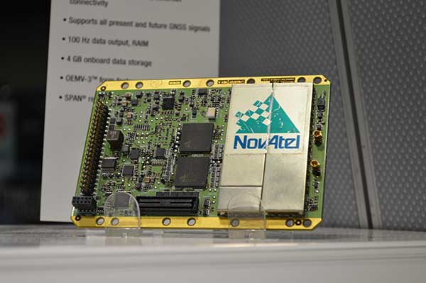
Andy Yin, international sales director at ComNav Technology Ltd., talks about the company’s M300 Pro and new OEM boards at INTERGEO 2015, which was held Sept. 15-17 in Stuttgart, Germany.
The M300 Pro GNSS reference station receiver integrates ComNav’s new-generation OEM board and includes web service and remote control features.
The first OEM board, which can support all GNSS constellations (GPS, GLONASS, BeiDou and Galileo), will be released at the end of September, according to ComNav.
Galileo satellites 9 and 10 are functioning perfectly, and the initial series of flight operations is continuing as part of the critical launch and early orbit phase, according to a European Space Agency Rocket Science blog by Daniel Scuka.
Galileo 9 and 10 lifted off together at 02:08 GMT on Sept. 11 from Europe’s Spaceport in French Guiana atop a Soyuz launcher, bringing to 10 the total number of Galileo satellites in orbit.
“The pair are being stepped through an intense series of check-outs, confirmations, mode changes, configurations and health verifications by the joint ESA/CNES mission team working around the clock at ESOC, Darmstadt, Germany,” Daniel writes. “The team are now focusing on conducting a series of thruster burns designed to start the drift of the two satellites toward their target orbital positions.”
“Following the burns performed during the LEOP (launch and early orbit phase), the satellites will continue naturally drifting, ending up in their final desired operational orbits at about 23,222 km after another set of thruster burns, planned to achieve fine positioning in orbit, around the end of October,” said Liviu Stefanov, co-flight director from ESA.
With the excellent performance of the spacecraft and the ground teams, the LEOP is expected to wrap up soon.
UNAVCO’s GAGE Facility includes more than 2,000 continuously operating GPS/GNSS reference stations around the world.
UNAVCO has selected Septentrio to be the preferred vendor of next-generation GNSS reference stations for the Geodesy Advancing Geosciences and EarthScope (GAGE) Facility. The Preferred Vendor status is valid through the duration of the GAGE Facility Cooperative Agreement with the National Science Foundation (NSF).
The selection of Septentrio was made following a rigorous competitive selection process. Under the agreement, Septentrio will supply GNSS reference stations to upgrade and expand the continuous GNSS reference station networks operated by UNAVCO.
UNAVCO is a non-profit university-governed consortium that facilitates geosciences research and education using geodesy. UNAVCO’s GAGE Facility includes more than 2,000 continuously operating GPS/GNSS reference stations around the world. UNAVCO-supported networks include EarthScope’s Plate Boundary Observatory (PBO), the Continuously Operating Caribbean GPS Observational Network (COCONet), the Trans-Boundary Land and Atmosphere Long-Term Observational and Collaboration Network (TLALOCNet) and the Polar Earth Observational Network (POLENet).
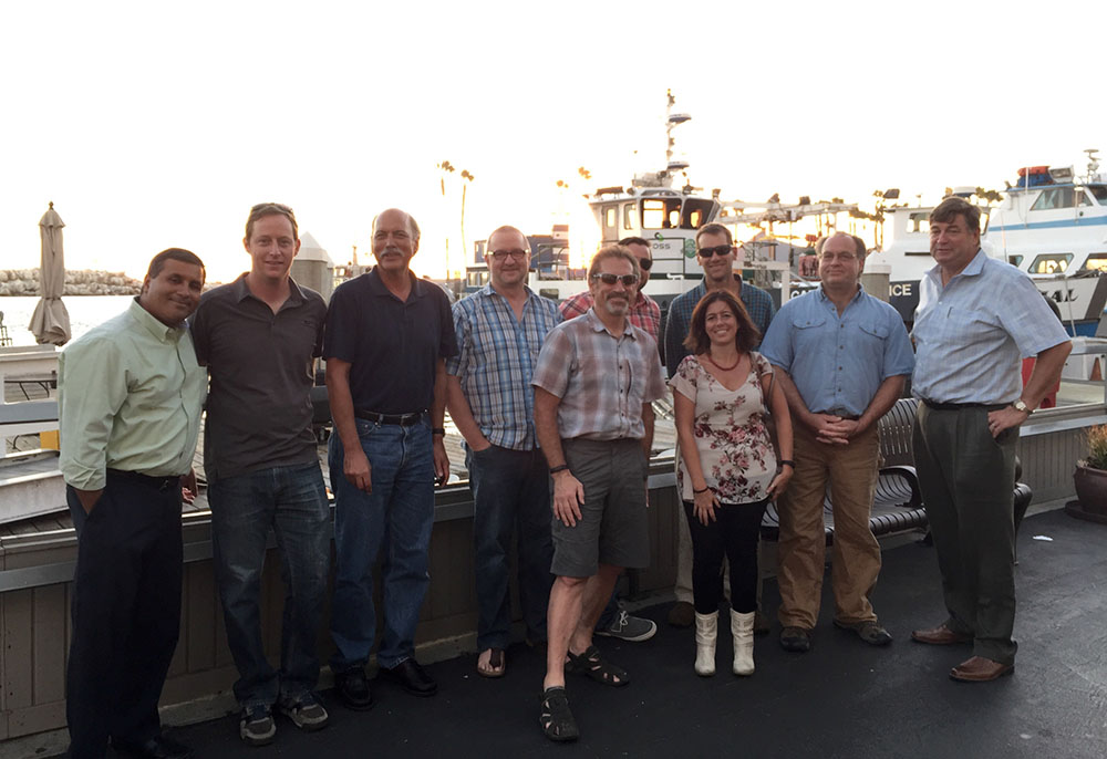
UNAVCO staff from Boulder, Colo., with three Septentrio staff near Septentrio’s headquarters in Torrance, Calif. Back row from left to right: Mo Kapila, Director of OEM Sales, Septentrio; Henry Berglund, Engineer, Development and Testing; Chuck Meertens, Director of Geodetic Data Services; Dave Mencin, Real Time GPS Manager; James Downing, Contracts and Permitting Manager; Jim Normandeau, Manager of Principal Investigator Project Support, Equipment, and Repairs; Warren Gallaher, Engineer, Development and Testing; and Neil Vancans, Vice President, Septentrio Americas. Front row from left to right: Freddy Blume, Manager, Development and Testing and Francesca Clemente, Manager, Technical Support, Septentrio. (Credit: Septentrio)
“This decision, following a highly competitive technical evaluation, is an important validation of Septentrio’s family of high-performance GNSS receivers,” said Neil Vancans, vice president, of Septentrio Americas. “Septentrio is firmly established as the preferred choice of receivers within the scientific and academic community for ionospheric observations, timing and other demanding applications, due to their superior multipath mitigation, resistance to ionospheric disturbance and in-band jamming. We look forward to working closely with UNAVCO to support its important mission of advancing geodetic science.”
“The critical technology in the new generation of reference station receivers is available in the Asterx 4 OEM boards, which also provide low and scalable power options. This technology is being extended across the full line of Septentrio products,” added Vancans.
“This Preferred Vendor relationship gives UNAVCO a unique opportunity to provide technical input during the ongoing development process of Septentrio’s next-generation PolaRx-series GNSS receivers,” said Frederick Blume, senior project manager for Development and Testing at UNAVCO.
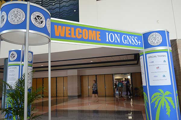
Septentrio made the announcement during ION GNSS+, being held this week in Tampa, Fla.
Alan Cameron, GPS World editor and publisher, interviews Technical Chair Paul McBurney; at left is Program Chair Gary McGraw. Each presenter was interviewed for “The ION GNSS+ Show” following a five-minute lightning presentation. (Courtesy of ION)
Tuesday night’s Plenary Session at ION GNSS+ took attendees to space with a high-flying presentation on NASA’s planetary exploration endeavors by keynote speaker James L. Green, director of Planetary Science for NASA. He touched on most of the planets, with the July fly-by of Pluto by the New Horizons probe the climax of his talk.
Following the keynote, the ION GNSS+ program chairs shared insights on the topics to be covered at the conference in a lighthearted — and very fast-moving — format. Each presenter had only five minutes to describe their program track. Afterward, they were invited to the set of “The ION GNSS+ Show,” where moderator (and GPS World editor and publisher) Alan Cameron asked them a few questions.
This year’s conference feature panels of industry experts, policy updates, the world’s largest GNSS commercial exhibit and more than 300 technical presentations presented through both Systems and Application Tracks and Peer-Reviewed Tracks.
Program chairs who gave lightning talks before joining Alan on the couch, and their topics, were: Paul McBurney, GopherHush Corp., Mass-Market Applications; Sandra Kennedy, NovAtel, High Performance & Safety-Critical Applications; Andre Hauschild, German Aerospace Center, System Updates, Plans and Policies; Zainab Syed InvenSense, Multisensor Navigation and Applications; Olivier Julien, ENAC, Algorithms and Methods; and Grace Gao, University of Illinois at Urbana-Champaign, Advanced GNSS Technologies.
Planetary Navigation. During his keynote address, Green took the audience on a journey navigating through the solar system. He explained that NASA’s goals are to advance our knowledge of the origin and history of the solar system, discover the potential for life elsewhere, and assess what hazards humans may face in exploring space. First stop was our nearest neighbor, the Moon, which was explored in 2012 by NASA’s Gravity Recovery and Interior Laboratory (GRAIL) spacecraft. GRAIL uncovered the origin of massive invisible regions that make the moon’s gravity uneven, a phenomenon that affects the operations of lunar-orbiting spacecraft. Because of GRAIL’s findings, spacecraft on missions to other celestial bodies can navigate with greater precision in the future.
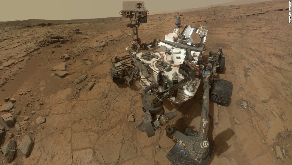
Moving on to Mars, Green shared the background and successes of the Curiosity rover, which is still on Mars researching the Red Planet. Curiosity also took a selfie.
Curiosity landed on Mars in August 2012 and took this selfie, which is an aggregate of more than a dozen separate images.
Green said Andy Weir’s novel The Martian, which has been made into a movie that will be out in October, is a realistic depiction of what exploring the hostile red planet would be like for humans.
The New Horizons flyby of Pluto drew several audience questions following Green’s presentation. With an orbit of 248 years, it was a challenge to determine the precise navigation route to the Solar System’s outermost planet, especially when travel at 16 kilometers a second could spell disaster if the probe encountered any space debris — even a particle the size of a grain of sand could end the mission. Mission control constantly reassessed the spacecraft’s trajectory using imagery from the Hubble space telescope and then New Horizons itself.
NASA was surprised to find that Pluto’s surface has relatively few craters.
Trimble debuted its new R2 GNSS receiver at INTERGEO 2015, held this week in Stuttgart, Germany.
The R2 GNSS receiver is a receiver that works with Trimble handheld devices and iOS, Android or Window mobile handhelds, smartphones and tablets using Bluetooth or USB connectivity. When paired with a mobile device, the receiver adds professional-grade GNSS capabilities for better accuracy. The rugged Trimble R2 provides GIS and survey professionals the flexibility to choose the mobile device, workflows and accuracy they need based on applications.
Trimble R2 GNSS Receiver for Mobile Devices
The Trimble R2 GNSS receiver is compact and portable, weighing 2.4 pounds. With one button operation and field swappable battery, the receiver can be pole or vehicle mounted or carried on a backpack. The R2 is a multi-constellation receiver that supports GPS, GLONASS, Galileo, BeiDou and QZSS satellite signals as well as SBAS.
With a variety of standard and optional correction capabilities, the Trimble R2 can achieve sub-meter to centimeter positioning for a broad range of accuracy requirements. The receiver is an option for the Bring Your Own Device (BYOD) strategy.
“Today’s geospatial professionals require flexible solutions which allow for configuration to meet their specific job requirements,” said Ron Bisio, general manager of Trimble’s Surveying and Geospatial Division. “The Trimble R2’s versatility to support GIS and survey workflows as well as BYOD deployment enables geospatial professionals to collect data using the mobile device, workflow and accuracy they choose.”
Workflows – GIS and Survey Field Software
Designed for both GIS field data collection and survey workflows, the Trimble R2 receiver integrates with Trimble TerraFlex mapping and GIS field software and Trimble Access survey field software.
TerraFlex software is a scalable cloud-based solution for geospatial data collection. By pairing the R2 with a smart device or Trimble handheld running TerraFlex, the solution addresses a wide variety of field requirements, including attribute-rich GIS data collection on consumer and professional devices.
Trimble Access software supports the workflows of everyday surveying tasks such as topographic and control surveys and specialized surveying tasks such as roads, monitoring, tunnels and mines. By pairing the receiver with a Trimble handheld running Trimble Access or TerraFlex field software, the Trimble R2 is a versatile solution that supports the full range of geospatial data collection workflows for both GIS and survey applications.
Flexible Accuracy
It us capable of receiving a broad range of corrections from traditional RTK, VRS networks and SBAS to Trimble RTX correction services via cellular/IP connections or satellite (L-band), the Trimble R2 provides high-accuracy data worldwide.
The R2 GNSS receiver can leverage the entire portfolio of subscription-based Trimble RTX correction services to accommodate a wide range of applications and accuracy requirements. This includes CenterPoint RTX (less than 4 centimeters), RangePoint RTX (less than 50 centimeters), and ViewPoint RTX (less than 1 meter) correction services.
Every fall thousands of geospatial professionals are drawn to Germany, like bees are to honey, for the largest geospatial exhibition on Earth. This year in Stuttgart, more than 17,000 attendees from 92 countries are flooding the halls of the Stuttgart Exhibition grounds located adjacent to the Stuttgart International Airport. Attendees are being treated to a vast array of geospatial technology treats from 500+ exhibitors representing 30 countries.
Unmanned Aerial Vehicles
I recall a few short years ago, there were only a handful of UAV vendors at the entire exhibition. Now, there is hardly an aisle that does not contain a quad-copter, fixed-wing aircraft or a UAV-related accessory. The growth of UAVs into the geospatial market growth has been the most explosive geospatial technology introduced in the past 25 years, the span of time that I’ve been involved in the geospatial industry. It’s over the top — there is so much hype surrounding UAV technology that there might be more sellers than buyers. It’s become so crazy that there are vendors presenting UAVs that haven’t even been built yet! It reminds me of the days that Atari would announce a new game system nine months before it was ready to ship.
In the UAV space, I wonder which companies are actually making money. My guess is very few. A few of the big players like DJI, Parrot (owns senseFly) and 3D Robotics are doing well, plus a few others. But it’s an unhealthy buyer/seller ratio. Something’s going to give.
The sensefly eXom UAV in flight.
Today’s winners in the UAV market are companies like Pix4D, Agisoft and others who make mission planning and image-processing software for UAV-collected data. They are smart in that they aren’t competing against the hundreds of other UAV airframes on the market; they work with data from most of them. Following is a 3D example of what the Agisoft software can create given a bunch of images shot with a $1,500 DJI Phantom at 200-foot elevation.
The resolution is very good, and you’re able compute material volume such as the piles of aggregate on the west side of the river.
Inexpensive RTK
In the past, I’ve written a lot about inexpensive RTK GNSS receivers. At the InfoAg Conference a couple of months ago, Swift Navigation announced it is testing its $500 RTK receivers. At INTERGEO, CHCNav introduced L1 RTK GNSS in a mobile phone (check our website for a video on that). It’s not capable of centimeter accuracy yet, but quickly heading in that direction. NVS Tech is also pushing sub-$500 L1 RTK GNSS modules.
It’s interesting because L1 RTK is nothing new. That technology was first introduced almost 10 years ago, and wasn’t accepted very well. Now, the UAV phenomena is breathing new life into L1 RTK receiver technology because it’s driving the requirement for low-cost, high-precision GNSS receivers. L1 RTK GNSS are finally getting the love they were looking for nearly 10 years ago.
In case you weren’t able to make it to INTERGEO this year, Joelle, Michelle and I are shooting a bunch of short (~2-minute) videos at various exhibition booths while we are here. We hope to give you a flavor of the geospatial technology being offered this year in Stuttgart.
Advanced control for multiple rod heights and prism offsets.
Carlson Software experts will be demonstrating the newest abilities of the 5.0 version of SurvCE, its data-collection software, at INTERGEO, being held in Stuttgart, Germany, Sept. 15-17. Carlson will have two stands: indoors at C8.017 (Hall 8) and outdoors at FG.004.
SurvCE v. 5.0 software is scheduled to be officially released and available for download following extensive testing and after final enhancements are completed in October. Those buying a new license of SurvCE 4.0 software between now and the release of SurvCE 5.0 will receive an automatic upgrade to 5.0.
SurvCE 5.0 focuses on speed and power. A new memory allocator empowers users to do more, faster, opening large drawing and coordinate files with ease.
Mission Planning user-defined list for obstruction masking.
Other top new improvements include the following:
Enhanced GNSS tilt sensor (IMU) for confirmation of level and the taking of measurements with tilted GPS/GNSS poles (works with selected GNSS such as Stonex and CHC in addition to Carlson);
All-new GNSS Mission Planning, which will include GLONASS mission planning;
Newly designed two-step stakeout procedure now intuitively and accurately guides the user to his point, delivering easy to follow navigation that shifts to proximity information as he gets close to target;
And map-picked, cursor-displayed stakeout and one-pick measurement options.
Featuring hundreds of additions and improvements, Carlson SurvCE 5.0 continues to support the widest range of popular and new release RTK GPS and conventional/robotic total stations of any other data collection software on the market.
“SurvCE 5.0 is incorporating new emerging technologies like IMU support, while still providing its renowned friendly user environment,” says Jesus Latova, SurvCE product director. “Simplicity and safety are our main focus in developing these new features, together with continuing the extensive instrument support capacity of SurvCE.”
Carlson SurvCE is both powerful and easy to use, providing users with the options to collect data as they prefer. SurvCE 5.0 will be available in nearly two dozen languages. These include: English, Chinese, Croatian, Czech, Dutch, Finnish, French, German, Greek, Hungarian, Italian, Korean, Polish, Portuguese, Romanian, Russian, Serbian, Spanish, Swediish, Tagalog, and Turkish.
Hardware from Carlson SoftwareAlso visit the Carlson outside stand (F.004, outside Hall 8) at Intergeo to see and sample its hardware options, produced to work specifically with its popular software. These will include the rugged, fast, and popular Surveyor2 data collector, the BRx5 GNSS receiver, and other equipment recommended by Carlson.
For more information about SurvCE 5.0 and additional Carlson Software offerings, call 606-564-5028 (U.S.) or +31 36 750 1781 in the Netherlands and ask for your local Carlson representative.
Exhibiting at CTIA Super Mobility 2015, Vanja Maric, director of sales and marketing for Rockville, Maryland-based antenna-maker Maxtena, pointed out the challenge that exists for antenna makers in an uncertain drone market: forecasting what will happen next and planning for that future.
“The problem with the drone space its so volatile and so fragmented, and it’s very, very hard to predict,” Maric said. “Speaking to industry leaders in the UAV market, they don’t even know what it’s going to be in three years, and it’s very hard to put all your cards in that.”
That fragmentation is largely a dichotomy between the needs of the professional-grade market and the recreational drone pilots, Maric said. Maxtena is currently the antenna provider for several large UAV manufacturers, although confidentiality prevents them from being named.
“It all comes down to the necessity of precision, and different industries have different needs. UAVs, for example, some use very simple GPS patch antennas, simple receivers and precise location is not as important,” he said. “Then you have guys in the professional space where it is a necessity.”
That necessity right now is in the survey market, particularly RTK solutions for construction and mining operations in emerging countries. The company has seen an uptick in customers from Asia looking for antennas for Beidou. More specifically, Maric said handhelds for lone worker tracking in open pit mining in China has had “fantastic” growth. The M1227 antenna released earlier this year accomplishes this goal.
Maxtena GPS antennas at CTIA 2015
“It’s not just hardware; they have a lot of costs—software, mapping— in on all that, and if that package is right, you have something special. However, don’t forget: The antenna is the link between you and the satellite. That antenna has to be right; that’s what most companies forget,” Maric said. “You can have the best receivers and software in the world, but if you can’t make the link you can’t do it.”
The GPS World staff reports live from ION GNSS+ in Tampa, Fla., September 14–18, providing news, photos, videos and more. GPS World will be there with a full team, including Editor and Publisher Alan Cameron, Managing Editor Tracy Cozzens, and our market-sector editors. We’ll be providing near-real-time coverage of the show on GPSworld.com and on Twitter.
GPS World will also video record the indoor navigation demonstrations, and portions will be posted online at the GPS World YouTubechannel.
If you’re attending, be sure to come by the GPS World booth during the exhibit hall reception Wednesday evening to film a video-selfie with Mary Ann, our August cover great white shark. The video-selfies give you 30 seconds to tell us about yourself and will be posted to our YouTube channel.
Check back throughout the week for updated information from the event.
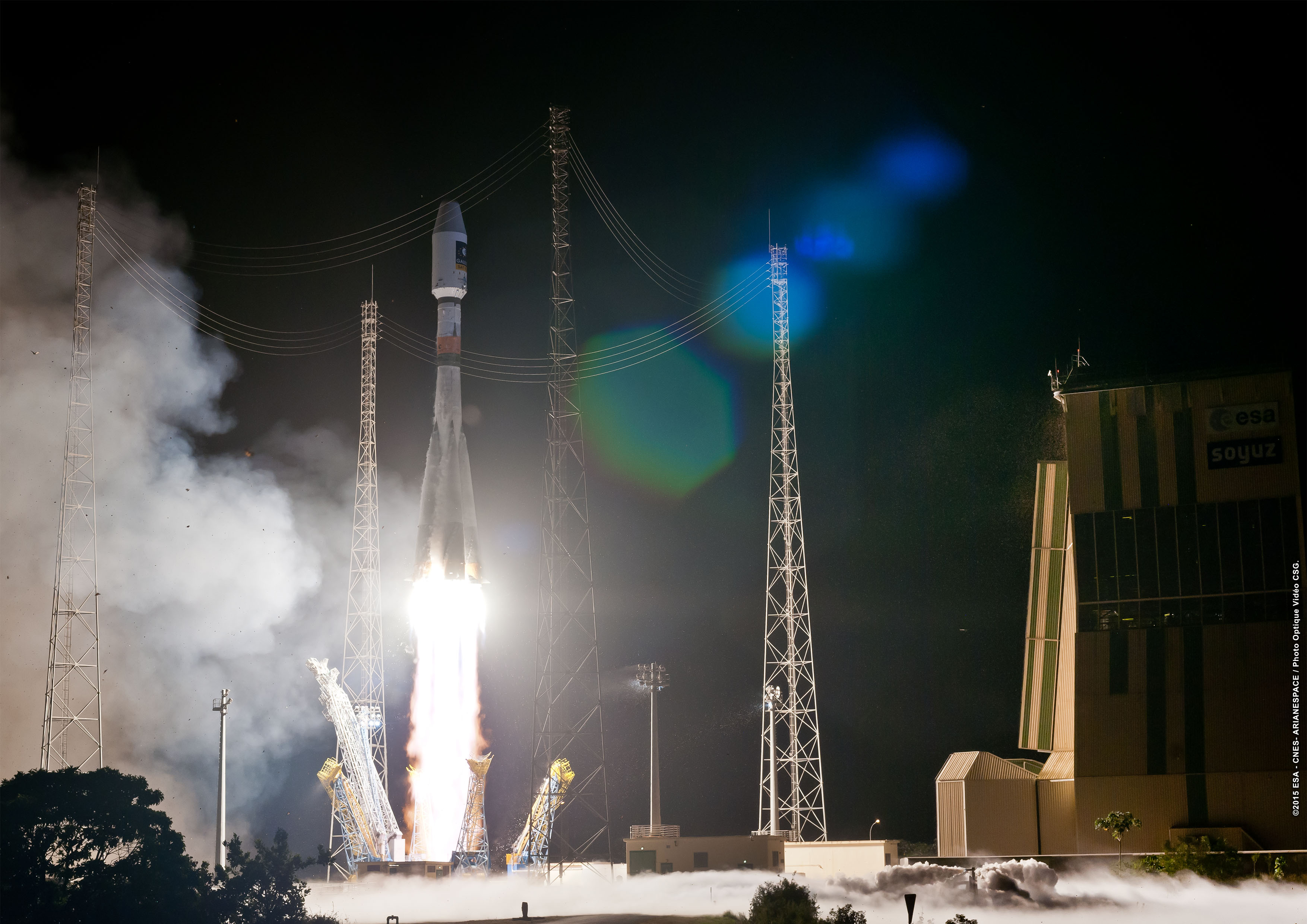
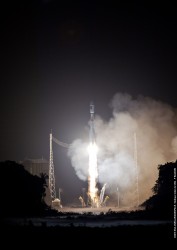
Soyuz launches Galileo 9 and 10 into orbit on Sept.10. (Credit: Arianespace)
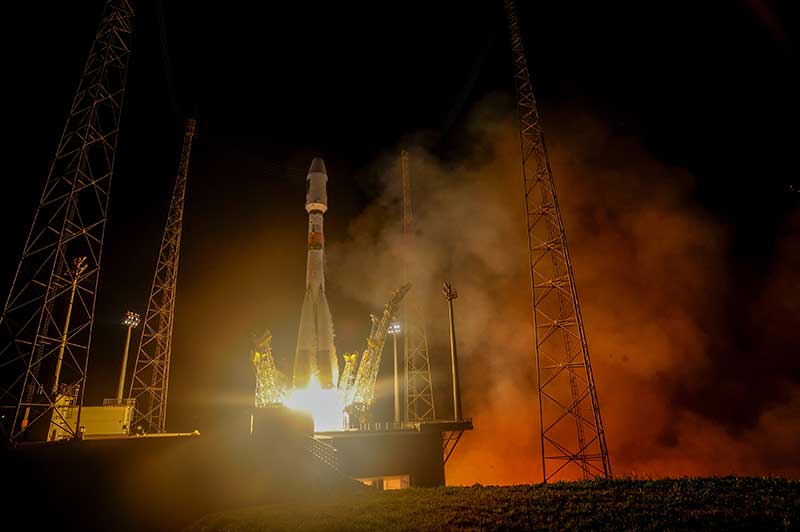
Arianespace’s 12th Soyuz flight from the Spaceport in French Guiana orbited two more spacecraft for Europe’s Galileo satellite navigation system on Sept. 10.
2015 is an important year for Arianespace at the service of European institutions, with 11 payloads to be orbited utilizing the company’s family of Soyuz, the heavy-lift Ariane 5 and lightweight Vega, Arianespace Chairman and CEO Stéphane Israël said after the liftoff.
Departing the Spaceport’s ELS launch complex near the city of Sinnamary at the planned exact liftoff time of 11:08:10 p.m. (local time in French Guiana), Soyuz deployed its two latest Galileo passengers after a flight of just under three hours and 47 minutes. This included the propulsion of Soyuz’ first three stages and two burns of its Fregat upper stage.
Israël noted these are the ninth and tenth Galileo spacecraft orbited by Arianespace, joining a constellation that ultimately will consist of 30 satellites. The satellites, named Alba and Oriana, are the latest FOC (Full Operational Capability) satellites, which are to operate in Galileo’s Orbital Plane A — one of three orbital planes being populated by the European navigation spacecraft.
The European Commission is managing and funding Galileo’s FOC phase, during which the network’s complete operational and ground infrastructure is being deployed. Design and procurement agent responsibilities have been delegated to the European Space Agency (ESA) on the Commission’s behalf.
Arianespace is set to launch two more satellites with Soyuz by year-end, before handing this task over to Ariane 5 beginning in 2016 with a launch carrying four satellites. One more Soyuz and two more Ariane 5s will continue the activity in 2017-2018.
“Galileo keeps us busy, and Arianespace is very proud to be the reference partner of this European flagship space program,” Israël said.
After expressing his appreciation to the European Commission and ESA for their confidence, he noted that 2015 is an important year for Arianespace at the service of European institutions, with 11 payloads to be orbited utilizing the company’s family of Soyuz, the heavy-lift Ariane 5 and lightweight Vega.
“These satellites address all space applications: navigation, Earth observation, science and technology, meteorology and secured communications,” Israël explained. “Thanks to our launcher family, we are fully capable of addressing all needs of European institutions.”
Soyuz’ flight with Galileo’s Alba and Oriana satellites occurred during the eighth of 12 Arianespace missions planned for 2015 — which will be a new record for the company’s launcher family. Its preparations at the Spaceport included the first use of the new FCube fueling facility, which is part of improvements in French Guiana to increase launch capacity, flexibility and schedule robustness.
Israël acknowledged those who contributed to this latest Arianespace success, including the Russian federal space agency, Roscosmos, and the country’s industrial partners; along with the European support companies; the French CNES space agency, and Arianespace own teams.
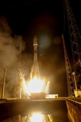
Galileo 9 and 10 lift off. (Credit: ESA)
Galileo 9 and 10 lift off.(Credit: ESA)
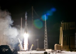
Soyuz launches Galileo 9 and 10 into orbit on Sept.10. (Credit: Arianespace)
Soyuz launches Galileo 9 and 10 into orbit on Sept.10. (Credit: Arianespace)
Europe’s own satellite navigation system has come a step nearer to completion today with Galileo 9 and 10, which lifted off together at 02:08 GMT on Sept. 11 from Europe’s Spaceport in French Guiana atop a Soyuz launcher.
All the Soyuz stages performed as planned, with the Fregat upper stage releasing the satellites into their target orbit close to 23 500 km altitude, around 3 hours and 48 minutes after liftoff.
“The deployment of Europe’s Galileo system is rapidly gathering pace,” said Jan Woerner, director general of the European Space Agency (ESA). “By steadily boosting the number of satellites in space, together with new stations on the ground across the world, Galileo will soon have a global reach. The day of Galileo’s full operational capability is approaching. It will be a great day for Europe.”
Two more Galileo satellites are scheduled for launch by end of this year. These satellites have completed testing at ESA’s ESTEC technical centre in Noordwijk, the Netherlands, with the next two satellites also undergoing their own test campaigns.
Galileo 9 and 10 lift off. (Photo: ESA)
More Galileo satellites are being manufactured by OHB in Bremen, Germany, with navigation payloads coming from Surrey Satellite Technology Ltd in the UK, in turn utilizing elements sourced from all across Europe.
“Production of the satellites has attained a regular rhythm,” said Didier Faivre, ESA’s Director of Galileo and Navigation-related Activities. “At the same time, all Galileo testing performed up to now — including that of the ground segment — has been returning extremely positive results.
“And while the continuing deployment of Galileo remains our priority, along with exploitation of EGNOS — Europe’s already operational satellite navigation augmentation system — ESA is also looking farther ahead.
“With the European Commission, we are doing the technical work to ensure Galileo goes on forever — locking in continuity of Europe’s navigation services into the long term, to meet performance on a par with the other global satellite navigation systems.”
Next year the deployment of the Galileo system will be boosted by the entry into operation of a specially customized Ariane 5 launcher that can double, from two to four, the number of satellites that can be inserted into orbit with a single launch.
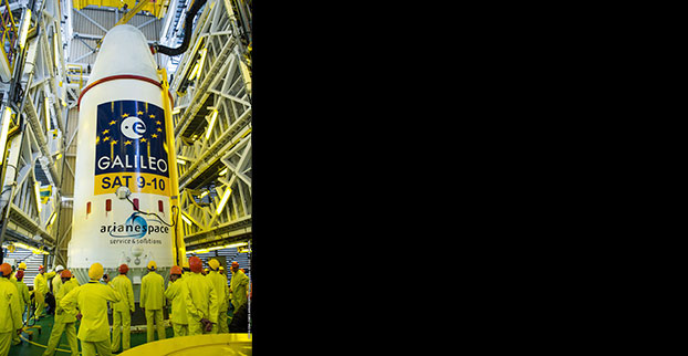
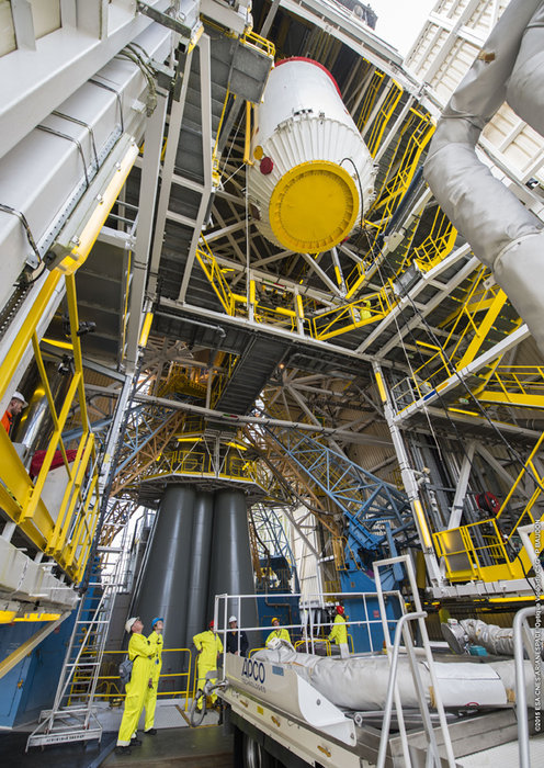
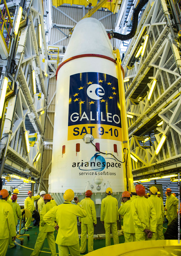
On Sept. 7, the upper composite containing Galileos 9–10 was transferred to the launch pad, then hoisted up to the top of the Soyuz launch tower to be joined to the other stages.
Galileo 9 and 10 are due for launch atop a Soyuz rocket at 02:08 GMT on Sept. 11 (04:08 CEST; 23:08 local time, Sept. 10) from Europe’s Spaceport in French Guiana. Streaming starts at 01:48 GMT (03:48 CEST) on the European Space Agency website. Or watch at Arianespace’s website (with commentary in French or English), starting 15 minutes before liftoff. You can also follow the launch live on your iPhone or iPad using the free Arianespace.tv app.
The first three stages of the Soyuz rocket take the Galileo satellites and their Fregat upper stage into low orbit. Then the reignitable Fregat, as much a spacecraft as a rocket stage, will take over the task of hauling the satellites higher through a pair of burns.
The satellites will be released in opposite directions by their dispenser once they reach their set 22 522 km-altitude orbit 3 h 47 min 57 sec after launch.
The webstream will cover the launch and orbital insertion in two parts, the first starting at 01:48 GMT (03:48 CEST) and ending at 02:40 GMT (04:40 CEST). The second part will begin at 05:43 GMT (07:43 CEST) and end at 06:50 GMT (08:50 CEST).
Two more satellites are scheduled for launch by end of this year. One is under test at ESA’s ESTEC technical centre in Noordwijk, the Netherlands, while the other has already completed its checks and is awaiting shipping to Kourou in the second half of October.
In addition, the first satellite of the following batch (Galileo-13) is undergoing its thermal-vacuum test at ESTEC, while the second (Galileo-14) arrived on Monday.