Category: GNSS

  • To L2C or Not to L2C? That Is the Operational Question.

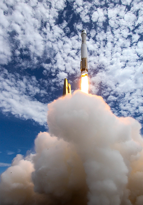
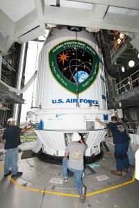
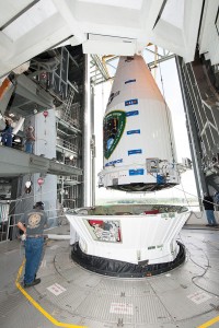
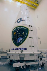
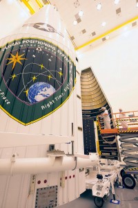
    Half of the GPS constellation now transmits the new civil signal, L2C. In a matter of weeks, that number will crest into the majority of the constellation when IIF-10 is set active and operational to users. By the end of the year or early 2016, look for 18 usable satellites transmitting L2C. That could be considered a nominal initial operating capability (IOC), though it is unlikely to be declared as such by the Air Force. We can anticipate a full operating capability (FOC) within five years. Many high-precision GPS receivers currently embody L2C signal processing capability.

    As Oscar Colombo, research scientist at NASA, noted in a recent CANSPACE contributed note, “This seems like a moment to start seriously thinking about using L2C as much as possible.”

    This month’s newsletter presents an amalgam, a panel discussion in virtual print, on several aspects and viewpoints stimulated by his posting,

    Some readers may want to peruse this U.S. government bulletin for a general description of L2C; others who feel sufficiently informed may skip directly two paragraphs down to “Three issues might be in the way of that being a practical proposition.”

    “L2C is the second civilian GPS signal, designed specifically to meet commercial needs. Its name refers to the radio frequency used by the signal (1227 MHz, or L2) and the fact that it is for civilian use. There are also two military signals at the L2 frequency. When combined with L1 C/A in a dual-frequency receiver, L2C enables ionospheric correction, a technique that boosts accuracy. Civilians with dual-frequency GPS receivers enjoy the same accuracy as the military (or better). For professional users with existing dual-frequency operations, L2C delivers faster signal acquisition, enhanced reliability, and greater operating range. L2C broadcasts at a higher effective power than the legacy L1 C/A signal, making it easier to receive under trees and even indoors. The Commerce Department estimates L2C could generate $5.8 billion in economic productivity benefits through the year 2030. The first GPS IIR(M) satellite featuring L2C launched in 2005. Every GPS satellite fielded since then has included an L2C transmitter.”

    Oscar Colombo’s CANSPACE note continues:

    “Three issues might be in the way of that [using L2C as much as possible] being a practical proposition, and I would appreciate comments on some or all of them:

    “(1) The fact that the new L2C navigation code (CNAV) is being transmitted, but flagged as pre-operational by the USAF, indicating that this organization is not yet ready to guarantee its fitness for use.

    “(2) The quarter-wave phase difference with the heritage signal L2.
    This one is important to know when fixing the ambiguities of differential observations (double differences and first order differences between satellites) combining L2C data from IIR-M and IIF satellites with those with only L2 (IIR and IIA). Some high-end commercial receivers correct for this phase difference, some don’t.  The latest RTCM document I’ve seen that touched on this issue came out in 2013 (RTCM Standard 10403.2, Paragraph 3.1.8, Table 3.1-5), and listed the choices , at that time, by nine leading manufacturers on this matter. The list does not include all of present-day manufacturers of high-end receivers, a list that changes over time.

    “(3) There is no proper place for L2C in files in the widely used Rinex 2.11 format.
    In principle, this can be taken care of by using data files in the Rinex 3 format. However, the use of Rinex 3, that has some major departures from 2.11, is not universal yet.

    “Does anyone  know of an up-to-date, reliable and comprehensive list of receiver manufacturers showing those that correct and those that do not correct for the quarter-wave phase shift?”

    GPS World contributing editors Eric Gakstatter (Geospatial Solutions) and Don Jewell (Defense) had a private conversation about the above, which I now make public.

    Don Jewell: “I can address this from a policy and operational perspective but you [Eric] have a better feel for the users perspective.

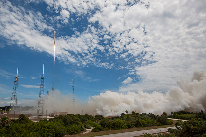
    “With two more successful IIF launches there will then be 18 L2C SVs broadcasting that signal, and that is considered by the government to be nominal IOC, an initial operating capability. Regardless of where you are on the Earth, shy of 60 deg N and 60 deg S, you should always have at least one or more L2C SVs in view.

    “We are probably looking at 2023 (8 more years) before the L2 carrier phase is in jeopardy of shifting without notice. If indeed that ever happens.

    “So from an operational and providers (HQ AFSPC, 50SW and 2SOPS) perspective, certainly the L2C signal should be useful and reliable. Just not normally guaranteed until FOC or full operational capability is declared, usually with 24 SVs broadcasting L2C. With no premature losses that will be halfway through the GPS III launch schedule ~ 2019-20.

    “Schedules are dynamic and always subject to change of course.”

    [Editor’s note: The L2 carrier isn’t going to go away or shifting to another frequency. What might go away is the P(Y) modulation on the L2 carrier if the DoD considers the P(Y) signals redundant once the M-code is fully embraced. If the P(Y) signal on L2 is no longer transmitted, then civil receivers currently using the P(Y) signal to obtain L2 carrier-phase measurements will no longer be able to do this.]

    Eric Gakstatter replied, “I’ve heard that some manufacturers say they are taking advantage of L2C when there are IIRM or IIFs in view and maybe some of the receivers I’m using are doing so. I’ve not paid attention to it.

    “It could be helpful in areas where users are trying to work in difficult environments such as near and under tree canopy.

    “In the case of RTK, I would think the reference station would have to broadcast L2C data.”

    A CANSPACE reader provided the following useful reference, which although it dates from 2012, still contains much immutable data: “The most recent view on the situation I have with L2C can be found here.”

    This links to the presentation slides from an American Geophysical Union 2012 Fall Meeting paper, “The Effects of L2C Signal Tracking on High-Precision Carrier Phase GPS Positioning: Implication for the Next Generation of GNSS Systems,” by Frederick Blume, Henry Beglund, and Lou Estey of UNAVCO, a non-profit university-governed consortium, facilitates geoscience research and education using geodesy.

    Oscar Colombo and other CANSPACE subscribers have contributed several further notes t the L2C discussion string.  To read them, it’s possible to access the archives here.
    Or you can more simply and elegantly subscribe to CANSPACE; see instructions here.

    Last month, Richard Langley and Oliver Montenbruck jointly communicated the following interesting aspect of the U.S. Federal Radionavigation Plan to CANSPACE readers:

    “in the new version of the FRP is a new phrasing of the earlier statement on guaranteed availability of the P(Y) signal only up to 2020:

    “The [U.S. Government (USG)] commits to maintaining the existing GPS L1 C/A, L1 P(Y), L2C, and L2 P(Y) signal characteristics that enable codeless and semi-codeless GPS access until at least two years after there are 24 operational satellites broadcasting L5. Barring a national security requirement, the USG does not intend to change these signal characteristics before then. Twenty-four satellites broadcasting the L5 signal is estimated to occur in 2024. This will allow for the orderly and systematic transition of users of semi-codeless and codeless receiving equipment to the use of equipment using modernized civil-coded signals. Note that it is expected that 24 operational satellites broadcasting L2C will be available by 2018, enabling transition to that signal at this earlier date. Civilian users of GPS are encouraged to start their planning for transition now.”

    Finally, Richard Langley notes that “I have a student looking into which Precise Point Positioning engines can currently process L2C observables, but his report is not yet available. Also, we are looking into adding an optional L2C processing capability to the University of New Brunswick PPP software, GAPS (GPS Analysis and Positioning Software), but that’s a month or so away.”

    As a postscript, there is a trending discussion at the LinkedIn group, GNSS R&D, Using C\A acquisition products to acquire L2C long code.

  • New LightSquared, Same Agenda, Billions at Stake

    In a late June filing with the Federal Communications Commission (FCC), Lightsquared asked the agency to reassign its spectrum licenses — which were at the root of a prolonged dispute in 2010 and 2011, and have never been fully utilized —  to a new licensee that would be wholly owned by a new company, New LightSquared. This is part of LightSquared’s efforts to re-emerge from bankruptcy.

    LightSquared wants to resume its own interference testing scheme, floated in 2011 after an independent, collaborative effort found ample LightSquared interference with GPS. The company has contracted with Roberson and Associates, a technology consulting firm, to develop its interference study.

    LightSquared is being represented before the FCC by Reed Hundt, a former FCC chairman who served from 1993 to 1997.

    LightSquared listed 28 different GPS receivers and related devices that it wants to test for interference with its terrestrial mobile broadband service. The devices include certified and non-certified aviation receivers and avionics equipment, general location, cell phones and 13 different high-precision clocks and receivers.

    Hundt specificaly identifed three companies — Trimble, Garmin, and John Deere — that he wants to come forward and provide proprietary technical and business information “in confidence” to tester Roberson. In statements to the FCC, Hundt twice used the phrase “speak now or forever hold your peace.”

    In March of this year, LightSquared obtained U.S. court permission to exit bankruptcy protection, which it entered in 2012. At that time, the FCC had concluded, after lengthy testing, hearings, charges and countercharges, that the wireless broadband service  proposed by LightSquared would interfere with GPS signals and associated positioning, navigation, and timing.

    New LightSquared reportedly has $1.25 billion in operating funds to help “make full use of its spectrum to provide existing and innovative services.”

    In a recent trial involving the assets of the bankrupt company, the value of its spectrum bands was estimated at possibly $4.5 billion or higher.

    GPS Industry Response. The GPS Innovation Alliance responded in early July to media reports on LightSquared’s position regarding the testing of the compatibility of terrestrial broadband and GPS.

    Following is the GPS Innovation Alliance’s response:

    “The GPS Innovation Alliance (GPSIA) supports a consensus-driven process, including all government and non-government stakeholders, to clearly identify and address remaining technical issues raised by LightSquared proposals to repurpose mobile satellite spectrum for terrestrial broadband use.

    “The technical challenges posed by these proposals are formidable, as evidenced by the conclusions of multiple U.S. government entities. Specifically, the U.S. Departments of Defense and Transportation and the NTIA have all found in the last several years that LightSquared’s proposals have significant potential to interfere with GPS.

    “Contrary to LightSquared’s recent suggestions, this is not simply a private matter between three GPS companies and LightSquared, but is important to all GPS users who rely on this critical technology every day. The Department of Transportation has sponsored an ongoing effort to assess adjacent band issues, and the GPS industry is actively engaged with the Federal Communications Commission (FCC), Department of Transportation (DOT) and other government stakeholders to drive consensus around next steps.

    “While we welcome the participation of LightSquared consultants, any further analysis of the technical issues should be informed by input from all of the relevant stakeholders, rather than the one-off efforts of an interested party.”

  • Royal Institute of Navigation Elects New Council

    Royal Institute of Navigation Elects New Council

    HRH The Duke of Edinburgh.
    HRH The Duke of Edinburgh.

    A new president and council were elected at the annual meeting of the Royal Institute of Navigation (RIN), held at the Royal Geographical Society in London on July 15.

    The meeting, which included presentations on the Mary Rose Trust and quantum technology, concluded with the declaration of ballot results for the new president, officers and council members.

    The RIN’s Patron, HRH The Duke of Edinburgh Prince Philip, divested outgoing President R. A. McKinlay and placed the Presidential Medal on the new incumbent, Captain James B. Taylor. James Taylor paid tribute to McKinlay and his outgoing officers and council members for their impressive leadership while in office.

    GPS World magazine founding editor Glen Gibbons received the Harold Spencer Jones Gold Medal from the duke in recognition of his “outstanding contribution to navigation as the founder and editor of various world-leading GNSS publications for more than 25 years, thus fulfilling a vital role in raising awareness and understanding of Global Navigation Satellite Systems.”

    Two President’s Invitation Addresses were given. Rear Admiral John Lippiett, chief executive of the Mary Rose Trust, gave a talk entitled “Insights into Tudor navigation from the Mary Rose,” and Prof. David Delpy, chair of the Strategic Advisory Board of the Engineering and Physical Sciences Research Council Quantum Technologies Programme, and chair of the MOD’s Scientific Advisory Council, gave a talk entitled “The UK National Quantum Technologies Programme and its relevance to Navigation.”

    Council members for 2015-16 are:

    President: Capt. J. B. Taylor, Order of the British Empire (OBE, Officer), Royal Navy (RN)

    Vice Presidents: Prof. T. Moore and Wg. Cdr. J. W. Lindsay, Royal Air Force (RAF)

    Treasurer: D. Cockburn

    Chairman of the Technical Committee: Dr. Sally Basker

    Chairman of the Membership & Fellowship Committee: D. Rydlard

    Chairman of the Audit & Risk Committee: D. Goddard, Order of the British Empire, Member (MBE)

    Other members of the Council:
    R. Angel
    D. Barrie (Order of the British Empire, Commander)
    Sqn. Ldr. J. Cairns, RAF (Retired)
    Lt. Cdr .F. A. Egeland-Jensen, RN
    Lt. Cdr. S. E. Gaskin, RN
    Dr. M. A. Hadley
    P. K. Hope-Lang
    Prof. S. Kos
    Ms. M. M. G. M. von Wendland

    Ex Officio Members:
    P. J. Brook, OBE, CAA
    Wg. Cdr. S. Gilbert, RAF
    John Pottle (Corporate), Spirent
    To be named, RN

    Director: Capt. P. Chapman-Andrews, LVO, MBE, RN

  • GPS IIF-10 Launches from Cape Canaveral

    GPS IIF-10 Launches from Cape Canaveral

    After the first main engine cut-off, the GPS IIF-10 mission entered a three-hour coast phase. (Courtesy:  ULA)
    After the first main engine cut-off, the GPS IIF-10 mission entered a three-hour coast phase. (Courtesy: ULA)

    UPDATE (July 15, 4 p.m. ET): United Launch Alliance (ULA) officials have declared the launch mission a success. The Centaur upper stage completed its second burn and released the GPS IIF-10 satellite into the navigation network to complete today’s launch of the Atlas 5 rocket.

    “Congratulations to the U.S Air Force and the entire mission team on today’s successful launch of the 10th GPS IIF satellite! In just a few days, on July 17, the Global Positioning System will celebrate the 20th anniversary of GPS achieving fully operational status,” said Jim Sponnick, ULA vice president, Atlas and Delta Programs. “ULA is very proud to play a role in delivering these satellites to orbit, with Atlas and Delta rockets having launched all 58 operational GPS satellites.”

    “Today’s successful launch is a testament to the outstanding teamwork of  government and industry partners’ commitment to mission success. The GPS IIF satellites are critical for GPS constellation global service for years to come,” said Lt. Gen. Samuel Greaves, Space and Missile Systems Center commander. “Thanks to the men and women of SMC, the 45th, 50th, 310th Space Wings, Boeing, United Launch Alliance, The Aerospace Corporation, the GPS IIF, and the Atlas V launch teams, we are sustaining and modernizing the world’s greatest space-based, precise positioning, navigation and timing service.”


    The tenth GPS IIF satellite lifted off from the Space Launch Complex (SLC)-41 at Cape Canaveral, Fla., on schedule at 11:36 local time (15:36 UTC) on July 15,  at the start of a nineteen-minute launch window.

    This is the second of three GPS constellation replenishment flights planned in 2015. The first launch, of GPS IIF-9 using a Delta IV rocket, occurred on March 25. A third launch, of GPS IIF-11 using an Atlas rocket, is scheduled for Sept. 22. The launch of GPS IIF-12 is scheduled for Jan. 26, 2016.

    The Boeing-built GPS IIF-10 is one of the next-generation GPS satellites, incorporating various improvements to provide greater accuracy, increased signals, and enhanced performance for users. GPS IIF-10 was the 70th spacecraft to be launched as part of the GPS constellation and the tenth in the Block IIF series that began launching in May 2010.

    GPS IIF-10 marks the 55th Atlas V launch since the vehicle’s inaugural launch in 2002 and the 27th flight of the 401 configuration. Every operational GPS mission has launched on a United Launch Alliance or heritage rocket. While the government has certified ULA competitor SpaceX for GPS III launches, a SpaceX Falcon 9 rocket exploded June 29, two minutes after launch of an International Space Station resupply mission.

    The Boeing-built GPS IIF satellites provide improved signals to support both the warfighter and the growing civilian needs of the global economy, the U.S. Air Force said in a statement. The GPS IIF satellites will provide improved accuracy through advanced atomic clocks, a longer design life than previous GPS satellites, and a new operational third civil signal (L5) that benefits commercial aviation and safety-of-life applications. It will also continue to deploy the modernized capabilities that began with the GPS IIR satellites, including a more robust military signal.

    Launch Photos

    Pre-Launch Photos

  • ESA Releases Guide on Galileo 5 and 6 Recovery

    The European Space Agency has published a short guide on the recovery of Galileo satellites 5 and 6. The PDF of “Salvage in Space: Recovering Galileo 5 and 6” can be downloaded.

    The four-page guide, written for a non-technical audience, describes the root cause of the anomaly that placed the two satellites into the wrong orbit, and the solution used to correct the orbits.

  • NASA Goddard Team Sets High-Flying Record with Use of GPS

    NASA Goddard Team Sets High-Flying Record with Use of GPS

    The red ellipses show the MMS orbit paths during the first and second phases of the mission. Each spacecraft uses GPS signals — which come from satellites situated along the green circle shown surrounding Earth — from the far side of Earth to track its position. (Credit: NASA/MMS)
    The red ellipses show the MMS orbit paths during the first and second phases of the mission. Each spacecraft uses GPS signals — which come from satellites situated along the green circle shown surrounding Earth — from the far side of Earth to track its position. (Credit: NASA/MMS)

    Editor’s Note: See more about the MMS mission in our August issue. The article is also posted here.

    News courtesy of NASA

    After years of hard work building a spacecraft, a mission team anxiously awaits after a launch — will the instruments they’ve crafted all work as well as planned? This is all the more true when flying new hardware, such as the onboard navigation tool on the four spacecraft that make up the Magnetospheric Multiscale, or MMS, mission, which launched on March 12. This navigation system had never before flown on a spacecraft with an orbit traveling so far from Earth — but if it worked, it would provide the precision navigation needed for MMS.

    And the results are now in: Not only has the MMS Navigator system exceeded all of the team’s expectations, it has set the record for the highest GPS use in space.

    • At the highest point of the MMS orbit, at more than 43,500 mile above the surface of the earth, Navigator set a record for the highest-ever reception of signals and onboard navigation solutions by an operational GPS receiver in space.
    • At the lowest point of the MMS orbit, Navigator set a record as the fastest operational GPS receiver in space, at velocities over 22,000 miles per hour.

    A precise tracking system is crucial for MMS, which requires extremely sensitive position and orbit calculations. The four spacecraft must fly in a tight pyramid formation to gather science data as they move through Earth’s magnetic environment. The formation is required to obtain three-dimensional observations of a phenomenon called magnetic reconnection that occurs when magnetic fields from the sun connect and disconnect with magnetic fields of Earth, which can allow energy and solar material to funnel into near-Earth space. With its instrument booms deployed, each spacecraft is the size of a baseball field — while flying as close as six miles from each other.

    Artist's concept of the MMS (courtesy of NASA).
    Artist’s concept of the MMS (courtesy of NASA).

    “Demonstration airplanes like the U.S. Navy’s Blue Angels fly in closer formations, but those planes are also much, much smaller and the pilots are always controlling the movements,” said Brent Robertson, deputy project manager for MMS at NASA Goddard Space Flight Center in Greenbelt, Md. “We have four giant spacecraft each with its own unique orbit that we make maneuvers on about every two weeks. It’s quite challenging to control this formation.”

    Tracking spacecraft can be done by radar stations from the ground, but it’s much more expensive and takes longer than an inflight system. However, using GPS as is typically done on Earth by such things as cars, boats and smartphones isn’t nearly as simple for something like MMS. For one thing, the bulk of its highly-elliptical orbit occurs above where the GPS transmitters orbit. So MMS must have specialized, extremely sensitive receivers to capture GPS signals transmitted from the far side of Earth. In addition the MMS spacecraft spin; each one makes three revolutions per minute.

    “Spinning adds a whole new dimension to trying to figure out where you are,” said Ken McCaughey, MMS GPS Navigator Product Development Lead at Goddard. “We have four GPS antennas on each spacecraft. As the spacecraft rotates we have an algorithm running that allows us to hand off from one antenna to the next without losing the signal.”

    In the first month after launch, the MMS team began turning on and testing each instrument and deploying booms and antennas. During this time, the team compared the Navigator system with ground tracking systems and found it to be even more accurate than expected. At the farthest point in its orbit, some 43,500 miles away from Earth, Navigator can determine the position of each spacecraft with an uncertainty of better than 50 feet.

    What’s more, the receivers on MMS have turned out to be strong enough that they consistently track transmissions from eight to 12 GPS satellites — excellent performance when compared to pre-flight predictions that there might be frequent drop outs during each orbit.

    Even if the receiver were to lose all GPS signals for part of the orbit, Navigator is specifically designed to handle such dropouts. By gathering as many observations as possible, integrated software called GEONS — for Goddard Enhanced Onboard Navigation System — can still compute the orbit by incorporating additional information including drag force, gravity, and solar radiation pressure.

    This system will be even more important during the second phase of the MMS mission when the orbit will double in size and travel all the way out to 95,000 miles from Earth.

    “It’s going to be very interesting to see how far out MMS can still receive signals,” said Robertson. “But Navigator has already far exceeded expectations. I think there’s a good chance we’ll end up being able to use GPS and save us some of the expense of using ground observations.”

    While Navigator technology and GPS receivers were previously flown for testing and to help navigate a low-earth-orbit mission, this is the first time that the complete Navigator package has been used to actively navigate a high-altitude mission. Now that the team knows it works so well, Navigator can be used for other missions that travel in similar high orbits.

    — By Karen Fox, NASA Goddard Space Flight Center

  • GPS IIF-10 Satellite Readied for July 15 Launch

    GPS IIF-10 Satellite Readied for July 15 Launch

    United Launch Alliance crews on July 7 placed the next GPS satellite on top of an Atlas V rocket for blastoff later this month, reports SpaceFlight Now.

    Liftoff for the GPS IIF-10 satellite will take place July 15, between 11:36 and 11:55 a.m. EDT, from Space Launch Complex (SLC)-41 at Cape Canaveral, Fla.

    This is the second of three GPS constellation replenishment flights planned in 2015. The first launch, of GPS IIF-9 using a Delta IV rocket, occurred on March 25. A third launch, of GPS IIF-11 using an Atlas rocket, is scheduled for Sept. 22. The launch of GPS IIF-12 is scheduled for Jan. 26, 2016.

    The Boeing-built GPS IIF-10 is one of the next-generation GPS satellites, incorporating various improvements to provide greater accuracy, increased signals, and enhanced performance for users.

    GPS IIF-10 marks the 55th Atlas V launch since the vehicle’s inaugural launch in 2002 and the 27th flight of the 401 configuration. Every operational GPS mission has launched on a United Launch Alliance or heritage rocket. While the government has certified ULA competitor SpaceX for GPS III launches, a SpaceX Falcon 9 rocket exploded June 29, two minutes after launch of an International Space Station resupply mission.

    To keep up to speed with updates to the launch countdown, dial the ULA launch hotline at 1-877-852-4321 or visit ULA’s Facebook page, ULA’s Twitter and ULA’s Instagram.

  • GPS Innovation Alliance Responds to Latest Lightsquared Comments

    GPS Innovation Alliance Responds to Latest Lightsquared Comments

    Figure 1. LightSquared propagation models can underestimate interference by more than a factor of 100 (>20 dB). (Click to enlarge.)
    Figure 1. LightSquared propagation models can underestimate interference by more than a factor of 100 (>20 dB). Two-ray models accounting for ground reflections show LightSquared signals at levels 6 dB above free space predictions several miles out. (Figure from August 2011 GPS World.)

    The GPS Innovation Alliance has responded to recent media reports on LightSquared’s position regarding the testing of the compatibility of terrestrial broadband and GPS.  

    LightSquared is asking the GPS industry to participate in new tests on interference between LightSquared’s spectrum and GPS receivers or waive its right to complain, according to a lawyer representing LightSquared.

    Following is the GPS Innovation Alliance’s response:

    “The GPS Innovation Alliance (GPSIA) supports a consensus-driven process, including all government and non-government stakeholders, to clearly identify and address remaining technical issues raised by LightSquared proposals to repurpose mobile satellite spectrum for terrestrial broadband use.

    “The technical challenges posed by these proposals are formidable, as evidenced by the conclusions of multiple U.S. government entities. Specifically, the U.S. Departments of Defense and Transportation and the NTIA have all found in the last several years that LightSquared’s proposals have significant potential to interfere with GPS.

    “Contrary to LightSquared’s recent suggestions, this is not simply a private matter between three GPS companies and LightSquared, but is important to all GPS users who rely on this critical technology every day. The Department of Transportation has sponsored an ongoing effort to assess adjacent band issues, and the GPS industry is actively engaged with the FCC, DOT and other government stakeholders to drive consensus around next steps. 

    “While we welcome the participation of LightSquared consultants, any further analysis of the technical issues should be informed by input from all of the relevant stakeholders, rather than the one-off efforts of an interested party.”

    In a filing last week with the FCC, LightSquared listed 28 different GPS receivers and related devices that it wants to test for interference with its terrestrial mobile broadband service. The devices include certified and non-certified aviation receivers and avionics equipment, general location, cell phones and 13 different high-precision clocks and receivers.

  • Expert Advice: The Tigers Claim Their Territory

    Expert Advice: The Tigers Claim Their Territory

    Tigers-CSNC2015

    Report from the 2015 China Satellite Navigation Conference

    By Greg Turetzky

    This May, the sixth China Satellite Navigation Conference (CSNC) was held in Xian, site of China’s famous buried warrior tombs. This was the fourth time I have attended, and every year the event has grown in both attendance numbers and global importance.

    The conference opened with the usual provider updates on satellite systems and international collaboration. There was nothing truly unexpected. All the providers continue to make progress towards launching new satellites with new capabilities, as well as providing regional augmentation systems for aircraft navigation.

    The hosts were their usual gracious selves and put on a very entertaining evening at “The Night of Beidou” event with wonderful food as well as music, dancing and and acrobats.

    Tigers-pullquote

    Exhibit Hall

    The show floor continues to grow at a rapid rate. The program listed122 exhibitors. The market has clearly entered the rapid proliferation stage. The booths were large, well-staffed and busy even during times when technical sessions were in progress. It was hard for me to determine what kind of business was being conducted as there were not many booth staff that spoke English. However, that seemed very appropriate as it was clear that the Chinese domestic market for BeiDou, or BDS, is well established and growing.

    In fact, many of the booths were regionally sponsored as there seems to be plenty of local subsidization to grow the GNSS industry in all areas of China. Many companies were displaying end-user products for all segments, from watches to phones to automotive to survey. I also noted significant growth in the number of chipset suppliers; I stopped counting at 10. Of further note and interest, the first few mergers/partnerships have taken place, as the market starts to make its natural turn from proliferation to consolidation.

    Technical Sessions

    The technical content of the conference is impressive. Approximately 280 papers were presented in up to nine simultaneous tracks over three days. Another 100+ posters were available for viewing.

    Here are titles of a few of the papers I liked:

    • Analysis of relative positioning performance of BDS triple frequency
    • Anti-spoofing design for Civil Navigation Signal system
    • Clock-error resolution strategy and precision analysis of GNSS real-time precise satellites
    • Research on detection and identification methods of satellite navigation RAIM multi-satellite failures.
    • Research on Wi-Fi/INS indoor pedestrian navigation system based on environmental feature augmentation
    • Reflections on demands of BDS intellectual property rights in satellite navigation industries
    • Review of anti-interference RF of satellite navigation receivers
    • A new TOA estimation method for the navigation pulse of X-ray Pulsare.

    If you plan to visit next year, you should consider bringing a translator. Many of the sessions have simultaneous translation, and most of the presentations have both English and Chinese slides, but not all of them. In the past, I have always enjoyed the policy and IP session, but this year it did not have a translator and the presenters spoke in Chinese, so I cannot give you much information. I did notice that several other U.S. companies had sent representatives who were native Chinese speakers.

    Conclusion

    The Chinese market is now full of grown tigers. I think they worry more about domestic competition for large domestic opportunities than they do about foreigners taking market share from them. That kind of competition has spurred them to catch up quickly in terms of technology and performance to where the big foreign competitors are. I foresee intense domestic competition in the short term leading to fewer, bigger, stronger players who will then be well positioned to compete in the global marketplace.


    GREG TURETZKY is a principal engineer at Intel responsible for strategic business development in Intel’s Wireless Communication Group focusing on location. He has more than 25 years of experience in the GNSS industry at JHU-APL, Stanford Telecom, Trimble, SiRF and CSR. He is a member of GPS World’s Editorial Advisory Board. See his previous reporting on the 2014 CSNC, “Tigers, Tycoons on View at China Satnav,” and the 2013 conference, “Little Tigers versus Wolves.”

    The statements, views, and opinions presented in this article are those of the author and are not endorsed by, nor do they necessarily reflect, the opinions of the authors present and/or former employers or any other organization the author may be associated with.

  • Thad Allen Discusses eLoran at GEOINT 2015

    In this exclusive interview, Admiral Thad Allen, former commandant of the U.S. Coast Guard, discusses PNT alternatives to GPS for navigation, including eLoran and the activation June 19 of a signal on an eLoran tower in preparation for a timing signal trial.

    Art Kalinksi interviewed Adm. Allen during GEOINT 2015, held June 22-25 in Washington, D.C. Kalinski is the monthly columnist for Geointelligence Insider, part of the Geospatial Solutions website, a sister site to GPS World magazine.

    Allan is an executive vice president at Booz Allen Hamilton, and a leader in the firm’s Departments of Justice and Homeland Security business in the civil market. In 2010, President Obama selected him to serve as the National Incident Commander for the unified response to the Deepwater Horizon oil spill in the Gulf of Mexico.

  • IS-GNSS 2015 Extends Scholarship Paper Deadline

    Organizers of the International Symposium on GNSS (IS-GNSS 2015) have extended the deadline for submission of the abstracts for scholarship applied papers for one week. The new deadline is July 7 23:59:59 JST (UTC+9).

    The one-week extension was added because organizers are presenting a paper in the Korean Institute on July 1.

    The deadline for submitting abstracts for regular papers remains August 15.

    The IS-GNSS 2015 will be held Nov. 16-19 in Kyoto, Japan. It will bring together experts engaged in PNT and GNSS technologies — including industry professionals, practitioners, academics and researchers — to share their latest research results and allow cross-disciplinary exchange of knowledge to advance the fields.

    The student scholarship will be offered to a student with the most promising paper. “If you have students, please encourage them to apply,” said Akio Yasuda, president of Institute of Positioning, Navigation and Timing of Japan.

    The program will include keynote addresses, oral presentations, interactive poster sessions, panel sessions, open interactive forums and an informative trade exhibition.

    The Asia and Pacific Rim meeting of the CGIC (Civil GPS Service Interface Committee) will be co-located with ISGNSS 2015 to help improve understanding of world trends in developing and deploying GNSS.

    For more information on the conference, including sponsorships and exhibits, email [email protected].