Category: GNSS

  • SBAS Working Group Looks to Galileo for Aircraft Guidance, Defines L5

    SBAS Working Group Looks to Galileo for Aircraft Guidance, Defines L5

    Plans to harness Galileo and other satnav systems for next-generation satellite augmentation systems for aviation and other high-performance uses took a significant step forward at the latest gathering of worldwide operators and experts, reports the European Space Agency.

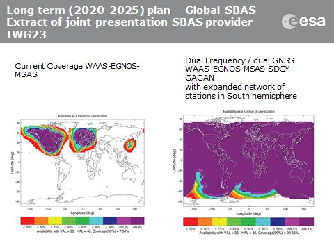
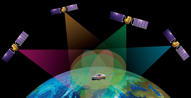
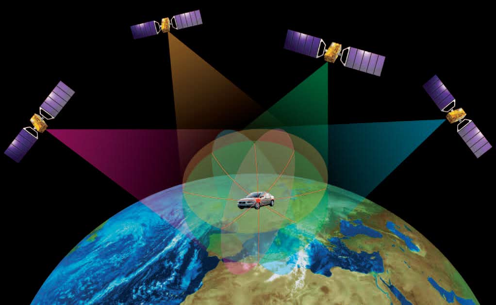
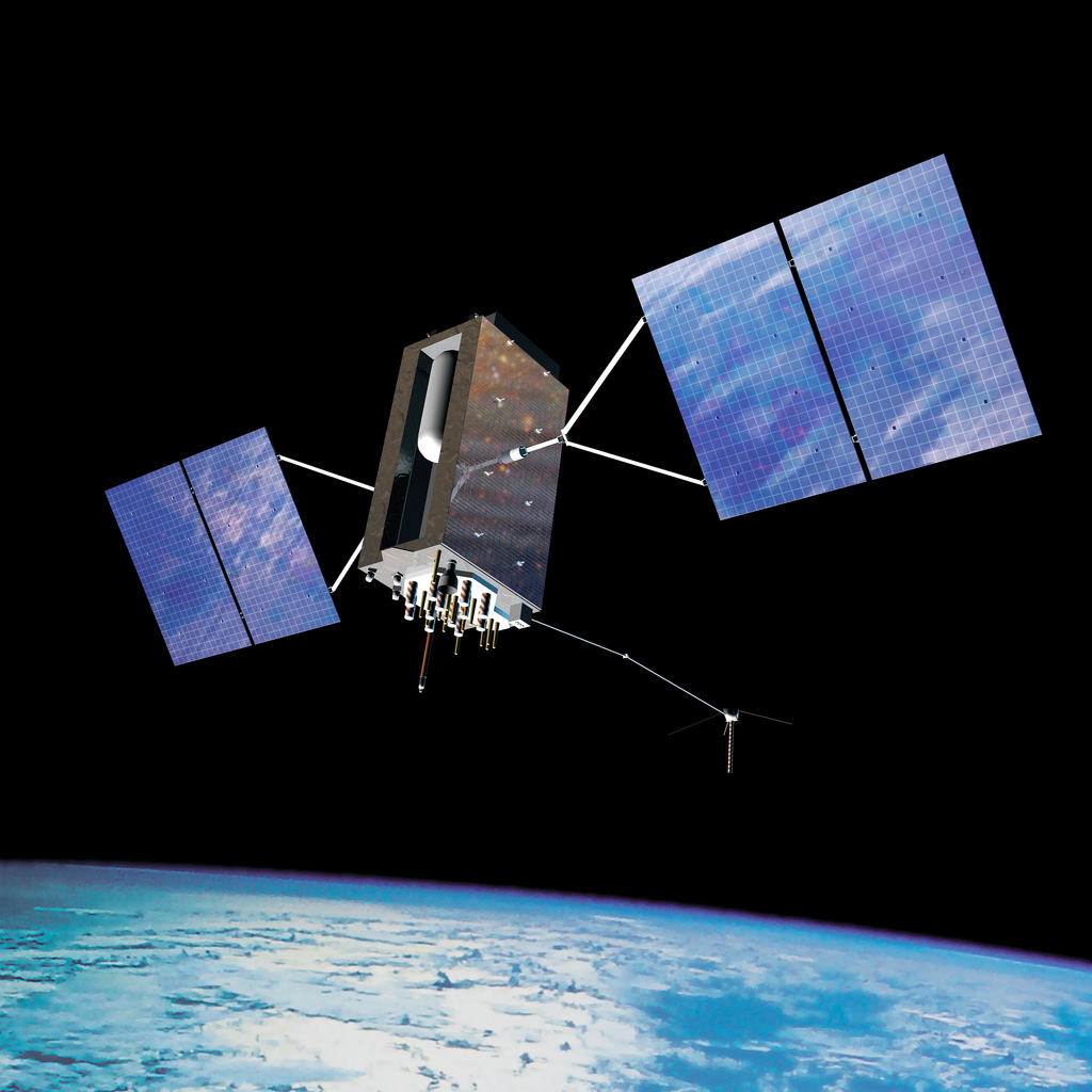
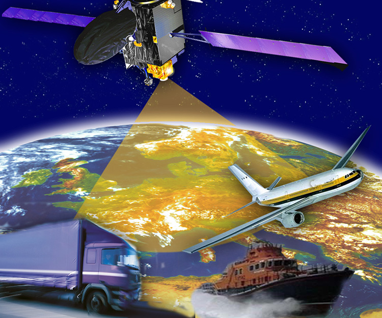
    Satellite augmentation systems combine additional ground stations and satellite transponders to sharpen satnav accuracy and reliability across given geographical regions — based on the U.S. GPS for now, but with plans to move to a multi-constellation design additionally employing Europe’s Galileo, China’s BeiDou, and Russia’s GLONASS systems in the post-2020 era.

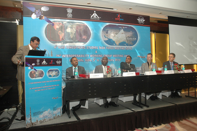
    The 26th Satellite Based Augmentation Systems (SBAS) Interoperability Working Group (IWG) took place in New Delhi, India on February 5–7.

    The 26th SBAS Interoperability Working Group (IWG) was introduced by V. Somasundaram, board member of the Airport Authority of India.
    The 26th SBAS Interoperability Working Group (IWG) was introduced by V. Somasundaram, board member of the Airport Authority of India.

    Among its achievements was to converge on a standard message definition for one of the channels — known as L5 — of the planned second-generation SBAS systems, which will utilize dual-frequency, multi-constellation signals.

    “Two solutions had been put forward, one by ESA based on work by European industry and one from the U.S. Federal Aviation Administration and Stanford University,” explains ESA’s Didier Flament, co-chair of the IWG.

    “A single definition coordinated between both bodies has been presented, combining the benefits of both solutions. The formal IWG review and approval loop has now been started with the objective of finalizing it for September’s IWG meeting.

    “The aim is to have it ready to submit to the official international SBAS standardization bodies — the International Civil Aviation Organization and the Radio Technical Commission for Aeronautics — as soon as October.”

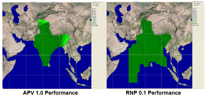
    The meeting also marked the significant progress made by Indian’s own SBAS system GAGAN, which underwent its final stability test last summer, followed by its safety certification in December.

    At this point GAGAN was declared certified for non-precision approach users , followed by its safety-of-life service being formally offered to civil aviation users on 14 February.

    GAGAN has been jointly undertaken by the AAI and the Indian Space Research Organisation, intended to provide improved accuracy, availability and integrity necessary to enable users to rely on satnav signals for all phases of flight – from en route as well as approach to all qualified airports within the GAGAN service area.

    SBAS services worldwide

    GPS has an accuracy of 5–10 meters. Across Europe, that accuracy is sharpened to 1–2 meters through EGNOS, an operational precursor to Europe’s Galileo global satnav system.
    EGNOS is an operational precursor to Europe’s Galileo global satnav system.

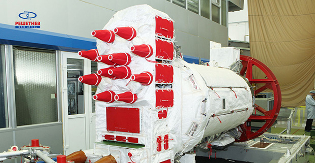
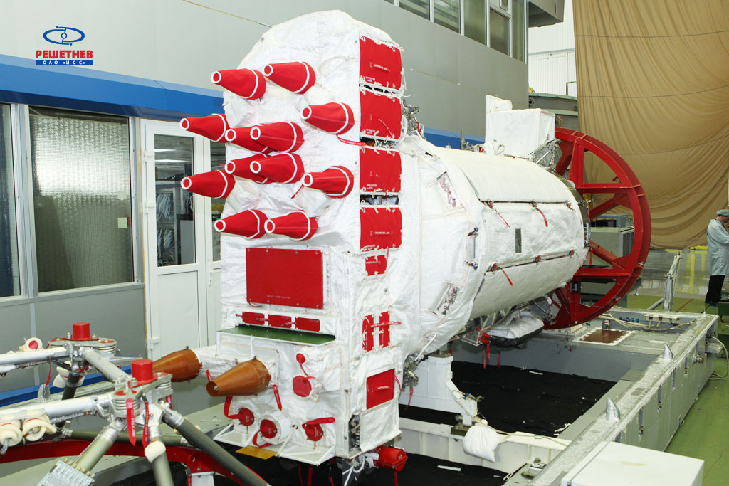
    GAGAN is the fourth certified SBAS to enter servicer worldwide. Europe has the European Geostationary Navigation Overlay Service (EGNOS), which was designed and built by ESA then turned over for operation by the European Satellite Service Provider, ESSP, overseen by the European Global Navigation Satellite System Agency  (GSA) — both of whom also participated in the meeting. ESA retains responsibility for the future evolution of EGNOS.

    The U.S. has the Wide Area Augmentation System (WAAS), developed and operated by the Federal Aviation Administration, with an extension over Canada called CWAAS (Canadian WAAS). WAAS celebrated its 10th anniversary of operational life last July.

    Japan has the Multi-functional Satellite Augmentation System (MSAS), developed and operated by Japan’s Civil Aviation Bureau. Japan is currently discussing plans to merge this capability with their new home-grown satnav system, QZSS.

    Along with GAGAN, the meeting also covered the progress made by the other SBAS systems under definition or development — the Russian SDCM, Chinese SNAS and Korean K-SBAS.

    The follow-up IWG meeting is due to take place in September in Tampa, Florida.

    Planned GAGAN service coverage for the two different service levels (RNP0.1 and APV1). GAGAN has been jointly undertaken by the Airport Authority of India and the Indian Space Research Organization, ISRO, to achieve smooth transition to satellite-based navigation and seamless air traffic management across continents. GAGAN is designed to provide improved accuracy, availability and integrity necessary to enable users to rely on GPS for all phases of flight, from en route through approach for all qualified airports within the GAGAN service volume. More precisely it is aimed to provide Non Precision Approach RNP0.1 service levels to the entire Indian Flight Information Region and Precision Approach APV1 service (equivalent to the current EGNOS Service) within a specified service volume within Indian land mass.
    Planned GAGAN service coverage for the two different service levels (RNP0.1 and APV1). GAGAN has been jointly undertaken by the Airport Authority of India and the Indian Space Research Organization, ISRO, to achieve smooth transition to satellite-based navigation and seamless air traffic management across continents. GAGAN is designed to provide improved accuracy, availability and integrity necessary to enable users to rely on GPS for all phases of flight, from en route through approach for all qualified airports within the GAGAN service volume. More precisely it is aimed to provide Non Precision Approach RNP0.1 service levels to the entire Indian Flight Information Region and Precision Approach APV1 service (equivalent to the current EGNOS Service) within a specified service volume within Indian land mass.

    Tackling ionospheric interference

    The New Delhi IWG took place concurrently with a related meeting, the ICAO’s 4th Ionospheric Study Task Force. This group has been tasked with the objective of developing region-specific models of ionospheric models to compensate for satnav signal interference or loss.

    The ionosphere, the electrically sensitive outer shell of Earth’s atmosphere, can be perturbed by solar activity. And because satnav signals pass from space by Earth they can then be disrupted in turn. Equatorial regions see the greatest disturbance, including signal delay or ‘scintillations’ making signals unstable.

    The aim is to develop reliable ionospheric models to compensate for these effects, particularly for equatorial SBAS regions, such as India. ESA is contributing with data from its worldwide Monitor network, gathering data to improve future EGNOS performance and potentially support further geographical extension.

    Comparing current worldwide SBAS coverage – based on WAAS, EGNOS and MSAS – to the situation envisaged for 2020–25: near-global coverage based on WAAS, EGNOS, MAAS, SDCM and GAGAN, with an expanded network of stations in the southern hemisphere, based on a common dual-frequency/dual satnav standard being finalized by the SBAS IWG.
    Comparing current worldwide SBAS coverage — based on WAAS, EGNOS and MSAS — to the situation envisaged for 2020–25: near-global coverage based on WAAS, EGNOS, MAAS, SDCM and GAGAN, with an expanded network of stations in the southern hemisphere, based on a common dual-frequency/dual satnav standard being finalized by the SBAS IWG.
  • CompassTools Installs Base Station for GPS Correction in Four Corners Region

    CompassTools Inc., a distributor of mapping and GIS products for field data collection, has installed a GPS reference station in Durango, Colorado, to provide freely available differential correction data to GPS users in the Four Corners area of Colorado, New Mexico, Utah and Arizona. The correction data can significantly enhance the accuracy of location coordinates captured by GPS receivers used in mapping and surveying applications.

    “We have many clients involved in GIS mapping projects for energy development, utility asset location and local government applications in the Four Corners region,” said CompassTools CEO Steve Chiles. “CompassTools set up the Durango reference station to help them complete their mapping projects with greater efficiency and accuracy and at less expense.”

    CompassTools is a value-added reseller of hardware and software mapping solutions from Trimble, Laser Technology, Ricoh, GeoSpatial Experts, Esri, and CartoPac. Since 1994, CompassTools has sold, leased, repaired, and offered training on the latest GPS and GIS mapping products in an eight-state region that includes Colorado, Wyoming, New Mexico, Minnesota, Nebraska, the Dakotas and parts of Texas. In addition, the firm provides expert GPS/GIS consulting and creates customized bundled packages to meet the specific needs of complex data collection projects.

    The Trimble NetR9 GNSS reference station installed by CompassTools in Durango is capable of receiving location signals from GPS, GLONASS, and Galileo. CompassTools established the unit as a Continuously Operating Reference Station (CORS) accepted by the National Geodetic Survey (NGS) and part of Mesa County Colorado’s Real Time Virtual Reference Network.

    “The Trimble NetR9 broadcasts differential correction data in real time via a cellular signal,” said Chiles. “And the correction data is also posted automatically to the CompassTools website for post-processing.”

    Chiles explained that this means the GPS user has the option — usually depending on the capabilities of their portable GPS receiver — to correct their location data and improve its accuracy in real time as they collect it in the field. Or the GPS user can download the correction data from the CompassTools website when they return to the office and process the data after the fact. An advantage of real-time correction is the user knows the accuracy of the GPS data being collected while still in the field.

    “The ultimate accuracy of the collected location data depends on the quality of GPS receiver being used,” said Chiles. “We have many clients in Durango using mapping-grade handheld GPS data collection devices achieving accuracy better than 10 centimeters using the reference station data.”

  • GNSS Receiver from Galileo Satellite Navigation Now on Cadence Core

    A software-based GNSS receiver is now available on Tensilica ConnX DSP IP cores, according to an announcement by Cadence Design Systems and Galileo Satellite Navigation, Ltd. (GSN), a developer of multi-system GNSS products including software receiver technology. The core is being demonstrated at the Cadence booth at Mobile World Congress, being held this week in Barcelona, Spain.

    The GSN GNSS receiver running on a Cadence ConnX BBE16 DSP consumes very little power — as low as 10mW of power on a 40nm process — and has the ability to work in lower rates, or snapshots for ultra-low-power mobile scenarios. The solution delivers high-sensitivity tracking, offering a seamless GNSS experience in challenging environments, the companies said.

    “GSN’s software-based approach for satellite receivers perfectly complements Cadence DSPs, taking maximum advantage of the flexibility of our DSP architecture,” said Jack Guedj, corporate vice president of Research and Development at Cadence. “The availability of GSN’s software on our ConnX BBE16 further reinforces the strength of our low-power programmable modem strategy for advanced communications.”

    “The Tensilica ConnX BBE16 DSP delivers outstanding performance for implementing our GNSS receivers and with a low-power footprint. This provides customers with the ability to easily upgrade their designs to include future satellite systems including Beidou, GLONASS, and Galileo via software,” said Eli Ariel, CEO at GSN. “With no additional silicon costs and at a low cost of deployment, this software-based solution results in a very compelling approach to implement satellite navigation functionality in many products where it otherwise might be impractical.”

  • Rx Networks Launches BeiDou Services

    Rx Networks, Inc., a mobile location technology and services company, has completed the upgrade of its GPStream Global Reference Network (GRN) to include the BeiDou constellation. A top-tier GNSS semiconductor vendor has already incorporated this new feature so its platform can take advantage of the extra satellites now available in the BeiDou constellation, the company said.

    Global real-time assistance and high-accuracy long-term orbit and clock prediction products are now uniformly available across the GPS, GLONASS and BeiDou constellations. In the second quarter of 2014, BeiDou support will also extend to GPStream PGPS — Rx Networks’ popular synthetic A-GNSS software that has been deployed in more than 100 million smartphones and personal navigation devices worldwide.

    In commercial service since 2006, the GPStream GRN is a collection of 26 highly reliable earth stations deployed in 21 countries. It forms the foundation underneath many of Rx Networks’ products, on which nearly a billion devices rely for their GNSS performance. The network is highly redundant and, combined with a carrier-grade service delivery network, is provided with a 99.999 percent service-level availability (SLA). A further upgrade, to support the European-run Galileo constellation, will be available later this year.

    From network operators’ commercial and E911 location servers to GNSS chipset vendors and device OEMs, the addition of BeiDou means faster and higher availability GNSS location fixes.

    “The addition of BeiDou to our existing GPStream GRN service meant a complete overhaul of our reference network and service delivery architecture while maintaining the 99.999 percent SLA we’re well known for,” commented Guylain Roy-MacHabee, CEO of Rx Networks. “As multi-GNSS chipsets come to market, there is commensurate requirement for a uniform, reliable and device-independent assistance data service like our GPStream GRN.”

  • New GPS IIF Satellite Launched

    New GPS IIF Satellite Launched

    A United Launch Alliance Delta IV lifts off from Space Launch Complex-37 with the Air Force's Global Positioning System (GPS) IIF-5 satellite. This launch marked the 25th Delta IV flight since the first flight in 2002. Credit: Ben Cooper/ULA
    A United Launch Alliance Delta IV lifts off from Space Launch Complex-37 with the Air Force’s Global Positioning System (GPS) IIF-5 satellite. This launch marked the 25th Delta IV flight since the first flight in 2002. Credit: Ben Cooper/ULA

    News compiled with the assistance of CANSPACE listserv.

    After a brief delay due to concerns over solar radiation trends, the GPS IIF-5 satellite was successfully launched at the end of the designated launch window at 01:59 UTC on February 21. The satellite, attached to the launch rocket’s upper stage, was initially placed in a highly elliptical orbit. Following a third burn of the rocket, the satellite was released into its assigned orbit at about 05:37 UTC today.

    Here is a video showing highlights of the launch:

    GPS IIF-5 will replace the aging spacecraft known as GPS IIA-28 in Plane A, Slot 3 of the constellation.The GPS IIA-28 satellite was launched aboard Delta 249 on November 5, 1997, as the final member of the Block IIA series. It will go into a reserve role in the network for the remainder of its useful life.

    This is the first of three GPS launches planned through July to replace aging craft in the constellation. GPS IIF-5 incrementally upgrades the constellation with improved accuracy, enhanced internal atomic clocks, better anti-jam resistance, a civil signal for commercial aviation, and a longer design life, all features of the Boeing-build Block IIF series. This will be the fifth of 12 Block IIF spacecraft being built to form the backbone of the GPS fleet for the next 15 years.

    Launch logo. The nickname of the IIF-5 satellite is Canopus, the brightest star in the modern constellation Carina and the second brightest star in the night-time sky, after Sirius.
    Launch logo. The nickname of the IIF-5 satellite is Canopus, the brightest star in the modern constellation Carina and the second brightest star in the night-time sky, after Sirius.

    According to the Air Force, the new capabilities of the IIF satellites will provide greater navigational accuracy through improvements in atomic clock technology, a more robust signal for commercial aviation and safety-of-life applications, known as the new third civil signal (L5), a second civil signal (L2C) available for the dual-frequency GPS receivers and a 12-year design life providing long-term service. These upgrades improve anti-jam capabilities for the warfighter and improve security for military and civil users around the world.

    “I am pleased with the outcome of today’s launch. The new capabilities provided by the IIF satellites will improve operations, sustainment and overall GPS service for the warfighter, international, commercial and civil communities,” said Col. Bill Cooley, director of the Space and Missile Systems Center’s Global Positioning Systems Directorate.

    “The modernized capabilities that are coming on board with the successful launch of GPS IIF-5 will support the worldwide GPS community for years to come. I would like to recognize the outstanding commitment and the superb dedication to mission success from the 45th and 50th Space Wings, our industry partners: Boeing and United Launch Alliance, and the GPS IIF and Delta IV program teams at the Space and Missile Systems Center,” said he said.

    The GPS Block IIF satellites are built by Boeing, and are operated by the United States Air Force following their launch by United Launch Alliance, using Evolved Expendable Launch Vehicles.

    • The first GPS IIF satellite was launched on May 27, 2010, and entered service on Aug. 26, 2010.
    • The second satellite, which launched on July 16, 2011, entered service on Aug. 22, 2011.
    • The third satellite launched on Oct. 4, 2012, and entered service 22 days later.
    • The fourth IIF was launched May 15, 2013, and entered service on June 21, 2013.

    Every modern GPS satellite was launched from Cape Canaveral Air Force Station.

    Each GPS IIF satellite delivers:

    • Greater navigational accuracy through improvements in atomic clock technology,
    • A new civilian L5 signal to aid commercial aviation and search and rescue operations,
    • Improved military signal and variable power for better resistance to jamming in hostile environments,
    • A 12-year design life providing long-term service and reduced operating costs,
    • An on-orbit, reprogrammable processor that can receive software uploads for improved system operation.

    “Once again, a group of talented mission partners rose to the challenge of launching another successful mission from the Cape,” said Col. Douglas Schiess, commander, 45th Operations Group, who served as the Launch Decision Authority. “Those mission partners include the 45th Space Wing, the Space and Missile Systems Center, the 50th Space Wing, United Launch Alliance, Boeing, and our other industry partners with the Delta IV and GPS IIF launch teams.”

    A United Launch Alliance Delta IV lifts off from Space Launch Complex-37 with the Air Force's Global Positioning System (GPS) IIF-5 satellite. This launch marked the 25th Delta IV flight since the first flight in 2002.
    A United Launch Alliance Delta IV lifts off from Space Launch Complex-37 with the Air Force’s Global Positioning System (GPS) IIF-5 satellite. This launch marked the 25th Delta IV flight since the first flight in 2002.
    div_gpsiif5_l5
    A United Launch Alliance Delta IV lifts off from Space Launch Complex-37 with the Air Force’s Global Positioning System (GPS) IIF-5 satellite. This launch marked the 25th Delta IV flight since the first flight in 2002.
  • ESA Helps Prepare Satnav Mass Market for Galileo Services

    ESA Helps Prepare Satnav Mass Market for Galileo Services

    Satellite navigation.
    Satellite navigation.

    With the first Galileo services set to begin this year, the European Space Agency (ESA) is working directly with European manufacturers of mass-market satnav chips and receivers to ensure that their products are Galileo-ready.

    “Our objective is to make sure, ahead of the European Union’s declaration of early Galileo services that mass-market devices are ready and able to make use of them,” explained Riccardo de Gaudenzi, head of ESA’s Radio Frequency Systems, Payload and Technology  Division.

    “In coordination with the European GNSS Agency, we put out an open call to satnav manufacturers offering testing with our laboratory facilities. We have gone on to work with five mass-market chipset makers and a comparable number of professional receivers manufacturers.”

    Key facilities being used at ESA’s Navigation Laboratory include its state-of-the-art “hybrid localization solution rack,” where receiver chips can be plugged in. This rack generates simulated constellations of Galileo, GPS and other satnav systems along with Wi-Fi or mobile networks which phone-based satnav chips often additionally employ. It can also simulate inputs from the kind of inbuilt gyro-type devices receivers employ for dead reckoning, to continue positioning measurements when satellites are out of view.

    Hybrid localization solution rack.
    Hybrid localization solution rack.

    Another resource is the octobox — a mini anechoic chamber into which phones or mobile devices can be placed, to feed them simulated satnav and cellular network signals.

    Octobox
    Octobox

    Testing in the field is carried out with the Lab’s Telecommunications and Navigation Testbed Vehicle. This fully equipped van carries its own extremely accurate receivers to assess the performance of the consumer items being tested.

    Whether they are being used for vehicle navigation, shipment navigation, or precision agriculture, the performance of satnav terminals comes down to the specialized chips embedded within them. The same is true of mobile phones, although their chips tend to be optimized for low-power, high-sensitivity operations.Post

    Test vehicle.
    Test vehicle.

    “This is a very useful initiative from our point of view, closing the loop between Galileo and industry,” commented Philip Mattos of ST Microelectronics, whose Teseo-2 receiver chips are used in satnavs and embedded in cars.

    “Thanks to earlier collaboration with ESA and the EU, the millions of multi-constellation satnav chips we sell annually have been equipped for Galileo signals since 2009. It will take only a software update to enable them to start using Galileo,” Mattos said. “We have worked a lot with simulated Galileo signals, but this cooperation is allowing us to optimize our software based on access to actual signals and background technical information.”

    Combining radio frequency and silicon elements, a single 1-cm square chip can detect signals from multiple satellite constellations — Russia’s GLONASS and China’s BeiDou as well as Galileo and GPS — then convert them into precise positioning measurements.

    Beamed across thousands of kilometers of space, the signals are incredibly faint, barely distinguishable from background noise. But a technique called correlation gain synchronizes them with copies of each satellite’s broadcast code stored in the chip’s memory to boost them to usable levels.

    Data from other systems, such as in-car accelerometers or gyros, can also be fed into the positioning measurements as desired.

    For mass-market single-frequency designs, an ESA-created ionospheric model allows the subtraction of ionospheric delays, its performance coming close to dual-signal standards.

    Chips also apply stored ephemerides data embedded in satellite signals — updates on where satellites are positioned in the sky — to speed up acquisition times.

    The first four Galileo satellites are already in orbit and operational. Over the course of 2014 six more satellites are planned to join them in three separate Soyuz launches. Galileo initial services are scheduled to start by the end of this year.

  • ESA Awards Contract to IFEN to Develop Advanced GNSS Signal Test Bed

    A contract to design and to deliver an advanced multi-GNSS constellation signal simulator and interface environment testbed was awarded by the European Space Agency (ESA) to IFEN GmbH on October 28, 2013. This contract is concluded in the context of the Signal Test Bed (SIGTB) activities of the European GNSS Evolution Programme (EGEP).

    In addition to addressing the second generation of Galileo, which is planned to provide higher accuracy and signal robustness, the GNSS Signal Test Bed will include the following capabilities:

    • Flexible adaptability to all signal and message standards, whatever the future may bring.
    • Extensive investigation of intentional signal interferences.
    • Testing of GNSS signal performance in newly evolving standards.
    • Generation of even more realistic test scenarios that include background and intentional interference.
    • Refined scenarios of various distortions of GNSS signals.
  • GNSS Vulnerable: What to Do?

    Brad Parkinson
    Brad Parkinson

    Too Much Sensitivity, Not Enough Robustness, Says Parkinson

    Brad Parkinson, the founding architect of GPS, told a UK conference that the system needs to be made more robust to ensure worldwide availability of services to users. His concerns over GPS availability relate to threats such as the loss of authorized frequency spectrum (implicitly creating licensed jammers), space weather due to hyperactive ionospheric conditions, and deliberate or inadvertent jamming of GPS signals.

    He warned that GPS is more vulnerable to sabotage or disruption than ever before, and charged that politicians and security chiefs are ignoring the risk. Western governments are “in their infancy in recognizing the problem,” he remarked further in an interview with London’s Financial Times. “[In the United States] I don’t know anyone that is really in charge of it. The Department of Homeland Security should be [but] … they don’t have any people that understand it very well. They’ve got one person without any budget to speak of.”

    He also warned that Europe’s €5 billion Galileo system is equally at risk.

    Parkinson proposed a three-stage program to:

    • Protect (legally) the signal and physically eliminate jamming sources;
    • Toughen the GPS/Galileo receiver’s resistance to interference;
    • Augment the GPS signals with other satellites or with ground-based transmitters such as eLoran.

    To support his proposal, Parkinson stated, “The number one need for all GPS or Galileo users is availability. Over the years, manufacturers of signal receiver technologies have focused too much on sensitivity and not enough on resilience or robustness. The maritime industry is a particular concern where users have taken GPS for granted. They must increase preparedness and backups as they do in aviation or other GNSS using industries.

    “Even today, most ships have only GPS and the vision of their crew to guide them when approaching harbours. As you can see from today’s conference there are a wealth of solutions to toughen and backup GPS, many of which are not technologically difficult nor expensive, but still their adoption in sectors such as global shipping is certainly not adequate.”

    As part of his protection program, Parkinson urged that penalties for jamming GPS networks be coordinated worldwide. “In Australia, if you cause interference likely to cause prejudice to the safe conduct of a vessel, it’s five years in the jug [jail] and $850,000.” Contrasting this with a U.S. case that may simply impose a forfeiture of the culprit’s jamming device, Parkinson added, “I’m calling for the community of nations to move to the Aussie-type penalties.”

    In the toughening regard, Parkinson alluded to integration of GPS data with information derived from an inertial positioning system. “If you combine all of these things, a good set should be able to fly within 1 kilometer of a jammer with a 10-kilometer range,” said Parkinson. “That’s what I call toughening.”

    Parkinson made his remarks as the keynote speech at GNSS Vulnerabilities and Resilient PNT 2014, hosted by the Royal Institute of Navigation. He will also deliver the keynote address, “Assured PNT: Assured World Economic Benefits,” for the European Navigation Conference on April 15 in the Netherlands.

  • GPS Satellite Launch Set for Thursday

    GPS Satellite Launch Set for Thursday

    GPS IIFThe United Launch Alliance Delta 4 rocket family will launch a new GPS IIF satellite from Cape Canaveral Thursday night.

    Liftoff is scheduled for Thursday at 8:40 p.m. EST, at the start of a 19-minute launch opportunity, according to the United Launch Alliance. The window is timed to deliver the GPS IIF-5 satellite directly into Plane A of the navigation network 11,000 miles above Earth.

    GPS IIF-5 will replace the aging spacecraft known as GPS IIA-28 in Plane A, Slot 3 of the constellation. The GPS IIA-28 satellite was launched aboard Delta 249 on November 5, 1997, as the final member of the Block IIA series. It will go into a reserve role in the network for the remainder of its useful life.

    Spaceflight Now will host a live stream of the launch.

    This is the first of three GPS launches planned through July to replace aging craft in the constellation. GPS IIF-5 incrementally upgrades the constellation with improved accuracy, enhanced internal atomic clocks, better anti-jam resistance, a civil signal for commercial aviation, and a longer design life, all features of the Boeing-build Block IIF series. This will be the fifth of 12 Block IIF spacecraft being built to form the backbone of the GPS fleet for the next 15 years.

    The Delta’s flight will last three hours and 33 minutes from liftoff until spacecraft separation, firing its cryogenic upper stage in three different burns to reach an initial parking orbit and taking a two-step transfer route to reach the circular GPS orbit tilted 55 degrees to the equator.

  • GLONASS-M Satellite Shipped to Launch Site

    GLONASS-M Satellite Shipped to Launch Site

    GLONASS-M54

    On the night of February 12-13, the GLONASS-M #54 spacecraft left ISS-Reshetnev’s facilities in Zheleznogorsk, Russia, and was transported by air to the Plesetsk cosmodrome.

    A Soyuz 2.1b / Fregat rocket with the navigation satellite GLONASS-M #54 on board is scheduled for launch in mid-March. The exact launch date is due to be set at a meeting of the state commission.

    As soon as the satellite arrived to the spaceport, the joint team of ISS-Reshetnev specialists and the cosmodrome’s staff members started the launch preparation campaign.

    Five satellites of the GLONASS-M series are planned for launch in 2014 to maintain GLONASS in its full operational capability. Three satellites will be launched in a single batch, while the other two will fly into orbit in two single launches.

    GLONASS-M #54 will also carry an additional instrument – a high-accuracy thermal stabilization unit that was installed on the spacecraft to undergo testing and flight qualification. Next-generation spacecraft intended for the GLONASS system are going to be equipped with this instrument to provide increased positioning accuracy.

    Three more GLONASS-M spacecraft have already been built by ISS-Reshetnev and are being stored at the company’s premises waiting for launch.

    GLONASS-M54-2

  • Up to Seven GLONASS Ground Stations Planned outside Russia in 2014

    Russia will deploy up to seven ground monitoring and augmentation stations for GLONASS outside of Russia, reports The Voice of Russia radio. GLONASS/GNSS Forum Association Executive Director Vladimir Klimov explained the plans at a conference.

    “It is planned to deploy about six or seven stations on foreign territories this year,” Klimov said. Negotiations for the stations are now taking place with foreign nations, he said.

    About 50 GLONASS ground stations are planned for construction. The stations will significantly improve GLONASS performance and provide efficient applications for high-precision navigation services and smooth monitoring of systems of coordinates and Earth rotation parameters, he said.

    Currently, there are 46 GLONASS ground stations on Russian territory, eight in neighboring countries, three in Antarctica, and one in Brazil.

  • GPS III Payload Facing Delays

    An artist’s rendering of the GPS III satellite.
    An artist’s rendering of the GPS III satellite.

    Gen. William Shelton, chief of Air Force Space Command, said the date when prime contractor Lockheed Martin and payload manufacturer Exelis are expected to have the first GPS satellite ready for launch will slip from its original target at the end of this fiscal year, according to National Defense Magazine. Technical difficulties are slowing the development process, he said.

    “We’re not happy at all. Is my patience wearing thin? Yes. Has it gotten to the place where I am going to step off the cliff? No,” he said at a breakfast sponsored by the Air Force Association’s Mitchell Institute.

    Gen. Shelton said the Air Force is working closely with the contractors.

    Shelton said the issue highlights the problem inherent in relying on one contractor for a critical technology, reports Space News. Exelis Geospatial Systems has supplied the payloads for all previous generations of GPS satellites.

    “The payload hardware is built and is currently in test,” said Jared B. Adams, director of communications for Exelis geospatial systems, in an email to National Defense Magazine. “Last year, Exelis identified some development issues with the navigation payload for the first GPS III satellite that needed further work. Significant testing with flight-like engineering units and the first GPS III satellite’s flight hardware indicates that the known technical issues have been resolved, and GPS III will meet all mission and quality requirements.”

    The payload delay is not expected to push back the first launch of the Lockheed Martin-built GPS III satellites in 2015. Lockheed Martin Space Systems is under contract to build eight GPS III satellites.