Category: GNSS

  • ESA Selects Averna for Signal Analysis, Monitoring of Galileo

    ESA Selects Averna for Signal Analysis, Monitoring of Galileo

    Averna, developer of test solutions and services for communications and electronics device makers worldwide, announced today that the European Space Agency (ESA) has selected Averna’s Record & Playback solution for signal analysis and monitoring of Galileo satellites.

    The R&P platform selected by ESA features the RP-5300, a compact 2-channel wideband RF recorder designed to record live RF signals in the field, and the URT-2200 RF Player for GNSS. Averna’s R&P solution is powered by RF Studio, a high-performance RF recorder and playback software specifically designed for RF designers and researchers, to facilitate recording, analysis and storage of RF signals.

    The Averna RP-5300 RF Recorder is specifically adapted for all GNSS applications, including Galileo, GPS, GLONASS, and Compass (BeiDou-2). The system has two 50-MHz wide channels that can be tuned on any frequencies from 330 MHz to 2500 MHz. To address the many synchronization and coherency challenges of GNSS testing, Averna has developed a proprietary software/hardware architecture that allows control and tight synchronization between multiple recording channels and systems under the 1 nanosecond (ns) level.

    “Averna’s RP-5300 is the leading commercial product offering two 50-MHz wide channels that can capture such a wide range of real-world RF signals, complete with the interference and general degradation that end-users will experience. Two units can even be interconnected to enable a 4-channel, phase-coherent synchronized recorder,” commented Brendan Wolfe, director of Market Development for Averna. “The ESA is using the latest technology available and we are thrilled that our products have been chosen for this important undertaking.”

    “Averna’s advanced record-and-playback systems support our pressing needs for long and extensive data-collection campaigns in the field,” said M. Crisci, Head of the Radio Navigation Systems and Techniques Section at the European Space Agency. “Averna’s R&P solution enables us to record multiple wideband signals at the same time, over a wide frequency range, and then replay the signals repeatedly. As receivers become more and more sophisticated, it is imperative that real-world signals and conditions be recreated for thorough validation and testing.”

    Galileo is Europe’s program for a global navigation satellite system (GNSS), providing a highly accurate, guaranteed global positioning service, interoperable with the U.S. GPS and Russian GLONASS systems. It currently has four satellites in service and upon completion it will consist of 30 satellites and ground infrastructure. The Galileo system is a collaboration between the European Union and the ESA.

  • Expecting Twins: A How-To Guide to Dual Launch

    Expecting Twins: A How-To Guide to Dual Launch

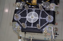
    Recently released views of the next two Galileo satellites in the European Space Agency’s testing lab, along with dual-launch rumblings from the U.S. Air Force and Lockheed Martin, occasion this story about two birds with one drone. That is, an unmanned autonomous vehicle bound for the exosphere. The rest of the GNSS world is on board with this topic; isn’t it about time GPS caught up?

    The first two Galileo Full Operational Capability (FOC) satellites will launch as a pair, earlier advertised as a September blast, now possibly delayed until December; a second dynamic duo will follow sometime thereafter. Then two again, and two, and two, until the Ariane 5 rocket launches four at once. Four!

    The latest official U.S. Air Force plans say that by the ninth GPS III satellite (SV-09), the program plans to initiate programmatic and hardware changes to allow for the first-ever GPS dual launch. The motive, of course, is cost savings. The GPS program (probably) has no need to hurry, as other GNSSes do, in order to have a full constellation operative broadcasting — previous predictions about constellation gaps notwithstanding.

    Even with dual launch, according to Lockheed Martin Navigation Systems vice president Keoki Jackson (and here I am drawing from Don Jewell’s Space Symposium column), from SV-09 forward the savings will only amount to about $70 million per launch, because it will require a larger launch vehicle.

    Only $70 million. Well, to quote Senator Everett Dirksen, adjusting for inflation, “$70 million here, $70 million there, pretty soon, you’re talking real money.”

    Take this all in the context of GPS III having reached the point that it will cost nearly $450 million to place a single GPS space vehicle and payload in orbit.

    Rising costs and the possibility to combat them with dual launches constitute at least one of the driving forces behind the NavSat or NibbleSat drawing-board concept: a small GPS satellite, without the burden of other non-nav payloads.

    Coincidentally, an initiative underway seeks to evaluate “new launch entrants,” according to General Willie Shelton, commander, Air Force Space Command. “If a new entrant can come in and provide a cost-effective launch capability for several launches, then we will look seriously at them as well,” he told Don Jewell in an interview nearly a year ago.

    Jewell: “Why don’t we move into the arena of trying to pin down a vehicle or set of vehicles for dual launch? You and I once discussed GPS III vehicles 7-8 for that honor, and you mentioned at the time that it was a moving target. Where do we stand today?

    General Shelton: Don, I think we are now probably talking about GPS III vehicles 9-10.  We are still in the  study phase on this issue with Lockheed Martin and United Launch Alliance. We are still trying to figure out how we would do dual launch and what kind of capabilities we need to develop. I think this is really the wave of the future…being able to put two up simultaneously will save us a lot in launch costs.”

    In April of this year, John Frye, Lockheed Martin’s GPS III capability and affordability insertion manager, reiterated, in comments regarding the Delta Preliminary Design Review (dPDR) for the GPS III satellite, “The design modifications from this dPDR address ways to further reduce Air Force launch costs by $50 million per satellite through dual launch of two GPS III space vehicles on a single booster. This successful dPDR milestone sets the stage to proceed with SV09 design maturation.”

    Rockets. Recently,  the U.S. Air Force Space and Missile Systems Center (SMC) signed a Cooperative Research and Development Agreement (CRADA) with Space Exploration Technologies Corp., better known as SpaceX, as part of the company’s effort to certify its Falcon 9 v1.1 launch system for National Security Space (NSS) missions.

    SMC and SpaceX will look at the Falcon’s flight history, vehicle design, reliability, safety systems, and other aspects. Once the evaluation is complete, the SMC commander will determine whether SpaceX has the capability to successfully launch NSS missions using the Falcon 9 v1.1.

    Currently, United Launch Alliance’s Delta IV and Atlas V are the only certified launch vehicles capable of lifting NSS payloads — such as the GPS satellites — into orbit.

    The Falcon CRADA may be a preliminary, tentative move towards dual-launch capability.  Consider:

    An earlier iteration, Falcon 9, can reportedly lift payloads of 4,850 kilograms (10,700 lb) to geostationary transfer orbit (GTO). The Falcon 9 v1.1— subject of the CRADA and scheduled for first flight in mid-2013—will use a longer first stage powered by nine Merlin 1D engines arranged in an octagonal pattern. Development testing of the v1.1 Falcon 9 first stage was just completed in June. These improvements will increase the payload capability by nearly 50 percent. The new first stage can also be used as side boosters on Falcon Heavy, which reportedly will have a capability of lifting 12,000 kg (26,000 lb) to GTO.

    According to an Air Force fact sheet, the GPS III satellite has a launch weight of 8,115 lb.

    The Atlas V 401 rocket, most recently used to launch the GPS IIF-4 satellite in May, has a GTO launch capability of 4,750 kg. (10,472 lb.)  A steroid version of the Delta IV, the Delta IV Heavy, has a GTO launch capability of 13,130 kg (28,950 lb), more than any other currently available launch vehicle. It also carries a more substantial price tag.

    To sum up these various vectors pointing largely in the same direction, GPS has a potential in the somewhat near-mid distant future of going to dual launch.

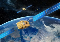
    Meanwhile, this has been fait accompli for the other GNSSes.

    Galileo

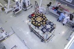
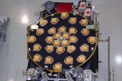
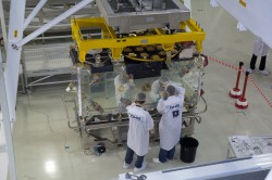
    The first two in-orbit validation (IOV) satellites built by Astrium traveled aloft together in October 2011, as did the third and fourth IOV satellites in October 2012.

    According Paul Flament, European Commission Programme Manager and Head of the EU Satellite Navigation Programme Unit, in an interview earlier this year with GPS World, “Satellites 5 and 6 will be launched in September of this year, aboard a Soyuz launcher from Kourou, and numbers 7 and 8 will follow in December.” These launches may since have been re-adjusted to later dates, respectively.

    “Then, in 2013 we will see three Soyuz launches of two satellites each. We do not have the precise launch dates yet, but they are likely to be in April, June, and September. In December 2014, we expect to have the first launch using the Ariane 5 launcher, which is capable of deploying four satellites in one go. This means that by the end of 2014 Galileo will have deployed 18 satellites in orbit.

    “In 2015, there will be two Ariane 5 launches, one in the middle of the year, one at the end, each carrying four satellites.”

    GLONASS

    Within days, perhaps, three GLONASS-M satellites will blast off together from Baikonur: GLONASS 48, 49, 50. This is only the latest of GLONASS triple launches.

    As Richard Langley is my witness, the Russians accomplished a GLONASS hat-trick as long ago as September 1986!  The first in a more recent series of triplets, in December 2010, failed rather spectacularly and cost Russia an estimate 5 billion roubles ($160 million), setting back GLONASS by six months. The system has since intermingled single- and triple-satellite launches.

    Compass

    China has demonstrated success with two dual launches of mid-Earth orbit satellites, among its constellation lodged at varied heights. Compass-M3 and Compass-M4 rose together in April 2012, as did M5 and M6 in September of that year.


  • ESA Unveils ‘New Breed’ of Galileo Satellite

    ESA Unveils ‘New Breed’ of Galileo Satellite

    The European Space Agency (ESA) has released a series of photos providing the first detailed views of the next batch of Galileo satellites, the first of which has already been delivered to ESA for rigorous testing in simulated space conditions. Scroll down to see the photos.

    The first Galileo Full Operational Capability (FOC) satellite was delivered to ESA’s ESTEC technical centre in Noordwijk, the Netherlands, on May 15. It is being prepared for testing in the ESTEC Test Centre, a unique facility for Europe with all the facilities needed to validate a satellite for launch under one roof.

    This initial FOC satellite is functionally identical to the first four Galileo In-Orbit Validation satellites already in orbit, the operational nucleus of the full Galileo constellation, but has been built by a separate industrial team.

    Like all the other 21 FOC satellites so far procured by ESA, the satellite’s prime contractor is OHB in Bremen, Germany, and the navigation payload was produced by Surrey Satellite Technology Ltd. in Guildford, UK. The photos shown here were taken at OHB.

    The satellite is approximately the size and shape of an old-fashioned telephone booth, dominated by its circular L-band antenna that will continuously broadcast navigation messages down to Earth.

    The smaller, hexagonal antenna beside it will perform a no less vital task — picking up emergency messages from vessels in distress to relay to search and rescue authorities, contributing to the international Cospas–Sarsat system.

    A second Galileo FOC satellite is due to join its predecessor at ESTEC later this summer, preparing for a launch scheduled for later this year.

  • A New MobileGIS Workflow: Trimble Goes Device-Agnostic

    Earlier this week, I stepped outside of the box I’ve resided in for many years when I wrote a GPS World article about a specific product. It was unusual because for the more than seven years I’ve been writing for GPS World, I’ve never written specifically about a certain product. No, I’m not caving into advertiser (or potential advertiser) pressure or influence. I don’t play that game.  I’ve chosen to write about specific products or services when I feel they represent significant industry changes.

    Now, for Geospatial Solutions this week, I’m in the same predicament. So, for the second time in a week, I’m stepping outside of my box.

    Since its incorporation, Trimble Navigation’s name has been synonymous with GPS devices. Its mission, at least to me, was to build GPS receivers and software solutions to sell its GPS receivers. Historically, the company has made it difficult for other companies to utilize their technology. I recall back in the 1990s when I was in charge of GPS mapping hardware/software for one of Trimble’s competitors. Trimble submeter GPS base stations blanketed the U.S. (and many parts of the world) and the company kept the data in the proprietary SSF format so that none of its competitors could use its base-station data. Trimble’s GPS/GIS ecosystem was closed to their competitors and their market share for GPS mapping devices (such as GeoExplorer or GeoXT/XH) dominated the GPS/GIS mapping industry. Trimble’s distribution channel thrived, which further contributed to its market dominance.

    For a long time, the device-centric marketing strategy worked well for Trimble employees and shareholders. However, every party must come to an end, and this case is no exception.

    In Trimble’s latest financial release (April 30, 2013), the company reported that GIS revenues declined in its third quarter and that “Non-GAAP operating margin was down primarily due to product mix in GIS sales.”

    The days of high-end GNSS receivers dominating the GIS data-collection market are coming to an end. Yes, there will be some innovative new features like inertial positioning, MEMS and other positioning technologies that will allow manufacturers to command a higher price, but the cost of mainstream, high-precision GNSS devices is declining and will continue to decline. Furthermore, tablets and mobile phones muddy the waters as they are increasingly more powerful devices that can run powerful data-collection software.

    What is Trimble doing about this?

    This week, the company introduced the Trimble TerraFlex software ecosystem.

    I saw a sneak preview of the concept a couple of months ago. When I saw it, I knew it was a paradigm shift from the classic Trimble device-centric ecosystem to a device-agnostic, workflow-centric ecosystem.

    Translated: You can use any mobile device and/or GPS receiver of your choosing within Trimble’s TerraFlex ecosystem.

    Perhaps the coolest feature of the software is that you can run it on an Apple (iOS 5 or later), Android (4.x or later), or Windows Mobile (6.5 or later) device. In these days of BYOD (Bring Your Own Device) to work, that’s a powerful feature. Support for Windows Phone devices is missing, but that’s understandable because of the lack of traction for those devices to this point.

    TerraFlex_4-handhelds_option-2
    TerraFlex supports iOS (5 or later), Android (4.x or later), and Windows Mobile (6.5 or later)

    Of course, it’s still an ecosystem, so although the mobile apps are free, you must subscribe to Trimble’s cloud service ($250/year per user), much like using the free ArcGIS for Android/iOS/WindowsMobile apps requires an Esri cloud subscription. However, at $21/month it’s very affordable and flexible. Use any GPS/GNSS receiver you like and use the mobile device you are comfortable with.

    With the desktop software, you can build the data-collection form for the mobile device, complete with attributing.

    TerraFlex-Cloud_template editor
    TerraFlex Form Editor for designing mobile device data-collection forms

    In speaking with the Trimble marketing folks about the ecosystem, their intent is not only to reach the traditional people involved in GIS data collection, but also those who aren’t, such as a city public works crew, a utility worker, a construction worker or others who are already comfortable with the mobile device they carry. Will it work? Perhaps, but it will take someone at the enterprise level to assume the lead in designing the forms. Either way, it’s probably got the best potential to reach the non-GIS market that I’ve seen so far.

    However, building a better mousetrap doesn’t always work. In 1960, Jerome McCarthy published Basic Marketing: A Managerial Approach, which discussed the four Ps of marketing: product, price, promotion, place (distribution). With geospatial technologies, especially geospatial hardware, place (distribution) has played an important role. In fact, dealer support can make or break a new product or deny a company access to the market. In thinking about Trimble, its mapping and GIS division (in its various forms) has built a strong dealer network over the past 20+ years, and salespeople in its distribution channel have been selling device-centric products since the beginning. This is going to be a serious issue in promoting Trimble’s TerraFlex software. Trimble dealer salespeople are accustomed to selling hardware, not services. Furthermore, Trimble dealers are accustomed to receiving 20 percent margin on GPS receivers that sell for thousands of dollars, and sales of those devices has been pretty easy due to Trimble’s market dominance. That won’t be the case with TerraFlex. It’s a new concept that will require the salesperson to sell the concept, not a device that one can hold in one’s hand. How seriously will salespeople promote a service that sells for $250/year per device? How can one convince and transform a dealer salesforce from being device-centric to workflow-centric? That task may be more difficult to accomplish than the effort it took to design and write the TerraFlex software.

    Thanks, and see you next time.

    Follow me on Twitter at https://twitter.com/GPSGIS_Eric


    Webinar This Thursday

    Nightmare on GIS Street: GNSS Accuracy, Datums and Geospatial Data

    Date: Thursday, June 20, 2013
    Time: 10 a.m. PDT / 1 p.m. EDT / 6 p.m. GMT

    Summary: A look at the challenge of dealing with horizontal datums in your GIS. We are moving into a new era in dealing with datum transformations. Geodata 2.0 is coming, and it can create big headaches when attempting to combine disparate geospatial databases. Sensors such as GPS receivers, remote sensing imagery, and 3D scanning provide much more accurate data, setting up a collision with outdated and mismatched legacy horizontal datums.

    Speakers:

    Kevin_M_Kelly_headshotKevin Kelly, Geodesist, ESRI, Inc.
    Kevin Kelly is a Geodesist with ESRI in Redlands, California where he researches and implements geodetic algorithms and applications for the ArcGIS software. His experience spans over 35 years in hydrography, geodesy, surveying and most recently, geographic information systems. He has held the posts of Manager of Geodetic Services for the Province of Ontario, Chief Geodesist for the Kingdom of Saudi Arabia’s Military Survey Department and Senior Project Surveyor for The Keith Companies (now Stantec, Inc.). Mr. Kelly received a Master of Applied Science in Geodesy at the University of Toronto, Canada and holds an Honors Diploma in Hydrographic Surveying Technology from Humber College in Toronto. He is also a licensed Geodetic Surveyor in the Province of Ontario, Canada.
    Craig Greenwald

    Craig Greenwald, Technical Director, GeoMobile Innovations
    Craig Greenwald is the Technical Director and a principal at GeoMobile Innovations Inc. He has worked in the GPS and Mobile GIS industry for over 13 years, including seven years for GIS software leader, ESRI and is well known for his work on the ESRI ArcPad team. Craig leads the GeoMobile software development and consulting team specializing in Mobile GIS and field data collection applications and technology providing Mobile GIS software, consulting, and training services to GeoMobile Innovations? clients. Craig has real world experience designing, implementing, and consulting on all sizes of projects, ranging from local campground trash mapping to the U.S. national census, and has been a key developer in GeoMobile?s commercial applications such as LaserGIS for ArcPad and Geo-Photo Inventory Tool for Garmin GPS solutions.

    Michael L. DennisMichael L. Dennis, RLS, PE, Geodesist, NOAA
    Michael L. Dennis, RLS, PE, is a geodesist at NOAA’s National Geodetic Survey (NGS) where his duties include analysis of geometric (“horizontal”) and vertical datums; evaluation of data processing and survey network adjustment procedures; development and promotion of standards and guidelines; integration of NGS products and services with GIS; and public outreach. Mr. Dennis is also a registered professional engineer and surveyor with private sector experience, including ownership of a consulting and surveying firm. Mr. Dennis is an officer of the American Association for Geodetic Surveying (AAGS), an American Congress on Surveying and Mapping (ACSM) Fellow, and a member of the Arizona Professional Land Surveyors Association and the Geomatics Division of the American Society of Civil Engineers.

    Moderator:

    Eric GakstatterEric Gakstatter, Editor of Geospatial Solutions Monthly and Survey Scene
    Eric Gakstatter has been involved in the GPS/GNSS industry for more than 20 years. For 10 years, he held several product management positions in the GPS/GNSS industry, managing the development of several medium- and high-precision GNSS products along with associated data-collection and post-processing software.

    REGISTER TODAY!

  • Tallysman Wireless Wideband Dual-Feed GPS L1/GLONASS/ Galileo Antennas

    Press-Release-Tallysman-TW4421_TW1421-W
    Photo: Tallysman

    Tallysman Wireless announces the TW4421 and TW1421 antennas, which offer a step forward in performance for small GNSS antennas, the company said.

    The TW4421 is a low-cost dual-feed magnetic mount antenna covering the GPS L1, GLONASS L1, Galileo and SBAS (WAAS, EGNOS & MSAS) frequency band (1574 to 1606 MHz). The TW4421 features a 25-millimeter dual-feed wideband patch element that provides excellent multipath rejection with a more linear carrier phase response, by virtue of a low axial ratio across the full frequency bandwidth, Tallysman said. It is especially suitable for high accuracy applications, and also offers high out-of-band signal rejection.

    The TW4421 is housed in a compact IP67 magnetic mount enclosure and is available with a wide range of connector options.

    The TW1421 embedded antenna is lightweight (30 gm) and features a very small footprint (35 mm diameter x 7.25 mm). The TW1421 is suited for use in applications where performance and small size are of paramount importance, such as extreme-sport-wearable tracking devices and UAVs.

    “Most small low-cost GPS/GLONASS/Galileo antennas are narrow-band devices with an elliptically polarized response at the GPS and GLONASS frequencies,” said Gyles Panther CEO of Tallysman Wireless. “The TW4421/1421 antennas feature a 40-percent wider bandwidth patch, with a dual-feed structure, which provides unparalleled multipath rejection previously only available in much larger, more expensive antennas.”

  • Trimble Announces TerraFlex Software, Cloud Services for GIS

    TerraFlex1

    Trimble has introduced TerraFlex, a new software and services platform to manage data collection activities for everyday geospatial projects. Trimble TerraFlex helps managers maintain control of the flow of geo-enabled field data, the company said.

    According to the announcement, two essential components comprise the TerraFlex platform — cloud services and a mobile app. With an online data repository and streamlined toolset for creating custom form templates, TerraFlex Cloud services provide managers and team leaders with a centralized system to configure and manage the data collection process. In the field, the TerraFlex Mobile app provides a common interface for users of a range of common mobile and smart devices. The result is more flexibility in the field and streamlined integration of data into the office environment.

    Trimble reports that regardless of the type of mobile device preferred — iOS, Android or Windows Mobile — the TerraFlex interface provides a consistent experience. For dedicated data collection activities, a user can choose a professional field device such as a Trimble Juno GPS handheld. For ad-hoc fieldwork, the user can also use a standard smartphone to access the same flexible form templates. Managers responsible for integrating field data can now be confident that all users, regardless of field hardware platform are following trusted field workflows.

    TerraFlex-Cloud_template editor

    With the evolution of smartphones, more field workers now have access to basic positioning technologies and can contribute to the geospatial initiative. Trimble TerraFlex provides an intuitive interface for capturing data in the field, standardizing workflows and streamlining integration of data with the office.

    “With Trimble TerraFlex, organizations can deploy a common workflow to collect or inspect their assets,” said Daniel Wallace, general manager of Trimble’s GIS Data Collection Division. “Designed for simplicity in a mobile environment, Trimble TerraFlex can enable a new generation of field workers to contribute to geospatial initiatives.”

    Regardless of whether mobile workers are using Trimble devices or smartphones, virtually everyone can be both a producer and consumer of geospatial data. With minimal or no training required for field crews, managers and project leaders can get diverse teams working together fast. All field data is captured via the cloud for integration into a GIS, database or mapping application.

    Trimble TerraFlex is available online now. The Mobile apps are available in Apple’s App Store and Google’s Play store. TerraFlex is also available through Trimble’s authorized GIS and Survey distribution channels. To learn more about Trimble TerraFlex and register for a free 30-day trial of the system, visit www.trimble-terraflex.com.

  • GPS CNAV Civil Capabilities Now Being Tested

    CNAV-logoU.S. Air Force Space Command is now testing CNAV capabilities on the GPS L2 and L5 signals. The initial CNAV Live-Sky Broadcast began June 15 and will take place until June 29. Civil users and manufacturers are invited to participate.
    The GPS Directorate (SMC/GP) is implementing the CNAV (Civil Navigation) Test Program, conducting Live-Sky CNAV testing before deployment of the Next Generation Operational Control System (OCX). CNAV is a capability to be provided by Civil Navigation message types for the purpose of improved GPS navigation through the use of signals L2C and L5.

    According to the GPS Directorate, the CNAV Live-Sky testing program will span several years and will evolve to support GPS enterprise and modernized civil navigation performance objectives. Objectives include:

    1. Verify and validate the CNAV requirements specified IS-GPS-200F and IS-GPS-705B.
    2. Facilitate the development of robust IS-compliant L2C and L5 civil receivers.

    Below is the latest Notice Advisory about the upcoming test issued to NAVSTAR users. More information can be found in the NAVCEN test plan PDF.


    NOTICE ADVISORY TO NAVSTAR USERS (NANU) 2013034 NANU TYPE: GENERAL

    *** GENERAL MESSAGE TO ALL GPS USERS ***

    The purpose of this notification is to inform users of an upcoming event related to the GPS satellite constellation.  Air Force Space Command will be
    testing CNAV capabilities on the GPS L2C and L5 signals on Jdays 2013/166-2013/182.  There are no planned GPS satellite outages or degradations for this activity. L2C and L5 CNAV message testing should be transparent to GPS receivers that do not process L2C or L5 CNAV.  These test events will provide an opportunity for civil users and manufacturers to participate in L2C and L5 evaluation. Details on the test plan are located at the NAVCEN web page. Any military or civil users who encounter user equipment problems during or after testing should contact the applicable POCs identified below as soon as possible.  Aviation users should file reports consistent with FAA-approved procedures. Users are cautioned that L2C and L5 signals are not operational.

    *** GENERAL MESSAGE TO ALL GPS USERS ***

    POC: CIVILIAN – NAVCEN AT 703-313-5900, HTTP://WWW.NAVCEN.USCG.GOV
    MILITARY – GPS OPERATIONS CENTER at
    HTTPS://GPS.AFSPC.AF.MIL/GPSOC, DSN 560-2541,
    COMM 719-567-2541, [email protected],
    HTTPS://GPS.AFSPC.AF.MIL
    MILITARY ALTERNATE – JOINT SPACE OPERATIONS CENTER, DSN    276-3514,
    COMM 805-606-3514, [email protected]


  • SMC Investigates New Potential GPS Satellite Launch Option

    The U.S. Air Force Space and Missile Systems Center has signed a Cooperative Research and Development Agreement (CRADA) with Space Exploration Technologies Corp., better known as SpaceX, as part of the company’s effort to certify its Falcon 9 v1.1 Launch System for National Security Space (NSS) missions. This cooperative agreement facilitates data exchanges and protects proprietary and export-controlled data. The CRADA will be in effect until all certification activities are complete.

    A CRADA enables the Air Force to evaluate the Falcon 9 v1.1 launch system according to the Air Force’s New Entrant Certification Guide (NECG).  As part of the evaluation, SMC and SpaceX will look at the Falcon 9 v1.1’s flight history, vehicle design, reliability, process maturity, safety systems, manufacturing and operations, systems engineering, risk management and launch facilities.

    SMC will monitor at least three certification flights to meet the flight history requirements outlined in the NECG. Once the evaluation process is complete, the SMC commander will make the final determination whether SpaceX has the capability to successfully launch NSS missions using the Falcon 9 v1.1.  SMC anticipates entering into additional CRADAs with SpaceX to evaluate its Falcon Heavy rocket and with Orbital Sciences for its Antares launch vehicle.

    “Certifying Evolved Expendable Launch Vehicle’s for new entrants is in keeping with the Air Force strategic intent  to promote the viability of multiple domestic EELV-class launch providers as soon as feasible,” said Col. William  Hodgkiss, Launch Systems director.

    Currently, United Launch Alliance’s Delta IV and Atlas V are the only certified launch vehicles capable of lifting NSS payloads — such as the GPS satellites — into orbit. The addition of multiple certified launch vehicle providers bolsters assured access to space by providing more options for the warfighter to place needed capabilities on orbit.  While certification does not guarantee a contract award, it does enable a company to compete for launch contracts. Those contracts could be awarded as early as Fiscal Year 2015 with launch services provided as early as Fiscal Year 2017.

  • Leica Infinity Software Released for Nova MS50 Multistation

    A new office software program, Leica Infinity, has been launched by Leica Geosystems for easy management, visualization, processing and georeferencing of combined total station, imaging and scanning data from the Leica Nova MS50 MultiStation. Part of an extensive portfolio of software that completes the Leica Nova solution, Leica Infinity provides users with custom deliverables and helps them make informed decisions, Leica said.

    With a simple user interface, optimized data organization and dynamic data visualization, Leica Infinity gives a project overview and ensures streamlined workflows, Leica said, Scan data can be inspected, cleaned up automatically to remove outliers and re-calculated together with the total station setups. Multiple scans can be combined for the creation of information-rich surfaces.

    The instant access to raw data at all times allows users to combine and cross-check scans against processed or archived data and survey results with only a couple of clicks in order to make the right decisions. Leica Infinity offers all the tools to document and report on individual steps and final results before data can be exported for further processing to a broad choice of CAD software packages.

  • Air Force Video Explains GPS Role in Daily Life

    All of us in the GPS industry know someone who only thinks of GPS as a feature of their smartphone. You might direct them to a new YouTube video presented by the U.S. Air Force, which summarizes the worldwide role of GPS. It also touches on the GPS modernization program and new signals.

    The seven-minute video explains in simple terms how important GPS has become to everyday life — for aircraft and ship navigation, global financial transactions, precision agriculture, weather forecasting, disaster relief, and, of course, smartphones.

  • Lockheed Martin Completes Functional Testing of GPS III Electronic Systems

    A Lockheed Martin-led industry team has completed successful functional integration tests of the spacecraft bus and network communications equipment on the first satellite of the next generation Global Positioning System, known as GPS III.

    The recent testing of GPS III space vehicle 1 (SV 1) bus — the portion of the space vehicle that carries mission payloads and hosts them in orbit — assured that all bus subsystems are functioning normally and ready for final integration with the satellite’s navigation payload. Systems tested included: guidance, navigation and control; command and data handling; on-board computer and flight software; environmental controls; and electrical power regulation. The SV 1 satellite’s network communication equipment subsystem that interfaces with the ground control segment and distributes data throughout the space vehicle also passed all tests as expected.

    This milestone follows February’s successful initial power-on of SV 1, which demonstrated the electrical-mechanical integration, validated the satellite’s interfaces, and led the way for functional and hardware-software integration testing.

    “The successful completion of the SV 1 bus functional check out validates that the spacecraft is now ready to begin the next sequence of payload integration and environmental testing, prior to delivery,” explained Keoki Jackson, vice president of Lockheed Martin’s Navigation Systems mission area.

    GPS III SV 1’s navigation payload, which is being produced by ITT Exelis, will be delivered to Lockheed Martin’s GPS Processing Facility (GPF) near Denver later in 2013. The hosted nuclear detection system payload has already been delivered and mechanically integrated. The satellite remains on schedule for flight-ready delivery to the U.S. Air Force in 2014.

    GPS III is a critically important program for the Air Force, affordably replacing aging GPS satellites in orbit, while improving capability to meet the evolving demands of military, commercial and civilian users. GPS III satellites will deliver three times better accuracy and — to outpace growing global threats that could disrupt GPS service — up to eight times improved anti-jamming signal power for additional resiliency. The GPS III will also include enhancements adding to the spacecraft’s design life and a new civil signal designed to be interoperable with international global navigation satellite systems.

    The U.S. Air Force has produced a video about the GPS satellite modernization program:

    Lockheed Martin is under contract for production of the first four GPS III satellites (SV 1-4), and has received advanced procurement funding for long-lead components for the fifth, sixth, seventh and eighth satellites (SV 5-8).

    The GPS III team is led by the Global Positioning Systems Directorate at the U.S. Air Force Space and Missile Systems Center. Lockheed Martin is the GPS III prime contractor with teammates ITT Exelis, General Dynamics, Infinity Systems Engineering, Honeywell, ATK and other subcontractors. Air Force Space Command’s 2nd Space Operations Squadron (2SOPS), based at Schriever Air Force Base, Colo., manages and operates the GPS constellation for both civil and military users.

    Headquartered in Bethesda, Maryland, Lockheed Martin is a global security and aerospace company that employs about 118,000 people worldwide and is principally engaged in the research, design, development, manufacture, integration, and sustainment of advanced technology systems, products, and services. The corporation’s net sales for 2012 were $47.2 billion.

  • MicroSurvey Releases Software for Leica Nova MS50

    MicroSurvey, the maker of MicroSurvey CAD and the MapScenes System, announces the release of three new software versions optimized to make full use of datasets from the new Leica Nova MS50 MultiStation. MicroSurvey CAD Ultimate 2013, MicroSurvey CAD Studio 2013 and MapScenes PointCloud 2013 provide complete point cloud and Leica Nova MS 50 support in an intuitive interface that allows users to quickly and easily integrate 3D point cloud data into their workflows, the company said.

    MicroSurvey CAD Ultimate 2013, a complete desktop survey and design software solution for surveyors, contractors and engineers, provides a field-to-finish CAD survey solution with the Leica Nova MS50 MultiStation. Users can import datasets from the Leica Nova MS50 complete with all TPS measurements, pictures, points and scan data. For users who need to enhance their data visualizations with fly-through movies and animations, MicroSurvey CAD Studio 2103 includes all the functionality of MicroSurvey CAD Ultimate plus a powerful animation module capable of creating movies.

    MapScenes 2013, a powerful drafting, point cloud data visualization and animation tool for forensic investigators, accident scene reconstructionists and other public safety professionals, now includes the ability to take advantage of the rich 3D datasets captured by the Leica Nova MS50 MultiStation, MicroSurvey said. MapScenes 2013 lets the user quickly and easily draw in the point cloud view for extremely fast, accurate linework as well as use the scan data from the Leica Nova MS50 in animations for accurate and compelling reconstructions.

    MicroSurvey CAD Ultimate 2013, MicroSurvey CAD Studio 2103 and MapScenes 2013 are available as optional software packages with the Leica Nova MS50 MultiStation. For more information, visit www.microsurvey.com or www.mapscenes.com.