Category: GNSS

  • First Galileo FOC Satellite Heads to Testing

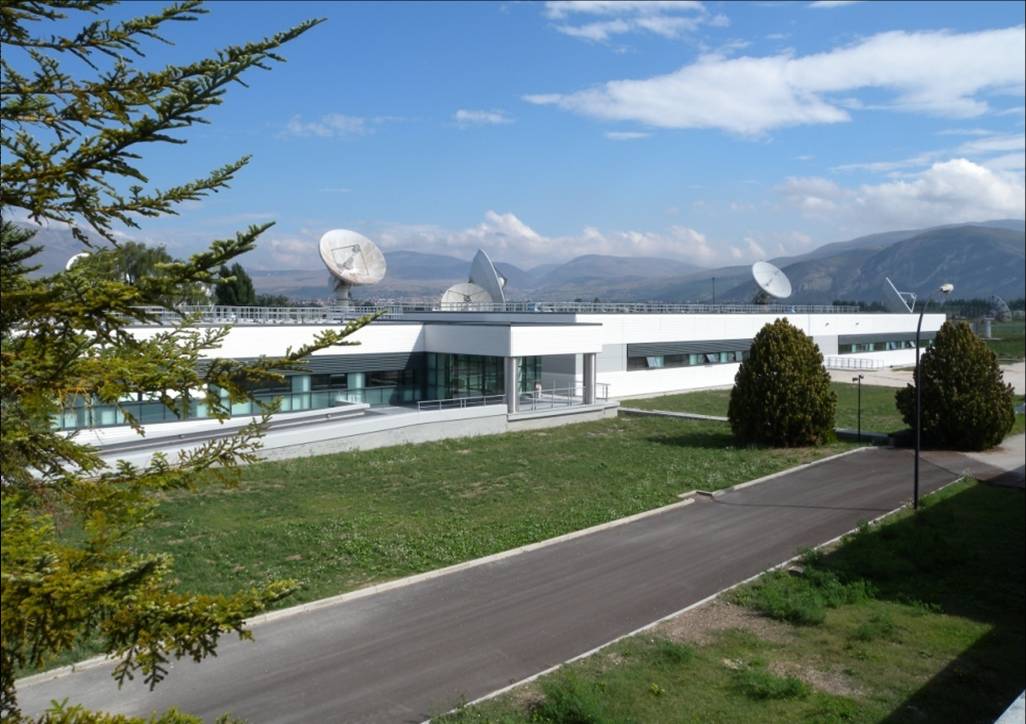
    In the early hours of May 15, Galileo’s first full operational capability (FOC) satellite left the manufacturer’s integration hall in Bremen, Germany. The satellite, assembled by OHB System AG, is now headed for Noordwijk in the Netherlands, where it will undergo an environmental testing campaign and further system testing at the ESTEC’s Test Center on the premises of the European Space Agency (ESA).

    Before the satellite was shipped, it had successfully completed integration and system testing, according to OHB System.

    Photo credit: OHB System AG.
    The first Galileo FOC satellite. (Photo credit: OHB System AG.)

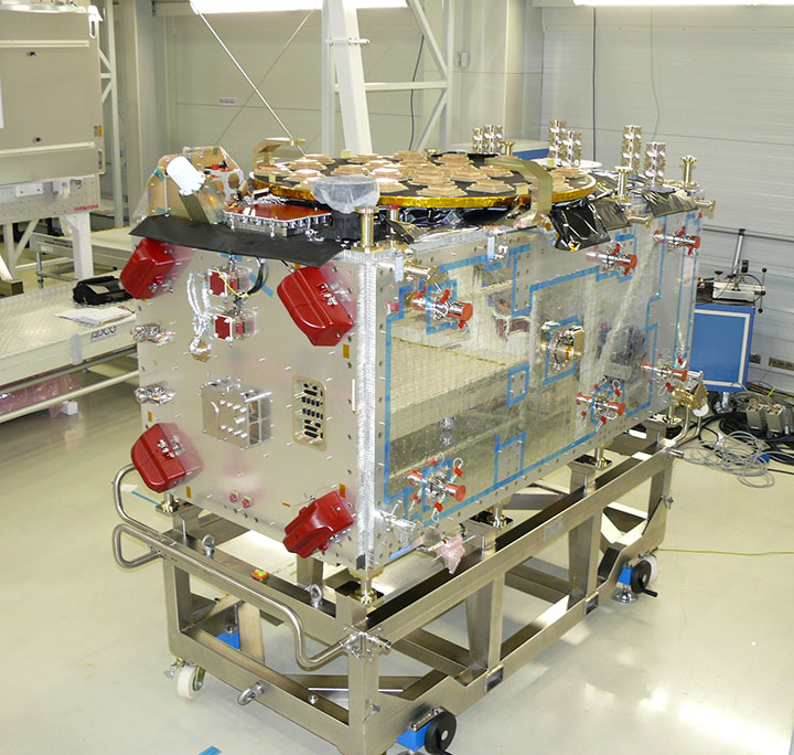
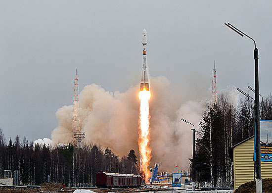
    Its twin FOC satellite is in the final phase of completion at OHB System. Over the next few weeks, it will also be integrated and tested, after which it will be shipped to Noordwijk. The two satellites are to be placed in orbit on board a Soyuz launcher, which will is planned to lift off from Kourou in French Guyana this fall.

    These two satellites are the first of a series of 22 Galileo FOC satellites manufactured by OHB System and its industrial partners. The FOC phase of the Galileo program is managed and funded by the European Union. The European Commission and ESA have signed a delegation agreement by which ESA acts as design and procurement agent on behalf of the commission.

    At ESA’s test center, thermal vacuum testing will simulate the temperature extremes the satellites must endure in the airlessness of space throughout their 12-year working lifetimes. Without any moderating atmosphere, temperatures can shift hundreds of degrees from sunlight to shadow.

    Other activities on the schedule include shaker and acoustic noise testing — simulating the vibration and noise of launch — as well as electromagnetic compatibility and antenna testing, placing the satellite in chambers shielded from all external radio signals to reproduce infinite space and check that its various antennas and electrical systems are interoperable without harmful interference.

    Each satellite will offer the full range of Galileo positioning, navigation and timing services, plus search and rescue message relays, their accuracy ensured by on-board atomic clocks kept synchronized by a worldwide ground network.

    “The Galileo FOC satellites provide the same capabilities as the previous IOV satellites, but with improved performance, such as higher transmit power,” explained Giuliano Gatti, head of the Galileo Space Segment Procurement Office. “They are to all intents a new design that requires a full checkout before getting the green light for launch. By fully validating this satellite, the second flight model due to follow it here at beginning of June, and the third one due to arrive in ESTEC at middle of July, we gain full knowledge of their characteristics, and the further satellites in the series will require less rigorous functional testing.”

  • Maiden EGNOS Flight Trials Prove Successful in Eastern Europe

    Maiden flight trials have been successfully conducted in Moldova using GMV’s magicSBAS solution. These trials form part of a GMV-led European Commission FP7 collaboration project.

    In 2011 the European GNSS Agency (GSA) awarded GMV the EEGS2 project (EGNOS Extension to Eastern Europe). The main objective of the project is to demonstrate through flight trials the benefits of the European Geostationary Navigation Overlay Service (EGNOS) in areas of Eastern Europe where it is not yet available, such as Poland, Romania, Ukraine, Moldova and Russia, and to prepare the civil aviation authorities and air navigation service providers for future use of the system.

    In the context of this project, after the tests conducted in Spain, the maiden flights have been successfully carried out in Moldova, using the equipment and tools developed by GMV. The Moldova demonstrations have given pilots and service providers a clear idea of the potential benefits of EGNOS and the flying procedures of the near future, GMV said.

    Four flights had previously been conducted in Spain in November, December and February. The satisfactory results of these flights then paved the way for the demonstrations in Moldova.

    The magicLPV system, developed under this project, enables LPV approaches (localizer performance with vertical guidance) to be carried out using the signal generated by the magicSBAS application. This test environment allows any region of the world to analyze the air-navigation benefits to be obtained with deployment of a Space Based Augmentation System (SBAS). This signal is read by Internet and transmitted by radio frequency in the vicinity of the airport, allowing LPV approaches to be made in places where SBAS is either completely unavailable or available only on a very limited basis.

    Eight flights in all were carried out in various Moldovan airports, including Chișinău International Airport. Test results were highly satisfactory, demonstrating the simplicity of equipment configuration and operation, and the performance of the magicSBAS signal, GMV said.

    “These trials are an important milestone for GMV, for the project and, fundamentally, for the use of EGNOS in the countries of Eastern Europe in the near future,” said Miguel Romay, executive director of GNSS–Aerospace.

    GMV will continue with these demonstrations in other countries of Eastern Europe. The next trip in two weeks will be to Romania, where new flights are expected to be just as successful.


  • ComNav Offers GPS+BeiDou Board

    The K501 GNSS OEM board by ComNav is a GPS+BeiDou small-sized OEM board. K501 has advanced dynamic acquisition ability and high-accuracy carrier phase calculating. By using the GPS+BeiDou dual system high-dynamic processing engine, work in difficult environments is easier and RTK positioning accuracy can reach the centimeter level. The hardware size, interface, and data command are compatible with major brand OEM boards.

    201342815202868161
    The K501 GNSS OEM board by ComNav

    Features include:

    • GPS L1/L2+BeiDou B1/B2 dual satellite system calculating
    • Configurable GPS/BeiDou single-system positioning and GPS+BeiDou dual-system positioning
    • Compatible with other major brands on physical size, interface and data command
    • Directly export PJK coordinate
    • Supports short, middle and long baseline, RTK working distance can reach 50 KM
    • Easy to customize, can satisfy different kinds of demands
    • Built-in 100M internal memory
  • ComNav BeiDou+GPS Receiver Provides Positioning in Antarctic

    China’s icebreaker Xuelong, or Snow Dragon, returned to Shanghai April 9 after successfully completing China’s 29th Antarctica scientific expedition. As a high-accuracy GNSS solutions provider, ComNav supplied a GPS+BeiDou GNSS receiver for this expedition. This was the first time that the ComNav GNSS receiver worked in such an extreme environment.

    The reliable performance of the receiver impressed the expedition team. “The fast-searching satellites speed and the accurate positioning result saved us lots of time in the extreme cold field,” said one team member. It was the first time that a BeiDou receiver was used in the Antarctic, according to ComNav.

    The research vessel left the southern port city of Guangzhou on November 5, 2012, for Antarctica. It covered 29,000 nautical miles over its 156-day southern voyage, among which 6,000 nautical miles were in ice regions. A total of 239 researchers on board completed 53 research tasks on biology, ecology, geophysics, ocean, climate, environment and glacier, and engineering construction missions.

  • GPS Block IIF-4 Launch Set for Today

    GPS Block IIF-4 Launch Set for Today

    News courtesy of CANSPACE Listerv.

    Update: The launch window for the liftoff has been adjusted slightly to  21:38-21:56 UTC.

    The United Launch Alliance (ULA) Atlas 5 rocket’s rollout to the pad  took place Tuesday. Weather forecasters have predicted an 80
    percent chance of favorable conditions for launch.

    Updates on the mission and live video coverage of the launch is available.

    Live video will also be available here and on this satellite feed (for those of you still with backyard dishes): SES 2, Transp. 21, C-band, 87° West

    ULA is also posting to Facebook and tweeting to Twitter at twitter.com/ulalaunch; look for the #GPSIIF-4 hashtag.


    The next GPS satellite launch is scheduled for May 15 with the launch window extending from 21:39 to 21:58 UTC. An Atlas 5 rocket will be used to place the satellite, GPS IIF-4, into orbit from Cape Canaveral Air Force Station.

    This is the first time in almost 28 years that an Atlas rocket will be used to launch a GPS satellite. All of the prototype or Block I satellites were orbited with Atlas rockets. Since then, Delta rockets have been used exclusively for GPS launches. The IIF satellites are being launched with a mixture of Atlas and Delta rockets.

    The IIF-4 satellite, also known as SVN66, will operate as PRN27. SVN66/PRN27 will eventually occupy the C-2 slot, replacing SVN33/PRN03, a Block IIA satellite launched in 1996. Reportedly, SVN66/PRN27 will go through an extended period of testing following launch, and is not expected to be set healthy until August. SVN33 will become a reserve or backup satellite.

    Ground Stations: ER = Eastern Range; BOSS = Call sign of New Hampshire   Station, New Boston Air Force Station, New Hampshire; LION = call sign   of Telemetry & Command Station, Royal Air Force Oakhanger, Hampshire,   U.K.; Diego Garcia = Diego Garcia Station (call sign REEF), British   Indian Ocean Territory; Guam = Guam Tracking Station (call sign GUAM),   Dededo, Guam. TDRS: Tracking and Data Relay Satellite MES1: Centaur first main engine start MECO1: Centaur first main engine cutoff MES2: Centaur second main engine start MECO2: Centaur second main engine cutoff At spacecraft separation, the GPS satellite's orbit will be circular   with a height of 11,047 nautical miles or 20,459 kilometers and an   inclination of 55 degrees.
    Ground Stations: ER = Eastern Range; BOSS = Call sign of New Hampshire Station, New Boston Air Force Station, New Hampshire; LION = call sign of Telemetry & Command Station, Royal Air Force Oakhanger, Hampshire, U.K.; Diego Garcia = Diego Garcia Station (call sign REEF), British Indian Ocean Territory; Guam = Guam Tracking Station (call sign GUAM), Dededo, Guam.
    TDRS: Tracking and Data Relay Satellite
    MES1: Centaur first main engine start
    MECO1: Centaur first main engine cutoff
    MES2: Centaur second main engine start
    MECO2: Centaur second main engine cutoff
    At spacecraft separation, the GPS satellite’s orbit will be circular with a height of 11,047 nautical miles or 20,459 kilometers and an inclination of 55 degrees.
    (Courtesy of SpaceFlight Now) This is the 45th Launch Support Squadron crew patch for the GPS 2F-4   mission, which is Boeing's Space Vehicle (SV) #5. Each SV is a named   for a navigation star and its constellation. SV-5 is named Vega, with   constellation Lyra. On the patch, they are the large star and   constellation in the background of space. The United Launch Alliance   Atlas 5 rocket is shown lifting the satellite from the Eastern Launch   Site at Cape Canaveral Air Force Station. The Squadron mascot is a   gator, and a lyra is a Greek harp. SSgt Thomas Hogan drew a   "Toga-Gator" and Lt Ken Stuart did the patch design.
    (Courtesy of SpaceFlight Now) This is the 45th Launch Support Squadron crew patch for the GPS 2F-4 mission, which is Boeing’s Space Vehicle (SV) #5. Each SV is a named for a navigation star and its constellation. SV-5 is named Vega, with constellation Lyra. On the patch, they are the large star and constellation in the background of space. The United Launch Alliance Atlas 5 rocket is shown lifting the satellite from the Eastern Launch Site at Cape Canaveral Air Force Station. The Squadron mascot is a gator, and a lyra is a Greek harp. SSgt Thomas Hogan drew a “Toga-Gator” and Lt Ken Stuart did the patch design.


  • ISGNSS 2013 Issues Call for Papers

    The International Symposium on GNSS 2013 (ISGNSS 2013) will be held in Istanbul from October 22 to 25 at Congress Center in Yildiz Technical University of Istanbul. It is being organized by Bulent Ecevit University of Zonguldak, Yildiz Technical University of Istanbul and Turkish Chamber of Survey and Cadastre Engineers. The symposium has been organized since 1999 by the International Program Committee of International Symposium on GPS/GNSS.

    The theme of ISGNSS 2013 is “Connecting Continents through GNSS where Europe and Asia Meet.” As for all the past symposiums on GNSS, this symposium will provide opportunities to connect scientists, researchers and professional all around the world, as Istanbul connects the continents.

    Organizers invite presenters to submit abstracts and papers until July 21. Paper topics include those listed below, or any other related topic.

    • GNSS Current Status, Organizational and Governance Issues
    • Regional Navigation Satellite Systems
    • Atmospheric Effects on GNSS
    • GNSS Augmentation Systems
    • GNSS-Related Remote Sensing and GIS
    • GNSS Policy, Services and Opportunities
    • CORS
    • Surveying, Mapping and Geodesy
    • Indoor Positioning
    • GNSS Receivers, Antenna, Algorithms and Products
    • Signal Processing, Interference, Multipath
    • Land applications and Intelligent Transport Systems
    • Aviation, Marine and Space Applications
    • Inertial Navigation
    • Sensor Networks
    • Precise Point Positioning
    • RTK and e-GNSS
    • LBS and Telematics
    • Alternatives and Backup to GNSS
    • Timing and Scientific Applications
    • Engineering applications
    • Multisensor Fusion
    • International GNSS Applications and Developments
    • Agriculture, Mining and Rural Industries
    • Consumer and Urban Applications
    • Machine Automation and Control

    For more information, email [email protected]

  • Expert Advice: The Challenge of BeiDou

    Mark Sampson
    Mark Sampson

    By Mark Sampson, Racelogic

    GNSS is changing. The days of only American GPS satellites providing signals to the civilian population are gone as new constellations are launched. GLONASS was a slow starter, but is now well established, and its signal architecture is now commonly implemented in manufacturers’ chipsets. Galileo is still very much in test phase with global coverage planned for 2019, although position fix using only Galileo satellites has already been demonstrated. The Japanese QZSS system, designed to aid navigation in urban canyons, is partially operational with further launches announced for the near future.

    The latest openly documented network to come online is BeiDou-2, or BDS. Formerly known as Compass, the Chinese constellation now provides signals to China and surrounding areas, but plans for global coverage should come to fruition by the end of the decade.

    Full control over its own constellation gives a country military, socio-political, and commercial advantages, especially if additional functionality — such as search and rescue services — is introduced alongside the standard navigational broadcast. BDS is unique in its use of a combination of standard-orbit and geo-synchronous satellites, the latter giving it a wider range of signal designed to carry more information.

    The populace stands to benefit from a wide variety of localized and global satellite coverage, but only if there are end-user products available that actually make use of the new signals. Any manufacturer wanting a share of the market in China, for instance, will need to get BeiDou-2 integrated into its chipsets quickly, especially if an import levy is placed upon devices that don’t support it (as nearly happened with GLONASS).

    How do you go about implementing BDS support in your new GPS product if you’re based in Europe or America? The coverage isn’t global yet; you can’t just go out into the office car park to test, and how are you going to incorporate the signals from the three geostationary satellites without actually being underneath them? Moving to China isn’t very practical, so the solution is a GNSS record-and-replay device.

    Manufacturers and other customers will want to seek out simulators from companies that have been highly proactive in ensuring their products provide full support for each constellation, even before they come fully online. The convenience in being able to test new designs, applications, and system integration with reliability and consistency can bring significant savings in development cost and time.

    With 14 BDS satellites currently in operation, and the recent release of the Interface Specification, we find more and more companies in the marketplace have been asking for BeiDou functionality. An added benefit for existing users would be flexible hardware capable of taking a simple firmware upgrade in order to record and replay BeiDou as well as GPS and GLONASS.

    Icing on the system-testing cake would be a hard drive containing pre-recorded scenarios from China and Europe, with good BDS visibility, so that bench testing can commence immediately. Given that such a device can record raw signals, live recordings can be taken in Asia and then transferred to test facilities around the world.


    Mark Sampson is Racelogic’s LabSat product manager. He has more than 15 years of experience in the development of GNSS technology. Working closely with leading businesses such as Bosch, Intel, Samsung, and Telefonica, he provides knowledge and expertise in testing any GNSS device, application, or integration.

  • Out in Front: The System, Simulated

    Wealth, breadth, and depth. That’s what this issue brings you, in signal simulation- and testing-related content. Unfortunately, the wealth on offer has to large extent elbowed out our two news sections, The Business and The System. The former is given short shrift in this issue and the latter even shorter herewith, in pithy precis with website shortcuts. And our apologies.

    Let’s all remember, brevity is the soul of wit.

    GPS III Flexible Signal Generator. With completion of the Delta Preliminary Design Review for the GPS III satellites, Lockheed Martin and the U.S. Air Force announced that “an innovative new waveform generator permits the addition of new navigation signals after launch to upgrade the constellation without the need to launch new satellites.”

    IGS Real-Time Service. The International GNSS Service, a worldwide federation of agencies involved in high-­precision GNSS applications, announced the launch of its Real-­Time Service (RTS). The RTS is a global-scale GNSS orbit and clock correction service that enables real-time precise point positioning and related applications requiring access to IGS low-latency products. The RTS is offered in beta as a GPS-­only service for the development and testing of applications.

    QZSS Will Grow to Four. The Japanese government has ordered three navigation satellites from Mitsubishi Electric Corp. to expand the Quasi-Zenith Satellite System, currently orbiting the sole Michibiki. QZSS augments GPS navigation signals for users in the Asia-Pacific region. NEC Corporation has been awarded a contract for the QZSS ground control segment.

    Real-Time PPP with Galileo. Fugro Seastar AS achieved this task within a week of all four Galileo satellites being activated. Fugro is now generating Galileo orbit and clock corrections, which can be used in conjunction with the Fugro G2 decimeter-level corrections associated with its GPS/GLONASS PPP service.

    BeiDou Ground System Approved. The BeiDou Ground-Based Enhancement System (BGBES), a network of 30 ground stations, an operating system, and a precision positioning system, was approved by a Chinese government evaluation committee. The system is expected to improve BDS positioning accuracy to 2 centimeters horizontal and 5 centimeters vertical via tri-band real-time precision positioning technology, and to 1.5 meters with single-frequency differential navigation technology.

    CNAV Test on GPS L2C and L5. The U.S. Air Force Space Command announced that CNAV capabilities on the GPS L2C and L5 signals will be tested in June. The civilian navigation message to be carried by modernized GPS will have similar data to the existing NAV message, but its structure will be different, with increased message bandwidth for greater information density. L2C and L5 users and receiver manufacturers are encouraged to review the test plan, provide comments, and participate in the evaluation process.

    GPS at the Smithsonian. Brad Parkinson’s presentation, “GPS for Humanity — The Stealth Utility,” is now available as video on UStream.The talk helped introduce the new Smithsonian National Air and Space Museum exhibit, “Time and Navigation: The Untold Story of Getting from Here to There,” which is now open and free to the public in Washington, D.C.

  • The Search Is on for a New Galileo Master

    The 2013 European Satellite Navigation Competition is under way. The top prize will be granted the title of Galileo Master.

    Logo: European Satellite Navigation
    European Satellite Navigation Competition 2013

    For the tenth time, the annual competition is looking for services, products, or business innovations that use satellite navigation in everyday life. Around EUR 1 million in prizes is up for grabs, including cash prizes, business incubation, coaching, patent consulting, prototyping and marketing support, access to customers and user communities, and publicity in the satellite navigation network.

    Individual entrepreneurs or teams from a company, research institute, or any other organization are invited to sign up. To participate, first select the region whose prize would best support the business case from the more than 20 regional partners worldwide in the section Regional Prizes. Then see what this year’s Special Prize partners are offering in the section Special Prizes.

    The overall winner — the Galileo Master — will be selected from among all the regional and special-prize winners by a panel of experts. He or she will be granted an additional cash prize of EUR 20,000 and the opportunity to realize the winning idea as part of a six-month incubation program in the region of their choice.

    Submissions are open until June 30.

    Dirk Elias, Galileo Master 2012
    Dirk Elias, Galileo Master 2012

    In 2012, Dirk Elias of Portugal was named Galileo Master for his entry, “Seamless Navigation Through Ultra Low Frequency Magnetic Field Communication (ULF-MC).”

    Begun in 2004 with three partner regions, the European Satellite Navigation Competition has grown into a leading global network of innovation and expertise in GNSS, with more than 20 regions and 190 industry and research experts around the world.

    The goal is to promote innovation and the entrepreneurial spirit along the GNSS value chain to benefit the citizens of Europe and the rest of the world. Many of the business cases submitted in previous years have been implemented and successfully brought to market, organizers said.

  • New EGNOS Open Service Definition Released

    The European Commission has released version 2.0 of the EGNOS Open Service Definition Document (SDD), according to the European GNSS Agency. The revised document reflects recent improvements in EGNOS geographic coverage and other enhancements.

    The new version 2.0 of the European Commission’s EGNOS SDD (Open Service Definition Document) reflects recent improvements implemented for the EGNOS service. The document shows significant improvements in the geographic coverage of the EGNOS Open Service as can be seen from the map on this site.

    The update is of particular interest to receiver manufacturers, GNSS applications developers and users.

    EGNOS is the European Geostationary Navigation Overlay Service and is the European Satellite-Based Augmentation System (SBAS) that complements the GPS system by improving the accuracy and providing integrity for the signal.

    Both European businesses and citizens are benefiting from EGNOS. It can support new applications in many different sectors such as agriculture (for high-precision spraying of fertilisers) or transport (enabling automatic road-tolling or pay-per-use insurance schemes). EGNOS can also support much more precise personal navigation services, both for general and specific uses.

  • Russia Launches GLONASS-M Satellite

    News courtesy of CANSPACE listserv.

    GLONASS-M satellite No. 47 was launched from the Plestesk Cosmodrome on April 26 at 05:23:41 UTC by a Soyuz 2-1b rocket.

    “At 12.55 [08:55 UTC] the GLONASS-M spacecraft was taken under management by the Titov Main Test and Space Systems Control Centre. The spacecraft is installed [in orbit] and has maintained stable telemetry, and its onboard systems are operating normally,” said Colonel Alexei Zolotukhin of the Russian Aerospace Defence Forces.

    The satellite, also known as Kosmos 2485 and GLONASS 747, was placed in orbital plane 1 and is drifting to its designated slot.

    Initial two-line element set for the satellite:

    1 39155U 13019A   13117.72709898  .00000014  00000-0  00000+0 0    85
    2 39155 064.8833 235.0937 0113505 116.3660 245.7001 02.09126432    35

    ISS Reshetnev, the manufacturer of the satellite, reported that the first communication session confirmed that the spacecraft is operating as designed, its mechanical systems deployed, and Sun and Earth acquisition was completed successfully.

    According to the CEO – Chief Designer of ISS Reshetnev, Nicholas Testoedova, this GLONASS-M satellite will be a reserve. The following year, after the completion of the examinations and tests, it will replace one of the older exhausted units.

    After reaching a designated orbit, likely slot 2 in orbital plane 1, the satellite will complete several weeks of commissioning and testing before entering regular service. There are currently 24 operational GLONASS satellites. The GLONASS-M satellite is the second generation GLONASS satellite.

    DSC_6623s2 DSC_6571s3 DSC_3787s1

  • Galileo Now Tells UTC Time

    Europe’s four Galileo satellites are now working as clocks accurate to a few billionths of a second, disseminating the exact time through their signals expressed as the UTC Universal Coordinated Time global standard, reports the European Space Agency.

    “A billionth of a second equals a nanosecond, a time interval far beyond our own human capacity of appreciation,” explains Marco Falcone, ESA’s Galileo System Manager.

    The prediction error for the offset between Galileo System Time and UTC, expressed in nanoseconds. The UTC value available to the user via Galileo is expected to be accurate within 26 nanoseconds, but in spring 2013 it has been even better, with a prediction error in the last two months of less than five nanoseconds.
    The prediction error for the offset between Galileo System Time and UTC, expressed in nanoseconds. The UTC value available to the user via Galileo is expected to be accurate within 26 nanoseconds, but in spring 2013 it has been even better, with a prediction error in the last two months of less than five nanoseconds.

    “A single lightning flash across the sky during a thunderstorm lasts about ten milliseconds, which is already 10 000 000 nanoseconds. But for high-tech applications, as well as navigation services, nanosecond accuracy is essential.”

    The replacement for Greenwich Mean Time, UTC is part of all our daily lives: it is the timing used for Internet, banking and aviation standards as well as precise scientific experiments, maintained by the Paris-based Bureau International de Poids et Mesures (BIPM).

    The BIPM computes UTC based on inputs from collections of atomic clocks maintained by institutions around the world, including ESA’s ESTEC technical centre in Noordwijk, the Netherlands.

    ‘Galileo time’ is derived independently of UTC but is being kept close to it, with a precise ‘offset’ between the two values being calculated continuously and then disseminated through Galileo’s navigation message.

    Galileo, like all other satellite navigation systems, is based on the highly precise measurement of time. A receiver on the ground pinpoints its position by calculating how long signals from satellites in orbit take to reach it.

    Matching the receiver and satellite clocks then multiplying the time taken by the speed of light gives the range between user and satellite, allowing the receiver to fix its own location relative to four or more satellites.

    “Each navigation system has its internal reference system time used to synchronise all system clocks and maintain overall coherence,” adds Marco.

    Galileo's navigation message embedded in its signals include precise timings based on Galileo System Time, kept close to global time standard UTC with a precise offset given, accurate to at least 26 nanoseconds.
    Galileo’s navigation message embedded in its signals include precise timings based on Galileo System Time, kept close to global time standard UTC with a precise offset given, accurate to at least 26 nanoseconds.

    “Galileo runs on Galileo System Time, GST, which is fixed on the ground at the Galileo Control Centre in Fucino, Italy, by the Precise Timing Facility, based on the average of different atomic clocks.

    “Strictly speaking, for navigation purposes alone this internal reference system time does not need to be in agreement with UTC at the highest level of accuracy but with this agreement being the case, it is therefore possible to immediately disseminate UTC to the users to the best  accuracy and this is the aim of Galileo.”

    The offset between GST and UTC is currently estimated in Turin, Italy, by the Istituto Nazionale di Ricerca Metrologica (INRIM), where time measurements are performed every day with the most precise techniques available to check GST status.

    INRIM has been supporting ESA’s Galileo development since the early phases of the project. More recently INRIM has overseen the creation of a ‘Time Validation Facility’ for Galileo in collaboration with five other European time-measurement institutions: the Physikalisch Technische Bundesanstalt in Germany, the National Physics Laboratory in the UK, the Systeme de References Temps Espace/Observatoire de Paris in France, the Real Instituto y Observatorio de la Armada in Spain and Observatoire Royale de Belgique.

    Galileo's Ground Control Segment (GCS) in the Fucino Control Centre in Italy oversees Galileo navigation services and satellite payload operations.
    Galileo’s Ground Control Segment (GCS) in the Fucino Control Centre in Italy oversees Galileo navigation services and satellite payload operations.

    Each day, the most precise European clocks and national time scales are compared to GST and the offset compared to UTC is estimated and provided to the Galileo Control Centre. This offset is then uploaded to the Galileo satellites for transmission in the navigation message available to users.

    As explained by Patrizia Tavella from INRIM, “The UTC value available to the user via Galileo is expected to be accurate within 26 nanoseconds, but in the last two months it was even better, with a prediction error in the last two months of less than five nanoseconds.”