Category: GNSS

  • ACCEPT: University of Alabama prepping next generation of PNTF experts

    ACCEPT: University of Alabama prepping next generation of PNTF experts

    4.The top screen showing the hydrogen maser and cesium clocks in an adjacent isolated room used for realization of the timescale for research purposes. Students presenting their work to the USNO and Microchip Inc., visitors. (Photo: University of Alabama, Tuscaloosa)
    The top screen showing the hydrogen maser and cesium clocks in an adjacent isolated room used for realization of the timescale for research purposes. Students presenting their work to the USNO and Microchip Inc., visitors. (Photo: University of Alabama, Tuscaloosa)

    The University of Alabama, with the support of the National Science Foundation (NSF), has established a program unlike any other in the country. It focuses on positioning, navigation, timing, and frequency (PNTF) as its own discipline, with a special emphasis on precise timing.

    The Alabama Collaborative for Contemporary Education in Precision Timing (ACCEPT) is an NSF Research Traineeship (NRT) program designed to train the next generation of graduate (master’s and Ph.D.) degree holders in PNTF.

    ACCEPT provides interdisciplinary training and education for physics, engineering, mathematics and computer science majors. The school hopes to make it a graduate program eventually. Enrollees are awarded a fellowship that includes a $34,000/yr stipend.

    “The ACCEPT program was created because industry and government officials told us they could never find enough people in this field,” said Adam Hauser, the program’s executive director, who is also an associate professor of physics and astronomy at the university. According to Hauser “It is the only program in the nation directly addressing a larger scale workforce development in precision timing.”

    Left to right: Dr. LeClair, Dr. Hauser and Dr. Bandi founded and run the ACCEPT PNT program at University of Alabama. (Photo: University of Alabama, Tuscaloosa)
    Left to right: Dr. LeClair, Dr. Hauser and Dr. Bandi founded and run the ACCEPT PNT program at University of Alabama. (Photo: University of Alabama, Tuscaloosa)

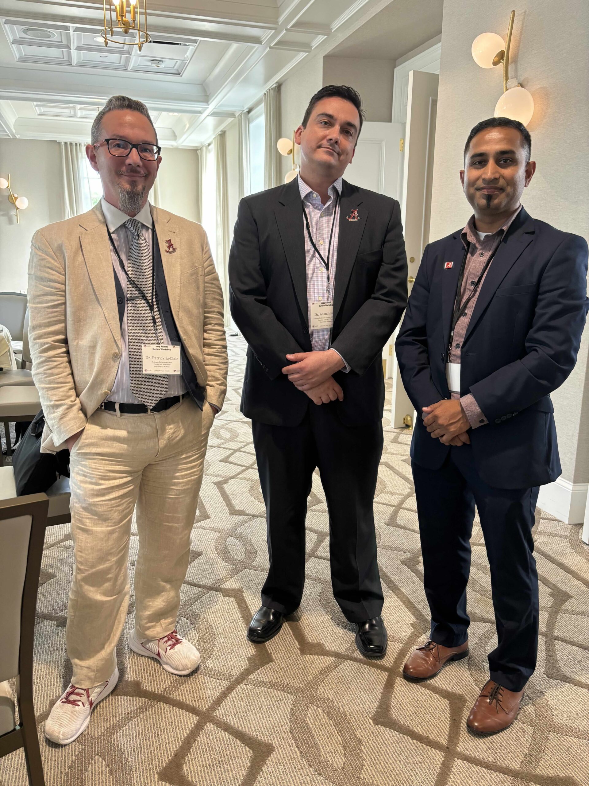
    ACCEPT’s Technical Director — also billed as “Time Lord” — is Thejesh Bandi, an associate professor. He reinforces Hauser’s message about the scarcity of focused talent in the area. “This field is greying,” he says. “We need young minds who will also bring in fresh ideas.”

    Hauser describes the program as “a flexible multidisciplinary course curricula that includes professional development, and real-world training with our industry and government partners.”

    The program’s “interdisciplinary” nature is reflected in the ACCEPT team. In addition to physics and astronomy, faculty from mathematics, electrical and computer, civil, aerospace, and mechanical engineering, as well as the communications and higher education departments, are included.

    This diversity of expertise is needed for ACCEPT’s ‘holistic education” approach founded on four pillars.

    1. Industry-Directed Curriculum: First, because the goal is to supply qualified graduates to fill critical national needs in industry, the foundational curriculum is based on and will continue to evolve with input from commercial entities in the PNTF space. In addition to several government agencies and labs, the ACCEPT Advisory Board includes representatives from SpectraDynamics, Aerospace Corporation, Raytheon Technologies, Microchip Technologies, L3Harris Technologies, OEWaves, Inc, Safran S.A., Northrop Grumman Corporation and the Resilient Navigation and Timing (RNT) Foundation.
    2. Sustained Industry & Community Immersion: The program’s major focus is moving beyond academia. Internships and PNTF professional community events are mandatory. Students attend the National Institute of Standards and Technology (NIST) Time and Frequency Division’s time and frequency seminar each year. In their second year, they begin attending the Institute of Navigation’s annual Precise Time and Time Interval (PTTI) meeting. As their research and professional skills mature, they are expected to progress from attendees to poster presenters and speakers.
    3. Professional Development: Reinforcing preparation for moving beyond the classroom, ACCEPT trains students to “… effectively work across academic, policy, governmental and industry sectors,” according to Hauser. “They need to be able to advocate as a professional to a larger audience effectively.” This means including students in programs like the university’s Speaking Studio and Capstone Center for Student Success. Communication skills, teamwork and ethics are particular focus areas.
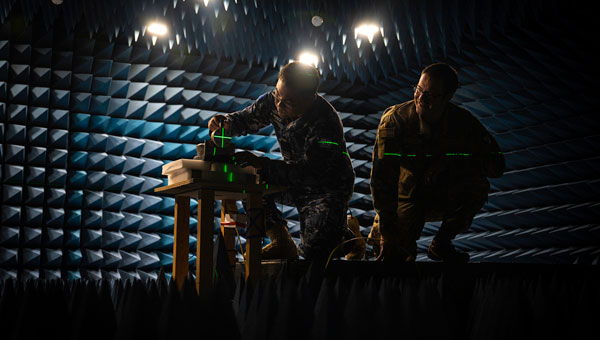
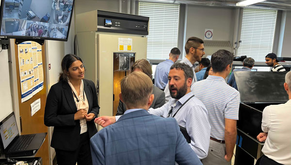
    4. Research: Bandi’s Research Quantime Lab is hosted by Professor Patrick LeClair’s Department of Physics and Astronomy. “Research projects for ACCEPT fellows and trainees are designed in conjunction with our government and industrial partners and focus on cutting-edge innovations that solve today’s problems in currently used technologies,” Le Clair said.

    The lab strongly focuses on Quantum Engineering research, though there are also opportunities in Characterization and Calibration, Networking and Synchronization, and research into Precision Devices.

    Click here for more information about applying for an ACCEPT fellowship or becoming an industry partner.

  • US Air Force and SandboxAQ address GPS jamming and spoofing

    US Air Force and SandboxAQ address GPS jamming and spoofing

    Photo: SandboxAQ
    Photo: SandboxAQ

    SandboxAQ has been awarded an SBIR Phase 2B Tactical Funding Increase (TACFI) by the United States Air Force (USAF) to further develop its dual-use AQNav magnetic navigation (MagNav) system. Under the contract, SandboxAQ and its partner AFWERX will explore new configurations of the AQNav technology, including a pod-based attachment, for use on a broader range of aircraft platforms, such as unmanned aerial systems.

    AQNav navigation technology combines proprietary artificial intelligence (AI) Large Quantitative Models (LQMs), powerful quantum sensors and the Earth’s crustal magnetic field, resulting in a solution that operates effectively in all weather conditions, day or night and across any terrain. AQNav technology is completely passive and operates in real-time, offering an unjammable and un-spoofable alternative to traditional navigation methods. This system functions entirely independently of GNSS, offering a secure and dependable navigation option in environments where satellite signals may be compromised or unavailable. This is a key example of applying quantitative AI – AI models trained on quantitative data and not language. SandboxAQ is a leader in Large Quantitative Models (LQMs), in this case to pull the signal from the background magnetic noise for navigation.

    This funding increase extends a prior Direct-to-Phase-II SBIR contract awarded to SandboxAQ in January 2023. To date, SandboxAQ’s AQNav technology has logged more than 200 flight hours and more than 40 sorties across multiple regions on four different aircraft types, ranging in size from single-engine planes to large military transport aircraft. In this process, AQNav was successfully tested in two USAF exercises – Exercise Golden Phoenix and Exercise Mobility Guardian – Air Mobility Command’s largest exercise at the time.

    AQNav uses a powerful quantum magnetometer system to acquire data from Earth’s crustal magnetic field, which exhibits geographically unique patterns – similar to a human fingerprint. AQNav uses proprietary LQMs to compare this data against known magnetic maps, enabling the system to quickly and accurately find its position. Due to the high sensitivity of foundational quantum sensors, AI algorithms are applied to improve the signal-to-noise ratio, removing any mechanical, electrical, or other interference that would impact the system’s ability to acquire its location.

    AQNav is available worldwide and can be used in air, land, and sea applications. The system does not rely on visual ground features or satellite transmissions to function and is not affected by weather conditions. Additionally, AQNav’s passive technology emits no electronic signals, which reduces the aircraft’s detectability. It operates at room temperature, requires no shielding, and has a small form factor that can be integrated into a wide variety of platforms, from multi-engine airliners to unmanned aerial vehicles.

    SandboxAQ is developing AQNav as a dual-use solution to address the need for resilience to GPS vulnerabilities, which extends societally and economically. In addition to the USAF, SandboxAQ is engaged with several aerospace leaders to test and develop AQNav, including other allied governments, Boeing and Acubed — Airbus’s Silicon Valley research and innovation center.

  • Onocoy launches RTK service

    Onocoy launches RTK service

    Photo:

    onocoy has launched the onocoy real-time kinematic (RTK) service designed to offer positioning capabilities worldwide.

    The service utilizes blockchain technology and a decentralized network of reference stations, offering users accurate correction data for applications requiring centimeter-level positioning. onocoy RTK offers global coverage with data quality controls in place to verify correction information before distribution.

    According to onocoy, the service offers quick convergence times and high accuracy due to its dense network of reference stations. It outputs data in the standardized RTCM format for integration with various systems.

    onocoy RTk targets industries such as agriculture, construction, mining, robotics and autonomous systems that require flexible and reliable high-precision positioning. onocoy says it is also developing business-to-business offerings, including access to station data and customized solutions.

    With this launch, onocoy aims to expand access to RTK technology and advance high-precision positioning capabilities across sectors.

  • PNT Vision 2035 – A must read

    PNT Vision 2035 – A must read

    In June, the Navigation Innovation and Support Program (NAVISP) Advisory Committee (NAVAC) of the European Space Agency (ESA) issued a paper titled PNT Vision 2035. It provides an interesting overview of the state of positioning, navigation and timing (PNT) and where it will be a decade from now.

    According to ESA’s website, key findings in the paper include:

    • Increasing Dependence on PNT Services – particularly for consumer and autonomous solutions. Accurate timing remains a critical use case, especially in telecom and power distribution.
    • Geopolitical and Technological Challenges: Rising cyber-attacks, jamming and spoofing, advancements in AI, ML and quantum computing will have significant impacts. Anticipate new regulations.
    • Technological Trends Driving PNT Demand: The proliferation of connected devices (IoT), autonomous driving, advanced air mobility, smart grids and autonomous vehicles will drive the demand for resilient and robust PNT.
    • System Architecture Evolution: Future PNT systems will utilize a combination of data sources, including multiple GNSS constellations, cellular networks (5G/6G), terrestrial systems, augmentation systems, and autonomous sensors. This “system of systems” approach will enhance performance and ensure independence from single points of failure.
    • Emerging Technologies and Sensor Integration: Advances in space segment technologies, receiver designs and sensor integration, new signal designs, flexible payloads, advanced clocks, inter-satellite links, and higher power amplifiers are highlighted.
    Luis Mayo
    Luis Mayo

    We spoke with Luis Mayo, NAVAC’s chair, to get his take on this seminal work.

    Question: To set the stage, what is NAVAC?

    Luis Mayo: NAVAC is a group of external PNT experts that ESA has assembled to provide independent advice on navigation issues, and especially for NAVISP.

    Q: Where can NAVAC’s formal recommendations be found?

    Mayo: We perform an assessment of the NAVISP status every two years. We provide our recommendations as a conclusion of this assessment. Beyond that, our formal recommendations are collected in documents like this white paper or in proposals for modifications or adjustments to the work plans of the programs.

    Q: How does ESA leadership generally view and react to NAVAC conclusions and recommendations? Does it act upon every recommendation?

    Mayo: They are generally receptive. However, we are just an advisory body, so it is up to them to take on our recommendations. They often do so and use our advice to add weight to their proposal to the Navigation Programme Board, but they do not necessarily have to.

    Q: PNT Vision 2035 is a substantial document. Clearly it involved some time and effort. Why was it written? Is it something ESA requested?

    Mayo: The paper was the initiative of NAVAC members to inform the ESA Ministerial Conference in 2025. These conferences take place every three years to define the roadmap for the next period. New European space programmes, extensions or redirections of existing ones, and budgets are approved at these meetings.

    Q: We thought we might make a modest contribution to the definition of the future ESA navigation programmes. What, if anything, did NAVAC find surprising or unexpected about findings included in the Vision?

    Mayo: I would say that we hardly found anything too unexpected or surprising. The findings are the conclusion of multiple discussions on the subject over the past few years. We have just expressed them in a more articulated way.

    If anything, and from my personal perspective, I would like to highlight that this exercise helped me realize that the deployment of some of the most exciting or expected applications of PNT technologies — such as autonomous driving — depend on the development and deployment of multiple other technologies that might not be necessarily available in the mid-term.

    AVAC’s first meeting in 2018. From left to right: Javier Benedicto, ESA Navigation Director, and NAVAC members Alessandra Fiumara, Peter Grognard, Giorgio Solari, Rafael Lucas Rodriguez, Pierluigi Mancini, Roger McKinlay, Stefano Debei, Nityaporn Sirikan, Bernd Eissfeller and Luis Mayo.
    AVAC’s first meeting in 2018. From left to right: Javier Benedicto, ESA Navigation Director, and NAVAC members Alessandra Fiumara, Peter Grognard, Giorgio Solari, Rafael Lucas Rodriguez, Pierluigi Mancini, Roger McKinlay, Stefano Debei, Nityaporn Sirikan, Bernd Eissfeller and Luis Mayo. (Photo: ESA)

    Q: What are the three most important things policymakers should understand from the document?

    Mayo: First is that many infrastructures or services critical to the daily lives of the citizens are dependent on PNT technology.

    Second, they cannot take for granted that GPS or Galileo services will be always available, not to mention GLONASS or BeiDou. Satellite navigation systems are vulnerable and are continuously under threat. Enabling assured PNT service is a must.

    And third, there is more to PNT than satellite navigation. Other complementary or alternative technologies should not be abandoned. In fact, some of those technologies might even change the way in which we have traditionally conceived satellite-based navigation.

    Q: What are the most important things policymakers should do to enable the PNT needed by 2035?

    Mayo: I think they have to sustain the existing satellite-based navigation systems and foster the development of new technologies and systems that improve the robustness of the services. We have done a lot so far to provide PNT services globally. When you come to think of that, it’s really wonderful what we have achieved this far. We cannot afford to lose what we have, but that has proven not to be enough. Therefore, policymakers should keep helping the development of new technologies and services that complement what we have, improve the quality of the services and ensure its continuous availability and integrity.

    They should also look beyond the current service volume. Spacefaring nations should be aware of the fact that they will need this kind of technology to support future missions. Deploying systems able to provide PNT services beyond the coverage of the current GNSS is an absolute necessity to support such missions.

    Q: The vision says the EU must consider no longer having access to GLONASS and BeiDou. There are a number of threats that are common to all GNSS. Why not consider loss of access to all either temporarily or permanently?

    Mayo: We have not considered a completely catastrophic situation such as losing access to all GNSS in our vision. We understand that GPS, Galileo and eventually other constellations or augmentation systems will remain available and provide at least partial coverage for PNT services.

    Q: The vision makes recommendations about mitigating interference, using AI and extending the GNSS service volume. What else should policy and technology decision-makers take from the document and act upon?

    Mayo: We must not forget there is a clear case for investing in future PNT systems. ESA should keep up to pace with foreign competitors that seem ready to increase their expenditure in these types of problems.

    They also have to be conscious that satellite-based navigation is not enough. We have to look for alternative and complementary systems to reach the level of confidence that we need on PNT solutions.

    Q: Perhaps you are thinking of all the PNT systems China has deployed?

    Mayo: I am really thinking about what we are not doing in Europe or in the United States. We need to build alternatives that might not have global coverage but would allow us to maintain essential PNT services running at home.

    Q: Resilience seems to be an important theme in the document, but it was not the subject of a specific recommendation. Could you speak to that?

    Mayo: Resilience is a pervasive theme throughout the whole document. This is a major concern. We have to find a way to build a system of systems that can deliver to the user a trustworthy PNT solution at any time.

    Resilience is, today, a key consideration in PNT, and we cannot do anything but acknowledge this fact. We might not have insisted enough on the importance of this feature for future PNT systems, but policymakers must undertake any actions required to improve the resilience of the existing PNT systems and services, probably by promoting the development of alternative independent PNT systems.

    Q: What else should GPS World readers know about the Vision?

    Mayo: Read the document. It is not that long. Also, think that it has been written from an independent and experienced standpoint. We at NAVAC do not pretend to hold the full truth, but I believe that we have a quite comprehensive view of the matter and that this would be useful for the reader.

  • FCC searching for public comments on NextNav petition

    FCC searching for public comments on NextNav petition

    Photo: NextNav
    Photo: NextNav

    The Federal Communications Commission (FCC) has issued a public notice seeking comment on NextNav’s filing to reconfigure the Lower 900 MHz band (902 to 928 MHz band).

    This action comes in response to NextNav’s April 2024 filing, which proposes a comprehensive restructuring of the band to enable the deployment of a 5G terrestrial positioning, navigation, and timing (PNT) network.

    NextNav’s proposal aims to create a 5 MHz uplink in the 902-907 MHz band paired with a 10 MHz downlink in the 918-928 MHz segment. This reconfiguration is designed to complement and serve as a backup to GPS while also freeing up spectrum for 5G broadband services.

    NextNav CEO Mariam Sorond said the spectrum band reconfiguration complements GPS to continue location mapping and tracking services and national security needs. “Our plan creates abundance from scarcity in this band by unleashing much-needed spectrum for wireless technology. These common-sense solutions can benefit consumers and our national interests at no cost to taxpayers,” Sorond said.

    However, the FCC’s public notice raises several questions regarding the protection of incumbent users, including federal radiolocation systems, industrial, scientific, and medical (ISM) equipment, and unlicensed Part 15 devices. The Commission seeks input on how these existing operations would be safeguarded under NextNav’s proposal.

    Comments are due Sept. 5, 2024. Following this comment period, the Commission will review the feedback to develop proposed rules for the potential reconfiguration of the Lower 900 MHz band.

  • Experts to PNT leaders: “It’s not working!”

    Experts to PNT leaders: “It’s not working!”

    The President’s National Space-based Positioning, Navigation and Timing (PNT) Advisory Board has warned United States leaders that the nation is highly vulnerable to disruption of GPS services. Also, national PNT issues have not received sufficient priority and attention for the last 20 years, and no one is accountable for system performance.

    The warning came in a four-page memo to the Deputy Secretaries of Defense and Transportation from retired Admiral Thad Allen, Chair of the advisory board. The memo was nominally a report of the board’s April 2024 meeting in Colorado Springs.

    The overwhelming majority of Allen’s message, though, dealt with GPS and U.S. PNT being vulnerable, the importance of PNT to the nation’s safety and security and the failure of the government to do the things it said it should and would do. It says:

    “America’s continued over-reliance on GPS for PNT makes critical infrastructure and applications vulnerable to a variety of well-documented accidental, natural and malicious threats.

    …our conclusion is that PNT, in general, and GPS, in particular, have not been accorded their rightful prominence in the national policy agenda.

    Simply put, the Board believes that the 20-year-old framework for GPS governance and the current policy statements establish neither the priority that the system deserves nor sufficiently clear accountability for its performance.”

    The reason for this was assessed to be that the leadership and governance structure established by 2004’s NSPD-39 and confirmed in 2021’s SPD-7 was not working.

    Allen gave a recent policy document on critical infrastructure as an example. All critical infrastructure sectors use PNT, and most depend on it.

    “These findings were reinforced just earlier this year by the release of the National Security Memorandum on Critical Infrastructure Security and Resilience (NSM-22, April 30, 2024). We were surprised to discover that GPS is nowhere mentioned in that important document.”

    While not mentioned in the memo, PNT was also not mentioned in national cybersecurity documents issued last year. This is despite timing being essential to the operation of IT systems, and time and location data being key elements in many applications.

    Allen’s memo also emphasized that the real issue is not about GPS, but overall national PNT capability. He went so far as to say, “Space Policy Directive 7 (SPD-7), U.S. Space-based PNT Policy, must be revisited and the term ‘space-based’ should be removed from its title” (emphasis added).

    Reinforcing this message, the following table comparing U.S. and Chinese national PNT systems was included in the memo.

    Photo:

    “The Board believes it is time to take a fresh look at our approach to PNT governance and establish a clear strategy for re-establishing an unquestioned position of leadership for the United States. To be successful, such a strategy requires a governance structure characterized by clearer authority and accountability. Ideally, the administration should propose legislation to Congress that would support this goal with a clear mandate (authorization) and resources (appropriations) adequate to the task.”

    As part of his report of the April meeting, Allen’s memo reaffirmed the board’s nine recommendations from January of last year and added three more:

    • Direct the U.S. Space Force to establish a way for “good enough” monitoring of GPS L5 signals using existing capabilities and set L5 signals healthy subject to a “use at your own risk” caveat, just as is done with L2C today. We recommend establishing a deadline of September 2024.
    • Direct federal Chief Information Officers to acquire and install multifrequency dual-system (GPS-Galileo) receivers to complement GPS use. The Department of Transportation and the Department of Homeland Security should actively encourage critical infrastructure users to adopt multifrequency dual-system (GPS-Galileo) receivers.
    • Assign a lead agency and single individual with clear responsibility and authority for the end-to-end prompt detection, characterization, and removal of significant sources of interference to GNSS in the United States.

    Allen’s memo comes on the heels of a similar warning to United States leaders about the nation’s vulnerability to GPS disruptions. On July 18, the

    National Security Space Association published a report titled “America’s Asymmetric Vulnerability to Navigation Warfare: Leadership and Strategic Direction Needed to Mitigate Significant Threats,” which cited several national PNT shortfalls from the Federal Radionavigation Plan as significant concerns.

    Two of that paper’s key findings are:

    “Long-standing lack of progress on issues important to U.S. national, homeland, and economic security,” and

    “Focused leadership, properly empowered and resourced, is essential to the national PNT strategy’s success.”

    It warned that significant disruption to GPS “could have cascading effects which unravel America’s socioeconomic fabric…”

  • US and Australia partner to improve GPS resilience in contested environments

    US and Australia partner to improve GPS resilience in contested environments

    Personnel from the Australian Joint Precision Navigation and Timing Directorate, Joint Capabilities Group and Joint Navigation Warfare Center align GPS test equipment in the JNWC anechoic chamber at Kirtland Air Force Base, N.M., in preparation for a GPS resilience test April 15, 2024. This combined effort not only enhances GPS navigation resilience but also exemplifies the power of international cooperation in addressing security threats. As the world faces evolving challenges, partnerships like these remain essential for maintaining an edge in contested environments. (U.S. Air Force photo by Senior Airman Spencer Kanar)
    Personnel from the Australian Joint Precision Navigation and Timing Directorate, Joint Capabilities Group and Joint Navigation Warfare Center align GPS test equipment in the JNWC anechoic chamber at Kirtland Air Force Base, N.M., in preparation for a GPS resilience test April 15, 2024. This combined effort not only enhances GPS navigation resilience but also exemplifies the power of international cooperation in addressing security threats. As the world faces evolving challenges, partnerships like these remain essential for maintaining an edge in contested environments. (U.S. Air Force photo by Senior Airman Spencer Kanar)

    The Australian Department of Defense has collaborated with the Joint Navigation Warfare Center (JNWC) to enhance the resilience of GPS devices in contested environments. The JNWC’s mission is to ensure positioning, navigation and timing (PNT) superiority for the Department of Defense and its partners. This joint effort aimed to test the performance of GPS devices under simulated jamming conditions.

    Personnel from the Australian Joint Positioning, Navigation and Timing Directorate worked with JNWC experts to evaluate the Defense Advanced GPS Receiver (DAGR), a crucial device used by U.S. and allied forces for navigation across land, sea, and air. The testing took place in an anechoic chamber designed to replicate contested and limited GPS conditions, providing insights to improve the device’s resilience.

    The JNWC, recognized for its expertise in navigation warfare, created optimal conditions for this assessment. The specialized chamber allowed them to test the DAGR’s performance in a jamming environment, generating data that can inform the device’s warfighting effectiveness. The team explored solutions such as antennas that enhance jamming resilience, and the findings will be shared with coalition partners to strengthen collective space resilience.

    The collaboration serves as a model for international cooperation in addressing security threats, enhancing GPS navigation and timing resilience for allied forces.

  • CACI provides PNT support to US Space Command

    CACI provides PNT support to US Space Command

    Photo:CACI International has been awarded a ten-year contract valued at up to $450 million to support the Joint Navigation Warfare Center (JNWC), an operational center of U.S. Space Forces and the Department of Defense’s (DOD) center of excellence for navigation warfare (NAVWAR).

    Under this contract, CACI will provide 24/7 operations support, joint and operational planning, adversary positioning, navigation and timing (PNT) capability assessments and other tasks to enhance joint force, DOD combatant commander, interagency and allied NAVWAR requirements.

    “Adversary PNT capabilities rapidly evolve, putting our warfighters and national security operations at risk around the world,” said John Mengucci, CACI president and CEO. “CACI’s experts comprehensively understand multi-domain PNT threats and advise combatant and joint force commanders on how to swiftly respond to NAVWAR threats and operational requirements.”

    PNT is critical to U.S. national security and NAVWAR. This includes deliberate defensive and offensive actions to ensure and prevent PNT use through space, cyber and electronic warfare. The contract represents new work for CACI, with mission experts supporting global NAVWAR reach-back operations via the Joint NAVWAR Operations Center (JNOC). These experts will assist combatant commanders in operating in PNT-disrupted, denied and degraded areas by conducting operational field assessments, war gaming scenarios, modeling and simulating threats and more.

  • US dangerously behind, PNT leadership needed

    US dangerously behind, PNT leadership needed

    Photo: tifonimages / iStock / Getty Images Plus / Getty Images
    Photo: tifonimages / iStock / Getty Images Plus / Getty Images

    Describing a dangerous “asymmetric vulnerability to navigation warfare” a recent paper from the National Security Space Association (NSSA) calls for a wide variety of actions to mitigate the threat. The most important, “Focused leadership, properly empowered and resourced…”

    The nineteen-page paper, in some ways, reads like a primer on GPS and positioning, navigation and timing (PNT), providing background and context for policymakers unfamiliar with the technology and the United States’ broad dependence upon it.

    “Long-standing lack of progress on issues important to U.S. national, homeland, and economic security.”

    The lack of focused leadership, according to the paper, is evidenced by long-standing failures to follow through on a variety of mandates from senior leadership over the course of the last 20 years. Quoting from the Federal Radio Navigation Plan, it cites persistent shortfalls in national capability as including:

    • Assured, real-time PNT in physically impeded environments (e.g., indoors, urban canyons, underground facilities).
    • Sufficient accuracy and integrity in electromagnetically impeded environments — including operations during spoofing, jamming, and natural and unintentional interference.
    • Higher accuracy with high integrity; timely notification/alarming when PNT performance is degraded or misleading, especially for safety-of-life applications or to avoid collateral damage.
    • Ensuring PNT services, including supporting information technology (IT) infrastructure and supply chain are protected from cyber threats
    • Ability to accurately locate sources of intentional and unintentional interference in a timely manner.
    • Insufficient resilience and survivability when GPS services are unavailable or untrusted.

    “American society has been transformed by the availability of GPS.”

    The paper describes four decades of GPS being incorporated into virtually every technology and used by every critical infrastructure. It calls the harm to society should it be lost “incalculable.” It also notes that the operation of many space systems that support critical infrastructure and/or critical national applications is itself dependent upon GPS for proper operation.

    The military utility and advantages brought by GPS are also discussed. These include:

    • Its role as the lynchpin for precision strike.
    • Enabling “… the maneuver, synchronization, and massing of effects from dispersed forces.”
    • PNT to achieve information and decision superiority over an adversary.

    “Merely the threat of disrupting GPS services might be enough to impact U.S. national security and foreign policy.”

    The paper says recent actions by and ongoing threats from adversaries of the United States are a critical concern.

    Electronic warfare (EW) and cyber attacks by Russia, China, Iran, and North Korea demonstrate the ease and effectiveness of such vectors, as well as the seriousness of the threat.

    As one example, Russia’s impending launch of a nuclear-armed anti-satellite weapon has the potential to both destroy or damage GPS satellites nearby and interfere with radio communications. NSSA recently published a paper on the Russian nuclear ASAT threat.

    A potentially even more serious threat would be if Russia should deploy a nuclear-powered directed energy or electronic warfare weapon. Such a device would be “reusable” and could threaten an even larger number of space platforms or, in the case of an EW device, both space-based and terrestrial receivers.

    “GPS blackmail”

    The paper posits that the United States’ overdependence on GPS is so great that it could be subject to “GPS blackmail.” It suggests that this may already have occurred.

    Prior to Russia’s invasion of Ukraine, it destroyed a defunct satellite with a ground-based missile, creating thousands of pieces of debris. Shortly thereafter, state-sponsored TV announced that Russia would destroy all 32 GPS satellites if NATO “crossed its red line.” Despite 90,000 Russian troops massing along the border, “U.S. officials decided against sending certain military equipment to Ukraine to avoid provoking Russia.”

    “…could have cascading effects which unravel America’s socioeconomic fabric…”

    NSSA warns that U.S. “critical infrastructures, national essential functions, and military forces could be at grave risk.” Among the impacts of a major GPS disruption, it counts:

    • Loss of U.S. political prestige and influence.
    • Degradation of the informational element of national power (IT and telecommunications).
    • Severe socioeconomic implications. “given the integration of GPS into critical infrastructures and their interdependencies, lengthy disruption just of the power grid, for example, could have cascading effects which [would] unravel America’s socioeconomic fabric…”
    • Harm to national and homeland defense. Leadership is needed to perform national essential functions.

    While the paper makes several specific recommendations for actions by various departments, it also identifies national-level leadership as key:

    “The United States must rapidly develop and implement a comprehensive, whole of nation, strategy to redress its asymmetric vulnerability to Navwar and restore U.S. leadership in space-based and terrestrial PNT. … Focused leadership, properly empowered and resourced, is essential to the national PNT strategy’s success.”

    The NSSA paper “America’s Asymmetric Vulnerability to Navigation Warfare: Leadership and Strategic Direction Needed to Mitigate Significant Threats” was sponsored by the Resilient Navigation and Timing Foundation and can be accessed here.

  • US Army issues white paper request for CMFF prototypes

    US Army issues white paper request for CMFF prototypes

    Photo: U.S. Army
    Photo: U.S. Army

    The U.S. Army has released a Request for White Papers (RfWP) to develop new C5ISR modular open Suite of standards (CMOSS) mounted form factor (CMFF) prototypes.

    Through CMFF, the Army aims to easily and rapidly equip ground vehicles and aviation platforms with positioning, navigation and timing (PNT) and electronic warfare (EW), through capability cards plugged into a common chassis.

    The chassis, which offers power, networks and radio frequency, allows Soldiers to “plug and play” capabilities right into the vehicle without the need to custom install and upgrade individual communication and computing systems.

    In this prototype effort, the key needs are to develop, procure and furnish the Army with the CMFF chassis, also known as Mounted Common Infrastructure (MCI), plus the smart display for user interface, hardware development, software development and Plug-In Cards with the following capabilities:

    • Converging tactical communication waveforms.
    • Mission Command applications.
    • Assured Positioning, Navigation, and Timing (APNT.)
    • Force Protection capabilities.

    The Army plans to award a contract using the Other Transaction Authority (OTA) with system of system and prototype integrators to provide the complete CMFF system offerings. Industry partners who respond to the RfWP will have an opportunity to showcase the fully functional CMFF system at a technology demonstration in late summer 2024.

    “The power of the true concept is when you can take a chassis and put it in another vehicle and you can mix and match cards,” said Col. Shermoan Daiyaan, project manager for Mission Command. “That’s when you’re following a standard. You’re matching a standard, and it just works.”

  • KrattWorks awarded $6M for GNSS-free navigation

    KrattWorks awarded $6M for GNSS-free navigation

    Photo: Krattworks
    Photo: Krattworks

    The European Defense Fund (EDF) and the Ministries of Defense of Estonia and Finland have awarded a $6 million investment to Project BadB, a consortium led by KrattWorks, an Estonian defense technology company. The project focuses on developing advanced navigation solutions for land and aerial vehicles that operate independently of GNSS.

    Project BadB aims to address the challenges posed by rapidly evolving electronic warfare technologies, such as radio jamming and GNSS spoofing. The project seeks to ensure reliable navigation for unmanned systems operating in contested environments, enhancing their operational effectiveness in active war zones and other critical areas.

    Specific objectives of the project include the development of weather-independent up-to-date satellite imagery maps for unmanned aerial and ground vehicles, a machine vision module, an image recognition system and a path planning system, based on sensor data, cross-platform data sharing and swarming.

    GIM Robotics will develop GNSS-denied navigation software for land vehicles, designed to resist and detect jamming and spoofing so vehicles can navigate accurately — even when GNSS signals are unavailable. The company’s technology allows land vehicles to maintain precise navigation using alternative data sources, such as satellite imagery and sensor integration.

    According to EDF, the project has gained attention among European defense and innovation leaders, who see it as solving a burning issue for the rapidly growing unmanned systems sector. The situation on the technology front has changed significantly in the past two years, as the sector faces new obstacles and opportunities each day.

    “We are witnessing an unprecedented fundamental change in the character of war, and our window of opportunity to ensure that we maintain an enduring competitive advantage is closing,” said General (ret) Mark Milley.

    GNSS-free navigation and geolocation also possess potential for civic use – such as in applications for critical infrastructure management, natural disaster mitigation and autonomous transportation systems.

    Project BadB was selected during the EDF 2023 Calls for Proposals, with a project duration of 24 months. The EDF aims to boost cooperation between companies and research entities to enhance European defense capabilities.

    For more information on Project BadB, visit the EDF Project Overview.

  • Iridium focuses on timing and critical infrastructure

    Iridium focuses on timing and critical infrastructure

    Mike O'Connor
    Mike O’Connor

    Satelles, which developed the Satellite Time and Location (STL) system, recently became part of Iridium, which already owned a large share of the company. I spoke with Michael O’Connor, previously Satelles’ CEO, who is now Executive Vice President of Iridium’s PNT Division.

    Besides the ownership change, has anything changed in your organization?

    What was the Satelles business is now part of the broader Iridium company. We’ve been partnered very closely with Iridium since the genesis of Satelles more than a decade ago. It really made strategic sense to become a part of Iridium. The industry is clearly at an inflection point. We don’t have to look too far to understand that the mainstream is catching on to the things that you have been writing about for years. Now, people are realizing what’s actually happening. Various users — especially those near conflict areas — are starting to truly experience jamming and spoofing events. The world is starting to recognize that there’s a need for solutions. The U.S. Department of Transportation has just come out with a complementary PNT plan. They put out a request for a quotation recently to engage the industry.

    Companies like ours, and others in the industry who have been developing solutions to this problem for many years, will finally start to see traction with customers. We just signed an agreement with L3 Harris to roll out GNSS augmentation or complementary PNT for the Federal Aviation Administration (FAA) to networks. Not just industry, but also the U.S. government is now taking steps to implement the resilience that’s needed to protect critical infrastructure. So, the timing is good.

    Does being now fully part of Iridium give you any additional access to the company’s satellite network?

    We will be rolling out, over time, some additional capabilities and expanded service areas. We will be announcing ways in which, by integrating the companies, we can expand more quickly into new geographic areas, providing additional signal coverage in areas where Satelles had not previously been able to do so. As Satelles, we were very focused on timing and national critical infrastructure. Iridium’s business lines align with some of the directions in which Satelles was already intending to grow in any case — such as maritime, internet of things (IoT) and possibly even someday aviation. There are areas where we will be able to expand our reach much more quickly than we ever would have been able to do as a standalone company.

    STL makes indoor positioning possible because the signal is much stronger due to Iridium’s satellites’ much lower orbit than that of GPS satellites, correct?

    Exactly right. It’s really about the signal power. Part of it is being closer to Earth, part of it is that we are on a channel that was dedicated to paging, back when people had pagers on their belts and was designed with a higher power signal than the Iridium satellites’ two-way voice and data channels. Additionally, we’ve designed the signal itself to also have some coding gain. So, all those things ultimately increase the receive sensitivity of a receiver by about 30 dB, which makes the signal 1,000 times stronger.

    In the mix of complementary PNT options and systems, what are your system’s strengths?

    There is no single silver bullet solution to complementary PNT. We can offer our solution, but different applications have different needs, for sure. What Iridium offers with the Iridium STL service is a system that’s available today to protect critical infrastructure — we’ve been delivering this to customers, we have thousands of users; it’s available globally — we effectively have a global license, a global capability, a global satellite constellation. We also have the distinct advantage of a high-power signal that can reach places where GNSS cannot. So, we focus on applications for which we can offer some unique value. A lot of that is based on the underlying Iridium satellite network. A long time ago, Iridium secured global rights for the L-band spectrum. Besides being in LEO, the network has inter-satellite links that enable it to cover the whole world from a finite, manageable set of ground monitoring sites.

    Because of all these aspects of its network, Iridium can offer something unique in the industry. Other solutions have different advantages and disadvantages. There is a breadth of solutions across the industry. All these entities are trying to solve the same important problem. Different users of PNT and different users who have a need for complementary PNT will see the advantages and disadvantages of different solutions out there. So, we like that there’s a thriving ecosystem of solution providers.

    Iridium Communications will provide its Satellite Time and Location (STL) service to more than three dozen L3Harris-operated communications network backbone nodes and a similar number of Federal Aviation Administration (FAA) facilities throughout the United States. (Image: Iridium)
    Iridium Communications will provide its Satellite Time and Location (STL) service to more than three dozen L3Harris-operated communications network backbone nodes and a similar number of Federal Aviation Administration (FAA) facilities throughout the United States. (Image: Iridium)

    Regarding markets, end users and user applications, what’s your focus?

    Our focus today is very much around timing and national critical infrastructure. We are in that market today, but it is one where we also see the greatest growth. We already have several partners who are selling products into those markets — including Adtran Oscilloquartz, VIAVI and Safran — and products available today. That market is just starting to recognize the need for complementary PNT and accelerate its adoption.

    Our primary focus today is making those customers successful with our solutions. Looking at new market opportunities, we are exploring the next products and markets we will pursue, but it is likely to be in an area that overlaps with those in which Iridium already has great partners and customers to which we can provide additional value. Maritime is a good example. Aviation may be a longer sales cycle. It would be speculating as to what that next big market will be because right now we are very focused on that initial market.

    As far as timing for critical infrastructure — cell phone towers, electrical distribution, data centers, etc. — are your boxes replacing the previous ones or sitting next to them?

    They can do either. The products that our partners offer include GNSS plus STL, so it can replace the GNSS-only solution in those systems. A lot depends on the customer and the application, of course. Our partner would provide a solution that includes GNSS plus STL; it typically would replace a GNSS-only solution and provide resilience by having a complementary PNT capability.

    The solutions we’re providing to the FAA are not on-aircraft solutions. They are ground infrastructure solutions that keep the integrity of the ground networks, which are of course Safety of Life critical to the operation of our national airspace. We are providing the timing solution for the FAA within that data center infrastructure.