Image: GPS World; outdoor, Andriy Solovyov/Shutterstock.com; indoor, Rade Kovac/Shutterstock.com
\Registration is now open for the fifth GNSS Raw Measurements Task Force meeting, which will take place on May 17. Participation is online, where participants will gain access to Task Force members’ experience and learn about progress on using raw measurements in Android devices.
The aim of the EUSPA’s Raw Measurements Task Force is to bridge the knowledge gap between raw measurement users. The meetings of the task force are a key element in this effort, providing a forum for stakeholders to share experience and knowledge around raw measurements use.
Following a welcome address from Fiammetta Dianithe, EUSPA’s head of Market, Downstream and Innovation (MADI) Department, the opening session will include a keynote presentation from Google`s Frank Van Diggelen and Mohammed Khider. Updates on EGNSS opportunities from the Galileo programme will be provided by members of the MADI team.
After the break, the agenda will be dedicated to presentations from Task Force members, targeting their innovative work using raw measurements. The last session focuses on testing results and implementation of EGNSS differentiators. For the full draft agenda, click here.
Since its launch in 2017, the task force has expanded from a handful of experts to a community of more than 100 agencies, universities, research institutes and companies. Membership is open to anybody interested in GNSS raw measurements. To join the task force, contact [email protected].
EUSPA’s mission is to link space to user needs. Over the past year, EUSPA has increased access to EU space data and services around the world, launched new Galileo satellites, and put in place additional satellite navigation services.
EUSPA operates Europe’s satellite navigation systems Galileo and EGNOS. It is also the gatekeeper to a secure EU Space Programme, providing end users with the confidence of knowing that the space-derived data they depend on is safe and secure.
The agency plays a central role in the market uptake of the data and services offered by the EU Space Programme components. EUSPA also manages the development of GOVSATCOM hubs, which will provide secure, cost-efficient communication capabilities to security and safety-critical governmental missions, operations and infrastructure.
the entry into service of a new Galileo satellite for additional accuracy to end-users
publishing the EO and GNSS Market Report, a comprehensive market intelligence study providing trends for the entrepreneurs and investors.
3.1 billion Galileo-enabled smartphones sold globally since 2016.
“I am more than proud of what EUSPA has achieved in a year. I am also proud to be at the helm of an organization staffed with dedicated professionals, with a service-oriented mindset who work to make EU Space accessible to citizens,’’ said Rodrigo da Costa, EUSPA executive director. “EUSPA remains committed to helping the union and its citizens maximize the socio-economic benefits of space.”
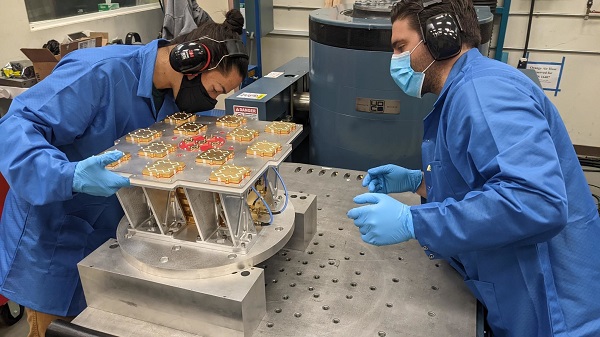
Xona has completed environmental testing for its upcoming demo mission, a significant step towards realizing its high-performance commercial navigation system
Xona Space Systems announced that their first in-space demonstrator has been delivered to Spaceflight Inc. for final integration after successfully completing testing and is scheduled for launch on SpaceX’s Transporter 5 in May.
Xona is an aerospace startup developing a precision navigation and timing system in low Earth orbit. It plans to build an independent high-performance satellite navigation and timing system to meet the needs of intelligent systems.
Xona’s first demonstration mission successfully completed testing at Experior Laboratories and prepares for launch on a Falcon 9 in May. (Photo: Xona)
Satellite navigation systems such as GPS and Galileo are in the domain of major governments (and free to users). Xona said it is part of the new commercialized space movement, using it to bring benefits to satellite navigation and timing.
Xona Space is launching Huginn, the first of two missions, demonstrating the capability of its Pulsar constellation. Pulsar’s architecture uses small, powerful satellites in low Earth orbit, more than 20 times closer to Earth than GPS satellites, which are in medium Earth orbit.
Pulsar is planned to deliver high-performance navigation and timing services by combining security and signal designs with Xona’s patent-pending distributed atomic-clock architecture to enable robust precision navigation services from low-cost satellites. Its precision LEO positioning, navigation and timing (PNT) service leverages advances in small satellite technology to provide users with a secure and robust alternative to traditional GNSS.
Xona’s system architecture utilizes the efficiency of small satellites to provide an affordable global system with more than 10 times better accuracy and 100 times better interference mitigation than legacy systems, the company claimed
Huginn will transmit the first precision navigation signals from a LEO spacecraft, designed to test and validate the core software and hardware technology that Xona has developed for Pulsar. The mission will also demonstrate the functionality of end-user equipment on Earth and supporting ground systems.
Huginn is now going through final integration with Spaceflight in preparation for launch on the scheduled Transporter 5 mission in May.
“We’re thrilled that Huginn has successfully completed its very rigorous test campaign in preparation for launch and are incredibly proud of the Xona team for achieving such a critical milestone,” said Brian Manning, CEO of Xona. “Through this process, we learned a massive amount and will be incorporating these lessons into our second demo mission as well as the production satellites.”
Following the Launch of Huginn, the Xona team will shift focus to the second demonstration mission as well as the development of the Block I Pulsar system.
The final Pulsar constellation will consist of several hundred LEO satellites, delivering secure and robust precision PNT services designed to meet the needs of advanced applications such as self-driving cars, precision agriculture and construction, augmented reality, critical infrastructure, and many others.
“It is inspiring to see what this team has been able to achieve going from a blank slate to orbit in less than a year from the time we completed our ground-based prototype testing,” Manning said. “This is a huge step in the development and deployment of our Pulsar constellation, and we’re looking forward to a very exciting year here at Xona.”
Xona is backed by Seraphim Space Investment Trust (LSE:SSIT) and MaC Venture Capital, with participation from Toyota Ventures, Daniel Ammann (co-founder of u-blox), and Ryan Johnson (former CEO of BlackBridge, operator of the Rapideye constellation). Follow-on investors also include 1517 Fund and Stellar Solutions.
U-blox and Geespace have signed a memorandum of understanding to expand their respective augmentation services for high-precision applications. Both partners will be able to extend their service offering to the U.S., European and Chinese markets, primarily in the automotive sector.
Geespace is provider of aerospace information and communications (AICT) infrastructure and application solutions.
The agreement between u-blox and Geespace seeks to create a combined offering that will enable both companies to offer full-stack high-precision positioning software and hardware solutions to customers across the United States, Europe and China. It will enable Geespace, which provides automotive GNSS augmentation services to its parent company Geely Group, to use the u-blox PointPerfect GNSS augmentation service to grow its coverage to serve Geely’s automotive brands.
Meanwhile, it will enable u-blox to expand the coverage of the PointPerfect service to offer customers a comprehensive high-precision solution for products sold in China, and benefit from simplified development and logistics efforts.
The rise of reliable and cost-effective high-precision positioning has improved the accuracy of GNSS solutions to the order of tens of centimeters, enabling new applications in the automotive, industrial and robotics industries. Global adoption has, however, been hampered by a fragmentation of the augmentation services landscape, the companies stated in a press release.
For global adoption to become a reality, worldwide coverage is required, as is unified pricing and business models designed to serve mass-market high-precision solutions for automotive and industrial customers operating on a global scale, the companies said.
By Michael J. Dunn, Space Systems Command, Capability Area Integrator for Positioning, Navigation and Timing
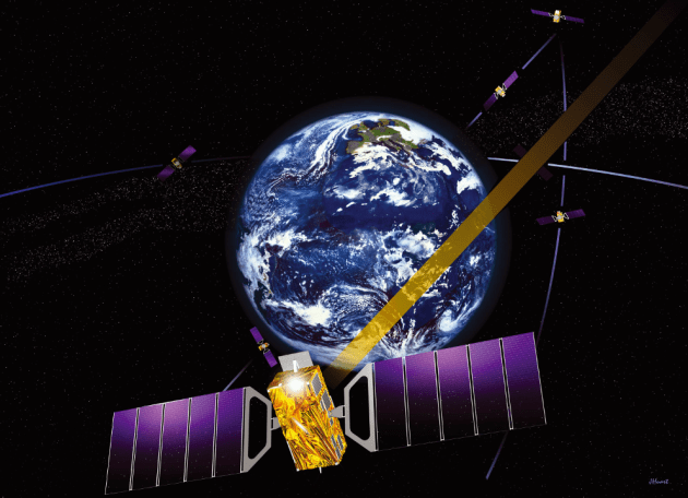
The Global Positioning System is the premier positioning, navigation and timing (PNT) source for more than six billion users worldwide. It is vital to the function of all 16 of the United States’ essential critical infrastructure components. Life as we know it relies on the essential services that GPS provides.
The United States Space Force (USSF) is committed to maintaining a healthy GPS constellation that continues to deliver the “gold standard” of PNT availability and reliability throughout the world. Continuous improvements in equipment and performance have been a hallmark of the enterprise since its inception. 2021 was no exception, with a continued record-setting delivery of new capabilities.
Space Systems Command (SSC) at Los Angeles Air Force Base in El Segundo, California, is laser-focused on delivering the most important modernization in GPS history. The government and industry team are committed to bringing major upgrades to the space, control and user-equipment segments. It is an exhilarating time for the GPS enterprise. The specific updates within each segment cement the continued evolution in GPS and the USSF commitment to delivering advanced capabilities to the nation and the world.
Space Segment
Currently, 37 GPS satellites are on orbit, with 29 satellites set healthy. The baseline constellation requirement is 24 satellites. The system continues to perform in stellar fashion, providing an average 48-centimeter position accuracy throughout 2021.
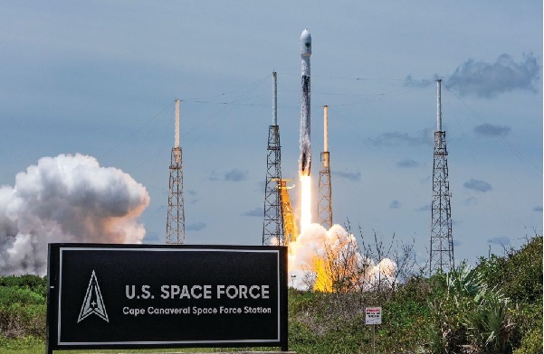
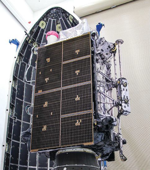
Orbital systems modernization is focused on the GPS III satellite fleet, and the program continues to deliver peerless capabilities. GPS III space vehicles (SV) 1–4 were all operationally accepted in 2020. In 2021, the most notable event was the launch of GPS III SV05 in June. The satellite successfully achieved operational acceptance and mission-capable status for USSF in just under two weeks: a new record. SVs 6–8 are available for launch and are awaiting their launch windows. SV09 system-level testing is in progress. SV10 component deliveries continue. GPS III provides up to eight times better anti-jam and a new L1C signal to improve user connectivity.
For the GPS IIIF program, the long-range picture remains bright as the contract for GPS IIIF SVs 15–17 was awarded in October 2021. The delivery of the first GPS IIIF is expected early in 2026. GPS IIIF will build upon the tremendous increase in capability provided by GPS III with the addition of a search-and-rescue payload, a laser retroreflector array for precise ranging, a fully digital navigation payload, and a Regional Military Protect capability that will provide 60 times greater anti-jam for operations in electromagnetically hostile environments.
GPS III space vehicle 05 (GPS III-SV05) launched in June 2021 from Cape Canaveral Space Force Base, Florida, aboard a SpaceX Falcon 9 launch vehicle. (Photo: SpaceX)
Control Segment
The next-generation Operational Control System (OCX) continues to execute within its program baseline. OCX will provide enhanced command and control capabilities, modernized architecture, robust information assurance and cyber security.
OCX’s incremental development approach began with OCX Block 0, which is the launch and checkout system (LCS) for GPS III. The LCS successfully supported the launch and checkout of GPS III SV 01–05. OCX Blocks 1 and 2 will control all legacy GPS III satellites and both legacy and modernized signals.
Despite barriers presented by the global COVID-19 pandemic, all 17 global OCX monitoring station installations were completed in July 2021. Most of the remaining equipment was fielded throughout December 2021. System integration and verification continues with transition to operations scheduled for early 2023.
The Next Generation OCX 3F contract was awarded in April 2021. The program will modify OCX to launch and control GPS IIIF satellites with enhanced capabilities. Acquisition Milestone B is expected in 2022, and operational acceptance is planned for 2027.
MGUE: The future warfighter’s battlespace edge. (Image: Space Systems Command Production Corps)
User Equipment Segment
Millions of GPS receivers are fielded, but very few of them can use the military code (M-code) signal that is being broadcast by 24 GPS SVs. To keep our competitive advantage against the adversary, the GPS enterprise is focused on developing modernized GPS user equipment (MGUE) that takes advantage of these signals. The MGUE program is a joint service program developing modernized, M-code-capable military GPS receivers. The program is broken into two increments (Inc 1 and Inc 2). Both are designed to deliver secure PNT performance, allow navigation warfare operations, enhance anti-jam, anti-spoof and anti-tamper, and enable Blue Force Electronic Attack.
MGUE Inc 1 achieved a major milestone in September 2021 with successful testing on the Marine Corps Joint Light Tactical Vehicle (JLTV). The event took place in an electromagnetically degraded GPS environment at White Sands Missile Range, New Mexico. The JLTV is a pathfinder lead platform for the MGUE program. Lead platforms for the other services, the Army Stryker combat vehicle, Air Force B-2 bomber, and Navy Arleigh-Burke Class Guided Missile Destroyer, will commence integration testing in FY23 and FY24.
MGUE Inc 2 development continues to make progress in maturing the next generation ASIC technology required for all weapon-system platforms to provide functionality and backward compatibility. It will deliver a miniature serial interface card in CY26 to support handheld and ground applications. Eventually, MGUE receiver cards will be loaded onto hundreds of Department of Defense (DOD) weapon systems.
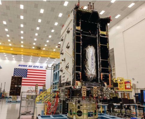
GPS III SV04 in Highbay (Photo: Lockheed Martin)
Partner Community
The GPS enterprise is committed to cooperation on a global basis. It works closely with the DOD, the armed services, the U.S. Coast Guard, other federal agencies, the International Civil Aviation Organization and all the other global and regional navigation satellite systems toward the development of PNT in the global commons.
A highlight of this cooperative work is GPS enterprise involvement in the National Executive Committee for Space-Based PNT (PNT EXCOM), which supports the interests of the various federal bodies, especially the Department of Transportation (DOT) and the Federal Aviation Administration (FAA). The PNT EXCOM is applying GPS technology to a broad variety of governmental activities, including the development of the Next Generation Air Transportation System and intelligent transportation systems.
The GPS enterprise commitment to international partners is unwavering. Our support to the North Atlantic Treaty Organization (NATO) is ongoing with support to the Capability Panel 2 for Navigation working toward the integration of MGUE and compatibility arrangements with Europe’s Galileo system. A highlight this year was the first delivery of MGUE loan equipment to the United Kingdom, Canada, Germany, and the Republic of Korea. Germany is the first country to purchase MGUE equipment.
Conclusion
GPS is the foundation of global PNT and a cornerstone of modern life. Improvements to the enterprise are continual. As the nation moves into the complex and dynamic world of the coming decades, the dedicated military, civilian and industry professionals that provide this world-changing capability will continue their challenging and rewarding work. Semper Supra!
The “encapsulation” of a GPS satellite. (Photo: U.S. Department of Defense)
The Open PNT Industry Alliance (OPIA) issued a statement regarding the recently approved U.S. Fiscal Year 2022 Appropriations Act. The alliance advocates for support of alternative positioning, navigation and timing (PNT) services.
In its statement, the 21 corporate members express support for the funding provided to the Department of Transportation to pursue alternative forms of PNT.
The OPIA also highlights a change to the National Timing Resilience and Security Act that eliminates the “land-based” technology requirement. The consensus among members is that the adjustment was needed so that the law would allow for multiple forms of PNT, a concept that aligns with the diverse technology principles of the coalition.
The Consolidated Appropriations Act for Fiscal Year 2022 (H.R. 2471) promotes robust positioning, navigation, and timing (PNT) technologies and preserves competition that drives innovation in the market.
Important Funding for PNT Services
The FY 2022 Appropriations Act, passed by the U.S. Congress and signed into law by President Biden on March 15, 2022, provides $15 million for the U.S. Department of Transportation (U.S. DOT) to establish a program that will support the U.S. government’s pursuit of many types of alternative PNT. The legislation aligns with U.S. DOT’s January 2021 “Complementary PNT and GPS Backup Technologies Demonstration Report” and summarizes how the funding will be applied.
OPIA encourages U.S. DOT to apply this funding to procure alternative PNT services and supplementary solutions that will protect critical infrastructure. Our members are prepared to engage civil government officials and critical infrastructure owners and operators to match needs with solutions.
Critical Change to Existing PNT Law
The National Timing Resilience and Security Act of 2018 (NTRSA) focused attention on the need to reinforce GPS. Congress subsequently recognized that NTRSA would be harmful to the commercial PNT market. The FY 2022 Appropriations Act revises the NTRSA to align with the U.S. DOT’s 2021 report that “the best strategy for achieving resilient PNT service is to pursue multiple technologies to promote diversity in the PNT functions that support transportation and other critical infrastructure sectors.”
This straightforward change to the NTRSA is as follows:
“Section 312(a) of title 49 United States Code, shall be amended by striking ‘land-based,’ after ‘operation of a’.” When the revised objective of the NTRSA is read in context, it is evident that the law is now fully inclusive of multiple forms of alternative PNT:
Subject to the availability of appropriations, the Secretary of Transportation shall provide for the establishment, sustainment, and operation of a land-based, resilient, and reliable alternative timing system (1) to reduce critical dependencies and provide a complement to and backup for the timing component of the Global Positioning System (referred to in this section as “GPS”); and (2) to ensure the availability of uncorrupted and non-degraded timing signals for military and civilian users in the event that GPS timing signals are corrupted, degraded, unreliable, or otherwise unavailable.
This move by Congress comports with the findings of the U.S. DOT’s report on PNT which state that “suitable and mature technologies are available in the private sector and offer owners and operators of critical infrastructure a diverse array of complementary PNT services to meet their GPS backup needs. Because such needs are application-specific, GPS resilience across all critical infrastructure sectors will require a plurality of diverse PNT technologies to meet multiple use cases.”
The commonsense modification to the NTRSA allows multiple alternatives to GPS and other global navigation satellite systems (GNSS) to deliver against a complex and ever-expanding set of institutional and end-user requirements.
The alignment with OPIA’s bedrock principles is clear:
A diverse technological landscape offers varied operational characteristics to support all critical infrastructure sectors.
True resilience requires diversity that a sole-source technology cannot meet in terms of reliability, performance, and the flexibility to address evolving attack prevention and threat response needs.
The ingenuity of the private sector marketplace will drive the emergence of multiple cost-effective GPS/GNSS alternatives that evolve according to technological innovations and market dynamics.
Open PNT Industry Alliance members provide what critical infrastructure needs for resilience: alternative forms of PNT that complement GPS/GNSS as well as augmentation services, security solutions, and hardware/software for time synchronization, navigation and location applications.
The following op-ed was released by U.S. representatives Don Bacon and Mikie Sherrill, co-chairs of the congressional Global Positioning System Caucus.
The US military needs a modernized GPS capability to maintain superiority
By Rep. Don Bacon and Rep. Mikie Sherrill
Don Bacon
In December 1993, the U.S. declared that the satellites comprising the Global Positioning System constellation had achieved initial operational capability, representing the culmination of a 20-year effort to develop and launch the first global navigation satellite system.
GPS, which began as a U.S. government project to provide positioning, navigation and timing information by broadcasting radio signals from satellites to the ground, stands alone in the revolutionary impact it has had on both our warfare abilities and our commercial industries. However, an aging constellation and unyielding international competition has put America’s GPS superiority at risk.
“We believe it is critical to our international interests that the U.S. reinvest in GPS modernization. We cannot afford to overlook the satellites.”
Mikie Sherrill
In the decades since achieving initial operational capability, GPS has become integrated into virtually every facet of the U.S. economy and is part of everything from our cellphones to our financial, agricultural, transportation and manufacturing sectors — and to every aspect of our national security.
Even as GPS has grown to become a fundamental part of our everyday life, the U.S. provides GPS signals for free to users worldwide. And yet, China, Russia, the European Union, India, and Japan have all developed regional or global satellite systems since GPS was launched.
Most recently, China’s completion of its BeiDou system comprised of over 30 satellites — part of its broad Belt and Road Initiative — risks endangering U.S. technological leadership. Beijing has made it clear that it will leverage BeiDou as part of an overall strategic effort to obtain greater influence internationally, heavily subsidize the adoption of BeiDou-equipped infrastructure for government and military use in countries throughout its region, and advantage BeiDou-compatible domestic products.
As the House co-chairs of the congressional GPS Caucus, we believe it is critical to our international interests that the U.S. reinvest in GPS modernization. We cannot afford to overlook the satellites — the oldest of which were launched in the late 1990s or early 2000s — that underpin civil and social infrastructure, including civil aviation, banking systems, financial markets, power grids, precision agriculture, and communications networks and applications. Even as manufacturers develop multi-constellation devices that can receive signals from both GPS and other global systems, it is more critical than ever that the U.S. accelerate its investment in next-generation GPS satellites.
To that end, the U.S. has begun modernizing the GPS constellation, with significant technological benefits for U.S. warfighters and civil users. New GPS satellites provide three times greater accuracy, and eight times improved resistance to inference and signal blocking known as jamming. However, the replacement of outdated GPS satellites in the constellation has not kept pace with our international competition and emerging global threats.
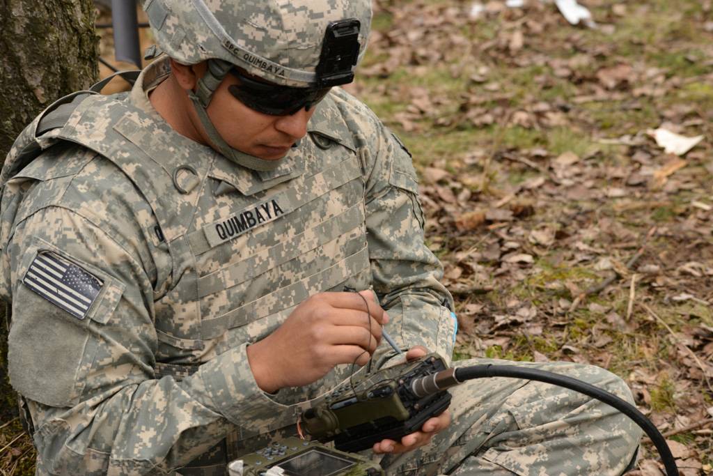
A U.S. paratrooper uses a Defense Advanced GPS Receiver during a live-fire exercise at Grafenwoehr, Germany. (Photo: Spc. Markus Rauchenberger/U.S. Army)
We believe that our efforts to invest in American technological leadership must include an increased launch rate of new GPS satellites with both crosslinks and on-orbit reprogrammable capabilities. Crosslinks enable greater accuracy, and on-orbit reprogrammability can counter jamming and spoofing by providing means to update signal and/or data streams and quickly counter emerging threats without the need to produce and launch new satellites.
A necessary and critical element of GPS modernization is also the development of a systematic road map for the use of our modernized GPS system by civil manufacturers and users across industries. Together, these steps will allow the United States to maintain its global leadership; enable U.S. firms to continue to offer innovative GPS-based products and services; and counter efforts by our international adversaries to give preference to their own technologies.
As the first and unrivaled provider of space-based services to the public, GPS currently provides $1 billion in economic impact from the U.S. civil GPS sector every day. As we move to a multi-constellation world, it is more critical than ever that the U.S. accelerates investment in our GPS enterprise to enable the next-generation benefits that a modernized constellation will bring to our warfighter, the U.S. economy and the free nations of the world.
Rep. Don Bacon, R-Neb., is a member of the House Armed Services Committee and a co-chair of the congressional Global Positioning System Caucus. He retired from the U.S. Air Force as a brigadier general.
Rep. Mikie Sherrill, D-N.J., serves on the House Armed Services Committee and is a co-chair of the congressional Global Positioning System Caucus. She served in the U.S. Navy for nearly a decade as a helicopter pilot and Russian policy officer.
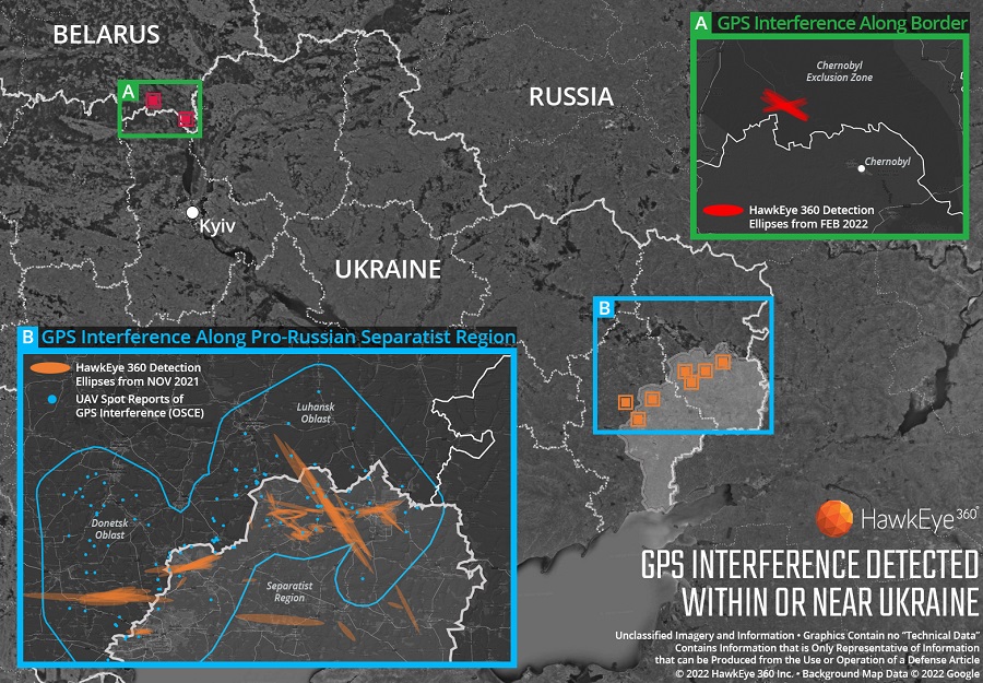
Technology from HawkEye 360 Inc. has detected and geolocated extensive GPS interference over Ukraine, starting months before the Russian invasion. HawkEye 360 uses satellites to monitor radio-frequency signals that might threaten military and civil navigation applications.
The capability was tested in 2021 in a variety of exercises and is available as part of HawkEye 360’s RFGeo signal product catalog.
When HawkEye 360 analysts examined Ukraine over the past five months, they discovered continued and increased GPS interference across the region. The data showed extensive GPS interference in November 2021 along the boundary of the pro-Russian separatist-controlled regions in Luhansk and Donetsk.
Open-source information confirmed unmanned aerial vehicles (UAVs) operating in the area were disrupted because of lost GPS connections.
In February 2022, HawkEye 360 detected GPS interference along the border between Ukraine and Belarus, shortly before the Russian invasion started. This February activity occurred north of Chernobyl within the Chernobyl Exclusion Zone, demonstrating the integration of electronic warfare tactics into Russian military operation to further degrade Ukraine’s ability for self-defense.
“GPS is a fundamental ‘global commons’ service that all modern economies depend upon. GPS signal interference has the potential to significantly disrupt air travel, logistics, finance, transportation, communication and many other basic services,” said John Serafini, CEO of HawkEye 360.
“Whether unintentional or deliberate, interference that prevents people, vehicles, ships, and planes from determining accurate locations can be devastating to government and commercial activities alike,” Serafini said. “Since HawkEye 360 can monitor hundreds of millions of square kilometers daily, we are able to notify clients when and where GPS interference occurs, so they can respond quickly to mitigate the impacts.”
Interference can be inadvertent by equipment operating too close to GPS frequency bands. However, deliberate interference has spiked across the globe due to the low cost, ease of deployment, and general availability of GPS jamming technology.
Military forces use GPS jammers to obscure and protect critical troops, facilities and equipment from attack and can be a leading indicator of future military activity. Drug cartels use GPS jammers to deter surveillance from overhead drones. Use of jammers is illegal in most developed nations.
HawkEye 360’s detection product offers a valuable capability to monitor for illicit and unintentional GPS interference that can significantly disrupt critical location services, representing the company’s global commitment to make the world a safer place, the company said.
“Seen & Heard” is a monthly feature of GPS World magazine, traveling the world to capture interesting and unusual news stories involving the GNSS/PNT industry.
A “BeiDou positioning system for subways” began construction March 20 on the Beijing subway capital airport express line. The project will cover a 30-kilometer-long section of the express line, including five stations. To provide positioning, the BeiDou Navigation Satellite System (BDS) will be combined with 5G for indoor positioning or in areas where the satellite signals are blocked. The system will improve the positioning accuracy in subways to less than 2 meters, making it available for vehicle dispatching, passenger transport organization and emergency response. In addition, it allows passengers to use their phones to navigate and position in complex environments in subway stations through three-dimensional navigation.
Image: ESA
THE SHAPE OF OCEAN WATER
The European Space Agency (ESA) investigated a technique to precisely measure sea-surface topography based on an idea submitted by the Institute for Space Studies of Catalonia (IEEC). The technique involves GNSS reflectometry — signals that have been reflected off of the sea surface at very low angles. The ESA-funded activity involved developing a GNSS receiver and setting up an experiment in the Balearic Islands to collect GNSS signals reflected off the sea surface. The team linked the coherence of the reflected signals to wave height and elevation angle of GNSS satellites. The team then processed the signals for optimized measurements of the shape of the sea surface, useful in applications such as ocean current forecasting, climate research, ship routing, cable laying and debris tracking.
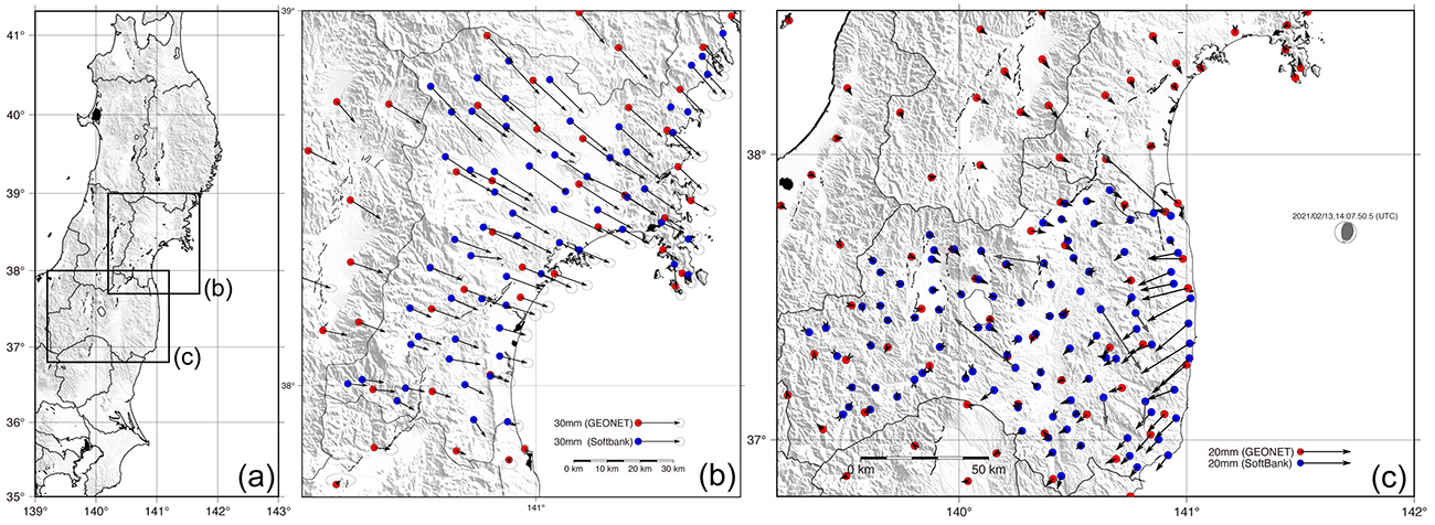
Image: Japan network/Ohta and Ohzono, Tohoku University
CELLPHONE NETWORK DETECTS EARTHQUAKES
A paper published Feb. 9 in Earth, Planets and Space by Japanese Earth science researchers analyzed the potential of a dense network of GNSS receivers, installed at cellphone base stations, to monitor crustal deformation as an early warning indicator of seismic activity. Results showed that data from a cellphone network can rival the precision of data from a government-run GNSS receiver network, while providing more complete geographic coverage. Japanese cellphone carriers have constructed networks of GNSS receivers to improve locational information for such purposes as automated driving. The study examined the potential of a GNSS network built by SoftBank Corp. to play a role in monitoring crustal deformation.
Photo: Falklands Maritime Heritage Trust
ENDURANCE IN POLAR ICE
Researchers have discovered the remarkably well-preserved wreck of polar explorer Ernest Shackleton’s ship, Endurance, a century after it was swallowed up by Antarctic ice. A team of marine archaeologists, engineers and other scientists used an icebreaker ship and underwater drones to locate the wreck at the bottom of the Weddell Sea, near the Antarctica Peninsula. The ship is at a depth of 3,008 meters, 4 miles south of the position originally recorded by navigator Frank Worsley. The expedition team used two Saab autonomous underwater vehicles to explore in a pre-programmed search pattern. After the ship was located, technicians swapped out sonar equipment for a high-resolution camera and a laser-surveying device to make highly detailed scans of the site.
Russia’s brutal aggression on Ukraine changed the world in a few days. Devastation and displacement in Europe already are on a scale unseen since World War II, and the risk of a catastrophe greater by orders of magnitude has not been as high since the Cuban Missile Crisis of 1962, the year I was born. Given the long production timeline of a monthly magazine, I will not venture a guess as to what the headlines will be on the day you read this.
The Russian assault has sharply raised concerns about GNSS vulnerabilities. In a March 17 bulletin, the European Union Aviation Safety Agency (EASA) warned of a GNSS outage leading to the degradation of navigation and surveillance. Reports analyzed by EASA indicate that since Feb. 24, GNSS spoofing and jamming has intensified in the Baltic Sea, neighboring states, Eastern Finland, the Black Sea and the Eastern Mediterranean. “The effects of GNSS jamming and/or possible spoofing,” the bulletin stated, “were observed by aircraft in various phases of their flights, in certain cases leading to re-routing or even to change the destination due to the inability to perform a safe landing procedure.”
Russia already has aided in the proliferation of handheld GPS jammers, the deployment of road-mobile jammers, and even development and testing of space-based jammers. Now, it could turn its substantial cyberspace hacking capability against the ground-control segments of GPS and Galileo.
When Russia tested an anti-satellite weapon on Nov. 15, 2021, the Kremlin claimed on state television that this capability “means that if NATO crosses our red line, it risks losing all 32 of its GPS satellites at once.” This threat was particularly dangerous because GPS satellites carry, as a secondary payload, the U.S. nuclear detonation detection system.
At a panel discussion about resilient GPS that I moderated at the International Wireless Communications Expo in Las Vegas on March 24, Diana Furchtgott-Roth, an adjunct professor at George Washington University and former deputy assistant secretary for Research and Technology at the U.S. Department of Transportation (DOT), titled her presentation “Russia Proves America Needs Backup GPS.” She cited the National Defense Authorization Act of 2017, the National Defense Authorization Act of 2018, and the National Timing Resilience and Security Act of 2018, which instructed DOT to provide a complement and backup for civilian GPS. The legislation required the Secretary of Transportation to put in place a backup system for GPS by the end of 2020, subject to congressional appropriations. However, she pointed out, these funds have not yet materialized.
Multiple technologies can and should be used to complement GPS. Several of them are mature and commercially available, including signals from low Earth orbit satellites and terrestrial broadcast stations.
Meanwhile, the United States should accelerate the launch schedule for GPS III satellites already produced. They provide better accuracy, anti-jamming capabilities, and opportunities for civilian connectivity that could offer critical assistance to its European allies.
A new letter has been sent to both President Biden and congressional leadership by 90 groups opposed to Ligado’s plans to launch a terrestrial network in the L-band used by GPS.
The letter, dated April 25, marked the two-year anniversary of a controversial decision by the U.S. Federal Communications Commission (FCC) to adopt the Ligado Order.
The 90 groups represent companies, organizations and associations united in their grave concerns over “imminent — but preventable — harm from Ligado’s proposed terrestrial network.” These groups have serious concerns about how Ligado’s plan threatens to interfere with services provided by the GNSS, aviation and real-time environmental satellite-data communities.
Staying the order is necessitated by the clear bipartisan will of Congress. After adoption of the order in 2020, Congress mandated an independent technical review to further assess the harmful interference that would be caused by Ligado’s proposed network and required the Department of Defense to brief federal representatives across the government “at the highest level of classification” on the potential for widespread harm from Ligado’s proposed terrestrial operations.
On this basis alone, the FCC should stay the order to adequately consider the material new information that will be uncovered as a result of these ongoing Congressionally mandated processes, according to the letter writers.
Their concern was made even more real following the announcement by Ligado that the company intends “to commence operations in the 1526-1536 MHz band on or after Sept. 30, 2022.”
NAVISP includes projects for autonomous and connected driving. (Image: ESA/F. Bagiana)
Many of the experts that designed and oversaw the Galileo system are now supporting European companies in developing new navigation technologies and services through the Navigation Innovation and Support Programme (NAVISP) of the European Navigation Agency (ESA).
NAVISP supports navigation research and development, such as ways to improve satellite navigation, alternative positioning systems, and new navigation services and applications. Working in partnership with European industry and researchers, more than 200 NAVISP projects have been initiated so far.
NAVISP is divided into three elements.
Element 1 focuses on improving and expanding satellite navigation, as well as establishing novel positioning, navigation and timing (PNT) services.
Element 2 focuses on innovation for competitiveness, developing new PNT products and services.
Element 3 supports European Union Member State priorities, including support for national testbeds and programs.