The research satellite will in collecting high-quality, high-resolution data for terrestrial, coastal and ocean ecosystems for a three-year period after launch, according to Matthew McCabe, director of the KAUST Climate and Livability Initiative. McCabe described the launch as a qualitative process for the Kingdom’s efforts in the field of protecting and restoring ecosystems on land and at sea.
A CubeSat is a small satellite consisting of one or several 10x10x10 cm units, no more than 1.33 kilograms per unit. CubeSats can range from 1 unit (1U) to 12 units (12U). The KAUST satellite is 6U.
“In the past, launching a satellite was the sole domain of governments, with costs well beyond the reach of a university,” McCabe said. “CubeSats are helping to democratize space, providing the opportunity to launch a customized platform at a fraction of the traditional cost.”
The data collected will provide high-resolution details about current conditions of ecosystems in the region, and monitor improvements from environmental management strategies, supporting the Saudi Green Initiative among others.
The CubeSat is equipped with Spire’s GNSS reflectometry reflectors, as well as a hyperspectral imaging sensor. It is supported by advanced capabilities in processing and artificial intelligence.
The satellite will allow KAUST University researchers collect and analyze high-resolution images of the Earth’s surface for detailed mapping of terrestrial environments, monitoring of vegetation cover status, exploration of coastal ecosystems and coral reefs, development of precision agricultural research, and a host of other Earth and environmental science applications.
The imaging sensor can image areas of interest anywhere in the world across more than 30 user-adjustable spectral bands. The sensor data can be combined with Spire’s GNSS receiver to monitor micro-environmental variables such as soil moisture, helping in many areas such as agriculture, forestry and land management.
“The capacity to observe the Earth in high-resolution hyperspectral detail will allow for the production of enhanced metrics to map and monitor change anywhere in the world,” McCabe said. “Closer to home, Saudi Arabia is focusing considerable effort towards the protection and restoration of its precious terrestrial and ocean systems. The data from this KAUST CubeSat will be invaluable in providing new information on both the state of existing ecosystems, and for monitoring changes resulting from improved management strategies – something that can be used to support aspects of the Saudi and Middle East Green Initiatives.”
UNMANNED SOLUTION, a South-Korean company based in Seoul, develops autonomous vehicles, including driverless shuttles, autonomous agricultural equipment, robots, and educational platforms. (Image: SBG Systems)
What is complementary / alternative positioning, navigation, and timing (PNT)? In this month’s cover story, five of our marketing partners share their perspective on this question and explain how their products address it.
The four global navigation satellite systems (GNSS), two regional navigation satellite systems and public and private augmentation services continue to provide exceptional levels of accuracy and reliability for positioning, navigation and timing (PNT). Yet their well-known vulnerabilities also continue to fuel the need for alternative/complementary sources of PNT data, especially for new and rapidly expanding user segments such as autonomous vehicles.
What constitutes a complementary service to GNSS for PNT and what constitutes a true alternative is partly a matter of definition and opinion. In a January report, the U.S. Department of Transportation stated
…suitable and mature technologies are available to owners and operators of critical infrastructure to access complementary PNT services as a backup to GPS. To achieve the parallel objective of resilience, as described in Executive Order (EO) 13905, that path should involve a plurality of diverse PNT technologies. Promoting critical infrastructure owner/operator use of those technologies that show strong performance, operational diversity, operational readiness, and cost-effectiveness is worthwhile. Based on this demonstration, those technologies are LF and UHF terrestrial and L-band satellite broadcasts for PNT functions with supporting fiber optic time services to transmitters/control segments. (Andrew Hansen et al., Complementary PNT and GPS Backup Technologies Demonstration Report, prepared for the Office of the Assistant Secretary for Research and Technology, Department of Transportation, January 2021, p. 195.)
A portion of the former USCG Loran Support Unit in Wildwood, New Jersey, with its iconic Loran antenna. (Image: UrsaNav, Inc)
For this year’s Q&A on complementary / alternative PNT, I asked five companies in the GNSS/PNT space to tell us how they define the issue, what solutions they prioritize, what markets they target, and which of their products specifically address the need to make PNT more resilient.
Roger Hart: The deep adoption of the state-sponsored, space-based global navigation satellite systems (GNSS) defines them as the primary PNT source at this time. Inertial navigation, long predating GNSS, does provide an independent navigation solution but does not provide time. In today’s conversation, alternative PNT generally refers to deriving position and timing from existing signals not purposed for navigation, to ground-based location systems, and also to emerging satellite systems that operate at higher power — or out of the GNSS band — to provide a diversity of PNT sources.
David Sohn: Simply put, alternative PNT is usually anything that is not GNSS. So, this includes PNT derived from low Earth orbit (LEO) satellites; vision, radar, lidar combined with inertial measurement units (IMUs) and map matching; positioning off cellular WiFi, digital TV signals and other signals of opportunity; legacy nav aids like VORTAC, ILS, DME and eLoran; and new dedicated infrastructure positioning systems like Locata, NextNav or RFID.
Matthieu Noko: Here at SBG Systems, for 15 years we have been developing navigation systems based on smart coupling of GNSS technology and inertial sensors. From our perspective, inertial sensors as well as sensors such as odometers or DVL, combined with high-end algorithms and RAIM, build consistent alternatives to GNSS-only systems in the vast majority of outdoor applications. Inertial sensors dramatically enhance GNSS-only navigation systems, making it possible to provide navigational data during GNSS outages in urban environments or to reject false GNSS measurements due to multipath effects.
As its entry into the driverless category of the Formula Student Germany car race, AMZ modified the car it has used in competition since 2015 to be driverless. (Image: SBG Systems)
The hybridization of several technologies makes it possible to reach a sufficient reliability level for the majority of commercial applications. However, in some indoor applications or in case of intentional jamming or spoofing, a higher resiliency is required. Using visual odometry can then complement quite effectively the navigation system, although this technology is still at a research level. Compared to infrastructure-based alternative PNTs — such as WiFi, Bluetooth or ultra wideband (UWB) ranging — visual odometry has the great advantage of not requiring any infrastructure.
Jacob Amacker: GNSS remains the dominant method of PNT in terms of market applicability and performance, but there are many rival technologies that have great potential and will compete with GNSS going into the future. The most important changes in PNT will be methods of position localization that are able to replace GNSS, and we will likely see these technologies integrated into huge systems, making use of ubiquitous technologies such as lidar. Whereas GNSS still provides the most accurate timing, as systems get more complex, time synchronization becomes a bigger issue, so different methods of this need to be explored.
There are many ways of improving the navigation data overall. Most commonly an IMU and a Kalman filter will be employed to stabilize any errors in the position localization method. A Kalman filter is a method of processing data from a range of sources—say, GNSS, an IMU, and a wheel speed sensor—and using them in such a way as to arrive at the position with a greater accuracy and precision than either source alone would be able to achieve. This process, however, requires precise timing for each data stream. Therefore, one area in which alternative PNT has to compete with GNSS is timing precision. GNSS makes use of atomic clocks used on satellites that are as accurate as you will get. There are also several ways of synchronizing time. A timing system can only be as precise as the most precise clock on the network, but there have been developments, such as Precision Time Protocol (PTP) that can synchronize timings across a network of clocks over Ethernet connections. Traditionally, PPS has been used and whereas this is still very precise it is not able to compete with PTP on convenience or sophistication.
Charles Schue: The common definition these days for “alternative PNT” seems to be with respect to, or as compared to, GPS or GNSS. Even the U.S. DOT’s website speaks to PNT as related to GPS.
I used alternative, complementary and backup somewhat interchangeably during my entire career with the U.S. Coast Guard. In recent years, I injected “co-primary” into the conversation as well. Prior to GNSS becoming ubiquitous, alternative, complementary and backup were not technology-based terms, but were instead operationally based. For example, “the prudent mariner” or “the prudent aviator” should use all means at their disposal to safely navigate their platform. For the navigator, this would include visual, audible and electronic signals or aids. The solution of choice obviously was the one that provided the highest accuracy, availability, integrity and continuity. However, prudence required always checking the solution of choice against other readily available alternatives, preferably that complemented each other, to ensure safety and continuity of operations. At one time, shipboard navigators might have at their disposal Loran-C, OMEGA, GPS, INS, radar, sextant, visual bearings (such as lights and landmarks), beacons, and soundings. Similar alternatives were available on aircraft.
Although always in the mix, timing was often in the background until around 2000. Then it started to become as important as positioning and, in many areas, even more important than positioning. Today’s incredible dependence on technology, and interdependence between technologies, means that knowing your “when” has become as important as knowing your “where”.
Whatever the terminology, the definition of alternative PNT should include some key features. Firstly, we should accept that the solution of choice today is GNSS, and we should define it as primary or co-primary. Next, we should acknowledge that when the primary solution is available and trustworthy, it should always be used, or at least considered. Finally, the primary solution should continually be compared with alternatives to ensure safe and secure provision of PNT to the user. Thus, an alternative PNT solution is one that is readily available; provides an easy and seamless transition to/from the primary or other alternatives; allows continuity of operation at a possibly degraded, yet usable, level of accuracy, availability, integrity or continuity; and is dissimilar enough from alternatives to withstand the effects that might be affecting the primary solution.
Do you agree with the U.S. DOT’s assessment, cited above, of what it will take to make the national PNT much more resilient and reliable? If you do, how do your offerings fit into that framework?
RH: While there are intricate differences in the signals generated by the primary PNT systems, they are all quite similar in terms of frequency and power and are all vulnerable to the same types of interference. Achieving the most resilient solutions will require the use of alternative RF bands and non-RF sources. Having a variety of alternative PNT sources will allow users to integrate the method most applicable to their platform constraints. Integration across the various PNT sources will need time synchronization to take full advantage of the alternate PNT systems. Our offerings work concurrently with GNSS, providing simulation and testing of GNSS and alternative PNT as true complements, while also offering the ability to measure timing accuracy in real time.
DS: Yes, we agree with the DOT’s assessment. However, to be clear, the DOT does not require “LF and UHF terrestrial and L-band satellite broadcasts for PNT functions with supporting fiber-optic time services to transmitters/control segments.” It stated that to achieve resilience, systems “…should involve a plurality of diverse PNT technologies…that show strong performance, operational diversity, operational readiness and cost-effectiveness.” Their demonstrations showed that those technologies they called out meet these criteria. Our solutions have been leading this resilient approach by offering several diverse, alternative PNT references.
We have fielded time-server equipment that operates from both GNSS and eLoran. Our standard offering time servers are equipped with multiple references from GNSS, network-based time services from NTP, PTP and PTP WR; internal references from disciplined atomic clocks; wireline references from IRIG, 1PPS or ASCII time code; and LEO PNT reference from the STL signal.
(Image: SimonSkafar_E+_Getty Images)
L-band or more generally the use of geostationary satellites was until very recently the only communication link for PNT augmentation services, although these signals are weak and easily disturbed or masked, especially at high latitudes. Resilient navigation will clearly need to allow multiple downlinks for corrections such as terrestrial networks (4G/5G) or satellite-based internet. In the mid-term, we expect the correction delivery over IP to become the standard, and L-band corrections to be used as a backup only. All our high-performance products already include an NTRIP client able to handle the IP corrections very easily.
JA: This is certainly one option. Largely, it is borne out of a need to compensate for the disadvantages of GNSS. This larger range of frequencies would provide a range of satellite-borne signals that have different penetration characteristics and information carrying properties but the same core purpose. Therefore, somebody making use of such a system will be better able to receive these signals even when under obstructions. Of course, some obstructions will still be impenetrable to GNSS signals and there is a long way to go to developing a comprehensive solution that can deal with timing differences when the signals travel through objects. It is likely that some other source of timing information, for example through the proposed fiber-optic services, will be necessary to smooth out these issues. Although we will see this much-needed upgrade to cover the shortfalls of GNSS employed, many other alternatives will start to take prominence. It is difficult to say which solution will win out, and it is likely that an upgraded GNSS will continue to dominate for the next decade or two at least. In terms of our offerings, we are exploring all possibilities and keep our core technology open to any position localization method. Of course, we will welcome any new technology that is a viable and improved method of PNT.
CS: I have long been an advocate of a system-of-systems approach simply because there is no PNT solution available yet that works everywhere, under all conditions, for all users, all the time. Many solutions provide only a component of PNT: an INS provides position (the “PN”), and an atomic clock provides time (the “T”). However, an INS does not know “where” it is without initialization and updates, and an atomic clock does not know “when” it is without initialization and updates. Fiber is awesome but is not wireless. Many alternatives depend upon GPS/GNSS as a necessary input. Others are augmentations that depend upon GPS/GNSS as inputs and not direct alternatives, such as space-based or land-based augmentation systems. Some are mode-dependent — such as VOR, DME, ILS, and TACAN for aviators — and thus not useful to other modes: time/frequency, maritime, land-mobile or handheld.
So, yes, we agree with the government’s assessment that low-frequency (LF), generally referring to eLoran in the United States, is the best, very wide area, terrestrial, wireless alternative, and is an essential component of any resilient PNT framework. Irrespective of whether the implementation is Loran-C, eLoran or LFPhoenix, LF is the lowest cost terrestrial PNT solution per million square miles of coverage. All our offerings are focused on the LF portion of the resilience framework. Our offerings easily integrate with any existing PNT technology and have proven in real-world government testing their ability to survive heavy jamming and spoofing environments.
What markets and applications do you target?
RH: Spirent Federal provides simulation test solutions to U.S. government and affiliated organizations. Applications range from core GNSS receiver development to real-time, hardware-in-the-loop system integrations. We have a long history of supplying the U.S. government and contractors with first-to-market products, from Y-code, SAASM, inertial and M-code, to sensor fusion of the latest alternative signals and sensors. We provide test solutions to safety-critical applications that are expected to have the same level of operational performance both in GNSS-available and GNSS-denied environments. Providing a single test platform that can help validate performance in both environments has received positive responses from users in the autonomous vehicle industry.
DS: Aerospace and defense, data-center and communication networks, public safety, industrial control, search and rescue, and space.
Autonomous self-driving mobility solutions move people and goods at appropriate speeds in urban and campus environments. (Image: SBG Systems)
MN: SBG targets a large range of applications including from a relatively small BVLOS drone for remote operation to large hydrographic vessels or airborne survey. We divide the applications into two main categories:
Surveying and mapping, where the inertial navigation system is used to stabilize the measurements from a lidar, sonar or camera to generate high-precision maps.
Control applications, where the PNT and orientation solution is used in real time to feed autopilot or to stabilize a camera. These applications include unmanned vehicles, machine control, camera pointing and more. High resilience is then critical to ensure safe navigation.
JA: Two main applications we are targeting with alternative PNT are surveying and ADAS systems. Both of these applications often make extensive use of lidar systems. We are therefore looking at lidar-based simultaneous localization and mapping (SLAM) algorithms to aid PNT or to provide relative position localization without GNSS. In cases when GNSS is totally unavailable, it is usually possible to set up ground control points. Although these cases are limited, they give much more flexibility in options. Anticipating a future where autonomous driving is the norm and not the exception, new building projects will need to be planned with the adequate systems in place to allow for them, and this will include a system such as UWB.
CS: Our employees have been involved in the design, development, deployment or sustainment of every Loran-C and eLoran system site in the world (transmission, control or monitor) since the mid-1970s, including components of the Russian Chayka system. Our service provider and end-user technologies are operationally proven in commercial and military environments. We specifically target the maintenance and upgrade of existing systems, as well as the implementation of new systems, globally.
Which of your products directly address the need for alternative PNT?
RH: In a broad sense, Spirent offers a market-proven and innovation-driven solution portfolio for the simulation of inertial sensors through the SimINERTIAL and SimSENSOR product lines, seamlessly integrated with our GNSS simulation. Spirent is actively engaged with several alternative RF vendors to incorporate signal simulation capability and will offer an alternative RF navigation product in 2021 called SimAltNav Replay. This product will allow for concurrent GNSS and alternative RF signal simulation. Additionally, Spirent offers many other alternative PNT solutions for testing resilient systems for connected vehicles and sensor-fusion algorithms for tactical and military-grade systems. We are developing new products to incorporate an open Ethernet interface allowing for open-source Ethernet-based sensor simulation.
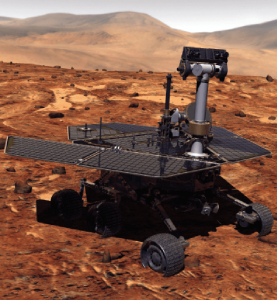
Remotely controlled rovers are used to test and practice complex tasks in Mars-like desert environments. (Artist’s Rendering: Stocktrek Images_Stocktrek Images_Getty Images)
DS: Our time servers are equipped with high-quality precise internal time references such as OCXOs or atomic clocks and then disciplined by external references such as GNSS. They are resilient because they can operate precisely for long periods in GNSS-denied situations as standalone devices in holdover mode or from multiple alternative references, such as:
network-based NTP, PTP and PTP WR time services
wireline references from IRIG, 1PPS or ASCII time code
LEO PNT reference from the STL signal
eLoran when available
They are also resilient because they detect and mitigate interference from the GNSS signal before it can corrupt the PNT solution.
Our GNSS simulators are adding alternative PNT features to provide a complete test and evaluation solution for resilient PNT systems. We have recently added INS/IMU test features and have integrated with Anritsu’s cellular test stations to evaluate and qualify combined GNSS/cellular location functions. Orolia GNSS simulators support generation of custom GNSS signals and playback of IQ waveforms, and provide complete toolsets for GNSS jamming and spoofing testing. This allows creation of the threat environment to allow evaluation of alternate PNT signals as backup or alternative to GNSS. Orolia offers an open-source framework allowing any end user to develop their own sensor plug-in leveraging the Skydel simulation engine.
Our Resilient PNT for Defense product line includes the VersaPNT, which uses alternate non-GNSS PNT sensors such as IMUs, barometers, wheel ticks, INS and non-GPS-based LEO satellites. Alternate RF navigation or non-GNSS sources of radio frequency (RF) are of interest in highly degraded or contested signal environments. Interest is focused on low-Earth-orbit (LEO) constellations. These systems offer high receiver signal power (relative to GNSS) and a secure and resilient link to augment GNSS.
MN: All our products are designed to answer to challenging GNSS conditions, starting with our Ellipse series, which includes an industrial-grade IMU capable of coping with short-term GNSS outages. Its miniature size allows integration in robotics and also makes it suitable for cost-sensitive applications. Our Apogee and Horizon series, with their navigation-grade IMUs, are the most resilient systems in the event of GNSS outages. These products reach very high-end performance in real time, but become exceptional when used with our post-processing software Qinertia. Tightly coupled algorithms make the solution capable of coping with long-term GNSS outages.
JA: We have previously created solutions using retroreflective strips for path following with driving robots. and we are also compatible with Locata’s system, a large infrastructure solution popular for automation in shipping ports. More recently, we have released an offering for UWB in an integration with Pozyx. This is perfect for GNSS-denied environments as a direct replacement for what GNSS can provide in terms of position information. We are also exploring alternative ways to synchronize clocks and get timing information. This year we have developed PTP functionality on all of our devices. Alternative PNT is going to be vital as we look to the future of navigation and thinking about how we can navigate flawlessly anywhere and address more complex environments, particularly urban areas.
CS: We are focused on the provision of terrestrial low-frequency equipment and systems for primary, co-primary, alternative, complementary and backup PNT. We provide all the products and services required to design, develop, install, certify, operate and maintain Loran-C, eLoran and LFPhoenix equipment and systems. We provide the technology to perform coverage diagrams and site surveys; all the equipment required at a transmission site; all the equipment required at a differential reference station or quality-of-service site; all the equipment required for a monitor and control site; ASF measurement and analysis equipment; and various models of end-user equipment (including receivers and antennas) for the timing/frequency, maritime, aviation, land-mobile and handheld markets.
GPS III SV05 (nicknamed Armstrong) was launched on June 17. (Photo: U.S. Space Force)
The U.S. Space Force’s Space and Missile Systems Center (SMC) transferred Satellite Control Authority of the GPS III SV05 to the 2nd Space Operations Squadron at Schriever (2 SOPS) Air Force Base on June 28. The fifth GPS III satellite — nicknamed Armstrong —was launched into space on June 17.
On June 29, GPS III SV05 received Operational Acceptance approval, marking the first GPS III SV to receive SCA handover and Operational Acceptance within 24 hours and decreasing the time from launch to on-orbit operational capability by 97 percent.
In 2020, the GPS enterprise launched two GPS III SVs in the midst of a global pandemic. According to Los Angeles Air Force Base, home of SMC, the delivery time from launch to Operational Acceptance approval has continued to shrink, with innovation and teamwork across the GPS enterprise enhancing rapid identification and elimination of redundant on-orbit verification steps.
Launch of SV05 was the first National Security Space Launch on a previously flown Falcon 9 booster, reusing the same booster that delivered GPS III SV04 to orbit in November 2020.
GPS III SV05 joins a constellation of 31 operational satellites. “The inclusion of GPS III SV05 into the operational constellation marks another significant milestone for the enterprise with 24 M-code capable satellites,” said Colonel Heather J. Anderson, transition director.
The Lockheed Martin-built GPS III SVs provide improved accuracy, advanced anti-jam capabilities, and increased resiliency for the GPS constellation and 4 billion users worldwide. GPS III SV05 will be set healthy to all global users in September, following the completion of on-orbit testing.
Testing on Galileo’s second-generation hardware has begun.
Test versions of the satellites’ navigation payloads is undergoing evaluation by Airbus Defence and Space at its Ottobrunn facility in Germany and by Thales Alenia Space at the ESTEC technical center in the Netherlands of the European Space Agency (ESA).
Known as the Galileo Payload Testbeds (GPLTBs), these are development models of the navigation payloads intended for the Galileo Second Generation (G2) satellites. The navigation antennas of the testbed payloads are being testing to check whether they meet the ambitious performance levels set for the G2 satellites.
Instead of being assembled from space-ready components like an actual satellite payload, the GPLTBs are built from electronic parts placed in test racks, with a proof-of-concept version of a navigation antenna attached.
“The goal with these test campaigns is to prove their design concepts early, and anticipate any technical issues that might arise as early as possible,” said Cédric Magueur, ESA’s payload manager for the Thales G2 satellites.
“These campaigns also make it possible to develop and validate new performance measurements concepts for these new generation of complex navigation payloads,” said Dirk Hannes, ESA’s payload manager for the Airbus G2 satellites. “This will allow us to optimize the production efficiency of the flight model series.”
The second satellite in the European Data Relay System (EDRS) undergoes tests at Airbus’s Compact Antenna Test Range facility. (Photo: ESA)
“Results from the testing will feed into the up-coming Preliminary Design Review for the new satellites, backing up the analyses by the companies with solid measurements,” Cédric said. “Such early testing also supports the ambitious timescale for the development and construction of G2 satellites, with the first satellites planned to reach orbit by the middle of this decade.”
There are 26 Galileo satellites now in orbit; deployment of 12 more will begin by the end of this year. Next will come the first 12 G2 satellites, featuring enhanced navigation signals and fully digital payloads. The new generation will be made up of two independent families of satellites meeting the same performance requirements, produced by Thales Alenia Space in Italy and Airbus Defence and Space in Germany.
Airbus Defence and Space’s GPLTB is undergoing radiated testing at the company’s Ottobrunn facility, inside a Compact Antenna Test Range (CATR). Meanwhile, the Thales Alenia Space GPLTB is about to start testing inside ESTEC’s own Hybrid European Radio Frequency and Antenna Test Zone (Hertz) chamber. The metal-walled chambers are isolated from external radio interference, with inner walls studded with foam pyramids to minimize radio-frequency signal reflections, mimicking the void of space.
“Up until now all GPLTB testing has taken place by plugging them into test boards,” Cédric said. “These test campaigns mark the first time that their performances will be confirmed in terms of radiating signals. In our first phase we will perform near-field measurements directly around the antenna to measure all the characteristics of the signal shape, to check it matches previous conductance tests. Then, via computation, we can derive its far-field performance.”
In the second test phase, the actual far-field measurements will be performed using another feature of the chambers, a pair of paraboloid reflectors. In this way, the signal from the testbed can be reshaped as if it had traveled the long distance that actual Galileo signals need to travel, from an altitude of 23,222 km down to Earth’s surface.
At Airbus, the testing is being undertaken in reverse order, with the far-field measurements taking place before performing the near-field measurements.
The U.S. Space Force will host the 2021 Public Interface Control Working Group and Open Forum in September and November. The meetings are open to the public in person and virtually on Wednesday, Sept. 29, 8:30 a.m. to 4 p.m., and Tuesday, Nov. 19, 8 a.m. to 4 p.m. (Pacific Time).
The meeting and forums will discuss the following documents:
The purpose of the meeting is to update the public on GPS public document revisions and collect issues and comments for analysis and possible integration into future GPS public document revisions.
The meeting will be held in person at
Los Angeles Air Force Base
Great Room, -PCT Campus
100 Sepulveda, Blvd.
El Segundo, CA 90245
Attendees are highly encouraged to participate virtually. It can be accessed at this link or at this link.
The official public notice in the Federal Register provides further information, including how to register, submit comments and dial in on the telephone.
A new draft policy in India seeks to foster global use of its Indian NavIC satellite navigation system. The draft Indian Satellite Navigation Policy 2021 (SATNAV Policy 2021) is part of reforms of the Indian Space Research Organisation (ISRO)/Department of Space (DoS).
“ISRO/DOS shall work towards expanding the coverage from regional to global to ensure availability of [the] NavIC standalone signal in any part of the world without relying on other GNSS and aid in wide utilization of [the] Indian navigation system across the globe,” states the policy document.
DoS will push NavIC for global use to meet demand for positioning, navigation and timing in commercial, strategic and societal applications. It aims to ensure the continuous availability of free-to-air navigation signals for civilian uses, while providing secured navigation signals for strategic uses.
The draft document plans for continuity of NavIC and GAGAN services, while also ensuring Indian satellite navigation and augmentation signals are compatible and interoperable with other GNSS/SBAS signals. The International Telecommunication Union (ITU) regulated frequency allocation to prevent interference among signals from different systems. This interoperability allows users to seamlessly switch from one constellation system to another and results in improved navigation signal, especially in a situation where an area is obscured from one satellite system.
DoS will continue to work with ITU for frequency allocation. It will also take part in the United Nations Committee on Peaceful Uses of Outer Space (UNCOPUOS), International Civil Aviation Organisation (ICAO) and International Maritime Organisation (IMO).
In addition, ISRO will provide technical support for academic institutions in GNSS research and applications.
CICERO-2 satellites will track Earth’s atmosphere, water, surface and interior
Remote sensing company GeoOptics Inc. has upgraded its CICERO constellation of satellites that measure the Earth’s climate. With launches beginning next year, CICERO-2 will form a unified Earth observatory allowing governments, industry and individual stakeholders to monitor and prepare for the impacts of climate change.
“In today’s environment, in which precision Earth sensing is becoming ever more critical, GeoOptics is deploying a flexible observatory made up of dozens of small satellites,” said Alex Saltman, Chief Executive Officer of GeoOptics. “The real time services will satisfy a broad range of needs for government and civil users around the world.”
The first CICERO-2 satellites launched are designed to achieve key milestones in small satellite Earth observation, including:
Advanced GNSS reflectometry (GNSS-R). Advanced GNSS-R measures many phenomena near Earth’s surface, including ocean winds, flooding, land cover (snow, ice, vegetation), soil moisture and topography by means of reflected GNSS signals. NASA’s recent CYGNSS mission demonstrated the broad utility of the GNSS-R technique. GeoOptics is working with NASA’s Jet Propulsion Laboratory (JPL) to deploy an advanced operational version, offering dramatically enhanced performance in a small, low-cost package. This collaboration is funded jointly by GeoOptics, the U.S. Air Force, and NASA.
Triple radio occultation (GNSS-RO). GNSS-RO enables Profiling of atmospheric temperature, pressure, density and other key properties. First proposed by company founder Tom Yunck while he was at JPL, GNSS-RO offers extreme measurement precision and is an essential contributor to global weather forecasting. The CICERO-2 satellites will yield three times the data volume of their predecessors and many times the volume.
Global precipitation watch. The CICERO-2 satellites will monitor heavy precipitation using polarimetric radio occultation (RO), an advanced remote sensing technique pioneered by GeoOptics’ collaborators at JPL and the Spanish PAZ mission.
Measuring weather changes
For GeoOptics’ strategic partner Climavision, a weather data provider, these innovations will enable customers to manage significant risks in a time of global change. “With these new developments in remote-sensing technologies from GeoOptics, we’ll be able to further enhance our climate and weather prediction capabilities,” said Chris Goode, CEO and co-founder of Climavision. “Through the combination of advanced RO profiles, GNSS-R data about surface conditions and our proprietary gap-filling radar network data, we’ll help customers in weather-sensitive industries see weather like never before and give them the tools and data to make informed critical decisions.”
GeoOptics will later extend the system to a range of new applications, including precise mapping of Earth’s gravitational field, which has been named a top NASA Earth science priority for the next decade. This measurement shows the imprint of climate-related movement of water and other key changes in the Earth.
With internal investment and nearly $4 million from NASA, GeoOptics has devised a unique system architecture for daily gravity mapping with clusters of small satellites. This patented technique promises to improve gravity sensing 20-fold over current methods at a fraction of the cost.
Under the umbrella of the National Oceanographic Partnership Program (NOPP), GeoOptics is also designing a radar instrument to observe ocean vector winds, topography, soil moisture and a variety of other surface properties with patented multi-satellite radar techniques. NOPP is seeking to sponsor a trial flight of GeoOptics’Cellular Ocean Altimetry/Scatterometry Technology (COAST) within the next two years.
Tom Yunck, GeoOptics’ Chief Technology Officer, said, “These advanced remote sensing applications – from basic RO to advanced radar and gravity mapping – exploit shared micro technologies that fit in the palm of one’s hand. Each new function builds naturally upon the previous, yielding prodigious observing capacity in a low-cost system of great simplicity and reliability.”
“CICERO-2 is designed to help provide high-priority NOAA climate and weather monitoring observations, as ranked by the NOAA Space Platform Requirements Working Group (SPRWG),” said Conrad C. Lautenbacher (Vice Admiral, USN ret.), executive chairman of GeoOptics and former National Oceanic and Atmospheric Administration (NOAA) administrator. “It can also play a key role in supporting crucial Defense Department satellite weather data requirements.”
GeoOptics’ CICERO satellites continue to provide precise global profiles of the Earth’s atmosphere. In February, NOAA selected GeoOptics to provide the first commercial satellite data to be included in its operational forecasts.
In 2020, GeoOptics was selected by NOAA to lead an end-to-end design study for its next-generation low-orbiting weather satellite system, planned to come online later this decade, building in part on RO and GNSS-R technologies.
The Navigation Technology Satellite-3 (NTS-3) program is making major strides in developing a new navigation spacecraft for in-space demonstration. The NTS-3 is scheduled to launch to geosynchronous orbit from Cape Canaveral in 2023.
This summer, Northrop Grumman Corp. delivered the ESPAStar-D spacecraft bus to L3Harris Technologies of Palm Bay, Florida.
“The transfer of the bus allows L3Harris to move forward building the NTS-3 spacecraft,” said 2nd Lt. Charles Schramka, the program’s deputy principal investigator. “L3Harris will perform tests and begin integrating the NTS-3 PNT payload onto the bus. Together the bus and payload will form the NTS-3 spacecraft.”
Following L3Harris’s work, the Air Force Research Laboratory (AFRL) will test the bus with the NTS-3 ground control and user equipment segments, and will perform its own integrated testing on the overall NTS-3 system architecture.
Northrop Grumman has successfully delivered an ESPAStar-D spacecraft bus to L3Harris in support of the NTS-3 mission. (Photo: U.S. Air Force)
NTS-3 in the Vanguard. In 2019, the U.S. Air Force designated NTS-3 as one of three Vanguard programs — priority initiatives to deliver new capabilities for national defense. The NTS-3 mission is to advance technologies to responsively mitigate interference to position, navigation and timing (PNT) capabilities, and increase system resiliency for GPS military, civil and commercial users.
“This is the first time an ESPAStar bus has been built and delivered as a commercially available commodity,” said Arlen Biersgreen, NTS-3 program manager. “NTS-3 is using a unique acquisition model for the ESPAStar line that fully exercises the commercial nature of Northrop Grumman’s product line, in order to provide the bus to another defense contractor for payload integration using standard interfaces.”
The ESPAStar-D bus, built in Northrop Grumman’s satellite manufacturing facility in Gilbert, Arizona, includes critical subsystems such as communications, power, attitude determination and control, in addition to configurable structures to mount payloads.
The bus will “provide affordable, rapid access to space,” according to Northrop Grumman. Its configuration, using an Evolved Expendable Launch Vehicle (EELV) Secondary Payload Adapter (ESPA), allows multiple separate experimental payloads to be stacked together on one launch vehicle. AFRL developed the ESPA ring to transport space experiments, allowing for lower cost and more frequent trips to space for government and industry users.
Besides the bus delivery, there are other advances in the program.
GNSSTA receiver. In June, AFRL took delivery of an experimental receiver — GNSS Test Architecture (GNSSTA). The receiver was developed by the AFRL unit the Sensors Directorate, located at Wright-Patterson Air Force Base in Ohio, and Mitre Corporation. GNSSTA is a reprogrammable software-defined signal receiver that will allow the Air Force to receive both legacy GPS and advanced signals generated by NTS-3.
AFRL will continue its integration efforts through 2022 to ensure all parts are working together for the fall of 2023 NTS-3 launch.
“With the delivery of the bus we are entering into the next phase of payload integration,” Biersgreen said. “These recent breakthroughs allow the program to continue to move forward and prepare for launch of the first U.S. integrated satellite navigation experiment in over 45 years.”
Artist’s concept for NTS-3 in geostationary orbit. (Artist’s concept: 2d Lt. Jacob Lutz, AFRL)
Russia has postponed the launch of its first next-generation Glonass-K2 satellite until early in 2022, according to a report from TASS. The launch was originally scheduled for the fourth quarter of this year. The delay is due to a portion of onboard equipment requiring further work following a ground-based test run.
Glonass-K2 is the next-generation navigation satellite of Russia’s GLONASS positioning system. The K2 satellites are expected to provide navigation precision of less than 30 cm.
A team of companies and government agencies is developing satellite services provided by ASECNA’s A-SBAS (Satellite-Based Augmentation System) for Africa and the Indian Ocean. Besides the current SBAS, the joint venture will deliver precise point positioning (PPP, through CNES and Geoflex) and danger warnings for a wide range of applications in Africa.
Working together are the Agency for Air Navigation Safety in Africa and Madagascar (ASECNA), Nigerian Communications Satellite Ltd. (NIGCOMSAT) and Thales Alenia Space, the joint venture between Thales (67%) and Leonardo (33%). The project is backed by Geoflex, a provider of cloud services that deliver improvements to GPS/GNSS applications to achieve positioning accuracy to within 4 centimeters on land, at sea and in the air.
The new SBAS services are expected to aid agriculture and other sectors in Africa. Here,volcanic cinder cones and farming in rich volcanic soils on the border of the Democratic Republic of Congo and Rwanda. (Photo: iStock/Getty Images Plus)
Demonstrations
The three partners successfully demonstrated the additional services on July 7 and 8 in Brazzaville, Congo, by calling on the SBAS signal they have broadcast over the Africa and Indian Ocean (AFI) region since September 2020 to provide the first SBAS open service in this part of the world via the NigComSat-1R satellite. This trial follows successful flight demonstrations this year in Lomé in January and Douala in June.
The first demonstration of the special urgent situation warning service via satellite showed the system’s ability to broadcast a warning message via the A-SBAS signal to mobile phones, without requiring a terrestrial network. This service sends a message to the populations concerned, providing information on the type of danger and instructions to be followed.
The second demonstration entailed the transmission of GNSS corrections based on CNES/Geoflex PPP technology and also using the A-SBAS signal. This approach showed the system’s ability to achieve positioning accuracy to within centimeters across the entire African continent.
The new satellite service paves the way for applications in a broad range of sectors, including precision agriculture, land and maritime transport, rail safety, drone navigation, mapping and surveying. The ASECNA SBAS was developed as part of the ‘’SBAS for Africa & Indian Ocean’’ programme as a first step towards providing robust navigation services in the aviation sector.
ASECNA’s 18 Member States are Benin, Burkina Faso, Cameroon, Central African Republic, Comoros, Congo, Côte d’Ivoire, France, Gabon, Guinea Bissau, Equatorial Guinea, Madagascar, Mali, Mauritania, Niger, Senegal, Chad and Togo.
The successor to the first quasi-zenith satellite, dubbed Michibiki, is expected to launch this year.
Michibiki was launched by the Japan Aerospace Exploration Agency (JAXA) in September 2010 and was transferred to the Cabinet Office in 2017. The replacement satellite is now undergoing prototype testing at the satellite manufacturer’s facility(Mitsubishi Electric Co. Ltd. Kamakura Seisakusho) in Kanagawa.
The tests will confirm performance of the replacement satellite before it is put into service. It is undergoing acousitic, vibration and thermal vacuum tests to ensure it will remain functional after launch and in space.
After testing, the satellite will be transported to the Tanegashima Space Center for launch, which is expected to take place later this year.
Replacement for Michibiki: The L-band antenna that transmits the positioning signal is mounted on the Earth-oriented left side. (Photo: JAXA)
Though built to succeed the first QZSS satellite, the replacement is based on the second and fourth satellites
Main specifications of the successor to the first satellite and other satellites:
item
First machine
Units 2 and 4
Unit 3
Successor to the first machine
Orbit
Quasi-zenith
Quasi-zenith
Rest
Quasi-zenith
Positioning signal
L1-C / A,
L1C, L1S,
L2C, L5, L6
L1-C / A, L1C,
L1S, L2C,
L5, L5S, L6
L1-C / A, L1C,
L1S, L1Sb, L2C,
L5, L5S, L6
L1-C / A
(L1-C / B (* 1)),
L1C, L1S, L2C,
L5, L5S, L6
L band antenna
Helical method
(* 2)
Helical method
(* 2)
Patch method
(* 3)
Patch method
(* 3)
Generated power
5.3kW
6.3kW
6.3kW
6.3kW
mass
About 4t
About 4t
About 4.7t
About 4t
Design life
10 years or more
Over 15 years
Over 15 years
Over 15 years
Launch year
2010
2017
2017
2021
(planned)
Launch
rocket
H2A202
H2A202
H2A204
H2A202
(* 1) Signal transmitted by BOC (Binary Offset Carrier) modulation of L1-C / A code
(* 2) Antenna with spiral antenna elements arranged
(* 3) Antenna with planar antenna elements arranged
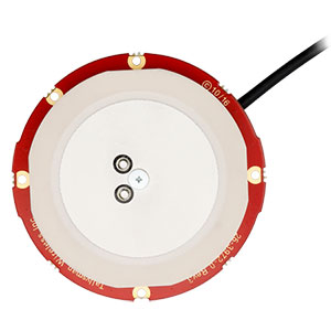
Tallysman Wireless has added new eXtended Filtering (XF) features to the TW3900 series of Accuntena precision antennas. Tallysman designed the XF feature to mitigate interference from all near-band signals and ensure that the antenna provides the purest GNSS signals.
Tallysman’s TW3972XF, TW3972EXF, TW3972LGXF, TW3967XF, and TW3967LGXF are triple-band antennas that support GPS/QZSS (L1/L2/L5), GLONASS (G1/G2/G3), Galileo (E1/E5ab), BeiDou (B1/B2/B2a), NavIC L5, and L-Band correction services.
Worldwide, the radio frequency spectrum has become congested as many new LTE bands have been activated, and their signals or harmonic frequencies can affect GNSS antennas and receivers. In North America, the planned Ligado service, which will broadcast in the frequency range of 1526 to 1536 MHz, can affect GNSS antennas that receive space-based L-band correction service signals (1539–1559 MHz).
The TW3972-XF antenna. (Photo: Tallysman)
New LTE signals in Europe [Band 32 (1452–1496 MHz)] and Japan [Bands 11 and 21 (1476–1511 MHz)] have also affected GNSS signals. Lastly, the Inmarsat satellite communication uplink (1626.5–1660.5 MHz) commonly used on maritime vessels can also affect nearby GNSS antennas.
Tallysman’s custom XF filtering has been tested to mitigate new (Europe and Japan) and existing LTE signals, enabling the XF antennas to produce clean and pure GNSS radio frequency data. The deep XF filter technology will be applied to all of Tallysman’s product lines.