Category: GNSS

  • Spire’s Earth observation contract includes GNSS-RO, GNSS-R data

    Spire’s Earth observation contract includes GNSS-RO, GNSS-R data

    New task order continues delivery of comprehensive space data and opens availability to all U.S. government-funded researchers and federal agencies

    Image: Just_Super/iStock/Getty Images Plus/Getty Images
    Image: Just_Super/iStock/Getty Images Plus/Getty Images

    Spire Global,  a global provider of space-based data and analytics, has announced the continuation of its participation in NASA’s Commercial Smallsat Data Acquisition (CSDA) Program with a $6 million contract extension.

    The contract continuation, Task Order 6 (TO6), is a subscription data solution that includes radio occultation (RO) data, grazing angle GNSS-RO, total electron content (TEC) data, precise orbit determination (POD) data, soil moisture and ocean surface wind speed GNSS reflectometry (GNSS-R) data and magnetometer data.

    This data will be available to all federal agencies, NASA-funded researchers and, more broadly, to all U.S. government-funded researchers for scientific purposes.

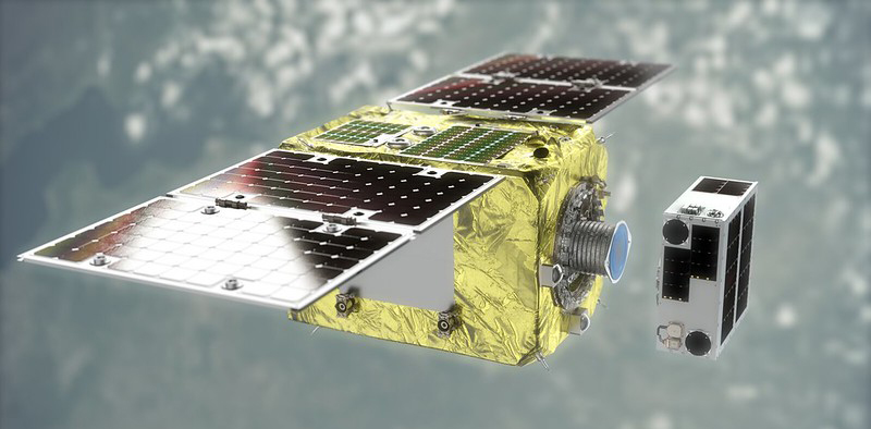
    Under CSDA Program TO6, Spire will deliver a comprehensive catalog of data, associated metadata and ancillary information from its Earth-orbiting small-satellite constellation. The company operates its constellation in low Earth orbit and collects upwards of 10,000 radio occultations per day with consistent global coverage.

    For TO6, Spire will provide rolling access to 12 months of radio occultation data with a 30-day latency. This data will be archived and maintained by NASA under the CSDA Program’s SmallSat Data Explorer (SDX) database.

    “Programs like CSDA highlight the incredible potential of private-public partnerships in the federal government to drastically accelerate our ability to confront some of the greatest challenges of our time, such as climate change,” said Peter Platzer, CEO of Spire. “With the end-user license agreements, our data is now available to all federal agencies and the larger NASA scientific community to help support Earth observation research across fields.”

    The program includes end-user license agreements (EULAs) to enable broad levels of dissemination and shareability. All federal agencies and U.S. government-funded researchers will have access to Spire’s data for scientific purposes under TO6 and will be able to request access to the data via the CSDA Program’s Commercial Datasets webpage.

    “At NASA, the CSDA Program has continued to blossom as a valuable resource to our team for our Earth observation research and analysis. We are committed to growing the program as well as continuing the work we have started,” said Will McCarty, project scientist at the CSDA Program and  research meteorologist at NASA Global Modeling and Assimilation Office. “Spire has been a valued partner through CSDA’s development since its inception, and with this additional task order, we are excited about the new insights and results that will come not only from within NASA, but also through broader collaboration through the domestic government scientific community.”

    NASA has used Spire data in its research on water and sea-ice levels in the polar regions, the height of the planetary boundary layer (PBL), and the day-to-day variability of thermospheric density at flight level.

    NASA also noted that Spire data has shown positive benefit to its GEOS Atmospheric Data Assimilation System, which uses space-based data to analyze the Earth’s atmosphere and assimilate the data into its Earth observation systems.

    As one of the original vendors for the CSDA Program, Spire provides NASA yearly updates to the scope of work under this agreement to ensure alignment of data to the agency’s needs.

  • Impact of ION ‘NAVIGATION’ journal continues to grow

    Impact of ION ‘NAVIGATION’ journal continues to grow

    This is the sixth consecutive year of growth of the journal’s impact factor

    Logo: IONThe Institute of Navigation announces that its quarterly journal, “NAVIGATION: The Journal of The Institute of Navigation,” has recorded its sixth consecutive year of growth of the publication’s Journal Impact Factor (JIF).

    The JIF, an index that calculates the yearly average number of citations to recent articles published in a journal, is considered a bellwether of the relative importance of a journal within its field. A journal with a higher impact factor generally is viewed as being more important than those with a lower impact factor due to its citation rate.

    NAVIGATION’s JIF has now increased to 2.1, representing a consecutive seven-year increase.

    NAVIGATION’s JIF growth reflects the continued focus and leadership of the Journal’s Editor, Richard B. Langley, who is also the editor of GPS World’s Innovation column. Also key to NAVIGATION’s growth is its editorial board, which includes: Penina Axelrad, Daniele Borio, Michael Braasch, Liang Chen, Pau Closas, James Curran, Naser El-Sheimy, Paul Groves, André Hauschild, Christopher Hegarty, Changdon Kee, Jiyun Lee, Sherman Lo, Gary McGraw, Michael Meurer, Thomas Pany, Boris Pervan, Jason Rife, Andrey Soloviev, Todd Walter, Zheng Yao and Zhen Zhu, and the Journal’s managing editor Lisa Beaty.

    NAVIGATION is the leading peer-reviewed scientific journal publishing articles on all areas related to the science and art of positioning, navigation and timing (PNT) and is indexed and abstracted in

    • Advanced Technologies & Aerospace Database (ProQuest)
    • ArticleFirst (OCLC)
    • COMPENDEX (Elsevier)
    • Current Contents: Engineering, Computing & Technology (Clarivate Analytics)
    • Earth, Atmospheric & Aquatic Science Database (ProQuest)
    • Electrical & Electronics Abstracts (IET)
    • Google Scholar (Google)
    • INSPEC (IET)
    • Materials Science & Engineering Database (ProQuest)
    • Natural Science Collection (ProQuest)
    • Science Citation Index Expanded (Clarivate Analytics)
    • SciTech Premium Collection (ProQuest)
    • SCOPUS (Elsevier)
    • Technology Collection (ProQuest)
    • Web of Science (Clarivate Analytics)
    • NAVIGATION is published by ION, in partnership with Wiley.
  • Orolia unveils EdgeSync network timing platform

    Orolia unveils EdgeSync network timing platform

    The new cost-effective small form factor is designed for NTP and PTP functionality

    Photo: EdgeSync
    Photo: EdgeSync

    Orolia has introduced EdgeSync, a new cost-effective network timing platform that provides Network Time Protocol (NTP) and Precision Time Protocol (PTP) Grandmaster and Boundary Clock functionality for real-time edge applications.

    High performance, scalability, ease of use and manageability make EdgeSync particularly suitable for a wide range of applications, including data centers, finance, mobile edge computing, enterprise, smart grid, industrial internet of things (IoT), process control or telecommunications.

    “EdgeSync is a great addition to Orolia’s timing product line because it’s ideally suited to meet the demanding requirements of today’s modern networks, including 5G infrastructure,” said Jeremy Onyan, director of Time Sensitive Networks at Orolia. “It delivers NTP and PTP capability to industries like process control, broadcast and telecom in a cost-efficient form factor that doesn’t sacrifice performance while taking advantage of the growing demand for edge applications.”

    EdgeSync uses a multi-GNSS receiver (GPS, Galileo, GLONASS, Beidou and QZSS), PTP and Synchronous Ethernet (SyncE) as input references and generates PTP, SyncE, NTP and timing signals (10 MHz, 1 PPS and Time of Day message) as outputs. It features dual 1 GbE ports for both copper RJ45 and optical network timing connections.

    EdgeSync also can provide IEEE 1588-2008 (PTP) Grandmaster and Boundary Clock functionality. The device leverages unique PTP algorithms to deliver stringent timing for demanding, precise applications and supports multiple industry PTP profiles for interoperability. An enhanced oscillator and PTP slave capacity option allow users to choose the EdgeSync performance level to meet their specific needs.

    EdgeSync is available both in the Orolia Online Store (shipping to U.S. addresses only) and directly from Orolia technical sales representatives.

  • Fugro SpaceStar positioning service heads into space

    Fugro SpaceStar positioning service heads into space

    Fugro’s SpaceStar GNSS precise point positioning (PPP) service provides high-accuracy positioning in space

    Artist's rendering of Loft Orbital’s YAM-2 small satellite in orbit. The small sat will demo Fugro's PPP service. (Image: Loft Orbital)
    Artist’s rendering of Loft Orbital’s YAM-2 small satellite in orbit. The small sat will demo Fugro’s PPP service. (Image: Loft Orbital)

    Loft Orbital on June 30 launched its YAM-2 satellite, the first satellite equipped with Fugro’s SpaceStar next-generation positioning technology from Cape Canaveral in Florida onboard a SpaceX Falcon 9 rocket. Now in orbit, the satellite will provide an on-orbit demonstration of the new service.

    From its 525-km Sun-synchronous orbit, SpaceStar is using PPP to deliver high-accuracy sub-decimeter onboard positioning in real time during YAM-2’s low Earth orbit (LEO) operations. Fugro’s proprietary positioning software is integrated into YAM-2 and receives precise GNSS real-time orbit and clock corrections from geostationary satellites. Highly accurate positioning in LEO is becoming increasingly important for Earth observation applications, safe constellations management, and space debris collision avoidance.

    “We’re especially excited to demonstrate this new functionality,” said Loft Orbital CTO, Pieter van Duijn. “Fugro’s SpaceStar service is something that can really help not only Loft Orbital’s missions, but also be of interest to the wider application of space situational awareness and safety.”

    “We are extremely proud to be providing our real-time PPP service to the YAM-2 small satellite,” said Daan Scheer, Fugro’s satellite positioning commercial manager. “We’ve been able to bring this innovative product to market thanks to our close cooperation with Loft Orbital, and we’re looking forward to completing a successful in-orbit demonstration mission. The accuracy of our SpaceStar position service is not only contributing to our purpose of a safe and liveable world but, by facilitating safer navigation in space, even beyond.”

  • US Space Force issues ICD revisions for GPS

    US Space Force issues ICD revisions for GPS

    CGSIC logo

    The U.S. Space Force Space and Missile Systems Center (SMC) has issued official, signed Interface Specification (IS) and Interface Control Document (ICD) revisions for GPS. The documents listed are available through the U.S. Coast Guard’s GPS Technical References and at GPS.gov.

    • IS-GPS-200M Navstar GPS Space Segment/Navigation User Interfaces
    • IS-GPS-800H Navstar GPS Space Segment/User Segment L1C Interface
    • IS-GPS-705H Navstar GPS Space Segment/User Segment L5 Interface
    • ICD-GPS-240D Navstar GPS Control Segment to User Support Community Interface

    Past versions of these documents are archived at GPS Technical References and at  GPS.gov Old Versions. Interface Revision Notices (IRN) incorporated into the new documents also can be found on these websites.

    The Space Force is soliciting public comments on the following Proposed Change Notices (PCNs).

    RFC-00467: 2021 Proposed Changes to the Public Documents

    While these PCNs use the August 2020 versions of the ICDs as baseline documents, any approved changes will be incorporated by the next document revisions. Comments are due Aug.24.

    SMC has also announced the date of the next Public Interface Control Working Group meeting. Full details will be provided in an upcoming Federal Register Notice, but advance notice can be found here.

  • Many technologies can help GNSS, but few can replace it

    Many technologies can help GNSS, but few can replace it

    Matteo Luccio
    Matteo Luccio

    Alternative. Complementary. Backup. Co-primary. These are some of the terms used to refer to sources of positioning, navigation and timing (PNT) data other than GNSS satellites.

    The four current GNSS constellations — supplemented by two regional ones and by public and private augmentation systems — have firmly established themselves as the primary source of PNT data by virtue of their accuracy, reliability, global coverage and ubiquitous use. Yet, this widespread dependency on them — especially on GPS — coupled with their well-known vulnerabilities to jamming, spoofing, other RF interference, multipath, solar flares and space debris (see page 10) — make the development of alternative sources of PNT data imperative. In fact, the U.S. Congress has repeatedly mandated it.

    Typically, when talking about alternative PNT, we are referring to sources of PNT data that either were not originally developed for navigation purposes — such as television broadcast towers used as “beacons of opportunity” — or that use a higher broadcast power or a different frequency band than GNSS. They include legacy systems and new versions of legacy systems, such as eLoran.


    “The only replacement for a GNSS is another GNSS.”


    Other non-GNSS sources of PNT data have a wide range of benefits, limitations and costs, including infrastructure requirements. Most provide only the P and the N, or only the T, in PNT. Inertial systems, for example, once initialized can provide positioning and navigation, but need to be periodically re-initialized to compensate for their drift. Therefore, while excellent for maintaining the navigation solution during short GNSS outages and very helpful in identifying false GNSS measurements due to multipath, they are no replacement for GNSS. Cameras, radar and lidar, while often excellent sources of relative positioning, cannot provide absolute positioning.

    It is even harder to replace GNSS when it comes to timing. Already enormously important in synchronizing the Internet, financial transactions and broadcasting, this service is essential to the development of complex new systems, such as integrating autonomous and legacy vehicles into digital traffic networks.

    As in other human enterprises, the key to resiliency in PNT is diversity: a mix of systems based on sufficiently distinct technological foundations so that a threat to one does not imperil the other ones. Additionally, having a variety of available sources of PNT data will enable users to choose the ones most suited to their platforms.

    However, we need to distinguish between technologies that can assist GNSS, such as inertial, and those that could substitute GNSS. I agree with Chuck Schue’s definition of the latter (see cover story, page 28): “an alternative PNT solution is one that is readily available; provides an easy and seamless transition to/from the primary or other alternatives; allows continuity of operation at a possibly degraded, yet usable, level of accuracy, availability, integrity or continuity; and is dissimilar enough from the primary solution to withstand the effects that might be affecting it.”

    Ultimately, Schue pointed out to me, “the only replacement for a GNSS is another GNSS.” So, let us stop referring to systems that are not true substitutes for GNSS as “alternative PNT.” Complementary is a more appropriate adjective.

  • GPSPatron seeks to protect critical infrastructure

    GPSPatron seeks to protect critical infrastructure

    Screenshot: GPSPatron
    Screenshot: GPSPatron

    GPSPatron is offering products and services to protect equipment, particularly GNSS-dependent critical infrastructure. Its GP-Probe TGE2 is designed to protect time servers against threats including spoofing, jamming, ionospheric scintillation and system errors. An embedded PPS phase-error measurement function enables reliable monitoring of the time server’s health by measuring the time offset between internal and external PPS.

    The GP-Probe, in conjunction with GP-Cloud, allows development of robust, resilient clock-synchronization systems. GP-Cloud is a web application for monitoring the quality of the GNSS signal and detecting anomalies in RAW GNSS data.

    Every second, the three-channel GP-Probe measures several signal parameters of all perceptible GPS, GLONASS, BeiDou and Galileo satellites and sends them to GP-Cloud for real-time processing. GP-Cloud allows users to investigate GNSS signal parameters, recognize attack scenarios, and improve resiliency to current and future GNSS threats.

    GPSPatron also provides laboratory testing services of GNSS equipment to identify vulnerabilities. It uses its own GP-Simulator to simulate spoofing attacks. Typical test objects are RTK base stations and time servers. Testing can help uncover possible attack scenarios.

    GPSPatron offers its solutions as a service, providing monitoring without investments in new hardware and software, as well as leasing of equipment.

    GP-PROBE TGE2 FEATURES

    • Three RF channels enable spatial signal analysis to detect coherent spoofing
    • 60 MHz RF signal analyzer for spectrum monitoring with FPGA-powered correlative peak analysis for non-coherent spoofing detection and interference classification
    • Optional GP-Blocker with an embedded noise generator suppresses the most powerful counterfeit RF signals
    • Authenticated PPS output for synchronization of external equipment
    • PPS input for checking time server health and monitoring the entire synchronization system
    • Optional GP-divider enables use of one GNSS antenna for two receivers
    • Form factor of 19-inch rack, half-size
    • Double power module: 110 – 220 AC, 18 – 75 DC
    • Active/passive GNSS antenna support
    • 4G modem and 100BASE-TX Ethernet for data transferring to GP-Cloud
    • Web interface for configuration (HTTP or HTTPS)
  • Editorial Advisory Board PNT Q&A: Promising alternatives to GNSS

    What is the most promising development or project in alternative PNT?

    Photo: Orolia
    John Fischer.

    “PNT from LEO (low-Earth orbit) satellites offers the most immediate alternative to GNSS because the signals are ~30 dB or more stronger, reducing jamming vulnerability. With these new constellations being launched to improve communications, PNT services can ‘piggyback’ on the secure two-way links and avoid spoofing attacks as well. Geometric dilution of precision (GDOP) will not be a problem in these large second-generation constellations with dozens of satellites in view. Wide bandwidth links should yield accuracies to rival GNSS. There may be subscription fees to get this added resiliency, but nothing worthwhile is ever free.”

    John Fischer,
    Orolia


    Bernard Gruber
    Bernard Gruber

    “It depends on the application. I believe that alternative PNT, and specifically systems that complement GPS/GNSS, will continue to drive forward at a very rapid pace. Quite frankly, the ‘affordability of GPS’ from a commercial and military user business case was impossible to ignore for years. Today, the threat to GNSS signals is very real. History illustrates that ‘alternative’ systems that employ environmental data (magnetic, celestial), radio navigation (Loran, VOR), sensors (gyros, accelerometers), seekers (SAL, EO/IR) and IMUs all have new and promising developments today.”
    Bernard Gruber,
    Northrop Grumman


    Thibault Bonnevie, SBG Systems
    Thibault Bonnevie

    “Inertially aided GNSS solutions are now mature and provide excellent navigation performance in many challenging conditions. On the research side, there are many exciting alternative PNT projects ongoing. RF-based solutions, such as Bluetooth/Wi-Fi or LEO satellite ranging, give promising results but are still subject to jamming or spoofing. Just like GNSS. Vision-based SLAM is probably the most exciting technology as it enables navigation in a wide range of situations and does not rely on any kind of infrastructure. It only requires low-cost sensors to be operated.”
    Thibault Bonnevie,
    SBG Systems


    Headshot: Ismael Colomina
    Ismael Colomina

    “We all know that predictions are hazardous, especially about the future. This said, I confess that I am particularly interested in the technical, regulatory and commercial development of the LEO-based PNT technology with either dedicated constellations, like XONA’s Pulsar, or broader scope ones such as Iridium Next, Starlink or Kuiper. While GNSS has progressed tremendously in recent times — it plays a large role in the navigation of autonomous vehicles — it is still vulnerable to intentional or unintentional jamming. Integration of LEO-based PNT with current GNSS and other motion sensors appears to be a fascinating field ahead of us..”
    Ismael Colomina,
    GeoNumerics

  • RUAG Space provides GNSS-equipped computer for space debris removal

    RUAG Space provides GNSS-equipped computer for space debris removal

    The ELSA-d satellite servicer and client launched March 2021, the team prepares to demonstrate the servicer’s technology and capability to remove the Client debris from this summer. (Image: Astroscale)
    Launched in March, the ELSA-d satellite will demonstrate space-debris removal this summer. (Image: Astroscale)

    RUAG Space has provided its GNSS-equipped computer to command Astroscale UK‘s ELSA-M Servicer, a spacecraft designed to remove space debris.

    Space debris is a growing concern for the space industry. End-of-life services by Astroscale (ELSA) — a spacecraft decommissioning service for satellite operators — will progress to a commercialization phase this year with the ELSA-M. The M stands for multi-client servicer.

    The Astroscale ELSA-M spacecraft is designed to de-orbit multiple retired satellites in low Earth orbit, which will then burn up on atmospheric re-entry.

    “The ELSA-M servicer will be optimized to remove multiple retired satellites from low-Earth orbit in a single mission,” said John Auburn, managing director of Astroscale UK and group chief commercial officer. The ELSA-M servicer is specifically designed for servicing constellation satellites, such as those launched by GNSS authorities or by the global satellite communications network OneWeb.

    The computer from RUAG Space will include a GNSS receiver and interface unit. Based on RUAG Space’s constellation On Board Computer (cOBC), the computer controls the ELSA-M spacecraft, enabling repeated multi-debris removal maneuvers and management of equipment, reaction wheels and magnetometers linked to it. The cOBC is designed to be a flexible off-the-shelf computer with high integration and short lead time, enabling high-volume manufacturing.

    The computer system developed in partnership with RUAG Space — with software from Astroscale and hardware from RUAG Space — will support the rendezvous between Astroscale’s servicer spacecraft and the client spacecraft, a retired or defunct satellite.

    The GNSS receiver in the RUAG Space Computer is entirely from RUAG Space, including the NavRIX Integral antenna, which is integrated into the computer. The single-frequency GNSS receiver is capable of processing GPS and Galileo signals and offers several real-time positioning performance options ranging from 20-m 3D rms (root mean square) to better than 1-m 3D rms.

    Photo: RUAG Space
    Photo: RUAG Space

    Specs of the cOBC’s GNSS receiver

    • Tracks GPS L1 C/A or Galileo L1B / L1C signals and provides position, velocity and time
    • Accuracy down to a maximum error of 3.5 m RMS 3D with use of dynamic filtering
    • Pulse per second (PPS) time error < 1 μs RMS
    • Operation with or without external LNA
  • Sen. Inhofe introduces bill to make Ligado pay everyone harmed

    Sen. Inhofe introduces bill to make Ligado pay everyone harmed

    The bipartisan RETAIN GPS and Satellite Communications Act seeks to compensate all GPS and satellite communications users harmed by the April 2020 Ligado Order from the FCC.

    Sen. Inhofe with his staff introduces the RETAIN GPS and Satellite Communications Act. (Photo: RNTF}
    Sen. Inhofe introduces the RETAIN GPS and Satellite Communications Act. (Photo: RNTF)

    On June 23, Senator Jim Inhofe (R-OK) held a press event on the lawn of the U.S. Capitol. There he announced his introduction of the “Recognizing and Ensuring Taxpayer Access to Infrastructure Necessary for GPS and Satellite Communications Act” or the “RETAIN GPS and Satellite Communications Act.”

    Inhofe is the ranking member of the powerful Senate Armed Services Committee. That committee’s chair, Senator Jack Reed (D-RI), is a co-sponsor, as are Senators Tammy Duckworth (D-IL) and Mike Rounds (R-SD).

    The bill has several provisions, all of which are aimed at ensuring anyone using the frequencies the Federal Communications Commission (FCC) allocated Ligado in April 2020 will compensate all GPS and satellite communications users that are harmed.

    This would pose a significant increase in financial liability for Ligado. Under the current FCC order, is only responsible for reimbursing the federal government for costs to modify systems and replace equipment.

    Many see this provision as manifestly unfair. “The FCC is requiring Ligado to pay damages to federal equipment, so the company should also pay damages to equipment owned by ordinary Americans,” said George Washington University economics professor Diana Furchtgott-Roth.

    “With Ligado 5G transmitters overwhelming GPS signals, pipeline maintenance and systems operations would be affected. Plus, private pilots might find that navigation technology does not operate, joggers might find that their health trackers ceased to work, and firefighters might not be able to get to their destinations.”

    She estimates the cost of damage to non-federal entities to run into the billions of dollars. Furchtgott-Roth previously served as and Acting Assistant Secretary for Economic Policy at the Department of Treasury and Deputy Assistant Secretary at the Department of Transportation.

    The FCC decision was, and remains, controversial. Seven different petitions to reconsider were filed by various organizations and coalitions, including the National Telecommunications Information Agency (NTIA) on behalf of the entire executive branch.

    The FCC has yet to respond to any of the petitions, though it has denied requests to stay its order pending resolution of concerns.

    Inhofe has long been concerned about the FCC’s action. As then-chair of the Senate Armed Services Committee, he held hearings, issued press releases, and made public statements aimed at Ligado’s financial backers and potential backers. All warn of disastrous consequences should Ligado’s plan for transmissions in the bands adjacent to GPS be put into operation.

    Inhofe also ensured several provisions were included in the 2021 National Defense Authorization Act (NDAA) that addressed the FCC’s action. These include:

    • A requirement for the Department of Defense (DOD) to estimate and report to Congress the cost of damage to department systems as a result of the FCC order.
    • Prohibiting use of department funds to upgrade or modify military equipment to make it resilient to interference caused by broadcasts in the spectrum allocated (the FCC order requires this to be funded by Ligado).
    • Prohibiting DOD from contracting with any entity using the frequency bands allocated to Ligado unless the Secretary of Defense certifies the use will not interfere with GPS services.
    • Requiring the Secretary of Defense to contract with the National Academies of Sciences, Engineering, and Medicine for an independent technical review of the FCC order.

    More information about the proposed “RETAIN GPS and Satellite Communications Act” is available at the Senator’s website.


    Dana A. Goward is President of the Resilient Navigation and Timing Foundation. The foundation has petitioned the FCC to reconsider its decision regarding Ligado Networks.

  • SpaceX launches GPS satellite to provide PNT services

    SpaceX launches GPS satellite to provide PNT services

    SpaceX launched into orbit for the U.S. Space Force the fifth GPS III satellite (SV05) on June 17.

    Photo: U.S. Space Force
    Photo: U.S. Space Force

    GPS III SV05 eventually will replace one of the legacy GPS IIR satellites. Once GPS III SV05 is operational, about 16% of the 31-satellite constellation will be modernized with GPS III’s new capabilities.

    M-Code Requirement Met

    GPS III SV05 is the 24th M-code satellite on orbit, completing the constellation’s baseline requirement to provide U.S. military forces a more-secure, harder-to-jam and spoof GPS signal.

    GPS III SV05 is the fifth Lockheed Martin-built, next-generation GPS III space vehicle. The SpaceX Falcon 9 rocket is the first U.S. Space Force mission to reuse a previously-flown booster, the company said.

    The U.S. Space Force contracted Lockheed Martin to design and build GPS III/GPS IIIF satellites to help modernize today’s GPS satellite constellation with new technology and advanced capabilities. Lockheed Martin said the GPS III provides three-times greater accuracy, eight times improved anti-jamming capability for U.S. military forces; a new L1C civil signal to the constellation that is compatible with other GNSS; and a new modular design that allows new technology and capabilities to be added in the future to better address changing mission needs and emerging threats.

    Future GPS III Satellites

    GPS III Space Vehicles 06, 07 and 08 already are complete and waiting to be called up for their launch dates, which are to be determined.

    In addition, GPS III SV09 was core-mated, meaning it reached a major production milestone in which two major satellite components — the mission module and the propulsion core — are paired to form one space vehicle. The GPS III SV10 currently is in the component build up stage.

    Lockheed Martin has been contracted to design and build up to 22 additional GPS III Follow On – or GPS IIIF – satellites (SV11-32), with even more capabilities. Contract options for the first four GPS IIIFs, SV11-14, have been exercised so far.

    Photo: Lockheed Martin
    The U.S. Space Force contracted Lockheed Martin to design and build GPS III/GPS IIIF to help modernize today’s GPS satellite constellation. Photo: Lockheed Martin
  • Space Foundation announces details for 36th Space Symposium

    Space Foundation announces details for 36th Space Symposium

    Global space community convenes in person and virtually Aug. 23-26

    space symposium event logoSpace Foundation, a nonprofit advocate organization founded in 1983, is offering a hybrid in-person and virtual experience for its  36th Space Symposium. The event will take place Aug. 23-26 in person at The Broadmoor in Colorado Springs and virtually through Symposium 365 digital platform.

    “The past year has challenged us all, but the space community has demonstrated its perseverance and inspiration in countless ways,” said Space Foundation CEO Tom Zelibor. “The capabilities are now in hand for us to safely gather again in person, while expanding our reach to host attendees from around the world virtually and make them part of the Space Symposium experience.”

    Tom Zelibor, CEO, Space Foundation
    Tom Zelibor, CEO, Space Foundation

    Working with its multiple partners, corporate members, and stakeholders, Space Foundation has created a hybrid program for the first time in nearly four decades of Space Symposium operations that will allow for in-person and virtual attendance. The in-person assembly of global space leaders and innovators will be limited in its physical size to comply with public health ordinances, but the virtual assembly will allow unlimited, real-time and on-demand access to the event.

    “As the preeminent advocate and gateway for lifelong education, trusted information, and seamless collaboration, Space Foundation is doing everything we can to bring together this community of people and organizations engaged in space exploration and space-inspired industries that define the global space ecosystem,” Zelibor added.

    Registration and details are on the event website.