Category: GNSS

  • Jade Morton honored with ION’s Kepler Award

    Jade Morton honored with ION’s Kepler Award

    The Institute of Navigation’s (ION) Satellite Division presented several annual awards Sept. 25 during the ION GNSS+ Virtual Conference.

    Morton Honored with Kepler Award

    Dr. Y Jade Morton
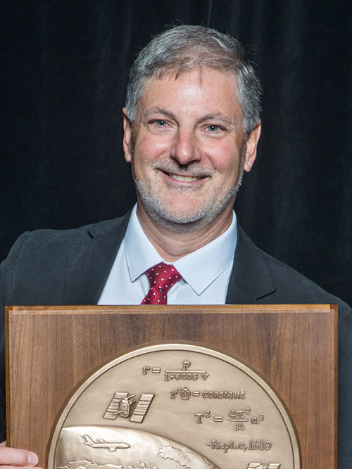
Y. Jade Morton received the Johannes Kepler Award for advances in scientific and navigation receiver technology, automated data collection, robust carrier phase tracking, remote sensing, and profound impact as an educator and author.

    Morton is the director of the Colorado Center for Astrodynamics Research at the University of Colorado, Boulder ,where she mentors students, faculty, staff and an ever-expanding international network of collaborators throughout the world. She is a prolific author with more than 270 publications. She was awarded her Ph.D. in Electrical Engineering at Pennsylvania State University. She has also authored articles for GPS World.

    Receiver Technology Pioneer. Morton has made pioneering contributions to the advancement of GNSS receiver technology and utilization of these enhanced capabilities for scientific discovery. Her work brings together scientific rigor with state-of-the-art engineering innovations to simultaneously improve PNT, while revealing remarkable new applications for GNSS.

    Morton’s lab-developed event-driven GNSS data acquisition systems (EDAS), designed to capture severe space weather and ionosphere disturbances of GNSS signals, which could not be handled by existing GNSS monitoring receivers. Her lab designed and built remotely-configurable, multi-GNSS, multi-band, SDR hardware using off-the-shelf components; and developed software including machine-learning algorithms for automatic event detection to trigger raw data recording during these events.

    Network established. Her lab deployed these receivers worldwide. The network has enabled unprecedented studies and forecasting of ionosphere/space weather phenomena, detection of satellite oscillator anomalies, and development of advanced GNSS receivers for navigation and remote sensing under challenging conditions.

    Morton’s group has made groundbreaking advances in GNSS carrier-phase processing and established theoretical performance bounds. Her group developed optimal carrier tracking loop architectures and implementations, and successfully applied the techniques to processing signals experiencing strong ionospheric scintillation for ionosphere and space weather research; radio-occultation signals traversing moist lower troposphere for weather and climate modeling; weak coherent reflected signals from ocean, land, and sea ice for precision altimetry applications; and navigation in urban canyons and on high dynamic platforms.

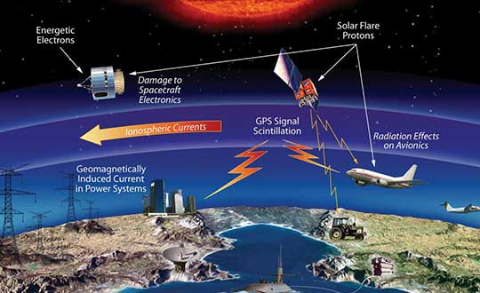
    Morton is an expert on space weather and ionosphere monitoring. Her research findings range from climatology and morphology of ionospheric plasma irregularities to spatial, temporal and frequency domain characteristics; cause-effect relationships between solar-geomagnetic activities and GNSS signal disturbances; and radio wave propagation theory and simulation. The studies, based on data from her GNSS networks, magnetometers, radar and satellite-based measurements, cover the globe from the arctic to the equator and span an entire solar cycle.

    Volunteer service. Morton has served numerous organizations with thousands of hours of volunteer service including organizing each of the ION’s large technical conferences and leading over 10 student teams participating in ION’s autonomous lawn mower and snowplow competitions, is credited as one of the co-organizing founders of the ION’s Pacific PNT conference, has served as the ION Satellite Division Chair and is the current ION President. Dr. Morton is a past recipient of the IEEE Kershner Award and the ION’s Burka and Thurlow Awards. She is a Fellow of the ION, RIN and the IEEE.

    The Johannes Kepler Award recognizes and honors an individual for sustained and significant contributions to the development of satellite navigation. It is the highest honor bestowed by the ION’s Satellite Division.

    Kimia Shamaei Honored with Parkinson Award

    ION’s Satellite Division presented Kimia Shamaei with its Bradford W. Parkinson Award Sept. 25 for her thesis, “Exploiting Cellular Signals for Navigation: 4G to 5G.”

    The Bradford W. Parkinson Award is awarded annually to an outstanding graduate student in GNSS. The award, which honors Dr. Parkinson for his leadership in establishing both the U.S. Global Positioning System and the Satellite Division of the ION, includes a personalized plaque and a $2,500 honorarium.

    Any ION member who is a graduate student completing a degree program with an emphasis in GNSS technology, applications, or policy is eligible for the award. ION thanks the altruistic experts who served on this year’s selection committee.

  • UK hits reset on how to deliver satnav

    UK hits reset on how to deliver satnav

    The United Kingdom will explore new options for satellite navigation and timing capability to support critical infrastructure, it announced in a press release.

    The Space-Based Positioning Navigation and Timing Programme (SBPP) will explore new and alternative ways to deliver vital satellite navigation services to the U.K. for transport systems, energy networks, mobile communications, and national security and defense.

    The SBPP also aims to boost the British space industry and develop the U.K.’s own capabilities in these services.

    UK GNSS program reinvented

    The new program follows the work of the UK GNSS program, which concludes Sept. 30. UK GNSS began in 2018 as a result of Brexit and the U.K.’s departure from the Galileo program.

    UK GNSS is an exploration programme that has developed outline plans for a conventional satellite system as an alternative to American GPS or the EU’s Galileo. The program will now be reset as the SBPP to build on this work to consider newer, more innovative ideas of delivering global satnav and secure satellite services to meet public, government and industry needs.

    In 2018, the government announced an 18-month program, led by the UK Space Agency, to develop a conventional GNSS, which could meet U.K. security requirements and support the U.K.’s sovereign space and cryptography sectors.

    Work completed by the UK GNSS Programme so far has developed cutting-edge British expertise in areas such as spacecraft and antenna design, satellite and ground control systems, systems engineering and simulation, which have wider applications across the space sector, in addition to supporting specialist U.K. jobs and industrial GNSS capability.

    SBPP program to meet everyday needs

    Image: melis82/iStock / Getty Images Plus/Getty Images
    Image: melis82/iStock / Getty Images Plus/Getty Images

    The refocused SBPP program could include technology that supports people’s everyday lives, such as emergency services to locate incidents, financial services companies to regulate exchanges on the U.K. stock market, or energy networks to ensure households receive power. Satellite navigation systems are also necessary to unlocking future technologies such as driverless cars, smart cities and artificial intelligence.

    Capitalizing on the ingenuity of British businesses and academics, the program will explore the use of different kinds of satellites at various levels of orbit by exploiting technologies offered by companies at the cutting-edge of innovation such as OneWeb, Inmarsat and Airbus.

    A Cabinet Office Study examining the need for a U.K. space-based system for secure positioning, navigation and timing concluded that any solution would need to examine more options and further work is needed to determine what form a potential system takes so it provides value for money.

    To meet U.K. industry and government needs for resilient global navigation and timing while also providing value for money to the public, the new SBPP will consider collaboration with international allies to share satellite navigation services, costs and technology.


    Also see

    With new space program, UK continues march to more holistic PNT


    “Satellites underpin so many of the services that we all use every single day, from precise train timetables on our phones and satnavs in our cars,” said Business Secretary Alok Sharma. “Through our Space-Based Positioning Navigation and Timing Programme, we will draw on the strengths of the U.K.’s already thriving space industry to understand our requirements for a robust and secure satellite navigation system. This includes considering low-orbiting satellites that could deliver considerable benefits to people and businesses right across the U.K., while potentially reducing our dependency on foreign satellite systems.”

    “I am delighted to see a further boost to the U.K.’s already thriving space industry,” said Scotland Office Minister Iain Stewart. “The U.K. government works closely with industry and academia to support the sector. We have high ambitions for the U.K. to be a global sector leader. The U.K. government is expanding its plans to understand requirements for a satellite navigation system. Satellite navigation provides the core services that we all use every day such as our mobile networks and is the key to unlocking further technical innovation in the future. This new programme will potentially pave the way for greater independence from foreign systems such as the United States’ GPS or the EU’s Galileo system which will allow greater opportunities for British businesses.”

    “Our work to date has developed cutting-edge U.K. expertise in satellite navigation spacecraft, antenna design and control systems, while supporting high-skilled jobs,” Graham Turnock, CEO of the UK Space Agency said. “Now is the time to drive this work further to look into wider, more innovative ways of delivering this important national capability — to help protect our critical infrastructure and put the U.K. at the forefront of the development of new space technologies.”

    Currently, the U.K. is entirely dependent on foreign systems for these critical navigation services. SBPP will enable to the U.K. to build on its thriving space industry, home to global players such as Inmarsat, Airbus, Surrey Satellites (SSTL) and others, to become a global leader in space navigation technologies, developing new opportunities for businesses in the U.K. and overseas and creating new highly skilled jobs.

    The government has made clear its ambitions for the U.K. to become a globally competitive space power and is taking action through the newly established National Space Council, emerging National Space Strategy and the Integrated Review of Security, Defence, Development and Foreign Policy, to create the conditions for a strong, secure and innovative space sector that delivers for the British people.

    A government-backed study from London Economics estimated that sustained disruption to existing satellite navigation capabilities would likely cost the U.K. economy £1 billion per day. Investment in space technology and services will enable the U.K. to build back better, unleashing the country’s global competitiveness and underpinning growth and high-skilled jobs.

  • With new space program, UK continues march to more holistic PNT

    With new space program, UK continues march to more holistic PNT

    Photo: UK government
    Photo: U.K. government

    News from the British government appears to be a part of the United Kingdom’s diversification away from primary reliance on GNSS for positioning, navigation and timing (PNT) services, and toward a more diverse set of sources.

    The nation has previously undertaken establishment of a National Timing Centre for distribution of time from suites of atomic clocks and has long transmitted an eLoran timing signal from a government facility in Anthorn.

    Thursday’s press release, titled “Government to explore new ways of delivering ‘sat nav’ for the U.K.,” reinforces the government’s commitment to space-based PNT, but not necessarily from GNSS.

    OneWeb satellites

    The announcement follows significant criticism in Parliament of the nation’s purchase of a 45% share of the bankrupt communications satellite company OneWeb, with the India’s Bharti Holdings having the majority stake. OneWeb had 74 of its planned 648 satellites in orbit when it declared insolvency. With new ownership and financing in place, it plans to resume operations and launch another 36 satellites in December.

    Prime Minister Boris Johnson’s motivation for making the investment was to offset Britain’s post-Brexit exclusion from Europe’s Galileo system. The idea was that OneWeb assets in low earth orbit (LEO) could provide a global British PNT capability.

    This concept faced political and technical opposition from the start. Many technologists in the U.K. and elsewhere doubted that the constellation could be easily adapted to provide sufficiently accurate PNT services. The doubts were so serious that the senior career civil servant responsible for signing the agreement to invest in OneWeb took the very unusual step of refusing to do so without written direction from the political appointee she worked for.

    Before the OneWeb investment, the U.K. government had been studying establish of its own GNSS like America’s GPS and Europe’s Galileo. Sources say the required investment was much higher than the nation wanted to make and would provide little added capability beyond that available from extant systems.

    According to Thursday’s press release, the UK GNSS effort was exploratory and will end this month. It will be “reset” as the Space-Based Positioning Navigation and Timing Programme (SBPP). This project “will explore new and alternative ways that could be used to deliver vital satellite navigation services to the United Kingdom which are critical for the functioning of transport systems, energy networks, mobile communications and national security and defence, whilst boosting the British space industry and developing the U.K.’s own capabilities in these services.”

    While the press release is short on detail, it does mention satellites at low earth orbit and that “a wider range of options” will be examined. This could suggest redoubling efforts on getting PNT from OneWeb, and/or investing in regional PNT satellites.

    Galileo again?

    The press release also says SBPP will “consider collaboration with international allies to share satellite navigation services, costs and technology.” This may signal reengagement with Europe on involvement with Galileo.

    Some observers have said that Brexit did not have to automatically mean that the U.K. was excluded from the Galileo project. European Union membership is not required for participation in the European Space Agency which is responsible for Galileo. Switzerland and Norway, for example, are not EU members, but are members of ESA and sit on its governing board.

    The U.K. government has been very concerned with PNT and GNSS vulnerability since at last 2012 when large solar flares became part of its National Risk Register. In 2017 a London Economics Report found that a five-day GNSS disruption would cost the nation more than $1.3B per day.

    This most recent announcement indicates that Britain is still intent on going its own way and diversifying PNT sources, while still acknowledging the ongoing importance of GNSS and keeping its options open with allies.


    Dana Goward is president of the Resilient Navigation and Timing Foundation. He is the proprietor at Maritime Governance LLC. In August 2013, he retired from the federal Senior Executive Service, having served as the maritime navigation authority for the United States. As director of Marine Transportation Systems for the U.S. Coast Guard, he led 12 different navigation-related business lines budgeted at more than $1.3 billion per year. He has represented the U.S. at IMO, IALA, the UN anti-piracy working group and other international forums. A licensed helicopter and fixed-wing pilot, he has also served as a navigator at sea and is a retired Coast Guard Captain.

  • History of the GNSS industry and milestones ahead

    History of the GNSS industry and milestones ahead

    Headshot: Ellen Hall
    Ellen Hall, president & CEO, Spirent Federal Systems

    The history of GPS is fascinating. In 1957, a study by JHU’s Advanced Physics Laboratory (APL) utilized the Doppler effect to monitor the recently launched Sputnik, allowing researchers to pinpoint the satellite’s position. This endeavor led to the development of the Navy Transit program, the first satellite navigation system, which was successfully testing in 1960. The United States Global Positioning System (GPS) was officially launched in 1973 as a worldwide solution designed to overcome previous limitations. The U.S. Air Force developed the GPS, which designated 24 satellites for full operational capability (FOC) in 1995.

    As a result of a horrific incident in 1983, in which Korean Air Lines Flight 007 wandered into Soviet airspace due to a navigation error and was subsequently shot down by the Soviets, the Reagan administration ordered worldwide access to GPS to ensure a tragedy like this could never happen again. The Clinton administration discontinued Selective Availability to make GPS more responsive and accurate to civil and commercial needs. This led to prolific global use and dependence on GPS for everything from providing data for precision farming applications to the critical timing of financial transactions. This increasing demand for and dependence on GPS has accentuated the importance of securing and safeguarding the system. Vulnerability testing, anti-jamming measures and alternative navigation solutions have become vital in both augmentation and backup for this critical utility.

    As often happens with inventions created through government-sponsored studies, civilian uses become so ubiquitous that the original studies that led to GPS are long forgotten. It is as if GPS has simply always existed. Accordingly, the ground-breaking contributions of certain individuals should be remembered, such as Gladys West for her work in the development of computational techniques necessary for GPS precision. Pioneers such as Roger L. Easton of the Naval Research Lab, Ivan A. Getting of The Aerospace Corporation and Brad Parkinson of APL are credited with inventing GPS and changing, quite literally, how the world works.

    I cannot imagine the world without GPS in some form. The content of what was once only in sci-fi movies is quickly becoming reality with driverless cars, pilotless aircraft and spacecraft. There are no limits on the possibilities in this field. The excitement about the future motivates brilliant minds from classified military installations to the latest civilian laboratories financed by the “Rocket Billionaires,” such as Elon Musk and Steve Bezos.

  • GNSS reflectometry measurements improved with COVID-19 pandemic

    GNSS reflectometry measurements improved with COVID-19 pandemic

    Parked cars near ground station decreased accuracy from 2 to 4 centimeters

    A new study shows that the quality of GNSS reflectometry measurements may have improved significantly during the pandemic because of the lack of cars parked near the ground station, according to Science Daily. GNSS reflectometry is used for earthquake early warning systems, determining flood risks, and many other geodesy applications.

    The study, carried out by geodesists from the University of Bonn, investigated the location of a precise GNSS antenna in Boston, Massachusetts.

    GNSS reflectometry works well if the surrounding ground is flat, like the surface of a mirror, study author Jürgen Kusche explained to Science Daily. “But many GNSS receivers are mounted on buildings in cities or in industrial zones. They are often surrounded by large parking lots — as is the case with the antenna we investigated in Boston.”

    The researchers show that parked cars significantly reduced the quality of the elevation data by scattering the GNSS signals, causing them to be reflected several times before they reached the antenna, like a cracked mirror. This reduces signal intensity and provides “noisy” data — hard to correct with pattern recognition because the parked cars change positions every day.

    “Before the pandemic, measurements of antenna height had an average accuracy of about 4 centimeters due to the higher level of noise,” Makan Karegar told Science Daily. “During the lockdown, however, there were almost no vehicles parked in the vicinity of the antenna; this improved the accuracy to about 2 centimeters.”

    While GNSS stations were historically installed in sparsely populated regions, recent installations have been in urban areas to support engineering and surveying work.

    “Our study recommends that we should try to avoid installation of GNSS sensors next to parking lots,” Karegar said.

    Citation. Makan A. Karegar, Jürgen Kusche. Imprints of COVID‐19 lockdown on GNSS observations: An initial demonstration using GNSS interferometric reflectometry. Geophysical Research Letters, 2020; DOI: 10.1029/2020GL089647


    Feature photo: welcomia/ iStock / Getty Images Plus / Getty Images

  • Europe issues tender for GNSS high-accuracy evolution

    Europe issues tender for GNSS high-accuracy evolution

    Image: ESA
    Image: ESA

    The European Commission (EC) is seeking help to build a roadmap for high-accuracy Galileo and EGNOS services.

    The EC Directorate-General for Defence Industry and Space (DG-DEFIS) has issued an Invitation to Tender for a service contract to address how the future evolution of European GNSS (EGNSS) could be beneficial for innovative demanding applications.

    The new service contract will assess the feasibility of an integrity service complementing EGNSS high accuracy in the 2030+ timeframe.

    The new service contract will feed into the evolving needs of demanding new applications without disrupting the current business models of established service providers, according to the European GNSS Agency. The tender will assess various steps needed for the Galileo and EGNOS services to evolve.


    A webinar to explain the framework and objectives of the procurement and the different tasks in the procurement is planned on September 23 at 16:00 CEST.


    Emerging and next-generation applications will require more demanding positioning solutions to be able to offer innovative services. The use of an integrity service complementing European GNSS (EGNSS) High Accuracy in the 2030 horizon could result in the provision of an accurate and reliable positioning solution that would translate into the overall improvement of future innovative and demanding services.

    As part of the services provided by Galileo, the Galileo High-Accuracy Service (HAS) will provide high-accuracy positioning and synchronization information, the EC said.

    EGNOS version 3 will extend the service area to the entire landmasses of EU Member States. New EGNOS services could be implemented in further releases of EGNOS as an option for the integrity service complementing EGNSS High Accuracy.

  • Transiting to GPS and beyond

    Transiting to GPS and beyond

    Headshot: Terry Moore
    Terry Moore, professor emeritus, University of Nottingham

    The end of July was quite a momentous occasion for me as I accepted the offer of voluntary redundancy from the University of Nottingham after almost 35 years of employment. If I then add the six years I spent at Nottingham as an undergraduate and then as a postgraduate student, that totals almost 41 years of my life spent at the university.

    I guess it is not surprising that recently I have spent some time reflecting on those years and the changes that have occurred in positioning and navigation throughout that long period. My first degree was in civil engineering, although I did specialize in land surveying in the final year.

    Professor Ashkenazi. My first contact with satellite navigation was early in 1981, when Professor Vidal Ashkenazi, later my mentor and good friend, brought a JMR-1 Transit Doppler NAVSAT receiver into our second-year surveying lectures. That gentle repetitive beep as the receiver tracked the Transit satellites had me hooked for life. I don’t think I realized then that navigation and positioning would be the focus of my working life, but I was fascinated by the technology and prospects, and it really was one of those life-changing moments.

    1984: Texas Instruments TI-4100. (Photo: NOAA National Geodetic Survey)
    1984: Texas Instruments TI-4100. (Photo: NOAA National Geodetic Survey)

    My Ph.D. continued in surveying and geodesy, and the focus was on the precise orbit determination of the LAGEOS geodetic satellite using Satellite Laser Ranging measurements. The goal was to investigate the determination of Earth Rotation Parameters (the Polar Motion and diurnal spin of the Earth) as part of an international collaboration known as Project MERIT.

    Using Transit. I remember taking a Magnavox MX 1502 Transit receiver down to a conference at Herstmonceux Castle, and over the weekend I set up the instrument in my parent’s back garden in Sheffield, much to their amazement.

    2020: Garmin Fenix6 smartwatch. (Photo: Garmin)
    2020: Garmin Fenix6 smartwatch. (Photo: Garmin)

    I did not start working on GPS until 1985, through my post-doc research position, sponsored by British Petroleum. This was investigating the first uses of GPS within the oil-and-gas sector for precise offshore positioning on platforms and survey vessels. The early GPS receivers we used were the Texas Instruments TI-4100 receivers, of which we borrowed five for the first long survey campaign to measure precise heights down the East Coast of England and Scotland. What a “pleasure” they were to use. I remember manually typing in the elements of the almanac for the receiver to acquire one satellite at a time.

    Soon after we bought our first two Wild-Magnavox WM-101 receivers, which looked to be masquerading as Samsonite luggage. And now here I sit typing this article with GNSS receivers in the Garmin watch on my wrist and the Samsung phone beside me on the desk.

    Last weekend, I was walking in the Lake District of England with my wife and daughter, and I did a quick count of our GNSS receivers. We had eight GNSS receivers (in watches, phones and handheld receivers) between the three of us, and of course there were others in our cars and the cycling GNSS receivers all nearby. How things have changed and how could we have imagined such as staggering growth in the ubiquity of GPS, and now GNSS, over those past 35 years.

  • Russia tests new GLONASS-guided missile

    Russia tests new GLONASS-guided missile

    Photo: Russia Ministry of Defense
    Photo: Russia Ministry of Defense

    The Russian Defense Ministry has tested new ammunition for its Tornado-S missile system, which is delivered via the multiple launch rocket system (MLRS), reports Russian newspaper Izvestia. Tornado-S is an ultra-long-range missile with a previous flight.

    The new MLRS is equipped with GLONASS signal reception equipment and an automated guidance and fire control system. The operator can enter coordinates into the system and give the command to set the guides and open fire. In addition, the system can itself receive and process information from reconnaissance vehicles and drones. For each missile, both range and azimuth angle can be set. The MLRS can launch 12 missile at once.

    Previously, the declared flight range of the Tornado-S missiles was about 120 km. Distance with the new ammunition was not disclosed, but the goal was 200 km. The main feature of the missiles is the ability to turn on the target after launch.

    The Russian Army was expected to receive 30+ Tornado MLRS this year.

  • China to lose access to Australia tracking station

    China to lose access to Australia tracking station

    China will lose access to a strategic space tracking station in Western Australia when its contract expires, a decision that could affect BeiDou constellation service in the Pacific region, according to a Reuters report.

    A contract between the Swedish Space Corp. (SSC) and China has given Beijing access to a station antenna since 2011, but the SSC satellite station is primarily used by the United States and its agencies.

    The Swedish state-owned company told Reuters it wouldn’t enter into any new contracts at the Australian site to support Chinese customers after its current contract expires, but did not disclose the exact date.

    Ground stations are a vital part of space programs given they create a telecommunications link with spacecraft. While stations have different capabilities, they can be equipped to coordinate satellites for civil-military GNSS such as Beidou, Russia’s GLONASS, the European Union’s Galileo system, and U.S.-owned GPS.

    China’s space program has been increasing its access to overseas ground stations in recent years in line with the expansion of its space exploration and navigational programs.

    “Generally speaking, anywhere you put a GNSS monitoring ground station will improve the accuracy of positioning for that region,” said Joon Wayn Cheong, a senior research associate at the University of New South Wales’ School of Electrical Engineering.

    China wants to remove its dependence on GPS as part of broader plans to expand its global influence, says Christopher Newman, professor of Space Law and Policy at Northumbria University in Newcastle, England. “GPS could be made unavailable to them in a military conflict. An independent secure system is crucial for the capabilities of the People’s Liberation Army [China’s military] with respect to targeting, weapons, navigation,” he told Reuters.

    Beijing last year reestablished diplomatic ties with the small Pacific island nation of Kiribati, where it has a mothballed ground station.


    Feature image: Pgiam/E+/Getty Images

  • ASECNA, Thales provide African early SBAS open service

    ASECNA, Thales provide African early SBAS open service

    Service opens a new era of satellite navigation performance augmentation in the Africa and Indian Ocean Region

    Photo:The Agency for Air Navigation Safety in Africa and Madagascar (ASECNA) has started to broadcast a satellite-based augmentation system (SBAS) signal over Africa and the Indian Ocean (AFI) region.

    This is the first SBAS open service in this part of the world, according to Thales Alenia Space. The signal is broadcast via the NIGCOMSAT-1R satellite managed and operated by Nigerian Communications Satellite Ltd. under the Federal Ministry of Communications and Digital Economy of Nigeria.

    The early open service is provided as part of the “SBAS for Africa & Indian Ocean” program, which pursues the autonomous provision over the continent of SBAS services to augment the performances of the satellite navigation constellations GPS and Galileo.

    With improved accuracy to within a meter — and boosted integrity, availability and continuity of safety-related applications — the SBAS services will improve flight safety and efficiency in Africa. It will also benefit the economy in land, sea and rail transport areas, as well as mass-market applications, supporting user safety, cost-effectiveness and sustainable development.

    Early Service Goals

    The launched open service aims to carry-out technical trials, and to undertake with partner airlines field demonstrations for aircraft to demonstrate the benefits of the future operational safety-of-life SBAS services, expected in 2024. It will also include early precise point positioning (PPP) and emergency warning service, both to be demonstrated.

    The signal in space is generated by a dedicated system testbed, developed as part of the “SBAS for Africa and Indian Ocean” preliminary design phase, financed by the European Union and awarded to a Thales Alenia Space joint venture between Thales (67%) and Leonardo (33%). The system prototype uses the SAGAIE reference station network deployed by CNES and ASECNA with the support of Thales Alenia Space.

    The signal is broadcast via the SBAS payload on Nigcomsat-1R GEO satellite of the Nigerian Communications Satellite and an uplink station deployed in Abuja (Nigeria). It is compliant to the Standards and Recommended Practices of the International Civil Aviation Organisation, and the Minimum Operational Performance Standard developed by the RTCA (Radio Technical Commission for Aeronautics) organization. It will be visible in the whole Africa and Indian Ocean, up to the West Australian coast, and also in Europe.

    “We are proud to be part of this ambitious program to provide satellite navigation services in the Africa and Indian Ocean region. The use of our geostationary communication satellite Nigcomsat-1R navigation payload to broadcast the first signal will be Africa’s premier contribution to SBAS as a regional satellite-based augmentation system for the continent,” said Abimbola Alale, MD/CEO of NIGCOMSAT Ltd.

    “Our long-standing expertise acquired with the development of EGNOS SBAS in Europe and KASS SBAS in Korea combined with our new leading-edge satellite positioning technologies makes Thales Alenia Space the ideal partner to best support countries to implement their own SBAS efficiently. The equatorial region represents also a key engineering challenge for such a system due to difficult ionosphere conditions, for which Thales Alenia Space has developed a proven solution,” said Benoit Broudy, vice president of the Navigation business at Thales Alenia Space in France.

    “The provision of the first African SBAS early service is a crucial major step forward in the development of satellite navigation in the AFI Region, and in the deployment of the ‘SBAS for Africa and Indian Ocean’ system, the navigation solution for Africa by Africa. It demonstrates the ambition and commitment of ASECNA to enhance air navigation safety for the benefit of the whole continent, in line with my vision for the unification of the African Sky,” stated Mohamed Moussa, director general of ASECNA.

    About ASECNA

    ASECNA is an international public organization. Its main mission is to provide air navigation services within an airspace of 16,500,000 square kilometers, divided into six flight information regions (F.I.R) as defined by the International Civil Aviation Organization (ICAO).

    ASECNA also develops solutions for airport management, aviation infrastructure studies and construction, equipment maintenance, calibration of air navigation instruments and training for civil aviation staff.

    Its 18 Member States are: Benin, Burkina Faso, Cameroon, Central African Republic, Comoros, Congo, Côte d’Ivoire, France, Gabon, Guinea Bissau, Equatorial Guinea, Madagascar, Mali, Mauritania, Niger, Senegal, Chad and Togo.

  • Modern miracle brings timing to the ‘Information Superhighway’

    Modern miracle brings timing to the ‘Information Superhighway’

    Photo: Orolia
    John Fischer, vice president, advanced R&D, Orolia

    In 1990, I had just left the military electronics industry (radars, electronic warfare) and entered the growing wireless telecom industry. Recall, this was at the end of the Cold War with shrinking U.S. defense budgets. Alas, after eagerly waiting for the full operational performance of GPS throughout the 1980s, I unfortunately missed its early successes.

    I spent the 1990s in startups, working to provide wireless alternatives to dial-up and leased lines. We founded Clearwire, which eventually became WiMax — the broadband wireless on-ramp to this new “information superhighway” we now call the internet.

    However, within a few years, we started to look for a way to synchronize our adjacent basestations to avoid interference at overlapping regions. Those of us who came from the military navigation sector turned to GPS. We began to use a GPS receiver to give us a 1PPS sync.

    This worked well, although we had to train our installers not to put the GPS antenna high up on the tower with all the others, but low, away from the transmission beams. It was hard for them to believe we got better reception on the ground than up high!

    The Trimble Accutime 2000. (Photo: Trimble)
    The Trimble Accutime 2000. (Photo: Trimble)

    By the late 1990s, Trimble had introduced its Accutime 2000, which made our lives easier. (Everything futurist in those days was called Something-2000 — the new millennium was approaching). Today, it is the standard for time sync, but back then, it was novel.

    When I think of the progress in terms of Moore’s Law (semiconductor performance doubles every 18 months), we have been through 20 doublings since 1990. That is an improvement factor of a million!

    However, technological advancement alone does not account for GPS’ huge success. The fact that the U.S. military opened its system for use by everyone in the world, and the continued cooperation of all nations in making all GNSS systems interoperable, is mind blowing.

    We are living in the world that John Lennon only “Imagine(d)”: all the people sharing. In 2020, we are now focused on GNSS vulnerabilities and protecting the integrity of GNSS signals, which are such an integral part of our daily lives. GPS is truly a modern miracle.

  • Space weather bill passed by US Congress to improve forecasting, mitigation

    Space weather bill passed by US Congress to improve forecasting, mitigation

    The effects of space weather on critical Earth systems. (Image: NASA)
    The effects of space weather on critical Earth systems. (Image: NASA)

    The United States Congress has passed bipartisan legislation to address how the government deals with threats posed by emissions from the Sun to critical infrastructure such as GPS.

    The Promoting Research and Observations of Space Weather to Improve the Forecasting of Tomorrow (PROSWIFT) Act S.881 now awaits signature by the president.

    The bill sets forth provisions to improve the ability of the United States to forecast space weather events and mitigate its effects.

    It provides statutory authority for the National Science and Technology Council’s Space Weather Operations, Research, and Mitigation Working Group, which coordinates executive branch efforts to understand, prepare, coordinate, and plan for space weather.

    The bill directs the Office of Science and Technology Policy, National Oceanic and Atmospheric Administration (NOAA), National Science Foundation, Air Force, Navy, National Aeronautics and Space Administration (NASA), National Security Council, and Federal Aviation Administration (FAA) to carry out specified space weather activities.

    The legislation

    • assigns roles and responsibilities to agencies involved in space weather research and forecasting
    • ensures agency coordination to better predict severe space weather events and mitigate impacts
    • calls for coordination between the government and the non-governmental space weather community including academia, the commercial sector and international partners.

    Senators Gary Peters (D-MI) and Cory Gardner (R-CO) introduced the first version of the bill in 2016 and a successor passed the Senate in 2017. Reps. Ed Perlmutter (D-CO) and Mo Brooks (R-AL) shepherded it through the House, which passed it Sept. 16.