Category: GNSS

  • Galileo next-gen satellites to be more powerful, reconfigurable

    Galileo next-gen satellites to be more powerful, reconfigurable

    ESA shifts from Galileo transition plan to full second-generation plan.

    News from the European Space Agency

    With 26 satellites now in orbit and more than 1.5 billion smartphones and devices worldwide receiving highly accurate navigation signals, Europe’s Galileo navigation system will soon become even better, ensuring quality services over the next decades.

    Following the European Commission’s decision to accelerate development of Galileo Next Generation, ESA has asked European satellite manufacturers to submit bids for the first batch of the Galileo Second Generation (G2) satellites. The new spacecraft are expected to be launched in about four years.

    Paul Verhoef, director of the Galileo Programme addresses the audience at ESA's annual Navigation Days, held Jan. 26. (Photo: ESA)
    Paul Verhoef, director of the Galileo Programme. (Photo: ESA)

    The next-generation satellites will provide all the services and capabilities of the current first generation with a substantial improvements and new services and capabilities.

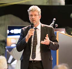
    “We want an ultra-flexible and mostly digital design,” said Paul Verhoef, ESA director of Navigation.

    “Developing the second generation is challenging for both industry and for ESA. In 2024, we need to launch the first satellites for this new state-of-the-art constellation.”

    Invitation to Tender

    Following almost 24 months of a competitive dialogue procedure with the three large system integrators involved, ESA issued a “Best and Final Offer” invitation to tender on Aug. 11 to Airbus, OHB System AG and Thales Alenia Space.

    ESA is implementing a dual-sourcing approach, and two parallel contracts are expected to be signed by the end of 2020 among the current three bidders. Under the plan, each of the two selectees will build two satellites for development purposes, with options for up to 12 satellites in total.

    The first satellites of the new constellation are expected to be launched before the end of 2024, together with updated ground systems to support the new satellites.

    Reconfigurable in Orbit

    In addition to being more powerful, the second-generation Galileo satellites will be more flexible, able to be reconfigured in orbit in order to satisfy the expected evolution in end-user needs.

    A number of challenges exist for the bidders. The goal of a digital and fully flexible design represents the cutting edge of industrial capability.

    Navigation Antenna Progress

    A Galileo satellite undergoes its fit-check validation at the Spaceport. Flight VA240. (Photo: ESA/Arianespace)
    A Galileo satellite undergoes its fit-check validation at the Kourou Spaceport in French Guiana. (Photo: ESA/Arianespace)

    Furthermore, the required navigation antennas will have a very advanced design; much research and development by ESA has been done, yet more remains for industry.

    ESA has already built such an antenna as a proof of concept at the Agency’s ESTEC technology center in the Netherlands to ensure feasibility, and the know-how has been shared with the three bidders.

    “Each bidder must determine how they can best manufacture the navigation antenna, and we’ll have to see how each proposes to do it. Also, requiring a fully flexible payload is quite a challenge. No such navigation spacecraft of that type have flown yet,” Verhoef said.

    Ambitious Plan

    The European Commission has decided that what was previously going to be called the “transition batch” of new satellites will now become, in fact, the Galileo Second Generation satellites. The European Commission and EU Member States have already made clear that they want to be very ambitious and further increase the technical capabilities of the Galileo system.

    The name change reflects of how the current batch is actually shaping up.

    The transition satellites were initially foreseen as interim upgrades, to cater for the potential risk of late delivery of the later, completely new and very advanced G2 satellites.

    Estimated Lifetime Increased

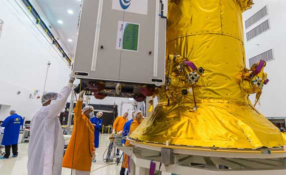
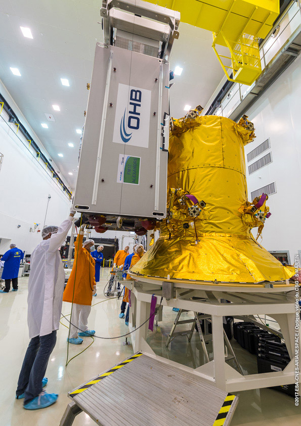
    Based on constant measurements of the performance of the current satellites in orbit, their predicted lifetime has increased. So, together with a slight spreading out of the launches of the Batch 3 satellites — currently under construction by OHB and in testing at ESTEC —this will ensure service continuity before the new, advanced capabilities of Galileo become operational.

    The second-generation satellites will gradually take over from the current first-generation satellites in the provision of Galileo services. At a future date, they will all constitute a complete constellation plus the necessary in-orbit spares.

    ESA serves as the design, development and procurement agent for Galileo satellites on behalf of the European Commission, which funds the system overall.

  • White House office asks what to research to protect GPS

    White House office asks what to research to protect GPS

    logoThe White House Office of Science and Technology Policy is asking for ideas on what technology to research to protect GPS. The research and development dollars are earmarked for projects that minimize or eliminate disruption to critical infrastructure from intentional and unintentional interference.

    The “Notice of Request for Information on Positioning, Navigation, and Timing Resilience” was issued Aug. 10 in the Federal Register.

    The office is seeking input “from all interested parties on the development of a National Research and Development Plan for Positioning, Navigation, and Timing (PNT) Resilience.

    “The plan will focus on the research and development (R&D) and pilot testing needed to develop additional PNT systems and services that are resilient to interference and manipulation and that are not dependent upon global navigation satellite systems (GNSS).

    “The plan will also include approaches to integrate and use multiple PNT services for enhancing resilience,” the RFI states.

    The effort is specifically headed by the Subcommittee on Resilience Science and Technology (SRST.) “The input received on these topics will assist the subcommittee in developing recommendations for prioritization of R&D activities,” the RFI states.

    Deadline for comments is 11:59 pm ET on Sept. 9.

    Responses should be submitted via email to [email protected] — include “RFI Response: PNT Resilience” in the subject line of the message.

  • Following Mars probe, UAE to launch two navigation satellites

    Following Mars probe, UAE to launch two navigation satellites

    The United Arab Emirates (UAE) will launch the first of two navigation satellites in 2021, according to the Emirates News Agency (WAM), spurred by the successful launch of a Mars probe on July 19.

    The satellite is designed to demonstrate the country’s technological capabilities. A second, further enhanced satellite will be launched in 2022, said Khaled Al Hashmi, director of the National Space Science and Technology Center (NSSTC) at UAE University, Al Ain.

    The satellites are the first project of Satellite Assembly, Integration and Testing Center, a collaboration formed by Tawazun Economic Council with Airbus and the NSSTC.

    Funded by the UAE Space Agency, the satellites are not intended to add a navigation system — at least not right away. “We try to select a certain technology, design and develop the satellite and payload here, and will own the intellectual property rights,” Hashmi told WAM, the state news agency.

    The UAE’s navigation satellite project is part of the Science and Technology Roadmap created by the UAE Space Agency and the NSSTC on developing new technologies. The NSSTC was jointly established by UAE University, UAE Space Agency and the Telecommunications Regulatory Authority (ICT-Fund).

    Decision on the program came following the successful launch of the Hope Probe, which opened collaboration opportunities between the UAE and global space agencies and companies. In the first Arab interplanetary mission, the probe will reach Mars in 2021 to provide a complete picture of the planet’s atmosphere.

    Engineers and technicians at the Mohammed bin Rashid Space Center prepare the Hope Probe for its trip to Mars. (Photo: UAE Space Agency)
    Engineers and technicians at the Mohammed bin Rashid Space Center prepare the Hope Probe for its trip to Mars. (Photo: UAE Space Agency)
  • BeiDou a threat to the West, but perhaps not individuals

    BeiDou a threat to the West, but perhaps not individuals

    Recent completion of China’s BeiDou satellite navigation system has rekindled privacy and security concerns among some in the West. China has incorporated a two-way messaging capability into BeiDou that many fear will be used to track individuals and install malware on user devices.

    Most satellite navigation experts view such concerns as far overblown.

    At the same time, though little discussed, BeiDou’s completion does signal a new phase for China’s status as a world power and its ability to challenge the West on many fronts.

    Two-way communications

    It is possible for specially equipped receivers to communicate back to the BeiDou constellation. But this is not true for the vast majority of receivers (including those in cell phones). Industry experts say that all mass market chips for every GNSS system, including BeiDou, are “receive only.” Only specially equipped devices will be able to take advantage of its two-way communications capability, and it should be quite apparent to users when it is in operation.

    Users, they say, should be much more concerned about location privacy and security issues that have been around for decades. Mobile phones have long reported user locations through the cellular network based upon information derived from GPS, WiFi ranging and other position calculations. The ability to hack and compromise a cell phone or other receiver will not be affected by the addition of BeiDou as a receive-only location source.

    It is also important to note that using specialized equipment for two-way communication with a Global Satellite Navigation System (GNSS) is not something new to BeiDou. While the Chinese system may have improved upon the capability, users with the right equipment can send messages using the Search and Rescue functions to the United States’ GPS, Europe’s Galileo, and Russia’s GLONASS.

    China has risen

    Completion of BeiDou, unquestionably a significant technical achievement, does signal a significant step up for Chin’s status as a world power and influencer. It is a declaration of technical independence from the West with wide ranging geo-political impacts.

    These were anticipated and summarized in a 2017 report by the US-China Economic and Security Review Commission. It listed China’s goals for BeiDou as:

    “(1) address national security requirements by ending military reliance on GPS;
    (2) build a commercial downstream satellite navigation industry to take advantage of the quickly expanding market; and
    (3) achieve domestic and international prestige by fielding one of only four such global navigation satellite systems (GNSS) yet developed”

    Military Power and National Security. The Chinese military has long sought its own GNSS. This was amplified during a crisis in 1996 when it fired three missiles toward Taiwan as a warning. One struck the sea about 11 miles from a Taiwanese military base, but the other two disappeared. China claims that the United States interfered with GPS signals and was to blame. The Chinese military was both horrified and humiliated.

    Having a sovereign GNSS eliminates the problem of relying on the U.S., Russia, or Europe for satellite navigation. That it is the world’s newest system also certainly has its advantages. China has undoubtedly incorporated state of the art anti-jamming and anti-spoofing capabilities into the version of BeiDou used by the military. After decades of observing others interfering with GNSS signals, and doing a fair bit of it on their own, it would be hard to imagine Chinese engineers not including the latest resilience features.

    An operational BeiDou also means that China’s military is much freer to interfere with GPS and other GNSS in pursuit of tactical and strategic advantage without endangering its own services and infrastructure. It is likely that the levels of jamming and spoofing seen near the Spratley Islands and mainland ports will increase. Even if they do not, the increased possibility of Chinese interference will add yet another degree of complexity and uncertainty for western military forces.

    Economic Power. The technological and commercial benefits of BeiDou for China are unquestionably substantial as well. Direct benefit from the manufacture and sale of equipment, plus spinoff industries and technologies, add to an already impressive national technology and economic portfolio. This is especially true since positioning, navigation, and timing (PNT) services are a “silent utility” underpinning so many network and other technological systems. The huge domestic market and robust overseas sales continue to grow (by 20% per annum according to Chinese reports) providing huge returns.

    Prestige and Soft Power. “BeiDou launch marks China’s rise to ‘major space power’” read a recent headline in the Asia Times. This is perhaps understated as, with BeiDou complete, there is, technologically, little the West has achieved that China has not equaled. This has greatly enhanced China’s global standing and made it, in the eyes of many in the developing world, an ally and provider as good or better than the U.S. or Europe.

    And China is eager to share its new PNT utility with others to further, not just its economy, but more importantly its long-term strategic interests.

    Forsaking GPS

    Regionally, China has been encouraging neighbors to adopt BeiDou for national PNT and forsake GPS. As one example it provided Thailand with nearly $300M in foreign aid targeted to promoting BeiDou use by Thai government organizations.

    Writing in July in The Diplomat, Dr. Namrata Goswami observed

    “… BeiDou is located within China’s ‘Information Silk Road,’ a subset of its land and maritime silk routes under the Belt and Road Initiative (BRI). China is now able to extend influence in a multidomain environment (land, sea and space) via its BeiDou space system, which provides navigation to aircraft, submarines, missiles, as well as commercial services dependent on such navigation. China’s Ministry of Industry and Information Technology sells the Information Silk Road, to include BeiDou and 5G networks, to global audiences as a completely self-sufficient technology infrastructure that anticipates life in the 21st century.”

    This extends China’s influence through BeiDou even farther and has led a number of nations to seek closer ties with China through BeiDou.

    Mohamed Ben Amor, secretary general of the Tunisia-based Arab Information and Communication Technology Organization, an organization of the Arab League, told GPSDaily.com, “Cooperation on the BDS is of special significance for the Belt and Road construction…The next step of the China-Arab cooperation is to achieve further connectivity and both sides can apply the BDS to promote regional technological and economic development.”

    Iran’s view

    Iran has had a Memorandum of Understanding with China about BeiDou since 2015. It provides for BeiDou ground stations in Iran, access for Iran to high-precision services, and establishment of an Iranian center for space data collection.

    And In a tweet last week Iran’s Ambassador to China cited BeiDou’s completion as the “…end to the monopoly of the U.S.’s GPS.” He said, “There is great potential for aerospace cooperation with China,” and went on to suggest that Iranian aerospace students could work as a bridge between the two countries.

    Similar comments have been published from entities in India, Indonesia, Malaysia, and throughout Southeast Asia.

    China is indeed to be congratulated for a significant achievement with the completion of BeiDou. Even more noteworthy, though, is how it has integrated BeiDou seamlessly into its national plans for technology, economic, military and diplomatic efforts — a comprehensive, coordinated program to boost its standing in the world, especially relative to the United States and Europe.


    Dana Goward is president of the Resilient Navigation and Timing Foundation. He is the proprietor at Maritime Governance LLC. In August 2013, he retired from the federal Senior Executive Service, having served as the maritime navigation authority for the United States. As director of Marine Transportation Systems for the U.S. Coast Guard, he led 12 different navigation-related business lines budgeted at more than $1.3 billion per year. He has represented the U.S. at IMO, IALA, the UN anti-piracy working group and other international forums. A licensed helicopter and fixed-wing pilot, he has also served as a navigator at sea and is a retired Coast Guard Captain.

    Photo: XinhuaNet
    Photo: XinhuaNet
  • US Space Force grants GPS III SV03 operational acceptance 

    US Space Force grants GPS III SV03 operational acceptance 

    The United States Space Force (USSF) and the Space and the Missile Systems Center achieved another major GPS milestone on July 27 when the GPS III Space Vehicle (SV) 03 received USSF’s Operational Acceptance approval.

    This marks the third GPS III satellite to receive operational acceptance in less than a year.

    GPS III SV-03 satellite packed prior to shipment to Cape Canaveral. (Photo: Lockheed Martin)
    GPS III SV-03 satellite packed prior to shipment to Cape Canaveral. (Photo: Lockheed Martin)

    The GPS III satellites are the newest generation built by Lockheed Martin that provide precise positioning, navigation and timing information with three times better accuracy, and up to eight times improved anti-jamming capability than previous generations of GPS satellites.

    SV03 was launched on June 30 and was the second National Security Space Launch (NSSL) mission launched on a SpaceX Falcon 9 rocket. This was the first NSSL mission where a Launch Service Provider recovered a booster, with SpaceX successfully recovering the first stage and fairings as part of the launch.

    The GPS III SV03 mission was dedicated to Colonel Thomas G. Falzarano, 21st Space Wing commander, who passed away in May.

    “We are adding GPS warfighter capability and resiliency with each new GPS III satellite. The on-boarding of GPS III SV03 enables our first use of cross link commanding capability for assured nuclear detection,” said Lt. Col. Michael Schriever, 2nd Space Operations Squadron commander. “With the GPS III SV03 addition to the constellation, our modernized signals capable satellites increases to 22 vehicles. This results in nearly a fully capable Military-Code constellation, which our space warfighters will operate to deliver expanded capabilities to the joint force.”

    The USSF’s Space and Missile Systems Center, located at Los Angeles Air Force Base, California, is the center of excellence for developing, acquiring and delivering military space systems. Its portfolio includes

    GPS, military satellite communications, defense meteorological satellites, space launch and range systems, satellite control networks, space based infrared systems, and space situational awareness capabilities.

  • The GPS Innovation Alliance adds BAE Systems as member

    The GPS Innovation Alliance adds BAE Systems as member

    The global security, defense and aerospace company joins alliance dedicated to protecting, promoting and enhancing the use of GPS technology

    GPSIA logoThe GPS Innovation Alliance (GPSIA) is welcoming BAE Systems Inc. as the newest member of the organization. BAE Systems, a global defense, security and aerospace company, joins member companies John Deere, Garmin, Trimble, Lockheed Martin and Collins Aerospace, a unit of Raytheon Technologies Corp., as well as 11 national organizations that make up GPSIA’s affiliates program.

    As the newest member of the alliance and the third aerospace and defense corporation to join the organization in eight months, BAE Systems will work with GPSIA to support its goal of enhancing GPS innovation, creativity and entrepreneurship — while advocating as the voice of the GPS industry in Washington.

    Logo: BAE Systems“We are excited to welcome BAE Systems as the newest member of the Alliance — a monumental addition that marks the doubling of our membership in the past eight months,” said GPSIA Executive Director J. David Grossman. “The continued growth of GPSIA demonstrates the criticality of protecting GPS and the substantial value our organization delivers through advocacy, information sharing, and technical standards. We remain committed to ensuring the economic and societal benefits of GPS are fully realized.”

    BAE Systems is a global leader in designing and implementing high-end technology to extend the reach and significance of GPS in defense. BAE Systems’ radiation-hardened electronics have been on board satellites and spacecraft for almost 30 years and are currently providing the high-performance onboard processing capability for the GPS III satellite mission. Promoting space resiliency for over 30 years, BAE Systems is a cornerstone of the growing importance of GPS technologies on the space frontier.

    BAE Systems has not only pioneered critical technologies suitable for GPS applications in space, but has also developed, manufactured, integrated and supported GPS receivers and guidance systems for advanced military applications on land, sea or air.

    The company was instrumental in the development of NAVWAR sensor technology, intended to meet growing challenges associated with maintaining military positioning, navigation and timing (PNT) advantage using satellite navigation, and has engineered top-tier jammers and navigation systems for decades. Their work has been critical in securing the safety and technological supremacy of our nation’s defenses.

    “GPS is an essential part of our world — from our infrastructure and economy to the security of our nation,” said Frank Ruggiero, senior vice president, government relations, BAE Systems. “As a leading provider of defense electronics and communications systems, we are excited to join the GPS Innovation Alliance to expand the development of cutting-edge GPS technologies.”

  • GPS III Space Vehicle 04 safely arrives in Florida

    GPS III Space Vehicle 04 safely arrives in Florida

    The U.S. Space Force Space and Missile Systems Center on July 14 delivered the fourth GPS III satellite to Cape Canaveral Air Force Station, Florida. The satellite is scheduled for launch on Sept. 30.

    GPS III Space Vehicle (SV) 04 was safely transported from the Lockheed Martin facility in Waterton, Colorado to Space Coast Regional Airport in Titusville, Florida. The satellite was carried aboard a C-17 Globemaster III originating from Joint Base Lewis-McChord, Washington.

    The fourth GPS III satellite arrived at Cape Canaveral July 14 for launch on Sept. 30. (Photo: USAF)
    The fourth GPS III satellite arrived at Cape Canaveral July 14 for launch on Sept. 30. (Photo: USAF)

    The delivery of GPS III SV04 starts the clock for final testing and checkout prior to launch. The satellite will be processed at the Astrotech Space Operations facility in Florida to ensure the full functionality of the satellite, prepare the satellite for propellant loading, and encapsulate the satellite in its protective fairing. At the completion of these activities, the satellite will be horizontally integrated with the SpaceX Falcon 9 launch vehicle.

    “The shipment of the fourth GPS III satellite was successfully conducted just two weeks after the launch of our GPS III-SV03 satellite. This operation is a remarkable achievement and testament to the hard work of the entire GPS team members from all across the country,” said Col. Edward Byrne, SMC’s Medium Earth Orbit Space Systems Division chief. “The delivery of SV04 marks the start of our third GPS III launch campaign on a SpaceX Falcon 9 rocket and brings us another step closer in advancing the GPS constellation with more capable satellites.”

    GPS III SV04 is slated to launch in September. Once on-orbit, it will join the operational constellation of 31 GPS satellites, delivering enhanced resiliency, better accuracy, and advanced anti-jam capabilities.


  • GPS military code installs complete at master control sites

    GPS military code installs complete at master control sites

    The United States Space Force’s Space and Missile Systems Center on July 27 completed the military code (M-code) Early Use (MCEU) hardware and software upgrade to the GPS Operational Control System (OCS).

    Completion of the upgrade is a major step toward Operational Acceptance of the long-awaited GPS M-code.

    Photo: U.S. Air Force photo/Dennis Rogers
    Photo: U.S. Air Force photo/Dennis Rogers

    The encrypted M-code signal enhances anti-jamming and anti-spoofing capabilities for the warfighter. M-code signals are currently available on all 22 GPS Block IIR-M, IIF and III space vehicles currently on orbit.

    The installs were completed at the Master Control Station at Schriever Air Force Base, Colorado, and Alternate Master Control Stations at Vandenberg Air Force Base, California.

    The MCEU upgrade allows the OCS Architecture Evolution Plan to task, upload and monitor M-code within the GPS constellation, as well as support testing and fielding of modernized user equipment.

    Operational Acceptance Set for November. MCEU will be in a trial period before Operational Acceptance in November. Once Operational Acceptance is granted, upcoming Military Ground User Equipment (MGUE) will be able to leverage the M-code signal-in-space to provide more secure position, navigation and timing (PNT) to warfighters.

    “Working closely with Lockheed Martin and our other mission partners — with the common national goal of providing enhanced PNT signal security and safety always in sharp focus — means we’re able to deliver the right mission capability faster to our warfighters,” said Lt. Col. Steven A. Nielson, program manager of the MCEU project.

    MCEU serves as a gap-filler for M-code operations before the entire GPS constellation’s operational transition to the Next Generation Operational Control System Block 1, which is now in development.

    A key to enabling M-code is a new software-defined receiver being installed at all six Space Force Monitoring Sites. The M-code Monitor Station Technology Improvement and Capability receiver uses commercial, off-the-shelf hardware to cost-effectively receive and process M-code signals, enabling OCS operators to monitor the signals.

  • 2 SOPS all-female crew gains control over GPS III SV03

    2 SOPS all-female crew gains control over GPS III SV03

    News from Schriever Air Force Base

    On July 23, the 2nd Space Operations Squadron (2 SOPS) gained Satellite Control Authority of GPS satellite vehicle number 76 — also known as GPS III SV03 — which was launched on June 30. This handover was special: for the first time, a crew of eight women space operators took control of the satellite.

    Schriever’s 2 SOPS, the providers of GPS signals to billions of users worldwide, made history July 23 when a crew of eight women space operators gained satellite control authority of satellite vehicle number 76 (SVN 76), previously known as GPS III SV03.

    The crew included 1st Lt. Kelley McCaa, 2 SOPS satellite vehicle operator; 1st Lt. Alexis Thuli, 2 SOPS operations assistant flight commander; Staff Sgt. Kelly Malone, 2nd SOPS satellite systems operator and crew chief; 1st Lt. Mary McLaughlin, 2 SOPS payload system operator; 1st Lt. Mikayla Roberts, 2 SOPS mission analyst; Senior Airman Joelle Schritt, 19th SOPS mission planner; Airman 1st Class Gillian Clover, 2 SOPS satellite systems operator; and Airman 1st Class Larissa Contreras, 2 SOPS SSO.

    “It’s like the grandparents hand the keys to the parent, then the parent hands the keys to us,” said McCaa. “When a new satellite is launched, we don’t have full authority of it. [Lockheed Martin] takes it over [after launch], then we bring it into our systems and then we actually gain full control of [the satellite] as a squadron.”

    The 2nd Space Operations Squadron gained satellite control acceptance of satellite vehicle number 76, July 23, 2020, at Schriever Air Force Base, Colorado. The new satellite will provide more than 5 billion users across the globe with stronger precision, navigation and timing signals. It will also bring improved capabilities to warfighters. (U.S. Air Force photo by Dennis Rogers and Kathryn Calvert)
    The 2nd Space Operations Squadron gained satellite control acceptance of satellite vehicle number 76, July 23, 2020, at Schriever Air Force Base, Colorado. The new satellite will provide more than 5 billion users across the globe with stronger precision, navigation and timing signals. It will also bring improved capabilities to warfighters. (U.S. Air Force photo by Dennis Rogers and Kathryn Calvert)

    The new satellite will provide more than 5 billion users across the world with stronger precision, navigation and timing signals, Schriever Air Force Base said.

    “With these new satellites, they have a lot of capabilities we didn’t previously have,” said McCaa. “There are certain things the new generation of satellites are capable of doing that are brand new to us, and will immediately enhance our GPS signal, helping the warfighters down-range.”

    The crew included eight uniformed 2 SOPS and 19 SOPS (the Air Force Reserve component) Airmen who gained SCA of the satellite.

    “We have a lot of females in the squadron, and given the crew scheduling, we had the opportunity to establish an all-female crew,” said Thuli. “We decided to have this female team on crew during the SCA, creating a more historic event for the squadron.”

    Maj. Lucia White, 2 SOPS assistant director of operation, said the 45th Space Wing female meteorologists at Cape Canaveral Air Force Station, Florida, who determined weather was suitable for rocket launch June 13, inspired her to bring the idea to life in 2 SOPS.

    First Lt. Mikayla Roberts, 2nd Space Operations Squadron mission analyst, poses with a model satellite July 23, 2020, at Schriever Air Force Base, Colorado. Roberts was one of eight women who worked on the historic all-female crew. (U.S. Air Force photo by Dennis Rogers and Kathryn Damon)
    First Lt. Mikayla Roberts, 2nd Space Operations Squadron mission analyst, poses with a model satellite July 23, 2020, at Schriever Air Force Base, Colorado. Roberts was one of eight women who worked on the historic all-female crew. (U.S. Air Force photo by Dennis Rogers and Kathryn Damon)

    “We want to inspire future generations of young women and let them know they can have a place in the Space Force,” White said. “[The Space Force] is the place to be, especially for those who may have barriers to overcome.”

    In addition to the operational crew, Brig. Gen. Traci Kuekermurphy, Mobilization Augmentee to the Space Force Director of Operations and Lt. Col. Maggie Sullivan, Space and Missile Systems Center, granted SCA approval for their respective entities making the entire transfer an all-female event.

    Not only did 2 SOPS and the 45th SW have female crews, the Department of the Air Force also made history when it selected Chief Master Sgt. JoAnne Bass to serve as the 19th Chief Master Sergeant of the Air Force. Bass is the first woman to serve in this role.

    According to the National Science Foundation, women make up only 28% of employment in science and engineering career fields. Furthermore, an even smaller percentage of women serve in the Air Force, at about 21%.


    Feature image: The women of the 2nd Space Operations Squadron made history as the first ever all-female space operations crew July 23, 2020, at Schriever Air Force Base, Colorado. The crew gained satellite control acceptance of SVN-76, officially adding another satellite to the GPS III fleet. (U.S. Air Force photo by Dennis Rogers and Kathryn Calvert)

  • GPSIA asks FCC to reexamine Ligado decision

    GPSIA asks FCC to reexamine Ligado decision

    GPSIA logoThe GPS Innovation Alliance (GPSIA) sent a letter to FCC Commissioner Michael O’Rielly on July 30 regarding Ligado Networks.

    The letter highlights what appears to be different characterizations of the engineering information in the FCC’s record, and suggests that these contrasting statements “support a careful re-examination of the bases of the Ligado Order and a stay of the decision while that occurs.”

    “GPSIA appreciates your continued interest and efforts in this proceeding, and your willingness to consider whether a stay of the Ligado order may be appropriate,” the letter states. “As the record in this proceeding makes clear, sound technical analyses were conducted on Ligado’s network by DOT — a neutral third-party U.S. government expert on GPS. Further evaluation of those analyses should prompt the Commission to set aside the Ligado order so that its understanding of the DoT ABC Report can be better aligned with the authors of the report.”

    Read the full text of the letter.

    Hold on Third FCC Chairmanship. In a related report, the chairman of the Senate Armed Services Committee Sen. Jim Inhofe (R-Okla.) on July 28 placed a hold on the nomination of O’Rielly to another five-year term chairing the commission.

    Inhofe said he would block O’Rielly until the nominee “publicly commits to vote to overturn the current Ligado order,” according to a report from Space News.

    “Over the past few months, I have sent letters, held hearings and called countless officials to highlight what we all know to be true: the FCC’s Ligado order is flawed and will lead to significant harm to our military and the thousands of individuals and businesses that rely on GPS,” Inhofe said.

  • Readiness confirmed for July 31 WAAS satellite launch

    Readiness confirmed for July 31 WAAS satellite launch

    Logo: Arianspace

    Approval is given for Arianespace’s Ariane 5 flight on July 31

    Arianespace’s fifth mission of 2020 has been given the green light for liftoff following a July 29 launch readiness review conducted at the Spaceport in French Guiana.

    The launch will deliver the Intelsat Galaxy 30 (G-30) satellite into orbit. G-30 will become part of the  Wide Area Augmentation System (WAAS), the air navigation aid developed by the U.S. Federal Aviation Administration to augment GPS and GNSS.

    Besides G-30, the Ariane 5 launch vehicle will also carry the Mission Extension Vehicle-2 (MEV-2) and BSAT-4b. All satellites are flight-ready, along with the Spaceport’s infrastructure and the network of downrange tracking stations.

    With approval granted, Ariane 5 also is cleared for rollout on July 30 from its Final Assembly Building to the ELA-3 launch zone. Liftoff will occur on July 31 during a 46-minute launch window opening at 6:30 p.m. local time in French Guiana. To watch the launch live, visit the Arianespace website.

    Ariane 5 will deliver a total payload lift performance of approximately 10,468 kg. on the mission to geostationary transfer orbit (GTO), which is designated Flight VA253. This total factors in the three passengers, plus the workhorse vehicle’s multi-payload deployment system and integration hardware.

    G-30 and MEV-2 — both produced by Northrop Grumman to serve the operational needs of Intelsat — are stacked together in the upper position of Ariane 5’s payload configuration. G-30 will be deployed first during the 47-minute flight sequence, followed by MEV-2.

    To be released last as the mission’s lower passenger, BSAT-4b is being launched by Arianespace as part of a turnkey contract between the Japanese operator B-SAT and the satellite manufacturer, Maxar.

  • Research Roundup: GPS reveals volcanic activity under Europe

    Research Roundup: GPS reveals volcanic activity under Europe

    Scientists have discovered new evidence for active volcanism next door to some of the most densely populated areas of Europe. The study crowdsourced GPS monitoring data from antennae across western Europe to track subtle movements in the Earth’s surface, thought to be caused by a rising subsurface mantle plume.

    The Eifel region lies roughly between the cities of Aachen, Trier and Koblenz, in west-central Germany. It is home to many ancient volcanic features, including the circular lakes known as maars. Maars are the remnants of violent volcanic eruptions, such as the one that created Laacher See, the largest lake in the area. The explosion that created the lake is thought to have occurred around 13,000 years ago.

    The mantle plume that fed this ancient activity is thought to still be present, extending up to 400 kilometers (km) into the earth. However, whether or not it is still active is unknown. “Most scientists had assumed that volcanic activity in the Eifel was a thing of the past,” said Corné Kreemer, lead author of the new study. “But connecting the dots, it seems clear that something is brewing underneath the heart of northwest Europe.”

    An aerial view of Laacher See, a volcanic caldera lake with a diameter of 2 km in Rhineland-Palatinate, Germany. Created by volcanic activity, maars like this are also found in other parts of Europe and on other continents, but Eifel-Maars are the classic example worldwide. (Photo: bbsferrari/iStock / Getty Images Plus/Getty Images)
    An aerial view of Laacher See, a volcanic caldera lake with a diameter of 2 km in Rhineland-Palatinate, Germany. Created by volcanic activity, maars like this are also found in other parts of Europe and on other continents, but Eifel-Maars are the classic example worldwide. (Photo: bbsferrari/iStock / Getty Images Plus/Getty Images)

    In the new study, the team — based at the University of Nevada, Reno and the University of California, Los Angeles — used data from thousands of commercial and state-owned GPS stations all over western Europe. The research revealed that the region’s land surface is moving upward and outward over a large area centered on the Eifel, and including Luxembourg, eastern Belgium and the southernmost province of the Netherlands, Limburg.

    “The Eifel area is the only region in the study where the ground motion appeared significantly greater than expected,” said Kreemer. “The results indicate that a rising plume could explain the observed patterns and rate of ground movement.”

    The new results complement those of a previous study in Geophysical Journal International that found seismic evidence of magma moving underneath the Laacher See. Both studies point towards the Eifel being an active volcanic system.

    The implication of this study is that there may not only be an increased volcanic risk, but also a long-term seismic risk in this part of Europe. The researchers urge caution, however. “This does not mean that an explosion or earthquake is imminent, or even possible again in this area. We and other scientists plan to continue monitoring the area using a variety of geophysical and geochemical techniques, to better understand and quantify any potential risks.”

    GPS observations of ground movement under the Eifel area. Colors represent contoured vertical motion inferred from GPS station data, and white and black arrows indicate the direction in which the crust is horizontally stretching or compressing, respectively. The highest upward motion of ~1 mm per year is found near the Eifel volcanic field. (Image: Study authors)
    GPS observations of ground movement under the Eifel area. Colors represent contoured vertical motion inferred from GPS station data, and white and black arrows indicate the direction in which the crust is horizontally stretching or compressing, respectively. The highest upward motion of ~1 mm per year is found near the Eifel volcanic field. (Image: Study authors)

    Citation: “Geodetic evidence for a buoyant mantle plume beneath the Eifel volcanic area, NW Europe” by Corné Kreemer, Geoffrey Blewitt, Paul M. Davis. Geophysical Journal International, Volume 222, Issue 2, Aug. 1, 2020, pp. 1316–1332, https://doi.org/10.1093/gji/ggaa227