Category: Opinions

  • MSU developing CORS dashboard and geodetic program

    MSU developing CORS dashboard and geodetic program

    Photo: Dana Caccamise II
    Photo: Dana Caccamise II

    In my November 2023 GPS World newsletter, I highlighted the announcement made by the National Geodetic Survey (NGS) of the recipients of the National Oceanic and Atmospheric Administration (NOAA) FY 23 Geospatial Modeling Competition awards. The primary objectives of these projects are to modernize geodetic tools and models and to develop a geodetic workforce for the future. My last three GPS World newsletters — February 2024, March 2024 and April 2024 — highlighted three of the grantees, Scripps Institution of Oceanography, The Ohio State University, and Oregon State University that included developing models to address what NGS denotes as the Intra-Frame Deformation Model (IFDM) and creating geodesy curriculums that will help address the geodesy crisis. Changes in these geomatic programs will provide students with the skills in geospatial systems that will make available opportunities for employment in the public and private sectors. This newsletter will address the proposal by the fourth NGS geospatial modeling grant awardee, Michigan State University (MSU).

    First, it should be noted that this award is denoted as the MSU geospatial modeling award; that said, the execution of the project will be led by MSU, along with two sub-awardees — University of Alaska Fairbanks (UAF) and Michigan Tech University (MTU). Jeffrey Freymueller and Julie Elliott are the MSU grant’s principal investigators (PI). They provided me with information about the goals and objectives of their grant proposal.

    The MSU proposal includes enhancing software and monitoring capabilities for NGS, enhancing graduate-level geodetic education and providing opportunities for graduate and undergraduate students to be exposed to geodetic science. Again, focusing on geodesy curriculums will help address the geodesy crisis and will provide students with the skills in geospatial systems that will increase their opportunities for employment in the public and private sectors. The proposal has two main goals and objectives.

    Goals and objectives

    CORS Dashboard 

    • Build an online, web-based CORS dashboard that will support monitoring of the continuously operating reference station (CORS) network.
    • Making it easier to continually validate the current position of CORS sites to the existing motion models (IFDM).
    • To validate and correct the motion models themselves in the presence of time-dependent tectonic and volcanic activity.

    Education

    • Work with partner universities toward developing and establishing a consortium model for future distributed geodetic degree programs that leverage the capabilities and capacity of multiple universities.
    • Develop new course material for graduate level geodetic education that is intended for hybrid or asynchronous remote delivery and the establishment of a formal degree program.
    • Host summer undergraduate interns who will work on a variety of geodetic projects including the CORS dashboard.
    • Two graduate students will be supported to work on various aspects of the proposed work at MSU and MTU.

    Anyone using NGS’s “user-friendly” software knows that they are working on improving their web-based services. However, NGS still needs help from outside users.

    I want to emphasize that I am not criticizing NGS’s products and services. I worked for NGS for over three decades, and I personally know that NGS has limited resources to accomplish too many tasks. NGS needs to focus on the science and get help with the development of models, tools and the dissemination of results and data. That is one of the reasons that these geospatial modeling grants are important to all users of the National Spatial Reference System (NSRS).

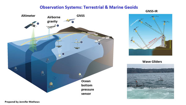
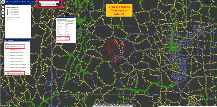
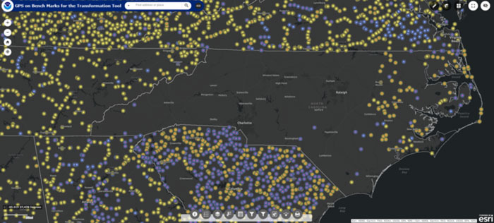
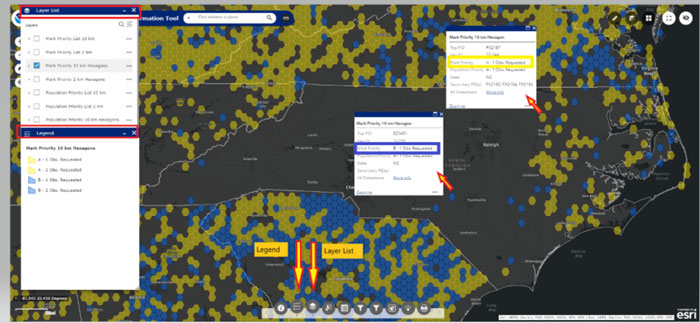
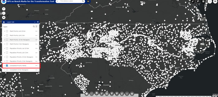
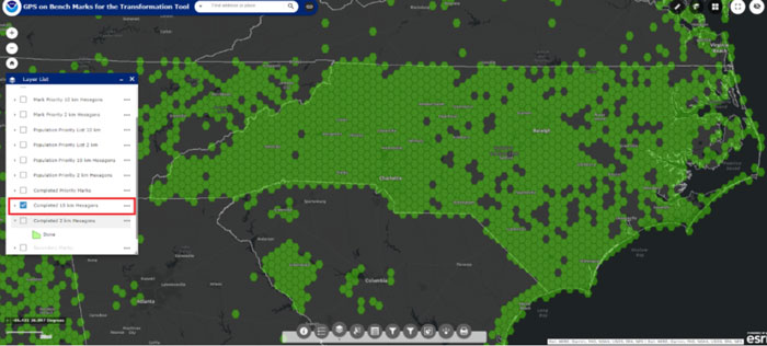
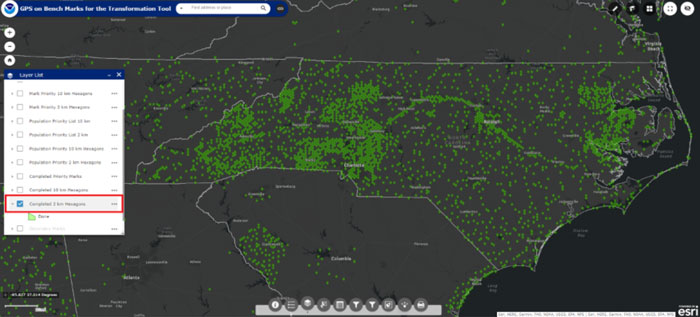
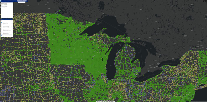
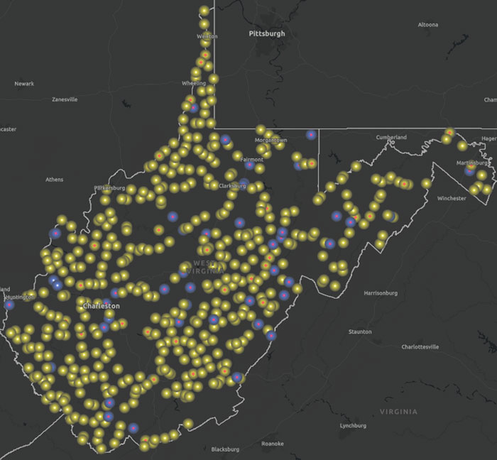
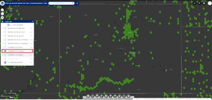
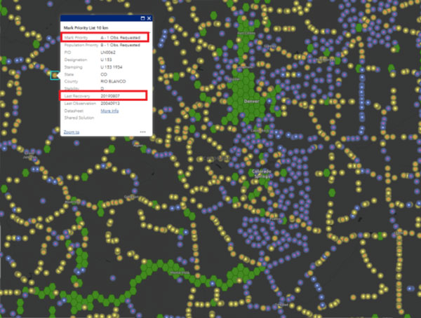
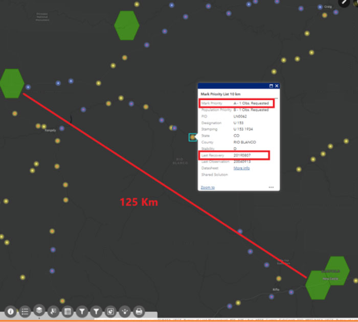
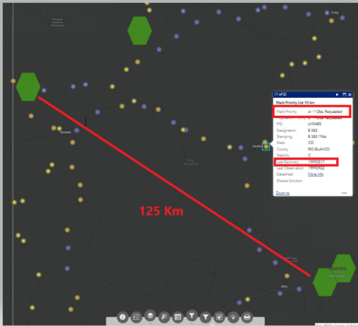
    The proposed CORS Dashboard will be very useful to NGS employees monitoring the CORS and evaluating the IFDM. The proposal highlights that users of NGS products and services have various precision and accuracy requirements and that all users expect that NGS products will be sufficiently precise and accurate to meet their positioning needs. Their design of the CORS Dashboard will provide a tool for effectively monitoring and assessing a CORS site status and the validity of its coordinates. The first phase of this tool is being developed for internal use at NGS. However, in my opinion, after all the bugs have been identified and dealt with, NGS will release a version for the user.

    Not all CORS are created equal. So, having a CORS Dashboard that quickly identifies and notifies CORS users of a systematic deviation at a site, regardless of cause, will avoid promulgating erroneous positions to users. In addition, providing statistical information about a CORS site such as short- and long-term plots and their residuals would provide users with helpful information for planning a GNSS project. The metadata of CORS is extremely important since most of the CORS included in the NOAA CORS Network are not maintained by NGS.

    CORS managers are supposed to notify NGS when they make any change to their CORS site such as an antenna change and any changes surrounding the CORS site, including new vegetation or construction that could cause potential obstructions. The CORS Dashboard will help identify issues with CORS before users include them in their projects.

    NGS’s OPUS Project online user guide provides information on selecting the best CORS.  The following is from the user guide:

    • Using the centered time-series plots, select the candidates with RMS (in northing, easting, and up) less than 2 cm. Candidates with large spikes, data gaps or discontinuities should be rejected. Selecting candidates in this manner will provide some assurance that the published coordinates and velocities at the CORS agree with the daily solutions for the CORS.
    • The best CORSs should have “consistent” data depicted in 90-day short-term time-series plots. NGS processes each day of GNSS data collected at each CORS and plots the differences between the resulting coordinates and the published coordinates on short-term time-series plots (in terms of delta northing, easting, and up). These plots can be accessed for every CORS at https://geodesy.noaa.gov/corsdata/Plots/. CORS with plots that depict significant biases from the published coordinates (more than 2 cm in northing, easting, or more than 4 cm), spikes or data gaps should be avoided.

    NGS has developed a Beta CORS Time Series Tool that provides information that assists users in the selection of appropriate CORS for a project. The tool computes and displays the residual differences from the daily NGS OPUS-NET solutions with the coordinates from the official CORS’ coordinate functions. The tool also generates a summary table with the mean, standard deviation, and root-mean-square error of the residuals. On April 24, 2024, NGS announced the release of a beta version of a new NOAA CORS Network (NCN) Station Web Page. According to the announcement, each CORS in the NCN will have its own page with data, metadata, maps and photos for that station displayed in a modular layout so information is easily found all in one location. I will describe this new beta site in a future newsletter.

    The new, modernized NSRS will offer time-dependent coordinates based on an IFDM. This has been described in previous GPS World newsletters (February 2022 and August 2022). The MSU proposal includes developing a model that accounts for crustal movements — such as earthquakes, slow slip events, and volcanic eruptions, — as well as slower, cumulative growth of error due to post-seismic deformation, surface loading (ice or water changes) and changes in rates of human-induced subsidence due to fluid withdrawal. Like any model, the IFDM model will have uncertainties. Being able to provide a realistic estimate of the uncertainties of the IFDM is very important. The PIs of the proposal have extensive knowledge and experience in generating models and uncertainties. As noted in their proposal, the “problem” may not be an issue with the site or the equipment but with the model. See the box titled “Excerpt from the MSU Proposal.”  I have highlighted several sections that I believe are important to the users of the new, modernized NSRS.

    Excerpt from the MSU ProposalExcerpt from the MSU Proposal (2)

    As anyone who has been following my newsletters knows, I have been highlighting the geodesy crisis and programs that advance the science of geodesy — July 2020, November 2022, and December 2022. The proposal includes developing geodetic science courses that will be optimized for hybrid or asynchronous online courses that address advanced technical topics on GNSS, InSAR, map projections, reference frames, and adjustment theory. This will build on existing programs at MSU, UAF and MTU that will provide an online graduate degree in geodesy. MSU envisions this to be a step toward a consortium-based enhanced graduate-level education that provides a range of course options and flexibility. The university believes that there will be opportunities to expand the consortium in the future. The courses have not been finalized yet,  but below are some of the topics and concepts that are being considered for the program.

    Topics and Concepts
     

    Map Projections

    Map projections, geodetic datums, grid systems and transformations. Use of mapping software including GMT.


    Geodetic Models

    Course provides solid geospatial background in geodetic reference frames, datums, geoids and reference ellipsoids. 2D and 3D geodetic network adjustments are considered based on 3D spherical models.


    Modern Geodesy and Applications

    Modern geodetic methods including GPS, measuring steady or time-variable motions, the physical models that are used to interpret these observations and applications to active geological processes, the cryosphere and hydrology.


    Geodetic Methods and Applications

    Theory and application of modern geodetic tools to measure Earth’s surface deformation with emphasis on GPS and InSAR. Basics of data processing; evaluation of signals and modeling of their sources; applications include magma systems, earthquake cycle and hydro- and cryosphere. Labs in Python require programming experience


    Geodetic Data Processing and Analysis

    Course provides students hands-on experience in the selection, processing and analysis of geodetic data sets, particularly InSAR and GNSS. Selection of data from diverse sources, evaluation of data strengths and weaknesses, processing and analysis of data and application to the investigation of geological problems.
     

    Solid Earth Geophysics and Geodynamics

    Theory and applications of solid-Earth geophysics including geochronology, geothermics, geomagnetism and paleomagnetism, geodesy and gravity, rheology and seismology.


    Foundations of Geophysics

    Applications of continuum mechanics, heat flow theory and potential theory to geophysical, geologic and glaciological problems. Topics such as postglacial rebound, non-Newtonian fluid flow, thermal convection, stress-relaxation, rheology of Earth materials, gravity and magnetics will be discussed. Emphasis will be placed on methods and tools for solving a variety of problems in global and regional geophysics and the geophysical interpretation of solutions.
     

    Positioning with GNSS

    In-depth study of GPS, GLONASS, Galileo, COMPASS satellite systems; theory and processing of global positioning measurements.
     

    Intro Numerical Tools for Earth and Environmental Sciences

    Introduction to Linux and C including numerical methods, integration, curve-fitting and differential equations with an emphasis on applications to the geological sciences.


    Programming and Automation for Geoscientists

    Basic concepts of computer programming and effective task automation for computers, with an emphasis on tools and problems common to the geosciences and other physical sciences. Use of Python, Jupyter Notebooks, shell scripting and command line tools, making scientific figures, maps and visualizations.


    Data Analysis and Adjustments

    Course explores fundamentals of mathematical error propagation theory, including various observation equations, least squares adjustment and Kalman filter methods. Blunder detection, decorrelation and inversion of patterned large matrices processes are considered. Involves analysis of position estimation deploying geospatial measurements.


    Inverse Problems and Parameter Estimation

    An inverse problem uses observations to infer properties of an unknown physical model. This course covers methods for solving inverse problems, including numerous examples arising in the natural sciences. Topics include linear regression, method of least squares, estimation of uncertainties, iterative optimization and probabilistic (Bayesian) and sampling approaches.
     

    Numerical Analysis

    Direct and iterative solutions of systems of equations, interpolation, numerical differentiation and integration, numerical solutions of ordinary differential equations and error analysis.
     

    3D Surveying and Modeling with Laser Scanning Data

    Theory and application of terrestrial lidar scanning. Typical application scenarios are also included. Intensive lab component provides hands-on experience in lidar point cloud processing and visualization.


    Advanced Photogrammetry – Satellite Photogrammetry

    Fundamentals of spaceborne imaging systems relevant to topographic mapping. Imagery products —preprocessing levels and metadata. Specific methods of space photogrammetry. Review of contemporary spaceborne imaging systems and imagery products available. Airborne non-frame sensors and photogrammetric processing of the imagery.


    Microwave Remote Sensing

    The principles and applications of active and passive microwave remote sensing with emphasis on spaceborne remote sensing of the Earth’s atmosphere, land and oceans. The laboratory section will provide hands-on experience on special processing techniques and the possibility of using these techniques for a student-defined term project in areas of geology, volcanology, glaciology, hydrology and environmental sciences


    InSAR and its Applications

    Introduction to the concepts of repeat-pass spaceborne SAR interferometry. Practical use of the technique to derive displacements of the solid Earth, glaciers and ice sheets to a precision of a few centimeters and accurate digital elevation models of the Earth’s surface.

    As previously stated, these courses have not been finalized. An important aspect of the courses is that they contain content that will provide students with the skills and knowledge in geodetic concepts to help address the geodesy crisis in the United States.

    I first mentioned the need for more trained geodesists in my July 2020 article for the “First Fix” column of GPS World, where I stated that the shortage of U.S.-trained geodesists poses a significant economic risk for the United States. In that column, I mentioned how geodetic science and technology now underpin many sciences, large areas of engineering such as driverless vehicles, UAVs, navigation, precision agriculture, smart cities and location-based services.

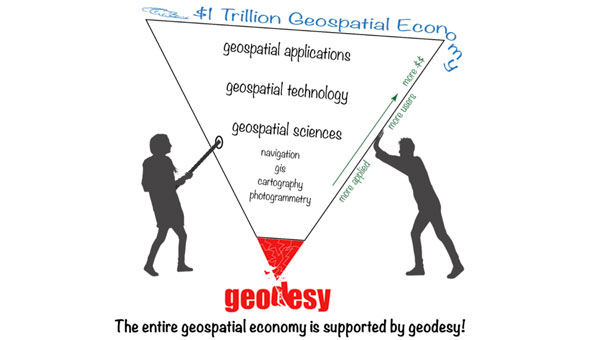
    My November 2022 GPS World Newsletter highlighted “The inverted geospatial pyramid” graphic, which depicts how the entire $1 trillion geospatial economy is supported and dependent on geodesy. A lack of geodetic expertise in the United States presents a significant challenge, with future impacts on positioning, navigation, mapping and dependent geospatial technologies. These changes in the geomatic programs at the universities being funded by NGS’s geospatial modeling grants will provide students with the skills in geodetic concepts that will provide opportunities for employment in the public and private sectors involved with geospatial technology.

    This newsletter and my past three GPS World newsletters highlighted the four NGS Geospatial Modeling grantees, which included creating geodesy curriculums that will help address the geodesy crisis. The MSU proposal describes a consortium-based enhanced graduate-level education program that will provide a range of course options and flexibility. I believe their proposed hybrid or asynchronous online program will provide more opportunities for individuals to study geodesy and advance the science of geodesy.

    One final note about the NGS Geospatial Modeling Grants. On June 4, 2024, Brad Kearse, director of NGS, will moderate a session at the UESI Surveying and Geomatics 2024 Conference held in Corvallis, Oregon, on June 4 to 5, 2024. This will be a good opportunity for participants to obtain a better understanding of the geospatial modeling grants.

    Lunch & panel discussion: NGS Geospatial Modeling Grants panel session

    Moderator: Brad Kearse, Acting Director, NGS

    The NGS Geospatial Modeling grant program is focused on modernizing and improving the National Spatial Reference System (NSRS) and address emerging research problems in the field of geodesy. A secondary objective of this funding opportunity is to support a geodesy community of practice in collaboration with federal and nonfederal stakeholders to address the nationwide deficiency of geodesists and improve the coordination and use of geospatial data. This panel session will explore the research and other activities underway from recipients of the most recent round of the NGS Geospatial Modeling Grant Program.

  • Unmanned news

    Unmanned news

    K1000ULE in flight. (Photo: Kraus Hamdani Aerospace)
    K1000ULE in flight. (Photo: Kraus Hamdani Aerospace)

    There was a lot of press noise in December 2023 about DOD’s Replicator program– which has been interpreted as a project to field thousands of U.S. UAVs to counter a perceived weakness in the face of China’s options for waging UAV war. Then there was a move by the Replicator program office to better explain its approach. It was reported as having at least four concurrent elements:

    1. Encourage U.S. industry to conceive and implement ways to overcome the new aspects of conducting war and possibly use more UAVs more often.
    2. Let China know that the United States is already on the move to not only keep up with but exceed Chinese capabilities.
    3. Overhaul the extremely burdensome and slow existing DOD procurement machine to make large, rapid acquisitions.
    4. Invigorate DOD military services to quickly adapt to find ways to use UAVs in multiple offensive and defensive roles.

    Presumably, lessons learned in Ukraine — where both sides have been throwing both improvised and specially designed explosive drones at each other — and U.S. Red Sea encounters with Houthi rebels — have helped to frame some of Replicator’s objectives.

    Anyone who has labored through a DOD request for proposal (RFP), RFP response, competitive re-bid and maybe even more competitive re-rebid that potentially led to months of questions and waiting leading to an ultimate reward or disappointment can imagine what hoops the procuring agency had to jump through. They can also imagine the time that elapsed from the definition of a requirement to a written firm procurement specification, and approval of a procurement package.

    Never mind the allocation of procurement staff, establishing a budget and then processing of possibly multiple responses – this is a complex, arduous and time-consuming task for both industry and the procurement agencies. With help from the Defense Innovation Unit (DIU), it is anticipated that acquiring and fielding thousands of commercially available autonomous drones will now go quicker.

    Imagine the inertia needed to change the way that military services use the materiel they’ve acquired and how difficult it might be to change what is bought and how it is used at the very front end of a war effort. When the opposition chucks many, small, inexpensive, airborne bombs at you and you do not have an immediate answer other than a limited number of multi-million-dollar interceptor missiles, it can be very painful. Matching drones with drones is essential.

    Replicator was initially envisaged as a $1 billion program over two years to counter this and other problems for the warfighter.

    On March 23, Congress finally passed the FY 24 $825 billion defense spending bill — almost six months late — which contained $200 million for Replicator, and DOD began to scramble to find an additional $300 million for the program’s first year. It should work out as there is money currently unspent from the FY23 budget that DOD has already requested Congress to re-allocate, and there is only a little more than six months left for this fiscal year anyway.

    It is rumored that AeroVironment, with its Switchblade 600 semi-autonomous, one-way Kamikaze UAV, may benefit from an early Replicator procurement. With an anti-armor charge, Switchblade weighs about 50 lb and can fly for 24 miles and up to 40 minutes before engaging its target, allowing adequate time for manual intervention.


    The U.S. Navy has selected a solar-powered UAV from a California start-up because it is the best demonstrated commercially available option for their Marine Corps scouting group.

    The K1000ULE from KHAero in Emeryville, California is a long-range reconnaissance UAV.

    With 24-hour flight endurance, extremely quiet and virtually radar-undetectable, the UAV provides the Marines with a suitable scouting tool – almost a launch-and-forget facility for day and night, most weather recon activities. It is also a relatively low workload for a team of only three to five personnel to transport and operate.

    With vertical take-off and landing capabilities, the K1000ULE is ideal for covert autonomous operations from unprepared areas that a small squad might secure. The mission equipage includes full-motion video with target identification and classification and a secure communications systems.

    With anti-jam, anti-spoofing multi-constellation GNSS, the vehicle can operate reliably in most signal-denied areas. It finds and automatically uses thermal columns to soar up to 20,000 ft and loiter undetected. It is capable of beyond visual line of sight (BVLOS) flight, can carry ADS-B for airborne collision avoidance and can be operated in swarms by a single operator when required – quite some UAV!


    The Kratos XQ-58A Valkyrie Wingman UAV was developed to work with and on-behalf of high-end airborne assets, such as the F-22 and F-35, and is termed an ‘attributable’ adjunct to these ~$90 million fighter/ground-attack aircraft. Autonomous, driven by AI, and stealthy, the jet-powered UAV carries General Aviation electronics, along with other military communications. It is said to cost in the $5 to 10 million range — which makes it somewhat disposable if it is sent into a “tight or risky” location from which its fighter escort should hold back.

    With a 3,000 miles range, 45,000 ft ceiling and carrying capacity of up to 1,800 lb of under-wing armaments, the aircraft can be controlled from an accompanying aircraft as a “Loyal Wingman,” or from the ground and be dispatched to carry out an autonomous, independent mission, requiring approval by a person to release weapons.


    The XQ-58A was recently flown with two U.S. Marine Corps F-35 fighter jets at Eglin Air Force Base, Florida to demonstrate the capability for electronic attack and to fly alongside these fifth-generation high-end aircraft. The UAV autonomously detected, classified, and positioned multiple simulated targets during the exercise and provided target-tracking information to the F-35s.

    The “Loyal Wingman” concept is still being developed and there are other companies, including Boeing Australia, flying competing prototype UAVs.


    So, a more mil-spec tone to this month’s UAV updates, nevertheless a short recap of recent interesting unmanned, autonomous aircraft developments.

  • First Fix: Three recent articles that prove GNSS is constantly in the news

    First Fix: Three recent articles that prove GNSS is constantly in the news

    In one way or another, GNSS is constantly in the news, even though it rarely makes the headlines. Three recent articles prove this point.

    Matteo Luccio
    Matteo Luccio

    The article “Starburst” in the March 4 issue of The New Yorker, written by staff writer Kathryn Schulz, details how the next big solar storm could devastate the U.S. power grid and communication systems and questions whether we are prepared for it. Schulz focuses repeatedly on the key role of GNSS and how devastating it would be if their signals were disrupted by a solar storm. She points out that a large solar storm has not occurred since widespread electrification, let alone in the digital age, and that some scientists now believe there is an approximately 12% chance of an extreme geomagnetic storm striking Earth in the next decade. “The Army,” Schulz wrote, “concerned about overreliance on vulnerable technologies, has reinstated courses in orienteering, and the Navy has resumed teaching sailors how to use a sextant.”

    A March 12 article in WISPOLITICS — which bills itself as “Wisconsin’s Premier Political News Service” — reports on a letter from the chairman of the U.S. House Select Committee on the Strategic Competition between the United States and the Chinese Communist Party, Mike Gallagher, to Federal Communications Commission (FCC) Chairwoman Jessica Rosenworcel. Following reports that U.S. cell phones and other devices are receiving and processing signals from Chinese and Russian GNSS satellites, Gallagher asked Rosenworcel whether it is “contrary to FCC rules for handsets and other devices to receive and process signals from unauthorized GNSS constellations.” I have long wondered the same thing. If any of you readers has a firm understanding of this issue, please let me know. Gallagher also asked whether it is “the responsibility of component vendors, device makers, or carriers to ensure that such signals are not received and processed by devices that use GNSS” and whether the FCC has taken any enforcement actions on this matter.

    A March 14 article by Elliot Ackerman and James Stavridis in The Wall Street Journal warns that, as its headline says, “Drone Swarms Are About to Change the Balance of Military Power.” Ackerman, a Marine veteran, is the author of numerous books and a senior fellow at Yale’s Jackson School of Global Affairs. Admiral Stavridis, U.S. Navy (ret.), was the 16th Supreme Allied Commander of the North Atlantic Treaty Organization (NATO) and is a partner at the Carlyle Group. “Drones have become suddenly ubiquitous on the battlefield — but we are only at the dawn of this new age in warfare,” they wrote. “[D]ozens or hundreds of drones in AI-directed swarms will have the capacity to overwhelm defenses and destroy even advanced platforms. Nations that depend on large, expensive systems like aircraft carriers, stealth aircraft or even battle tanks could find themselves vulnerable against an adversary who deploys a variety of low-cost, easily-dispersed and long-range unmanned weapons.” While the article focuses on AI and does not mention GNSS, the latter is a key enabling technology for UAVs, as readers of this magazine know well.

  • Oregon State University to support new generation of geodesists, surveyors and geospatial professionals

    Oregon State University to support new generation of geodesists, surveyors and geospatial professionals

    In my November 2023 GPS World newsletter, I highlighted the announcement made by the National Geodetic Survey (NGS) of the recipients of the National Oceanic Atmospheric Administration (NOAA) FY 23 Geospatial Modeling Competition Awards. The primary objective of these projects is to modernize geodetic tools and models as well as develop a geodetic workforce for the future.  My past two GPS World newsletters, February 2024 and March 2024, highlighted two of the grantees — Scripps Institution of Oceanography and The Ohio State University — that included developing models to address what NGS denotes as the Intra-Frame Deformation Model (IFDM).  This newsletter will address another NGS geospatial modeling grant awardee, which is the proposal made by Oregon State University (OSU).

    The title of the OSU proposal is “NSRS Modernization and Geodetic Workforce Development.”  Christopher Parrish, Ph.D., director of the Geospatial Center for the Arctic and Pacific (GCAP), is the lead principal investigator (PI).  I met him when we both worked for the NGS years ago.  The goal of the OSU project is to improve the National Spatial Reference System (NSRS) and enhance workforce development and geodetic science.

    I will highlight several items in the proposal, but first, I must address the issue of two universities with the same acronym, which is “OSU.”  In my opinion, since The Ohio State University officially used the acronym first, it is The OSU, but Chris said we are just going to have to agree to disagree.  See “Two Universities with the Same Acronym” for the facts.

    Photo:

    There could be some confusion in my newsletters because the acronym OSU is used by The Ohio State University and Oregon State University.  That said, in the remainder of this newsletter, OSU will refer to Oregon State University.

    The OSU project is organized by the following three themes:

    1) Development and Investigation of Geodetic Tools, Models, and Workflows.

    2) Enhancement of Geodetic Infrastructure.

    3) Geodetic Partnerships, Education and Outreach.

    The project will develop and support a new generation of geodesists, surveyors and geospatial professionals. The plan will build on OSU’s Geomatics graduate program, the University of Alaska Anchorage (UAA) undergraduate Geomatics program, and partnerships throughout the nation to provide opportunities for both undergraduate and graduate students to directly participate in cutting-edge research.  This part of the proposal will help address the geodesy crisis.  As I mentioned in my March 2024 newsletter, I have been highlighting the geodesy crisis and programs that advance the science of geodesy — July 2020, November 2022, and December 2022.

    The goals of the OSU proposal will be achieved through the following five objectives:

    Objective 1: Develop and test novel approaches to integrate precise point positioning (PPP) and real-time networks (RTNs) into the NSRS, including the development of a real-time network (RTN) alignment service.  The current focus includes:

    1. Explore alternative methods to monitor RTN health.
    2. Develop a semi-automatic workflow for aligning RTNs to the NSRS.
    3. Create an accessible web-based interface to empower surveying practitioners and RTN managers with real-time network alignment information.

    The proposal states: A user-friendly real-time network alignment program will be very helpful to RTN operators during the implementation of the new, modernized NSRS.

    Part of the proposal includes contributing to the development and evaluation of NGS’s OPUS Projects web tool for the inclusion of multi-GNSS, gravity, leveling and total station observations.

    The inclusion of additional types of data into OPUS Projects will allow users to incorporate all survey data from their projects into the new, modernized NSRS such as leveling data to estimate NAPGD2022 orthometric heights.

    Objective 2: Create standard operating procedures (SOPs) to ensure proper implementation of and transition to the new 2022 datums for geospatial applications such as topographic mapping, photogrammetric surveys and asset inventories.

    Developing standard operating procedures will provide consistency between different surveying and mapping agencies, as well as routines developed by software companies during the implementation phase of the new, modernized NSRS.

    The OSU proposal includes developing automated methods to manage the Oregon Real-Time GNSS Network (ORGN) to improve the ability of users to observe real-time coordinates in the new, modernized NSRS.

    This work is very important to all RTN operators.  It will lead to the development of a National Real-Time Network (RTN) alignment service that will allow RTN operators/managers to align their RTN with the new, modernized NSRS.

     Objective 3: Improve the Columbia River Inter-Tribal Fish Commission’s, and the Yurok Tribe’s hydrodynamic models of the Columbia and Klamath Rivers through use of the modernized NSRS.

    This may seem like a very local benefit, which it obviously is, but the RTN improvements enabled through their other tasks will support efficient, accurate bathymetry collection at greatly reduced cost and will extend training into a broader community of users.  NAPGD2022 and GEOID2022 will improve the use of the data for hydrodynamic modeling throughout the nation.  Therefore, these enhancements will enable improvement in the modeling of water levels in other water systems and in the accurate representation of dynamics of shallow water habitat.  This is a benefit that will be useful to many NSRS users.

     Objective 4: Assist in the development and testing of OPUS-Projects and M-PAGES.  As previously mentioned, part of the proposal includes contributing to the development and evaluation of OPUS Projects for the inclusion of multi-GNSS.

    This is important because incorporating multiple satellite systems, such as GPS, GLONASS, Galileo and BeiDou, into the processing routine will improve the precision and accuracy of coordinates, especially in the height component.

     Objective 5: Develop and train the next generation of geodesists, surveyors and geospatial professionals and broaden participation in these fields through existing and new collaborative programs between the tribal, academic and government members of the Geospatial Center for the Artic and Pacific (GCAP), where education and outreach are part of its mission.  GCAP provides training workshops covering topics such as GNSS, geodesy, 3D laser scanning and least squares adjustments.

    These types of workshops are usually locally given but part of the proposal includes working with Oregon State E-campus to expand the workshops to an online education program.  This will benefit a lot of surveyors, mappers, and geospatial users across the Nation.

    These five objectives will be achieved through eight focused tasks organized into the three themes previously mentioned.  The new, modernized NSRS will affect in some way the daily operations of all geospatial users.  I have highlighted several tasks that, in my opinion, are critical to the implementation of the new, modernized NSRS. For example, incorporating all types of geodetic data into OPUS Projects will help facilitate the implementation of the new NSRS; developing a National RTN Alignment Service will allow RTN operators/managers to align their RTN properly and correctly with the new, modernized NSRS; and working with Oregon State E-campus to expand the workshops to an online education program will increase outreach efforts that will benefit many users across the geospatial community.

    Photo:

    Key benefits: 

    • Enhancing and extending diverse use of the NSRS where these advances are most needed.
    • CORS postprocessing with PPP will facilitate both CORS monitoring and position.
    • Providing impactful and critical workforce development such as new career opportunities for future generations by expanding undergraduate and geomatics education opportunities and capacity as well as career advancement and upskilling opportunities for the existing workforce.
    • New outreach programs will actively engage Alaska Native communities and K-12 students.
    • Graduate and undergraduate students involved with the project will have unique interdisciplinary experiential learning opportunities collaborating with professionals.
    • Providing broader impacts to society and the planet, including improved resilience to coastal and seismic hazards with improved monitoring capabilities, and developing a diverse geodetic science and geomatics workforce in a currently underserved region.

    This newsletter and my past two GPS World newsletters highlighted three of the NGS Geospatial Modeling grantees, Scripps Institution of Oceanography, The OSU, and OSU, which included creating geodesy curriculums that will help address the geodesy crisis.  Changes in these geomatic programs will provide students with the skills in geospatial systems that will make available opportunities for employment in the public and private sectors.  My next newsletter will address the fourth NGS geospatial modeling grant awardee: Michigan State University’s proposal.

  • Unmanned aircraft update

    Unmanned aircraft update

    Why was there a mix up in Tallahassee, Florida while trying to legislate for eVTOL air taxis and vertiports? Is China catching up on low-observable surveillance drones? And there’s news of an improved indoor UAV inspection system. This all appears to be happening in UAV-land this month.

    Not sure what’s cooking in my home State of Florida on approval of anticipated vertiports for use by eVTOL (electric Vertical Take-Off and Landing) and existing helicopter-type aircraft. Florida Department of Transportation (FDOT) published the findings of a state-formed aviation group in 2023 which appear to be pretty reasonable recommendations to ease approval of future vertiports – something seen as a major step forward for the introduction of eVTOL air-taxis in Florida. The Florida House passed Bill HB 981, which incorporated the FDOT findings and sent it to the Florida Senate for approval.

    Now, Senator Gayle Harrell has introduced an amendment to the bill for review by the Florida Senate, which seemingly adds unwanted restrictions. So, the Association for Uncrewed Vehicle Systems International (AUVSI) released an article criticizing the Senator’s proposed legislation as presenting additional hurdles for eVTOL introduction. AUVSI’s concerns with the Senate version focus on restrictive zoning language, which the Senator’s version has included as follows:

    “Ensure that a political subdivision of the state does not exercise its zoning and land use authority to grant or permit an exclusive right to one or more vertiport owners or operators and authorize a political subdivision to use its authority to promote reasonable access to advanced air mobility operators at public use vertiports within the jurisdiction of the subdivision.”

    In addition to the AUVSI article, an Advanced Air Mobility (AAM) coalition of key industry leaders — including AUVSI and BETA, Eve, Ferrovial, Joby, Lilium, Vertical, and Skyports Infrastructure — sent a letter with critical comments directly to Florida House leaders. AUVSI has been and continues to be supportive of Florida DOT’s AAM plan and recommendations, and has supported the House version of legislation.

    AUVSI believes Senator Harrell’s version would have created uncertainty and provided anti-AAM voices with a powerful tool to delay vertiport construction through drawn-out litigation. This language was widely viewed as problematic by both industry and lawmakers with whom AUVSI has collaborated during Florida’s state session.

    Fortunately, on March 7th the Florida House refused to concur with the Senate’s amendment. Now, however, the bill appears to be stalled and the Florida Legislature has packed up and gone on vacation for the summer.

    As things have progressed, we initially had the B2 ‘Spirit’ Strategic Stealth Bomber, a world first for the USAF and Northrup Grumman who built and fielded the secret, 172 ft wingspan, ‘radar-invisible’, tailless, long-range, defense-penetrating aircraft that has become a legend in its own right. Introduced in 1988, only 21 were produced.

    Then we had the 66ft wingspan RQ-170 ‘Wraith’ Stealth-UAV built by Lockheed Martin for USAF/CIA and introduced in 2007.  Used in a reconnaissance role, some have hinted that it may have replaced the U-2 spy plane in some roles – nevertheless, it’s a big drone that could imply long-range, high-altitude snooping.

    So now enters the Chinese ‘Sky Hawk’, a jet-powered, low-observable drone with only a 23 ft wingspan; which has an uncanny resemblance to both the B2 Spirit and more so the RQ-170 Wraith.

    We are told that the design of this UAV has recently undergone significant ‘enhancements’ and that flight testing of the variant has begun. Although smaller than the US RQ-170, the design is intended to enable ‘stealthy’ overflights of other territories. One of the recent additions is a V/UHF communications capability and the potential that brings for in-flight collaboration with fighter aircraft (aka US Loyal Wingman program) and autonomous operations once instructed.


    Inspecting areas inside operational facilities can lead to major difficulties for first-hand physical access by maintenance/inspection personnel. Flyability in France has developed a drone that can operate inside a spherical cage encasing the whole vehicle, while still being able to receive radio commands and transmit video and data. Elios 3 is the latest product, which has been used in numerous successful inspection missions and has collected video to verify detailed machine and plant status.

    Now a critical area of verification which has been especially difficult to obtain has been added, which enables the measurement of object thickness using Ultrasonic sensing. The Ultrasonic Testing (UT) that the new probe makes possible allows thickness measurement of building walls, pipe walls, corrosion build-up, beams and a whole slew of previously unmeasurable, hidden features that may have gone without full inspection in the past.

    Customers of Flyability’s inspection drone in the oil, gas, chemical, and maritime industries have encouraged the addition of thickness measurement for some time, so Flyability hooked up with Cygnus Instruments to develop the UT measurement probe which has now been successfully ‘grafted’ into the Elios 3 drone.

    The Flyability drone can enter and explore closed/confined spaces that were previously dangerous and were perhaps almost impossible for people to physically inspect, so the addition of UT capability greatly enhances an already good thing!


    So, efforts by Florida to quickly adapt to the coming age of eVTOL, and to Vertiports which will allow people to gain access to air taxis, seems to have come into some sort of conflict with AUVSI – the very proponent for this mode of UAV transportation. We’ll have to see how this is resolved, as it surely will be.

    Technology catch-up by the Chinese developer of the Sky Hawk low-observability drone appears to be something to keep an eye on for a while. And meanwhile, new options for an autonomous indoor drone may be something the maintenance/inspection industry has been seeking for some time.

  • Scripps Institution of Oceanography establishes a geodesy program

    Scripps Institution of Oceanography establishes a geodesy program

    In my November 2023 GPS World newsletter, I highlighted the announcement made by the National Geodetic Survey (NGS) of the recipients of the NOAA FY 23 Geospatial Modeling Competition Awards. The grantees’ proposals include developing models to address what NGS denotes as the Intra-Frame Deformation Model (IFDM). The primary objectives of these projects are to modernize geodetic tools and models, as well as to develop a geodetic workforce for the future. A significant improvement in the new, modernized National Spatial Reference System (NSRS) is the time-dependent component being incorporated in the computation of reference epoch coordinates (RECs). That said, developing models that accurately capture the time-dependent component is extremely important to providing reliable, consistent, and accurate RECs. My February 2024 newsletter highlighted NGS’s grant to The Ohio State University for developing a fully kinematic reference frame for the Continental United States and Canada. Similar to the OSU project, a goal of the Scripps Institution of Oceanography (SIO) project is to provide an accurate IFDM, which will provide reliable, consistent and accurate RECs. On Jan. 10, 2024, Yehuda Bock, Ph.D., gave a presentation about this at the general membership meeting of the American Association for Geodetic Surveying (AAGS). His presentation can be downloaded from the AAGS’s website: https://aagsmo.org/.

    Summary of the SIO Geospatial Award. (Image: NGS website)
    Summary of the SIO Geospatial Award. (Image: NGS website)

    Bock is director of the California Spatial Reference Center (CSRC), which is responsible for “establishing and maintaining an accurate state-of-the-art network of GPS control stations for a reliable spatial reference system in California.” I highlighted the CSRC in my June 2023 GPS World Newsletter.

    Yehuda’s proposal included the following three activities:

    • Create a formal Geodesy Program at SIO to address the nationwide deficiency of geodesists. Expand current geophysics curriculum – funding for five graduate students.
    • Develop an IFDM to supplement the NSRS for users in regions with significant ground motions, using GNSS and InSAR/GNSS displacement fields (funded by NASA projects) and underlying geophysical models. CSRC will exercise the IFDM through its community of public, private and academic users of precise spatial referencing in our challenging region of secular and transient crustal movements.
    • Investigate a unified vertical reference frame, including a marine geoid optimized to be consistent with the full spectrum of observations from modern gravimetric geoids (e.g., GRAV-D, ICGEM), remotely sensed observations (e.g., SWOT, ICESat-2), in situ ocean observations and assimilating ocean models and the TRF.

    Yehuda’s project includes creating a formal geodesy program at SIO that will help to address the geodesy crisis. Anyone keeping up with my columns knows that I have been highlighting the geodesy crisis and programs that advance the science of geodesy (July 2020, November 2022, and December 2022).

    Yehuda showed a slide that highlighted “What Geodesy Can Tell Us About Earth.”  Looking at the slide, geodesists are needed in the field of climatology, meteorology, hydrology, geology, volcanology, oceanography, and glaciology, as well as surveying, mapping, and navigation. All these disciplines study Earth’s dynamic processes and involve geodesy.

    From Dr. Yehuda Bock Presentation to the AAGS General Membership Meeting. (Image: AAGS website)
    From Yehuda Bock Ph.D.’s presentation to the AAGS General Membership Meeting. (Image: AAGS website)

    The images “Geodesy Curriculum at SIO (PhD, MSc)”, “Geodesy Courses – 1” and “Geodesy Courses – 2” provide information about the Geodesy Program as SIO.

    From Dr. Yehuda Bock Presentation to the AAGS General Membership Meeting. (Image: AAGS website)
    From Yehuda Bock, Ph.D.’s Presentation to the AAGS General Membership Meeting. (Image: AAGS website)

    Notice that some of the courses focus on topics that are important to real world applications. For example, GNSS precise point positioning applications to seismotectonics, GNSS signal propagation applications to atmospheric remote sensing and GNSS reflection: soil moisture and sea level and the vertical datum.

    From Dr. Yehuda Bock Presentation to the AAGS General Membership Meeting (Image: AAGS website)
    From Dr. Yehuda Bock Ph.D.’s presentation to the AAGS General Membership Meeting. (Image: AAGS website)
    PhotoFrom Dr. Yehuda Bock Presentation to the AAGS General Membership Meeting (Image: AAGS website)
    FromYehuda Bock, Ph.D.’s presentation to the AAGS General Membership Meeting. (Image: AAGS website)

    In addition to the graduate-level courses, they are proposing an undergraduate course titled Geodesy and Geospatial Information. The purpose of the course is to provide students with the skills in geospatial systems that will provide opportunities for eventual employment in the public and private sectors.


    Proposed Undergraduate Course

     Title: Geodesy and Geospatial Information

    Course justification and content objectives: Geodesy is the study of Earth’s size (geometry), shape (gravity field) and deformations (e.g., plate tectonic motions, subsidence). It provides access to a well-defined spatial reference system for precise geospatial information (latitude, longitude, height, elevation with respect to sea level) used for positioning, navigation, surveying and mapping. Geodesy is also an important discipline within the earth, atmospheric and oceanographic sciences, using observations of GPS and other satellite navigation constellations, remote sensing platforms (satellite and drone), and various terrestrial sensors. It is a data- and analysis-intensive discipline increasingly requiring modern data science methods. This introductory course will provide students with a solid background in geospatial systems for eventual employment in the public and private sectors. The course will also serve as a pipeline to the geodesy track at SIO/Earth Sciences and to other academic institutions and to alleviate the nationwide deficiency of geodesists. The objective is to provide basic knowledge of geodetic concepts for Earth and data scientists and the underlying geodetic framework for precise spatial information.

    Learning objectives:

    • Acquire basis concepts of geodetic science.
    • Provide overview of geodetic instrumentation and observations.
    • Develop elementary skills in geodetic data analysis.
    • Explore existing geodetic infrastructure and data repositories.
    • Experience hands on visualization and manipulation of geospatial information.
    • Understand the underlying geodetic framework for precise spatial information systems.
    • Provide example of data science applications in solving geodetic problems.

    Preferred background: statistics, linear algebra, Matlab/Python


    In my opinion, universities should provide a general elective course for undergraduate students that provides an introduction in how geodesy influences your daily routines. For example, how does my phone know where I am and how does it know the best route I should take to get to my destination?

    How Does My Phone Know Where I Am? (Image: Dave Zilkoski)
    How Does My Phone Know Where I Am? (Image: Dave Zilkoski)

    The second task in the SIO proposal is to develop an IFDM. The concept of an IFDM is part of NGS’ modernized, NSRS. Several of my previous My July 2023 GPS World newsletter highlighted a presentation by Yehuda discussing a kinematic datum that uses an intra-frame velocity model to estimate positions at any time with respect to a reference frame and epoch.

    As I mentioned in my July 2023 newsletter, California’s geodetic network is significantly affected by crustal movement. To help address this issue, the CSRS updated the NAD 83 coordinates, it is denoted as CSRS epoch 2017.5 (NAD 83). Part of the implementation of the CSRC epoch 2017.50 (NAD 83) was to have the new epoch-date coordinates transmitted with RTCM 3.0 data streams. This is something that other RTN operators from around the nation will have to do after NGS publishes the NSRS coordinates. The CSRS is a model from which others can learn.

    During his presentation to AAGS, Yehuda highlighted his methodology of integrating InSAR and GNSS to develop an IFDM that provides for higher spatial resolution to improve the model between GNSS stations.

    The boxes titled “SCIP Dynamic Datum Utility” and “Output from SCIP Utility” provide an example of an input and output of the utility, and the box titled InSAR/GNSS Integration for Higher Spatial Resolution” is a conceptual diagram of the concept.

    Not only has this abbreviation been spelled out before, but here the full phrase appears three times, in three consecutive sentences.

    SCIP Dynamic Datum Utility. (Image: SOPAC website)
    SCIP Dynamic Datum Utility. (Image: SOPAC website)
    Output from SCIP Utility. (Image: (SOPAC Website)
    Output from SCIP Utility. (Image: (SOPAC Website)
    From Yehuda Bock Ph.D.'s Presentation to the AAGS General Membership Meeting (Image: AAGS website)
    From Yehuda Bock Ph.D.’s Presentation to the AAGS General Membership Meeting
    (Image: AAGS website)

    The image provides an example of the concept in the San Joaquin Valley, California.

    InSAR/GNSS Integration Example.
    InSAR/GNSS Integration Example.

    The following statement is in the note section of the slide:

    “Area of subsidence in San Joaquin Valley. Our weekly displacement time series at GNSS station P056 shows significant changes in subsidence rate over the period 2006 to 2022, for a total of 3.3 feet that reflects periods of drought and increased groundwater use. On the upper right is the InSAR time series at that location for a shorter period of time.”  This shows the potential of using InSAR to improve the IFDM in areas of sparse CORS.

    The third item in the proposal is to “Investigate a unified vertical reference frame, including a marine geoid optimized to be consistent with the full spectrum of observations from modern gravimetric geoids (e.g., GRAV-D, ICGEM), remotely-sensed observations (e.g., SWOT, ICESat-2), in situ ocean observations and assimilating ocean models, and the TRF.”

    The images below provide a list of the reference surfaces involved in unifying the vertical reference frames and the observing systems involved in the project. Understanding the geoid at the land-sea interchange is important to estimating accurate GNSS-derived orthometric heights along the coast as well as in the oceans. My August 2021 newsletter highlighted the concept of establishing an International Height Reference System (IHRS) so that all countries could provide physical heights across their boundaries and over the oceans. This project would support that international activity.

    From Yehuda Bock Ph.D. Presentation to the AAGS General Membership Meeting. (Image: AAGS website)
    From Yehuda Bock Ph.D.’s Presentation to the AAGS General Membership Meeting. (Image: AAGS website)
    From Yehuda Bock Ph.D.'s Presentation to the AAGS General Membership Meeting. (Image: AAGS website)
    From Yehuda Bock Ph.D.’s Presentation to the AAGS General Membership Meeting. (Image: AAGS website)

    This newsletter and my previous GPS World newsletter highlighted two of the grantees, \SIO and OSU, which included developing models to address what NGS denotes as the IFDM.

    The SIO program includes creating a formal geodesy program at SIO that will help to address the geodesy crisis. In addition to the graduate level courses, they are proposing an undergraduate course that will provide students with the skills in geospatial systems that will provide opportunities for eventual employment in the public and private sectors. My next newsletter will address another NGS geospatial modeling grant awardee – Oregon State University’s proposal.

  • EAB Q&A: Satellite-based high-accuracy services

    EAB Q&A: Satellite-based high-accuracy services

    Should GPS have a satellite-based high-accuracy service, like Galileo’s and BeiDou’s? What would it take to build it?


    Bernard Gruber
    Bernard Gruber

    “No. As Peter Lynch once said, ‘Know what you own, and know why you own it.’ Although this sage advice was for individuals buying equities, I would offer the same for GPS investing in or ‘guaranteeing’ high-accuracy service. Myriad differential GPS solutions currently exist, next generation atomic clocks are in orbit now, internet-based corrections are available. Evolution will improve accuracy, and techniques for higher accuracy will develop when they are needed by the market. I would rather see investment continue in Alt Nav and compatible GPS solutions. As for Galileo and BeiDou authentication plans, I may provide a different answer.”
    — Bernard Gruber
    Northrop Grumman


    Headshot: Jules McNeff
    Jules McNeff

    “What’s in a name? For most people, GPS already provides a high-accuracy service. Depending on how one uses its signals, you can already track the movement of tectonic plates and changes in Earth reference frames — that’s pretty high accuracy. There are always those who want more, but it’s unreasonable to expect GPS to be the only source, given performance and resilience gains with positioning, navigation, and timing (PNT) augmentations and complements along with GPS basic services. The GPS providers need to focus on Job One, a robust set of GPS services for all its users, and not have that mission complicated further.”
    — Jules McNeff
    Overlook Systems Technologies 

  • Tough Times for Russian Navigation System

    Tough Times for Russian Navigation System

    The Russian satellite navigation system is experiencing tough times as Western sanctions and Russia’s ever-growing international isolation seriously complicate its further development.

    Prior to Feb. 24, 2022, when Russia invaded Ukraine, Russia’s navigation sector was developing well and had a healthy growth rate, which is reflected by the steady growth and improved performance of its satellite constellations. However, the start of Russia’s war with Ukraine and the consequent international sanctions regime against Russia has put an end to the hopes for further development of the sector and especially of its flagship GLONASS global navigation satellite system (GNSS).

    As for GLONASS, as academician Nikolai Testoedov, general designer of JSC Information Satellite Systems Reshetnev, one of Russia’s leading satellite manufacturing companies, said during a general meeting of the Russian Academy of Sciences, the main problem is that Western sanctions do not allow Russia to bring its positioning accuracy to the desired 30 cm or at least 50 cm.

    According to Testoedov, the main reasons for this are serious problems with the supplies of electronic components, most of which Russia traditionally imported. “Until 2014, when the first sanction restrictions were introduced, the share of imports in Russia’s entire satellite constellations reached 42%,” Testoedov said. “Currently we implement a strategy of import substitution in the sector, which is designed until 2030 and involves a transition to 100% domestic products. As of 2014, we had 6,000 electronic components of foreign origin. Since 2014, a lot of work has been done to combine various equipment. Now, it is used in Russia’s satellite constellations.”

    It has already brought some results. According to Ivan Revnivyh, head of the GLONASS department of the Russian space corporation Roscosmos, thanks to the new satellites that have been launched in recent years, the accuracy of GLONASS civil signals has increased up to 1.32 meters. According to Revnivyh, Russia plans to continue work in this direction as part of its existing federal project “Maintenance, development and use of the GLONASS system,” which intends to increase the accuracy of the signals up to 0.3 m.

    Russia plans to continue to improve GLONASS’s accuracy until it matches that of other GNSS and meets International Civil Aviation Organization (ICAO) requirements.

    “When landing a civil aircraft at unequipped airfields,” Testoedov said, “the signal should arrive with a delay of no more than 6 seconds, with an accuracy of no worse than half a meter.”

    Despite the sanctions, Russia plans to continue to develop GLONASS. As part of these plans, starting from 2025, it plans to launch modernized GLONASS-K2 satellites in an import-substituted and multifunctional version. Thanks to this, the signal will be 100 times more powerful than the standard one. That will be primarily achieved by using dedicated navigation satellites weighing about 1 ton.

    After 2030, Russia also plans to place six satellites in geosynchronous orbits (about 36,000 km), which will increase the availability of the signal in Russian cities and difficult terrains.

    There are also plans to create a constellation of 300 satellites in low-Earth-orbit (LEO) at an altitude of 500 to 100 km. They are expected to increase the strength Russian satellite signals by more than 1,000 times.

    In recent years, Russia has faced restrictive policies implemented by various international bodies, including the International Bureau of Weights and Measures and the International Association of Geodesy. According to Russian experts, many of these bodies are currently taking discriminatory measures against Russian systems and technologies.

    In this regard, Russia plans to propose to the countries members of BRICS — an intergovernmental organization comprising Brazil, Russia, India, China, South Africa, Egypt, Ethiopia, Iran and the United Arab Emirates — to design products and systems whose characteristics will be comparable to those of Western origin. According to Reshetnev Systems’ experts, however, this could improve results — mainly, accuracy — by only 20 percent, which would not be critical for Russia.

    GLONASS, which first achieved a full constellation of 24 satellites in 1995, currently consists of 24 satellites of three types: GLONASS-M, which has been produced since 2003, GLONASS-K which has been produced since 2011, and two GLONASS-K2, which Russia launched in 2023. All the satellites are part of the Cospas-Sarsat system.

    Despite the fact that the life expectancy for most Russian GLONASS satellites is seven to 10 years, many of them, according to Testoedov, are already more than twice as old. Russia plans to replace at least six GLONASS satellites within the next two to three years. In the first years of launching the constellation, Roscosmos usually launched nine satellites into orbit at once; currently, it is launching only one or two at a time.

    Still, it is possible that these rates will increase significantly, as by 2030 Russia plans to increase its constellation of satellites by up to 1,000 satellites. For this purpose, the country plans to produce 200-250 satellites per year.

    According to the head of Roscosmos, Yury Borisov, space industry enterprises should produce one satellite per day by 2030. According to him, the Russian Federation is ready to learn from the experience of other countries in this area, such as China.

  • Questions that urgently need answers

    Questions that urgently need answers

    Image: enot-poloskun / iStock / Getty Images Plus / Getty Images
    Image: enot-poloskun / iStock / Getty Images Plus / Getty Images

    The Department of Defense (DOD) shoulders an enormous responsibility, perhaps one whose significance the world does not fully grasp: the sheer number of military, civil and commercial users, each with hundreds of unique use cases, that depend on the Global Positioning System (GPS).

    No other DOD-operated system serves such a diverse array of users and interests. From Special Operators to ship and tank drivers, pilots and operators, the military user base is expansive. Civil users include first responders, general aviators, and those supporting the international flying public, whose numbers are again setting records. Additionally, countless average people like you and me just “use it” in our daily lives without considering how it works. The ever-expanding commercial market consists of $1.7 trillion in 2023 dollars in economic benefits accruing to the U.S. economy alone, millions of jobs, and fierce global competition to produce the “best of the best” of the 6.5 billion user receivers in operation today.

    With these users and interests in mind, what does that mean for GPS’ future? It raises more questions than answers — about policy, governance, program execution and threats that urgently need to be addressed:

    • What indicators will determine whether the United States has met its policy goal to be the global leader in “service provision and the responsible use of global satellite navigation systems, including GPS and foreign systems?”
    • Building on this publication’s previous articles, what constitutes a “Gold Standard” in 2024? Which users determine this definition? How and when do foreign global navigation satellite systems’ capabilities factor into this definition?
    • What funding levels ensure the security, accuracy, availability and resilience of GPS? In Fiscal Year 2022, Congress provided more than $2 billion for DOD to procure and conduct research and development on GPS III and IIIF satellites, procure military user equipment, and upgrade the ground architecture. In 2022, the Department of Transportation received $22 million for GPS resiliency and $92 million for the Wide Area Augmentation System. Is this level of funding sufficient to bring innovative technologies to GPS?
    • Speaking of innovation, U.S. law directs DOD to “sustain and operate” GPS for military and civilian purposes. How can innovative GPS technologies contribute to “sustain and operate” missions?
    • Who should participate in decisions regarding the timing of GPS upgrades and satellite launches?
    • Where does the most accurate data on cyber and other threats to GPS satellites, ground stations, military and civil user equipment, and commercial receivers reside? Who evaluates that data to determine the overall risks to GPS? Should those risks be shared with all users? How quickly will the most severe risks be mitigated?
    • Do the Federal Communications Commission, the Department of Homeland Security, and the Department of State have sufficient resources to detect and prosecute illegal and irresponsible spoofing and jamming incidents in the United States and overseas?
    • What is the earliest date the much-anticipated L1C, L2C, and L5 signals can be operational?

    The GPS Innovation Alliance (GPSIA) believes the U.S. government does not have to shoulder such difficult and urgent questions alone. GPSIA looks forward to sharing insights while working with government agencies and the wider user community to answer these questions and put in place executable plans to address these challenges.

  • EAB Q&A: What are the key challenges and promising trends for GNSS/PNT?

    EAB Q&A: What are the key challenges and promising trends for GNSS/PNT?

    What are the key challenges and promising trends for GNSS/PNT over the next three to five years?


    Headshot: Bernard Gruber
    Bernard Gruber

    “In 2023, the GPS program celebrated its 50th anniversary. It has had untold positive impacts on the world. I strongly believe this trend will continue through GNSS and complementary PNT systems for the next 50 years! That said, continuing challenges faced in the era of great power competition — specifically, to disrupt, deny, and destroy PNT capabilities — pose a clear and present danger. Ingenuity, competition, and strong coalitions will drive how we think and how we utilize our incredible resources – human and system – to persevere.

    Unfortunately, challenges will always exist. Since the beginning, the GNSS community has had to deal with jamming threats, such as pervasive black market ‘cigarette lighter’ jammers, militarily sophisticated ones, or brute force high powered systems. This challenge will not go away. The burgeoning of artificial intelligence and machine-to-machine computations offers an opportunity and poses a threat: as commercial and government entities embrace these technologies, they exponentially increase the need to adapt.

    Several promising trends will continue. Through the hard work of countless governmental organizations supporting the National Coordination Office, periodicals such as GPS World, academic papers, conferences and symposiums, marketing and communications, the public is now aware of how vital GNSS and PNT systems are. Second, buyers, operators, and users will demand that robustness be built into systems by anticipating needs such as increased cybersecurity, assured access, and tiered defense schema.

    Third, innovative technical trends will drive increased processing power, cybersecurity/encryption toughness, signal diversity, adaptive antennas, and network augmentations, while an ever-increasing focus on model-based engineering and digital twins will allow us to field and learn faster. Additionally, as signal diversity grows, the opportunity for software-defined radios that utilize authenticated and available signals while ignoring others automatically will mature; programs such as the NTS-3 demonstration will at minimum force the decision of how we adapt.”

    — Bernard Gruber
    Northrop Grumman


    Headshot: Jules McNeff
    Jules McNeff

    “Trends have emerged and evolved over the last three decades — since GPS became operational — that addressed earlier challenges and yet have created new, and possibly more daunting, ones. Early issues with awareness and acceptance of the need for continuous, precise positioning, navigation and timing (PNT) have been overcome, and the markets and governments have responded with a proliferation of PNT services — both space-based and other.

    I’ll leave the market trends and opportunities to our industry colleagues and focus more closely on some remaining challenges that are particularly vexing to me. That requires stepping outside the comfortable GNSS/PNT-as-a-technology engineering and science bubble full of topics for collegial international cooperation. Instead, one must look at GNSS/PNT as an incredibly valuable tool for public safety, political and economic advantage, and military dominance, all separate, but closely interrelated and so as a tool to be protected. Other nations, some unfriendly to the United States, recognize the political/economic reality and are deploying PNT services to compete with GPS and erode international public confidence.

    The U.S. government appears complacent and naively unwilling to accept that changes are necessary in its approach to international economic competition in PNT technology over the immediate future. Similarly, in the public safety arena, most of U.S. critical infrastructure (CI), an area of federal government responsibility, is well-known to be vitally dependent on GPS to function. However, the government agencies responsible for CI have been beyond reluctant to implement needed resilience measures, specifically regarding the terrestrial enhanced Loran (eLoran) system, which would provide substantial resilience if GPS service were lost or disrupted. This is despite multiple requests over the last decade from Congress and the National PNT Advisory Board to recapitalize eLoran.

    At the same time, friendly and hostile foreign nations invest in their own eLoran systems to bolster PNT resilience within their sovereign territories. Knowing this, the United States cannot be happy with a situation that threatens economic and national security, yet it persists. Finally, and also important to public safety, we need to get serious about how PNT positions (geoaddresses) are reported to the public – important for economic purposes and specifically for incident/accident location and emergency response operations of all kinds. Continuing reliance on lat/lon as a default or on unique proprietary methods is both ineffective and dangerous given the ready availability of the U.S. National Grid as a public resource, as identified in the U.S. Federal Radionavigation Plan. As with eLoran above, the public safety challenge is to save lives and livelihoods and not allow them to remain at risk.

    — Jules McNeff
    Overlook Systems Technologies 


    Jean-Marie Sleewaegen
    Jean-Marie Sleewaegen

    Recent years have seen a spectacular boost in the number of global navigation satellite systems (GNSS) satellites and signals. The launch pace has now slowed down, which does not mean the end of GNSS innovation. On the contrary, now comes the time to exploit and get the best out of all these new signals and services.

    One of the first benefits of signal diversity is improved resilience: the more signals, the more fallback options in case of jamming or spoofing. Designing the optimal blend of all the constellations and signals into a precise and resilient PNT solution is and will remain a major innovation challenge in the industry. The recent introduction of Galileo OSNMA and the announcement of authentication services by other systems will play a key role in this evolution.

    Having many types of signals also means that there are many ways of dealing with them. This is particularly visible in the current PPP-RTK offerings. Various service providers use different correction formats as well as protocols and this complexity is still too exposed to users. A key challenge will be the standardization and consolidation of the correction environment in a multi-constellation and multi-signal context. At the receiver side, this involves evolving from a vendor-specific to a correction-agnostic approach.

    In the next few years, the focus will also expand beyond classical GNSS, with the announcement of the first low-Earth orbit (LEO) LEO PNT constellations, promising improved precision, resilience, and security compared to traditional medium-Earth-orbit (MEO) GNSS. The promises and challenges of  LEO PNT constellations and their interoperability with GNSS will undoubtedly foster major innovations in the PNT industry.

    — Jean-Marie Sleewaegen 
    Septentrio 


    F. Michael Swiek
    Michael Swiek

    A basic question for the next three to five years is how will we be receiving PNT, or P, N, and/or T individually or in combination and from where? We have become accustomed to receiving reliable PNT from government-operated MEO satellite constellations. However, new options appear to provide PNT or P, N, or T from LEO constellations, terrestrial beacons, etc., from both government and private sector providers. These options can help address vulnerabilities in traditional GNSS services and provide options for new applications. The question becomes one of coordination and integration of diverse solutions. The challenge is managing the technical, market and regulatory elements while not undermining existing stable infrastructure or future innovation.

    — Michael Swiek 
    GPS Alliance

  • Kamikazi UAVs and X-Wings

    Kamikazi UAVs and X-Wings

    A UK judge just jailed a student for building a UAV. How could that be? Well, the 3D-printed UAV built by a guy in his room at home was only part of the story. It turns out that his jailing was perhaps more related to his connection to the Islamic State of Iraq and Syria (ISIS), and his apparent intent to use this UAV loaded with explosives or a chemical weapon to attack ISIS enemies.

    3D-printed drone seized by anti-terror officers and rear access panel (Image: West Midlands CTU/PA)
    3D-printed drone seized by anti-terror officers and rear access panel (Image: West Midlands CTU/PA)

    The experts who analyzed the vehicle stated that it was only partially built and appeared somewhat ‘primitive’ in its construction. It would seem that an explosive charge or chemical weapon would need to be located with its fusing circuitry at the front end of the UAV, and maybe the enclosure was rather an access panel to aid the build process.

    It is unclear whether the protruding black item towards the front of the UAV is either a GNSS or communications antenna. This antenna would normally be placed on the upper skin and relatively close to the autopilot or comms radio. It is possible that there is a communications/control signal antenna at the top of the vertical stabilizer. Rudimentary landing gear can be seen aft of the control surfaces of the wing, but the rear propulsion does not appear adequate for the size of the vehicle. Not a bad attempt to create an amateur UAV, but a pretty bad idea for the guy involved to intend it to be a kamikaze, one-way drone for ISIS — he received a 20-year sentence.

    Both Russia and Ukraine continue to churn out new models of one-way UAVs, which they enthusiastically hurl at one another. Russia unveiled a new swarm drone known as ‘Product 53’ which apparently has the ability to seek and identify targets autonomously.

    With a payload of only 3-5 kg it cannot inflict severe damage on major targets, but the plan is apparently to bombard an area with large numbers of Product 53 controlled as a swarm.

    So, Russia’s latest software-driven, sophisticated kamikaze UAV is a far cry from the primitive, partially constructed, 3D-printed UAV which lead a UK court to jail its constructor. Much more was obviously made of his encrypted online contacts with ISIS and his intent to inflict potential death and destruction on behalf of a terrorist group.


    On a far brighter note, a Defense Advanced Research Projects Agency (DARPA) project known as Control of Revolutionary Aircraft with Novel Effectors (CRANE), which first went out to industry for proposals back in 2021, has now moved into Phase 3 build and manufacture following a successful Phase 2 Critical Design Review (CDR).

    Aurora Flight Sciences, a Boeing Company subsidiary, has been authorized to begin building a 7000 lb X-wing manned/unmanned aircraft. The aircraft is intended to prove out a design for aerodynamic control without the use of moving surfaces.

    Illustration of proposed X-Wing aircraft (Image: DARPA)
    Illustration of proposed X-Wing aircraft (Image: DARPA)

    Elevators, flaps, slats and rudders on conventional modern aircraft require significant internal hydraulics and/or cabling and actuators throughout the airframe, which add to the complexity, and potential failure modes, aerodynamic drag and weight. Most current UAVs emulate these flight control systems and use external control surfaces.

    The DARPA X-Wing aircraft may use compressed air jets or even electrical discharges emitted at critical actuation points along its outer surface to ‘gently push’ the aircraft from its existing path through the airstream, which allows the remote pilot to maneuver the aircraft. Known as Active Flow Control (AFC) this technology has been prototyped to one extent or another in recent years, but this DARPA/Aurora project aims to prove the concept.

    For the demonstration aircraft, normal moving control surfaces will be installed and retained. The aircraft will initially be flown using these standard airflow controls to form a baseline for how the aircraft performs. The control surfaces will then be locked down and the aircraft will be flown using AFC, and the performance will be compared to the standard controls baseline.

    Understandably, the earlier phases of the project likely worked through the required control systems for the unique X-wing configuration. Aurora may have been well positioned to provide such flight control systems, autopilot and software from its store of Guidance, Navigation, and Control (GNC) technology — the basis for the operation of autonomous air vehicles.


    Building illicit UAVs intended for terrorism may not be one of the best academic projects to undertake when you’re an ISIS supporter; Russia and Ukraine appear to be in a race to mass produce ever more sophisticated UAVs; and DARPA/Aurora appear to be headed to a relatively heavy prototype air vehicle demonstrating not only X-Wing technology, but also active flight control. Overall, there is a variety of news on UAVs in various configurations and applications.

  • Time is running out to submit GNSS or leveling data for initial NSRS modernization

    Time is running out to submit GNSS or leveling data for initial NSRS modernization

    The National Geodetic Survey (NGS) has announced that users have until February 29, 2024, to submit data for the initial National Spatial Reference System (NSRS) modernization rollout. This means time is running out to submit GNSS or leveling data for initial NSRS Modernization. It is anticipated that NGS will release the new, modernized NSRS in 2025, once new data is incorporated into the database. The following newsletter will provide some advice on strategically selecting marks to improve the local accuracy of the NAVD 88-to-NAPGD 2022 transformation tool.

    Image: NGS Website
    Image: NGS website

    As the announcement stated, NGS is in the process of compiling, organizing, and cleaning all the relevant GNSS and leveling data contained within the NGS Integrated Database and the OPUS shared solutions database for preparation of the new, modernized NSRS. The data will be used in national scale survey adjustments using NGS’ new software package called LASER (Least-squares Adjustments: Statistics, Estimates, and Residuals). The adjustments will compute the initial sets of geometric and orthometric reference epoch coordinates (RECs) on many existing survey control marks and CORS around the country. The definitions of RECs and survey epoch coordinates (SECs) are spelled out in NOAA Technical Report NOS NGS 67, NGS’s Blueprint Part 3. My April 2021 GPS World newsletter highlighted the Blueprint Part 3 document, and my August 2022 GPS World newsletter provided details on RECs and SECs. Using the results of the adjustments, NGS will produce a suite of models and tools that will enable users to access and work within the Modernized NSRS.

    During the last several years, NGS’ GPS on Benchmarks program has been encouraging stakeholders and partners around the country to submit GNSS data to NGS on marks that they use. This will ensure that these marks will have updated RECs when the new system is implemented. Also, just as important, marks that also have North American Vertical Datum of 1988 (NAVD 88) heights will be used to improve the local accuracy of the NAVD 88-to-NAPGD 2022 transformation tool.

    NGS’ plans include accepting user data, but after February 29, 2024, they will not include additional GNSS and leveling data for the initial REC national adjustment and for use in building the transformation tools. In 2018, I wrote a series of GPS World newsletters that highlighted NGS’ GPS on BM program (February 2018, April 2018, June 2018, and August 2018). At that time, the GPS on BM program was very useful in the development and implementation of the hybrid geoid model GEOID18. This newsletter will provide an update on the GPS on BM Transformation Program and provide some advice on strategically selecting marks to improve the local accuracy of the NAVD 88-to-NAPGD 2022 transformation tool.

    Links to the GPSonBM Transformation Tool web map and GPSonBM Progress Dashboard are provided in NGS’ announcement. As the announcement states, the GPSonBM Transformation Web Map provides information on marks that have GNSS-derived ellipsoid heights and published NAVD 88 orthometric heights, and where there are still gaps.

    Photo:

    When users click the link GPSonBM Transformation Tool Web Map, they are connected to a web map depicting a prioritized list of marks where new GNSS observations would be most helpful to the development of the transformation model between the current vertical datum (e.g., NAVD 88) and the modernized NSRS.

    NGS’ prioritized list of benchmarks are labeled as Priority A or B. Clicking on the “About” button on the webpage provides information about the priority marks. See the boxes titled “GPSonBM Transformation Tool Web Map” and “Excerpt of Information on Priority A and B Marks.”

    GPS on BM Transformation Tool Web Map. (Image: NGS website)
    GPS on BM Transformation Tool Web Map. (Image: NGS website)

    Photo:To assist users in their selection of marks, NGS developed criteria based on spatial resolution factors. See the box titled “Excerpt of Information on Spatial Resolution Factors.” As previously stated, time is running out. In my opinion, users should prioritize their GPS on BM plans based on the NGS’ criteria. I have highlighted what is important for users to consider when selecting marks.

    Photo:Many areas across the country do not have benchmarks at the 10 km spacing, so there are some areas without any hexagons or marks. As stated in the spatial resolution factors, NGS will interpolate over any areas with no GPS on benchmarks. In areas that have gaps larger than 10 km, that is, that are missing hexagons, I would recommend occupying several marks in each hexagon surrounding the gap to ensure that marks with valid NAVD 88 heights are part of the transformation tool. The web tool defaults to the Denver, Colorado, region when you access it but users can drag the map to an area of their interest or select a location.

    Locating marks using the GPSonBM transformation tool web map. (Image: NGS Website)
    Locating marks using the GPSonBM transformation tool web map. (Image: NGS Website)

    Acquiring data in mountainous regions and areas that have large distances between completed hexagons is probably the most important for users to focus on. The box titled “Locating Marks Using the GPS on BM Transformation Tool Web Map” provide marks that need to be observed.  As an example, I have highlighted two areas that have large distances between benchmarks and completed hexagons.  In this case, it would be important to occupy a couple of marks in the highlighted locations. Clicking on a mark provides a box with the following information: Mark Priority, Population Priority, PID, Designation, Stamping, State, County, Stability code, Last Date of Recovery, Last Date of Observation, Link to NGS Datasheet, and a Link to a Shared Solution (if one exists).

    Clicking the link titled “More Info” next to Datasheet brings up the NGS datasheet for the mark, and clicking the link titled “More Info” next to Shared Solution” brings up the Shared Solution information (see the boxes titled “Mark Priority Information for Mark G 80,” “Excerpt from NGS Datasheet for Mark G 80,” and “Shared Solution for Mark G 80.”). I would recommend that State surveying organizations (and surveyors) perform this type of analysis and strategically occupy marks that fill in important gaps. There is less than two months remaining to submit data to NGS that will support the transformation tool. 

    Excerpt from NGS datasheet for Mark G 80. (Image: NGS website)
    Excerpt from NGS datasheet for Mark G 80. (Image: NGS website)
    PhotoShared solution for Mark G 80. (Image: NGS website)
    Shared solution for Mark G 80. (Image: NGS website)

    The GPSonBM Progress Dashboard illustrates the progress that each state and territory has made toward NGS’ goal of 10 km (and 2 km) data spacing nationwide.

    GPSonBM Program Dashboard. (Image: NGS website)
    GPSonBM Program Dashboard. (Image: NGS website)

    Users can see the GPS on Benchmark information for a particular state by clicking on the name of the state on the left side of the website.

    Selection of North Carolina. (Image: NGS website)
    Selection of North Carolina. (Image: NGS website)

    I highlighted North Carolina because I live in that state. The map informs the users of how many 10 km priority A (89) and B (32) marks are remaining to be occupied, and the percentage completed (92%). Clicking on the link “To see remaining marks to be collected use GTT Web Map App,” located under the map, depicts the remaining marks to be collected. As you can see from the plot, North Carolina has several marks in the eastern portion of the state that still need to be occupied with GNSS.

    Status of GPS on benchmarks in North Carolina. (Image: NGS website)
    Status of GPS on benchmarks in North Carolina. (Image: NGS website)

    A nice feature of the map is the legend and layer list buttons. Also, information about the mark appears if you click on a mark.

    Example of Legend and Layer List. (Image: NGS website)
    Example of legend and layer list. (Image: NGS website)

    The image below provides a list of layers that can be selected using the webtool.

    Photo:

    The following image depicts marks that have been completed. As you see from the plot, North Carolina has been very active in the GPS on Benchmark program.

    Completed marks in North Carolina. (Image: NGS website)
    Completed marks in North Carolina. (Image: NGS website)

    Users can also click on the button to see which 10 km (and 2 km) hexagons have been completed (see the boxes titled “Completed 10 km Hexagons in North Carolina” and “Completed 2 km Hexagons in North Carolina”).

    Completed 10km Hexagons in North Carolina. (Image: NGS website)
    Completed 10km Hexagons in North Carolina. (Image: NGS website)
    Completed 2km Hexagons in North Carolina. (mage: NGS website)
    Completed 2km Hexagons in North Carolina. (mage: NGS website)

    The North Carolina Geodetic Survey, under the leadership of Gary Thomson, along with NC surveyors has been involved with the GPSonBM program from its inception.

    As previously stated, the website provides the list of priority benchmarks and the status of GPS on Benchmark for each state. There are other states that have been very active in the GPS on Benchmark program such as Minnesota and Wisconsin.

    Completed 10 km Hexagons in Great Lakes Region. (Image: NGS website)
    Completed 10 km Hexagons in Great Lakes Region. (Image: NGS website)

    The following images provide the GPS on Benchmark information for West Virginia.

    Status of GPS on benchmarks in West Virginia. (Image: NGS website)
    Status of GPS on benchmarks in West Virginia. (Image: NGS website)
    Completed marks in West Virginia. (NGS website)
    Completed marks in West Virginia. (NGS website)
    Completed 10 km hexagons in West Virginia. (Image: NGS)
    Completed 10 km hexagons in West Virginia. (Image: NGS)


    The following image provides a plot of an area in West Virigina that highlights a region with a large gap between completed 10 km hexagons. If a user was interested in supporting the development of the transformation model in West Virigina, occupying a mark with GNSS in this area would help improve the local accuracy of the NAVD 88-to-NAPGD 2022 transformation tool.

    Overlay of completed and status of benchmarks in West Virginia. (Image: NGS website)
    Overlay of completed and status of benchmarks in West Virginia. (Image: NGS website)

    North Carolina and West Virginia are not large states compared to some western states. The boxes titled “Status of GPS on Benchmarks in Colorado,” “Completed Marks in Colorado,” “Completed 10 km Hexagons in Colorado,” and “Overlay of Completed and Status of Benchmarks in Colorado” provide the information for Colorado. Looking at the plots there appears to be many regions that could use GPS on Benchmark occupations.

    Status of GPS on benchmarks in Colorado. (Image: NGS website)
    Status of GPS on benchmarks in Colorado. (Image: NGS website)
    Completed marks in Colorado. (Image: NGS)
    Completed marks in Colorado. (Image: NGS)
    Completed 10 km hexagons in Colorado. (Image: NGS website)
    Completed 10 km hexagons in Colorado. (Image: NGS website)

    Looking at the plot in the image below, there appear to be many marks that were occupied in populated areas such as Denver, Fort Collins, and Colorado Springs. The marks along the southern border were part of NGS’ 2017 Geoid Slope Validation Survey (GSVS) Project. The area highlighted by the orange box is an area that is lacking GPS on Benchmark occupations. The distance between the nearest completed 10 km hexagon is 60 kilometers. In other words, the two completed hexagons are more than 120 km apart. As previously stated, NGS will interpolate over any areas with no GPS on benchmarks.

    Overlay of completed and status of benchmarks in Colorado. (Image: NGS website)
    Overlay of completed and status of benchmarks in Colorado. (Image: NGS website)

    Again, in areas that have gaps larger than 10 km with missing hexagons, I recommend occupying several marks in each hexagon surrounding the gap to ensure that marks with valid NAVD 88 heights are part of the transformation tool. To demonstrate this concept, I have selected an area in Colorado near benchmark U 153 (PID LN0062).

    Benchmark U 153 in Colorado. (Image: NGS website)
    Benchmark U 153 in Colorado. (Image: NGS website)

    The following image depicts the locations of the completed hexagons near benchmark U 153.

    Photo:

    NGS has developed web tools to assist users in the selection of marks for the program. Two web tools that I find useful are the Leveling Project Page and the Passive Mark Page. The Leveling Project Page provides information on leveling line data. Users can find information about the marks involved with a certain leveling line. There are links to the Passive Mark Page and NGS datasheets on the Leveling Project Page. My October 2020 GPS World newsletter described the Passive Mark Page web tool in more detail, and my June 2021 GPS World newsletter demonstrated the use of the tools.

    In this example, I selected U 153 because it was located between two completed 10 km hexagons that are 125 km apart. That said, looking at the information from the passive mark web tool, it appears that the published height of the benchmark is based on 1934 leveling data. That by itself is not a bad thing but the Orthometric Height Residual is very large (-23.1 cm). This implies that the difference between the GNSS-derived orthometric height using Geoid18 and the published NAVD 88 height disagreed by 23.1cm. This could be due to the movement of the mark and, in my opinion, is not a good candidate for the transformation tool.

    Photo:

    Photo:

    As previously stated, NGS’ Leveling Project Page, provides information on the benchmarks and associated data involved in a leveling line. See the box titled “Excerpt from NGS Leveling Project Page for L2577.” Users can find information about all the marks involved with a certain leveling line.


    Excerpt from NGS Leveling Project page for L2577. (Image: NGS website)
    Excerpt from NGS Leveling Project page for L2577. (Image: NGS website)
    Distance between 10km hexagons near B 383 in Colorado. (Image: NGS website)
    Distance between 10km hexagons near B 383 in Colorado. (Image: NGS website)

    Again, I used the Passive Mark tool to find detailed information about the mark. See the box titled “Excerpt from NGS Passive Mark Tool for B 383.” This mark was last leveled in 1966 and the Orthometric Height Residual is small (1.2 cm). This implies that the difference between the GNSS-derived orthometric height using Geoid18 and the published NAVD 88 height disagreed by 1.2 cm.

    This could be a good candidate for the GPS on BM program and the transformation tool.

    Excerpt from NGS passive mark tool for B 383. (Image: NGS)
    Excerpt from NGS passive mark tool for B 383. (Image: NGS)

    Photo:

    For completeness, I looked at another mark in the same area.

    Distance Between 10km hexagons near B 154 in Colorado. (Image: NGS website)
    Distance Between 10km hexagons near B 154 in Colorado. (Image: NGS website)

    I highlighted this mark because it was last leveled on the same 1934 leveling line as mark U 153. Unlike U 153, looking at the information provided by the Passive Mark tool for B 154 indicates that the GNSS-derived orthometric height agrees with the published leveling-derived orthometric height. The orthometric height residual is only -2.1 cm. This would be another good candidate to fill the area between the two completed hexagons.

    Photo:Photo:

    This newsletter provided some advice on strategically selecting marks to improve the local accuracy of the NAVD 88-to-NAPGD 2022 transformation tool. Again, I would recommend that state surveying organizations and surveyors perform the analysis described above and strategically occupy marks that fill in important gaps. There is less than two months remaining to submit data to NGS that will support the transformation tool.

    NGS has developed web tools such as Passive Mark Page and Leveling Project Page to assist users in identifying marks for inclusion in the development of the transformation model between the current vertical datums (e.g., NAVD 88) and the modernized NSRS.