Category: Opinions

  • Surveyors, not the tools, define the profession

    Surveyors, not the tools, define the profession

    Many have debated how the surveying profession has morphed into something less than what our predecessors would have called surveying.

    In earlier times, the surveyor was an honored figure in the community and held in high regard, like the local doctor and clergy. Surveyors had the final word on boundaries and the limits of a family’s land holdings, so they were treated like royalty.

    Measuring devices were simple yet complicated enough for only the trained person to understand how boundary lines were determined. Surveyors during those times depended much on natural monumentation and terrestrial features; these items made for solid and definable boundaries. Measurements along these features were to be completed only by surveyors and their means of determining distances.

    Much has changed since those centuries past, including the reputation of the surveying profession. No longer are we mentioned in the same breath as doctors, clergy and lawyers. Even engineers are seen as “more professional” than surveyors. Many have debated how the surveying profession has been degraded from the noble status it once enjoyed and morphed into something less than what our predecessors would call surveying.

    There are many layers to each of the previously described professions, but they all have several things in common: each one relies on data collection, analysis, and professional opinion. Each of these steps requires a specific skill set that includes education and experience. Nowhere in this process does it allow for advancing technology to completely replace any of these steps.

    The evolution of technology and associated tools may help improve the profession, but it will not replace the knowledge necessary to be considered a true professional. Data collection within most professions is the biggest beneficiary of technology; surveying is a testament to these advancements. The breakdown, however, is the availability of the technology to the public and turning non-practitioners into low budget pseudo-surveyors.

    Photo: lukaszfus/iStock/Getty Images Plus/Getty Images
    Photo: lukaszfus/iStock/Getty Images Plus/Getty Images

    What makes us professionals

    Here is the abridged version of the definition of “professional” according to the Merriam-Webster Dictionary Online:

    professional (adjective)
    : of, relating to, or characteristic of a profession
    : engaged in one of the learned professions
    : characterized by or conforming to the technical or ethical standards of a profession
    professional (noun)
    : one who is professional
    : one who engages in a pursuit or activity professionally

    Similar professions have several examples of how the collection of data is a separate process and experience level from its analysis. Consider the following:

    MRI technicians train for their jobs through education, interning and experience. They know how to place patients within the equipment, shield them, apply the rays, and produce the scans as required by their job description. In simple terms, they are data collectors of patients’ medical conditions. Technicians do not analyze the scans nor offer any opinion on the prognoses of the patients. They are, however, relied upon to obtain the proper scans correctly and efficiently for review by doctors.

    Staff accountants or clerks are typically charged with data entry, maintaining ledgers and journals, and verifying data/entry accuracies. Often, clerks organize invoices, statements, and other receivables for input into clients’ accounts. Much of the work for this position is electronic and relies on the employees to be savvy with spreadsheets and able to import various data formats and spot suspect data. Once this work is completed, it become the responsibility of certified public accountants (CPAs) to review and certify the information. The key role here, however, is the accurate compilation of the accounting data.

    Paralegals play a key role in doing the heavy lifting of data collection for lawyers. Paralegals perform client and case research, interview witnesses, handle discovery of case information, and draft many of the documents needed by lawyers. They are tasked with assembling exhibits, delivering and filing necessary court documents, and helping with trial preparation. While they cannot express legal opinions on any case matter, it is the paralegals’ work that lawyers use to develop case strategies. Once again, the data collection is the key to the success of the lawyers’ work.

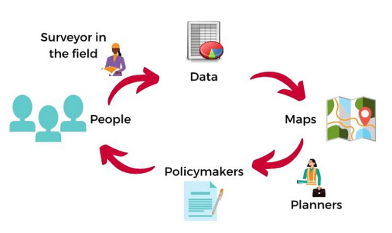
    Professional surveyors are no different from doctors, accountants, and lawyers in these examples. They rely on data collection obtained by experienced staff trained to operate sophisticated instruments and data collectors.

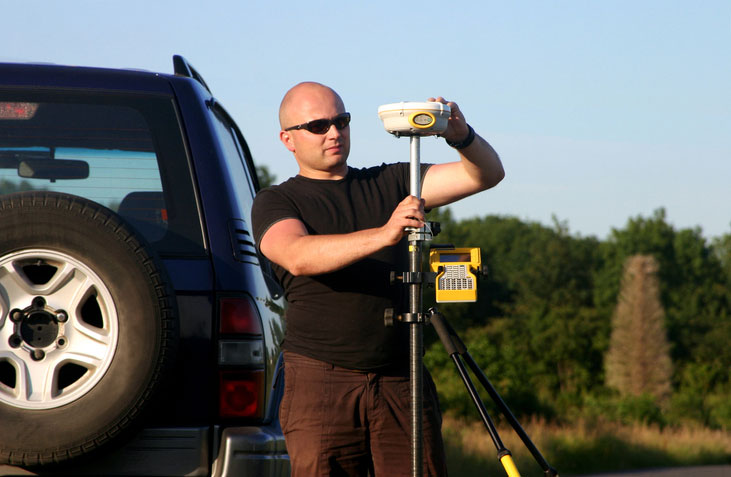
    Field technicians often serve as surveyors’ eyes, so specific training is necessary to ensure that they can accurately locate the required information. Technicians, however, cannot offer legal opinions on the location of land and parcel boundaries.

    This function is solely on the shoulders of land surveyors, who are licensed specifically in that jurisdiction to apply legal principles and case law to boundary issues.

    Photo: aerogondo/iStock/Getty Images Plus.Getty Images
    Photo: aerogondo/iStock/Getty Images Plus.Getty Images

    There is one in every crowd — the North Carolina lawsuit

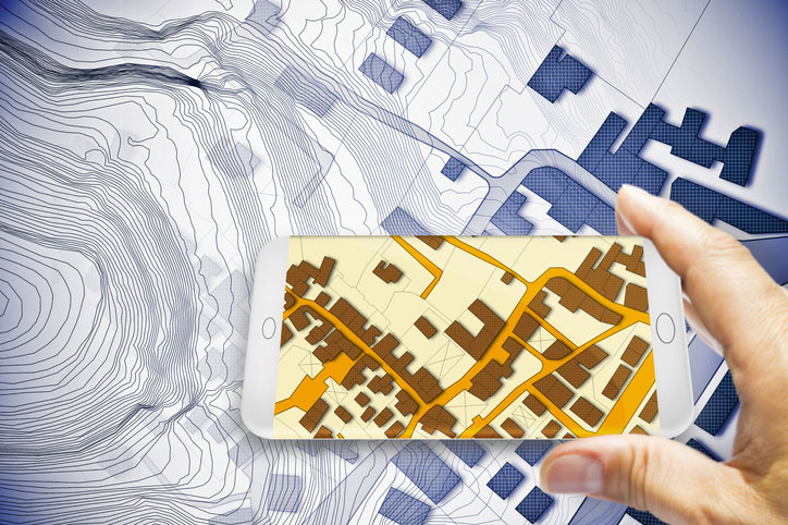
    For those who are not paying attention, we are solidly in the 21st century and fully engulfed in the proliferation of geospatial data. Surveyors remain at the forefront of these technological advances with a plethora of tools and techniques being introduced on a regular basis.

    These tools and associated software are much advanced compared to their earlier surveying instrument counterparts, but through extensive programming and easy-to-use interfaces, this equipment may seem simple to use to the layperson. The elder surveying generation likes to refer to newer technicians as button pushers, because the users perform no true calculations.

    Yes, there are necessary checks and balances even with the new equipment, but the knowledge to operate these instruments is user-friendly and intuitive. So what happens when the technology is used by someone who is not a surveyor?

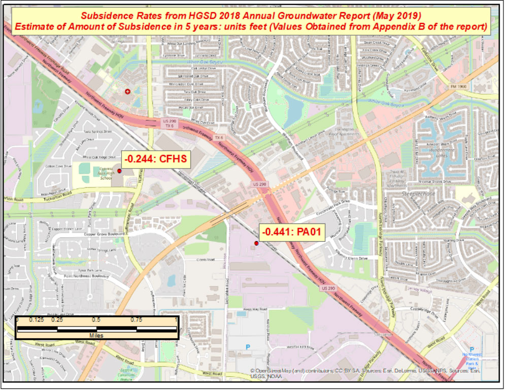
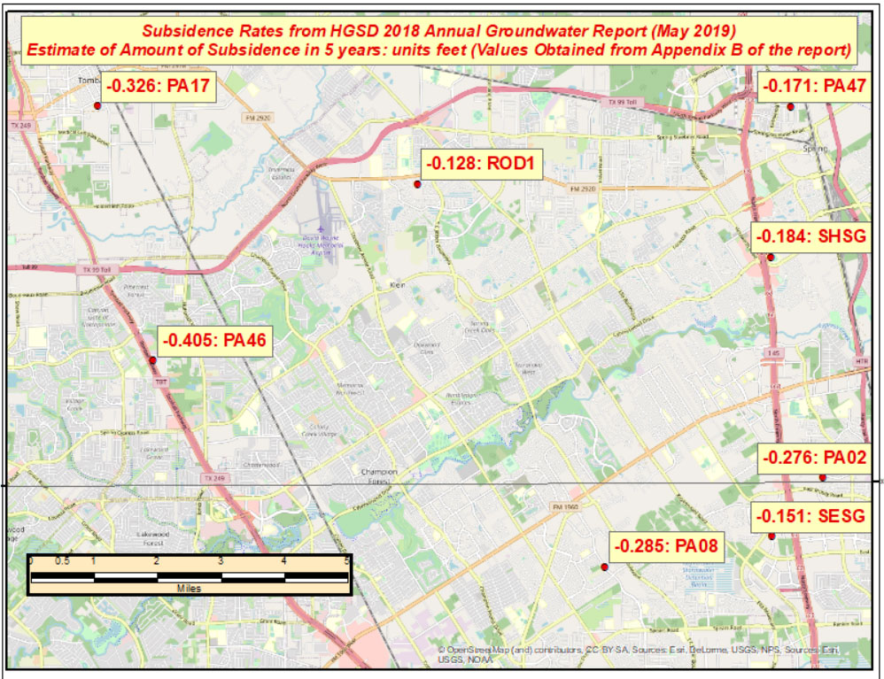
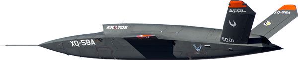
    Among the hazards of making these newer tools and software widely available is how they are used by the non-professional public. As many surveyors have already read about in the news and social media, a UAV operator in North Carolina has filed suit against the NC Board of Examiners for Engineers and Surveyors.

    The board previously ordered the operator to discontinue his UAV flights that engaged in mapping, surveying and photogrammetry services. The operator had been providing images to realtors and homeowners that depicted graphical lines representing property lines, but also included a disclaimer that the product was not intended for surveying purposes. The board ruled he was surveying without a license. The operator is now suing the board and accusing them of violating his First Amendment rights of free speech.

    This case is a high-tech example of what surveyors have faced in the past with overzealous owners of metal detectors. Many instances of low-budget outfits and even fence installers have been brought before state licensing boards because they misrepresented surveying services.

    It should also be noted that survey field crews who use their equipment during off hours to help family or friends with property location without their licensed supervisor’s knowledge face the same consequences. While the “corner finders” are somewhat harmless and get a slap on the wrist from licensing boards, it is the high-tech offenders who are creating much of the harm to the public.

    These situations with unlicensed surveying practices have greatly increased simply because of the available technology and low cost of entry. While GNSS receivers, robotic total stations, and associated data collectors are still quite expensive, new remote-sensing applications are being produced using consumer-grade equipment and advancing software. As technology continues to increase based upon miniaturization and capability, the costs also continue to decrease based upon volume of sales.

    Can I get that UAV in purple like my phone?

    Illustration: jemastock/iStock/Getty Images Plus/Getty Images
    Illustration: jemastock/iStock/Getty Images Plus/Getty Images

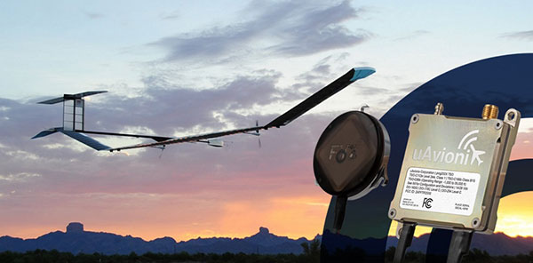
    Leading the charge into non-licensed use of new technology is the UAV and the new standard use of GPS technology within its guidance system of reasonably priced units. Hobby planes and helicopters have been around for years but required lots of skill and space to fly and were quite expensive. The invention of the multi-rotor UAV with integrated GPS has created an easy-to-fly vehicle with lots of capability.

    Couple this new vehicle with a high-resolution camera for photos and video; now it allows amateurs to be aerial cinematographers. Image storage space is not an issue due to increased SD card capacity and speed.

    A well-built UAV with all these capabilities is now very affordable and available everywhere. This revolution has led to larger format platforms with more rotors and heavier payloads for more sophisticated cameras and sensors. Once you have the photos and video, now you must do something with them.

    The advancement of software technology for processing photos, video, and remote sensing modules has become the hottest ticket in site modeling. The combination of the UAV’s capability and the software’s output enables trained pilots and software technicians to provide orthometric-based imagery. This imagery was previously completed by airplanes and cameras costing hundreds of thousands of dollars and processed by technicians on high-end computers using years of skill and experience.

    This entire operation can now be completed by one person with less than a $5,000 initial investment. This is a far cry from the funding needed in years past to outfit a survey vehicle with the necessary equipment and personnel to do this same project.

    Enter the FAA and new rules for flying unmanned aircraft. After much consideration, the FAA instituted guidelines for flying UAVs along with requiring a pilot’s certification to fly for commercial purposes. They also specified limits to UAV sizes and payloads, and limited flights to 400 feet above the ground.

    Many companies have purchased UAVs to provide aerial photos of their own facilities and projects, but fail to realize that publishing their images or videos qualifies them as a commercial user. Unfortunately, these regulations are much like driving a car without a license or insurance — it is only against the law if one is caught.

    The iPhone 12 Pro’s lidar scanner


    Another technology that will be catching on soon is lidar imagery from smartphones. The Apple iPhone 12 Pro and Pro Max contain sensors capable of capturing lidar data that is easily imported into computer drafting software. Several phone apps are also available for integrating this data into survey drawings. Geospatial data is literally at your fingertips.

    50 states, 50 rulebooks

    Rules and policies are put in place to regulate various professions and surveying is no different. The goal of these rules is simply to protect the public. Unlawful practice by non-licensed and/or non-qualified persons is a detriment to public safety.

    The question is often raised about professional surveying licensure and the ability to practice in multiple states. Each state differs in statutory rules regarding boundary surveys. The colonial states (and Texas) follow a metes-and-bounds standard while the remaining states generally adopt a PLSS rule. Local surveying methods, terrain challenges and early settlers often affected the statutes enacted by each state, therefore variations in licensing must be applied to applicants.

    However, the guiding principles for land surveyors remain the same in all states to protect the public. Boundary establishment and retracement is the sole responsibility of licensed land surveyors.

    The tools of the trade are a completely different matter. Controlling the surveying services would be easier if the equipment and supplies necessary to do the work were only available to licensees, but the free market will never let that happen. If a company has $30,000 and wants a robotic total station but has no surveying license, the dealer will not stop the sale. When we drop the price tag to an $800 UAV purchase for performing aerial photography, no one bats an eye. As the cost of equipment continues to fall, the number of unlicensed users will climb.

    Photo: Francesco Scatena/iStock/Getty Images Plus/Getty Images
    Photo: Francesco Scatena/iStock/Getty Images Plus/Getty Images

    ‘Men have become the tools of their tools’ (Henry David Thoreau)

    The point of this topic is that surveying is not about the tools necessary to complete the task. Surveyors carried out their work for thousands of years before electronic instruments and can continue to do so if they choose. The advancement of the equipment and the technology has made it easier for surveyors to do their work, but the true meaning of the task lies within the profession.

    Boundary analysis and determination is the responsibility of land surveyors. Data collection for that analysis can be completed by technicians using a variety of measuring tools. The team works together to complete the surveying process.

    Anyone can buy the tools; that, however, does not make them qualified to use them properly. It is not reasonable for one to buy a scalpel and offer brain surgery with a disclaimer. Ask any surveyor; there are some boundary retracements that are the equivalent of brain surgery. And we do not get to put a disclaimer on it.

  • GPS: The environment’s unsung hero

    GPS: The environment’s unsung hero

    J. David Grossman
    J. David Grossman

    Can GPS support a greener, more sustainable planet? The answer is an emphatic “yes,” and it is already doing so today.

    GPS has become a fundamental technology across nearly every sector of the U.S. economy, including agriculture, transportation, construction and municipal services. In each of these industries, the use of GPS has produced substantial environmental benefits, such as lowered carbon emissions, increased water efficiency, decreased use of environmentally sensitive inputs, and reduced waste.

    Agriculture

    Let’s take a closer look at how GPS is protecting our nation’s critical environmental resources. We begin with agriculture where it is estimated that the absence of GPS during peak planting season could result in an economic loss of more than $15 billion, according to a National Institute of Standards and Technology report.
    During the past two decades, GPS has transformed American farming, enabling increased crop yields, cost efficiencies, and environmental sustainability through the precise application of seed, water, fertilizers and pesticides and the efficient use of fuel. In sum, precision agriculture lets farmers do more with less wasted seed, less fertilizer, less fuel, less pesticide, and more crop yield.

    GPS Innovation Alliance (GPSIA) founding member Deere & Company reports that precision agriculture technologies can have a huge impact on resource efficiency and sustainability. By 2030, GPS-enabled precision agriculture implemented globally could save 180 billion cubic meters of water, says the World Economic Forum.
    Similarly, according to the U.S. Department of Agriculture’s Natural Resources Conservation Service (NRCS), if “[GPS] guidance systems were used on 10 percent of the planted acres in the United States, fuel use would be cut by 16 million gallons, herbicide use by two million quarts, and insecticide use by four million pounds per year.” For a single Midwest row crop farmer, with 6,500 acres using precision agriculture techniques, Deere & Company estimates that more than 1,600 gallons of fuel could be saved, and more than 400,000 kg CO2 equivalent emissions could be avoided, over the course of a production cycle — the equivalent of nearly a million (992,000) passenger car miles driven per year.

    Infographic: GPS Innovation Alliance
    Infographic: GPS Innovation Alliance

    Construction

    Construction is another industry that has been revolutionized by GPS. Today, high-precision GPS is used to support the building of roads, bridges and other significant infrastructure projects. In 2019, testimony before the U.S. House Small Business Committee, an executive of GPSIA founding member Trimble described several examples of how digital construction technologies, including GPS, can more efficiently plan and execute complex construction projects.

    In one such example from Southern California, the improvements “reduced the wetland impact by 58 acres; reduced the impact to sensitive species; reduced landslide risk; reduced residential displacement; and minimized the impact on existing utilities (resulting in few utility relocations to undisturbed areas).”
    GPS receivers are also embedded in many bulldozers, excavators and graders, resulting in reduced waste and lower fuel consumption. They can reduce greenhouse gas emissions, with an estimate from Trimble suggesting that the use of machine control technologies can cut more than one billion pounds of CO2 usage per year.

    NextGen Air

    GPS is also at the heart of the Next Generation Air Transportation System, or NextGen, of the Federal Aviation Administration (FAA). Capt. Sully Sullenberger, during a 2020 GPSIA-sponsored event, described air traffic control modernization as depending “massively on the ubiquity and reliability of GPS.”

    Along with the safety benefits of knowing the precise location of an aircraft, GPS enables optimized flight paths that the FAA says can reduce “flying time, fuel use, and aircraft exhaust emissions.” These efficiencies have already resulted in $1.2 billion in fuel savings, according to the FAA.

    During a 2010 test flight over Puget Sound, Washington, Alaska Airlines found that the use of GPS-aided flight procedures reduced emissions by 35% compared to a conventional landing. Other airlines have also quantified these benefits, finding substantial savings in fuel consumption simply by cutting a single minute from each flight.

    Weather and Disaster Forecasts

    No one can argue the fact that weather events like hurricanes, floods and droughts have a huge impact on the environment and public safety. According to the National Oceanographic and Atmospheric Administration (NOAA), in 2020 such events cost $95 billion in damages. You may not realize, however, that NOAA uses GPS signals to support three-dimensional meteorology, space weather and geophysical applications throughout the United States.

    Even NOAA’s Geostationary Operational Environmental Satellites (GOES) use GPS signals to enhance their ability to provide the data we all receive in each morning’s TV weather forecast, improving weather predictions and our own storm situational awareness. GPSIA member Lockheed Martin manufactures both the GOES-R series of weather satellites and the U.S. Space Force’s more powerful, next-generation GPS III satellites that are now being launched to modernize the GPS constellation.

    Municipalities

    Lastly, we examine the environmental benefits for municipalities that use GPS for key government services, including the real-time tracking of garbage trucks, snowplows and buses. Throughout the country, towns and cities have seen substantial savings in dollars, fuel and time from implementing GPS-enabled technologies.
    In Niles, Illinois, for example, the Department of Public Works partnered with GPSIA founding member Garmin to optimize the routing of snowplows. Using GPS technology, drivers reduced the use of salt by as much as 40%, resulting in more than 700 tons saved. In 2020, in recognition of its innovative use of GPS, the department received the Management Innovation Award from the American Public Works Association. Similarly, GPSIA member CalAmp found that GPS use for vehicle tracking can result in fuel savings of $90 per vehicle per month.

    Ensuring GPS

    Ensuring these environmental benefits can continue to be realized requires that the spectrum used by GPS be protected from harmful interference. It will also depend on continued funding by Congress to modernize the GPS constellation and ground control. Additionally, as Congress considers a major infrastructure bill, including funding for states and localities, we would encourage projects to make use of GPS and other innovative technologies that can drive down costs, reduce carbon emissions, and eliminate waste — including advanced digital-construction management systems that use GPS data to reduce project costs and speed project delivery.
    GPS has changed our everyday lives for the better, and as our dependence on this technology continues to grow, so will its impact on environmental sustainability efforts.


    J. David Grossman is Executive Director of the GPS Innovation Alliance.

  • Ingenuity makes historic flight on Mars

    Ingenuity makes historic flight on Mars

    Only if you have been living under a rock will it be a surprise to hear that the unmanned helicopter called Ingenuity has arrived on Mars attached to the SUV-sized rover called Perseverance. Both have been on the Red Planet since they landed on Feb. 18.

    NASA has since then been in checkout and test mode for both rover and UAV, but Perseverance got a pretty clean bill of health and was commanded to motor over to a flat piece of adjacent Jexero crater — now referred to as the airfield or heliport. There, Ingenuity was detached from the underbelly of Perseverance. Then the little bird lost its power feed from mama rover. Now it has to rely on its own batteries and a small solar panel. The big SUV rover pulled away to a safe 215-foot distance ,and the folks at NASA set about preparing Ingenuity for flight.

    This article was written during the period when things were proceeding with some hesitancy and delay, so things in the article unfold in the same sequence as we all experienced them while we eagerly awaited Integrity’s maiden flight.


    The Ingenuity waits to take its first flight. (Photo: NASA)
    The Ingenuity waits to take its first flight. (Photo: NASA)

    Countdown to Flight

    At only 4 pounds (weighing 1.5 pounds on Mars), the Ingenuity UAV is small, but it’s packed with electronics that allow it to communicate via top-mounted antennas with the rover.

    It carries a lithium ion battery recharged by a small solar panel mounted on top (350 watts is required for a 90-second flight). The UAV also contains heaters to maintain the avionics through the cold of the Martian night. It carries two cameras — a black-and-white navigation camera and a high-density color imager — plus sensors for image processing, data collection and storage, navigation processing and vehicle control.

    One of the objectives for this first flight demonstration is the miniaturization and weight reduction of all these electronics. The NASA website is a little obscure about how the UAV navigates, but perhaps it uses some form of terrain matching/image processing in conjunction with an onboard inertial sensor and laser altimeter.

    Early Shutdown. The UAV had already survived a few nights on its own at around -117F when NASA began to spool up the two four-foot long blades to around 50 rpm during the checkout, and all seemed well until April 9, when a full-speed 2400 rpm spin-test began, and there was an early shut-down due to a watchdog timer — intended to shut things down if something wrong was detected prior to flight. None of this was learned in real time, as radio signal commands take more than 15 minutes to travel the 173-million-miles from Earth to Mars, with the same delay to send back data from what has already happened.

    The density of atmosphere on Mars is only 1% that of Earth, so getting Ingenuity off the ground is more complicated than on Earth. The four-foot-long composite carbon blades have much more surface area than here on Earth for a typical UAV. The two contra-rotating blades spin at around 2400 rpm — a drone on Earth would typically spin its rotors at around 450 rpm.

    Testing on Earth. NASA tested this configuration in a huge vacuum chamber with 1% air density, and Ingenuity flew just fine. The lower gravity on Mars — about 38% that of on Earth — will also help compensate for the lower level of lift available from the Martian atmosphere.

    Because of the radio link delay to and from Mars, Ingenuity can fly and land autonomously only once commands are received. Onboard sensors provide data to enable the vehicle to execute the stored flight profile. The navigation camera provides guidance, and the 13-megapixel color-imaging camera can record the scene. Data and video collected are sent back to the rover for transmission to Earth via the Mars Reconnaissance Orbiter, an Mars satellite that acts as a data relay.

    Ingenuity left the rover and rested on the surface of Mars, while NASA ran a slew of preflight checks. (Photo: NASA)
    Ingenuity left the rover and rested on the surface of Mars, while NASA ran a slew of preflight checks. (Photo: NASA)

    The First Hop. The first‘ hop  was planned to last only a few seconds, but subsequent flights promise to be 165-foot plus, at more than 16 feet above the surface. If things go well, NASA might get more adventurous for the planned fourth and fifth flights.

    All these flights are supposed to happen during the first month of Ingenuity’s flight activity; then Perseverance has to move on with its real task — searching for signs of ancient life on Mars. With no communications possible without the rover, the current plan is to abandon the little bird, even though it may still be fully functional.

    Working to Clear the Watchdog Timer. NASA worked to clear the watchdog-timer problem and give Ingenuity clearance to fly. Over the weekend of April 10–11, the Ingenuity team came up with a fix for flight software. which overcomes the watchdog-timer issue.

    However, before the new software could be uploaded to the ground station on Earth and sent to the Perseverance rover for onward transmission to Ingenuity, extensive testing and validation of the software change was necessary. The existing flight software had not been changed for more than two years, so it’s  understandable that NASA wanted to be sure before uplinking new software.

    Past the April 14 Date. The initially predicted flight date of April 14 came and went, and we still awaited news of the outcome of the next rotor spin-up test. Lift-off and autonomous flight and landing were still to come.

    Meanwhile, another team member came up with a fix to the sequencing of commands that would transition Ingenuity from ground to flight mode, the place in the sequence where things had previously hung up. The revised sequence was sent to Mars and on April 16. The subsequent spin test went off successfully with the contra-rotating blades turning at the anticipated flight speed of 2400 rpm. Apparently, the work on the new version of flight control software was still proceeding, but NASA had decided they have sufficient confidence to set a new flight date of April 19.

    Monday April 19 — The Integrity photographs its shadow while airborne. (Photo: NASA)
    Monday April 19 — The Integrity photographs its shadow while airborne. (Photo: NASA)

    Maiden Flight

    Then, while we all slept, on April 19 at 3:30 a.m. Eastern Time, Integrity executed the command. It  autonomously took off, hover edat a height of 10 feet for around 60 seconds, and then returned to its Martian airfield.

    Above is a picture Integrity took of its own shadow while airborne. it was around noon on Mars in bright sunlight, hence the clear, well-defined shadow. Data received some time later via Perseverance and the Mars Reconnaissance Orbiter contained laser altimeter readings that confirmed this first flight. The color video from Perseverance also shows the spinning rotors and the UAV taking off, hovering at 10ft, descending and landing.

    A small patch that Integrity carries is from the Wright Brothers’ flimsy, powered Wright Flyer, which flew for the very first time on Earth on Dec. 17, 1903. Now we have the very first powered flight on another planet. NASA has scheduled another four or five flights for Integrity, so we may soon even see moving panoramas of Mars from Integrity.

    So now we can chalk up the first powered flight on another planet as another major human achievement — discounting, of course, that maybe some other species has done it eons ago. But, nah, we all know Mars is a dead planet, now.

    Tony Murfin
    GNSS Aerospace

  • NGS revises NOAA report on working in the modernized NSRS

    NGS revises NOAA report on working in the modernized NSRS

    The National Geodetic Survey (NGS) has revised an important technical document on the modernized National Spatial Reference System (NSRS). Zilkoski explores a use case on flood mapping, discussing an Elevation Certificate example, Flood Insurance Rate Map and Flood Insurance Study. NGS has scheduled a webinar for April 8 to discuss the four use case examples. 

    In February 2021, the National Geodetic Survey (NGS) revised NOAA Technical Report NOS NGS 67 Blueprint for the Modernized NSRS, Part 3: Working in the Modernized NSRS. Users can download the publication. See the box titled “NOAA Technical Report NOS NGS 67.”

    NOAA Technical Report NOS NGS 67.(Image:NGS)
    NOAA Technical Report NOS NGS 67. (Image: NGS)

    On March 11, NGS held a webinar describing the revised document (see box titled “Working in the Modernized NSRS”). Download a video of the webinar and the presentation.

    Working in the Modernized NSRS. (Image: NGS}
    Working in the Modernized NSRS. (Image: NGS}

    The revised document added four use cases to describe how someone might access and use the NSRS in the future:

    • Use Case 1: Flood Mapping,
    • Use Case 2: Passive Control for a Multi-year Corridor Project,
    • Use Case 3: Transitioning Data to the Modernized NSRS, and
    • Use Case 4: Leveraging the Modernized NSRS for Airport and Other Infrastructure Monitoring.

    The box titled “Major Changes to NOS NGS 67” highlights the changes in the February 2021 revised version.

    Major Changes to NOS NGS 67. (Image: NGS)
    Major Changes to NOS NGS 67. (Image: NGS)

    This column will highlight one of the four use cases:  “Use Case 1: Flood Mapping.” The case study discusses the Elevation Certificate (CE) example, Flood Insurance Rate Map (FIRM), and Flood Insurance Study (FIS).

    The following is the scenario that NGS considered in this use case:

    “This use case’s examples are set in an imaginary flood-prone coastal community experiencing non-uniform ground subsidence at the watershed scale (see Figure 10). Although many areas are not subject to this level of vertical motion, the full benefits of NSRS modernization are most apparent in this context. We illustrate differences in the use of the NSRS of today and the modernized NSRS with two common NFIP workflows. First, we consider steps anticipated in the certification of NAPGD2022 elevations for a NFIP Elevation Certificate. Second, we step into the shoes of a FEMA Mapping Partner to examine the ways future NSRS tools support more accurate mapping in Flood Insurance Rate Map (FIRM) and Flood Information Study (FIS) updates.”

    I think this is a good scenario to use to demonstrate the full benefits of the NSRS modernization in areas of subsidence, but I believe there are important issues that will need to be addressed before the implementation of NAPGD2022 in flood mapping projects. I will highlight some of these issues later in the newsletter. First, let’s look at NGS example.

    As depicted in figure 10 in NOS NGS 67 technical document, the area has three difference subsidence rates (<0.1 cm/yr., 2 cm/yr., and 5 cm/yr.). See the box titled “Diagram of fictional case study location for Use Case 1.” As NGS stated in the document, “Although many areas are not subject to this level of vertical motion, the full benefits of NSRS modernization are most apparent in this context.”

    This may not be the typical situation of a flood mapping project but it should be noted that this type of high individual rates and large relative rate differences has occurred in the Houston-Galveston, Texas, region (see the following publications):

    NGS’s example illustrates differences in the use of the NSRS today and the future NSRS with two common National Flood Insurance Program (NFIP) workflows. The example addresses surveyors performing a FEMA Elevation Certification using NAPGD2022 elevations, and the ways future NSRS tools support more accurate mapping in Flood Insurance Rate Map (FIRM) and Flood Information Study (FIS) updates.

    Figure 10 from NOAA Technical Report NOS NGS 67 — Diagram of fictional case study location. The arrows correspond to hypothetical rates of ground subsidence. (Image: NGS)
    Diagram of fictional case study location for Use Case 1 (Figure 10), The arrows correspond to hypothetical rates of ground subsidence. (Image: NGS)

    It should be noted that according to the September 27, 2017, Office of Inspector General Department of Homeland Security OIG-17-110 report, FEMA’s goal is to review flood maps every five years.

    “According to the National Flood Insurance Reform Act of 1994, FEMA must assess the need to revise and update all floodplain areas and flood risk zones identified once during each 5-year period. Thus, valid miles will expire every five years if not assessed. Failure to assess an NVUE compliant mile within the 5-year window will result in the mile being re-categorized as “Unknown” in the Needs Database. Unknown miles have not been subjected to the validation process to determine whether they reflect the current flood risk or are in need of restudy. In 2009, FEMA set a goal to attain 80 percent NVUE by the end of fiscal year 2014.” — Excerpt from Department of Homeland Security OIG-17-110 report

    The modernized NSRS will help facilitate meeting this goal. This is described in NGS’s use case example:

    NFIP products will primarily utilize the official NSRS reference epochs

    “As the NFIP is structured today, NFIP products will primarily utilize the official NSRS reference epochs. Additionally, some NFIP products such as the EC form itself, as well as guidance, and technical references for FIRM and FIS preparation would benefit from updates that reflect changes to the NSRS. While the time-dependency and incorporation of a gravimetric geoid model will manifest as improved risk assessment reliability in inundation map products, we notably anticipate that NSRS modernization will have a limited impact on the basic structure of most recommended workflows associated with the NFIP of today. The most significant development is therefore the opportunity for FEMA’s National Flood Mapping Program (NFMP) to increasingly leverage the new capabilities of the NSRS to ensure that current, accurate ground elevation data is used, and to better incorporate relevant flood control structure and future conditions mapping data to support decision-making beyond the NFIP. Details of how the modernized NSRS can help FEMA achieve broader NFMP objectives and opportunities for data-driven case studies to explore this are described at the end of the use case.”

    So, what does this really mean? The document uses two diagrams to explain how the new NSRS would be used to estimate a height for a FEMA Elevation Certificate (see box titled “Figure 11 from Use Case 1”). The top cartoon labeled “Tie to Passive Control” describes the process being performed today. That is, a surveyor locates the two closest marks that have published orthometric heights, follows the appropriate surveying procedures to ensure that the marks have not moved since the last time they were leveled to, and then performs the appropriate procedures to obtain the height for the Elevation Certificate. Depending on the location of the published orthometric heights in the area of the structure, this process could be very expensive. The lower cartoon labeled “Tie to Active Control” describes the process that will be used in the modernized NSRS using NADGP2022 heights. The user would occupy a temporary mark near the structure with GNSS to obtain a NAPGD2022 orthometric height computed using the appropriate ellipsoid height and geoid height value, and then perform the appropriate leveling procedures to obtain the height for the Elevation Certificate. This process will provide the most up-to-date height in the area.

    Figure 11. Cartoon of Elevation Certificate field surveys based on establishing a tie to the NSRS via passive control leveling (top panel) and via active control with GNSS (lower panel). (Image: NGS)
    Figure 11 from Use Case 1. Cartoon of Elevation Certificate field surveys based on establishing a tie to the NSRS via passive control leveling (top panel) and via active control with GNSS (lower panel). (Image: NGS)

    There is an issue that should be noted here: the temporary mark determined using active control may provide the most up-to-date height at a particular location but that height may not be consistent with the heights used to establish the Base Flood Elevation (BFE). At first, someone would say, that’s good because it’s indicating that the flood hydraulics have changed on the floodplain map. However, without performing a detailed height analysis in the region, the user won’t really know whether the BFE value should be updated based on the current changes in topography in the floodplain region. In other words, if the entire region has subsidence at the same rate then the relative height difference hasn’t changed, and the new starting height may not be consistent with the published BFE on the FEMA Floodplain Map. In most floodplain mapping regions, the changes in heights are probably less than the accuracy of the maps but using the height of a mark that is not consistent with the BFE could place a homeowner’s house incorrectly in a flood zone. A good surveying practice would include occupying several marks with GNSS (or leveling between marks) that were involved in the creation of the flood insurance study and the generation of the floodplain map to ensure that the height used on the Elevation Certificate is consistent with the BFE. This is a good procedure to use for the current NSRS as well as the modernized NSRS. However, this is not economically practical using the current NSRS but could be in the new NSRS which is a major benefit of the modernized NSRS.
    So, let’s look at the Houston-Galveston region using the latest information available.

    Download latest FEMA Flood Insurance Rate Map (FIRM). See box titled “Excerpt from FEMA FIRM Map Number 48201C0440N.”

    Excerpt from FEMA FIRM Map Number 48201C0440N. (Image: FEMA)
    Excerpt from FEMA FIRM Map Number 48201C0440N. (Image: FEMA)

    According to the latest Flood Insurance Study (FIS), the heights used in the study were based on a 2001 adjustment performed by the county. You can download the FIS from FEMA Flood Map Service Center | Search All Products, 48201CV001G (fema.gov) and map1.msc.fema.gov.

    I’d like to highlight a few statements in the FIS. First, the reports states that the FIS and DFIRM are referenced to the NAVD (2001 Adjustment). See the box titled “Page 111 from November 15, 2019 Flood Insurance Study 48201CV001G.” The report provides a link for users to obtain the latest vertical control data. Users can find information about the Harris County Floodplain Reference Marks here (See box titled “Harris County Floodplain Reference Marks.”) Users also can access the vertical control data at the county website.

    Page 111 from Nov. 15, 2019, Flood Insurance Study 48201CV001G. (Image: FEMA)
    Page 111 from Nov. 15, 2019, Flood Insurance Study 48201CV001G. (Image: FEMA)
    Harris County Floodplain Reference Marks. (Image: Harris County Flood Control District)
    Harris County Floodplain Reference Marks. (Image: Harris County Flood Control District)

    The box titled “Snapshot of Vertical Control from Harris County Floodplain Reference Marks Website” depicts the location of one of the reference marks, denoted as 050190.

    Snapshot of Vertical Control from Harris County Floodplain Reference Marks Website. (Image: (Image: Harris County Flood Control District))
    Snapshot of Vertical Control from Harris County Floodplain Reference Marks Website. (Image: Harris County Flood Control District))

    Clicking on the datasheets link, provides the information about the floodplain reference mark in the Harris County Flood Control District’s system (see the box titled “Harris County Floodplain Reference Mark Datasheet”).

    Harris County Floodplain Reference Mark Datasheet. (Image: Harris County Flood Control District)
    Harris County Floodplain Reference Mark Datasheet. (Image: Harris County Flood Control District)

    It should be noted that the GNSS-derived orthometric heights were based on GEOID99 and the official hybrid geoid model published by NGS today is GEOID18. A GNSS-derived orthometric height computed using NGS’ webtool OPUS will use GEOID18 not GEOID99. The difference between GEOID99 and GEOID18 at this location is approximately 0.45 feet (0.138 meters). Users must ensure that they are using heights that are consistent with the BFE on the FIRM. The new NAPGD2022 will help to reduce issues associated with effects due to changes in geoid models.

    Page 113 from the November 15, 2019 Flood Insurance Study 48201CV001G addresses the issues associated with riverine flood in the region. (See the box titled “Page 113 from November 15, 2019 Flood Insurance Study 48201CV001G.”) The highlighted sections basically state that subsidence within inland watersheds has little or no effect on flood depths when the entire watershed subsides at the same rate. However, it also states that differential subsidence can cause changes in flood depths. The report goes on to say that the “Harris County and Incorporated Areas are affected by wide-scale, uniform subsidence with minor differential subsidence within individual watersheds.” It also states that “The local effects of subsidence may be adequately addressed, in the short term, by assuming that BFEs subside by the same amount the ground subsides.” The Houston-Galveston, Texas, region is a very complicated area due to the differential subsidence and numerous individual watersheds.

    Page 113 from November 15, 2019 Flood Insurance Study 48201CV001G. (Image: FEMA)
    Page 113 from November 15, 2019, Flood Insurance Study 48201CV001G. (Image: FEMA)

    That said, let’s look some of the latest subsidence data in the region. The Harris-Galveston Subsidence District’s 2018 Annual Groundwater Report By Robert Thompson, William M. Chrismer, and Christina Petersen, PhD, P.E. provide some of the latest estimates of subsidence in the region. The box titled “HGSD Exhibit 18” depicts the locations of the GNSS sites used in the study. The plot provides the average compaction in centimeters over the past five years. The values range from 0.0 cm/year to greater than 2.5 cm/year.

    HGSD Exhibit 18. (Image: Harris-Galveston Subsidence District)
    HGSD Exhibit 18. This map shows the locations of the GPS sites throughout the area. The colored dots represent the average compaction over the past five years for each site, in centimeters. They range from 0.0 cm/year to greater than 2.5 cm/year. (Image: Harris-Galveston Subsidence District)

    I used the information from Appendix B provided in the report to generate a few plots that show the estimate of subsidence in feet over 5 years. I’ve highlighted some marks that have large relative height changes. (Note: The units of the previous figure are centimeters; the units of the next several plots are feet.)

    Estimate of Amount of Subsidence in 5 Years – Units: Feet. (Image: David Ziljoski)
    Estimate of Amount of Subsidence in 5 Years – Units: Feet. (Image: David Zilkoski)

    The relative height change between the two marks PA01 and CFHS, which are about 1.5 kilometers (approximately 1 mile) apart, is 0.197 feet in only 5 years. (See the box titled “Estimate of Amount of Subsidence in 5 Years at Pam 1– Units Feet.”)

    Estimate of Amount of Subsidence in 5 Years at Pam 1 – Units: Feet. (Image: David Ziljoski)
    Estimate of Amount of Subsidence in 5 Years at Pam 1 – Units: Feet. (Image: David Zilkoski)

    The estimated relative height change between mark PA46 and ROD1, which are about 8 kilometers (approximately 5 miles) apart, is 0.277 feet in five years. (See the box titled “Estimate of Amount of Subsidence in 5 Years at Pam 46 – Units: Feet.”)

    Estimate of Amount of Subsidence in 5 Years at Pam 46 – Units: Feet. (Image: David Ziljoski)
    Estimate of Amount of Subsidence in 5 Years at Pam 46 – Units: Feet.(Image: David Zilkoski)

    The effect of these large relative differences may not have any effect on the BFE on a particular watershed. These subsidence estimates are at a specific mark so they only provide information at a particular location. The new NAPGD2022 along with NGS’s webtools will enable users to economically obtain current, accurate heights in the entire region. Leveraging the capabilities of the new NSRS will help facilitate the implementation of FEMA’s goal of assessing the need to revise and update all floodplain areas and flood risk zones identified once during each five-year period.

    There’s one last item that I’d like to highlight in this newsletter. On March 12, NGS announced that they are suppressing height information in Southeast Texas. See the box titled “NGS Announcement to Suppresses Height Information for Southeast Texas” for more information.

    This column highlighted the potential effects of subsidence on published heights in the Houston, Texas, region, which implies that most of the published heights based on older surveys in the region are not current or accurate.

    NGS announcement to suppress height information for Southeast Texas. (Image: NGS)
    NGS announcement to suppress height information for Southeast Texas. (Image: NGS)

    According to the announcement, only 28 marks will have publicly available orthometric heights on NGS datasheets in Southeast Texas. This NOAA  website provides more information. See the box titled “NGS Southeast Texas Orthometric Heights.”

    NGS Southeast Texas Orthometric Heights. (Image: NGS)
    NGS Southeast Texas Orthometric Heights. (Image: NGS)

    I would encourage everyone to check out the website to obtain a better understanding of what this suppression of published heights means to their operations. Future newsletters will address the suppression of the orthometric heights in Southeast Texas, and how users can help densify the network and prepare for the new, modernized NAPGD2022. Again, a benefit of the new modernized NSRS will facilitate the establishment of consistent, accurate NAPGD2022 GNSS-derived orthometric heights.

    Lastly, NGS is convening the 2021 Geospatial Summit on May 4 and 5. The 2021 Geospatial Summit will provide updated information about the planned modernization of the National Spatial Reference System (NSRS). Register here.

  • Regulating advanced drone operations

    Regulating advanced drone operations

    Why permissions and regulations are an important part of workflows

    By Pierre-Alain Marchand
    Regulatory Compliance Manager, senseFly

    Pierre Alain Marchand
    Pierre Alain Marchand

    Now widely accepted as a mainstream commercial mapping tool, the benefits of using drones to make better-informed decisions and provide a robust return on investment are well understood.

    But progress in drone technology is shifting the focus to more advanced operations, a term that encompasses a wide range of activity, including beyond-visual-line-of-sight (BVLOS) flights and operations over people (OOP), as well as flying at night, as part of a fleet, or in restricted airspace.

    These types of flights typically require more planning and permissions, but both can help improve safety for people on the ground, as well as create long-term cost savings and improve data-collection efficiencies.

    Part 107 Waivers. However, while the benefits of advanced drone operations are increasingly well recognized, navigating these differences can be complex.

    For instance, the Federal Aviation Administration (FAA) requires all companies planning advanced drone operations to complete a Part 107 waiver, an official document that approves certain operations of aircraft outside the limitations of regulation.

    However, of the thousands of applications completed in 2018, only 23 were approved. Despite these poor figures, progress is being made to help make the approvals process more accessible.

    Testing. Drone testing has been key to getting operations to where they are today — and will continue to play a role when demonstrating how the required safety, regulatory and logistical criteria of advanced drone operations can be met. Its importance should not be underestimated; testing has the potential to speed up regulatory procedures and even expand drone operations.

    For that reason, investing in drone testing remains a priority today — the more data that is made available to backup a drone’s durability and reliability, the more evidence there is that the technology is safe and fit-for-purpose. SenseFly fixed-wing drones, for example, have thousands of hours of safety testing behind them, which is vital for streamlining and accelerating the approval of waiver requests and flight permissions.

    Testing can also create more opportunities within the project scope, for instance by allowing operators to fly in more built-up areas.

    Permissions. Although testing plays a key role in establishing regulatory compliance, it is still only one piece of the puzzle. With the rules for flying changing all the time, there is also the issue of navigating complex flight permission processes, which vary between countries.

    The good news is that we are now seeing authorities across the world taking measures to streamline the regulatory process and make the rules clearer for operators. For example, the FAA has recently launched its new BEYOND program, which will support efforts to move toward BVLOS operations being carried out under established rules rather than waivers. Type certification is also becoming increasingly important in the U.S., which may further signal a potential move away from waivers in the future.

    It’s promising to see the issue of regulatory compliance and flight permissions being placed at the top of authorities’ agendas. Connections are vital. Working in this way is a two-way process: both parties want to learn more about advanced drone operations and streamline the administration requirements.

    Although there is still work to be done to ensure advanced drone operations become more accessible, the industry is moving in the right direction. As the approval process becomes easier, we predict more commercial companies will see the value of these operations and begin implementing them in their workflows.


    Pierre-Alain Marchand is a regulatory compliance manager at senseFly , a commercial drone subsidiary of Parrot Group. For more information, visit the website or contact Marchand at [email protected].

  • Editorial Advisory Board PNT Q&A: Lessons from Galileo and BeiDou

    What is the single most valuable lesson GPS can learn from Galileo and/or BeiDou?

    Bernard Gruber
    Bernard Gruber

    Service continuity. Given that GNSS are so ubiquitous today, similar to the electrical grid, it is imperative that GPS continue the superb system of outage reporting via NANUs, transparency via GPS.gov, and statutory commitments via U.S. Code. Aligning to the U.S. commitment, continued Open Service Signal-in-Space, such as GPS-Galileo-BeiDou, allows thousands of planned and interoperable “apps” such as Google Maps and Waze to thrive. Although not directly in line with the question, terrestrial timing backup systems, similar to what China and some other countries do, is a valuable lesson in continuity from BeiDou.

    Bernard Gruber
    Northrop Grumman


    Ellen Hall
    Ellen Hall

    Perhaps the lesson could be, ‘It’s easier not to be first!’ Newer navigation constellations have the benefit of watching and learning from GPS — things done well and things to improve. From technology to operational procedures, a global navigation satellite system (GNSS) is difficult to execute. Would it have been easier or cost less if the United States had decided to land on the Moon after someone else had paved the way? Probably, but there is something very satisfying about being first! And, despite the fact that GPS satellites outlive their life expectancy, we keep launching new ones, with improved technology, to give the world better accuracy and more robust signals. The world of navigation welcomes Galileo, BeiDou, and all the others to follow.

    Ellen Hall
    Spirent Federal Systems


    Alison Brown
    Alison Brown

    “GPS could benefit from lessons learned from BeiDou as to the importance of resilience in providing PNT services. BeiDou has a total of 42 satellites now in operation and open signals are broadcast on six frequencies (B1I, B1C, B2I, B2a, B2b, and B3I). In comparison, GPS has currently 29 operational satellites and provides open signals on three frequencies (L1, L2, L5). As the global threat to GPS grows, from frequency incursions by evolving 5G systems as well as deliberate interference or spoofing, the ability to operate on different frequencies to provide resilience against harmful interference will become increasingly important.”

    Alison Brown
    NAVSYS Corporation 


    Jean-Marie Sleewaegen
    Jean-Marie Sleewaegen

    “While GPS remains a gold standard with decades of reliable service, the advent of BeiDou and Galileo has undoubtedly stirred up competition. While BeiDou is exceptionally fast at deploying new signals and services, Galileo is now transmitting the first ever authenticated OSNMA signals, helping secure GNSS receivers against spoofers. The main lesson is that it is better to have company than to be alone. Having multiple GNSS not only increases the number of satellites and signals, which improves positioning accuracy and reliability, but more importantly, it fosters continuous innovation, for the benefit of all users.”

    Jean-Marie Sleewaegen
    Septentrio

  • First Fix: Two PNTs are better than one

    First Fix: Two PNTs are better than one

    With a very good PNT device already installed for flying the aircraft, why not just tap into that one for the payload, right? This might not be a good idea, for several reasons.

    By John Fischer
    Vice president, Advanced R&D, Orolia

    Photo: Orolia
    John Fischer. (Photo: Orolia)

    The navigation device in a UAV is very important, precisely because there is no pilot. It must navigate autonomously. It must also be optimally suited for the airframe, either fixed or rotary wing, providing the accuracy and reliability for all modes of flight, from takeoff to landing. A lot of engineering goes into the design and certification of each UAV’s navigation system to qualify it for flight.

    UAVs can have multiple missions with interchangeable payloads: cameras for observation and inspection; communication equipment for relaying links or supplying emergency cellular base stations; or sensing equipment such as radar, lidar, spectrometers, etc. These payloads also need positioning, navigation and timing (PNT) sources for their missions, for example, to accurately geo-timestamp the collected data.

    With a very good PNT device already installed for flying the aircraft, why not just tap into that one for the payload, right? Actually, this might not be a good idea, for several reasons.

    Recertification. Modifying the navigation device, which is part of the flight control system, risks having to re-certify the aircraft for flight safety. Though a UAV has less severe restrictions on safety than a manned aircraft, it can still cause property damage or even injury and loss of life if it crashes in a populated area. The Federal Aviation Administration has numerous standards — DO-178 for software, DO-254 for hardware, DO-160 for testing — to ensure avionics are designed and tested for safe operation. Every modification, regardless of how small, must follow these standards and may require expensive re-certification of the aircraft’s airworthiness.

    Performance Requirements. These vary with each mission. The flight control system includes a navigation device that was selected based on the aircraft’s special requirements. These will not necessarily match the needs of the payload. For example, consider pitch, roll, and yaw sensing accuracy. The accuracy required to determine the pointing angle of a camera might not be the same as what is needed for level flight.

    Interchangeability. A particular UAV can have multiple payloads for different missions. Conversely, a particular mission payload can be adapted and installed on several different UAVs. Having a second PNT device matched to the payload allows it to stay with the payload as it is moved to different UAVs. This can lower the total cost of ownership and operation, since the extra cost of a second device is small compared to the adaption work and design changes necessary to make a single PNT device be suitable for all situations.

    Missing the T in PNT. Typically, the navigation device for flying the aircraft doesn’t have a precise internal oscillator for supplying time and/or frequency — it doesn’t need it. However, most payloads can benefit from the time/frequency component to enhance mission performance. A low phase noise oscillator with low g-sensitivity that is disciplined by the precise time supplied by a GNSS receiver can substantially improve the performance of any payload radar or communication system.

    A second device does not impact SWAP or cost significantly — GNSS receivers and inertial navigation systems are no longer large, expensive items. A second PNT device is typically small, weighing less than a kilogram and consuming only a few watts of power. There are also fewer connectors and cable harnesses when a removable payload is not sharing the aircraft’s PNT data, so the weight differential might be zero. PNT devices can share antennas on the aircraft via splitters, so there is no need to place additional antennas.

    Technology upgrades. Micro-electromechanical systems (MEMS), inertial sensors, cameras, lidars, radars and other sensors are all evolving at a rapid pace with better technology available with each passing year. Flight control systems evolve at a different pace — mostly because of the flight certification process, but also for lack of a driving need. UAVs navigate just fine with the equipment they have today. A separate payload PNT device allows the system designer to keep pace with evolving technology, choosing the latest and best for the mission without disrupting the navigation system.

    Just as “two heads are better than one” for problem solving, having two PNT devices in a UAV is often the better solution.


    John Fischer is vice president, Advanced R&D, Orolia, and a member of GPS World’s Editorial Advisory Board.

  • Search-and-rescue drone debuts, FAA issues remote ID rule

    Search-and-rescue drone debuts, FAA issues remote ID rule

    It’s hard to pick out an outstanding story or two this month from the dozens of new or related drone initiatives that bombard my inbox. But there’s always some that stand out, needing emphasis. This month, we look at these developments:

    • NEC Laboratories Europe introduces a potential drone solution for finding disaster victims
    • The FAA issues its remote ID rule, which also enables flight over people and nighttime operations
    • The Boeing Loyal Wingman succeeds with its maiden flight in Australia.

    Search-and-rescue drone

    Finding survivors is a primary task for first responders in disaster situations, so if a feasible approach using drones looks possible, its something we should prove out and implement quickly. Researchers at NEC Laboratories Europe, based in Germany, have come up with a drone shown to be able to locate a person’s cell phone — it works better in open situations, but takes longer and is less accurate when there are obstructions.

    The Search-and-Rescue Drone (SARDO).(Photo: NEC Labs/Antonio Albany)
    The Search-and-Rescue Drone (SARDO). (Photo: NEC Labs/Antonio Albany)

    The concept of the search-and-rescue drone (SARDO) is basically to hang cellphone-tower electronics on the drone, and then let it self-triangulate on the return signal from the victim’s phone. So if you know where you are and estimate distance by pinging the victim’s phone and measuring the transit time, then move a known distance and repeat, eventually you converge on the phone’s location.

    Putting all that into reliable flying algorithms is something; proving that your design works is significantly more tricky. Overcoming signal blockage due to debris brings another level of complexity, as does tracking the victim if he or she is moving.

    But this looks like a great initiative which should be developed further — a possible boon for finding people in earthquakes and other building-collapse situations.

    FAA Remote ID Rule issued

    Image: ConceptCafe/iStock/Getty Images Plus
    Image: ConceptCafe/iStock/Getty Images Plus

    On Jan. 15, the U.S. Federal Aviation Administration (FAA) finally issued its rules for remote ID: All UAVs greater than 0.55 pounds must transmit unique identifications. Although, it appears that even these lighter drones might also have to be capable of remote ID if operated commercially. The broadcast message has to include “identification, location, and performance information of the unmanned aircraft and its control station.”

    The good news is that there are now several potential suppliers of these broadcast modules. The rules allow for an implementation period that stretches out another 18 or 30 months — UAV manufacturers have 18 months to comply, while drone operators have 30 months.

    The rules also allow drone operators to fly their UAVs over people. There are four categories of drone, each with appropriate restrictions — all seemingly related to the injuries an out-of-control or falling drone could cause to a person. All such operations require that the FAA approve a written statement of compliance with these safety rules.

    The rules will certainly help with coverage of spectator sports such as the Super Bowl and regular outdoor events like PGA golf tournaments. It would appear that the Golf Channel and CBS have already begun to broadcast drone coverage of recent golf events. Such operations needing to verify their compliance now, rather than over the implementation period.

    And, of course, if you can fly over people, transiting over vehicles is now allowed. With an anti-collision light installed, night operations are also permitted once compliance is approved.

    Photo: Boeing Australia
    Photo: Boeing Australia

    Loyal Wingman’s first flight

    After three years of development, Boeing Australia got its Loyal Wingman unmanned aircraft off the ground on Feb. 27. The Loyal Wingman is sponsored by Boeing and the Australian RAAF.

    The UAV/UAS is also referred to as the Airpower Teaming System (ATS), and should likely be considered a contender for the U.S. Air Force Skyborg manned-unmanned teaming program. At least two other companies involved with the Skyborg program are already flying similar vehicles — Kratos Unmanned Aerial Systems and General Atomics Aeronautical Systems.

    Summary

    Anything that helps first responders find survivors in disasters is a good idea to take to users in the field as soon as possible, so the NEC Laboratories Europe initiatives is a welcome opportunity.

    After more than two years to get the final rules published, the FAA is finally coming online with its Remote ID rule — even though it entails significant work on operators’ parts over the next several months for them to implement. But the window now seems to be significantly wider for them to be able to take on more viable commercial business ventures.

    Finally, it’s good to see the Boeing ATS get into the air — the first aircraft in 50 years to be wholly built in Australia, with interest not only from the Australian RAAF, but also with potential participation in the USAF Skyborg program.

  • First Fix: Hunters and gatherers

    First Fix: Hunters and gatherers

    While farmers work on growing and gathering their crops in the most efficient ways possible, other people key to the agriculture industry are hunters. These hunters seek the most efficient and groundbreaking ways to carry out such tasks as plowing, planting, fertilizing, weeding and, finally, gathering.

    This month, among other machine-control applications, we focus on using GNSS technology to improve agricultural efficiency. According to research firm MarketsandMarkets, the precision farming market is estimated to be $7 billion in 2020 and is projected to reach $12.8 billion by 2025, growing 12.7% every year between.

    Factors driving growth include increasing farm mechanization in developing countries, rising labor costs, increasing strain on the global food supply, substantial cost savings associated with smart farming techniques, and government initiatives to adopt modern agricultural techniques. For a look at today’s technology, see our cover story.

    James Litton
    James Litton

    Sadly, this month we also say goodbye to a pioneer in the precision ag field. James D. Litton founded NavCom Technology in 1995 with three partners, Ron Hatch, KT Woo and Jalal Alisobhani.

    Litton’s career began at Magnavox in the early days of GPS, where he worked on the original proposal for GPS Phase I and helped develop new and advanced commercial navigation and survey receivers for both the Navy’s TRANSIT system and the Air Force’s GPS.

    In 1992, Litton opened a consulting firm, and in 1994, he and his partners founded NavCom with Litton as CEO. Under contract, NavCom developed a single-frequency WAAS-capable GPS aircraft navigation receiver.


    “His work transformed agriculture into a data-driven, technological industry.” — Brad Parkinson


    NavCom also began a relationship with Deere & Company, supporting more efficient and productive agriculture. This relationship was so successful that Deere, which recognized GNSS tech as a smart investment, purchased NavCom in 1999.

    Litton continued to lead the company and serve as part of Deere’s senior management team for eight more years.

    Among his many contributions to the GNSS field, his impact on global agriculture might well have been his greatest, according to Brad Parkinson, the original chief architect for GPS and Editorial Advisory Board member.

    “His work transformed agriculture into a data-driven, technological industry that was incredibly more efficient,” Parkinson said. “The cost savings and increases in productivity have impacted billions around the world.”

    Litton also authored several articles for GPS World.

    He died in January at his home in California with his family at his side. He was 89 years old. His family asks that donations in his name be sent to doctorswithoutborders.org.

  • Surveyors and their global role as humanitarians

    Surveyors and their global role as humanitarians

    Every year, surveying associations worldwide celebrate Global Surveyor’s Day during the third week of March. This year is no different (even during a pandemic) and will be recognized on Tuesday, March 23.

    While this past year has been full of challenges, the role of the surveyor on a global scale has continued to grow. As a professional land surveyor in the midwestern portion of the United States, my surveying experiences have been wide-ranging at times.

    For those who know of me and/or have followed my writings here in GPS World, you probably understand how my perspective for the surveying profession has come to be. For those who have no clue about my background, let me give you a brief refresher:

    • Second-generation surveyor, born and raised in Central Illinois, United States
    • Surveyed in rural, suburban and urban environments
    • Began writing for GPS World in 2015 to share my surveying perspective

    Even though my surveying career has spanned several decades, my experience has been limited to the areas described above. From my early days of spending hours in the county recorder’s office pouring through tract index books, all the way to viewing parcel shapes, scanned documents and high-resolution aerial imagery in today’s world, it seemed at face value that my experience covered most of the duties of the typical land surveyor.

    My career has encountered robotic total stations, all iterations of GPS/GNSS data collection, laser scanning, and now UAV data collection. Throw in the development of the personal computer, COGO and CAD software, the Windows operating system, pen plotters, and countless software breakthroughs, and my perspective of the surveying profession had been front row for all the great things we now take for granted.

    However, these advancements, in tandem with growing up in middle-class America, did not prepare me for a recent experience with a surveying/geospatial group new to me.

    VCSP Wisdom Workshop

    VCSP logoA virtual workshop was recently held to discuss the Volunteer Community Surveyor Program (VCSP) instituted in 2017 by the International Federation of Surveyors (FIG) and the FIG Young Surveyors Network (YSN). More than 125 attendees from worldwide locations logged into the sessions to learn about the program and how to become involved.

    The program, titled “Sustainable Solutions for Land Based Community Problems: Tools and Modern Approaches,” spanned two days and two four-hour sessions. Before we jump into the specifics of the program, first we will offer another brief refresher on FIG and its YSN.

    The Fédération Internationale des Géomètres, now known to English speaking nations as International Federation of Surveyors, was founded in July 1878. It has grown into a worldwide non-governmental organization representing more than 120 countries and their surveying/geomatics professions.

    FIG logoThe National Society of Professional Surveyors (NSPS) is a member organization and participates at various levels throughout FIG.

    The FIG Young Surveyors Network (FIG YSN) was initially established in 2006 as a working group, and upgraded in 2009 to network status due to its rapid growth. This group of young professionals and practitioners worldwide has worked with groups such as the United Nations, World Bank, National Society of Professional Surveyors (NSPS) and Council of European Geodetic Surveyors (CLGE) to promote the profession, increase opportunities for young professionals, and be an agent for social and climate change.

    This YSN workshop set lofty goals, including providing information about the VCSP as well as informing participants of the current means and methods of surveying in underdeveloped countries. For context, here are the program topics covered over the two days:

    DAY 1: Community problems, land tenure and tools for land management

    • Experiences and opportunities of humanitarian surveyors (past volunteer community surveys)
    • Land management, community development and open technologies
    • Identifying the relationship between land management and community development
    • The skills of a humanitarian surveyor
    • Introduction to STDM and Cadasta tools
    • An implementation of the STDM and Cadasta tools for land management

    DAY 2: Building capacity and implementing modern land-management approaches

    • Leveraging land-management tools for problem solving and decision making
    • Designing country-scale solutions for land rights and tenure security issues
    • Gathering resources for land management projects
    • How much have land rights and tenure insecurity impacted your country?
    • Documenting and publishing experiences
    • What’s next? Parallel sessions by FIG region

    Introduction to the humanitarian surveyor

    Like most land surveyors in the United States, our role has been well-defined for generations. We establish and/or reestablish parcel boundaries (that is, original or retracement surveys). While our duties have expanded based upon technology, the central responsibility of the surveyor has been established as an expert measurer and provider of boundary information.

    In the 200+ years since the westward expansion and formal establishment of most of the United States, the role of the surveyor has evolved into more of a commercial purpose. A surveyor’s principal responsibility is to protect the public, but that meaning has much different connotations in lesser developed countries.

    FIG Volunteer Community Surveyor working with locals to discuss parcel possession. (Photo: FIG Young Surveyors)
    FIG Volunteer Community Surveyor working with locals to discuss parcel possession. (Photo: FIG Young Surveyors)

    In the recent past, surveying efforts in many developing countries have been like the early General Land Office surveyors in the 1800s. A surveyor in these regions is out in front of development of unclaimed lands, observing natural and manmade boundaries to guide the decision-making process in establishing parcel rights. The methods and procedures used to date in many lesser developed countries are much like 19th-century surveying — primitive instruments and crude maps sketch property claims with little to no authority.

    Surveying: The Next Generation. Here is where the concept of the community or humanitarian surveyor comes into the picture. A new generation of surveyors is using modern technology not just to map existing boundaries and improvements, but also to collect additional data that will be analyzed to help improve living conditions. With the introduction of GNSS technology, establishment of parcel boundaries now takes an accurate and precise shape in GIS databases created for improving conditions in these areas.

    Additional attributes are collected to determine utility needs, communication availability and access to medical care.

    The easy solution seems to be that, as a larger part of the surveying community, we send teams of surveyors to these countries to locate and establish boundaries as well as perform site studies to determine living conditions and potential improvements. If it were just that easy…

    Local government: Friend or foe?

    Often, these surveyors are going into regions where the local or national governments do not agree with empowering their citizens with property rights and allowing them access to basic utilities. Part of the humanitarian surveyor’s role is to get to know the “lay of the land” when it comes to local order.

    Many remote places are controlled by local gangs, tribes or other factions. These groups forbid the population around them to own their property. Even though it may seem like these physical parcel boundaries exist, most of these people do not have title or land tenure rights. This is partly because of the local control situation, but can also be due to the lack of sophistication within the local or national government.

    Communication hurdles. Another hurdle for the humanitarian surveyor has nothing to do with their professional capability — it relies solely on appearance, body language and ability to bridge a communication gap. For example, most first-world nations rely strictly on communication skills and the competence to effectively work with other people. We often easily trust those who present evidence of competency with no previous interaction.

    In third-world countries, however, locals do not trust outsiders and place competency on those who have built long-term relationships with them. They also rely heavily on body language and facial expressions to convey trust. Local citizens in these areas are less likely to trust visiting older generations who are not able to understand these visual cues.

    Combining the factors of trust of the local citizens with the unsteadiness of government and/or lawlessness, the humanitarian surveyor must also be able to determine common property lines, locate lines of occupation, and remain neutral in providing guidance to adjacent neighbors. These conditions often include areas for crops and livestock, as well as places for food growth and development.

    With little to no money and lack of commerce available, many of these regions are food poor. Locals are forced to harvest their own food, so having a plot of land to grow these crops is critical.

    The surveying procedure for the VCSP. (Image: FIG Young Surveyors)
    The surveying procedure for the VCSP. (Image: FIG Young Surveyors)

    In more established areas, it can be challenging to determine land tenant rights with many shanties and lean-tos being joined structurally. It is equally difficult to determine if any common utilities exist in these areas, such as stormwater channels to help with rainfall.

    Add to these improvement location duties the need for better census data to help with government analyzation of population to apply for aid from other countries.

    The good thing is that technology has progressed in creating tools for geographically locating all these entities, including population, with a multitude of attributes to complete proper analyzation. But there is a catch.

    Technology challenges worldwide

    One of the biggest issue surveyors face when providing services in these areas is the lack of advanced technology and computers. These areas may not have reliable utilities, such as electricity or running water, much less viable internet or Wi-Fi. If computers do exist with local government, they are often years behind in computing power and software. Even operating systems like Windows are a rarity in many of these countries.

    Networking accuracy needed. Most humanitarian surveyors will bring their own equipment and computers, so that problem can be averted. But what about geographical locations? Yes, GNSS constellations are available worldwide, but accuracy using just satellite signals is not sufficient for location of parcels and improvements.

    To get survey-grade accuracy, the surveyor will typically utilize a correction service or base station on a known value. Most of these corrections are based on Continuously Operating Reference Stations (CORS) or similar established reference stations, so creating a georeferenced datum for the surveyed location takes time and knowledge. Once the network is established, lots of work and oversight is necessary to provide quality control on the data being located.

    Tackling parcel management on a global scale. (Image: FIG Young Surveyors)
    Tackling parcel management on a global scale. (Image: FIG Young Surveyors)

    To add to these issues, most of the staff necessary to complete the surveys must be brought in due to the lack of education at the location. The role of the humanitarian surveyor will also be to teach the craft of surveying to locals, who will continue to expand the area cadaster after the volunteer surveyor has left.

    Open-Source Software. However, affording the necessary equipment, computers and software to continue the newly established system is also a hurdle for the community. While the price of computer hardware has greatly reduced over time, the advancement of software and cost of upkeep provides a greater monetary challenge.

    Enter open-source software, based upon Linux and other free computer operating systems. This software has been developed with these situations in mind. It allows for customization to each user’s specific need. There are several GIS and data-collection platforms to fit the needs of these budding communities and countries. Open-source and public-domain software allow even the most basic of cadaster needs to be completed efficiently.

    Young surveyors network to the rescue

    From a technology standpoint, it makes sense that the FIG Young Surveyors Network began this program to help underdeveloped nations begin to create simple cadasters for assessing their property and improvement needs. The younger generation has grown up with technology and can easily teach someone how to embrace it and trust the results.

    This younger generation is also the developer of open-source software and tools and sees the value in providing low- to no-cost applications to those who need it most. While the hard part is collecting the data and working with the locals to establish common boundaries, count the population, and determine the utility needs, they take pride in being part of a solution for a segment of the world that may not have any other chance or choice.

    Participants in the Volunteer Community Surveyor Program (VCSP). (Photo: FIG Young Surveyors)
    Participants in the Volunteer Community Surveyor Program (VCSP). (Photo: FIG Young Surveyors)

    One of the interesting portions of the workshop was the breaks between segments. While it was a time to step away from the computer/tablet/phone, the organizers broadcast videos of musical groups from around the world and encouraged the participants to stand up and dance, with their cameras on. While I did not partake in the dancing (it was 4 a.m. at my home), I applaud the Young Surveyors for providing a welcoming atmosphere where each person could be themselves. Several of the participants were in Africa and Asia on cellphones, so creating a workshop environment that worked for all levels of engagement was fascinating.

    What I learned

    My biggest takeaway was simply learning about the term “humanitarian surveyor.” My earlier reference trying to relate these volunteers to the GLO surveyors, while in the same vein in establishing land boundaries, misses badly in terms of overall contribution to the communities in which the volunteers visit.

    The work they perform is truly humanitarian. While I have tried to comprehend the conditions they are facing, I again fall short in fully experiencing what the role has to offer.

    One of the testimonials was regarding a group that went to Nepal following the 2015 earthquake to help re-establish towns and parcels. The pictures were stunning, and the memories shared were heartfelt. To be one of these volunteers is truly a humanitarian effort.

    Well done, FIG Young Surveyors Network and the Volunteer Community Surveyor Program. I will do my best to not take life here for granted anymore.

  • Editorial Advisory Board PNT Q&A: GPS in popular culture

    Editorial Advisory Board PNT Q&A: GPS in popular culture

    Photo: KenWiedemann/iStock/Getty Images Plus/Getty Images
    Photo: KenWiedemann/iStock/Getty Images Plus/Getty Images

    What is your pet peeve about how GPS/GNSS is portrayed or discussed in the media and popular culture?

    Headshot: Terry Moore
    Terry Moore, professor emeritus, University of Nottingham

    “What really annoys me is the misinformed assumption that SatNav and GNSS are one and the same. There is now a proliferation of ‘Do Not Follow SatNav’ signs [in the United Kingdom], and so many anecdotal stories about accidents caused by drivers blindly following SatNavs in their vehicles. These are almost always due to the deficiencies of the mapping and the route guidance components of the SatNav systems and not due to any problem with GNSS whatsoever. Nevertheless, it is GNSS that takes the blame.”

    Terry Moore
    University of Nottingham


    Headshot: Julian Thomas
    Julian Thomas
    Managing Director

    “In films, you often see what looks like the tracking of a person inside a building using GPS. Yet, this cannot be done currently with satellites and the kind of technology that can track people or objects indoors is highly specialized and localized to that environment.”

    Julian Thomas
    Racelogic Ltd.


    Headshot: Stuart Riley
    Stuart Riley, vice president of GNSS technology, Trimble

    “My pet peeve is the oversimplification of consumer navigation issues. I ran a few searches for ‘GPS fails’ and almost immediately saw images of cars in water and stuck in narrow streets. All too often, this is attributed to a GPS issue or failure. From a consumer perspective, the overall system from maps to satellites is considered GPS. The reality is that GPS (the satellites and control segment) is extremely reliable. Historically, satellite issues have been minimal. The most likely navigation errors are routing errors and old or erroneous maps, coupled with users blindly following the directions, and, to a lesser extent, receiver design issues (e.g., lack of ICD compliance) and harsh conditions (deep urban canyons).”

    Stuart Riley
    Trimble


    Mitch Narins
    Mitch Narins

    “For many, GPS/GNSS remains the miracle cure for all that ails you — for position/surveillance (e.g., ADS-B), for navigation (RNAV and RNP), and for the largest user base, time and frequency. Even while acknowledging the risks, many still treat GPS/GNSS interference as the 500-year flood that will ‘never’ happen in their lifetimes and, if it does, can be excused away as force majeure. It seems that in most of the articles I read it is always a sunny day and GPS/GNSS works perfectly. The need to incorporate resiliency is never emphasized. Nobody would buy a car without a spare tire. Isn’t it time for GPS/GNSS users to recognize the need and insist that an appropriate PNT ‘spare’ be included in the deal?”

    Mitch Narins
    Consultant


    Headshot: F. Michael Swiek
    Headshot: F. Michael Swiek

    “We can chuckle while watching spies, super sleuths, and adventurers receive GPS positions in incredibly challenged environments — even in caves. My main beef is that nowhere is any mention made of who operates GPS. Instead, GPS is treated as an assumed given, embedded in a smart device, constantly and reliably available on demand anywhere and under all conditions. It is about time recognition and credit is given to those who actually make the miracle of GPS happen.”

    Michael Swiek
    GPS Alliance

  • Skyborg UAV aims to join frontline US fighter aircraft

    Skyborg UAV aims to join frontline US fighter aircraft

    It’s only a few weeks into the new year, yet there’s plenty happening in “UAV land” already. I expect another year of innovations, novel developments and groundbreaking firsts in unmanned aircraft.

    This month’s question: What’s a Skyborg? The U.S. Air Force (USAF) has awarded contracts to Kratos, Boeing and General Atomics to prove their approaches to the UAV program.

    All three have fielded existing, company-developed drones which are intended to fly alongside and be controlled by the latest frontline U.S. fighter aircraft. The idea is to have expendable force-multiplier unmanned aircraft support the capabilities of high tech, hugely expensive aircraft in order to undertake perhaps more risky missions, with the potential improvement acceptable versus unacceptable losses.

    Flying alongside frontline fighter aircraft, these jet-powered unmanned aircraft could undertake more risky close support parts of the mission, where loss of the UAV might be more likely, while the manned aircraft remains outside the high-risk envelope. Hence the term attritable is now being applied to these unmanned accompanying vehicles, which are intended to have a reduced cost profile so that loss of the UAV might be more tolerable.

    The Air Force Life Cycle Management Center (AFLCMC) has awarded Skyborg Vanguard Program contract amounts to Boeing ($25.7 million), General Atomics ($14.3 million) and Kratos ($37.8 million) for initial prototyping. All appear to have Skyborg prototypes in development.

    Kratos has subsequently announced other contract modifications related to the U.S. Air Force Research Laboratory (AFRL) Low Cost Attritable Aircraft Technology (LCAAT) program.

    Boeing will offer a variant of the Airpower Teaming System (ATS) drone being developed in Australia for the Australian Air Force. Engine runs and initial taxi tests were recently completed, however the program went into a short hiatus at the end of 2020 because of high COVID-19 infection rates in and around Sydney.

    Boeing will offer a variant of the ATS drone being developed for the Australian Air Force. (Photo: Boeing)
    Boeing will offer a variant of the ATS drone being developed for the Australian Air Force. (Photo: Boeing)

    General Atomics Aeronautical Systems Inc. (GA-ASI) is in the process of modifying two company-owned Avenger UAVs to incorporate upgraded datalinks and the Skyborg System Design Agent (SDA) software. Flight trials will investigate Artificial Intelligence capability for autonomous control of the UAVs while operating alongside manned aircraft – with the object of demonstrating that “a mix of manned and unmanned aircraft can communicate, collaborate, and operate together,” said David R. Alexander, president of GA-ASI.

    General Atomics Avenger unmanned aircraft. (Photo: GA-ASI)
    General Atomics Avenger unmanned aircraft. (Photo: GA-ASI)

    The jet-powered Avenger aircraft has been under development and evaluation for more than 10 years so it is well characterized, and its performance as a UAV is already understood.

    The XQ-58A Valkyrie UAV has benefited from earlier generations of Kratos high-speed jet-powered target systems — something none of the other Skyborg competitors have in their bag of tricks. Kratos has been providing high-speed target drones to the military for a number of years, so jet powered drones are something they have been developing and fielding for a long time.

    Kratos aerial target drone. (Photo: Kratos)
    Kratos aerial target drone. (Photo: Kratos)
    XQ-58A Valkyrie UAV. (Photo: Kratos)
    XQ-58A Valkyrie UAV. (Photo: Kratos)

    The Valkyrie UAV was developed under the LCAAT program to demonstrate unmanned low-cost capabilities, and to fly as a stealthy companion to manned aircraft. It is intended to carry internal and wing mounted weapons. The turbine division of Kratos is also investigating lower cost jet engine options for attritable UAVs.

    Meanwhile, continuing developments in detect and avoid (DAA) are progressing, moving towards a solution for one of the main problems holding back integration of unmanned aircraft into controlled airspace.

    A number of these solutions are based on ADS-B or Automatic Dependent Surveillance Broadcast, whereby the UAV location – usually position provided by onboard GPS — is transmitted at a regular interval by an equipped UAV. So any similarly equipped manned or unmanned aircraft can receive the ADS-B signal, has knowledge of where such flying obstacles might be and is therefore able to avoid a potential collision.

    And for pseudo-satellite applications like the Airbus Zephyr which must transition between low-level airspace and the stratosphere, having on-board certified ADS-B is essential so that other aircraft and FAA air-traffic control have full visibility of such a delicate airframe which is lacking great maneuverability during climb-out, on station at altitude and during descent.

    Zephyr pseudo-satellite UAV with uAvionix ADS-B transponder and GPS. (Photo: uAvionics)
    Zephyr pseudo-satellite UAV with uAvionix ADS-B transponder and GPS. (Photo: uAvionics)

    Since Zephyr transitions through Class A airspace, the manufacturer Airbus decided that it should be equipped with an ADS-B transponder and GPS source which had undergone FAA recognized qualification testing and which meets known Technical Standard Order (TSO) requirements.

    The equipment also needed to be small and use little power — at 70 grams and using only 2 watts, the uAvionix ping 200X transponder and truFYX GPS provide high power (54 dBm), high integrity transmissions of ADS-B and transponder mode data to Air Traffic Control (ATC) and other suitably equipped aircraft.

    Zephyr is an all-electric vehicle, using sunlight to derive power from large photo-voltaic arrays which cover its upper surfaces. Batteries store surplus energy which is not consumed during daylight and provide power in order to maintain aircraft station through the night hours. From a perch at around 70,000ft, Zephyr is apparently focused on Earth-observation capability with payloads envisaged to include Electro Optical, Infrared, Hyper spectral, Passive Radio Frequency (RF) Radar, Synthetic Aperture Radar (SAR), plus Early Warning, Lidar and Automatic Identification System (AIS).

    The Hover DAA solution. (Photo: Sagetech)
    The Hover DAA solution. (Photo: Sagetech)

    “Sagetech is another DAA supplier which is currently working with both fixed and rotary wing UAS customers who are incorporating DAA systems in their design and type certification projects,” said Tom Furey, CEO of Sagetech. “Sagetech is providing regulatory guidance, transponders and interrogators, and system design to ensure these UAV systems in development will satisfy the anticipated certification requirements. Sagetech itself, through technology development and partnerships with companies including Hover Inc., expects to offer a complete DAA prototype system by the end of this year.”

    So, lots of progress towards Skyborg drone teaming systems with $78min awards by the Air Force Life Cycle Management Center from an anticipated budget of around $400m, while certified Detect and Avoid solutions help move commercial drones towards potential regular flight in controlled airspace.