Category: Uncategorized

  • Skyworks launches GNSS front-end modules with integrated filters

    Skyworks Solutions, which manufactures analog and mixed-signal semiconductors, has launched three low-noise amplifier (LNA) front-end modules with integrated filters for GNSS. The devices are designed to provide high linearity, excellent gain, a high 1-dB input compression point and a superior noise figure.

    The pre-filters provide the low in-band insertion loss and integrated notch filtering for excellent rejection of desired frequency bands.

    Each device is supplied in small-footprint, surface-mount technology multi-chip module packaging — 1.1 x 1.5 x 0.7 millimeters for the SKY65713-11, and 1.7 x 2.3 x 0.7 millimeters for the SKY65715-81.

    The SKY65713-11 and SKY65715-81 both support products integrating GNSS functionality such as smartphones, personal navigation devices, wearables, machine-to-machine (M2M) systems, base stations, asset tracking instruments, professional radios and Internet of Things (IoT) applications. Both are designed for BeiDou and GPS receiver applications.

  • The GNSS of Things, and a Galileo/Copernicus interface

    A software offering an “open-source innovation platform for the GNSS of Things”  won the Special Prize in the Galileo Masters competition. Another entry showed the opportunities that lie at the interface of Galileo and Copernicus, the EU’s Earth-observation satellite project. The UK government has just published its first ever space policy document, and I am amazed as well as somewhat surprised that it took so long.

    Brits in Space
    I was born in 1961, the year of the original spaceman, and just a few days old when Yuri Gagarin boarded Vostok 1 and launched the era of manned spaceflight. My childhood was vividly punctuated by the triumphs and disasters of the early days of our exploration of outer space. So I am amazed – and somewhat perplexed – to think that it is only now, 55 years later – that the first British taxpayer-funded astro/cosmonaut has made it into orbit! But congratulations to Major Tim Peake and our best wishes for his six-month mission on the International Space Station.

    Even more amazing is that, coinciding with Major Peake’s flight, the UK government has just published the first ever UK Space Policy document. We Brits do consider ourselves to be pretty good at the old aeronautics and aerospace game, so again, it is amazing that we have not had a written space policy before now.

    The good news is that, apart from articulating an ambition to establish a commercial ‘space port’ in an otherwise currently undisturbed part of rural England, the policy has a clear focus on innovation and the use of space-based solutions for public services and security.

    Berlin innovation

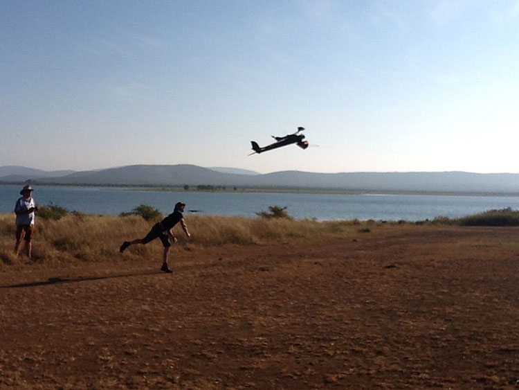
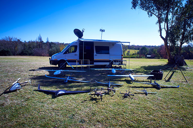
    Much European satellite innovation in the GNSS and Earth Observation sectors was on display at the Satellite Masters Conference and Awards Ceremony that took place in Berlin at the end of October. This annual event once again highlighted the wealth of creative people in the downstream GNSS community in Europe. As ever it was a joy to meet and talk to people young – often very young – and old who had genuine enthusiasm for the technical and commercial opportunities that GNSS technology is bringing and the ambition to bring these ideas to concrete fruition.

    In particular the European Satellite Navigation Competition (ESNC), otherwise known as the Galileo Masters, has helped to foster this community. And ESNC 2015 was no exception.

    For example, the recipient of the European GNSS Agency (GSA) Special Prize award at the Masters ceremony in Berlin was Rafael Olemedo. Rafael is a serial GNSS innovator and entrepreneur and his KYNEO concept is very much of the moment.

    The Internet of Things (IoT) – the integration of uniquely identifiable devices on the internet – is one of the main current global technology themes and GNSS is integral to its success. Location based services and timing data are essential of IoT applications in particular as a means to control and monitor mobile IoT devices.

    The basis of the KYNEO concept is a real need to be able to fast prototype applications and devices in the rapidly developing IoT field. Rafael describes KYNEO as an “open innovation platform for the GNSS of Things.”

    As I said Rafael has been here before and is a previous winner of the GSA Special Prize. In 2012 he won with his 3DSound idea: a personal navigation solution based on the integration of acoustic binaural technologies (i.e. 3D sounds) and GNSS technologies to guide people along a predefined track. His insight with KYNEO is that many different products and services are looking for similar solutions for positioning that can be flexibly adapted in different contexts. This is particularly so for developers in the IoT field.

    KYNEO is essentially an Arduino-compatible board that allows developers to rapidly and flexibly build their own solutions based on open–source software. Arduino is an open-source electronic prototyping platform for the creation of interactive electronic objects.

    Rafael highlights the flexibility of the KYNEO concept. “The KYNEO concept can easily provide a portfolio of functionalities in terms of positioning technologies, connection with other sensors, memory options, networking and communications,” he says. “Application developers can use it as a ‘black box’ or get more involved to customise the unit.”

    The KYNEO product is designed to be low-cost and competitive, but Rafael sees associated services as being the main money-spinner for his company. “There will be some profit in selling the products themselves, but these sales will open doors to services and consultancy,” he explains. “The product will give visibility to KYNEO and the technology support and consultancy services we provide.”

    It was also great to briefly meet up with the team behind the VADASE project who have developed a real-time GNSS monitoring system for seismology that I first covered in this column in September 2014. Dr Gabriele Colosimo and colleagues at Rome’s “Sapienza” University talked about their successful efforts to translate what had originally been an academic exercise to an industrial application. Their motto in commercialising the system was similar to Rafael’s being “keep it fast, keep it simple” and this year Leica Geosystems – for whom Gabriele now works – have launched a stand-alone receiver with the VADASE computational engine integrated. The receiver is able to compute real time fast displacements autonomously in man-made and natural structures.

    The Satellite Masters conference itself featured extended discussion of the leveraging of satellite-derived data and other space solutions for business and society. The amount of data that is, and will, be generated by space-based systems is quite incredible and possibly overwhelming. This is especially so for Earth Observation sector. How useful and timely information is derived from this torrent of data is a major challenge. As one participant put it: “Data is worth only as much as the insight you can gain from it.”

    One approach was demonstrated by the excellent GEO-VISION application that also showed the opportunities that lie at the interface of Galileo and Copernicus. Dr Harald Skinnemoen from AnsuR Technologies claims the project outcomes can provide visual situational awareness capability anywhere in the world, with the aim of enabling “observation to action”, within one minute worldwide. Quite an ambition.

    He sees two main markets: humanitarian and financial. Interestingly this research project is releasing products and applications to the market as it progresses. The project’s output was used, for example, by the UN to map the effects of the earthquake in Nepal and help prioritise their operations there. This provides valuable feedback to the research team and also means that investment for future development is being attracted from the start.

    Up in the air

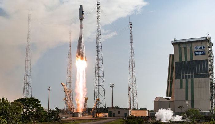
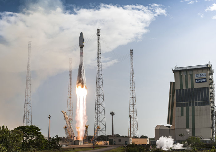
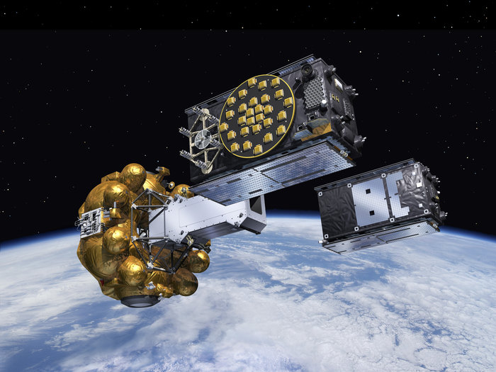
    Of course all these innovative applications rely on there being satellites up there to provide the infrastructure. And 2015 has been a very busy year for Galileo launches. The three launches in the year have effectively doubled the constellation in-orbit.

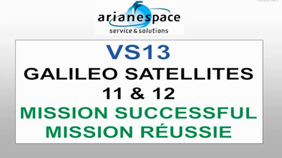
    The recent successful launch on 17 December from Kourou provides the next two satellites (named Andriana and Liene – aka FOC 11 and 12) that will be used to launch Galileo Early Services. This last launch was almost ten years on from first ever Galileo launch. Galileo GIOVE-A took off on 28 Dec 2005 from the Baikonur facility to lay claim to the frequencies allocated to Galileo by the ITU and to technically demonstration of the concept. It has been slow progress but perhaps we are almost there?
    A press conference on the eve of the launch discussed the future programme for Galileo, the status of the in-orbit satellites and Early Service provision.

    Carlo des Dorides confirmed that the nine fully viable satellites in orbit (including the two launched on 17 December) represent the “reduced constellation” that will deliver Galileo Early Services during the second half of 2016. The two satellites launched in September have almost completed their in-orbit testing and are on schedule to begin providing navigation signals during January. Carlo said the Early Services would consist of the Open Service (OS), Search and Rescue (SAR) and the Public Regulated Service (PRS) and provide proof of concept testing for Commercial Services (CS).

    These services will provide 100% of the accuracy to be expected from the full constellation but clearly cannot provide 100% continuity and availability. There are in fact 12 satellites in orbit but two are in eccentric orbits and one has a power problem.

    The European Commission’s Galileo Programme Manager Paul Flament talked about the two off-orbit Galileo satellites. Doresa and Milena are now in improved but eccentric orbits and a further few months of testing is being undertaken to confirm the contribution they can make to the Galileo GNSS services. But he confirmed that it was “100% sure” that they be contributing to the SAR and OS services in 2016. The only constraint was the Public Regulated Service (PRS) where security concerns meant they would definitely not contribute.

    With the four IOV satellites manufactured by Astrium and the 22 FOC satellites ordered from OHB that makes a total of 26 satellites – all to in the sky by 2018. You need 24 for a full constellation so with three satellites at less than 100% operational function currently – I make that one short. So it was good to hear that the European Commission will be publishing an open tender for the provision of eight more Galileo FOC satellites in the very near future. Paul Flament emphasised that European Union rules meant that a tender of this value had to be offered to the whole market. It will be interesting to see if more than one serious bid is received.

    During 2016 there is likely to be only one Galileo launch said current ESA Director of Galileo Programmes and Navigation-Related Activities Didier Faivre. He indicated that one Ariane 5 launch with the new four satellite dispenser would happen in a launch window between September and November. He indicated that there was an outside possibility of a second Ariane 5 launch in this window, but that depends on the overall launch calendar at the European spaceport. He was confident that the production and test chain for the Galileo satellites was working very well and could fulfil a second Ariane launch if an appropriate window was made available.

    This was Didier’s last Galileo launch as he will hand over to Paul Verhoef in 2016 (see below).

    Paul Flament also revealed that negotiations for possible US (and Norwegian) access to the Galileo PRS may start soon as Common Minimum Standards (the who and what legal and regulatory basis for users and receiver manufacturers etc.) had been agreed by EU Member States. This opens the way for the Commission to receive a mandate from the European Council to start negotiations with third party countries about participation in this government-only secure service.

    New faces, old faces
    The European GNSS world has seen a change of command over the autumn/ fall period. On 21 November the European Space Agency (ESA) Council approved new ESA Director General Johann-Dietrich Woerner’s proposal for his senior management team.

    Jan Woerner himself, of course, took up duty as ESA Director-General just six months ago on 1 July 2015. He seems to be bringing a breath of fresh air to ESA and is continuing to write a regular blog offering insights on his thinking. He first started the blog in 2010 when Chairman of the German Aerospace Centre (DLR).

    Of most importance to European GNSS stakeholders was the naming of Paul Verhoef as the new Director of Galileo Programmes and Navigation-Related Activities at ESA replacing Didier. Dutch national Verhoef is a former head of unit for satellite navigation programmes at the European Commission. He served in this position between 2005 and 2011 and was heavily involved in shaping the Galileo programme as we see it today. More recently he has been working as Head of Unit on renewable energy in the Commission’s Research and Innovation DG. Verhoef takes up his new role early in 2016.

    To complete the recent appointment news Carlo des Dorides was re-elected by unanimous vote as the Executive Director of the European GNSS Agency (GSA) on 30 October. His second four-year term at the helm of the GSA will focus on using the organisation that he has essentially built from the ground up to achieve the best possible return on Europe’s investment in this area.

    I hope that with all the players in place they can work together for a common goal. As Jan Woerner puts it at the end of a recent blog on the outcomes of the EU-ESA Space Council:

    “My sincere hope is that all future developments between the different actors in the European space sector are dictated by their respective expertise rather than any form of vanity or power games. The citizens of Europe have a right to expect from all of us that we use their money as efficiently as possible, avoiding any duplication of efforts and pointless struggles over position and status. This can be summarised under the motto United Space in Europe.”

    A statement that I feel all stakeholders in the European space community – and GNSS stakeholders in particular – can fully support.

    Best wishes to all our readers for 2016 – the year in which we all hope to see (at last) Galileo Early Services available.

    A bientȏt as they say in these parts.

  • Defeating poachers with stealth

    Defeating poachers with stealth

    Night and day: UAV patrols defend dwindling elephant and rhino populations.
    Night and day: UAV patrols defend dwindling elephant and rhino populations.

    To stem the staggering wildlife losses on the African continent from poaching, the Air Shepherd Campaign is employing a force of unmanned aerial vehicles (UAVs) equipped with GPS and infrared cameras.

    Teams on the ground, in close cooperation with wildlife reserve management organizations, use the UAVs and sophisticated predictive analysis to hunt the illegal hunters.

    More than 40,000 elephants were killed by poachers in Africa in 2014.The problem is similar for rhinoceros.

    Poachers operate at night, when park rangers equipped with conventional aircraft can’t fly. Air Shephard searches for poachers using predictive analysis to determine the behavior patterns of both animals and poachers. Small drones with cameras search likely areas — once poachers are identified, pre-positioned rangers can intercept the suspects.

    The hand-launched UAVs carry high-resolution cameras for both daylight and nighttime infrared scanning. At operating altitude, they can easily tell the difference between animals and humans, and transmit real-time geolocation information to the operating team on the ground. The UAVs fly for more than 1.5 hours; they are clean, stealthy and provide an eye-in-the-sky capability.

    UAV fleet deployed around an Air Shepard mobile operating center.
    UAV fleet deployed around an Air Shepard mobile operating center.

    The Charles A. and Anne Morrow Lindbergh Foundation, originator of the Air Shepherd Initiative, has partnered with a dedicated group in South Africa that, over the last two years, has flown more than 650 drone missions over one of the most sensitive rhino poaching areas in Africa. During that period, no rhinos were lost to poachers where the UAVs were flown.
    Once the process is proven, Air Shepherd expects it to be used in national parks and private reserves in South Africa and Botswana, then expand as funding increases to Namibia, Zambia, Tanzania, Gabon, Democratic Republic of the Congo, and eventually Asia.

    Learn more about the project at www.AirShepherd.org.

  • GPS artist creates global message of peace on Earth

    GPS artist creates global message of peace on Earth

    Above is the STORIES documentary video holiday card, which contains images of Yassan’s journey and the people and places he encountered along the way.


    The daytime version of Yassan's world-stretching art message of peace.
    The daytime version of Yassan’s world-stretching art message of peace.

    Peace on Earth: That’s the message spelled out across the globe by GPS artist Yassan in time for the holiday season.

    Yassan created a massive, international work of GPS art around the theme of world peace and, in the process, is attempting to break his own Guinness world record for the largest GPS drawing. Yassan is the Guinness world record holder for the largest GPS drawing by an individual. GPS World previously reported on his “Marry Me” project.

    Yassan visits Times Square in New York City.
    Yassan visits Times Square in New York City, at coordinates 40.7593 ° N, 73.9852 ° W.

    With the help of Japan Airlines and its partners, Yassan’s latest project covered 65,700 miles (105,734 km) around the globe, beginning in Tokyo and ending in San Jose del Cabo, Mexico. He traveled through Asia, Oceania, the Middle East, Europe, Africa and the Americas, and visiting 24 cities on six continents.

    To create his GPS drawings, Yassan carries an iPhone and GPS tracker that records his GPS location data as he travels. He then uploads this information to create a drawing on a map. The finished piece of GPS art — a planetary-scale holiday message for the world — spells “PEACE” across the planet.

    Yassan visits with Buddhist Monks.
    Yassan visits with Buddhist Monks in Colombo, Sri Lanka: 6.9165° N, 79.8568° E

    While a relatively new art form, GPS art is a natural progression stemming from much older, large-scale art forms. “In tracing the history of GPS art, you can draw a clear line of artistic evolution,” said Yassan, “beginning with the ancient Nazca lines in Peru, through Michael Heizer and his work with motorcycle tracks in the Nevada desert, to Richard Long’s walks through the English countryside, to the modern GPS artists.”

    Yassan continues, “Peace on Earth has proven very difficult to achieve, but is, at the heart of it, a very simple concept. I hope that this holiday message can convey this idea to the world.”

    A stop in London.
    A stop in London near Parliament: 51.5007° N, 0.1226° W

    On this journey, a video production crew, led by director and STORIES creator client Mark Apicella, accompanied Yassan, documenting the creation of this artwork as well as the artist’s interactions with local people at each of the 33 stops along this epic journey.

    Yassan makes a stop in Los Angeles with a visit to the edge of the continent, at 34.0074° N, 118.4966° W.
    Yassan makes a stop in Los Angeles with a visit to the edge of the continent, at 34.0074° N, 118.4966° W.
    Yassan celebrates at his final stop to complete the downstroke of the "P," at a place appropriately named “El Fin de la Tierra” — the end of the Earth, near Cabo San Lucas, Mexico: 22.8741° N, 109.8962° W.
    Yassan celebrates at his final stop to complete the downstroke of the “P,” at a place appropriately named “El Fin de la Tierra” — the end of the Earth, near Cabo San Lucas, Mexico: 22.8741° N, 109.8962° W.
  • Amtrak turns on positive train control for northeast corridor

    Travelers taking Amtrak between New York City and Philadelphia are now being protected by a new crash-prevention system.

    Amtrak, the United States’ national passenger railroad, has activated positive train control between New York City and Philadelphia, the last stretch of its tracks on the busy Northeast Corridor to get the system, reports the Wall Street Journal.

    Amtrak activated the system between Philadelphia and Washington, D.C., earlier this month. It is meeting an original Dec. 31 federal year-end deadline. In October, Congress extended the deadline to December 2018.

    If it had been operating, the safety system could have prevented an Amtrak derailment in Philadelphia in May that killed eight and injured more than 200 others.

    Positive train control prevents train-to-train collisions, over-speed derailments, incursions into established work zone limits and a train going to the wrong track because a switch was left in the wrong position.

  • FAA small unmanned aircraft registration begins

    The Federal Aviation Administration’s (FAA) Small Unmanned Aircraft System (UAS) registry is now live and ready for owners of hobby UAS to use at www.faa.gov/uas/registration. Registration is free for the first 30 days with a rebate, then $5 after that.

    The online registration system does not yet support registration of small UAS used for any purpose other than hobby or recreation — for example, using an unmanned aircraft in connection with a business. The FAA is developing enhancements that will allow such online registrations by spring of 2016.

    During the registration process, each owner must provide his or her name, home address and e-mail address. When registration is complete, the web application will generate a Certificate of Aircraft Registration/Proof of Ownership including a unique identification number for the UAS owner, which must be marked on the aircraft.

    Owners using the model aircraft for hobby or recreation will only have to register once and may use the same identification number for all of their model UAS. The registration is valid for three years.

    All aircraft weighing more than 0.55 pounds (250 grams) and less than 55 pounds (approx. 25 kilograms), including payloads such as on-board cameras, must be registered.

    Under this rule, owners who previously operated an unmanned aircraft exclusively as a model aircraft prior to Dec. 21, 2015, must register no later than Feb. 19, 2016. Owners of any other UAS purchased for use as a model aircraft after Dec. 21 must register before the first flight outdoors. Owners can use either the paper-based process or the new streamlined, web-based system. Owners using the new streamlined web-based system must be at least 13 years old to register.

    If assistance is needed with registration, email [email protected].

    The FAA also reminds unmanned aircraft owners there’s no need to work with a “drone registration” company to help file an application for a registration number. The registration site is designed to be simple and easy to use for every hobbyist.

    The FAA has partnered with several industry associations to educate the public about using unmanned aircraft safely and responsibly. Flight rules include:

    Fly below 400 feet altitude.

    • Keep your unmanned aircraft in sight at all times.
    • Never fly near manned aircraft, especially near airports.
    • Never fly over groups of people, stadiums or sporting events.
    • Never fly near emergency response efforts.
  • Galileo constellation now 12 after Thursday’s launch

    Galileo constellation now 12 after Thursday’s launch

    News from the European Space Agency

    The pace of deploying Europe’s own satellite navigation system continued to increase with today’s launch of the latest pair of Galileo satellites, doubling the number of satellites in space within nine months.

    Galileo 11 and 12 lifted off together at 11:51 GMT (12:51 CET, 08:51 local time) atop a Soyuz rocket from French Guiana.

    This sixth Galileo launch was a textbook operation: all Soyuz stages performed as planned, culminating in the Fregat upper stage deploying the twin satellites into orbit close to 23,500 km altitude, around 3 hours and 48 minutes after liftoff.

    Liftoff of Galileo satellites 11 and 12 aboard Soyuz VS13 took place at 11:51 GMT on Dec. 17, 2015.
    Liftoff of Galileo satellites 11 and 12 aboard Soyuz VS13 took place at 11:51 GMT on Dec. 17, 2015. (Photo: ESA)

    “With today’s launch, Europe has doubled the number of its Galileo satellites in orbit in just nine months,” commented Jan Woerner, director general of ESA.

    “Along with the ground stations put in place around the globe, this brings Galileo’s completion within reach. Initial Galileo services are scheduled to begin within next year, which proves the importance of this wise investment.”

    “The excellent performance of these satellites, as measured on the ground, allows Europe to join the club of the worldwide providers of satellite navigation services,” noted Didier Faivre, ESA’s Director of Galileo and Navigation-related Activities.

    “Production, testing and launch of the remaining satellites are now proceeding on a steady basis according to plan.

    The Fregat upper stage flew the latest two Galileo satellites most of the way up to medium-Earth orbit before they finally separated. (Artist's concept, courtesy of ESA).
    The Fregat upper stage flew the latest two Galileo satellites most of the way up to medium-Earth orbit before they finally separated. (Artist’s concept, courtesy of ESA).

    “Then, after the summer break in 2016, the tempo of deployment will increase further with the first of three customised Ariane 5 launchers that will carry four rather than two satellites into orbit each time.”

    This month will see the 10th anniversary of the launch of Europe’s very first navigation satellite: GIOVE-A, on Dece. 28, 2005. It secured the frequencies set aside for Galileo, gathered data on the medium-altitude orbit environment and flight-tested hardware for the working system.

    Watch the launch here:

    ESA declares success.
    Arianespace declares success.
  • FAA unveils UAS rule, begins drone registry Dec. 21

    FAA unveils UAS rule, begins drone registry Dec. 21

    The Federal Aviation Administration announced on Dec. 14 an official rule and registration process for hobbyists who own small unmanned aircraft weighing more than 0.55 pounds and less than 55 pounds, including payloads such as on-board cameras.

    The online registration system does not yet support registration of small UAS used for any purpose other than hobby or recreation — for example, using an unmanned aircraft in connection with a business. The FAA is developing enhancements that will allow such online registrations by spring of 2016.

    The registration procedure is a statutory requirement that applies to all hobby aircraft. Under this rule, any owner of a small UAS who has previously operated an unmanned aircraft exclusively as a model aircraft prior to Dec. 21, 2015, must register no later than Feb. 19, 2016. Owners of any other UAS purchased for use as a model aircraft after Dec. 21, 2015, must register before the first flight outdoors.

    The Registration Task Force delivered recommendations to FAA Administrator Michael Huerta and Transportation Secretary Anthony Foxx on Nov. 21. The rule incorporates many of the task force recommendations, the FAA says.

    “Make no mistake: unmanned aircraft enthusiast are aviators, and with that title comes a great deal of responsibility,” Foxx said in the announcement. “Registration gives us an opportunity to work with these users to operate their unmanned aircraft safely. I’m excited to welcome these new aviators into the culture of safety and responsibility that defines American innovation.”

    Owners may register through a web-based system or paper-based process. There is a $5 registration fee, but the FAA is offering a full rebate for those who register before Jan. 20, 2016.

    Under the rule, each aircraft must be marked with a unique number, although not necessarily the serial number. The goal is to help authorities track down an owner if a drone collides with another aircraft, flies too high or encroaches on an airport.

    Registrants will need to provide their name, home address and email address. Upon completion of the registration process, the web application will generate a Certificate of Aircraft Registration/Proof of Ownership that will include a unique identification number for the UAS owner, which must be marked on the aircraft.

    Owners using the model aircraft for hobby or recreation will only have to register once and may use the same identification number for all of their model UAS. The registration is valid for three years.

    “We expect hundreds of thousands of model unmanned aircraft will be purchased this holiday season,” Huerta said. “Registration gives us the opportunity to educate these new airspace users before they fly so they know the airspace rules and understand they are accountable to the public for flying responsibly.”

  • FLYPRO announces smartwatch-controlled XEagle drone

    FLYPRO announces smartwatch-controlled XEagle drone

    Shenzhen FLYPRO Aerospace Tech Co. has officially released the XEagle, an unmanned aerial vehicle (UAV) equipped with auto follow and obstacle avoidance functions.

    Photo: FLYPRO Aerospace Tech Co.Unlike other popular self-flying drone models on the market that are taken off by throwing the aircrafts in the air, which increases the risks of crashing the vehicles, XEagle introduces various features including voice control, smartwatch and automatic obstacle avoiding to offer a better user experience. By liberating both hands, users do not need to have any previous knowledge and experience when handling an XEagle.

    Designed for recording sports activities, FLYPRO has replaced traditional UAV remote controllers with XWatch for the new XEagle. XWatch is a smartwatch designed to control XEagle that’s portable and easy to navigate — users can control the devices to take off, land and follow, as well as adjust flight height with just one click on the wrist within 300 meters. The smartwatch design enables users to fly the aerial vehicles to take high-definition pictures and videos while engaging in intense sports such as skiing and mountain bike cycling.

    The voice control feature allows hobbyists to fly the XEagle without moving their hands at all — the built-in intelligent voice recognition system responses fast and accurately to commands in both Chinese and English. Users only need to instruct the XEagle with commands such as “FLYPRO, take off” and “FLYPRO, follow me” to launch the XEagle in the air and have it follow automatically.

    To lower the risk of crashing the UAV in both takeoff time and during flight, XEagle offers a crash prevention solution by installing four layers of protection. With an infrared obstacle avoidance system and built-in photoelectric sensors, the XEagle can calculate precisely and in real time for obstacles to avoid collisions. The detection is effective when the obstacle is at the distance between 0.1 to 15 meters with relative velocity of 12 meters per second. The UAV can dodge obstacles and barriers while flying in the air by changing its flight path automatically.

    As a newcomer in the UAV market, FLYPRO’s technological breakthrough in developing consumer drones not only resolves the safety concerns customers have with other similar UAVs, but also improves user experience through innovative control measures that makes flying the drones as easy as clicking a button, leading the UAV industry with the company’s user-centered philosophy and high product quality standards.

    “Now, customers favor UAV products with lower risks associate with operating the aerial vehicles as well as technological innovations that enable users to perform complex tasks without advanced training. When other companies are looking for ways to make UAV products more accessible to the public, FLYPRO has already achieved that with our innovative functions like smart watch control, auto follow and obstacle avoidance that allow everyone to enjoy flying the UAVs for sports and entertainment,” said Lin Hai, founder and CEO of FLYPRO.

  • PNT Roundup: Wi-Fi offers in-store advertising, analytics

    Coming to a store near you: Wi-Fi’s unparalleled reach means it will locate shoppers

    i80-Construction_chc-nav-T
    Marketing graphic for Cisco Mobile Concierge shows retail businesses how to engage with their customers “in a targeted contextual manner through their mobile devices within specific venues… Customers can now receive relevant information based on their location” within the store. (Courtesy of Smart Wi-Fi Systems)

    Wi-Fi indoor location application revenues will reach $2.5 billion by 2020, according to a report from ABI Research. Wi-Fi Indoor Location Applications and Revenues was released in Q4 2015.

    “Wi-Fi, as an indoor location and analytics tool, is in a very precarious position,” said Patrick Connolly, Principal Analyst at ABI Research. “Apple continues to create roadblocks, while Bluetooth low-energy (BLE) beacons have not only taken mindshare but also budgets. However, Wi-Fi is ubiquitous on smartphones and available in over 50 percent of major retail stores in the U.S., giving it unparalleled reach. Previously, it was an expensive and inaccurate technology, but Wi-Fi access point vendors like Zebra and Cisco have all upped their game on retail analytics, while start-ups like Euclid have helped to drive adoption worldwide.”

    Wi-Fi’s superior penetration means it is a much better technology than BLE beacons for in-store analytics today, according to ABI. While location-based advertising is stealing the headlines, retailers are finally waking up to in-store analytics, which represent a major evolution on people counting and loyalty programs. This data will streamline store layouts, improve staff management, measure advertising campaign performance, enhance loyalty/reward programs, and form the backbone of new smartphone services.

    One company active in this space, Cisco Mobil Concierge, promotes its location capabilities for retail, hotels, transport hubs, museums and more. Its Mobility Services Engine API offers such services as “track-and-trace interferers, rogues, Wi-Fi clients and RF tags; Geofencing and zone-based alerts; Thinksmart Localtion Analytics.”

    The latter software suite offers such data as shopper cluster points, dwell times, typical paths and crowding. From the shopper’s viewpoint, the experience begins when a smartphone automatically discovers the venue’s services; a “service available” and a media-access-control service access point (MSAP) pops up. The user clicks on the MSAP icon to view a list of services and can opt in to be tracked within the venue, presumably in exchange for special offers.

    According to Cisco, this means “new experiences, new revenue and opportunities for businesses everywhere.”

  • Chronos and UrsaNav partner on Loran PNT networks

    Chronos and UrsaNav partner on Loran PNT networks

    Taviga-logoThe founders of Chronos and UrsaNav have formed a new collaboration, named Taviga, that will focus on preserving and establishing low-frequency (LF) positioning, navigation and timing (PNT) networks the United Kingdom, Europe and the United States, using repurposed Loran-C or purpose-built eLoran technology.

    Taviga — named for timing and navigation — aims to ensure timing and navigation for critical infrastructure from cyber and other threats, and address the concern that over-dependence on single systems for PNT increases vulnerability.

    According to a joint press release, “Taviga combines the founders’ decades of experience specializing in low-frequency (LF) PNT technology and industrial timing applications at national and international levels. Its objective is to provide a commercially operated assured LF PNT service.”

    Charles Curry, founder of Chronos Technology Ltd. in the UK, and Charles Schue, founder of UrsaNav Inc. in the United States, joined forces to launch Taviga Ltd. and Taviga LLC. Taviga anticipates working in partnership with government agencies and other entities that have a vested interest in reducing the vulnerability and improving the resilience of critical national infrastructure with a dependency on the GPS and other GNSS sources of PNT.

    “We have been researching the precise timing capability of eLoran transmissions for over 10 years,” Curry said. “During that time, the system has never failed and most impressively it has continued to deliver sub-microsecond time accuracy traceable to UTC in some very challenging locations including deep inside buildings.

    “Our research program was supported by the UK’s Innovation Agency – Innovate UK through two flagship projects, GAARDIAN and SENTINEL,” Curry continued. These two projects highlighted the vulnerabilities that threaten GPS signals (and in the future, Galileo) such as jamming, interference and spoofing. They also demonstrated how eLoran is a technically dissimilar source of PNT and not vulnerable to the same types of interference. eLoran is a truly complementary source of PNT ideal for use in critical infrastructure applications that demand precise time and timing such as telecoms, broadcasting, financial services and power utilities.

    “Every government, academic and industrial study has resulted in the selection of the LF technology known as Enhanced Loran, or eLoran, as the best wide-area complement to GNSS,” Schue said. “There is no doubt that the combination of GNSS and eLoran provides the PNT resilience that most users require.

    “Whether the application is timing/frequency, aviation, maritime, land-mobile, or location based, integrated GNSS-eLoran solutions can provide the proof-of-time and proof-of-position necessary to safeguard national infrastructure and for business continuity of operations,” Schue said. “Additionally, adding eLoran into the PNT mix enables or enhances the capabilities of regional and purpose-built solutions. PNT resilience results from an eco-system made up of layered solutions. Over reliance on a single solution is neither prudent nor safe. It’s time for Taviga.”

    Tests have been conducted as part of Innovate UK supported research projects GAARDIAN and SENTINEL, which were led by Chronos Technology Ltd and included UrsaNav’s eLoran receiver engine. eLoran transmissions from the UK, Denmark, Germany, France and Norway have consistently demonstrated positioning accuracies of better than ten meters and timing accuracies of less than 100 nanoseconds in the area of differential eLoran reference sites. Taviga will now seek to engage those governments and others in discussions as to how to transition their Loran stations to commercial operation.

    Taviga’s goal is the long-term operation of an eLoran system for at least 10 years. This length of time provides the necessary service assurance continuity to enable industrial users to invest with confidence in an eLoran-based timing and navigation service that complements their GNSS solutions. As users become accustomed to the additional capabilities and resilience provided with a combined GNSS-eLoran solution, Taviga expects to expand the service footprint into other countries worldwide.

  • PlanetiQ signs weather satellite launch contract with India’s Antrix

    PlanetiQ signs weather satellite launch contract with India’s Antrix

    PlanetiQ has signed a contract with Antrix Corporation Limited, the commercial arm of the Indian Space Research Organization (ISRO), for the launch of PlanetiQ’s first two weather satellites on a Polar Satellite Launch Vehicle (PSLV) during the fourth quarter of 2016.

    Ten more satellites are planned for launch in 2017 to complete an initial set of 12 satellites that will dramatically improve global weather forecasting, climate monitoring and space weather prediction, and enable advanced analytics for numerous industries worldwide.

    The ISRO’s PSLV is among the world’s most reliable launch vehicles with 30 consecutive successful flights. It has launched 51 satellites for international customers from 20 countries, in addition to 33 Indian national satellites.

    “The stellar track record of the PSLV combined with our seven-year satellite design life provides the reliability and data continuity not just desired, but required by the operational weather forecast community,” said Chris McCormick, Chairman and CEO of PlanetiQ. “Within days after launch, we will validate and start delivering high-quality data and services to our customers.”

    24 hours of data from 12 PlanetiQ satellites = ~34,000 occultations/day.
    24 hours of data from 12 PlanetiQ satellites = ~34,000 occultations/day.

    Each of PlanetiQ’s 10-kilogram microsatellites will fly PlanetiQ’s Pyxis-RO sensor, an advanced satellite weather sensor in a small package that can penetrate through clouds and storms down to the Earth’s surface. Pyxis-RO uses a technique called radio occultation to track the bending of GPS and other signals as they travel through Earth’s atmosphere, and then converts the bending angle into high-precision measurements of global temperature, pressure and water vapor in the atmosphere, and electron density in the ionosphere.

    Pyxis-RO quadruples the data collection capability of radio occultation sensors on orbit today by tracking signals from all four major satellite navigation systems — GPS, Galileo, Beidou and GLONASS. With 12 satellites on orbit, PlanetiQ will collect 34,000 occultations per day, evenly distributed around the globe with high-density sampling over both land and water.

    Each occultation is a vertical profile of atmospheric data with high vertical resolution, comprised of measurements less than every 200 meters from the Earth’s surface up into the ionosphere. The data is similar to that collected by weather balloons, but more accurate, more frequent and on a global scale.

    “The world today lacks sufficient data to feed into weather models, especially the detailed vertical data that is critical to storm prediction. That’s why we see inaccurate or ambiguous forecasts for storms like Hurricane Joaquin, which can put numerous lives at risk and cost businesses millions of dollars due to inadequate preparation or risk management measures,” McCormick said. “Capturing the detailed vertical structure of the atmosphere from pole to pole, especially over the currently under-sampled oceans, is the missing link to improving forecasts of high-impact weather.”