Septentrio and CORE partner up to develop a GPS/GNSS receiver which will make use of Japan’s Centimeter-Level Augmentation Service (CLAS). CLAS corrections are broadcast directly via QZSS constellation to enable high-accuracy positioning across Japan.
Septentrio, a designer and manufacturer of high-precision GNSS technology, and CORE, a Japanese system integrator with extensive experience in GNSS, are jointly developing a receiver that can use the Centimeter-Level Augmentation Service (CLAS) of Japan’s Quasi-Zenith Satellite System (QZSS).
Septentrio’s multi-frequency GPS/GNSS receiver AsteRx4 will be used as a platform for the development of CLAS functionality. Septentrio receivers already track the L6 signal and can use QZSS for increased positioning availability and reliability.
CORE’s know-how will be instrumental for the deployment of CLAS on Septentrio receivers. The two companies are planning to launch their CLAS-enabled receiver in January 2020.
Japan’s CLAS is a self-augmentation GNSS correction service. Without the need for a ground link, it allows real-time kinematic (RTK) centimeter-level positioning all over Japan with convergence times of less than a minute.
It does this by broadcasting GNSS corrections directly via QZSS satellites, also known as Michibiki. These corrections are generated from the dense network of reference stations operated by Japan’s Geospatial Authority.
The two companies have also entered into a distribution contract that allows CORE to sell Septentrio high-precision positioning technology, including CLAS-capable GNSS receivers, in the Japanese market.
The new CLAS-enabled receiver will also incorporate Septentrio’s Advanced Interference Mitigation (AIM+) technology. In busy urban environments electromagnetic waves can interfere with GPS and GNSS signals.
AIM+ offers protection against such interference resulting in faster set-up times and robust continuous operation.
“QZSS Centimeter Level Augmentation Service has been limited to evaluation phase up till now. Realizing CLAS on Septentrio’s multifunctional, high-quality, cost-competitive platform allows our customers to finally use QZSS in their applications,” emphasized Takahiro Yamamoto, Director of GNSS Solution Development Center at CORE Corporation. “Galileo High Accuracy Service (HAS) is expected to start in 2020, so the demand for high accuracy GNSS receivers is also expected to increase. By complementing CORE’s QZSS technology and Septentrio’s Galileo technology, we can provide competitive products to global customers.”
“CLAS is a first-of-its-kind service which will contribute to the proliferation of high accuracy GNSS applications in Japan. Europe is also taking similar initiatives with their Galileo High Accuracy Service (HAS),” commented Neil Vancans, Director of Global Sales at Septentrio. “We are excited to enter into an agreement with CORE to enable the support of CLAS on our receivers. CORE’s expertise allows us to get the best out of CLAS and to follow new developments in QZSS evolution. Moreover, CORE’s expertise in system integration will allow us to tackle new markets in Japan.”
“Seen & Heard” is a monthly feature of GPS World magazine, traveling the world to capture interesting and unusual news stories involving the GNSS/PNT industry.
There’s an app for that
For 17 years, Kersey Valley Attractions in Archdale, N.C., created its annual corn maze by using a GPS-enabled tractor to cut paths out of grown corn. Instead of being limited by a tractor’s turning radius, this year’s “Maize Adventure” used a GPS planter programmed with a maze design from the MazePlay app. Based in Idaho, MazePlay provides maze design and cutting services throughout North America. The Apollo 11 example here is from Richardson Adventure Farm in Spring Grove, Illinois.
Photo: BMW
Just hit it already!
To speed play, officials for the PGA European Tour are using a GPS tracking system. Tracking devices were placed on one golf bag in each group in the BMW Championship, held Sept. 19–22 in Surrey, UK. When a group completed a hole, the information was sent to officials and displayed at five holes. Next year, all 18 holes will have displays, which include player names and indicate if the group is behind. The tour plans to increase fines for pace-of-play violations.
Photo: iStock.com/gchapel
GPS makes it (too?) easy
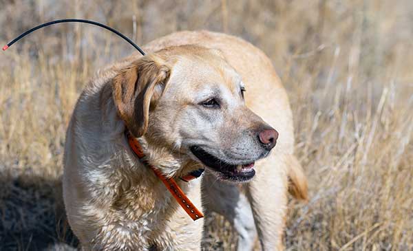
Animal rights groups are suing California over rules that allow animals to be hunted with the aid of hunting dogs wearing GPS tracking devices on their collars. The Animal Legal Defense Fund called the hunting method “unusually cruel and unfair” because tracking devices allow dogs to chase prey to the point of exhaustion, and then hunters follow the GPS signal to find an animal that can no longer flee and is easily shot. The lawsuit says the commission violated state environmental law by failing to conduct an assessment of how the use would affect wildlife.
Photo: Google
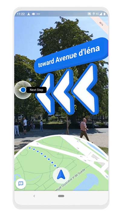
Google Maps come alive
Google Maps is beta testing a new Live View feature, allowing travelers to use augmented reality (AR) to better see which way to go. Arrows and directions are placed in the real world to guide the walker. Google has tested Live View with its Local Guides and Pixel community for several months, and has now expanded the beta to Android and iOS devices that support ARCore and ARKit.
Tallysman GNSS has added three new antennas to its Helical antenna line.
Released earlier this year, the helical antenna line provides unprecedented performance in a lightweight, compact form factor.
The line now extends beyond dual-band GNSS and Iridium support to also include single and triple GNSS frequency bands.
Tallysman helical antennas are designed for applications that require high performance and versatility, with an absolute minimum of weight, such as unmanned aerial vehicles (UAVs).
In addition to the HC600, HC871 and HC872, the expanded helical antenna family now includes:
the single frequency HC771
the dual- frequency (plus L- band corrections) HC882
the triple band (plus L- Band corrections) HC975.
The table below lists the complete Tallysman helical Family of antennas.
Terra Drone Corporation has launched a new UAV and artificial-intelligence (AI)-based solution designed for maintenance of power transmission and distribution equipment.
The solution was developed based on market gaps identified after inspecting more than 90,000 kilometers of power lines beyond visual line of site (BVLOS) throughout the world.
Acquired data is automatically processed and analyzed by artificial intelligence algorithms trained to detect crossovers at the bottom of transmission lines, buildings and construction machinery.
The system identifies rust on bolts, loosening and missing tower parts, bird’s nests and more. It then generates a smart report highlighting areas that require action. The error (identified anomaly) detection system is accurate up to 92.5%.
The algorithm for an area is developed through a process identifying anomalies in a training data set of 1,500 images. This allows for a custom solution to be created for the end client where all pertinent anomalies are identified and reported.
The development and training of the algorithm only need to be completed once for a particular type of asset and can be implemented easily at different locations on similar assets.
With such a high-precision algorithm, the productivity of AI processing allows for fast actionable results to be provided to clientele. Clients also have the ability to identify the appropriate security protocols for data storage in either a cloud-based or on-premises storage environment. These protocols can then be implemented in a custom client-specific solution.
Loosening and missing tower parts identified by high-accuracy detection system (Photo: Terra Drone)
Power transmission and distribution companies must conduct periodic inspections of power line infrastructure to ensure reliable electric power distribution, although the conventional methods of deploying ground staff or low-flying helicopters to complete the inspections, they are typically cost-prohibitive. Conventional helicopter and boots-on-the-ground service also pose HSE concerns with low flying helicopters and people working in the field. UAV service and AI inspection can aid in minimizing HSE concerns by reducing the number of workers in the field and eliminate low level manned helicopter missions.
This solution has been built from ground up with the aim to simplify and streamline the maintenance work for transmission and distribution facilities.
LORD Corporation has released the latest version of its SensorConnect sensing software, featuring significant updates that support sensor management and data collection and visualization for MicroStrain inertial products.
The update is designed to fully replace the inertial data collection and visualization capabilities in MIP Monitor. MIP Monitor will continue to be available on the website, but will no longer be updated to support new products.
“We’re excited to support users with a desktop software solution that provides a better experience for our inertial users,” said Justin Bessette, manager, Technology and Innovation, LORD Sensing, MicroStrain. “It is important for us to provide users a single tool to collect data and visualize output from both wireless and inertial product lines, side-by-side.”
In previous updates, SensorConnect offered basic support for inertial products. Release 12.0.9 marks the inclusion of all features necessary for inertial users to fully migrate from MIP Monitor to SensorConnect. Users will find all MIP Monitor features available in a more modern and flexible interface, with improved feedback. SensorConnect users will benefit from regular updates, new features and user experience improvements. Additional updates featured as a part of 12.0.9 include storing and displaying matrix, quaternion data and storing, and displaying data valid flags.
New features important for inertial users who are new to SensorConnect include:
Inertial Save/Load Settings (v10.4.9)
Packet Monitor (v9.17.4)
Record Packets to File (v10.4.9)
Support for Double-Precision (v10.0.8)
Initialize/Reset Estimation Filter (v9.9.2)
Initialize/Reset Estimation Filter screen added to enable inertial users to more easily configure, initialize and troubleshoot the device’s estimation filter
Documentation for inertial customers and release notes have been added to the MicroStrain website.
SensorConnect for MIP Monitor Users is designed for inertial users who are accustomed to using MIP Monitor for configuration, sensor management, data monitoring and data collection.
SensorConnect offers the capability to accomplish the same tasks with additional functionality compared to MIP Monitor. Current MIP Monitor users should switch to SensorConnect, the company said.
The United States Federal Aviation Administration (FAA) has awarded air carrier and operator certification to UPS Flight Forward, an unmanned aircraft system (UAS) delivery company.
Through the DOT’s UAS Integration Pilot Program, the FAA has now approved a Part 135 operating certificate for UPS Flight Forward. This allows the company to perform revenue-generating package delivery activities within federal regulations.
UPS Flight Forward may now operate multiple drones under one certificate. Under Part 135, the company can deliver vital healthcare supplies including by flying beyond visual line of sight.
The UPS subsidiary immediately launched the first drone delivery flight by any company under Part 135 Standard at WakeMed’s hospital campus in Raleigh, N.C. That flight, using a Matternet M2 quadcopter, was flown under a government exemption allowing for a beyond-visual-line-of-sight (BVLOS) operation, also a first in the U.S. for a regular revenue-generating delivery.
UPS said it has proven the need for drone delivery in healthcare operations, where the shortest time in transit can improve efficiency and help healthcare professionals better serve patients.
The medical delivery program at WakeMed is the result of testing conducted by UPS and Matternet in August of 2018 as part of their participation in the UAS Integration Pilot Program (UAS IPP).
UPS partnered with Matternet to launch its healthcare delivery service on the WakeMed campus. The revenue-generating service demonstrated the business case for drone delivery of medical products and specimens.
Now, with its Part 135 Standard certification, UPS is ready to build on this application and expand to a variety of critical-care or lifesaving applications.
Photo: UPS
“This is history in the making, and we aren’t done yet,” said David Abney, UPS chief executive officer. “Our technology is opening doors for UPS and solving problems in unique ways for our customers. We will soon announce other steps to build out our infrastructure, expand services for healthcare customers and put drones to new uses in the future.”
The company will initially expand its drone delivery service further to support hospital campuses around the country, and to provide solutions for customers beyond those in the healthcare industry.
Part 135 Standard certification enables UPS to integrate drones into the UPS logistics network, creating potential for new applications in many industries. The company has a long-term plan with milestones that include:
expansion of the UPS Flight Forward delivery service to new hospitals and medical campuses around the country.
rapid build-out of ground-based, detect-and-avoid (DAA) technologies to verify drone safety, while enabling future service expansion.
construction of a centralized operations control center.
regular and frequent drone flights beyond the operator’s visual line of sight.
partnerships with additional drone manufacturers to build new drones with varying cargo capacities.
adding new services outside of the healthcare industry, including the transport of special commodities and other regulated goods.
“UPS is committed to using technology to transform the way we do business,” said Scott Price, UPS chief transformation and strategy officer. “UPS’s formation of a drone delivery company and application to begin regular operations under this level of certification is historic for UPS and for the drone and logistics industries.”
As a participant in the U.S. Transportation Department’s Unmanned Aircraft Systems Integration Pilot Program, the North Carolina Department of Transportation (NCDOT) partnered with UPS Flight Forward. As the operator, they have been engaged in delivery of healthcare supplies around a major hospital campus in Raleigh, North Carolina. The flights have focused on the delivery of blood for potentially life-saving transfusions, as well as other medical samples for lab work.
The company demonstrated that its operations met the FAA’s rigorous safety requirements to qualify for an air carrier certificate. This is based on extensive data and documentation, as well as test flights.
The drone operations management platform provides information on 3D vertical structures and obstacles, and access to digital airspace, to improve drone flight safety.
Skyward’s drone airspace maps provide airspace data combined with essential ground intelligence including 3D views of key structures, transmission lines, and more than a million vertical obstacles.
The platform also provides access to LAANC, the Low Altitude Authorization and Notification Capability program provided by the U.S. Federal Aviation Administration.
Drone pilots in the field need to know how the surrounding area, including infrastructure, could affect flight, and Skyward offers this critical safety data to all users.
“Showing airspace is important, but it’s only part of the picture. The more intelligence that is available to understand how an area will affect the flight, the less risk a pilot has in the field,” said Mariah Scott, president of Skyward. “Skyward Airspace Intelligence is the only solution that provides easy-to-understand data for things like transmission lines, runways, over a million vertical obstacles, and a 3D view of key structures. It’s the next best thing to physically being in the field.”
In addition to comprehensive airspace information, the following data is now available for situational awareness:
Vertical structure obstacles (over one million structures identified from the FAA and FCC databases)
Major power transmission lines
Airports
Runways
Heliports
U.S. and Canadian National Parks
Stadiums
Hospitals
Schools
Pedestrian walking paths
Skyward Airspace Intelligence is part of a complete workflow that enables pilots mitigate weather, environment and business-specific risks.
Trade wars may be THE only serious limiting factor
The GNSS chip market worldwide is projected to grow by $2.7 billion, guided by a compounded growth of 8%, to 2025, according to ResearchandMarkets. Other market reports cite “huge growth” and “strong development” in GNSS-related markets such as simulators, aviation and defense. We can count ourselves lucky — or remarkably prescient — to be part of such a robust industry, in such uncertain times.
The world conquest by smartphones, smart cities and the internet of things (IoT) will strongly support this market growth. Also on the horizon is the rising tide of GPS-enabled vehicles, putting automotive telematics on the road to assisted-driver and ultimately autonomous driving.
M&A. Meanwhile, the fast pace of mergers and acquisitions among manufacturers and integrators will strengthen the GNSS economy and propel it even higher. Such interactivity will bring higher revenue shares to key players as well as support overall profitability increases to come.
Accurate monitoring of operations and assets; the astonishing rise of drones to active roles in many industries; and the constant innovation and imagination churning out new products, solutions and augmented services — all will consolidate the strength of our remarkable economy. The much-heralded arrivals of BeiDou and Galileo fully upon the scene will only make the immediate future stronger for our industry.
Chart: GPS World
PNT Broadly. Where GPS, GNSS, and multi-GNSS go, they carry other positioning technologies along on their coat tails: inertial, signals of opportunity, Wi-Fi, ultra-wideband and more. The growing pie is certainly big enough for all to get a large share.
That’s not to say there are no barriers to growth, no clouds on the horizon. Licensing, laws and regulations will, as ever, constrict growth. This is not always a bad thing. Controlled growth and wise use benefit us all, and prevent runaway bubbles that can burst for lack of proper internal support.
Mapping. Meanwhile, a host of well-established businesses and nascent enterprises exploit the increased interest in location-based information as an enabler for many consumer, organizational and governmental services. This means that mapping and all manner of technologies associated with it — laser, lidar, infrared and more — may grow at even faster rates.
A brave new world awaits. Once GNSS is integrated with artificial intelligence, there’s no telling where we’re headed.
Of the many uncertainties across the globe, economic warfare poses a greater risk to GNSS than does military conflict. The latter, cynically enough, will actually benefit the industry in the short run, though its effect may chill in the long run.
Chart: GPS World
Trade. One of the biggest questions confronting the industry now is whether the trade and tariff war between the U.S. and China will continue, and what effect it will have. Experts disagree widely on both questions, though almost all of them, except the leaders who are supposed to listen to them, agree that it’s generally a bad thing.
As was stated in these pages at this time last year, if business confidence falls as a result, global output could also drop.
Opportunities Outweigh Obstacles
Industry leaders confront spectrum issues, jamming
In contrast to the rosy forecast on the previous page, serious issues confront the GNSS market. None of them are more serious, thornier or difficult to resolve (despite the many solutions offered) than spoofing and jamming.
Like a tragic hero, GNSS carries a potentially fatal weakness within its strength. To be ubiquitous and highly precise, the signals come from space. Coming from space, they are weak and susceptible to malicious meddling.
Other political and technological obstacles put pressure on the GNSS industry, and therefore upon the whole PNT industry. GNSS always will be the backbone, the center core holding together various adjunct positioning, navigation and timing technologies.
These issues, following closely on the heels of spoofing and jamming, include but are not limited to: spectrum competition and spectrum management; cybersecurity; privacy; net neutrality; national security export controls; product liability; and failure, however temporary, of GNSS systems.
We’ve seen this last most recently with Galileo, but all the GNSS have suffered such setbacks, and surely will again. The nature of the response to each occurrence is the most critical factor.
Keep on the Sunny Side. However, the opportunities far outweigh the obstacles. The greatest opportunities always arise from the greatest asset that the industry possesses: intellectual capital.
Many of the opportunities are cited on the previous page. While high precision will continue to lead the innovation charge and provide the highest profit margins, the smartphone and the automobile will increasingly take up the MVP (most valuable positioner) role within the industry.
Market Intelligence. All these factors make unprecedented demands on management attention and agility. Executives need good market intelligence to keep abreast and ahead of fast-developing research and development trends, market shifts, developments in neighboring or competing technologies, and protectionist tariffs and import/export controls.
Insight provided by all regions, sectors and job titles
This year’s State of the GNSS Industry Survey provides insight from around the globe.
Just over half our respondents work for companies or organizations headquartered in North America; 15% are from Asia-based operations; roughly 10% each for enterprises in Europe and Latin America; slightly less for the Pacific region; and the rest of the replies scattered across Africa, the Middle East and Russia. Truly an international sampling!
Chart: GPS WorldChart: GPS WorldChart: GPS WorldChart: GPS World
Demographics. For job titles, we drew in-depth data from:
owner/president/CEO, 21%
engineer, 20%
general, product or program manager, 19%
other, mostly surveyors or GIS analysts, 18%
researcher, 10%
vice president, CTO, COO, CFO or similar, 6%
sales and marketing, 5%
Sector. The intelligence in the following pages accumulated from these industry verticals:
survey and high precision, 29%
defense, security, government, 19%
mapping, data acquisition/processing, GIS, 14%
satellites, signals and simulation, 9%
machine control, precision agriculture, or transportation (non-autonomous), 6%
Drones continue to move further into everyday life and activity as they become more involved in applications that touch almost everyone. Previously a curious novelty, now unmanned aircraft are almost commonplace.
Real Estate. Suppose you are buying a new house. Almost all the exterior home pictures and video on real-estate websites come from dones. The high-definition photo capability of any commercially available drone is well up to providing great panoramic aerial shots — now virtually required to market homes.
Suitable UAVs and their operators are either readily available, or real-estate agents are taking on the job, buying and flying the equipment and managing the video-processing software themselves. Approvals for regular real-estate operations using drones now can be more readily obtained The objective is near real-time approval using the U.S. FAA’s Low Altitude Authorization and Notification Capability (LAANC) system, with drone operations provided by an expanding list of independent UAS Service Supplier companies, cleared and qualified by the FAA to provide commercial drone operations.
Crop Monitoring. In agriculture, it is virtually expected that a large farm operation will be on a crop monitoring/maintenance program that entails regular drone data-collection flights and automated processing of geo-tagged photographic, thermal and laser crop images. An initial baseline set of images establishes the starting point for the program, and then analysis identifies crop weaknesses. A fertilizer/treatment “prescription” is then drawn up to address deficiencies. After applications throughout the growing areas, follow-up drone monitoring checks whether growth rates have improved or if more remedial action is necessary.
The cycle continues throughout the growing season. A number of large and small companies offer turnkey services to farmers, or farms themselves run subsets of this UAS-based operation.
Construction and Inspection. Mining and construction now also have drone services that gather and process image data to automate significant parts of the process, as does surveying and geospatial information services (GIS).
Facility inspection using drones follows the agriculture model, with initial overflights establishing a baseline status record against which subsequent image data is compared.
Indoor automation with drones also has enabled a huge reduction in time spent in frequent physical inspection of tanks, pressure vessels, holds and more. It also has greatly improved safety for inspection personnel who no longer have to crawl through extensive, potentially toxic environments, such as the containment vessels at Fukushima Daiichi.
News and Events. News gathering has been enhanced by the use of drones. Aerial videos capture the news quickly and inexpensively compared to helicopters, and provide overview situational awareness for the news audience. In the same vein, we can add crowd surveillance at large events, where higher levels of security are required, such as the 2019 FIFA Women’s World Cup in Paris.
Chart: GPS World
Package Delivery. One classic drone application — package delivery — still hasn’t arrived fully, but many trials have been underway for several years, particularly for the delivery of medical supplies. It seems now that UPS is making a significant effort to qualify a UAS system that meets existing manned delivery standards (FAA Part 137 operations) by the end of this year. Wish them luck: there are many elements to prove and demonstrate for an unmanned delivery system, particularly in populated areas.
Security and Defense. Extensive use of drones in local and national policing and security operations has become almost commonplace, too. Cost-effective and easy-to-fly UAV systems have begun to replace manned surveillance helicopters, with police forces discovering significant improvements in reaction speed and affordability.
And, of course, the use of drones by defense forces worldwide has expanded greatly. Most people can picture the familiar silhouette of the General Atomics Reaper as their image of what a military drone looks like. Many people might even now know where the Straight of Hormuz is located, following the world-wide reports of an apparent Iranian attack that brought down a Northrop Grumman RQ-4 Global Hawk, followed by the takedown of one or two Iranian drones by the USS Boxer in the same area. Drones would now seem to be predominantly associated by Joe Public with a level of military aerial presence — perhaps more so than in any civilian applications.
New and different configurations of UAS continue to rapidly emerge for any and all applications in both the civil and military sectors. Now that we have operating regulations for small UAS in the U.S. and elsewhere around the world, cost-effective commercial uses abound and support new and existing tasks, and the military is rapidly creating new variations to assist or replace manned ground, navy and airborne forces. Large and small investments in artificial Intelligence for drone automation seem to be announced almost daily – so we can expect some independent drone capability to emerge over time.
There is only much, much more to come.
TONY MURFIN is a GNSS aerospace consultant with several decades experience at leading companies in the GPS/aviation and OEM sectors.
A roundup of recent products in the GNSS and inertial positioning industry from the September 2019 issue of GPS World magazine.
OEM
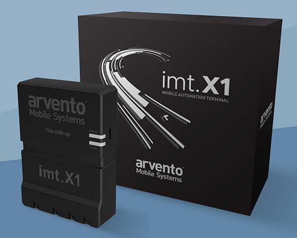
Vehicle tracker
Uses u-blox to detect panic breaking
Photo: u-blox
Arvento’s imt.x1 has a six-axis gyro sensor that can sense three-dimensional movement caused by emergency acceleration, panic braking and directional yaw and drift. With connectivity options including dual CANBus and Bluetooth, the system is eCall compatible and captures and provides data for accident analysis and other vehicle tracking functions. The system also uses the next-generation powerful Arm-based microcontroller. The system’s high position sensitivity and accuracy are based on integration of u-blox’s 2G, 4G and 5G-ready cellular modules as well as GNSS modules.
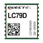
The compact LC79D module features concurrent multi-constellation GNSS receivers on dual GNSS bands. It uses L1 and L5 for GPS, Galileo and QZSS, L1 band for GLONASS and BeiDou, and L5 band for IRNSS. It can generally increase the number of visible satellites, significantly improve positioning drifting when driving in urban canyons and enhance positioning accuracy. Embedded with a low-noise amplifier (LNA) and multi-tone active interference, the module provides high sensitivity and reliable anti-jamming capability, ensuring exceptional acquisition and tracking even in weak signal areas.
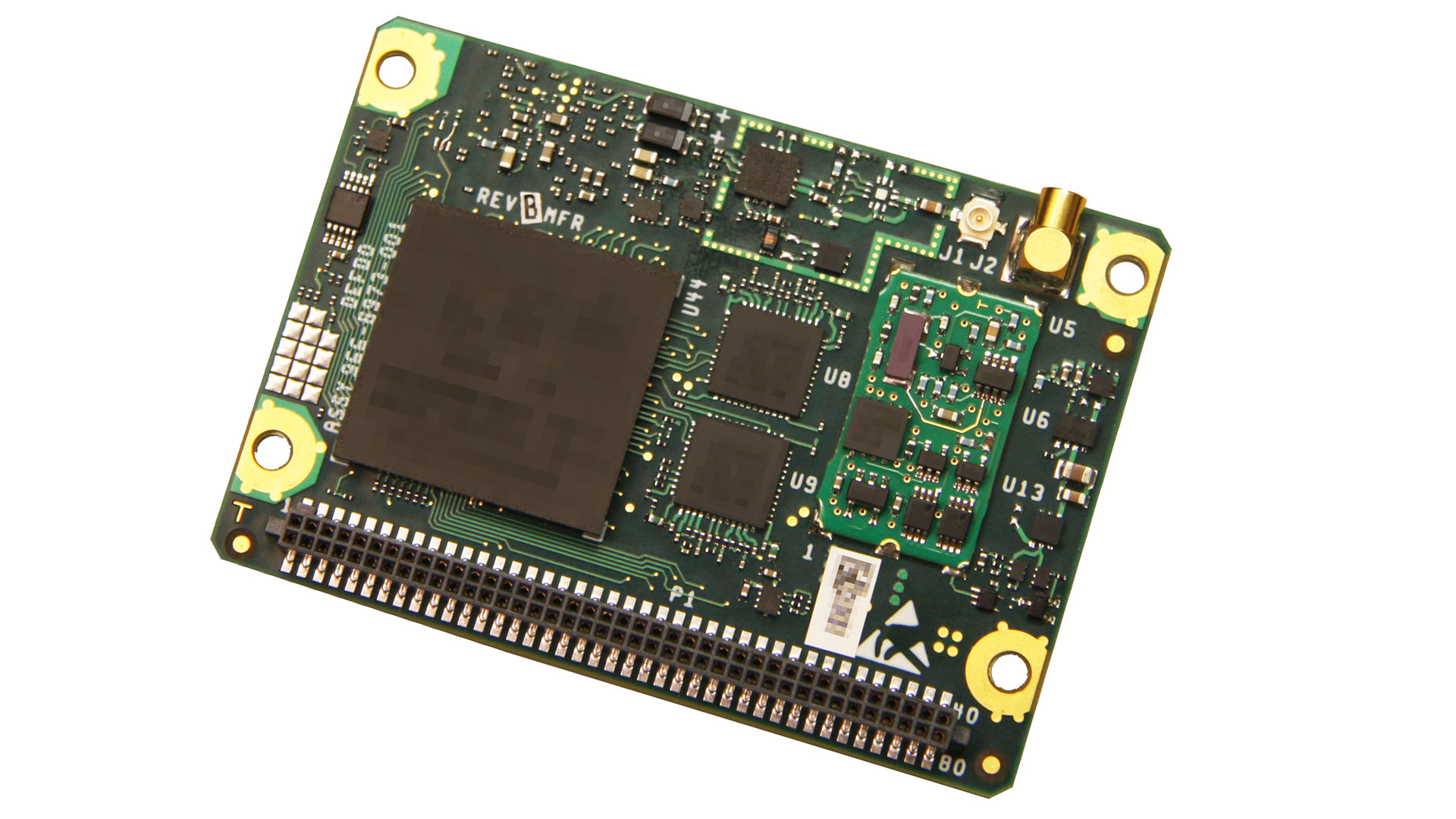
The mosaic development kit helps integrate mosaic into an existing system. Mosaic is a compact high-precision multi-frequency GPS/GNSS module that brings precision and reliability of high-end multi-frequency GNSS to mass-market applications. Its light weight and low power consumption makes mosaic suitable for robotics, automation, telematics and wearables. The kit supports connectivity through internet, COM ports, USB 2.0 and an SD Card slot. Mosaic provides Advanced Interference Mitigation (AIM+); extensive corrections support for high-accuracy positioning; integrity needed for safety-critical applications such as autonomous vehicles; and a 100-Hz update rate, suitable for robotics and fast-moving vehicles.
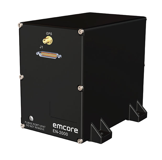
The EN-2000 is the newest addition to the Emcore-Orion series of micro-inertial navigation (MINAV) systems. It is compact and lightweight, weighing less than 7 pounds, with very low power consumption of 10 watts. It can deliver twice the performance of the EN-1000 with the same form factor. With its low size, weight and power (SWaP), the compact EN-2000 is suitable for unmanned aerial vehicles, unmanned underwater vehicles, unmanned ground vehicles, manned aircraft, rotorcraft and dismounted soldier applications. Its three-axis design uses a solid-state optical transceiver with advanced integrated optics, combined with new field programmable gate array (FPGA) electronics to deliver stand-alone aircraft-grade navigator performance at one-third the SWaP of legacy systems.
The Miniature PLGR Engine – M-Code (MPE-M) GPS receiver is a small Type II form factor ground receiver, and incorporates the company’s recently certified Common GPS Module (CGM). As a drop-in replacement for the thousands of customers using Collins’ Miniature PLGR Engine-SAASM (MPE-S) GPS receiver, the new MPE-M technology provides 10 times stronger anti-jamming capabilities for the direct acquisition of GPS signals than its predecessor. The MPE-M receives the current military Y-code GPS signal along M-code. It provides warfighters with improved security and assured positioning, and it satisfies the U.S. government’s requirement for all military GPS equipment to be M-code capable. It is designed for lightweight, ground-based applications such as radios, blue force trackers, targeting devices, vehicle line-replaceable units (LRUs) and small unmanned aircraft. The MPE-M’s security certification makes the receiver eligible for export to U.S. allies through the Foreign Military Sales (FMS) program.
The Catalyst software-defined GNSS receiver for Android phones and tablets is now available with a usage-based service plan: Trimble Catalyst On Demand. The new service plan meets the needs of industries and organizations that need a more flexible payment model. Organizations use Catalyst to record positions, navigate to points, measure relative distance and create digital maps. Trimble Catalyst On Demand provides scalable access to real-time kinematic (RTK)-quality GNSS positioning using a pay-per-use hourly pricing model in addition to the current Catalyst monthly plans. The service also enables automated domain-level email address access, which streamlines license allocation for organizations with a large number of users. (Pictured: Catalyst DA1 antenna).
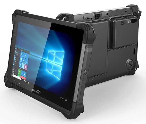
The DT301X is designed for 3D mapping. Its Intel RealSense Depth camera provides real-time 3D imaging combined with a dual-frequency GNSS module for real-time mapping and positioning. The digital images are better than high-definition standard, and are suitable for construction building information management (BIM) graphics. The highly durable IP65 and MIL-STD-810G-rated tablet in a slim case can be used in the field, office and vehicles. A bright 10.1-inch touchscreen provides indoor/outdoor viewing. The tablet includes long-range Bluetooth and 4G LTE mobile broadband for the latest in high-speed communications. An Intel 8th-generation Core i5 or i7 processor offers high performance while still being energy efficient.
Mapper for wide-area, mountain, urban and corridor surveys
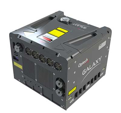
Photo: Teledyne Optech
The ALTM Galaxy PRIME wide-area lidar sensor offers collection efficiency, a small form factor and high-quality data sets that meet rigorous USGS lidar standards. It has a 6,000-meter above-ground-level (AGL) collection envelope and 1-MHz on-ground collection rate. Galaxy PRIME includes lidar technology enhancements to increase sensor performance and collection efficiency, improve data quality, and simplify the collection process. It can be used either gyro-stabilized or fixed-mounted, one camera or six, and full waveform or discrete. PulseTRAK technology enables a continuous operating envelope by eliminating data coverage gaps and irregular point density. Applications include wide-area mapping, urban mapping, natural resource management, engineering, infrastructure modeling, and powerline and transportation corridors.
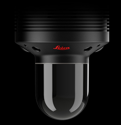
The Leica BLK247 real-time reality-capture device uses sensor fusion technology to detect and report physical changes within a space. It is designed for continuous 3D reality capture, extending capabilities for safety and security applications. The sensor provides real-time situational awareness through edge computing and lidar-enabled change-detection technology. Using artificial intelligence, the BLK247 can tell the difference between still and moving objects — such as a person walking who leaves a suitcase behind — and identify security threats to provide real-time alerts.
Version 15 of Grapher has new capabilities to improve the ability to model, analyze and interpret data as well as communicate the results. Grapher users can now access new Fit Curve, Axes and Statistical Plotting capabilities. Also, users are provided greater color customization functions in the latest release. Enhancements give Grapher users a more powerful ability to display and communicate the results of their work to others. The software provides 80 different 2D and 3D plot types for analyzing and displaying scientific data.
The Harris Aerial H4/H6 Hybrid multicopter is now offered as an integrated package with any Lidar USA scanning system. The Harris Hybrid can provide longer flights with lidar and industrial-grade cameras. The Harris Hybrids use a small generator running on 95 or higher octane fuel to power the UAV for up to five hours.The H6 can carry an A-series high-definition lidar system of 3 kg for 2.5 hours and a V-series of 5 kg up to 1.5 hours. For the lidar operator, this means most projects will require only one or two flights.
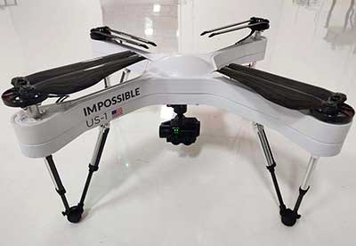
The US-1 was built with sensitive enterprise and government customers in mind. It was designed from the ground up in the United States with a battery-first approach to enable electric aircraft to compete with conventionally fueled incumbents. The US-1 runs on a secure open-source operating system by Auterion. It provides 78 minutes of flight time and high-resolution optical and thermal cameras. US-1 UAVs have been deployed to fight fires, locate pipeline leaks, and track armed suspects.
Impossible Aerospace, impossible.aero
The DRS-M600 reusable parachute safety solution, developed for DJI M600 and DJI M600 Pro, meets specifications of the ASTM F3322-18 standard. The successful completion of the ASTM standard test makes it possible for the Federal Aviation Administration to issue permits for its use on drones over crowds. The ASTM F3322-18 standard is the first standard for parachute systems designed specifically for small UAVs.
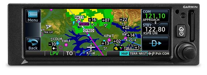
The GNC 355 is a GPS navigator with localizer performance with vertical (LPV) approach guidance. (Photo: Garmin)
The GNS 355 GPS navigator with localizer performance with vertical (LPV) approach guidance gives pilots the benefits of WAAS/SBAS GPS guidance with a modern communications radio. Intended for Class I/II aircraft that weigh 6,000 lbs./2,721 kg. or less, the GNC 355 is certified for more than 700 aircraft makes and models. Aircraft owners can incorporate the GNC 355 into an existing avionics stack because of its standard 6.25-inch wide by 2-inch tall design. The responsive touchscreen display allows pilots to quickly access direct-to functionality, moving map, flight plan, nearest, procedures, waypoint and terrain pages and create customizable data fields and shortcuts for quick, one-touch access to important information. Fully WAAS/SBAS IFR-approach-capable, the GNC 355 gives pilots the benefit of flying LPV, as well as Area Navigation (RNAV) approaches. Many approaches offer vertical approach guidance as low as 200-feet above ground level (AGL).
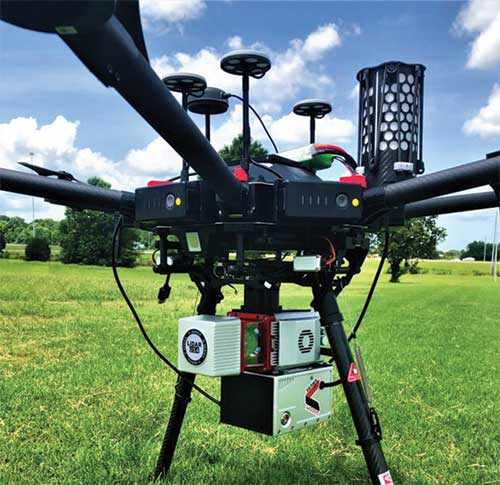
The Allystar INS Platform is a dual-antenna, multi-frequency, multi-GNSS inertial navigation system (INS) that delivers accurate and reliable position, velocity and orientation. It combines high-grade, six-axis, temperature-calibrated accelerometers and gyroscopes with a multi-frequency, multi-GNSS engine, the HD9300 series. The HD9300 is a dual-antenna chip-grade real-time kinematic (RTK) GNSS receiver for accurate positioning and heading. The Allystar INS platform contains an on-board sensor-fusion filter, plus navigation and calibration algorithms for different dynamic motions of land vehicles. The Allystar OBD Data Adapter (v1.0) enables users to read and monitor various sensors built into cars, obtaining real-time vehicle speed and gear signals from the on-board diagnostics (OBD) interface, and then output AT (attention) commands by serial port or serial peripheral interface (SPI).
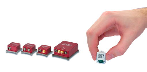
SBG Systems has announced a major firmware update for the Ellipse product line. New features have been added to version 1.7 to enhance performance of the sensor.
Automotive package. New features were developed to better answer needs of the autonomous testing and driving markets. These features include:
CAN odometer. Users now have the choice to connect an external odometer (DMI) with pulses or use their car odometer with velocity information. During the installation, users can enter a rough “resolution.” Then, SBG’s inertial sensor refines the odometer installation parameters to automatically obtain the best performance.
New outputs. Included are body velocity and slip angle, which calculates the “drift” angle between the vehicle assumed trajectory and its actual (deviated) trajectory.
Fixed lever-arms mode. For precision applications as well as low dynamics, and reduced warm-up time, the new Ellipse firmware allows users to run the Ellipse Kalman filter with no lever-arm estimation. This will ensure centimeter pass-to-pass accuracy for real-time kinematic (RTK) applications and allow operation in lower dynamics while reducing warm-up time.
To precisely calibrate the lever arms, the use of Qinertia Lite can be used to obtain centimeter precise lever arms. For general-purpose applications, the standard mode of operation that refines the lever arms in real time is still available.
Marine applications. The firmware update provides new features for advanced marine applications.
DVL aiding support. This helps to reduce drifts from the inertial sensor underwater, providing an interesting opportunity for projects such as short subsea navigation with affordable inertial sensors.
New output message (INDYN). INDYN brings support to performance sailing autopilots such as the B&G H5000.
Improved magnetic calibration (sbgCenter). The new sbgCenter embeds a new magnetic calibration algorithm that improves overall performance in challenging calibration while allowing even more difficult calibration conditions. This new calibration procedure also provides improved quality feedback.
The firmware download is protected by a password, the same credentials as for the last version. To request the password, e-mail [email protected].
A link to the live event will be sent to you two hours before the event. Your personalized event URL will be automatically generated by the ON24 system. To ensure receipt of the email, please whitelist this email address by adding it to your contacts: [email protected].
This presentation will begin at 1 p.m. Eastern / 10 a.m. Pacific on Thursday, Oct. 3. A recording will also be sent to you the following day so you can watch it on-demand.
Audience members may arrive 15 minutes prior to live time. If you have any questions, please contact event moderator Bethany Chambers at [email protected].