Aceinna and Point One Navigation launch hardware and software platform for precise positioning in agriculture, construction, mapping, surveying, robotics and trucking
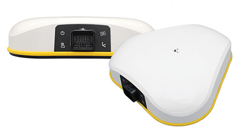
The OpenARC positioning service is now commercially available. OpenARC is a precise-positioning hardware and software platform for system integration of GNSS corrections with high-performance inertial navigation system (INS) and real-time kinematic (RTK) hardware.
OpenARC is offered by Aceinna, a developer of inertial-based guidance and navigation systems, and powered by Point One Navigation.
With an RTK positioning engine and GNSS corrections delivered from a ground-based network of secure base stations, OpenARC will reliably improve position accuracy for autonomous vehicles to centimeter-level accuracy. The platform combines Point One’s Polaris GNSS correction service with Aceinna’s OpenRTK330 hardware and software solution for developers of autonomous systems in trucking, precision agriculture, construction, mapping, surveying and robotics.
OpenARC provides high-precision positioning and localization applications, enabling centimeter-level accuracy for challenging tasks such as lane keeping, precision agricultural guidance, and UAV landing maneuvers.
OpenARC is integrated into the OpenRTK330LI navigation module to provide a secure, vertically integrated and easy-to-use positioning platform. OpenARC is very scalable, supporting single-unit installations and high-volume deployments.
Point One’s proprietary Polaris GNSS cloud correction service delivers superior station density in areas where operators need it the most, including urban centers and suburban surrounding areas, enabling cold convergence times of under 10 seconds.
Polaris provides continuous position monitoring and tracks all modern satellite constellations. Its base-station technology includes advanced anti-jam, interference mitigation, security and integrity monitoring. Its architecture allows for GNSS corrections in RTK or state space representation (SSR) configuration. Its open-source interfaces are compatible with multiple receivers and chipsets, and the service is compatible with any NTRIP/RTCM3 compliant receiver.
Altitude Angel, a unified traffic management (UTM) technology provider, is bringing to market airspace management solution GuardianUTM Enterprise.
GuardianUTM Enterprise provides a view of the airspace in the vicinity of airports and enables airport to start designing and providing UTM services for drone companies and drone operators, using Altitude Angel’s proven digital authorization and flight-management technology.
GuardianUTM Enterprise will initially be deployed to support regional and local airports and airfields.
Europe’s EASA U-Space regulations are expected to become law on Jan. 1, 2023. GuardianUTM Enterprise is designed to enable airspace authorities to digitize approvals for drone operations using services integrated with Common Information Service (CIS) and U-Space Service Providers (USSP) architectures.
Using GuardianUTM Enterprise, airports can set access policies and create automation workflows accessible via Altitude Angel’s UTM ecosystem. This ecosystem is used by hundreds of thousands of drone pilots, manufacturers and software companies to guarantee the airport the best available view of the sky and nearby drone operations, ensuring a growing sector of the aviation market is able to access the new airport UTM Service.
For larger airports with counter-UAS solutions, data from on-site surveillance systems can be optionally integrated to give airport security staff greater situation intelligence which is a critical step in encouraging greater drone use.
The solution can be rapidly deployed and configured for airports of any size; providing a flexible platform for enabling drones to be safely integrated in the airspace around these facilities: a crucial step in unlocking a wide variety of unique use-cases for drones.
GuardianUTM Enterprise provides digitalization of pre-flight and take-off approvals to drone operators within airspace. It offers high levels of automation, including customized automated access policies and approval workflows of unmanned operations.
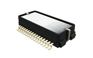
Murata has developed a new (micro-electro-mechanical systems (MEMS) six-degrees-of-freedom (6DoF) inertial sensor for GNSS positioning support, autonomous off-highway vehicles and dynamic inclination sensing. Murata’s new SCHA63T sensor is a single package 6DoF component. It can enable centimeter-level accuracy in machine dynamics and position sensing, and can assist in ensuring safe, robust and verified designs.
The sensor enables further advancement in technology and novel solutions for GNSS-based measurement instruments, advanced driver/operator assistance systems, and autonomous vehicles.
The product delivers highest performance available on the component level in the key parameters of bias stability and noise. Murata calibrates orthogonality of all measurement axes, which allows customers and system integrators to skip that critical process step.
A key focus area in product development for SCHA63T has been to ensure operation during high mechanical shock and vibration. Within the same product family, sensor variants are qualified according to the automotive AEC-Q100 standard. The SHCA63T sensor includes advanced self-diagnostic features and can achieve full compliance with ASIL-D (Automotive Safety Integrity Level-D).
The SCHA63T sensor features extensive failsafe functions and error bits for diagnostics. These include internal reference signal monitoring, checksum techniques for verifying communication, and signal saturation/over range detection.
The diagnostic feature of Murata’s three-axis accelerometer is the continuously operating self-test function, which monitors the sensor during measurement. This patented self-test function verifies the proper operation of the entire signal chain, from MEMS sensor element movement to signal conditioning circuitry for every measurement cycle. Even if the system using SCHA63T is not required to follow international functional safety standards, the provided design support documentation enables for customers a cost effective, robust and fast design process.
Murata, based in Japan, has more than 20 years of experience of providing inertial sensors for safety-critical automotive applications like electronic stability control.
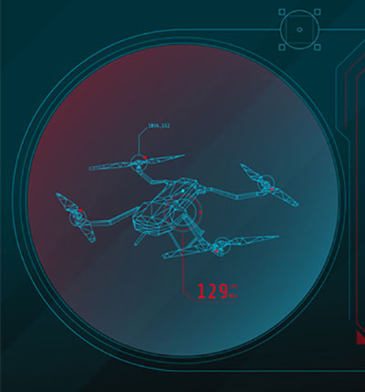
Oxford Technical Solutions has released the xNAV650, the latest in its line of inertial navigation systems (INS), suitable for use on drones.
INS provide surveyors with absolute position, timing and inertial measurements (heading and pitch/roll) that they can integrate into their survey projects. The measurements, when combined with data from other devices (such as lidar sensors and cameras), can greatly enhance the surveying process, leading to a greater return on investment, according to the company.
The xNAV650 is OxTS’ smallest, lightest and most affordable INS to date. It combines 20 years of navigation experience with the latest micro-electromechanical (MEMS) inertial measurement unit (IMU) technology and survey-grade GNSS receivers.
UAV Guidance
The xNAV650 provides highly accurate and reliable measurements – even when payload size and weight are imperative to consider, including for use with unmanned aerial vehicles (UAVs). It measures 77 x 63 x 24 mm and weighs 130 grams.
The xNAV650 INS is suitable for a wide range of UAV data-collection applications, including surveys of bridges, buildings, forests and rail; coastal monitoring; map creation and pipeline exploration.
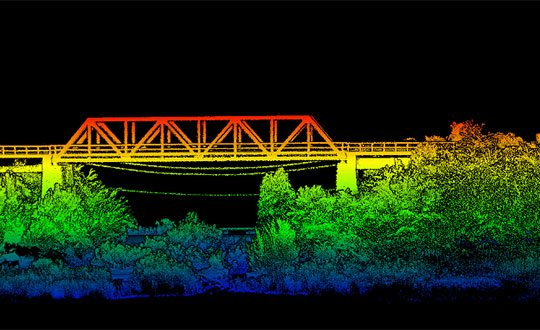
OxTS’ partner Dronezone used the xNAV650 INS and a Velodyne VLP-16 lidar on a drone to conduct a scan of an aging bridge to look for structural and potential hazards from overgrown foliage.
By fusing the timing, position and inertial data from the INS with the raw data of the Velodyne VLP-16 (using OxTS’ lidar georeferencing software OxTS Georeferencer), the surveyor was able to produce a highly accurate 3D point cloud of the bridge. Fusing the position and inertial data from the xNAV650 INS with the Velodyne VLP-16 lidar data provides a high level of clarit, which can be seen in the foliage, electricity lines and side of the bridge.
The resulting point cloud has enabled the engineers to easily and accurately pinpoint areas of the bridge that need closer attention.
Side view point cloud of bridge. Data collected using and OxTS xNAV650 INS and Velodyne VLP-16 lidar. Data processed using OxTS Georeferencer. (Image: OxTS)
NAVsuite Software
Data from OxTS INS can be fused with the data from almost any lidar sensor. Using OxTS Georeferencer software, point clouds can be georeferences from lidar units specifically from Velodyne, Hesai and Ouster sensors. Work is underway to integrate new lidar sensors from an even wider range of manufacturers into OxTS Georeferencer – allowing OxTS INS users to build a full navigation solution where much of the integration work is already taken care of.
OxTS NAVsuite software is included with all OxTS INS. The full range of software tools allows users of OxTS’ devices to configure and post-process data with ease.
Other optional software features are also available, including Precision Time Protocol (PTP) and GX/IX tight-coupling technology. PTP allows for a much simpler lidar survey set-up over ethernet while simultaneously stamping out time-drift by utilizing the high-quality INS clock source – GNSS. GX/IX tight-coupling technology, OxTS’ own proprietary navigation engine, ensures that users of OxTS Inertial Navigation Systems receive the most accurate measurements possible even in tough GNSS conditions.
Why permissions and regulations are an important part of workflows
By Pierre-Alain Marchand Regulatory Compliance Manager, senseFly
Pierre Alain Marchand
Now widely accepted as a mainstream commercial mapping tool, the benefits of using drones to make better-informed decisions and provide a robust return on investment are well understood.
But progress in drone technology is shifting the focus to more advanced operations, a term that encompasses a wide range of activity, including beyond-visual-line-of-sight (BVLOS) flights and operations over people (OOP), as well as flying at night, as part of a fleet, or in restricted airspace.
These types of flights typically require more planning and permissions, but both can help improve safety for people on the ground, as well as create long-term cost savings and improve data-collection efficiencies.
Part 107 Waivers. However, while the benefits of advanced drone operations are increasingly well recognized, navigating these differences can be complex.
For instance, the Federal Aviation Administration (FAA) requires all companies planning advanced drone operations to complete a Part 107 waiver, an official document that approves certain operations of aircraft outside the limitations of regulation.
However, of the thousands of applications completed in 2018, only 23 were approved. Despite these poor figures, progress is being made to help make the approvals process more accessible.
Testing. Drone testing has been key to getting operations to where they are today — and will continue to play a role when demonstrating how the required safety, regulatory and logistical criteria of advanced drone operations can be met. Its importance should not be underestimated; testing has the potential to speed up regulatory procedures and even expand drone operations.
For that reason, investing in drone testing remains a priority today — the more data that is made available to backup a drone’s durability and reliability, the more evidence there is that the technology is safe and fit-for-purpose. SenseFly fixed-wing drones, for example, have thousands of hours of safety testing behind them, which is vital for streamlining and accelerating the approval of waiver requests and flight permissions.
Testing can also create more opportunities within the project scope, for instance by allowing operators to fly in more built-up areas.
Permissions. Although testing plays a key role in establishing regulatory compliance, it is still only one piece of the puzzle. With the rules for flying changing all the time, there is also the issue of navigating complex flight permission processes, which vary between countries.
The good news is that we are now seeing authorities across the world taking measures to streamline the regulatory process and make the rules clearer for operators. For example, the FAA has recently launched its new BEYOND program, which will support efforts to move toward BVLOS operations being carried out under established rules rather than waivers. Type certification is also becoming increasingly important in the U.S., which may further signal a potential move away from waivers in the future.
It’s promising to see the issue of regulatory compliance and flight permissions being placed at the top of authorities’ agendas. Connections are vital. Working in this way is a two-way process: both parties want to learn more about advanced drone operations and streamline the administration requirements.
Although there is still work to be done to ensure advanced drone operations become more accessible, the industry is moving in the right direction. As the approval process becomes easier, we predict more commercial companies will see the value of these operations and begin implementing them in their workflows.
Pierre-Alain Marchand is a regulatory compliance manager at senseFly , a commercial drone subsidiary of Parrot Group. For more information, visit the website or contact Marchand at [email protected].
With a very good PNT device already installed for flying the aircraft, why not just tap into that one for the payload, right? This might not be a good idea, for several reasons.
By John Fischer Vice president, Advanced R&D, Orolia
John Fischer. (Photo: Orolia)
The navigation device in a UAV is very important, precisely because there is no pilot. It must navigate autonomously. It must also be optimally suited for the airframe, either fixed or rotary wing, providing the accuracy and reliability for all modes of flight, from takeoff to landing. A lot of engineering goes into the design and certification of each UAV’s navigation system to qualify it for flight.
UAVs can have multiple missions with interchangeable payloads: cameras for observation and inspection; communication equipment for relaying links or supplying emergency cellular base stations; or sensing equipment such as radar, lidar, spectrometers, etc. These payloads also need positioning, navigation and timing (PNT) sources for their missions, for example, to accurately geo-timestamp the collected data.
With a very good PNT device already installed for flying the aircraft, why not just tap into that one for the payload, right? Actually, this might not be a good idea, for several reasons.
Recertification. Modifying the navigation device, which is part of the flight control system, risks having to re-certify the aircraft for flight safety. Though a UAV has less severe restrictions on safety than a manned aircraft, it can still cause property damage or even injury and loss of life if it crashes in a populated area. The Federal Aviation Administration has numerous standards — DO-178 for software, DO-254 for hardware, DO-160 for testing — to ensure avionics are designed and tested for safe operation. Every modification, regardless of how small, must follow these standards and may require expensive re-certification of the aircraft’s airworthiness.
Performance Requirements. These vary with each mission. The flight control system includes a navigation device that was selected based on the aircraft’s special requirements. These will not necessarily match the needs of the payload. For example, consider pitch, roll, and yaw sensing accuracy. The accuracy required to determine the pointing angle of a camera might not be the same as what is needed for level flight.
Interchangeability. A particular UAV can have multiple payloads for different missions. Conversely, a particular mission payload can be adapted and installed on several different UAVs. Having a second PNT device matched to the payload allows it to stay with the payload as it is moved to different UAVs. This can lower the total cost of ownership and operation, since the extra cost of a second device is small compared to the adaption work and design changes necessary to make a single PNT device be suitable for all situations.
Missing the T in PNT. Typically, the navigation device for flying the aircraft doesn’t have a precise internal oscillator for supplying time and/or frequency — it doesn’t need it. However, most payloads can benefit from the time/frequency component to enhance mission performance. A low phase noise oscillator with low g-sensitivity that is disciplined by the precise time supplied by a GNSS receiver can substantially improve the performance of any payload radar or communication system.
A second device does not impact SWAP or cost significantly — GNSS receivers and inertial navigation systems are no longer large, expensive items. A second PNT device is typically small, weighing less than a kilogram and consuming only a few watts of power. There are also fewer connectors and cable harnesses when a removable payload is not sharing the aircraft’s PNT data, so the weight differential might be zero. PNT devices can share antennas on the aircraft via splitters, so there is no need to place additional antennas.
Technology upgrades. Micro-electromechanical systems (MEMS), inertial sensors, cameras, lidars, radars and other sensors are all evolving at a rapid pace with better technology available with each passing year. Flight control systems evolve at a different pace — mostly because of the flight certification process, but also for lack of a driving need. UAVs navigate just fine with the equipment they have today. A separate payload PNT device allows the system designer to keep pace with evolving technology, choosing the latest and best for the mission without disrupting the navigation system.
Just as “two heads are better than one” for problem solving, having two PNT devices in a UAV is often the better solution.
John Fischer is vice president, Advanced R&D, Orolia, and a member of GPS World’s Editorial Advisory Board.
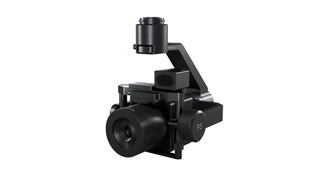
Phase One, a developer of digital imaging technologies, has announced the P3 Payload, a versatile solution designed for fast, efficient and safe inspection of critical infrastructure with an unmanned aerial vehicle (UAV).
The P3 Payload includes a Phase One iXM 100MP or 50MP camera, one of the RSM lens options, and a new gimbal with integrated rangefinder.
Available in the second quarter of 2021, the P3 Payload is offered in two configurations to meet a wide range of user requirements.
The P3 for the DJI M300 is plug-and-play, developed mainly for operators and service providers that already own, or are considering purchasing, a DJI M300.
The P3 MAVLink is ready for integration with drones based on the open-source MAVLink protocol, and suitable for bundling by OEMs and solution integrators.
“The P3 addresses the unmet need for a high-quality, integrated imaging solution for inspection of critical assets where capturing the details is of paramount importance,” said Michael Messerschmidt, portfolio director for drones and inspection. “The P3 Payload is designed specifically for aerial drone inspection of diverse infrastructure where every flight — and every shot — must count.”
The centerpiece of the payload is the customer’s choice of Phase One iXM 100MP or 50MP camera. Robust and waterproof, these sensors feature a dynamic range that guarantees sharp image collection in high-contrast or low-light environments. The variety of lens options ensures large surface areas can be captured with millimeter-level detail, even at safe distances from the asset. The new gimbal with the integrated laser rangefinder ensures precise and fast focusing on every shot, eliminating blurry and out-of-focus images.
The P3 Payload is suitable for these inspection applications:
High-value assets. Bridges, dams and energy facilities where the value of the structure itself is high and the demand for frequent, accurate and detailed data is critical.
High-risk assessment. Electric transmission lines, oil refineries and other complex sites where inherent danger requires high-resolution inspection from a distance that is safe for the structure, the drone and personnel.
Time-critical assets. Wind turbines, offshore oil rigs, and other facilities where inspection windows are limited, and every UAV flight must successfully capture the required information.
“We developed the P3 Payload for cost-effective, productive operation so that large surface areas can be covered in fewer images, significantly shortening the mission time,” Messerschmidt said. “More importantly, the P3 can be operated with minimal risk to the asset and ground crew.”
It’s hard to pick out an outstanding story or two this month from the dozens of new or related drone initiatives that bombard my inbox. But there’s always some that stand out, needing emphasis. This month, we look at these developments:
NEC Laboratories Europe introduces a potential drone solution for finding disaster victims
The FAA issues its remote ID rule, which also enables flight over people and nighttime operations
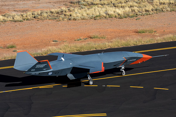
The Boeing Loyal Wingman succeeds with its maiden flight in Australia.
Search-and-rescue drone
Finding survivors is a primary task for first responders in disaster situations, so if a feasible approach using drones looks possible, its something we should prove out and implement quickly. Researchers at NEC Laboratories Europe, based in Germany, have come up with a drone shown to be able to locate a person’s cell phone — it works better in open situations, but takes longer and is less accurate when there are obstructions.
The Search-and-Rescue Drone (SARDO). (Photo: NEC Labs/Antonio Albany)
The concept of the search-and-rescue drone (SARDO) is basically to hang cellphone-tower electronics on the drone, and then let it self-triangulate on the return signal from the victim’s phone. So if you know where you are and estimate distance by pinging the victim’s phone and measuring the transit time, then move a known distance and repeat, eventually you converge on the phone’s location.
Putting all that into reliable flying algorithms is something; proving that your design works is significantly more tricky. Overcoming signal blockage due to debris brings another level of complexity, as does tracking the victim if he or she is moving.
But this looks like a great initiative which should be developed further — a possible boon for finding people in earthquakes and other building-collapse situations.
FAA Remote ID Rule issued
Image: ConceptCafe/iStock/Getty Images Plus
On Jan. 15, the U.S. Federal Aviation Administration (FAA) finally issued its rules for remote ID: All UAVs greater than 0.55 pounds must transmit unique identifications. Although, it appears that even these lighter drones might also have to be capable of remote ID if operated commercially. The broadcast message has to include “identification, location, and performance information of the unmanned aircraft and its control station.”
The good news is that there are now several potential suppliers of these broadcast modules. The rules allow for an implementation period that stretches out another 18 or 30 months — UAV manufacturers have 18 months to comply, while drone operators have 30 months.
The rules also allow drone operators to fly their UAVs over people. There are four categories of drone, each with appropriate restrictions — all seemingly related to the injuries an out-of-control or falling drone could cause to a person. All such operations require that the FAA approve a written statement of compliance with these safety rules.
The rules will certainly help with coverage of spectator sports such as the Super Bowl and regular outdoor events like PGA golf tournaments. It would appear that the Golf Channel and CBS have already begun to broadcast drone coverage of recent golf events. Such operations needing to verify their compliance now, rather than over the implementation period.
And, of course, if you can fly over people, transiting over vehicles is now allowed. With an anti-collision light installed, night operations are also permitted once compliance is approved.
The UAV/UAS is also referred to as the Airpower Teaming System (ATS), and should likely be considered a contender for the U.S. Air Force Skyborg manned-unmanned teaming program. At least two other companies involved with the Skyborg program are already flying similar vehicles — Kratos Unmanned Aerial Systems and General Atomics Aeronautical Systems.
Summary
Anything that helps first responders find survivors in disasters is a good idea to take to users in the field as soon as possible, so the NEC Laboratories Europe initiatives is a welcome opportunity.
After more than two years to get the final rules published, the FAA is finally coming online with its Remote ID rule — even though it entails significant work on operators’ parts over the next several months for them to implement. But the window now seems to be significantly wider for them to be able to take on more viable commercial business ventures.
Finally, it’s good to see the Boeing ATS get into the air — the first aircraft in 50 years to be wholly built in Australia, with interest not only from the Australian RAAF, but also with potential participation in the USAF Skyborg program.
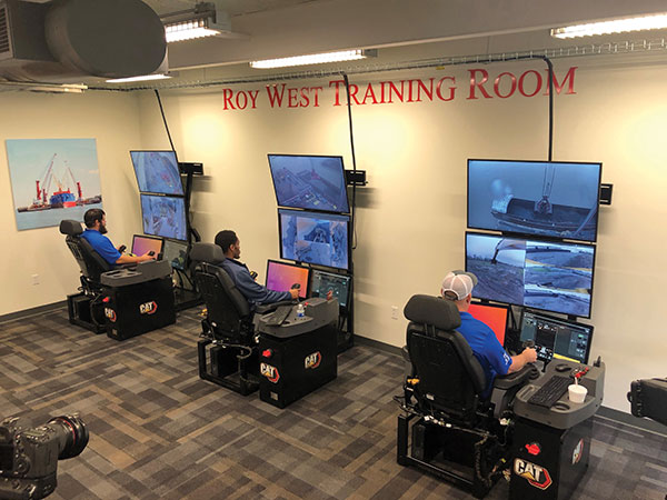
Caterpillar’s Cat Command system enables operators, including disabled veterans, to control machines in dangerous environments from the safety of a remote command center. (Photo: Caterpillar)
Caterpillar, the world’s largest manufacturer of construction equipment, has invested in the development of autonomous vehicles for more than 30 years and has the world’s largest autonomous fleet of haul trucks.
Its Cat Command suite of remote and semi-autonomous products for the construction industry helps increase safety, machine utilization and productivity for hauling, loading, excavating, drilling and dozing operations. They include onboard electronic and vision systems that allow machines to be controlled without anyone in the cab.
Options include
The line-of-sight Cat Command Console, which is supported by a shoulder harness
The Cat Command Station, which can be located onsite, for line-of-sight operation, or offsite
The semi-autonomous Cat Command for Compaction technology, which automates soil compaction to help deliver consistent results.
Over time, the company expects most of its machines to become compatible with its Cat Command technology.
Here are a few examples of how construction companies are using Caterpillar technology:
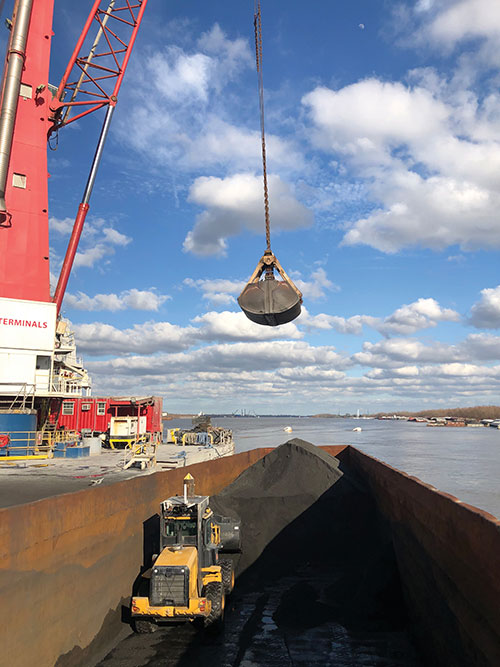
Cargo Barges. Associated Terminals, which transloads dry bulk and general cargo in the Port of South Louisiana, uses Cat Command to remotely control its small wheel loaders and excavators, keeping its personnel off the barges.
“It gives me a lot of peace of mind knowing that when we are doing our jobs, digging in these cargo holds in the vessels, my friend and co-worker is not operating the machine in the hold,” said Thomas Ramagos, a production manager for the company.
Fleet Management. Beverly Companies is a landscaping, snow removal and topsoil contractor in Chicago that owns equipment ranging from bulldozers to lawnmowers. The company uses my.cat.com and other Caterpillar fleet-management tools to track all its equipment in one place, help reduce machine downtime, manage repairs and maintenance, and order parts.
Civil Contracting. Saiia Construction Company, a civil contractor in Birmingham, Alabama, uses Cat Command to increase the safety of its employees, said Frank Montgomery, the company’s president. The material with which it deals is sometimes unpredictable, and rain events can change conditions significantly, explained Superintendent Clint Kennedy.
A remotely controlled front loader operates inside a barge. (Photo: Caterpillar)
Cat Command enables employees to work from an office trailer, rather than having to trudge through mud and muck to get to a piece of equipment. The controls in the seat are almost identical to the ones in the cab, Kennedy pointed out. Another employee can stand behind the chair and coach the operator.
High-quality cameras on site enable the operator to view the whole job site, while four on the machine enable the operator to distinguish brown dirt from red dirt and rocks from sand.
Caterpillar machines also collect massive amounts of data and transmit them over the air to the company, where they are analyzed and used in business applications.
Customers can access these data via my.cat.com and a mobile app to better understand and manage their vehicle fleets and operations, reduce fuel consumption, and improve productivity and safety. They can also access equipment locations, engine hours, parts and service records, and inspection reports.
According to Caterpillar, it had one million connected assets at the end of 2019, almost twice as many as three years earlier, and almost all its new construction machines are equipped with these connectivity systems. The Cat Productivity web-based suite of solutions works with Caterpillar machines of any age and brand. Of course, newer machines will provide richer data and more accurate results.
Successful test progresses Royal Australian Air Force’s teaming aircraft program
Boeing Australia and the Royal Australian Air Force (RAAF) successfully completed the first test flight of the Loyal Wingman uncrewed aircraft on Feb. 27.
The flight of the first military aircraft to be designed and manufactured in Australia in more than 50 years flew under the supervision of a Boeing test pilot monitoring the aircraft from a ground control station at the Woomera Range Complex in the South Australian outback.
“The Loyal Wingman’s first flight is a major step in this long-term, significant project for the Air Force and Boeing Australia, and we’re thrilled to be a part of the successful test,” said Air Vice-Marshal Cath Roberts, RAAF head of Air Force Capability. “The Loyal Wingman project is a pathfinder for the integration of autonomous systems and artificial intelligence to create smart human-machine teams. “Through this project we are learning how to integrate these new capabilities to complement and extend air combat and other missions,” she said.
Following a series of taxi tests validating ground handling, navigation and control, and pilot interface, the aircraft completed a successful takeoff under its own power before flying a predetermined route at different speeds and altitudes to verify flight functionality and demonstrate the performance of the Airpower Teaming System design.
“Boeing and Australia are pioneering fully integrated combat operations by crewed and uncrewed aircraft,” said Boeing Defense, Space & Security President and CEO Leanne Caret. “We’re honored to be opening this part of aviation’s future with the Royal Australian Air Force, and we look forward to showing others how they also could benefit from our loyal wingman capabilities.”
With support from more than 35 Australian industry teams and leveraging Boeing’s innovative processes, including model-based engineering techniques, such as a digital twin to digitally flight-test missions, the team was able to manufacture the aircraft from design to flight in three years.
This first Loyal Wingman aircraft is serving as the foundation for the Boeing Airpower Teaming System being developed for various global defense customers. The aircraft will fly alongside other platforms, using artificial intelligence to team with existing crewed and uncrewed assets to complement mission capabilities.
Additional Loyal Wingman aircraft are under development, with plans for teaming flights scheduled for later this year.
“Seen & Heard” is a monthly feature of GPS World magazine, traveling the world to capture interesting and unusual news stories involving the GNSS/PNT industry.
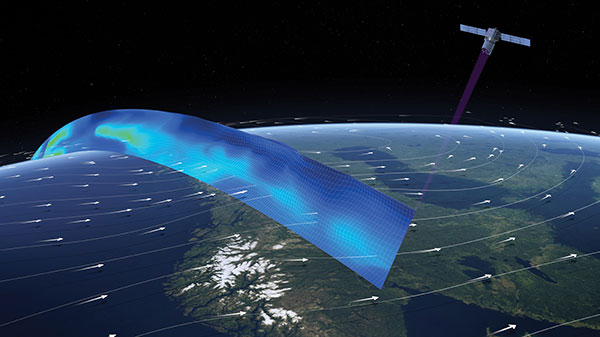
Image: ESA
Caught in a vortex
This winter’s polar vortex blasted the northern hemisphere. Understanding the vortex is the mission of the European Space Agency’s Aeolus satellite. Sudden stratospheric warming can disrupt the vortex, as it did this winter, causing the strong wind around the edge of the polar vortex to weaken or reverse (the processes involved are not fully understood). Aeolus emits short, powerful pulses of ultraviolet light from a laser and measures the Doppler shift from the light scattered back to the instrument from molecules and particles to deliver profiles of the horizontal speed of the world’s winds.
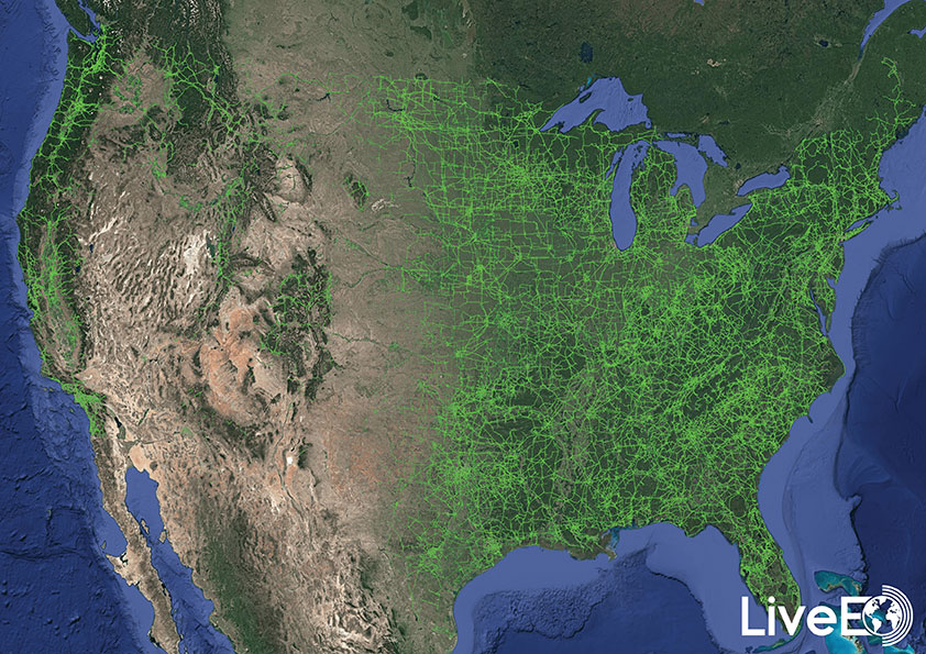
Image: LiveEO
Encroaching vegetation
For the first time in history, according to Berlin-based start-up LiveEO, vegetation encroachment risk to the U.S. transmission grid has been analyzed from space. LiveEO used more than 15,000 satellite images to evaluate risk to 574,000 miles of electricity lines. The analysis covers the detection of vegetation along transmission corridors, as well as identification of grid segments exposed at dangerously close distances. Globally, vegetation causes up to 56% of externally triggered power interruptions.
Photo: Motional
What happens in Vegas
The Hyundai-Aptiv joint venture Motional in February tested its vehicles without safety drivers in Las Vegas. The tests came less than three months after the company received the green light from the state of Nevada to test its vehicles without a human safety driver. The vehicles navigated intersections, unprotected turns and interactions with pedestrians and cyclists. A Motional employee rode in the passenger seat and was capable of stopping the vehicle if needed.
A roundup of recent products in the GNSS and inertial positioning industry from the March 2021 issue of GPS World magazine.
OEM
GNSS Receiver
1-cm accurate multi-band receiver
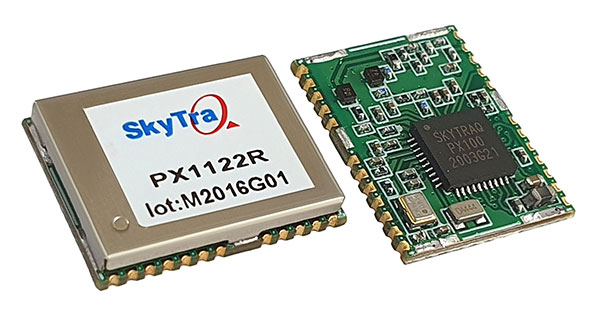
Photo: SkyTraq
The PX1122R is a 12 x 16 millimeter multi-band real-time kinematic (RTK) receiver for centimeter-level-accuracy positioning applications. It uses GPS L1/L2C, Galileo E1/E5b, GLONASS L1/L2 and BeiDou B1I/B2I signals concurrently to maximize positioning availability even in difficult urban environments. A single-chip system-on-chip, the PX1122R is designed to deliver reliable positioning for autonomous unmanned ground or aerial vehicles, the internet of things, and traditional land surveying and precision farming applications. It has an RTK initialization time under 10 seconds and a maximum update rate of 10 Hz. Its update rate provides in-time positioning with a fast response time and improved guidance for fast-moving applications. Moving-base RTK for GNSS precise heading is also supported.
SkyTraq, www.skytraq.com.tw/homesite/
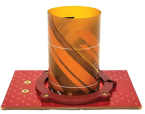
Iridium antennas
Available housed or embedded
Photo: Tallysman
The housed HC610 and embedded HC610E active Iridium antennas operate in receive-only mode and enable Iridium terminals to be installed tens of meters away from the antenna. The lightweight and compact helical antennas are designed to receive the Iridium Satellite Time and Location (STL) signals. Both antennas are light and compact and feature a precision-tuned helical element that provides an excellent axial ratio and operates without a ground plane. They feature a low-current, low-noise amplifier (LNA) and pre-filter to prevent harmonic interference from high-amplitude signals, such as 700-MHz band LTE and other nearby in-band cellular signals. The housed HC610 weighs 23 grams, is 33 x 54.2 mm, and features an IP67 robust, military-grade plastic enclosure, with a base-mounted male SMA connector and two screw holes for surface attachment. At 10 grams, the embedded HC610E is 27.5 x 38.7 mm and can be installed in a custom enclosure. It provides a base-mounted female MCX connector. An optional embedded helical mounting ring is available to attach the antenna to a flat surface.
Tallysman Wireless, tallysman.com
Receiver front end
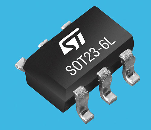
Designed for portable receivers
Photo: STMicroelectronics
The BPF8089-01SC6 GNSS receiver front end integrates the impedance-matching and electrostatic discharge protection circuitry typically implemented using discrete components. It provides a 50-ohm matched interface between the receiver’s antenna and LNA, and is ready for plug-and-play with the company’s STA8089 and STA8090 LNAs. It is suitable for use in portable receivers for the GPS, Galileo, GLONASS, BeiDou and QZSS constellations, which can be used in applications such as consumer satellite navigation, radio base stations, drones and tracking of assets or livestock.
STMicroelectronics, st.com
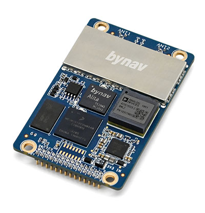
GNSS/INS board
Enhanced with an inertial measurement unit
Photo: Bynav
The Bynav A1 is a compact GNSS OEM board with a highly integrated tactical-grade inertial measurement unit (IMU) on board. With Bynav’s new-generation RTK algorithm engine and deeply coupled GNSS/INS algorithm engine, the A1 can provide continuous, reliable high-precision positioning, 3D attitude and velocity to applications such as autonomous driving, robotics, UAVs and mobile mapping. Weighing 25 g and measuring 46 x 71 millimeters, the credit-card-sized A1 is easy to integrate into any system while providing enhanced connection options including serial, Ethernet and CAN.
Bynav Technology, bynav.com
SURVEYING & MAPPING
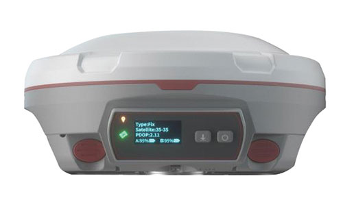
GNSS/IMU receiver
With tilt compensation
Photo: ComNav
The N5 IMU RTK receiver is user-friendly, with up to 60° tilt compensation ensuring quick measurement and precise position acquisition. A combination of high-end inertial measurement unit (IMU) and advanced GNSS real-time kinematic (RTK) technology, along with ComNav’s core algorithm, ensures high accuracy of less than 2.5 cm, making surveying and mapping in difficult environments easier. The N5 receives all current and future GNSS signals: GPS, GLONASS, BeiDou, Galileo and SBAS. The high-quality OLED display with sunlight readability provides clear viewing and allows users to handle all surveying operations on the screen. A 6800mAh Li-battery allows more than 15 hours of continuous work.
ComNav Technology, www.comnavtech.com
Point creation software
Imports/exports layout files
Photo: Topcon
Topcon Point Manager software is available as a plug-in for Autodesk AutoCAD and Autodesk Revit users in the United States and Canada. It automates point creation and imports and exports layout files to and from a robotic total station. Users will be able to access the solution as a plug-in component to their design package, creating multiple points on building information modeling (BIM) objects and 2D/3D drawings from within the Autodesk environments. Quality assurance and control efforts are improved with point and deviation reports, a likely reduction in on-site personnel, and avoidance of costly errors. Topcon MAGNET users can wirelessly send points to the field for layout, and completed layout files can be sent back to the office to update the model to match as-built conditions.
Topcon, topcon.com
Paving control platform
Directly references design
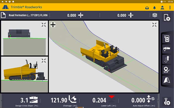
Screenshot: Trimble
The Trimble Roadworks 3D Paving Control Platform is an accurate, automatic 3D screen control system. It can improve paving productivity and rideability by directly referencing the design rather than a surface or stringline to minimize asphalt usage, reduce waste and overruns, enabling users to finish projects on time and under budget. The Android-based application runs on the 10-inch touchscreen Trimble TD520 display. Operators can personalize the interface to match their workflows, and configurable views make it easier to see the right perspective. The software uses components from Trimble Earthworks, and users can download third-party applications.
Trimble, trimble.com
RTK Receiver
Out-of-the-box features
Photo: Emlid
The Reach RS2 is a full-featured multi-band RTK receiver. All of its features are available out of the box, along with a survey app for iOS and Android. The Reach RS2 tracks L1/L2 bands on GPS, GLONASS and BeiDou, and L1/L5 on Galileo, and acquires a fixed solution in seconds. It achieves centimeter-level precision for surveying, mapping and navigation, and maintains robust performance even in challenging conditions. Centimeter accuracy can be achieved on distances up to 60 km in RTK and 100 km in PPK mode. It provides up to 22 hours of autonomous work when logging data and up to 16 hours as a 3G rover, even in cold weather.
Emlid, emlid.com
Total stations
Integrate with GNSS
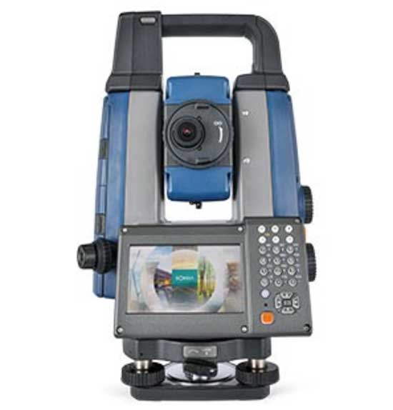
Photo: Sokkia
The iX-1200 and iX-600 robotic total stations are designed to be a part of a workflow solution for survey and layout in construction and infrastructure. They’re engineered for integration with field controllers, software and GNSS receivers. Users can switch to total station measurement integrated with GNSS through an optional upgrade. The stations also can be seamlessly integrated into BIM workflows.
Sokkia, sokkia.com
UAV
Thermal Payload
High-resolution gimbaled dual-thermal zoom
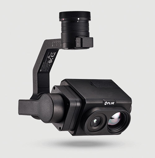
Photo: FLIR
The FLIR Vue TZ20 plug-and-play payload is fully integrated with the DJI V2 Matrice 200 and 300 series airframes. With 20X zoom capabilities, the FLIR Vue TZ20 provides drone pilots from the public safety and industrial inspection sectors with improved image detail and magnification to assess situations and make critical decisions. The 2x to 20x zoom provides a wide 95-degree field of view for maximum situational awareness, covering large areas in a single flight, or a narrow 18-degree field of view to put more pixels on target when needed. Factory calibrated, the dual 640 × 512 Boson thermal cameras are equipped with expandable infrared video streaming at 30 Hz.
FLIR, flir.com
Fixed-wing UAV
For surveyors, GIS professionals
Photo: SenseFly
The eBee Geo represents the first extension into a new eBee X series of fixed-wing UAVs and is positioned as a cost-effective option for surveyors and GIS professionals who may be unfamiliar with fixed-wing UAV mapping and data collection. With a maximum 45-minute flight time, the eBee Geo can achieve single-flight coverage of 160 ha at 122 m (395 A at 400 ft), suitable for smaller surveying firms and project-based drone service providers. Construction, urban planning and land management users can also benefit from the RGB imaging capabilities of the supplied senseFly S.O.D.A. camera fixed payload, while achieving greater efficiency and absolute accuracy down to 2.5 cm from the eBee Geo’s real-time kinematic (RTK) function. The eBee X is a premium version that offers users the high-precision of on-demand RTK/PPK for achieving absolute accuracy of down to 1.5 cm (0.6 in) without ground control points. Customers also have access to senseFly’s intuitive eMotion flight planning software.
SenseFly, sensefly.com
Actuator
With CAN and UAVCAN connectivity
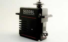
Photo: Hitec Commercial Solutions
The SG50BL actuator includes CAN 2.0 A/B or UAVCAN control options. It is designed with robust steel gears and a high-performance brushless motor. It is capable of operating at 18 to 32 volts. The actuator features a programmable digital circuit with a MOSFET amplifier; a BLDC motor; a magnetic encoder position sensor; five hardened steel gears with low gear backlash (less than .5°); a four ball-bearing supported output shaft; and nine needle bearing supported idlers. It has a rugged anodized aluminum alloy case and an IP68 waterproof rating. The SG50BL also is capable of 360° proportional rotation and has T4131012051-000 TE connectivity. Custom connector options are available.
Hitec Commercial Solutions, hitecnology.com
Smart antennas
Designed for tough environments
Photo: Trimble
The AX940 and AX940i high-precision GNSS smart antennas are designed for a range of high-precision applications, including UAVs. With multi-frequency, multi-constellation support for GPS, Galileo, GLONASS, BeiDou, QZSS and NavIC, the smart antennas can deliver reliable centimeter-level accuracy in a variety of environments. In addition, the Trimble AX940 and AX940i provide reliable, high-accuracy positioning without the constraints of a local base station or cell modem by using Trimble RTX correction services. Built-in inertial sensors on the AX940i allow a tight integration with GNSS observations in the RTK/RTX positioning and orientation engine, providing continuous high-rate low-latency output to guidance and control systems. The Trimble AX940 and AX940i provide flexible interfaces with high-speed data transfer and configuration; simplified integrations reduce development times; and an intuitive 3D graphical web page allows easy input of the lever arm for easier set up.