Tag: autonomous vehicles

  • UAVs active across all sectors

    UAVs active across all sectors

    Different platform configurations rapidly emerge

    Drones continue to move further into everyday life and activity as they become more involved in applications that touch almost everyone. Previously a curious novelty, now unmanned aircraft are almost commonplace.

    Real Estate. Suppose you are buying a new house. Almost all the exterior home pictures and video on real-estate websites come from dones. The high-definition photo capability of any commercially available drone is well up to providing great panoramic aerial shots — now virtually required to market homes.

    Suitable UAVs and their operators are either readily available, or real-estate agents are taking on the job, buying and flying the equipment and managing the video-processing software themselves. Approvals for regular real-estate operations using drones now can be more readily obtained The objective is near real-time approval using the U.S. FAA’s Low Altitude Authorization and Notification Capability (LAANC) system, with drone operations provided by an expanding list of independent UAS Service Supplier companies, cleared and qualified by the FAA to provide commercial drone operations.

    Crop Monitoring. In agriculture, it is virtually expected that a large farm operation will be on a crop monitoring/maintenance program that entails regular drone data-collection flights and automated processing of geo-tagged photographic, thermal and laser crop images. An initial baseline set of images establishes the starting point for the program, and then analysis identifies crop weaknesses. A fertilizer/treatment “prescription” is then drawn up to address deficiencies. After applications throughout the growing areas, follow-up drone monitoring checks whether growth rates have improved or if more remedial action is necessary.

    The cycle continues throughout the growing season. A number of large and small companies offer turnkey services to farmers, or farms themselves run subsets of this UAS-based operation.

    Chart: GPS World


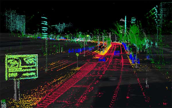
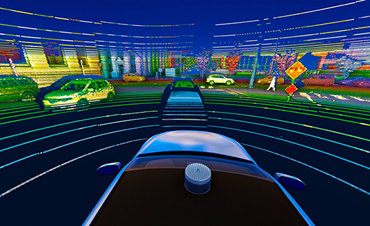
    Construction and Inspection. Mining and construction now also have drone services that gather and process image data to automate significant parts of the process, as does surveying and geospatial information services (GIS).

    Facility inspection using drones follows the agriculture model, with initial overflights establishing a baseline status record against which subsequent image data is compared.

    Indoor automation with drones also has enabled a huge reduction in time spent in frequent physical inspection of tanks, pressure vessels, holds and more. It also has greatly improved safety for inspection personnel who no longer have to crawl through extensive, potentially toxic environments, such as the containment vessels at Fukushima Daiichi.

    News and Events. News gathering has been enhanced by the use of drones. Aerial videos capture the news quickly and inexpensively compared to helicopters, and provide overview situational awareness for the news audience. In the same vein, we can add crowd surveillance at large events, where higher levels of security are required, such as the 2019 FIFA Women’s World Cup in Paris.

    Chart: GPS World
    Chart: GPS World

    Package Delivery. One classic drone application — package delivery — still hasn’t arrived fully, but many trials have been underway for several years, particularly for the delivery of medical supplies. It seems now that UPS is making a significant effort to qualify a UAS system that meets existing manned delivery standards (FAA Part 137 operations) by the end of this year. Wish them luck: there are many elements to prove and demonstrate for an unmanned delivery system, particularly in populated areas.

    Security and Defense. Extensive use of drones in local and national policing and security operations has become almost commonplace, too. Cost-effective and easy-to-fly UAV systems have begun to replace manned surveillance helicopters, with police forces discovering significant improvements in reaction speed and affordability.

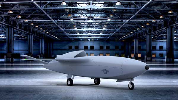
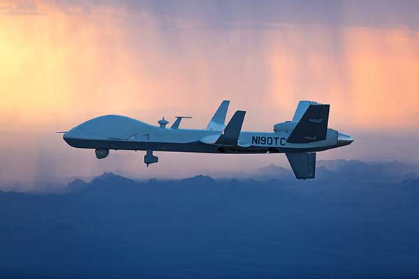
    And, of course, the use of drones by defense forces worldwide has expanded greatly. Most people can picture the familiar silhouette of the General Atomics Reaper as their image of what a military drone looks like. Many people might even now know where the Straight of Hormuz is located, following the world-wide reports of an apparent Iranian attack that brought down a Northrop Grumman RQ-4 Global Hawk, followed by the takedown of one or two Iranian drones by the USS Boxer in the same area. Drones would now seem to be predominantly associated by Joe Public with a level of military aerial presence — perhaps more so than in any civilian applications.

    New and different configurations of UAS continue to rapidly emerge for any and all applications in both the civil and military sectors. Now that we have operating regulations for small UAS in the U.S. and elsewhere around the world, cost-effective commercial uses abound and support new and existing tasks, and the military is rapidly creating new variations to assist or replace manned ground, navy and airborne forces. Large and small investments in artificial Intelligence for drone automation seem to be announced almost daily – so we can expect some independent drone capability to emerge over time.

    There is only much, much more to come.


    TONY MURFIN is a GNSS aerospace consultant with several decades experience at leading companies in the GPS/aviation and OEM sectors.

  • Lidar USA sponsors first UAS Rodeo hosted by GEOHuntsville

    Lidar USA sponsors first UAS Rodeo hosted by GEOHuntsville


    Logo: UAS Rodeo

    Lidar USA has become the Titanium sponsor for the first UAS Rodeo, hosted by GEOHuntsville out of Hunstville, Alabama.

    Operating since 1999, Lidar USA offers unmanned aerial vehicle (UAV) and mobile mapping systems for scanning, imaging and navigation.

    Its products will be on display at the UAS Rodeo, which is designed to give Part 107 UAS pilots involved in public safety activities a full-scale training, skill-building and competitive environment to share knowledge in UAS operations.

    The company said that integrating its mobile mapping solutions with the rapidly growing UAV industry has been pivotal to its success to adapt to a customer’s needs. UAS Rodeo will provide Lidar USA an avenue to show the UAS community its cutting-edge technology.

    The UAS Rodeo takes place Oct. 9-10 in Huntsville at the Public Safety Training Academy, 6001 Cecil Fain Drive NW.

  • Septentrio, Artisense demo localization tech for autonomous vehicles

    Septentrio, Artisense demo localization tech for autonomous vehicles

    High-precision GPS, INS and computer vision come together in a single package called VINS to be demonstrated at the Auto.ai show in Berlin on Sept. 25-27.

    Septentrio high-performance GPS/GNSS technology provides reliable absolute positioning inside this innovative computer vision localization system developed by Artisense, a company specializing in vehicle localization and 3D mapping solutions.

    Septentrio, a manufacturer of high-accuracy GPS/GNSS technology for demanding applications, is providing positioning technology to Artisense, a supplier of computer vision solutions for automated vehicles.

    Artisense incorporates Septentrio GPS/GNSS in their latest visual inertial navigation system (VINS), which will be demonstrated live at Auto.ai show in Berlin, Germany, on Sept. 25-27.

    VINS combines computer vision, inertial sensors and GNSS (Global Navigation Satellite System) measurements to deliver highly accurate global 3D positioning and orientation information in any environment, even indoors.

    “We are very pleased to work with Artisense on this technology and demonstrate how vehicle localization systems benefit from fusing computer vision with high-precision GNSS,” said Jan Van Hees, business development director at Septentrio. “The result of our cooperation is precise localization in any environment offering positioning reliability and redundancy needed for safety-critical applications such as autonomous vehicles or robotics.”

    Multi-constellation, multi-frequency GNSS technology provides reliable centimeter-level global positioning to the VINS system with accuracy required for lane-level maneuvering and V2V warning systems.

    Cameras and inertial sensors continue accurate localization as the vehicle moves into tunnels or parking garages with no line-of-sight to GNSS satellites.

    Although the system uses a relatively simple MEMs IMU and off-the-shelf cameras, it delivers precision and reliability of a high-end INS system. “Positioning accuracy and reliability are very important to us. Earlier this year we have deployed a large-scale mapping operation in Berlin where we tested a lot of different GNSS receivers. We saw the best results coming from Septentrio consistently,” said Johannes Start, Technical Product Manager at Artisense. “We continue to use Septentrio receivers because they are precise, they acquire RTK (real-time kinematic) fix quickly and reliably and they are easy to integrate.”

    The live demo at Auto.ai will offer a ride around Berlin in a car featuring VINS technology. One screen inside the car will continuously display the car’s location. Unlike the GPS of an average infotainment system, VINS will continue accurate localization anywhere, even in tunnels or in parking garages. The second screen inside the car will feature a real-time 3D point-cloud reconstruction of the car’s surroundings.

  • Defense in front of UAV development

    Defense in front of UAV development

    The MQ-9B SkyGuardian will participate in NASA-sponsored flight tests in 2020. (Photo: General Atomics Aeronautical Systems)
    The MQ-9B SkyGuardian will participate in NASA-sponsored flight tests in 2020. (Photo: General Atomics Aeronautical Systems)

    The defense segment is going from strength to strength — despite a phase not too long ago when defense spending appeared to be dropping. Widespread drone use received a boost with specialized equipment developed for defense forces applications.

    The Predator Advances

    The General Atomics Predator has gone from a long-distance loiter-and-observe UAV to frontline precision-strike capability, and has been adopted by many military forces around the world.

    From first flights in 1994 to initial production in 1997, the Predator has now evolved into many configurations equipped with piston engine, turboprop and jet; line-of-sight radio and satellite command and control; synthetic aperture radar and multi-spectral targeting system; video, TV and thermographic cameras; and laser designators and other payloads.

    From pure reconnaissance to various strike and attack configurations, the names have also changed. Predator, Reaper, Gray Eagle, Avenger, Protector, Guardian and SkyGuardian have a host of RQ/MQ designations. For instance, In the RQ-4 Global Hawk name, the “R” means reconnaissance, the “Q” means unmanned aircraft, and the “4” is the series.

    The SkyGuardian version of the Predator is a certifiable variant anticipated to ultimately become fully authorized for controlled airspace. It will take part in the NASA Systems Integration and Operationalization (SOI) demonstration program in mid-2020, which will highlight commercial UAS missions using larger drones in the national airspace.

    The Predator family has now been evolving for more than 25 years. Unfortunately, the popularity of the Predator family of military unmanned aircraft has led to recent headline news about Predators shot down in the Gulf of Hormuz, or crashed in Afghanistan — such is the price of success!

    Global Hawk Gathers Intel

    The Northrop Grumman Global Hawk has become a U.S. mainline, high-altitude intelligence gathering asset, deployed by both the U.S. Air Force (RQ-4 Global Hawk) and Navy (MQ-4C Triton). Other friendly nations have also shown various levels of interest in acquiring variants, including Germany, Australia, Canada, Japan and South Korea.

    Northrop Grumman has reintroduced the Firebird as a contender in the airborne intelligence, surveillance and reconnaissance (ISR) field. The Firebird can be configured as unmanned (ground control), autonomous or piloted, and has payload flexibility through open architecture, plug-and-play integration.

    The North Dakota UAS test range facility at Grand Sky has initiated procurement of two Firebird UAVs, which they intend to supply to their customers for mapping, inspection and monitoring applications using their extensive, long-range BVLOS capabilities.

    Skyborg Equipped with AI

    And then there’s this U.S. Air Force Skyborg program, which aims to drag the most possible out of artificial intelligence (AI) and automation in an airborne fighter support roll. Kratos has flown the drone hardware a couple of times – the XQ-58A Valkyrie is a “low-cost” unmanned aircraft designed to fly alongside front-line attack aircraft like the F-35 and F-18.

    The Air Force Research Laboratory (AFRL) is researching the technology, new sensors, payloads and networking capability these drones will be outfitted with to fly alongside manned fighter jets.

    A whole slew of other extremely capable drones are already being operated by the U.S. Army and Navy in a variety of support roles.

    Anti-Drone Detection and Prevention

    On the flip side, an entirely new related industry segment has come about in the last several years, usually adapting existing radar, sound, infrared or other ground detection systems.

    This segment is aimed at circumventing unwelcome drone encroachment over sensitive facilities. Airports, governments, prisons, and energy and water utilities are among the facilities who want to prevent unwanted drones penetrating their airspace.

    Solutions may be portable and short range, or ground-based and longer range, with the capability to take down an invading drone or detect where it came from and provide significant warning time.

    One solution uses an attack drone that ensnares an intruder-drone in a net and brings it the defender’s location to support second-level investigations. Whatever the solution, drone defense is a growing field.

  • U-blox GNSS modules help UAVs carry out life-saving work

    The u-blox ZED-F9P, a high-precision GNSS module that delivers centimeter-level accuracy within seconds, has been incorporated into the latest electric Tron F90+ fixed-wing unmanned aerial vehicles (UAVs).

    Quantum-Systems, a German company that specializes in electric VTOL (vertical take-off and landing) aircraft for civilian use, manufactures the Tron F90+, which is employed in mission-critical logistical activities such transporting emergency blood reserves to remote locations. Other uses include mining and agriculture-related tasks.


    Quantum-Systems and u-blox are both exhibiting at Intergeo in Stuttgart, Germany, Sept. 17-20. Quantum-Systems is at booth K1.074, and u-blox at booth L1.025.


    The Tron F90+ has a 3.5-meter wingspan and can travel at speeds of up to 160 km/hour with a 100-km flight range. It is the latest addition to the Quantum-Systems eVTOL UAV platform designed for cargo, inspection, survey and mapping, and reconnaissance in adverse conditions. Other models include the Trinity F9, Scorpion and Vector UAVs, all of which feature u-blox F9 high-precision GNSS technology.

    In developing the Tron F90+ UAV, the Quantum-Systems engineering team needed accurate enough position data to ensure that VTOL operations would always go smoothly, and the valuable payloads were protected from damage.

    Through the multi-band real-time kinematic (RTK) and raw code and carrier-phase data available to the ZED-F9P, the necessary positioning correction is assured and the pilot can complete even difficult maneuvers. Absolute position accuracy can be brought down to 3-5 centimeters.

  • Flirtey ready for drone deliveries to U.S. homes

    Flirtey, a pioneer of the commercial drone delivery, has unveiled the Flirtey Eagle, along with a video of the next-generation delivery drone performing consumer and automated external defibrillator (AED) deliveries to homes.

    Flirtey’s system is designed to safely get packages to customers with the delivery goal of less than 10 minutes using drones.

    Along with the Flirtey Eagle, the aircraft designer and manufacturer unveiled the Flirtey Portal, a sophisticated takeoff and landing platform that enables scalable store-to-door operations. Also part of the system is an autonomous software platform that enables drones to deliver safely to American homes.

    Flirtey said it is on course to conduct drone deliveries to U.S. homes as early as 2019.

    Here are highlights of the UAV’s technology.

    • Flirtey’s aircraft is designed to operate in 95% of wind and weather conditions, making it highly reliable for flight.
    • The Flirtey Eagle is designed to fit 75% of packages that get delivered to its customers’ homes during last-mile deliveries.
    • The Flirtey Eagle safely and precisely delivers its contents by lowering a tether, while the drone is suspended in air, and once the package is delivered, it then retracts the tether.
    • Flirtey’s aircraft is controlled by its autonomous software platform, which has received Federal Aviation Administration (FAA) approval for the first multi-drone delivery operation in the United States, enabling a single remote pilot to simultaneously oversee ten Flirtey drones.
    • Flirtey’s Portal is a sophisticated takeoff and landing platform that fits into one parking space, making its infrastructure easily scalable to the company’s partners for store-to-door delivery.

    Flirtey’s drone delivery technology has been developed from the ground up, originating from NASA’s drone program. Flirtey Founder and CEO Matthew Sweeny has brought together a team of aviation industry veterans from NASA, Raytheon, Lockheed Martin, and SpaceX, as well as military veterans from the army, navy, and air force.

    “We expect Flirtey’s advanced drone delivery system will become the industry standard in America,” said Matthew Sweeny, Flirtey founder and CEO. “Flirtey’s latest technology makes life-saving and commercial drone delivery to homes in the United States an imminent reality.”

    The Flirtey Eagle builds upon the advanced technologies developed for Flirtey’s previous generation aircraft that conducted the first Federal Aviation Administration (FAA)-approved drone delivery in the United States, which is going on display alongside the Wright Flyer in the Smithsonian National Air and Space Museum in Washington, D.C. Flirtey’s goal is to not only meet, but to surpass the rigorous safety standards of the FAA. Flirtey’s regulatory approvals include:

    • Approval to conduct multi-drone delivery operations, enabling a single remote pilot to simultaneously oversee 10 Flirtey drones
    • Approval to conduct drone delivery flights beyond visual line of sight (BVLOS), enabling Flirtey to conduct drone delivery operations with a pilot controlling the flights from a remote location
    • Approval to conduct drone delivery flights at night, making drone delivery accessible at any time

    Flirtey and the City of Reno were chosen for the FAA and Department of Transportation’s Unmanned Aircraft System (UAS) Integration Pilot Program (IPP). Within the IPP, Flirtey and the City of Reno have partnered with REMSA, local emergency medical services provider, to deliver AEDs to those in need. Flirtey’s AED delivery technology has the potential to save 150,000 lives per year, the company said.

    Based on demand from customers, Flirtey expects demand initially to outstrip supply. Flirtey’s drone delivery system was designed from the outset to meet the anticipated high demand.


  • Autonomous vehicles can reduce road fatalities

    Autonomous vehicles can reduce road fatalities

    Mothers Against Drunk Driving (MADD) has partnered with Velodyne Lidar, a provider of real-time 3D perception systems for a range of commercial applications, including autonomous vehicles. The initiative includes a website on the safety benefits of autonomous vehicle technology (see velodynelidar.com/madd-partnership.html) and an October conference on autonomous safety.

    “We have learned that technology is essential to getting us to our goal of zero deaths caused by drunk driving,” said MADD President Helen Witty. “Autonomous vehicle technology holds the incredible promise of helping us eliminate drunk driving.”


    World Safety Summit on Autonomous Technology
    Levi’s Stadium in Santa Clara, California | October 2, 2019

    The summit is designed to advance understanding of the safety benefits that can be achieved with autonomous vehicle technology. It is designed for business, government, public safety and community leaders. Attendees will have the opportunity to ride in autonomous vehicles.


    Marta Hall, Velodyne Lidar’s president and chief business development officer, added, “Our goal is to design, develop and mass-produce lower cost lidar sold for every model of car and truck.”

    The two organizations partnered in 2018 to create the website with information on how autonomous vehicles can help prevent roadway collisions. The site explains the basics of autonomous driving in easy-to-understand language for all audiences. Content modules include “Lidar 101,” explaining how lidar sensor technology is an essential component of self-driving vehicles.

    A 3D lidar sensor such as the Velodyne Alpha Puck can deliver information to help enable vehicle autonomy and advanced driver-assistance systems. (Image: Velodyne)
    A 3D lidar sensor such as the Velodyne Alpha Puck can deliver information to help enable vehicle autonomy and advanced driver-assistance systems. (Image: Velodyne)

    “The promise of safe, self-driving cars is very exciting, particularly for those of us who have seen the devastation that impaired driving and human error can bring,” said former MADD President Colleen Sheehey-Church.

    Puck Sensor.
    The Velodyne Alpha Puck is a lidar sensor specifically made for autonomous driving and advanced vehicle safety at highway speeds. In a session at July’s Automated Vehicle Symposium, company speakers presented “High-Definition 3D Lidars: An Integral Part of Future Autonomous Driving,” including use cases that have proven elusive for solutions based on camera and radar; and “State of Solid-State 3D Lidar,” a technical presentation on application-specific integrated circuits (ASICs).

    “Core lidar electronics are moving from a printed circuit board to an ASIC, which provides advantages such as higher density, lower cost and improved reliability,” said UAV and Robotics Business Manager Frank Bertini. “The trend roughly follows Moore’s Law, leading to dramatic decreases in size, weight and cost over relatively short time periods.”

  • Arm to offer Swift Navigation positioning for autonomous vehicles

    Arm to offer Swift Navigation positioning for autonomous vehicles

    The Swift/Arm partnership means Arm will offer Swift Navigation’s high-integrity, high-accuracy GNSS positioning solutions as an option on Arm-based platforms to developers of autonomous and connected vehicles. (Image: Swift Navigation)
    The Swift/Arm partnership means Arm will offer Swift Navigation’s high-integrity, high-accuracy GNSS positioning solutions as an option on Arm-based platforms to developers of autonomous and connected vehicles. (Image: Swift Navigation)

    Swift Navigation is partnering with Arm, a global leader in semiconductor IP.

    The partnership means Arm will offer Swift Navigation’s high-integrity, high-accuracy GNSS positioning solutions as an option on Arm-based platforms to developers of autonomous and connected vehicles.

    Swift Navigation is a San Francisco-based tech firm redefining GNSS positioning technology for autonomous vehicles.

    Standard GNSS positioning is three to five meters in depth which is not suitable for safety-critical systems requiring lane-level accuracy. For higher levels of autonomous capability, a vehicle needs to be able to determine its absolute location. To achieve this, high-precision localization is needed to get to accuracy down to the centimeter.

    Swift’s partnership with Arm will deliver a high-integrity, high-accuracy GNSS positioning solution for silicon makers and Tier 1 and 2 auto suppliers to integrate precise positioning into the sensor suite.

    Swift Navigation’s Starling is a GNSS positioning engine designed for just such automotive and autonomous vehicle applications. Starling’s software enhances the measurements for commercially available GNSS receivers to provide true precision and integrity capabilities. Starling is receiver-agnostic, so it is ideal for Arm customers as it works with a variety of automotive grade chipsets and inertial sensors.

    Swift’s partnership with Arm will deliver a high-integrity, high-accuracy GNSS positioning solution for silicon makers and Tier 1 and 2 auto suppliers to integrate precise positioning into the sensor suite. (Image: Swift Navigation)
    Swift’s partnership with Arm will deliver a high-integrity, high-accuracy GNSS positioning solution for silicon makers and Tier 1 and 2 auto suppliers to integrate precise positioning into the sensor suite. (Image: Swift Navigation)

    Swift and Arm are working together to provide developers of autonomous and connected vehicles a cost-effective, scalable and high-integrity positioning solution. Starling is designed to be compatible with industry leading silicon makers who build their solutions on Arm.

    Starling works with a variety of GNSS measurements engines and is a hardware proven, end-to-end solution, tunable for the specific requirements of a customer’s platform. This partnership elevates the capabilities of the connected car and simplifies the integration of high-precision GNSS into Tier 1 and 2, Silicon and Platform and Automotive OEM vendors.

    “We are pleased to join the ecosystem of Arm technology partners to deliver precise positioning solutions to its automotive and autonomous vehicle customers,” said Timothy Harris, chief executive officer of Swift Navigation. “This partnership opens up a broader audience of customers who can benefit from Swift’s positioning technology and builds on our mission to enable a future of autonomous vehicles.”

    “As we strive toward an autonomous future, the requirements of the automotive market are changing, and a more solution-based approach is needed,” said Dipti Vachani, senior vice president and general Manager, automotive and IoT line of business, Arm. “The combination of Arm IP uniquely designed for automotive and Swift’s GNSS solution gives our partners another key component on the road to the effective deployment of autonomous vehicles at scale.”

    Available for purchase today for Arm-based processors, the Starling positioning engine provides a rapid deployment, low total cost of ownership solution to enable widespread adoption of ADAS, connected car, C-V2X and autonomous solutions.

    Interested parties should visit this website to get more information on using the Starling positioning engine on Arm-based devices.

    The joint solution will be also be showcased at the IAA New Mobility World 2019 event from Sept. 10-15 at the Arm booth, Hall 5.0, stand A10, Frankfurt Messegelände.

  • Septentrio unveils GNSS/INS receiver for drones

    Septentrio unveils GNSS/INS receiver for drones

    Septentrio has introduced a GNSS/INS receiver designed specifically for unmanned aerial vehicles (UAVs). The AsteRx-i S UAS combines GNSS technology with industrial-grade inertial sensor to provide high-accuracy, reliable positioning and 3D orientation (heading, roll, pitch) to aerial drones and other compact robotic systems.

    Septentrio’s introduction of AsteRx-i S UAS builds on top of the success of the company’s existing UAV products, AsteRx m2 and m2a UAS. Its optimized SWaP (size, weight and power) increases UAV battery life resulting in longer flight times and improved productivity.


    Septentrio will showcase the new AsteRx-i S at

    • ION GNSS+, Sept. 16-20, Miami, Florida, U.S.
    • Intergeo, Hall 1, Booth D1.040, Sept. 17-19, Stuttgart, Germany

    Photo: Allison Barwacz
    Photo: Allison Barwacz

    This credit-card-sized receiver is designed for easy integration into any UAS (unmanned aerial system) and is compatible with popular autopilots such as Pixhawk and ArduPilot. It is a single-package GNSS/INS product, with an on-board IMU (inertial measurement unit) and standard connectors, allowing flexibility of sensor choice.

    “Quick receiver integration makes the lives of our customers easier. It also speeds up their system’s time-to-market,” said Danilo Sabbatini, Product Manager at Septentrio. “Our goal was to combine a high-performance product with a simple and flexible plug-and-play integration design, suitable for any aerial system.”

    Septentrio reliable centimeter-level positioning is based on multi-frequency, multi-constellation GNSS technology (GPS, GLONASS, Galileo, BeiDou, QZSS). AsteRx-i S UAS combines a GNSS receiver with a high-quality IMU to deliver reliable positioning together with 3D orientation.


    Septentrio’s unique GNSS — IMU integration algorithm provides continuous positioning during short GNSS outages (coasting) which can happen in flight near high structures, under bridges or during banking turns.

    AsteRx-i S UAS comes with built-in industry leading Advanced Interference Mitigation (AIM+) technology. In aerial drones, where lots of electronics are crammed into a small space, neighboring devices can emit electromagnetic radiation which interferes with GPS and GNSS signals.

    AIM+ offers protection against such interference resulting in faster set-up times and robust continuous operation. A built-in power spectrum plot allows users to analyze interference, helping locate its source and mitigating it.

  • GMV to develop autonomous vehicle positioning for BMW

    GMV to develop autonomous vehicle positioning for BMW

    GMV has been awarded a contract for development of a precise GNSS positioning system with integrity for the new generation of autonomous vehicles of the German carmaker BMW Group.

    The Spanish multi-national’s technology solution is going to be developed for the first time in BMW Group’s autonomous vehicles. GMV’s positioning software calculates the vehicle’s position and other magnitudes, using advanced GMV-developed algorithms, including components that have already been patented. These algorithms have been especially modified and adapted to meet BMW Group’s performance and safety requirements.

    Photo: BMW Group
    Photo: BMW Group

    The developed software will abide by the most demanding automotive standards and the highest quality levels of safety-critical software, GMV said.

    Another key component provided by GMV is a GNSS correction service to be run in a secure infrastructure using data from a global network of monitoring stations to be set up by GMV under this contract.

    This new project cements GMV’s position as a supplier of GNSS-based autonomous-car positioning solutions, the company said.

    “GMV has been investing for many years in the key GNSS technologies that are essential for autonomous driving systems,” said Miguel Ángel Martínez Olagüe, GMV’s general manager of Intelligent Transportation Systems. “For our company this contract represents a unique opportunity to capitalize on all that effort, providing a product of outstanding performance for the automotive industry.”

  • Skyfront drone performs first BVLOS flight under FAA Part 107

    Skyfront’s Perimeter 4 long-range hybrid gas-electric drone this summer successfully performed the first civilian beyond-visual-line-of-sight (BVLOS) flight without visual observers under the FAA’s Part 107 rules.

    The flight serves as a significant step toward the safe integration of unmanned aerial vehicles into the national airspace, according to the company.

    During the round-trip flight, the Perimeter UAV flew over mountainous, rugged terrain along a four-mile stretch of the Trans-Alaska pipeline. The UAV maintained a constant above-ground altitude of 400 feet with multiple ascents and descents of 1,000 feet on 45-degree slopes. Radio-based telemetry, command and control of the vehicle was uninterrupted during the flight.

    FAA representatives observed all aspects of the mission, including planning, system setup and ground-station operation. The Perimeter “did [the flight] safely, effectively and efficiently. It accomplished a beyond-visual-line-of-sight mission, and it was approved by the FAA,” said Robert Huber, program manager for the Integration Pilot Program (IPP) of the FAA.

    “Today’s flight was a milestone in the unmanned community,” said Troy Mestler, CEO of Skyfront. “We at Skyfront are excited to be pushing the limits of unmanned aerial vehicles here in the United States.”

    The Perimeter UAV was integrated with Iris Automation’s Casia collision avoidance system and was observed by Echodyne’s ground-based detect and avoid systems.

    The University of Alaska Fairbanks and the Alaska Center for Unmanned Aircraft Systems Integration purchased the UAV and organized the flight over the pipeline, with the approval of the Alyeska Pipeline Service Company.

  • Terra Drone expands to Australia with investment in C4D Intel

    Japan-based Terra Drone’s newest branch, Terra Drone Australia, will focus on the mining, oil and gas, power and forestry sectors.

    Terra Drone Corporation, an industrial drone services provider headquartered in Tokyo, has finalized its expansion into the Australian market after completing an equity investment in Australian firm C4D Intel Pty Ltd. As part of the deal, C4D Intel will immediately rebrand to Terra Drone Australia.

    The move by Terra Drone is the latest of the company’s investments into drone technology businesses across the globe and demonstrates the Japanese company’s commitment to the Australian market. The terms of the transaction were not disclosed.

    Founded in 2016, C4D Intel provides surveying, inspection and 3D modeling services to a diverse client base across mining, oil and gas, power and forestry industries in Western Australia.

    The company specializes in large-scale unmanned aerial surveys, confined space infrastructure inspections, high-altitude inspections, bridge and pipeline inspections, and asset 3D modeling.

    As Terra Drone Australia, the company will be able to leverage the additional growth capital to expand its service offering to include unmanned airborne lidar, bring innovative Terra Group technologies to Australia, and expand its operations to the East coast of Australia, Terra Drone stated in a press release.

    The Australian drone service provider’s existing clients include mining companies Rio Tinto and Fortescue Metals Group, and large utilities such as ATCO Gas Australia and Synergy.

    “We are delighted to join the No.1 industrial drone services company in the world, Terra Drone. When the world’s fastest-growing drone business chooses to expand to Australia, and selects our business to invest in, it speaks volumes about the opportunities available here and the vision we have for the company,” C4D Intel Operations Manager Will Wishart said.

    “There are many advantages of being a part of a global organization and this next phase of growth makes for very exciting times. We have already leveraged Terra Drone’s international network to bring new technology to Australia and look forward to accelerating this as we expand our operations across the Australian continent.”

    Terra Drone Corporation CEO Toru Tokushige added, “The establishment of Terra Drone Australia is another milestone for our international expansion strategy. Australia bears a strategic significance in our growth plans. Having a local presence in the region allows us to be close to our customers and strengthen our support to them.”

    Later this month, Terra Drone Australia will bring innovative drone technology from The Netherlands to Australia for proof-of-concept trials for global mining company Rio Tinto. The Terra UT Drone from Terra Inspectioneering will allow Terra Drone Australia to offer ultrasonic thickness testing of steel in hard to reach places, such as bin walls which are subject to wear.