Tag: autonomous vehicles

  • UAvionix offers free receivers for Hurricane Dorian recovery efforts

    UAvionix is offering free pingRX unmanned aircraft system (UAS) ADS-B receivers to first responders and UAS service organizations participating in rescue and recovery efforts associated with Hurricane Dorian.

    Hurricane Dorian is expected to travel along the Eastern coast of the U.S. northward at a slow pace, creating extensive damage from winds and flooding.

    UAvionix is a designer and manufacturer of communications, navigation and surveillance (CNS) equipment for unmanned and manned aircraft.

    The pingRX. (Photo: uAvionix)
    The pingRX. (Photo: uAvionix)

    PingRX is a dual-frequency ADS-B receiver designed for use onboard a UAS. Retailing for $249 and weighing 5 grams, pingRX can provide the operator with a digital view of ADS-B-equipped aircraft in the airspace up to hundreds of miles away.

    When integrated with a compatible autopilot — such as ARDUPILOT, Pixhawk, PX4 or the Cube — local ADS-B traffic is displayed on the ground control station (GCS) display.

    Image: National Weather Service
    Image: National Weather Service

    The FAA’s mandate for ADS-B OUT equipage on manned aircraft has a deadline of Jan. 1, 2020, so equipage levels are currently high. Users are cautioned, however, that equipage is not at 100%, so reliance on ADS-B as a sole means of detect and avoid (DAA) is not advised.

    In 2017, in response to Hurricane Harvey’s landfall in Houston, Texas, UAS were used extensively for the first time in recovery and rescue efforts. The use of UAS has continued to grow in response to hurricane efforts ever since.

    Photo:
    Photos: NOAA

    “Over the past few years, the use of drones in hurricane and natural disaster recovery efforts has increased significantly due to the value of the real-time data collected in combination with ease of deployment,” said Christian Ramsey, uAvionix president. “First responders and recovery crews will undoubtedly work tirelessly for weeks in response to Dorian. We hope to make these efforts just a bit safer and encourage good airspace safety practices with the use of the pingRX systems.”

    The FAA has published guidance for UAS operators, urging strict adherence to Notices to Airmen (NOTAMS) and Temporary Flight Restrictions (TFR). The airspace in these areas can be crowded and unpredictable.

    First responders and UAS service organizations are encouraged to contact uAvionix at [email protected] for details on the offer.

    Grand Bahama Island before Hurricane Dorian. (Photo: ICEYE)
    Grand Bahama Island before Hurricane Dorian. (Photo: Google)
  • Altitude Angel demonstrates UAV traffic management in Europe

    Safely integrating autonomous drones into global airspace is the goal of Altitude Angel.

    The company has completed its involvement in the Gulf of Finland (GOF) U-Space project, declaring the trials to have been a “huge success” and an “amazing showcase” of its unmanned traffic management (UTM) technologies.

    The GOF U-space demonstrations are funded by the SESAR Joint Undertaking for European sky air traffic management research.

    In July and August, advanced drone operational demonstrations took place across Estonia and Finland, showcasing use cases that involved both manned and unmanned aircraft in shared airspace. The demonstrations relied on systems such as Altitude Angel’s GuardianUTM O/S to remain safe.

    GuardianUTM, the company’s core system, is already helping drones operate in controlled airspace. It powers the UK’s national UTM system, operated by NATS, the UK’s main air navigation service provider.

    Altitude Angel was a key UTM partner for the trials, providing services that included integration to the FIMS (flight information management system) for the transport of flight plans, telemetry/position reports, AIM (geofencing/volume reservations), as well as alerts and registration data to-and-from the drone operators and manned aviation which were involved in the trials.

    Altitude Angel was able to demonstrate its UTM platform across a number of scenarios that varied in scope and range, and included:

    • urban drone fleet operations with police intervention,
    • long-distance multisensory inspection flights over forests,
    • urban drone operations in controlled airspace,
    • powerline inspection in rural areas, maritime search and rescue, and
    • international parcel delivery.

    The demonstration series concluded with an urban Volocopter air taxi flight around Vantaa International Airport, Helsinki.

    “We’ve been working with the SESAR team for over a year on this project. It’s been a great few months in Finland and Estonia supporting the live demonstrations which have been huge success and an amazing showcase of our world-leading UTM technologies,” said Simon Wynn-Mackenzie, Altitude Angel’s head of products.

    “Not only did the scenarios give us another opportunity to demonstrate our production UTM platform in another real-life environment, they went a long way to showing the public how drones can be used in a positive and socially beneficial way on a daily basis,” Wynn-Mackenzie said.

    “Our only disappointment was that we were not able to demonstrate our world-first Conflict Resolution Service which we unveiled in July, as the trial scenarios had already been agreed. However, we’ll be looking to showcase our constantly evolving platform and several new services very soon,” he said.

    Other UTM demonstrations. In November 2018, Altitude Angel led the team behind Operation Zenith, which gave a view of the future of air traffic management and drone integration into busy, complex airspace, demonstrating how by using the right technology, it’s possible to safely integrate unmanned traffic into controlled airspace and open the skies to commercial airspace worldwide.

    Altitude Angel’s developer platform is open and available to all.

    The U-space initiative. The GOF U-space project, with a broad consortium of 19 members, demonstrates Europe is on course with its implementation of U-space, an initiative that aims to ensure safe and secure drone traffic management, taking into account the rapid growth in the use of drones.

    The GOF concept enables shared situational awareness for all aviation stakeholders. The success of the project is based on deep air traffic management experience of all consortium members, including three world-leading UTM technology vendors and two air navigation services providers, developing interoperability and data-sharing solutions that are aligned with SESAR’s overall U-space architecture.

    The U-Space project has received funding from the SESAR Joint Undertaking under the European Union’s Connection Europe Facility (CEF) programme under grant agreement SJU/LC/343-CTR.

  • Lidar USA partners with Teledyne Optech on UAV sensor integration

    Lidar USA partners with Teledyne Optech on UAV sensor integration

    Photo: Teledyne
    Photo: Teledyne

    Teledyne Optech’s new compact lidar sensor, the CL-90, is available for purchase through its first integration partnership with Lidar USA.

    For more than 20 years, Lidar USA has been building UAV sensor systems and has sold thousands of systems worldwide. Its ability to support numerous industries with cutting-edge integration makes them an ideal partner for Teledyne Optech’s compact lidar sensors, Teledyne stated in a press release.

    Lidar USA’s products are used for surveying-related tasks ranging from topography work, to highways and land development. They are also used for agricultural work for forestry and plant growth, and have applications in archeology as well.


    Teledyne Optech’s CL-90 sensor features exceptional canopy penetration for excellent ground coverage, higher downward point density for superior results in corridor/power line projects, long-range performance for maximum productivity at UAS ceilings and best-in-class data precision for tight-tolerance applications, the company said.

    “Our customers face many challenging projects and they need tools that can deliver,” said Lidar USA CEO Jeff Fagerman. “Whether it’s greater range, more accuracy or better penetration of vegetation, using the new Optech CL-90 gives us the means of providing the tool to get the job done.”

    Teledyne Optech Executive Vice President and General Manager Michel Stanier believes the partnership will help expand both companies’ global presence.

    “Teledyne Optech is pleased to partner with Lidar USA to bring our compact lidar sensors to market,” Stanier said. “Lidar USA is a premier UAV solution provider. As a result, we are confident that their integration expertise and strong global market presence will provide the ideal platform to deploy the CL-90’s rich, unique feature set into the UAV marketplace.”

    Lidar USA will be at Intergeo this year and can be found at ICS Foyer Stand 2 featuring a fully integrated CL-90 solution. Teledyne Optech will be featuring some of its new Compact Lidar suite of products this year at Intergeo Booth B3. 042 from September 17-19 in Stuttgart, Germany.

  • UAV update: MIL-SPEC drones lost, but progress for pseudo-satellites

    Some ups and downs for unmanned aircraft this month — good news that there is further progress on the pseudo-satellite front, but we also have MIL-SPEC drones lost to shoot-downs and recent crash landings. Amazon continues to advance toward deliveries really soon after orders, and another police department takes up drone use for aerial observation.

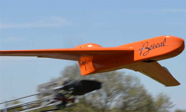
    High-Altitude Pseudo-Satellite UAS

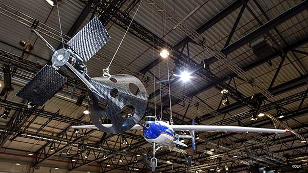
    HAPSMobile (Softbank 95% and AeroVironment 5% JV) is funding further development and testing of the Hawk30 family of high-altitude pseudo-satellite (HAPS) solar-powered unmanned aircraft, with the expectation of long-duration flights above 65,000 feet — “a super cell-tower up in the stratosphere…providing connectivity for everybody that needs it,” according to AeroVironment President and CEO Wahid Nawabi.

    HAPSMobile is collaborating with the Pan-Pacific UAS Test Range Complex (PPUTRC), which is managed by the University of Alaska (UA) Fairbanks, and with the University of Hawaii (UH) to conduct stratospheric test flights using the HAWK30 prototype HAPS vehicle. On behalf of this group, UA was recently granted a Certificate of Authorization by the U.S. Federal Aviation Administration (FAA) to fly HAWK30 as a stratospheric telecommunications platform system over the Hawaiian island of Lanai.

    The HAPSMobile team will prep test flights at Lanai during 2019, conducting safety verifications and working with island authorities to comply with local regulations. During the program, HAPSMobile will also explore contributions to environmental conservation and to agriculture. Hawaii — not a bad place to run test flights, you might say…

    Predator UAV downed

    Following the shooting down of a U.S. Global Hawk (really expensive) and one or two Iranian drones (not very expensive) in the Gulf of Hormuz, U.S. forces on Aug. 13 just crash-landed an MQ-1C Grey Eagle (Predator UAV family) southwest of Baghdad on farmland in the town of Radwaniyah. The following pictures were released by a local news group:

    The aircraft doesn’t appear to be too badly damaged, and seems to have been deliberately brought to rest in soft undergrowth on the edge of a field. So crash-landing might be an overstatement — rather an unplanned landing, perhaps? Then again, the landing gear appears to be significantly bent out of shape, so the U.S. Army 52178 drone’s contact with the ground might have been heavier than normal.

    The news source indicated that the drone might have been brought down by “electronic interference or have been intercepted by a cyber-attack.” perhaps references to potential jamming of some kind? Nevertheless, the aircraft landed safely and was then recovered by Iraqi Security Forces. There were no injuries or damage to property.

    The U.S. Army MQ-1C Gray Eagle provides both combat and intelligence forces with a long-endurance, armed, unmanned aircraft system (UAS) with significant range, altitude and payload flexibility.

    And another report hit the internet today that back in June, a £6 million U.K. Watchkeeper WK050 drone on a training flight met a somewhat messy end after overshooting its landing and coming to rest in a tree. But the report also mentions that there was some indication of possible operator error.

    Amazon Drone Deliveries?

    Fresh on the heels of Fed Ex deciding to dump Amazon as a customer because they would appear to be developing a competing delivery infrastructure, Amazon is proposing a semi-autonomous drone that could automate short-distance deliveries.

    In a recent letter to the FAA, Amazon is proposing trials in “sparsely populated” regions of the U.S. using its latest 88lb MK-27 Prime Air delivery drone. The UAV apparently has well-developed sense-and-avoid for the flight phase and uses optical capability for the delivery phase.

    If obstacles were to be detected in flight (other UAVs, low-flying manned aircraft, helicopters or birds) the MK-27 would avoid and fly round each obstacle. If an obstacle were detected during delivery (maybe the customer waving frantically to stay out of the cabbage patch) the delivery may be aborted and the drone would return to base. But would it automatically dispense one of those “We-called-while-you-were-out” postcards, fluttering down into the backyard so you could go pick up your package later?

    Seriously, though… The initial trials would be managed by an operator who can command a return to base if the drone gets into any trouble, but Amazon claims that the fail-safe autonomy built into the MK-27 will make this unlikely. The hardware and software have gone through extensive simulated testing, and the drone has already completed more than 10,000 simulated delivery flights into representative backyards.

    Amazon’s objective seems to be to eventually deliver packages within 30 minutes after the customer places an order — to Prime customers within ~8.5 miles from an Amazon fulfillment center.

    Growing Police Use of Drones

    The Oneida County, New York, Sheriff’s Office just announced that it is are now drone-trained and drone-equipped — with five certificated operators and a fleet of eight DJI Mavic drones for indoor and outdoor use.

    The DJI drones will not be modified and will be used as is. The Mavic 2 drones will provide all manner of aerial surveillance including flood and disaster monitoring. In addition, active shooter investigations and the like could involve initial indoor surveillance using Mavic Air drone(s) to provide armed police with situational awareness before any take-down efforts. Accident investigations, location of missing persons, house fires, and rescue efforts are other applications for the drones.

    The Sherriff’s department has been preparing for drone use for two years — five officers have already completed FAA-certified drone training, and others are expected to undertake training over time.

    Summary

    We have potential stratospheric “cell towers” being tested over Hawaii, landing accidents, preparations for potential rapid deliveries by Amazon drones, and another police department launching a drone unit. These are some of the expanding uses for drones, and the unfortunate reality that drones can sometimes get into operational difficulties.

  • Drone Rescue supports German Aerospace Center’s FALCon project

    Drone Rescue supports German Aerospace Center’s FALCon project

    The FALCon research project has already carried out initial flight experiments with unmanned small aircraft. Drone Rescue Systems (Photo: Drone Rescue Systems)
    The FALCon research project has already carried out initial flight experiments with unmanned small aircraft. (Photo: German Aerospace Center)

    The parachute safety solution manufacturer Drone Rescue Systems GmbH is supporting the European research project FALCon, the “Formation flight for in-Air Launcher 1st stage Capturing demonstration.”

    Under the leadership of the German Aerospace Center (Deutsches Zentrum für Luft- und Raumfahrt; DLR), research is being conducted on how launch vehicles can be returned to the launch site as efficiently as possible for re-use.

    The aim of FALCon is to achieve cost-efficient and environmentally friendly satellite transport. The focus of the project lies on the return of rocket stages after launch. To be able to reuse these stages, efforts are being made to recapture them in the air using a “rocket catcher.”

    For the next three years (March 2019 to February 2022) the focus will be on the development and flight demonstration of a technical solution for this idea. While still in the air, rocket stages are to be captured by a transport aircraft over the sea and pulled into the vicinity of the landing site. There, the stages are to land independently.

    “We are proud to be part of the FALCon research project together with five international partners and DLR as part of HORIZON2020 (EC grant 821953), the EU’s largest research and innovation program to date. The capture and towing of rocket stages in flight, that is, an autonomous and safe landing, is a particularly interesting topic for us as a manufacturer of parachute safety solutions,” said Andreas Ploier, CEO of Drone Rescue Systems GmbH.

    The research project has already carried out initial flight experiments with unmanned small aircraft.

  • IdeaForge provides specialized UAVs to Indian market

    IdeaForge provides specialized UAVs to Indian market

    The Ninja UAV. (Photo:: ideaForge)
    The Ninja UAV. (Photo: ideaForge)

    Lynx–Lawrence & Mayo, an Indian engineering equipment providers, has expanded its portfolio to include specialized drones, through its partnership with ideaForge, India’s largest UAV manufacturer.

    As part of the agreement, ideaForge’s drones equipped with more than a decade of UAV design expertise, will be accessible to Lynx – Lawrence and Mayo for applications across urban development, weather monitoring and testing, agro-technology and other sectors.

    Developed by a team of Indian Institute of Technology Bombay graduates, ideaForge has been celebrated for its innovations in the unmanned aerial vehicle (UAV) domain. It built a small, light autopilot in 2009 and India’s first autonomous quadcopter UAV. Their designs have led the development of world class, indigenous UAVs for security and surveillance, reconnaissance, mapping, photogrammetry and other industrial applications. Now, their UAVs even come with the capability to meet the DGCA regulations, to ensure NPNT compliance.

    Through this partnership, Lynx–Lawrence & Mayo will have access to ideaForge’s fleet of UAVs for inspection, surveillance, traffic and crowd management, and disaster management. The fleet includes:

    • Switch UAV – A fixed-wing vertical take-off and landing (VTOL) hybrid for terrain-independent deployment with long range, high endurance and high altitude capabilities.
    • Q-Series UAV – Enterprise specialist VTOL quadcopter built with military design philosophies.
    • Ninja UAV – Lightweight and economical micro UAV built specifically for mapping and advanced surveillance.
    • Netra Pro – Rugged quadcopter for maximum redundancy in extreme conditions.
    • Netra V-Series – Field-proven UAVs for mission-critical applications, integrated with high zoom HD real-time video transmission.

    “We at Lynx have been driving innovation and excellence in advanced precision equipment for engineering and industry. With the addition of innovative UAVs from ideaForge, we are delighted to add a range of advanced and futuristic drones to our portfolio,” said Glenford D’souza , Lynx senior general manager. “We will be strategically deploying these products to create an integrated and specialised service/solution offering to our existing and potential clients. We look forward to a long term and fruitful partnership.”

    IdeaForge has deployed more than 700 systems and has trained more than 1,200 pilots in services including the Indian Army, Navy and Air Force; state police forces; Indian railways; and many more agencies.

    IdeaForge drones have been used in defense and homeland security for border monitoring, anti-terror operations, counter insurgency operations, disaster management, traffic monitoring, campus surveillance, crowd management and more.

    With the flexibility to customize their drones for an array of requirements, ideaForge also provides end-to-end UAV solutions and services to the industrial and commercial sectors.

  • Kansas to fly BVLOS drone with onboard systems only

    Kansas to fly BVLOS drone with onboard systems only

    Kansas receives approval for first beyond-visual-line-of-sight drone flight in the nation using only onboard detect and avoid.

    The Kansas Department of Transportation (KDOT) has received permission to conduct the first beyond-visual-line-of-sight (BVLOS) drone operation in the nation leveraging only onboard detect-and-avoid systems.

    This is the first U.S. Federal Aviation Administration (FAA) authorized operation to fly without a requirement for visual observers or ground-based radar. It is the result of the 31-member Kansas UAS Integration Pilot Program (IPP) team efforts to advance drone technologies.

    In a collaborative effort among Kansas State University Polytechnic Campus (K-State Polytechnic), Westar Energy, Iris Automation and KDOT, the Kansas IPP team will fly a nine-mile track to evaluate technologies to inspect power lines in rural Kansas. This approval is the first of its kind for long line linear infrastructure and is the first step to enable routine commercial infrastructure inspection across the state.

    This is the first unmanned aerial vehicle (UAV) flight to leverage onboard sense and avoid systems alone for collision avoidance. It also marks the first required automated avoidance action.

    Historically, all FAA-issued Part 107 BVLOS waivers have required visual observers or ground-based radar. These mitigations limit the possibility of true BVLOS flights, as they are typically prohibitively expensive and limit operations to pre-defined corridor areas with radar coverage.

    This important milestone is facilitated by Kansas UAS IPP partner Iris Automation’s Casia onboard collision-avoidance system.

    “The UAS industry has worked over 10 years to demonstrate the most significant commercial benefit of drone operations within the United States,” said Bob Brock, KDOT director of aviation. “We are proThe Applied Aviation Research Center on the K-State Polytechnic Campus, which assisted in development of the safety case that ultimately led to FAA approval, will be responsible for the training and flight operations with a cross-functional team from the KDOT IPP. Flights will take place over the next few months, providing the FAA with much-needed data on true BVLOS activity.d of the joint state, university and industry team that made this landmark decision possible.”

    “The ability to fly BVLOS missions without ground-based radar or visual observers is a significant advancement, and Westar Energy views this as an opportunity to play a key role in shaping the future of UAS operations within the utility industry,” said Mike Kelly, Westar Energy Senior UAS coordinator. “Being able to operate under this waiver allows the Kansas IPP team the ability to research and develop truly scalable BVLOS UAS operations for the automated inspection of linear infrastructure.”

    “We look forward to leveraging this waiver to integrate UAS technology into the transmission line inspection process,” said Kurt Carraway, UAS Executive Director of the K-State Polytechnic Applied Aviation Research Center. “We are certain that utilities will be able to quickly realize a return on investment while mitigating safety to their maintenance personnel and increasing the reliability of their infrastructure to the general public.”

    “Flying rural missions like these without a human pilot onboard or costly radar on the ground is exponentially safer and more cost effective,” said Iris Automation CEO and Co-Founder Alexander Harmsen. “The FAA is trusting us to pave the way for a safer, scalable future together with this precedent-setting second approval of our system.”

    The U.S. Department of Transportation selected Kansas Department of Transportation as one of nine participants in the FAA UAS IPP. This program allows state, local and tribal governments to conduct advanced UAS operations to gather data to assist the rulemaking process that will set the boundaries for UAS operations in the United States.


    Feature photo: Kansas UAS IPP

  • Drotek releases Sirius RTK GNSS rover F9P

    Drotek releases Sirius RTK GNSS rover F9P

    Image: Drotek
    Image: Drotek

    Drotek Electronics is now offering the F9P Sirius RTK GNSS Rover, which is designed to be mounted on a moving vehicle. The u-blox ZED-F9P module inside provides 1-cm position accuracy, a convergence time under 10 seconds and a navigation update rate up to 20 Hz.

    The new Sirius RTK GNSS Rover F9P has a built-in active antenna patch. It receives GPS, Galileo, Beidou and GLONASS signals, providing additional accuracy. The F9 Sirius Rover is designed to fit most setup designs as well as integrate easily into a vehicle. Its six-pin JST-GH connector makes it plug-and-play with the Pixhawk Pro 3 autopilot.


  • Volkswagen, Ford join on self-driving cars

    Photo: Argo AI
    Photo: Argo AI

    In July, Volkswagen AG and Ford Motor Co. provided updates on their development alliance announced in January.

    The automakers plan to collaborate on autonomous vehicles, among other programs. Together, they are investing $2.6 billion in Pittsburgh startup Argo AI, which is developing a self-driving technology platform. Ford first invested in Argo two years ago.

    The investment includes the resources of VW’s Autonomous Intelligent Driving Group (AID), valued at $1.6 billion. AID will become Argo AI’s European operation.

    Volkswagen and Ford hope to achieve a self-driving platform that can be scaled comparatively quickly. Argo AI’s objectives are to

    • build for scale.
    • architect the software to be production quality.
    • have automotive-grade sensors and computers.
    • fully integrate their product with OEMs and automakers.

    A benefit to having the Argo AI system on more vehicles means the AI will obtain data through daily operation, enabling it to grow smarter and better.

    Argo AI has successfully tested its driverless vehicles in five U.S. cities: Pittsburgh, Palo Alto, Detroit, Miami and Washington, D.C.

  • Skyopener test highlights EGNSS benefits for drones

    Skyopener test highlights EGNSS benefits for drones

    EGNSS improves positioning integrity and accuracy for the Boreal drone. (Photo: GSA)
    EGNSS improves positioning integrity and accuracy for the Boreal drone. (Photo: GSA)

    News from the European GNSS Agency

    The Skyopener project, co-financed by the European GNSS Agency (GSA), aims to pave the way toward increased use of remotely piloted aircraft system (RPAS) in civil applications.

    The project has tested the benefits of multi-frequency GNSS and EGNOS in RPAS, revealing gains in availability, accuracy and robustness.

    There is increasing demand to operate RPAS over long distances because of their potential for a wide range of civil applications. However, regulation regarding RPAS use in civil airspace does not yet allow beyond-visual-line-of-sight (BVLOS) operations, and remotely piloted aircraft are not allowed to fly in non-segregated civil airspace and are not yet widely used for civil and commercial applications.

    This is something that Skyopener aims to change.

    RPAS for civil applications. The project is developing operational processes that will reduce all categories of risks associated with RPAS and allow an air navigation service provider (ANSP) to manage very-low-level RPAS operations. Thanks to the benefits it offers in terms of improved integrity and positioning accuracy, EGNSS (Galileo and EGNOS) will play a central role in these processes.

    Through these operational processes, Skyopener will contribute to the roadmap for the integration of civil RPAS into non-segregated airspace, which will have a huge impact on the service applications that can be offered by these aircraft.

    “Systems that enable RPAS to fly safely, in compliance with regulations, will enable market access and significantly reduce the cost of insurance premiums for RPAS operators, making a wide range of RPAS applications more commercially attractive and widely used,” said Marc Pollina, CEO of Skyopener consortium member M3 Systems.

    Excellent results. A test conducted by the project into the benefits of multi-frequency GNSS and EGNOS has delivered excellent results. The test found that the use of GPS and Galileo in L1/E1 and L5/E5 multi-frequency combinations provides improved availability, better accuracy and greater robustness against interference, as interference with one frequency band has no effect on the second.

    What’s more, EGNOS helps meet increasingly stringent requirements for robust navigation, continuity, accuracy and availability — further complemented by Galileo’s multi-constellation capacity and integration with other sensors such as inertial or vision sensors.

    The Boreal drone used in the project is a fixed-wing system that operates over a long range (more than 100 kilometers) in BVLOS, with EGNOS and Galileo enhancing navigation by improving positioning integrity and accuracy. In addition, the RPAS is equipped with a newly developed communication and navigation surveillance (CNS) system that combines use of GNSS, satcom and special security measures.

    Essential GNSS. GNSS technologies are essential for RPAS. The primary need is obviously for navigation — the RPAS uses GNSS waypoints to follow the trajectory defined in its mission. However, GNSS also addresses other key needs, such as geofencing to ensure that the RPAS keeps within the mission parameters and surveillance to enable adequate tracking by the operator and civil aviation authority.

    GNSS also enables high accuracy and, ultimately, automated landing and the geo-referencing of collected data. These benefits will increase in the future, with the Galileo authentication service reducing the risk of threats, and PPP data correction on E6 providing better geo-referencing.

  • Terra Drone Brazil conducts unmanned offshore tank inspection

    Terra Drone Brazil conducts unmanned offshore tank inspection

    Terra Drone Brazil, a group company of Japan-based Terra Drone Corp., has successfully completed Brazil’s first drone inspection of an offshore FPSO tank. The unmanned FPSO tank inspection was undertaken for Brazil’s state-owned oil company Petrobras.

    The ballast tank inspection using drones was conducted aboard P-66, a floating production, storage and offloading (FPSO) unit from Petrobras that is operating in the Pre Salt Area at Santos Basin. An FPSO is a floating vessel used by the offshore oil and gas industry for the production and processing of hydrocarbons, and for the storage of oil.

    Petrobras needs its cargo and ballast tanks inspected regularly for maintenance. Any kind of corrosion, cracks, fractures or welding anomalies must be identified quickly before they can damage the structural integrity of the ship.

    The drones are prepped for the tank inspection. The UAV inspection just over an hour. (Photo: Terra Drone)
    The drones are prepped for the tank inspection. The UAV inspection just over an hour. (Photo: Terra Drone)

    Traditionally, this inspection is done by sending a team of up to four men inside the confined tank space using scaffolds or rope access. This kind of close-up visual inspection of one tank alone can take from half a day to a full day, and pose a safety threat to the workers inside the tank.

    Using drones reduces the need for workers to enter the tank. “Not only is unmanned FPSO tank inspection safer, but it is also much quicker and more precise than manual inspection,” said Marcelo Belleti, executive director at Terra Drone Brazil. “Further, drone inspections for cargo tanks can lead to potential cost-savings as well.”

    Terra Drone Brazil completed the inspection of a ballast tank for Petrobras in little over an hour with a team of only two men. The high-definition pictures and videos captured by the drone ensured a quality deliverable report for all 40 points pre-defined for the close-up inspection.

    Terra Drone Brazil is certified by ABS (American Bureau of Shipping), DNV GL (Det Norske Veritas and Germanisher Lloyds) and Loyd’s Register as a service supplier approved for surveying using Remote Inspection Techniques (drones) as an alternative means for a close-up survey of the structure of ships and mobile offshore units. The Petrobras P-66 is ABS-certified.

  • Research Roundup: Using UAVs as GNSS satellites

    Real-time real-world testbed for new signals

    By Daniel S. Maier, Thomas Kraus, Daniela E. Sánchez, Ronny Blum and Thomas Pany, Universität der Bundeswehr München

    This research paper presents an update of the authors’ real-time real-world testbed for new GNSS signals. It includes experience gained in setting up an airborne pseudolite, UAVlite, to analyze the code- and phase-ranging performance and to test navigation message authentication schemes.

    UAVlites transmit GNSS-like signals free from any local transmitter multipath, in contrast to ground-based transmitters. A software-defined radio allows easy broadcast of new navigation signals, which can be tested in real environments.

    Purpose. To improve GNSS signals, it is important to test and analyze signal performance under various conditions and harsh environments. This is done mainly with computer simulation. However, a simulation always relies on assumptions and simplifications of a real-world problem.

    Therefore, the authors are developing a flexible, cost-efficient and highly adjustable test system, usable for real test scenarios. With this system, researchers can investigate GNSS signal structures, range performance, authentication methods, channel coding and signal behavior under foliage, blockage, jamming, spoofing and other interferences.

    Testbed Setup. Key elements include a UAVlite, two ground stations and a composite binary offset carrier signal. The system has demonstrated decimeter code-range accuracy and millimeter phase-range accuracy. Performance of a Galileo Open Service Navigation Message Authentication implementation was also analyzed.

    The testbed has potential in the field of signal analysis and optimization, especially in multipath, channel coding, authentication or robustness against jamming, spoofing or other interference for existing GNSS signals, and for developing potential new GNSS signals.

    This paper was presented at ION-GNSS+ 2018. See www.ion.org/publications/browse.cfm.