Orolia has launched the virtual Orolia Air Show, which will take place June 23-26. The free event aims to connect the global aviation industry.
“As the aviation industry is deeply impacted in daily operations and trade shows are on hold, Orolia is highlighting the importance of aviation technologies with this global event,” the company said.
Attendees will have the opportunity to catch up on the latest industry updates and compliance requirements in a series of one-hour sessions.
Session topics will include the next generation emergency locator transmitters for commercial airlines; combat search-and-rescue beacons to support critical military missions; advanced GNSS anti-jamming and spoofing solutions for commercial and military critical infrastructure; and timing and synchronization embedded systems.
Founded in 2006 and headquartered in France, Orolia provides resilient positioning, navigation and timing solutions.
Dozens of parties cite evidence of harmful interference and vast economic harm that FCC ignored in favor of dubious 5G marketing claims
Dozens of private-sector interests will file Petitions for Reconsideration of the Federal Communications Commission’s (FCC) recent order to allow Ligado Networks to rezone its satellite spectrum holdings for terrestrial mobile use and “flip” them for a profit, according to the Washington, D.C.-based communications firm Glen Echo Group.
Petitioners will ask the FCC to reconsider its decision, which has generated widespread opposition within the administration, on Capitol Hill and from other aviation and satellite spectrum users. Petitioners include:
Airline Pilots Association
Association of Equipment Manufacturers
Aviation interests (including the Cargo Airline Association, the International Air Transport Association and Airlines for America)
Iridium Communications
Lockheed Martin
Trimble
RNT Foundation
The petitioners argue the FCC’s Order ignored or improperly disregarded the great majority of evidence, including technical analyses submitted by parties showing harmful interference, and relied instead on “easily disproven claims that Ligado will provide a so-called 5G service,” the Glen Echo Group stated in a press release.
“The L-band is not included in any internationally recognized 5G standard, the spectrum is not harmonized regionally or globally for 5G, FCC’s 5G FAST Plan does not include Ligado or L-Band spectrum nor does the company have enough contiguous spectrum,” the release stated.
Airlines for America. “Airlines for America (A4A) strongly supports a broad industry coalition that has led at least 32 U.S. Senators from both sides of the aisle to urge the FCC to stay and reconsider granting Ligado Networks’ petition to repurpose critical frequency spectrum for ‘5G’ terrestrial communications services. The FCC’s rushed order in April ignored testing protocols intended to protect critical users likely to be impacted, including aviation uses of Global Positioning Systems (GPS) for navigation, and satellite communications. Beyond industry opposition, the U.S. Department of Defense also strongly opposed the FCC’s action.
“A4A is joining other industry constituents in directly petitioning the FCC to reverse its course, the effects of which could impact the safety of the flying public and impact operations, especially harmful outcomes in the recovery period following the COVID-19 pandemic.”
Aerospace Industries Association. The association represents more than 300 companies.
“Uninterrupted access to GPS is essential not only for our industry, but also for the American people, our national security, and the strength of the U.S. economy. This access is now threatened by the FCC’s decision to grant Ligado Networks’ application, despite years of evidence and the concerns outlined by several federal agencies about potential interference. With this motion, we are banding together to urge the FCC to reconsider this decision and allow safety and data to drive their decision-making on spectrum.”
The International Air Transport Association (IATA), which represents some 290 airlines or 82% of global traffic said, “Approving Ligado’s spectrum for 5G poses a strong risk of interference with GPS signals, including the potential interruption of GPS signals at low altitudes. The FCC should reverse this decision.”
Air Line Pilots Association (ALPA). President Capt. Joe DePete said, “Throughout its report and order, the FCC uses words like ‘possible’ and ‘feasible’ when talking about whether Ligado can operate. These are not the words you would want to hear your Captain use when talking about successfully completing your flight the next time you are sitting in the cabin. Aviation requires certainty and guaranteed performance from its systems. The FCC’s hasty, arbitrary, and incorrect decision will set a disastrous precedent that will impede ongoing work on spectrum sharing. The Ligado decision must be reversed immediately.”
Aviation Spectrum Resources Inc. “In jointly filing a petition for reconsideration of the FCC’s recent decision on Ligado Networks’ proposal, ASRI joins the wider aviation community in expressing our view that the decision is based on a fundamentally flawed interpretation of the data that have been presented to the Commission. Among other deficiencies, the FCC’s decision ignores the FAA’s reservations cited by the Department of Transportation, having implications for many low-level aircraft operators including helicopters and UAVs. The FCC Order also seems to acknowledge the mounting evidence that aviation safety satellite communications will receive interference, but it relies on the completion of private negotiations to resolve these questions while giving Ligado a green light to proceed, rather than requiring specific mitigations itself. ASRI believes the FCC should revisit its decision in conjunction with aviation experts to ensure the safety of air transport, medivac and other essential aviation operators are not affected by this decision.”
Iridium Communications. CEO Matt Desch said, “The FCC’s Ligado action prioritizes economic windfalls to a few speculators over safety of life, national security and important private sector companies whose customers would be most upended by their harmful interference.”
RNT Foundation. President and Director Dana A. Goward said, “The FCC treated this like a commercial communications issue instead of a decision about safety-of-life navigation. They didn’t even consider the overall cost to the public in lost lives and property.”
In addition to private sector interests, 14 federal agencies and numerous Republican and Democratic members of Congress oppose the FCC’s decision in favor of Ligado.
Aircraft throughout Europe are guided by EUROCONTROL, which will have access to ADS-B data through Aireon. Here, a plane lands at Schiphol Airport in The Netherlands. (Photo: Sjo/iStock Unreleased/Getty Images Plus)
Aireon and EUROCONTROL have signed a 10-year agreement to integrate space-based ADS-B data into their air traffic management processes across EUROCONTROL’S 41 Member States and two Comprehensive Agreement (CA) States.
The space-based automatic dependent surveillance-broadcast (ADS-B) data will enhance aircraft management capabilities, contributing to improve predictability, capacity, environmental impact supporting sustainable growth throughout the European region.
It will also support other applications, such as crisis management, contingency management, environmental monitoring, performance monitoring and expanded datasets for post-analysis, traffic statistics and safety-related assessments.
Spanning 43 countries from Turkey to Ireland, Finland to Portugal, EUROCONTROL’s aircraft management states encompass over 11.5 million square kilometers of terrestrial airspace, as well as part of the airspace over the North Atlantic, Mediterranean and Baltic.
Aireon data will be integrated into the EUROCONTROL’s enhanced tactical flow management system (ETFMS), which provides data to European aviation stakeholders, regardless of operational borders, in real time.
Space-based ADS-B data will enrich ETFMS’s complex traffic demand and slot allocation calculations, which currently rely on ground-based surveillance data and flight plan processing systems. As a result, Aireon’s data will support Europe’s primary flow management system to be more accurate in its trajectory predictions and unlock an otherwise unavailable operational capacity.
“With Aireon’s high-integrity, high-quality data, the EUROCONTROL network manager will have the ability to work with information from beyond the European airspace,” said Eamonn Brennan, director general, EUROCONTROL. “Full integration of Aireon space-based ADS-B data will allow us to be more accurate in our trajectory predictions and ensure higher levels of safety, predictability and efficiency in our flow management operations. This partnership is the latest development in our effort to ensure European airspace is one of the most dynamic and efficient in the world.”
EUROCONTROL. Having been nominated as the Network Manager by the European Commission until the end of 2029, EUROCONTROL is driving a coordinated and technologically advanced approach to the challenges faced by the European air traffic network.
Helping address the improvements that are needed in operations, cybersecurity, service provision, crisis management, airspace design, utilization and more, EUROCONTROL provides support and expertise to air navigation service providers (ANSPs), airlines, airports and military partners in the region to help make European aviation, safe, synchronized, efficient and environmentally friendly.
Aerion. In 2019, the European Aviation Safety Agency (EASA) certified Aireon as the first provider of aircraft surveillance-as-a-service. Additionally, Aireon has the only global, single-source dataset available to the industry.
For EUROCONTROL, this means that once the service is integrated into its systems, it will have unprecedented visibility into the full picture of aircraft arriving, departing and crossing over Europe over an area of six flight hours and 3,000 nautical miles around EUROCONTROL Member States.
“EUROCONTROL is a leader in air traffic flow management. They are the first customer to use Aireon data well beyond their own area of responsibility. This will enable them to maximize the effectiveness of their processes and procedures by including long-range arrivals and neighboring States into their capacity and demand measures,” said Don Thoma, CEO, Aireon. “EUROCONTROL recognizes the global value in connecting ANSPs through a common, high-fidelity, global data source that provides situational awareness of actual aircraft position information. We look forward to the benefits all EUROCONTROL customers will see in the near, medium and long-term.”
Aireon’s data will also be integrated in EUROCONTROL’s new system called iNM, which will implement incremental updates to all of EUROCONTROL’s operational systems and digital infrastructure in the course of this decade.
The MQ-9 Reaper drone. (Photo: U.S. Air Force/Paul Ridgeway)
A small aircraft’s encounter with a likely military drone near Edwards Air Force Base resulted in navigation failure, according to a report filed with NASA’s Aviation Safety Reporting System.
In October 2019, a single engine Piper P-46 Malibu was flying at 24,000 feet 36 miles north of Los Angeles en route San Diego.
Defense drone overhead
The pilot reported, “I saw a DOD drone (inverted V tail) pass overhead approximately 1,000 [feet] above. At the same time, my PFD [primary flight display] indicated that I had a large magnetic variation error, and in turn … indicated that I was now flying to a new way point (TCH VOR) located in Utah, well off my flight plan.”
Later, the navigation system indicated that the aircraft was on its way to a spot in Montana.
Interestingly, the flight plan displayed by another cockpit instrument, the Multi-Function Display, was not affected.
The aircraft had been operating under an Instrument Flight Plan. Federal Aviation Administration rules for light aircraft allow such operation with GPS as the sole navigation sensor.
With the primary flight display not operating properly, the aircraft was no longer able to fly a safe instrument approach to landing. Fortunately, the weather was such that it could proceed and land using Visual Flight Rules.
In the pilot’s words, “Had it not been a VMC [visual meteorological conditions] day allowing me to fly a visual approach, I would have had to [advise Air Traffic Control] – and find a way to land without any reliable approach capability.”
A combination of factors
The general consensus among experts is that this incident was inadvertent and likely arose from a combination of factors. Most significant were that the drone flew above the light aircraft, temporarily blocking some GPS signals, and emitting electromagnetic radiation from one or more of its on-board systems.
It is not possible to say what those systems and radiation may have been. It is unlikely they were intended to interfere with GPS reception, as that would pose serious safety-of-flight concerns in the nearby congested Los Angeles airspace.
GPS signals are infamously easy to disrupt, though. It is probable that the close proximity of the drone resulted in some radiation from its systems “spilling over” into GPS frequencies and causing the problem.
Of greater concern is that the light aircraft’s systems did not quickly reset and recover once the drone had moved off and the interference ceased. Had the aircraft been flying in the clouds or bad weather, the loss of its only radionavigation source could have been quite serious.
While not clear from the report, it is likely that the navigation system only recovered after a complete shutdown and restart. From the report in the NASA database:
“The system has since been checked and is operating correctly, but it seems pretty clear this was some type of interference / jamming arising from the DOD drone. Clearly, this is a significant risk to all aircraft, and because if [sic] occurred within the LA airspace it is a serious threat to safe flights.”
The need to address interference
Shortly before this incident, the International Civil Aviation Organization identified addressing interference with satellite navigation system signals an “urgent priority.” This was in response to concerns from several member countries and organizations citing safety of flight issues. One example cited was the near loss of a passenger aircraft flying in the mountains during a period of GPS disruption.
The October 2019 report of interference from the drone is number ACN 1696794 in the NASA Aviation Safety Reporting System. It can be accessed by searching here.
Photo: icholakov/iStock Editorial/Getty Images Plus
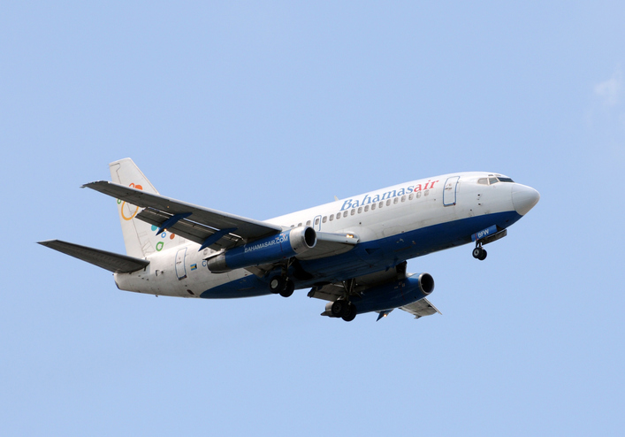
BahamasAir has missed the U.S. deadline for the new ADS-B mandate and is now forbidden from flying certain three of its four jets in United States airspace. The airline said it has adjusted its aircraft deployment accordingly, reports Forbes.
The U.S. Federal Aviation Administration mandated in 2010 that aircraft be equipped with hardware to use NextGen, a satellite-based air traffic control management system, to replace traditional ground radar technology. This step of the transition requires aircraft to have Automatic Dependent Surveillance-Broadcast Out (ADS-B) capability either at time of manufacture or retrofitted with a kit.
BahamasAir was unable to equip three of its Boeing 737-500s with ADS-B before the Jan. 1 deadline, so those aircraft have been taken off the routes it flies to Florida. It has one 737-700 and five ATR regional airliners that have ADS-B, and is using those aircraft for Florida. It also leased some planes to meet holiday season demands.
The airline says it’s maintaining its full schedule with no changes and the old 737s should be fixed in the next few months. Meanwhile, the agency has granted an exemption to the government of Canada for two of its old airframes.
Canadian Changes
The Royal Canadian Air Force operates four Challenger 601 business jets to take government and military officials on shorter flights in the U.S. and Canada. Two of those jets are too old to receive the ADS-B upgrade, so the FAA has said it will be allowed into U.S. airspace but may not get the most convenient routing from air traffic control, according to AVWeb. The FAA does have a process to waive the ADS-B requirement, but it has warned that the exemptions will be issued only under exceptional circumstances.
On Jan. 2, an Air Canada flight leaving Saint John was forced to avoid United States airspace on Thursday and take a longer path to Toronto, avoiding flying over Maine because of the mandate, reports the New Brunswick Telegraph-Journal. The change in flight pattern added roughly 20 minutes to the trip. Air Canada won’t speculate if the longer flight path and extended travel time will happen again.
At any given moment, more than 5,000 airplanes are flying over the United States. In a single year, nearly 778 million passengers will take to the skies — more than twice the population of the U.S., and the number increases each year. Aviation is the safest form of transportation. It is 100 times safer than driving. For every 100 traffic deaths, only one aviation related fatality occurs; and the Federal Aviation Administration (FAA) is working hard to make aviation even safer.
Safety is the FAA’s primary focus. The FAA Strategic Plan FY 2019– 2022 states its mission is to provide the safest, most efficient aviation system in the world. To achieve this goal, the FAA is implementing several initiatives. The technical aspects of these efforts fall under a framework called NextGen designed to modernize the nation’s air traffic control system. NextGen began in 2003 in the VISION 100 – Century of Aviation Reauthorization Act. At its core, NextGen is a geospatial framework with satellite navigation as its backbone.
The Geospatial Data Act (GDA) became law when President Trump signed the FAA Reauthorization on Oct. 5, 2018. You might have wondered how the GDA came to be included in the bill. It makes sense in the context of technology advancements towards a smart transportation network, specifically in aviation.
The smart transportation concept integrates all forms of transportation to provide economic and environmental benefits as well as increase safety and reduce wait times and congestion. A large part of smart transportation is based on geographic information technology. The aviation component of this smart transportation initiative falls within the FAA’s authority under the overarching framework named NextGen.
NextGen is an integrated concept improving the efficiency and safety of flight operations both on the ground and in the air. The use of geospatial technology enables precision time-management for controlling air traffic. The system allows each airplane to digitally coordinate with other aircraft in the area, taking into account such things as terrain and other known hazards to safely reroute air traffic as necessary. The FAA refers to this as trajectory-based operations. Those with a knowledge of GIS will recognize it as four dimensional: it calculates direction, speed, distance and time relative to position in x-y-z, and coordinates that information with other known data. Additionally, the system uses historical flight data and predictive analytics to maximize airspace for routing air traffic such as what is experienced during the holidays.
NextGen also uses a system called Optimal Profile Descents (OPD), which allows an airplane to trim its engines and descend along a glide slope from flight level into the airport. The point at which a plane begins its descent is a geospatial calculation to determine the precise point in space for the airplane based upon its altitude, weight, glide slope and distance to the airport. The benefits of OPD are reduced engine noise, fuel savings, less carbon emissions and a positive economic impact. NextGen is an across-the-board win for the airline industry, airline passengers, the economy and the environment.
According to an interview with Michael Whitaker, former deputy administrator of the FAA who was the Chief NextGen Officer, NextGen revolutionizes aviation by enabling digital data communication. It replaces radar-based navigation and tracking with satellite-based air traffic control. The cornerstone of NextGen is the Automated Dependent Surveillance Broadcast (ADS-B) system.
ADS-B is an aviator’s version of Waze, but with a lot more information. ADS-B(out) broadcasts an airplane’s Flight ID, ICAO Code, speed and location in three-dimensional space to air traffic controllers and to everyone who is equipped with ADS-B(in). The combination of ADS-B(out) and ADS-B(in) greatly increases situational awareness for aviators. On Jan. 1, 2020, all airplanes operating in controlled airspace needed to have ADS-B(out) installed. ADS-B transforms the entire National Airspace System into a satellite-based geospatial network. It integrates multiple sources of real-time data, such as weather, pilot reports, aircraft positions, 3D airspace information, and other sources of data, which can be overlaid on top of various basemaps and terrain elevation models, allowing pilots to make more informed and safer decisions.
Switching to ADS-B opens up more capacity in already crowded skies by decreasing the required vertical and horizontal separation distances between aircraft. At Hartsfield-Jackson International Airport, the busiest airport in the world, changing to performance-based operations allowed 8 to 12 more departures per hour; and in Memphis International Airport, one of the busiest airports for cargo operations, arrivals increased by 20%.
Rune Duke, senior director of government affairs, Airspace, Air Traffic and Aviation Security for the Aircraft Owners and Pilots Association (AOPA), said that ADS-B will allow much faster update rates for air traffic controllers on the order of once every second, compared to legacy radar systems that report positions every 8 to 12 seconds. For an airplane traveling at 350 knots, that is about 1 mile. A lot can change in a mile in densely packed airspace.
If you are reading this because of your love of maps and aviation, then I highly recommend the FlightAware and ForeFlight smartphone apps. FlightAware turns the phone into an ADS-B(in) receiver showing the location and flightpath of each aircraft in the immediate area on a basemap. I sit on my back deck and watch airplanes coming and going because I live under the flightpaths for Dulles International Airport, Reagan International Airport, Leesburg Executive Airport, the Montgomery County Airpark and the TERPZ waypoint. On occasion I see helicopters flying to Camp David because I am under that flight path as well.
So, I get to see a variety of aircraft. You can select the airplane icon to see information such as aircraft type, airline, Flight ID, departing and arrival airports, altitude, and groundspeed. Even more information is available by selecting the pop-up window. This is ADS-B information. ForeFlight, on the other hand, is a pilot’s flight bag on a tablet.
In the future, ADS-B will integrate Aircraft Hazardous Areas (AHA): temporary no-fly zones due to commercial space launches. Because of ADS-B, planes will automatically reroute around the AHA, and when the AHA expires, airplanes will be routed back through the area.
ADS-B supports evolving technologies such as remote towers, another significant change to air traffic control. Remote towers allow air traffic controllers to be at a location other than the actual airfield. Remote towers use a suite of sensors mounted at the airfield, including high-definition video, thermal and night vision that can be combined with the digital information provided by ADS-B, all of which is displayed on widescreen panels in a room duplicating the experience of being at the airport and directing aircraft. This allows smaller airports that cannot afford the huge expense of building and staffing an air traffic control tower to be part of a remote tower network. One remote tower center will be able to support several airfields. Leesburg Executive Airpark recently finished successful testing of one of the first remote tower operations in the United States.
“Over the next 10 years, we are going to see logistics and transportation open up, from being limited by currently rigid road infrastructure to operating on fully flexible and responsive aerial transportation networks,” said Patrick Watson, director of business development for Animal Dynamics.
The envisioned Platform Unmanned Cargo Aircraft. (Photo: PUCA)
ADS-B will also support the integration of unmanned aerial systems (UAS) into the airspace, specifically unmanned cargo aircraft (UCA). In the not too distant future, carrier air fleets without pilots or aircrew will be taking to the skies. UCAs do not require crews, so there will be no need for water, toilets, sewage containment, kitchens or a cockpit (in the traditional sense). Taking those out will allow for more space in the plane to carry cargo and fuel. Plus, without crews on board, there will be no time restrictions on crew hours — planes will be able stay aloft longer and travel further. ADS-B greatly enables the success of this technology.
Spire Global has released the company’s first product from Spire Aviation with the launch of its new AirSafe API (application program interface).
Spire Aviation’s AirSafe product uses low-Earth orbit ADS-B technology combined with ground-based collection to provide detail on global aircraft position reports for the world’s aircraft fleet operations.
With more than 70 million position reports every day and growing, AirSafe is positioned to provide best-in-class data over land and the world’s oceans.
The AirSafe product solves the industry’s need for flight tracking data covering both land and oceans at a competitive cost, illuminating trends in aircraft operations, the company said.
Airsafe enables a fixed-based operator to analyze historical data to safely increase productivity by better positioning resources in the future, and then using real-time data to create a proactive alerting system for diversion or air turnbacks.
Spire Aviation is building towards full surveillance of all remote areas of the globe and continues to grow its satellite constellation. Spire’s aggressive roadmap includes launch campaigns to ultimately provide an equatorial ICAO 4D/15 compliant method of aircraft tracking (+/- 15 degrees latitude) and global coverage enabled by inter-satellite links. These satellite launches will produce the an advanced nanosatellite constellation for aviation ADS-B and aviation weather forecasting.
Spire AirSafe also offers Spire’s proprietary weather forecasting products, enabling customers to benefit from fused aircraft location positional data and global winds aloft (Every 1,000 feet MSL) and clear air turbulence forecast.
Learn more about the benefits of working with Global ADS-B data and Spire’s Aviation Weather Forecast during an upcoming webinar.
Trade wars may be THE only serious limiting factor
The GNSS chip market worldwide is projected to grow by $2.7 billion, guided by a compounded growth of 8%, to 2025, according to ResearchandMarkets. Other market reports cite “huge growth” and “strong development” in GNSS-related markets such as simulators, aviation and defense. We can count ourselves lucky — or remarkably prescient — to be part of such a robust industry, in such uncertain times.
The world conquest by smartphones, smart cities and the internet of things (IoT) will strongly support this market growth. Also on the horizon is the rising tide of GPS-enabled vehicles, putting automotive telematics on the road to assisted-driver and ultimately autonomous driving.
M&A. Meanwhile, the fast pace of mergers and acquisitions among manufacturers and integrators will strengthen the GNSS economy and propel it even higher. Such interactivity will bring higher revenue shares to key players as well as support overall profitability increases to come.
Accurate monitoring of operations and assets; the astonishing rise of drones to active roles in many industries; and the constant innovation and imagination churning out new products, solutions and augmented services — all will consolidate the strength of our remarkable economy. The much-heralded arrivals of BeiDou and Galileo fully upon the scene will only make the immediate future stronger for our industry.
Chart: GPS World
PNT Broadly. Where GPS, GNSS, and multi-GNSS go, they carry other positioning technologies along on their coat tails: inertial, signals of opportunity, Wi-Fi, ultra-wideband and more. The growing pie is certainly big enough for all to get a large share.
That’s not to say there are no barriers to growth, no clouds on the horizon. Licensing, laws and regulations will, as ever, constrict growth. This is not always a bad thing. Controlled growth and wise use benefit us all, and prevent runaway bubbles that can burst for lack of proper internal support.
Mapping. Meanwhile, a host of well-established businesses and nascent enterprises exploit the increased interest in location-based information as an enabler for many consumer, organizational and governmental services. This means that mapping and all manner of technologies associated with it — laser, lidar, infrared and more — may grow at even faster rates.
A brave new world awaits. Once GNSS is integrated with artificial intelligence, there’s no telling where we’re headed.
Of the many uncertainties across the globe, economic warfare poses a greater risk to GNSS than does military conflict. The latter, cynically enough, will actually benefit the industry in the short run, though its effect may chill in the long run.
Chart: GPS World
Trade. One of the biggest questions confronting the industry now is whether the trade and tariff war between the U.S. and China will continue, and what effect it will have. Experts disagree widely on both questions, though almost all of them, except the leaders who are supposed to listen to them, agree that it’s generally a bad thing.
As was stated in these pages at this time last year, if business confidence falls as a result, global output could also drop.
Opportunities Outweigh Obstacles
Industry leaders confront spectrum issues, jamming
In contrast to the rosy forecast on the previous page, serious issues confront the GNSS market. None of them are more serious, thornier or difficult to resolve (despite the many solutions offered) than spoofing and jamming.
Like a tragic hero, GNSS carries a potentially fatal weakness within its strength. To be ubiquitous and highly precise, the signals come from space. Coming from space, they are weak and susceptible to malicious meddling.
Other political and technological obstacles put pressure on the GNSS industry, and therefore upon the whole PNT industry. GNSS always will be the backbone, the center core holding together various adjunct positioning, navigation and timing technologies.
These issues, following closely on the heels of spoofing and jamming, include but are not limited to: spectrum competition and spectrum management; cybersecurity; privacy; net neutrality; national security export controls; product liability; and failure, however temporary, of GNSS systems.
We’ve seen this last most recently with Galileo, but all the GNSS have suffered such setbacks, and surely will again. The nature of the response to each occurrence is the most critical factor.
Keep on the Sunny Side. However, the opportunities far outweigh the obstacles. The greatest opportunities always arise from the greatest asset that the industry possesses: intellectual capital.
Many of the opportunities are cited on the previous page. While high precision will continue to lead the innovation charge and provide the highest profit margins, the smartphone and the automobile will increasingly take up the MVP (most valuable positioner) role within the industry.
Market Intelligence. All these factors make unprecedented demands on management attention and agility. Executives need good market intelligence to keep abreast and ahead of fast-developing research and development trends, market shifts, developments in neighboring or competing technologies, and protectionist tariffs and import/export controls.
Insight provided by all regions, sectors and job titles
This year’s State of the GNSS Industry Survey provides insight from around the globe.
Just over half our respondents work for companies or organizations headquartered in North America; 15% are from Asia-based operations; roughly 10% each for enterprises in Europe and Latin America; slightly less for the Pacific region; and the rest of the replies scattered across Africa, the Middle East and Russia. Truly an international sampling!
Chart: GPS WorldChart: GPS WorldChart: GPS WorldChart: GPS World
Demographics. For job titles, we drew in-depth data from:
owner/president/CEO, 21%
engineer, 20%
general, product or program manager, 19%
other, mostly surveyors or GIS analysts, 18%
researcher, 10%
vice president, CTO, COO, CFO or similar, 6%
sales and marketing, 5%
Sector. The intelligence in the following pages accumulated from these industry verticals:
survey and high precision, 29%
defense, security, government, 19%
mapping, data acquisition/processing, GIS, 14%
satellites, signals and simulation, 9%
machine control, precision agriculture, or transportation (non-autonomous), 6%
A German research team successfully demonstrated a completely autonomous airplane landing in May, without assistance from any ground-based systems, fulfilling a key step towards autonomous air traffic and the much-bruited Urban Air Mobility (UAM).
An optical reference system, encompassing a camera in the normal visible range and an infrared camera for conditions with poor visibility, combined with GPS to bring the modified Diamond DA42 in for a safe, unpiloted landing at the Diamond Aircraft airfield in Wiener-Neustadt, Austria.
The team, from the Technical University of Munich (TUM) and the Technische Universität Braunschweig, formed the project they call C2Land with funding from the German federal government. Two 2019 conference papers by the researchers, cited at the end of this article, give the technical underpinnings of the C2Land system.
What’s New
Automatic landings by both commercial aircraft and small planes can and do take place at major airports with the Instrument Landing System (ILS) infrastructure to guide aircraft in with sufficient precision. Ground antennas send radio signals to the autopilot to make sure it navigates to the runway safely. Procedures in development to use GNSS alone to make autonomous landings also require a ground-based augmentation system.
But systems such as these are too expensive for small airports that will conceivably carry the major share of UAM: automated air freight transport and autonomous flying taxis.
What needs to happen before George Jetson air taxis become a reality? UAM will take place in the zone 500 to 5,000 feet above ground, transporting one to five passengers or cargo over distances of five to 50 miles. The vision shared by most UAM stakeholders, a group that includes NASA and the FAA, involves vertical take-off and landing rather than conventional “glide” takeoff and landing, but precise navigation to the landing spot is critical in both cases.
“Automatic landing is essential, especially in the context of the future role of aviation,” said Martin Kügler, research associate at the TUM Chair of Flight System Dynamics.
Fly-by-wire systems, semiautomatic and typically computer-regulated systems for aircraft navigation, use GPS signals for positioning. But since GPS is susceptible to errors, interference, and obstruction, it is not solely sufficient for landing procedures. Current GPS approach procedures require that human pilots resume control over the aircraft at 60 meters altitude, and land the aircraft manually.
To enable completely automated landings , the TU Braunschweig team designed an optical reference system: two cameras, one in normal visible range and one infrared camera for poor visibility conditions. Custom image processing software lets the system determine where the aircraft is relative to the runway based on the camera data it receives. Additional functions were integrated in the software, such as comparison of data from the cameras with GPS signals, calculation of a virtual glide path for the landing approach and flight control for various phases of the approach.
Visual Recognition
Test pilot Thomas Wimmer, who sat through the procedure with his hands folded, said “The cameras already recognize the runway at a great distance from the airport. The system then guides the aircraft through the landing approach on a completely automatic basis and lands it precisely on the runway’s centerline.”
The researchers presented their system in two papers at the Institute of Navigation’s 2019 Pacific PNT Meeting in April:
“Model-based Threshold and Centerline Detection for Aircraft Positioning during Landing Approach,” by S. Wolkow, M. Angermann, A. Dekiert, and Ulf Bestmann; and
“Linear Blend: Data Fusion in the Image Domain for Image-based Aircraft Positioning during Landing Approach,” by M. Angermann, S. Wolkow, A. Dekiert, U. Bestmann, and P. Hecker.
Photo: Ministry of Defense of the Russian Federation
Israeli security officials publicly accused Russia of disrupting and spoofing GPS signal reception in Israeli airspace throughout the month of June. The electronic warfare at which Russia is known to be adept was reportedly traced to the Khmeimim Air Base in Syria, where Russia maintains and actively flies a large number of warplanes on behalf of the Syrian government. The base is approximately about 350 kilometers (217 miles) north of Ben Gurion, so if the accusation is true, fairly powerful equipment is behind the attack.
Both Israeli and other-nationality airline pilots have reported interruptions in GPS reception during take-off and landing at Tel Aviv’s Ben Gurion International Airport. The Israeli Airline Pilots Association labeled the interruptions a spoofing attack, causing airplane receivers to report false positions.
The International Federation of Air Line Pilots’ Associations issued a Notice to Airmen: “GPS signal loss affects RNAV arrivals and departures and may create numerous alerts for systems that rely on internal position accuracy. Flight Crews should be aware of the potential risk, avoid distractions, and plan for alternative procedures as necessary.”
Pilots have since for the most part relied on Instrument Landing System, a precision runway approach aid based on two radio beams which together with both vertical and horizontal guidance during an approach to land at Ben Gurion International Airport.
The Israeli Airports Authority stated that the GPS attacks affected only airborne crews and not terrestrial navigation systems, and that they occur only during daytime.
The Russian ambassador to Israel has denied the accusations.
In April, a U.S. research institute, the Center for Advanced Defense Studies, documented more than 10,000 separate incidents of GPS disruption on Russian soil, in northern Scandinavia and in the Middle East between February 2016 and November 2018. It said Russia was “pioneering” the technique to “protect and promote its strategic interests.” GPS World summarized the report here, stating that “The Russian Federation is growing and actively nurturing a comparative advantage in the targeted use and development of GNSS spoofing capabilities to achieve tactical and strategic objectives at home and abroad.”
Tie-in with Iran Tensions. Meanwhile the Helsinki Times reported that researchers at the Finnish Geodetic Institute noticed unusual power variations in the GPS signal on June 20 and 21: “an increase of up to 10dBHz in the carrier-to-noise ratio readings comparing with the usual daily values.” Normally the variations are between -0.5 and 0.5 dBHz.
The same findings were communicated to the research community by Peter Steigenberger, senior scientist at the German Aerospace Center, DLR:
“Based on carrier-to-noise density ratio observations (C/N0) of IGS receivers, we observed global flex power operations on June 20 and 21, 2019. Flex power started subsequently for all healthy Block IIR-M and IIF satellites on June 20 between 15:18 and 17:49 UTC. C/N0 of the P(Y)-code tracking increased by roughly 10 dB for all healthy Block IIR-M and IIF satellites whereas C/N0 of the C/A-code decreased by about 2-3 dB for the healthy IIR-M satellites only. The changes in power levels are similar to flex power mode III discussed in “Steigenberger P, Thölert S, Montenbruck O. (2019) Flex power on GPS Block IIR-M and IIF, GPS Solutions, doi:10.1007/s10291-018-0797-8″. All satellites returned to normal power levels on June 21 between 6:00 and 10:00 UTC.”
On June 20, a US military drone was downed down by Iranian missiles. On June 21 President Trump tweeted that he had called off a dawn attack on Iran that day.
Whether the spoofing affecting Israeli airspace has any connection to building tensions 1,500 kilometers to the east is unknown.
Welcome to Part 2 of our coverage of the mammoth AUVSI Xponential 2019 show in Chicago, which drew 8,000 attendees, featured 300+ speakers on its technical program, and furnished a temporary home for more than 800 exhibitors. It was “Everything Unmanned” and a challenge to cover. Last month we looked primarily at new vehicles. This month’s column focuses on sensors, capabilities and apps aboard those and other airborne drones — and even an anti-drone drone!
Sagetech: For UAVs to gain entry to the US National Airspace System (NAS) and to other controlled airspace all around the world, sense-and-avoid capability is paramount. Sagetech comes from the world of Mode-S transponders, with which the majority of piloted aircraft are equipped. These devices transmit aircraft identification and provide the moving IDs on air-traffic controller display monitors. In the military sector, Identification Friend or Foe (IFF) interrogator-transponders enable similarly equipped aircraft of NATO countries to determine which are friendly aircraft within their immediate airspace, and which are not.
The MX12B Mode 5 IFF with FAA-certified civil modes. (Photo: Sagetech)
Sagetech has just released a micro-mode 5 MX12B aviation transponder that enables small unmanned aircraft to interoperate within NATO airborne units. The transponders weigh around 10lb, so mil-spec UAVs operating in NATO airspace can now also carry this light-weight unit.
For civilian UAVs, GPS has been added to provide aircraft position outputs in Automatic Dependent Surveillance Broadcast (ADS–B) message format, allowing other aircraft and UAVs to receive a vehicle’s location. The Sagetech ADS-B transponder is small, certified to Federal Aviation Administration (FAA) standards (TSO C-166b) and is affordable. Boeing Scan-Eagle UAVs apparently already carry Sagetech transponder capability.
The tailBeacon ADS-B retrofit. (Photo: uAvionics)
uAvionix: Another avionics supplier has brought out certified ADS-B capable transponders, but with a novel way to add the required capability to general aviation (GA) aircraft, typically smaller private planes. The FAA has mandated that all aircraft should be fitted with ADS-B capability by January 1, 2020 in order to fly within controlled airspace, so uAvionix has simplified ADS-B retrofit for older GA aircraft.
All aircraft have wingtip and/or rear-tail beacon lights; this update replaces their existing beacon with a light which also includes ADS-B capability when paired with the aircraft transponder.
The FYXnav TSO CERTIFIED GPS navigation source. (Photo: uAvionics)
uAvionix also supplies a couple of GPS sensors for external mounting on UAVs: the FYXnav sensor is FAA-certified to TSO-C199 Traffic Awareness Beacon System Class B.
Sensefly released a new inspection application for their eBeeX UAV, specifically designed for solar farms. With a dual thermal/video sensor for data collection and data processing using application-specific Raptor Maps software, Sensefly claims to reduce the inspection time required for a 150MW solar farm to around 1 day, a 300-times improvement on ground inspection using a hand-held thermographic sensor.
Provided an inspection operation could support five 70-minute eBee-X flights during one day, the UAV could over-fly up to 161 acres of solar panels at an altitude of 138ft, gathering anomalies during each flight. This adds up to 150MW of solar panels over the 5 flights. Sensefly claims this to be twice as fast as with multi-rotor dones. The Raptor Maps software then generates an inspection report identifying each anomaly, using the eBee X’s video and thermal imagery to identify, classify, and localize the detected problems.
The Fortem DroneHunter intercept drone. (Photo: Fortem)
Fortem makes an anti-drone defense combining a radar detection system with a DroneHunter drone that attacks other UAVs, releasing an 80ft net to capture intruders. For those nefarious drones which are hardened against RF countermeasures, this system is also touted as capable of recovering the offending drone without damage, returning it to the operator in a net at the end of a tether. The DroneHunter flies autonomously on its intercept mission, carrying a compact radar system integrated with a ballistic net release system.
Septentrio continued promotion of its Mosaic chip-level GNSS at Xponential. The new chip uses the same proven core DSP with a new RF front-end and a new processor, working with more than 30 signals from the existing six GNSS constellations, and with L-band and satellite-based augmentation systems (SBAS).
The chip appears to be aimed at the high-precision market, replacing the AsteRx-m2 board level receiver family.
The chip runs Septentrio RTK algorithms, is quite small (1.29 x 1.29 x 0.15 in), is designed for high-volume surface mount manufacture, and comes with a set of popular interfaces. The chip is sampling now, with production planned for later this year.
NovAtel is growing, opening new offices in the US and needing more local real-estate to fit its headquarters in Calgary, Canada. The company is now part of Hexagon Positioning Intelligence (Hexagon PI), a partial re-branding that includes VERIPOS correction services and recently purchased AutonomousStuff, specializing in ground vehicles. Each organization still operates individually through its own brands. On the NovAtel booth, existing products were presented through a number of new applications, including those of the growing mil-spec products group.
Summary. While AUVSI Xponential was over in early May, the companies who were there have not rested. All are developing new approaches for UAVs and unmanned ground vehicles, sensor systems for even wider applications than seen in Chicago, and all manner of other added capabilities. This business only gets bigger and more innovative.
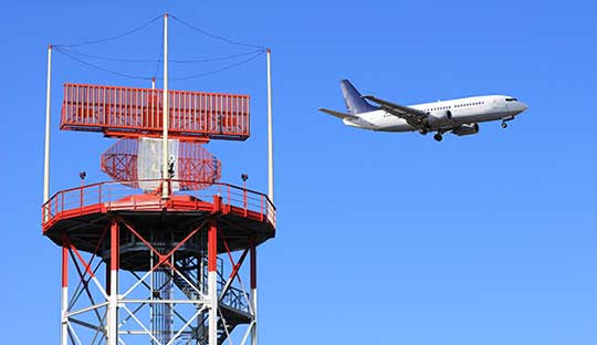
Orolia, a provider of resilient positioning, navigation and timing (PNT) solutions, announced that its SecureSync time and synchronization servers have been selected to support enroute radar systems across the U.S.
The selection comes as part of the Federal Aviation Administration’s (FAA) move towards a Next Generation Air Transportation System (NextGen). NextGen is about halfway through a multi-year investment and implementation plan.
The FAA plans to keep rolling out NextGen technologies, procedures and policies through 2025/2030 and beyond.
While NextGen will rely heavily upon GNSS to increase capacity, efficiency, and safety in the National Air Space (NAS), many technologies including legacies such as radar will be integrated into the system for maximum robustness to error and disruption.
The FAA employs a variety of radar types for short-, medium- and long-range air traffic control requirements. These diverse radars require different types of timing signals and outputs to suit their operations.
SecureSync. Orolia’s SecureSync provides the necessary timing outputs and signals to meet these requirements. The time server’s ability to provide resilient, accurate and reliable timestamps for the data that it receives from radars is used to quickly organize the data for the aircraft control user interface.
The only time and synchronization device approved by the Defense Information Systems Agency (DISA) for use in U.S. Government networks, Orolia’s SecureSync provides reliability, security and flexibility to synchronize critical aviation operations. SecureSync combines multi-GPS/GNSS signal synchronization, options for alternative signals and BroadShield GPS anti-jamming/spoofing protection for transportation systems. SecureSync combines Orolia’s precision master clock technology and secure network-centric approach with a compact modular hardware design.
The FAA selected Orolia for the competitive program based on its proven timing and synchronization technology and its ability to offer multiple output options as commercial off-the-shelf (COTS) products that do not require additional research and development time or investment.
“Consistently accurate timestamps and the synchronization of thousands of real-time flight data points are essential for safe and efficient enroute air traffic operations,” said Jean-Yves Courtois, CEO of Orolia. “Orolia is proud to support the FAA’s radar data and aircraft control user interface requirements to improve air travel services nationwide.”
More About the SecureSync COTS Product. Built-in time and frequency functions are extended with up to 6 input/output modules. Included with the base unit is a 1PPS timing signal aligned to a 10 MHz frequency signal without any 10 MHz phase discontinuity.
A variety of internal oscillators are available, depending on requirements for holdover and phase noise. On-board clocks synchronize to a variety of external references as standard, factory-installed or upgradable options.
Users may add alternate signals of opportunity to GPS or GNSS input references to improve resilience, or use them for indoor applications and choose from a variety of option cards to add to configuration of timing signals, including additional 1PPS, 10 MHz, time code (IRIG, ASCII, HaveQuick), other frequencies (5 MHz, 2.048 MHz, 1.544 MHz), telecom T1/E1 data rates, multi-network NTP and PTP. Modules can be customized for exact requirements.
To support network time synchronization, SecureSync supports the latest features of network time protocol (NTP) and precision time protocol (PTP, IEEE-1588v2). An optional multi-port NTP configuration allows for operation across 4 isolated LAN segments. Up to 6 PTP ports can be added to operate in various PTP deployments.
SecureSync is a security-hardened network appliance designed to meet rigorous network security standards and best practices. It ensures accurate timing through multiple references, tamper-proof management and extensive logging. Robust network protocols are used to allow for easy but secure configuration.
Features can be enabled or disabled based on network policies. Installation is aided by DHCP (IPv4), AUTOCONF (IPv6), and a front-panel keypad and display. The 1 RU chassis supports multi-GNSS (GPS/ Galileo/GLONASS/BeiDou/QZSS) input.
Options include SAASM, supporting L1/ L2, available for authorized users and required for the US DoD, and BroadShield GPS jamming and spoofing detection. The unit is powered by AC on an IEC60320 connector. DC as back-up, or primary, is available.