“Seen & Heard” is a monthly feature of GPS World magazine, traveling the world to capture interesting and unusual news stories involving the GNSS/PNT industry.
Photo: Mt. Qomolangma/miljko /E+/Getty Images
Chinese surveyors take BeiDou to the top
On May 6, more than 30 Chinese surveyors left base camp to summit Mount Qomolangma — known in the west as Mount Everest. The team is using both traditional and modern surveying and mapping technologies, and China’s BeiDou Navigation Satellite System (BDS) will be applied to the elevation survey for the first time. The previous survey in 2005 used GPS to measure the height (found to be 8,844.43 meters); this year’s survey uses all four GNSS, with BDS data as the main reference.
Image: BlackJack3D/E+/Getty Images
Quantum entanglement
In a paper published April 20 in Physical Review Letters, University of Arizona engineering and optical sciences researchers, in collaboration with engineers from General Dynamics Mission Systems, demonstrate how a combination of two techniques — radio frequency photonics sensing and quantum metrology — can give sensor networks a previously unheard-of level of precision. The work involves transferring information from electrons to photons, then using quantum entanglement to increase the photons’ sensing capabilities. The quantum-sensing paradigm could create opportunities to improve GPS receivers, astronomy laboratories and biomedical imaging capabilities, as well as improve the performance of any application that requires a network of sensors.
Researchers evaluating movement of GNSS ground stations have discovered large-scale, back-and-forth ground movement preceding the 2010 seaquake off of Chile and the 2011 Tohoku-oki seaquake off of Japan. Researchers from the Geoforschungszentrum Potsdam (GFZ) with collaborators from Chile and the United States say both quakes showed multiple strange reversals of ground motion — an extremely slow “wobbling” of the continental plate — over a period of five months (for Japan) and seven months (for Chile). The discovery was made possible by the amount of data collected by the GNSS stations in both countries.
Dogbot on patrol
A robot dog from U.S.-based Boston Dynamics reminded visitors to Bishan-Ang Mo Kio Park in Singapore to maintain social distancing due to the coronavirus pandemic, reported the BBC in May. The dogbot is fitted with lidar to monitor how busy the park becomes. It also carried a loudspeaker to broadcast social-distancing messages.
A Loyal Wingman drone rolls out, the U.S. Air Force (USAF) sponsors air taxi-cargo UAS development, and medical deliveries take place in Scotland and Florida — we have quite a wide selection for this month’s news.
Fighter support drone
Boeing Loyal Wingman prototype (Photo: Boeing)
Boeing Australia has just rolled out the first “Loyal Wingman” for the RAAF (Royal Australian Air Force) — in essence what looks like a completed first article of three prototypes on order for Australia’s Loyal Wingman Advanced Development Program.
The concept is to develop an “inexpensive, expendable” UAV which will fight alongside today’s frontline fighter aircraft, controlled from the ground or from the air. A “force-multiplier” which doesn’t risk either pilot or the heap-expensive interceptor/ground attack aircraft themselves, a real bonus for smaller air-forces, and a less costly way of increasing numbers.
The first prototype will now go into a ground and flight test program to prove out systems and flight capabilities – first flight would likely be later this year.
A team of 35 Australian aerospace companies are supporting the Loyal Wingman project, including BAE Systems Australia which has been selected to supply the flight vehicle management system, flight control computers and navigation equipment.
Flying cars?
The U.S. Air Force wants a fleet of them by 2023!
So in a novel way to stir interest in the concept of flying cars, or perhaps cargo carrying drones, the Air Force launched a program known as “Agility Prime.” The program may have begun conventionally with seed contract(s) to drone manufacturers, but their latest “webcast” approach provided an extensive overview of what this could mean to the U.S. industry.
From April 27 through May 1, a panel including Air Force leaders, two U.S. Senators, NASA and Federal Aviation Administration management, and key Air Force and Defense Department players participated in an open presentation to industry, investment and State Government participants — all with the aim of accelerating civilian development of “advanced air mobility vehicles.”
Recognizing that a principle problem is overcoming regulatory hurdles, USAF intends to provide a route to commercial revenue service such as logistics transport and disaster recovery by perhaps providing access to its key testing capabilities and facilities. With broad participation in the program by industry, government and investors (i.e. USAF don’t intend to pay for it all) the program would satisfy an operational safety and security baseline and provide a platform for the “Race to Certification” of commercial drone product(s) the USAF might also want to buy.
One of the possible solutions for a cargo drone already funded includes the Sabrewing Cargo Drone – known currently as Rhaegal-A.
Four electric powered ducted fans rotate for Vertical Take-Off and Landing (VTOL) and are powered by a Safran (French) Ardiden 3 helicopter turbine engine – giving this large UAV a design speed of 245 mph, a ceiling of 20,000 feet and range of 1000 miles.
Sabrewing has received $3.25m under a two year USAF sponsored Small Business Incentive Research (SBIR) project in the hope that the design could be eventually adapted to military logistics applications. The vehicle is intended to be able to fly autonomously, has detect and avoid capability, and can even operate when GPS is continuously jammed — something the military would probably appreciate. Potential casualty evacuation is also of great interest.
Medical supplies delivery
Meanwhile in the U.K., in cooperation with the U.K. Civil Aviation Authority (CAA), Skyports drone company is playing in the CAA’s “Sandbox.” This is another term for an umbrella/sequence of trials under CAA safety and security constraints where innovative approaches are given a chance to demonstrate that new aviation related things are possible, that they actually work and that they meet the CAA criteria. Skyports wants to test out Beyond Visual Line of Sight (BVLOS) operations for its upcoming trial of medical deliveries between Oban and Mull off the West Coast of Scotland.
As front-line health professionals fight to beat the COVID-19 pandemic, deliveries of essential medical supplies between medical facilities can be speeded-up significantly using drones. Skyports will begin the week-long trial between Mull and Oban medical centers in the last week of May.
The planned BVLOS flights will be over a 17-mile route in unrestricted airspace and avoid the Oban airport, crossing the narrow sea channel and onto the North coast of the Isle of Mull. Skyports already has experience transporting medical and other high-value cargo in other parts of the world. The candidate drone is equipped with Iris Automation Casia detect-and-avoid computer vision system, and Thales Remote ID, and the Skyports drone team is also supported by Thales SOARIZON flight management and mission planning system.
Drones to deliver prescriptions
And finally, something quite helpful during the current coronavirus pandemic — CVS and UPS having linked up some time ago, are to begin delivering prescription medication to customers in Florida. The process has been previously checked out during November last year trials in Cary, N.C.
UPS will use the Swiss Matternet M2 delivery drone, picking up medication at specific CVS location(s) and flying it to a delivery point at “The Villages” in Central Florida, then the “last-mile” delivery is by road — presumably by an outfit which knows the layout of this huge facility where something like 130,000 retirees live. Useful during this phase of Florida’s self-quarantine for elders who may find it difficult to get out to the drug store. Hope they start running the same service out of my local CVS.
Wrap-up
So from the extreme military application of drone support for fighter attack missions, and USAF sponsored development of air-taxis and cargo drones, through to medical supply deliveries by drone in remote areas of Scotland and prescription deliveries in Florida — activity never seems to abate in this growing industry.
GPS World is offering the latest news and updates concerning the coronavirus (COVID-19) pandemic as it affects the GNSS/PNT industry. Read a message from GPS World here.
Geospatial Solutions and GPS World are offering the latest news and updates concerning the coronavirus (COVID-19) pandemic as it affects the geospatial, mapping and GNSS/PNT industries. Read a message from GPS World here.
The Federal Aviation Administration (FAA) and the Association for Unmanned Vehicle Systems International (AUVSI) will host the 5th annual FAA UAS Symposium virtually, rather than in-person in Baltimore. The event will take place June 16-18.
This decision was made as a result of the ongoing concerns caused by the COVID-19 pandemic, the organizers said.
The FAA and AUVSI also will be hosting a series of virtual events that will address the content already planned for this year’s program. The fist will take place in early summer and will focus on UTM and international UAS integration. The second will take place in late summer with a focus on updates to the Integration Pilot Program and public safety operations.
According to organizers, those registered for the 5th annual FAA UAS Symposium will receive a separate message in the coming weeks to confirm options for participation in the virtual events.
Those selected as speakers for the 5th annual FAA UAS Symposium will receive a separate message from AUVSI’s Industry Education Team to confirm participation, as well as any schedule changes.
The world so close has never seemed so far away. Locked up and adrift, somewhere between the comfort of the past and the anxiety of the future, the present slowly passes by in a procession of nameless days. The living room has become a sundial. Shadows pass from one wall in the morning to the far side by day’s end. Outside, spring has sprung, but inside, winter lingers on.
Alone, we can do so little. Together, we can do so much. —Helen Keller
Times like these, detached and disruptive, are opportunities in disguise. Ironically, while the world is confined and socially distanced from one another, humanity is more connected than it has ever been. Hard to believe, but smart mobile devices began just over a decade ago; and we are in the midst of a growing tsunami of connected devices, cloud computing, big data and open source. These events, coinciding with the exponential growth of geographic information systems and data analytics, have set the stage for crowdsourcing and citizen science. The era of empowering individual contributors has begun.
It has probably gone unnoticed due to all the political wrangling in Washington, D.C., but over the last two administrations, with bi-partisan support, without recognition or renown, a monument to American ingenuity was christened. Beginning in 2010, the America COMPETES Reauthorization Act was passed. Then, in 2014, the White House elevated homegrown inventors and creators calling it the Maker Movement and hosted the first-ever National Maker Faire. In 2015, the STEM Education Act became law and in the same year the Senate introduced The Crowdsourcing and Citizen Science Act. In 2017, the American Innovation Competitiveness Act became law formally coining the term, crowdsourcing. In 2019, the White House Office of Science and Technology Policy (OSTP) delivered the first-ever comprehensive report to Congress about federal agencies activities involving crowdsourcing and citizen science (FedCCS). Also in 2019, OSTP along with the General Services Administration (GSA) hosted the U.S. Government Open Innovation Summit.
The OSTP FedCCS report to Congress titled, “Implementation of Federal Prize and Citizen Science Authority,” cites 169 FedCCS prize competitions conducted by 18 federal agencies, such as the National Aeronautics and Space Administration (NASA), the Centers for Disease Control (CDC), and the National Institute of Science and Technology (NIST). However, the number of FedCCS projects is much greater than what is covered in the report. On Challenge.gov the amount of competitions rose from 744 in 2016 to 875 in 2018, and the prize awards ranged from $0 to $20 million with an average payout of $75,000 in FY2018. The next report is due in 2021.
Governments tapping into the resources of its citizens for innovation is not new, but it has never been on this scale and granted such authority. One of the first official attempts was the United Kingdom’s Longitude Prize in 1719 offering a King’s ransom of £20,000 [see article: From the Pyramids to GIS/GPS] to solve positioning at sea. Great Britain still honors the original Longitude Prize using the name for their national grand crowdsource competition. Similarly, in the United States the grand challenge is the X-Prize, the most famous one being the Ansari X prize. You may not know the prize by its name, but as NASA’s Space Shuttle Program phased down, the Ansari X-Prize kicked-off the space race among private companies. Scaled Composites won the $10 million prize in 2004 reaching space in a reusable craft, which became Virgin Galactic.
The term “crowdsourcing” means a method to obtain needed services, ideas, or content by soliciting voluntary contributions from a group of individuals or organizations, especially from an online community. —15 USC Chapter 63 §3724 (2): Crowdsourcing and Citizen Science
The U.S. Federal Government already relies on the public for information to help improve and maintain its products and better serve the country. The National Oceanic & Atmospheric Administration (NOAA) has had an ongoing cooperative with the U.S. Power Squadrons since 1963 to report safety hazards to navigation and help maintain the information on maritime nautical charts. The agreement to support NOAA was renewed in 2013 for another 50 years.
Image: U.S. Geological Survey
The Federal Aviation Administration (FAA) accepts reports from the general public, especially aircraft pilots regarding the accuracy of information in the products it publishes which can affect changes to aeronautical charts and flight operations.
The U.S. Geological Survey (USGS) has The National Map Corps (TNMCorps), which began in 1994 with the Earth Science Corps and the Adopt-a-Quad program. These two programs consolidated into a single online crowdsourcing effort to support USGS in 2013. TNM Corps helps maintain USGS’s maps and allows private citizens to do feature collection activities. It is easy to join and simple to use making it a way for all ages to join the crowdsource movement. What is also significant about USGS is that Dr. Sophia Liu, Co-Chair of the Federal Community of Practice for Crowdsourcing and Citizen Science resides there. Dr. Liu helped stand-up FEMA’s crowdsourcing and citizen science unit in 2007. She is now the coordinator of FedCCS activities and helped co-write the 2019 OSTP FedCCS report to Congress.
Crowdsourcing is about actively engaging people in a certain task, sometimes a very specific micro-task that includes a two-way feedback loop with the public. We need to leverage the human power that is better at understanding, processing, and communicating information.
—Dr. Sophia B Liu, Innovation Specialist, USGS
Some of the most popular sites for GIS enthusiasts to get involved are Open Street Maps (OSM), GISCorps, GeoHIVE and Zooniverse. OSM has more than 2 million contributors worldwide and has been on the front line of international disasters beginning with the 2010 Haiti Earthquake. Through its Humanitarian OpenStreetMap Team (HOT) it has supported operations of the Red Cross, FEMA, and United Nations. Through the power of the crowd, OSM contributors rapidly map transportation networks in disaster areas to show the most accessible routes in order for rescue operations and emergency supplies to reach the most impacted communities.
The GIS Corps, founded in 2003, operates under URISA and coordinates short-term mapping volunteer projects for humanitarian relief, human rights, disaster response, and other important efforts. Over 4,500 volunteers have helped support 195 missions around the world such as Hurricane Katrina, Ebola outbreaks in Sierra Leone, and the Nepal earthquake, in fact, if there is a crisis somewhere in the world, GISCorps is most likely going to have an effort in place to support it.
GeoHIVE (Geospatial Human Imagery Verification Effort) is an imagery based geospatial crowdsource platform which began in 2015 eventually replacing Tomnod in 2018. Digital Globe formed a collaboration with Radiant Solutions, SSL and MDA combining efforts and resources creating a more robust crowdsourcing platform. GeoHIVE’s 3,000 volunteers have contributed to nearly 700 campaigns. Registering for GeoHIVE requires an Amazon Mechanical Turk account, which allows contributors to be compensated for crowdsource tasks.
Zooniverse began as an astronomy site to enable hobbyists to help classify galaxy types but quickly grew into a crowdsource platform that encompasses all sorts of projects in addition to its cosmic origins including art, biology, literature and there are several spatially related projects to be found, as well. With Zooniverse you can contribute to science by studying gravitational waves or categorizing auroras as the ionized plasma washes up onto our cosmic shore.
90% of all the scientists who have ever lived are alive today. —Steven N. Rader, Deputy Manager, NASA, Center of Excellence
That quote by Steven Rader of NASA is accredited to Derek de Solla Price in 1961 referring to the exponential growth in the number of PhD’s and patents throughout the world. But now, science is in the hands of the Makers — those with 3D printers or those who can program a virtual world, or design an augmented reality, or those who can extract patterns from data and provide meaningful intelligence in geography, demographics, genetics, biology, and every field of study.
Citizen scientists are making a significant mark upon the world. Take for example CeCe Moore, a genealogy hobbyist who became a self-taught expert and now tracks down killers solving several cases using her laptop and open source DNA records. Gary Hug, a backyard astronomer, who built his own observatory in Topeka, Kansas, has discovered over 300 asteroids in near Earth orbits, and in March, Michael Mattiazzo, a citizen scientist astronomy enthusiast, discovered comet (C/2020 F8) SWAN which will make its closest approach to Earth on May 13th inside Earth’s orbit. Then there is Ted Ground, a citizen scientist hero. Ted is a winner in multiple citizen science competitions winning the NASA ideation challenge for the Mars ballast payload, the Bureau of Land Reclamation challenge for identifying insect invertebrates in rivers and estuaries, and the INNOcentive challenge for identifying trace minerals in livestock.
The day before something is truly a breakthrough, it’s a crazy idea.
—Peter Diamandis, executive chairman of the X Prize Foundation
Challenges are competitions sponsored by governments, private industry, non-profits and international entities. At the end of this article are listed several challenge sites. Agencies of the U.S. government post their challenges on Challenge.gov and CitizenScience.gov. Challenges are opportunities to work on projects for NASA, DOD, EPA, NOAA, FEMA, USGS, DARPA, and a growing list of agencies and companies. Most of these projects can be worked on at home with a laptop. Some challenges are for money or other prizes and some are just for the recognition, but all of them are ways to improve skills, build connections, and enhance a resume.
In closing, the legislation signed into law since 2010 culminating in the America Innovation and Competitiveness Act of 2017 requiring bi-annual reports to Congress directs federal agencies to use Crowdsourcing and Citizen Science. This movement empowers the individual. There has never been a better time for an idea whose time has come.
All achievements, all earned riches, have their beginning in an idea. —Napoleon Hill, Author of Think and Grow Rich
A final note: The four-part television series, “The Crowd & the Cloud,” sponsored by the National Science Foundation (NSF) and hosted by Waleed Abdalati, former NASA chief scientist, can be seen here.
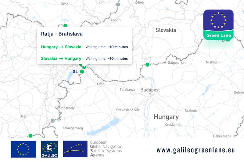
The European GNSS Agency (GSA) has collaborated with the European Commission to develop the Galileo Green Lane app, a mobile solution designed to facilitate the free movement of freight, reduce waiting times at European Union (EU) borders and prioritize essential goods during the COVID-19 pandemic response.
According to GSA, for border control authorities, the app provides a real-time visualization of the situation at border crossings, along with regular updates on the traffic flow situation.
For truck drivers, the app provides a real-time visualization of borders, through an EU-wide map indicating crossing times. This enables logistic companies and drivers to better prepare their routes, having advance knowledge of the waiting time at each border crossing, GSA said.
The app also offers a real-time overview of border traffic hold-ups, built on the foundation of Sixfold’s COVID-19 map. In mid-March, Sixfold began to provide supply chains, retailers and shippers with a free live border crossing map, which is updated in real-time.
“With the Galileo Green Lane app, the GSA is fulfilling its mission to address economic and societal challenges by leveraging the European GNSS capabilities,” said Pascal Claudel, acting executive director at the GSA.
The app has been tested at border crossings in Hungary and the Czech Republic, while other countries, including France, Greece, Italy, Romania and Spain, are about to start testing, GSA added.
Esri will be providing a COVID-19 Response Package for free to all nonprofit organizations responding to the pandemic. According to Esri, this includes data, templates and solutions that are accessible through Esri’s Disaster Response Program.
By mapping data with capabilities such as spatial analysis, Esri’s software allows organizations to track where COVID-19 cases are spreading, and — through predictive modeling — determine where additional capacity will be needed. Using data visualization in maps and dashboards, nonprofits can see affected populations, share information with stakeholders virtually and measure the impact of their response efforts, Esri said.
“Esri enables us to identify vulnerable communities, whether they currently have unmet needs or appear to have a thin cushion with which to absorb a crisis,” said Raj Kamachee, Team Rubicon CTO and CIO. “Thanks to this wealth of location-based data, we have responded not only reactively, but have also been able to reach out proactively to these vulnerable communities, establishing a relationship during ‘blue skies’ so they have someone to call when disaster strikes.”
According to Esri, it has supported more than 10,000 nonprofits to advance their missions with geospatial data and tools through the Esri Nonprofit Program, which was launched in 2010.
“It’s never been more critical to ensure that nonprofits have the solutions that will enable them to target and serve vulnerable populations, understand disease spread, gauge their effectiveness and engage their communities,” said Jack Dangermond, Esri founder and president. “Our company was founded as a nonprofit, and so we share a deep commitment to the goals and mission that these organizations pursue.”
Founded in 1969, Esri provides geographic information system software, location intelligence, and mapping.
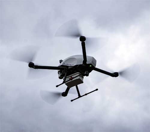
With more than 3 million people infected around the world, the coronavirus pandemic is pushing health authorities to research and develop new ways to react to critical situations, according to drone company Quaternium.
Public and private organizations are racing to develop experimental treatments and vaccines to fight COVID-19. At the same time, many local companies are trying to think outside the box to find ways to minimize the effects of the crisis. “Our current situation has opened up opportunities for innovative solutions, and we are best seeing them within the drone industry,” said Alicia Fuentes, CEO at Quaternium.
Photo: Quaternium
Drones have been deployed in the effort to contain the spread of the pandemic. “We’ve seen drones distributing public information, like voice messages, to those not following social distancing measures as well as delivering medical samples and spraying disinfectants to urban areas,” Fuentes said.
Unmanned solutions are easy to operate and can be quickly mobilized. “In addition to reducing the risk of health of sanitary workers, drones also get to unreachable places; they have become a versatile tool for managing this health catastrophe,” Fuentes said.
In Europe, several startups like Quaternium, Drone Tools and Manna Aero, and in the U.S. and Canada, companies such as Zipline and Draganfly are all exploring how they can help in their regions and neighboring countries to decrease the aftermaths of the pandemic and save more lives.
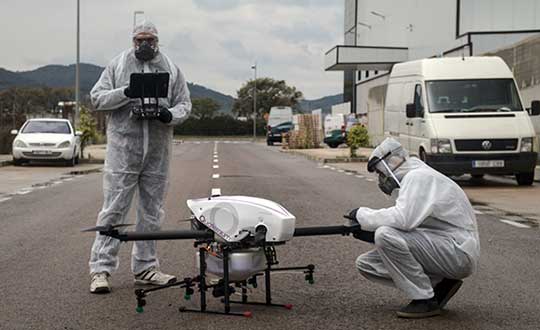
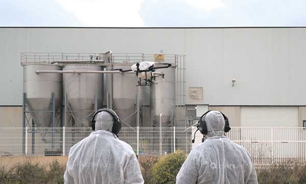
Quaternium demonstrates drone spraying
Quaternium has successfully been testing its hybrid drone, HYBRiX, to spray disinfectant products in Spain, showing how drone technology may serve in critical situations and how the company can support public authorities to help end the spread of the virus.
The company has also demonstrated aerial logistics solutions by delivering essential items to people in critical situations. Long-endurance drones can deliver supplies specifically for COVID-19 efforts, such as masks and gloves to first responders. HYBRiX can also deliver medicine to patients who can’t safely get to a pharmacy.
In the U.S., police departments are using drones from Impossible Aerospace to limit personal contact and share COVID-19 information, to reach out to homeless people (who are particularly at risk for coronavirus) and to monitor and enforce social distancing.
These are some of the areas where drones are being used to fight COVID-19.
Delivery drones
Due to COVID-19 being so contagious, it’s safer if human-to-human contact is minimized. UAVs are proving to be a valuable tool when delivering medical samples and essential items to health personnel. Several drone companies have made tests showing the crucial role that unmanned logistics can play against the spread of COVID-19.
Inform and prevent
“In the last weeks, we have seen speakers being mounted on drones to help inform people outdoors and prevent public gatherings. Drones can also be found flying with banners advising people on how to be more precautious when going outside,” Fuentes said. The mobility and flexible use of these UAVs make the mission of security agencies simpler, while avoiding close contact with the population, she said.
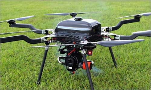
Aerial spraying and disinfection
First in China and now in Europe and the U.S., agriculture drones — originally designed to spray liquids on crops — are being adapted to spray disinfecting chemicals in public spaces and impacted areas. Experts have discovered that coronavirus is mainly transmitted by touching contaminated surfaces. This new virus has shown to be very contagious and resistant, staying on some surfaces up to 30 days, which makes disinfectant spray vital to helping reduce transmission mechanisms.
The battle with COVID-19 has just begun. Cases are continuing to rise in and outside of Europe. “Now more than ever, public authorities and private companies need to join forces in order to grow stronger and overcome this pandemic together,” Fuentes said.
Open space: the final frontier. These are the voyages of the professional surveyor and their crew. Their mission: to explore and survey strange new lands. To retrace old boundaries and to create new parcels and subdivisions. To boldly go where no one has gone before (unless it has been previously surveyed and platted…)!
With a nod to Star Trek fans (and apologies to Mr. Roddenberry), the surveyor has been the terrestrial version of the Captain Kirk and Science Officer Spock, exploring existing and uncharted territories. While most surveys completed in the modern day are retracements of previous parcels, there are still areas where surveyors are completing various tasks where no one has been before.
There are very few instances where a survey is performed near others. By this simple fact, one can argue that the surveyor is the original social distancer. The real question, however, lies within the determination of the value of the surveyor and if the work we perform is an “essential service.”
This article is not attempting to debate the value of the surveyor versus all the first responders, doctors, nurses, healthcare personnel and the hardworking employees doing their best to keep up with our basic needs. We are here to discuss the challenges faced by the surveyor and how technology has provided much-needed tools for crossing this abyss of doom and despair called COVID-19.
But first, let us talk about how we arrived at this extraordinary time for nearly everyone on the planet.
Photo: LeoPatrizi/E+/Getty Images
Worldwide upheaval or some close facsimile thereof
Every generation has a historical event, moment or era for which they remember exactly what they were doing:
“Greatest” generation (born before 1924): the Stock Market crash of 1929 and subsequent depression
“Silent” generation (born 1925-1945): Pearl Harbor and World War II
Baby Boomers (born 1946-1964): Korean War, the Kennedy assassination, the Moon landing and the Vietnam War
Generation X (born 1965-1980): Reagan assassination attempt, Challenger explosion, death of Princess Diana
Millennials (born 1981-1996): 9/11, Aurora and Sandy Hook shootings
Unfortunately, the series of events leading up to the nationwide shutdown because of the COVID-19 pandemic will unseat most of those events and eras. While previous pandemics (for instance, the Spanish flu of 1918) struck and killed many more people, the mobility of today’s population coupled with instantaneous media coverage provides a much different environment for this situation.
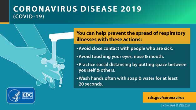
Image: CDC.gov
Obviously, we are not alone, and this virus has spared few countries and races. Different cultures across the globe have adapted for the pandemic in a variety of ways, and the U.S. has faced the same challenges across our diverse environments.
Depending on where one is located, they face a different set of challenges due to the pandemic. Several heavily populated urban areas are subject to a strict lockdown while states with mostly rural areas are less restrictive. One size does not fit all when dealing with limiting public exposure to others, but let us leave the debate of how much restriction is needed to the scientists and public officials. Many today do not agree with the rules we have been dealt with in going about with our lives. That is a discussion for another time and different forum.
Instead, let us discuss what we face going forward with our “new reality” of some form of social distancing and how the need for surveying and geospatial information remains for a large portion of this world. We must simply adapt to this situation with the adoption of new technologies and a revamped workflow.
Everything changes, whether we like it or not
The surveying profession is not unlike many other service-oriented and public-serving occupations, even with most of the field work being performed in solitude. We still deal with clients, governmental agencies, other consultants and the public.
The COVID-19 pandemic has changed the way we are now interacting with those outside partners with technological advances and modified communication conduits. Many of these methods existed well before this situation, but the rapid advancement of the pandemic forced many companies and employees into adapting very quickly.
Surveyors are no different, so let us run through the changes we have seen within the industry.
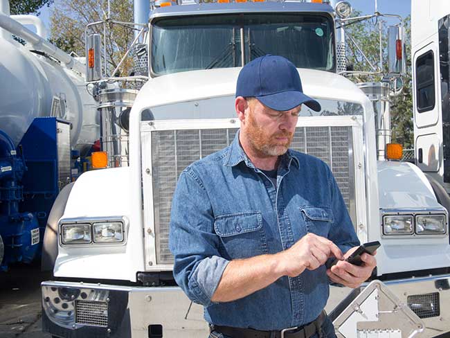
Project communication
The biggest challenge facing most surveyors in dealing with the pandemic atmosphere has been communication. Whether it is with employees, clients, government agencies or other consultants, communication has been affected mostly because of the elimination of face-to-face opportunities.
Technology to allow remote communication has existed for many years, but not many of us have taken advantage of it because of the convenience of in-person interaction. Who does not want to leave the office to meet with a client, shake their hand and close the deal? Or have the client come to your office and go over the intricacies of a complex survey?
Regardless of whether one is introverted or extroverted, human contact has always helped establish and solidify relationships. For most of us, this is how business has always been done, be it your client or your employees.
Obviously, the biggest area affected has been daily interaction with employees. Controlling workflow, handling projects and troubleshooting any situation is more difficult when the team is not physically in the same location. If a team member is overwhelmed, another one can immediate meet with them and help. Work is easily passed between teammates with little effort.
But working remotely? That takes more effort, consideration and technology to accomplish. Yes, video conferencing has been in place for many years, but mostly in large companies and only implemented it in a dedicated conference room. Not many employees were previously afforded a webcam, microphone and speakers along with the necessary software; all of these components are now standard issue. For many, programs like Zoom, Skype and Microsoft Teams are now a critical communication tool for timely and efficient sharing of information.
What about communication with field crews? Many would say that even a pandemic would not change how we stay in touch with field crews, but even these relationships have been affected. While there are survey companies operating with limited physical contact as a norm (large firms with projects regionally or nationwide), most surveyors still have a substantial amount of direct communication between field and office. This situation has forced many firms to take precautions, with crew members only handling specific pieces of equipment or performing a thorough cleaning if sharing during a project.
Project documents and files have typically been been handled manually with some electronic data files being transferred via email or internet. Depending on the size of the original document, having a full-size paper copy of a previous survey or subdivision plat has advantages to looking at a PDF image on a tablet or computer screen while in the field. Many companies outfit their field crews with 11 x 17-inch printers to be able to print larger detailed areas of bigger documents. Additional care must be taken if these items will still be used for field operations.
Image: Tim Burch
The transfer of data between office and field has become faster, more efficient and safer with technology. As data collectors have become more capable, direct connections via the internet to cloud storage is making transfer of project files and photos faster and more secure by providing immediate backup to guard against data loss. What used to take a trip to the office, connecting to a computer and downloading is now done in a matter of minutes without leaving the job site.
Field personnel are also benefiting from technology within our devices. Apps like FaceTime and programs like Microsoft Teams provide a gateway to video chatting so teammates can discuss projects in real time. Shared pictures, computer screens and face-to-face interaction provides an avenue to more effective communication and enhancing relationships between team members.
The pandemic has forced many surveyors to adapt and learn several new apps and programs to connect in new ways; however, this pandemic has also affected how we go about our field operations, too.
Enhanced data collection
Not many of the surveyor’s field activities are affected because of social distancing requirements, but the pandemic has forced our profession to be compliant with the new rules in case we are in proximity with others. Newer technology, using both terrestrial and aerial platforms, are now being utilized by more surveyors for their data collection needs.
Train employees now. As many companies have seen a slowdown in work due to pullbacks from projects moving forward, now is the time to get employees trained with the new technology and software to be better prepared for when the market comes back.
Using photogrammetry tools. Photogrammetry, lidar and laser-scanning systems are being purchased and implemented for everyday use and not just “special” projects with larger budgets. Not only are surveyors finding it keeps them further away from other people, it also allows for more efficient data collection and representation of existing conditions.
Flying unmanned aerial vehicles. UAVs continue to grow in popularity, and like the other technology discussed above, many firms are investing in becoming remote pilots and implementing aerial photography and lidar into their workflow. Previously, most surveyors (and the general public) would use Google Earth, Bing and other resources for aerial imagery to gain a better perspective on their project sites. Vendors are coming out with aerial products with more recent flights at a higher resolution, but do not offer the ability to extract reliable topographic data easily. In-house UAVs provide more flexibility and control over the information needed, and many are using their downtime to become familiar with aerial products.
Photo: GPS World
Dipping toes into remote sensing. Another sector of surveying equipment seeing increased use during this situation are new total stations with remote-sensing capability. Many surveyors may not have the need for a standalone laser or lidar scanner, so several manufacturers have introduced a total station that provides limited remote sensing for everyday use. While the built-in scanner is not nearly as robust as a traditional remote-sensing unit, it provides enough capability and accuracy for most users. This intermediate step of remote sensing helps a firm decide how much scanning they will produce and if an investment in a full function unit is right for them.
Upgrading GNSS receivers. We would be amiss if we did not mention that more surveyors are now upgrading their GNSS receivers to take advantage of more constellations, integration with IMUs and increased computing power of the latest data collectors. Some surveyors who are not as economically affected during this pandemic are taking advantage of great deals on new equipment and using this time to increase their capability and efficiency. As more satellite vehicles become available, the ability to gain accurate and precise locations is better than ever, so staying ahead of technology is still important in these times. We will continue to see more gains with L5 and L1C signals from the new GPS Block III satellites within the next few years, so staying current now is very important.
QA/QC — The electronic method
One trouble spot seen within the new paradigm is the ability to provide a thorough quality assurance/quality control (QA/QC) process on all surveying operations. Without the ability to print/plot original surveys at full scale, it becomes a more difficult procedure to review and analyze information on a computer screen.
The monitors used for drafting and calculations are getting bigger, but studies have shown the human eye will focus differently on an electronic screen compared to a survey on paper. There must be many other professions and occupations using similar technology who have yet to solve the QA/QC dilemma. Hopefully, our industry will find a way to help address this issue and provide guidance.
Image: Tim Burch
More connected than ever, yet still so alone
The COVID-19 pandemic of 2020 (let us hope that is all it encumbers) will be forever etched in our memories as frightening and unbelievable. More than 100 years has past since the last pandemic of this proportion has overwhelmed our population. We are much more advanced in our education of health, medicines and technology than the previous event, yet we were caught off-guard by the speed in which the virus spread throughout our lands. It taxed most of our health infrastructure beyond its limits and took its toll emotionally and financially to most of the population.
We were forced to adapt very quickly to a new norm of working remotely and independently of our co-workers and teammates. Did it hurt our productivity and profitability initially? Absolutely. Were our employees forced to learn new ways of doing their work and communicating by other means. Yes, they did. Was there a need for rapid troubleshooting of new procedures and task management? Of course. Has every transition of remote work been a success story? I doubt it, but it was not for lack of trying.
We are doing the best we can, and the surveying profession is rapidly trying to adapt. Like the rest of the world, the surveying profession will not be the same coming out of the restrictions placed upon us because of the pandemic. We have learned more about ourselves and how capable we are with tools we have. We also learned how we will transition with these skills into new technology not invented yet.
Surveyors are a tough bunch, so the social distancing and adaptation required to survive the COVID-19 pandemic of 2020 — while not easy by any stretch — has been handled with grace and professionalism. I would say to bring on the next one, but would rather this pandemic be in our rearview mirror quickly and not see anything like it ever again.
The show was originally scheduled to take place May 4-7 in Boston. It was then postponed to tentatively take place Aug. 10-12 in Boston. Because AUVSI was unable to secure the original location for the new dates, the trade show has been moved to the Kay Bailey Hutchison Convention Center in Dallas.
“While we are disappointed to leave Boston, we are excited to confirm that we will be once again hosting Xponential in Dallas, Texas,” said Brian Wynne, president and CEO of AUVSI. “We anticipate great participation based on the attendance and engagement we experienced there in 2017, and our AUVSI Lone Star Chapter has already extended a warm welcome on behalf of the Texas unmanned systems community.”
According to AUVSI, it based its decision to reschedule to the fall on concerns for the health and safety of the attendees of the trade show because of the coronavirus pandemic.
“For 48 years we have witnessed how innovation and resolve meet challenges head-on to reshape critical missions and business operations for the better,” Wynne said. “Our commitment to supporting the unmanned systems community remains unwavering, so amidst the current global health crisis we, too, must adapt to fulfill that mission.”
AUVSI also will implement a health and safety plan to address social distancing and other measures to help keep participants safe, the association said.
The AUVSI Xponential trade show highlights advancement of businesses and technologies in the unmanned systems industry.
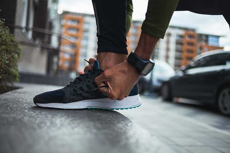
According to the company, the week President Donald Trump declared a national state of emergency marked a major shift in human activity.
Garmin data pointed to a massive decline in the overall number of steps taken during the second two weeks of March in the U.S. This trend is consistent with the company’s global trend data in China, Italy and other countries where the coronavirus pandemic struck first.
“We’re observing a remarkable shift in the types of activities people are doing, reflecting an unprecedented about-face when it comes to typical springtime exercise and activity,” Garmin said in a blog post.
To paint a clear picture of the initial trends, Garmin engineers and data analysts looked at the percent change in activity levels in the United States for specific sports and exercises and compared the first half of March with the second half of March to determine increases and decreases. The results also are baselined against the same time period in 2019.
Here’s an overview of how activity has changed.
Skiing and snowboarding: These activities are down 96%. This aligns with resorts closing because of the pandemic.
Cycling: Virtual cycling activity was up 64% in the second half of the month, a shift that appears even more atypical when comparing it to the same time period last year. March 2019 saw a 20% decline in the activity as cyclists naturally began to take their rides outside to enjoy the warmer weather, Garmin said.
Indoor/treadmill running: Indoor/treadmill running is down 44%. According to Garmin, this doesn’t mean this activity has come to a halt. Because gyms across the country are closed, a number of treadmills aren’t being used. In fact, virtual running saw a steep increase in the second half of March, and despite gym closures, overall indoor cardio is holding strong over 2019 levels and showing an 18% week-over-week increase from March 16 to March 30. This suggests more people are exercising, and they’re finding ways to do it from home, with and without their own equipment, Garmin said.
Lap swimming: Lap swimming is down 88%.
Walking: Walking is up 36% when comparing the front half of March to the back half of March. This surge is double the 18% increase observed over the same time period last year, Garmin reported.
Yoga: Garmin wearable device data shows an 11% increase in yoga activity, when comparing the front and back halves of the month. This is an increase in 2019 data, as well.
Golf: Golf has seen a 20% decline in activity for the second half of March. When comparing the same two time periods last year, golfing activity increased by 53%.