Raytheon Company has signed a strategic agreement with AirMap, an airspace intelligence platform for drones, to collaborate on projects to safely integrate unmanned aerial systems (UAS) into the national airspace system. This will help unlock the positive economic and social benefits of expanded commercial drone operations, the companies said.
Unmanned air traffic control advances will unlock safe, efficient and scalable drone operations with a myriad of economic and social benefits.
“AirMap is ushering in a new era in drone aviation,” said Matt Gilligan, vice president of Raytheon’s Intelligence, Information and Services business. “Drones must safely operate in an already complex ecosystem, which is where our experience matters.”
The agreement combines the two companies’ expertise:
Raytheon’s Standard Terminal Automation Replacement System, or STARS, is used by air traffic controllers across the U.S. to provide safe and efficient aircraft spacing and sequencing guidance for more than 40,000 departing and arriving aircraft daily at both civilian and military airports.
AirMap is a global provider of airspace intelligence for UAS operations, with over 250,000 registered users. In 2018, U.S. registered commercial drone pilots used AirMap to request more than 45,000 automated authorizations to fly in controlled airspace.
“Raytheon technology has helped safely and effectively manage airspace in the most complex, dense controlled airspace in the world for decades,” said Ben Marcus, AirMap co-founder and chairman. “They are an ideal partner to join AirMap on the path toward enabling safe, efficient, and scalable drone operations in U.S. low-altitude airspace between 0 and 400 feet.”
The two companies are working toward an integrated demonstration that will showcase how AirMap’s unmanned aircraft traffic management platform can increase air traffic controllers’ awareness of potential conflict between drones and manned aircraft near airports to ensure overall safety of the airspace.
Welcome to Part 2 of our coverage of the mammoth AUVSI Xponential 2019 show in Chicago, which drew 8,000 attendees, featured 300+ speakers on its technical program, and furnished a temporary home for more than 800 exhibitors. It was “Everything Unmanned” and a challenge to cover. Last month we looked primarily at new vehicles. This month’s column focuses on sensors, capabilities and apps aboard those and other airborne drones — and even an anti-drone drone!
Sagetech: For UAVs to gain entry to the US National Airspace System (NAS) and to other controlled airspace all around the world, sense-and-avoid capability is paramount. Sagetech comes from the world of Mode-S transponders, with which the majority of piloted aircraft are equipped. These devices transmit aircraft identification and provide the moving IDs on air-traffic controller display monitors. In the military sector, Identification Friend or Foe (IFF) interrogator-transponders enable similarly equipped aircraft of NATO countries to determine which are friendly aircraft within their immediate airspace, and which are not.
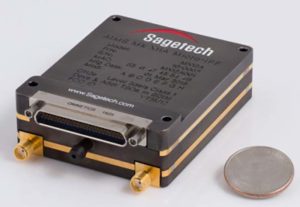
The MX12B Mode 5 IFF with FAA-certified civil modes. (Photo: Sagetech)
Sagetech has just released a micro-mode 5 MX12B aviation transponder that enables small unmanned aircraft to interoperate within NATO airborne units. The transponders weigh around 10lb, so mil-spec UAVs operating in NATO airspace can now also carry this light-weight unit.
For civilian UAVs, GPS has been added to provide aircraft position outputs in Automatic Dependent Surveillance Broadcast (ADS–B) message format, allowing other aircraft and UAVs to receive a vehicle’s location. The Sagetech ADS-B transponder is small, certified to Federal Aviation Administration (FAA) standards (TSO C-166b) and is affordable. Boeing Scan-Eagle UAVs apparently already carry Sagetech transponder capability.
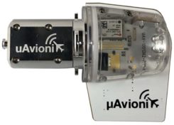
The tailBeacon ADS-B retrofit. (Photo: uAvionics)
uAvionix: Another avionics supplier has brought out certified ADS-B capable transponders, but with a novel way to add the required capability to general aviation (GA) aircraft, typically smaller private planes. The FAA has mandated that all aircraft should be fitted with ADS-B capability by January 1, 2020 in order to fly within controlled airspace, so uAvionix has simplified ADS-B retrofit for older GA aircraft.
All aircraft have wingtip and/or rear-tail beacon lights; this update replaces their existing beacon with a light which also includes ADS-B capability when paired with the aircraft transponder.
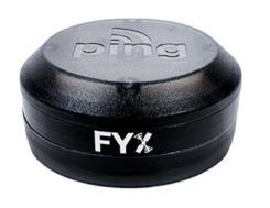
The FYXnav TSO CERTIFIED GPS navigation source. (Photo: uAvionics)
uAvionix also supplies a couple of GPS sensors for external mounting on UAVs: the FYXnav sensor is FAA-certified to TSO-C199 Traffic Awareness Beacon System Class B.
Sensefly released a new inspection application for their eBeeX UAV, specifically designed for solar farms. With a dual thermal/video sensor for data collection and data processing using application-specific Raptor Maps software, Sensefly claims to reduce the inspection time required for a 150MW solar farm to around 1 day, a 300-times improvement on ground inspection using a hand-held thermographic sensor.
Provided an inspection operation could support five 70-minute eBee-X flights during one day, the UAV could over-fly up to 161 acres of solar panels at an altitude of 138ft, gathering anomalies during each flight. This adds up to 150MW of solar panels over the 5 flights. Sensefly claims this to be twice as fast as with multi-rotor dones. The Raptor Maps software then generates an inspection report identifying each anomaly, using the eBee X’s video and thermal imagery to identify, classify, and localize the detected problems.
The Fortem DroneHunter intercept drone. (Photo: Fortem)
Fortem makes an anti-drone defense combining a radar detection system with a DroneHunter drone that attacks other UAVs, releasing an 80ft net to capture intruders. For those nefarious drones which are hardened against RF countermeasures, this system is also touted as capable of recovering the offending drone without damage, returning it to the operator in a net at the end of a tether. The DroneHunter flies autonomously on its intercept mission, carrying a compact radar system integrated with a ballistic net release system.
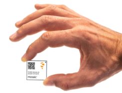
Septentrio continued promotion of its Mosaic chip-level GNSS at Xponential. The new chip uses the same proven core DSP with a new RF front-end and a new processor, working with more than 30 signals from the existing six GNSS constellations, and with L-band and satellite-based augmentation systems (SBAS).
The chip appears to be aimed at the high-precision market, replacing the AsteRx-m2 board level receiver family.
The chip runs Septentrio RTK algorithms, is quite small (1.29 x 1.29 x 0.15 in), is designed for high-volume surface mount manufacture, and comes with a set of popular interfaces. The chip is sampling now, with production planned for later this year.
NovAtel is growing, opening new offices in the US and needing more local real-estate to fit its headquarters in Calgary, Canada. The company is now part of Hexagon Positioning Intelligence (Hexagon PI), a partial re-branding that includes VERIPOS correction services and recently purchased AutonomousStuff, specializing in ground vehicles. Each organization still operates individually through its own brands. On the NovAtel booth, existing products were presented through a number of new applications, including those of the growing mil-spec products group.
Summary. While AUVSI Xponential was over in early May, the companies who were there have not rested. All are developing new approaches for UAVs and unmanned ground vehicles, sensor systems for even wider applications than seen in Chicago, and all manner of other added capabilities. This business only gets bigger and more innovative.
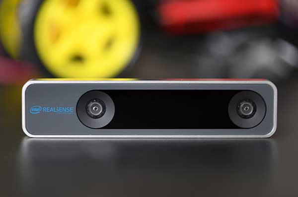
The RealSense camera uses two fisheye lenses and an IMU to construct location awareness. (Photo: Intel)
The Intel RealSense Tracking Camera T265, designed for positioning and maneuvering mobile robots and other portable systems, includes an inertial measurement unit (IMU) that enables developers to create solutions with advanced depth-sensing and tracking capabilities. Intel introduced the camera in Q1 of 2019. An earlier model, the D435i, also includes an IMU but is a depth camera, not a tracking camera.
As robots, drones and other autonomous mobile devices must — eventually — interact independently and intelligently with their environments, they must track their locations as they move, navigating unfamiliar spaces while discovering, monitoring and avoiding still and moving obstacles in real time.
Block diagram of camera components. (Image: Intel)
Moving toward that goal, the T265 includes two fisheye lens sensors, an IMU and an Intel Movidius Myriad 2 video processing unit (VPU), a system-on-chip component for image processing and computer vision at very high performance per watt.
Vision-based simultaneous localization and mapping (V‑SLAM) algorithms run directly on the VPU with very low latency. The T265 has demonstrated less than 1% closed-loop drift under intended use conditions. It also offers sub 6 ms latency between movement and reflection of movement in the pose.
The RealSense device measures 1 x 0.5 x 4 inches (108 mm x 24.5 mm x 12.5 mm), weighs around two ounces (55 g), and draws 1.5 watts to operate the entire system, including the cameras, IMU and VPU. Its spatial sensing and tracking capabilities are based on technology developed by RealityCap, acquired by Intel in 2015.
The camera performs inside-out tracking: it does not depend on external sensors to understand its environment. Tracking is based on information gathered from the two fisheye cameras, each with a 163-degree range of view (±5 degrees) and capturing images at 30 frames per second. The wide field of view from each sensor keeps points of reference visible to the system for a relatively long time, even if moving quickly.
Visual-Inertial Odometry. A key strength of visual-inertial odometry is that the sensors complement each other. The images from the camera are supplemented by data from the onboard IMU, which includes a gyroscope and accelerometer. The aggregated data from these sensors is fed into the SLAM algorithms.
The algorithm identifies sets of salient features in the environment, such as a corner of a room or object that can be recognized over time to infer the device’s changing position relative to those points.
The visual information prevents long-term drift from the inertial that degrades position accuracy. The IMU operates at a higher frequency than the cameras, allowing for quicker response and recognition by the algorithm to changes in the device’s position. A map of visual features and their positions is built up over time. In re-localization, the camera uses the features it has seen before to recognize when it has returned to a familiar place. The camera can locate its point of origin with an error margin of less than one percent.
Drone testing demonstrated that, in both cases, the tracking and position data generated by the peripheral was closely correlated with what was provided by GPS. This supports the viability of using it for navigation in areas where GPS is not available, such as under a bridge or inside an industrial structure.
SoftBank plans to introduce a centimeter-accurate, real-time satnav-based positioning service, specifically using Japan’s Quasi-Zenith Satellite System (QZSS), to guide autonomous vehicles across a range of industries in Japan. The company said it will install more than 3,300 control points at base stations across Japan to deliver centimeter-level accuracy over its mobile network coverage area to provide real-time kinematic (RTK) positioning.
Testing begins in July with a scheduled launch of commercial service by the end of November. Test partners include Yanmar Agribusiness Co., Ltd., a provider of autonomous assisted driving for agricultural machinery, Kajima Corporation, which performs construction site management with automatically controlled drones for aerial photography and monitoring, and SB Drive Corp., a provider of autonomous and assisted driving technology for buses.
SoftBank is developing proprietary low-cost GNSS receivers so that “new services and market expansion can be realized.” A Positioning Core System provided by ALES Corp. will generate correctional data based on signals received and transmitted by SoftBank’s own control points over SoftBank’s mobile communications network to agricultural and construction machinery, self-driving cars, drones and other equipment carrying GNSS receivers. The company expects that centimeter-level positioning can thus be done in real time.
In addition to control points at its own base stations, SoftBank will use the Geospatial Information Authority of Japan’s approximately 1,300 GPS-based control stations.
SoftBank is also developing services to enablec loud-based RTK positioning for devices without GNSS receivers. Cloud-based RTK will provide centimeter-level, location-based services for equipment that needs to be miniature and energy-efficient, such as infrastructure surveillance sensors and wearable devices.
SoftBank Group Corp. is a Japanese multinational conglomerate holding company headquartered in Tokyo. It owns operations in broadband, fixed-line telecommunications, e-commerce, internet, technology services, finance, semiconductor design and more. It is the 36th largest public company in the world, and the 2nd largest in Japan.
ALES is a joint venture established by SoftBank and Enabler in July 2018. Enabler employs GNSS and related technologies to produce such products/services as a synchronization solution for mobile base stations for subway stations and a patented indoor positioning/time synchronization infrastructure platform in Japan.
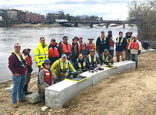
2019 Aquatic Airshow participants at Androscoggin River in Auburn, Maine, on May 1. (Photo: Mario Martin-Alciati, USGS)
The U.S. Geological Survey (USGS) and independent scientists gathered this month in Auburn, Maine, to evaluate the use of sensor-mounted unmanned aircraft systems (UAS) to gauge stream stage, velocity, bathymetry and discharge.
The technology is being evaluated and modeled to determine whether it will support the fast, accurate and safe measurement of rivers, especially when they are flooded or contain floating trees, ice or other debris.
Close to two dozen hydrologic, geospatial and scientific experts gathered in what has been dubbed the “2019 Aquatic Airshow” to assess the technology. They were led by John Fulton of the USGS Colorado Water Science Center, Jack Eggleston of the USGS Water Mission Area Hydrologic Remote Sensing Branch, and Joe Adams and Sandy Brosnahan of the USGS National UAS Project Office.
The USGS Water Mission Area works with partners to monitor, assess, research and report on a wide range of water resources and conditions, including streamflow, groundwater, water quality, water use and water availability.
The testing involved equipping drones with noncontact sensors, including ground-penetrating radar for measuring river depths, doppler velocity radar and cameras with velocimetric analysis for measuring water surface velocities and calculating mean-channel velocities; and high-resolution cameras for photogrammetric mapping of surface topography and vegetation structure.
All the evaluated sensors were equipped with GNSS receivers; some with RTK correction capability. Most of the drones used were equipped with a low-grade inertial measurement units (IMUs) for navigation.
Team members from the USGS Water Science Centers in Colorado, New England and Virginia collected ground-truth river monitoring data with acoustic doppler current profilers deployed from a boat and multiple other surveying techniques to verify the accuracy of the drone-based stream data.
Woolpert Chief Scientist Qassim Abdullah was one of two scientists from the private sector asked to participate in the airshow. Abdullah has more than 40 years of experience in analytical photogrammetry, digital remote sensing, and civil and surveying engineering.
For the event, Abdullah devised a process in which the data collected by the drones underwent Pix4D triangular adjustment to produce three-dimensional models of the water surface and river edges to assist the modeling of river velocity using the drone-based doppler velocity radar and large-scale particle image velocimetry.
USGS scientists are in the process of evaluating the data and modeling produced by this testing to conclude whether this technology will prove beneficial.
Abdullah said the airshow was a success due to the varied contributions from each member of the team, their diverse backgrounds and their shared focus on water research.
“This was a great example of how a public-private partnership can work together to activate and elevate necessary, groundbreaking technologies to address worldwide issues,” Abdullah said. “Airshow team members brought different perspectives, processes and applications to the testing, which not only proved essential for this project but will help with many others moving forward. I love working with this group and look forward to continuing to help advance these vital technologies.
The new senseFly Solar 360 UAV is designed to enable the automated and efficient inspection of solar farms.
Photo: SenseFly
SenseFly has introduced its senseFly Solar 360. Created in collaboration with software company Raptor Maps, the offering is an efficient thermal drone solution that enables the automatic assessment of solar plant performance at a sub-module level, the companies said.
Created by combining eBee X fixed-wing drone technology, senseFly’s Duet T thermal mapping camera and Raptor Maps’ software, senseFly Solar 360 is a fast and fully automated drone. It is easily integrated into solar management workflows without requiring either drone piloting skills or the manual analysis of aerial solar farm data.
“At senseFly we are continually looking across the industry to identify new commercial partners with whom we can bring to market what our customers need, which is vertically-focused end-to-end solutions,” said Gilles Labossière, CEO of senseFly.
“With Raptor Maps, we are collaborating with a true solar industry pioneer,” Labossière said. “Their software takes the guesswork out of solar farm inspection and, crucially, speeds up this process — from days down to hours. This efficiency, combined with the eBee X’s large coverage and reliability, ensures that farm owners and operators — or the drone service providers they employ — can inspect utility-scale solar farms more quickly, easily, and accurately than ever before.”
“Solar power is the largest source of new energy generation in the world,” said Nikhil Vadhavkar, CEO of Raptor Maps. “This rapid growth has fueled demand for industry-specific solutions to allow solar customers to scale. Our enterprise-grade software has been deployed across six continents and 25 million solar panels to increase power production and reduce risk and maintenance cost across solar portfolios. We are proud to collaborate with senseFly, the industry leaders in commercial fixed-wing drones, to increase access to Raptor Maps while providing a comprehensive, end-to-end solution that scales with the solar industry.”
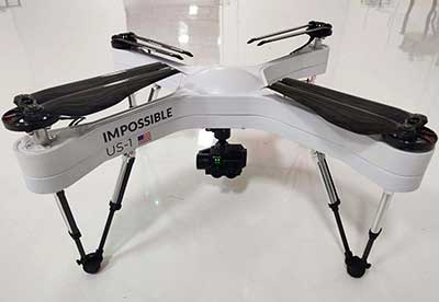
Auterion and Impossible Aerospace are collaborating to bring to market the US-1 UAV, which has a two-hour flight time.
Auterion is the provider of Auterion Enterprise PX4, an open-source-based, enterprise operating system for drones. Impossible Aerospace is Silicon Valley, California-based drone manufacturer on a mission to assemble the highest performance electric aircraft.
“During critical public safety incidents, real-time intelligence from a UAV is extremely important. This is why the two-hour flight time of the US-1 is a clear necessity.” said Spencer Gore, CEO of Impossible Aerospace. “We turned to Auterion for software because their operating system is auditable and trusted for government applications.”
“Public safety organizations can now field a drone with government solicited, cyber-secure and trusted software that enables the drone to stream real-time footage to a command center,” said Kevin Sartori, co-founder of Auterion. “Choosing Auterion and its open-source, open-standards approach will greatly simplify the integration of the US-1 into the IT-infrastructure of public safety organizations.”
Thousands of professional drone pilots and businesses around the world count on open-source flight control software PX4, which was created by Auterion co-founder Lorenz Meier in 2011 and has evolved into a global developer community. Similar to Red Hat, Auterion builds the open-source infrastructure so that drone manufacturers can go to market faster with new products flying trusted software.
The US-1 quadcopter made its public safety debut in February with a California-based police force. The drone gives police agencies a new category of assets that sit between lower-end drones and police helicopters. This enables a wider usage of aerial imagery and reduces the cost for first responders at the same time.
Topcon Positioning Group’s Dave Henderson offers a rundown on the company’s latest products, including the Falcon 8+ drone, Sirius Pro, MR-2 modular receiver, and B210 and B125 receiver boards, at Xponential 2019.
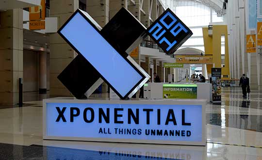
The GPS World and Geospatial Solutions staff are reporting live from the Association for Unmanned Vehicle Systems International’s (AUVSI’s) Xponential 2019 April 29-May 2 in Chicago.
The event convenes the global community of commercial and defense leaders in intelligent robotics, drones and unmanned systems. Check out news, photos and videos from the show.
Raytheon Company’s advanced high-power microwave and mobile high-energy laser systems engaged and defeated multiple unmanned aerial system targets during a U.S. Air Force demonstration. The mature HPM and HEL technologies offer an affordable solution to the growing UAS threat, the company said.
Raytheon made the announcement at AUVSI Xponential, which took place April 29-May 2 in Chicago.
Raytheon’s mobile high energy laser looks out into a wide-open sky. The company’s advanced high-power microwave and high-energy laser engaged and defeated dozens of unmanned aerial system targets in a recent U.S. Air Force demonstration.
The HEL system, paired with Raytheon’s Multi-Spectral Targeting System, uses invisible beams of light to defeat hostile UASs. Mounted on a Polaris MRZR all-terrain vehicle, the system detects, identifies, tracks and engages drones.
“Countering the drone threat requires diverse solutions,” said Stefan Baur, Raytheon Electronic Warfare Systems vice president. “HEL and HPM give frontline operators options for protecting critical infrastructure, convoys and personnel.”
Raytheon’s HPM uses microwave energy to disrupt drone guidance systems. High-power microwave operators can focus the beam to target and instantly defeat drone swarms. With a consistent power supply, an HPM system can provide virtually unlimited protection.
“After decades of research and investment, we believe these advanced directed energy applications will soon be ready for the battlefield to help protect people, assets and infrastructure,” said Thomas Bussing, Raytheon Advanced Missile Systems vice president.
Raytheon’s HEL and HPM were the only directed energy systems that participated in this Air Force experimentation demonstration. The event expanded on previous directed energy demonstrations such as a U.S. Army directed energy exercise held in 2017.
Mobilicom’s SkyHopper VU remote viewing terminal is specifically designed for commercial and industrial drones and robotics. (Photo: Mobilicom)
Mobilicom Ltd., a global mission-critical-communications solution provider, will present its SkyHopper end-to-end solutions for smart drones and robotics at the Association for Unmanned Vehicle Systems International’s Xponential 2019 trade show.
According to the company, SkyHopper brings all the key components that turn a drone into a smart drone. The SkyHopper product suite includes communication data links, cybersecurity and encryption that has been validated by the Israel Ministry of Defense and other government organizations; video processing; controllers and viewers.
The product line includes the SkyHopper PRO bi-directional data link, SkyHopper PRO V integrated video processing, SkyHopper ControlAir ruggedized controller and the SkyHopper VU remote viewing terminal.
According to the company, the SkyHopper PRO bi-directional data link delivers long range and non-line of sight communication that supports multiple transmission modes. The SkyHopper PRO V includes a dual-camera input, three camera interfaces, dual built-in video encoders and decoders, and local recording ability. The SkyHopper ControlAir allows users to control a drone or robot, as well as transmit or view a video and data while operating in air and ground missions. Finally, the SkyHopper VU offers a mobile HD video and telemetry receiver terminal for multiple viewers, specifically designed for commercial and industrial drones and robotics.
“We have done our homework in understanding what our customers need in order for their drones to successfully execute their missions,” said Oren Elkayam, CEO of Mobilicom. “As a result, while others focus on offerings for today, we offer solutions also essential for the future survival and scalability of commercial drones of robotics. With proprietary drone cybersecurity and radio technology and a highly experienced customer success team, SkyHopper has maintained a strong base of over 50 customers and counting.”
According to Mobilicom, its goal is to enable commercial drone and robotics manufacturers to increase their chances for success by focusing on their own business objectives, reducing time to market and minimizing resource expenditures.