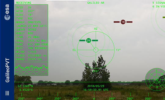
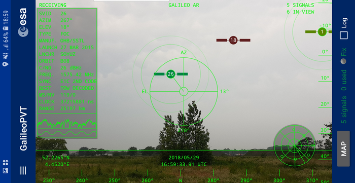
The European Space Agency (ESA) has released an augmented reality view of Galileo satellites in the sky close to its technical centre in the Netherlands.
The image comes from a Galileo-focused satnav app for Android smartphones, developed by ESA engineers. ESA ran an internal competition for its trainees to develop an app capable of making positioning fixes using only Galileo satellites.
“As part of our support for the competition, we developed our own app on a voluntary basis to serve as a benchmark,” said Paolo Crosta of ESA’s Radio Navigation Systems and Technology section. “We included this augmented reality view, so users can ‘see’ the satellites their smartphone is using as they hold it up to the sky.”
Galileo satellites viewed in smartphone app. (Photos: ESA)
The positioning calculations and assistance data functions for the app were developed by Paolo, with telecom engineer Tim Watterton contributing the main structure of the app, together with how it looks and its user interface.
“The satellites are overlaid in real time on the camera view in their predicted positions in the sky, based on ‘ephemeris’ information, assistance data that describes the current satellite orbits with high precision,” Watterton said. “When a signal is being received, the satellite is shown in green, overlaying the predicted position. The satellite shown in red is one of the two placed in elongated orbits, but these satellites are expected to be used soon in the operational constellation. Satellites colored orange are transmitting, but the signal is not detected, which may be due to obstruction by terrain or buildings.”
Panning the phone around to position the crosshair over a green-colored satellite adds additional information, such as its signal status, pseudorange (the uncorrected distance the signal has traveled to reach the receiver) plus the satellite’s manufacturer and launch date, among other items.
The reference app is now being tested with the hope of making it publicly available on the Google Play Store. Following the competition, the trainees are also testing their own apps with the goal of releasing them.
Technicians in SCAPE (Self Contained Atmospheric Protection Ensemble) suits fill Galileo satellites 22-26 with hydrazine fuel. (Photo: ESA)
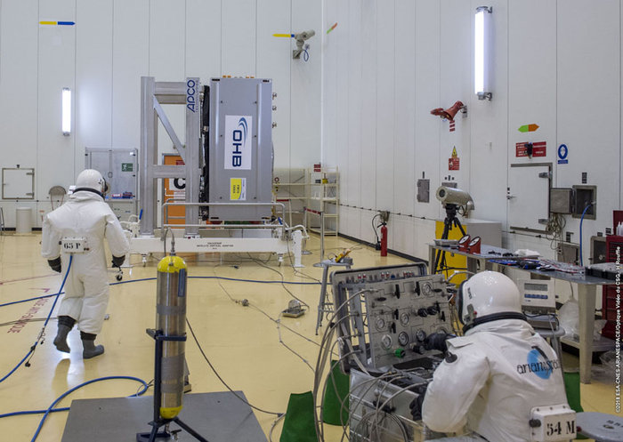
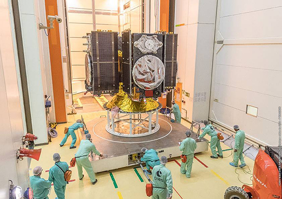
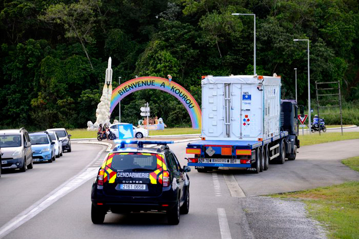
Europe’s next four Galileo satellites have been fueled at Europe’s Spaceport in Kourou, French Guiana, in preparation for their launch on July 25, according to the European Space Agency (ESA).
The four satellites were placed into their protective containers to be transported from the S1A processing building to the S3B payload preparation building, where they were filled with the hydrazine fuel that will keep the satellites manoeuverable during their 12-year working lives.
The next step is to fit the quartet onto the dispenser that holds them in place securely during launch and then releases them into space once the upper stage of the Ariane 5 rocket reaches its 22,922-kilometer-altitude target orbit.
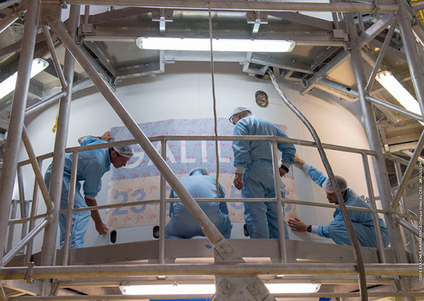
After that, the satellites plus dispenser will be fitted onto the upper stage then enclosed by the two sides of the protective launch fairing — one of which has had the mission logo added to it.
Meanwhile, the Ariane 5 for this launch (Flight VA244) has undergone assembly inside the Spaceport’s Launcher Integration Building.
Galileo’s Flight VA244 mission logo is attached to the Ariane 5 fairing ahead of the July 25 four-satellite launch. (Photo: ESA)
Europe’s satellite navigation system Galileo is already in use worldwide, usable by itself or in combination with the U.S. GPS. Now a combined Galileo–GPS positioning fix has been achieved in space — aboard the International Space Station — through an ESA–NASA collaboration.
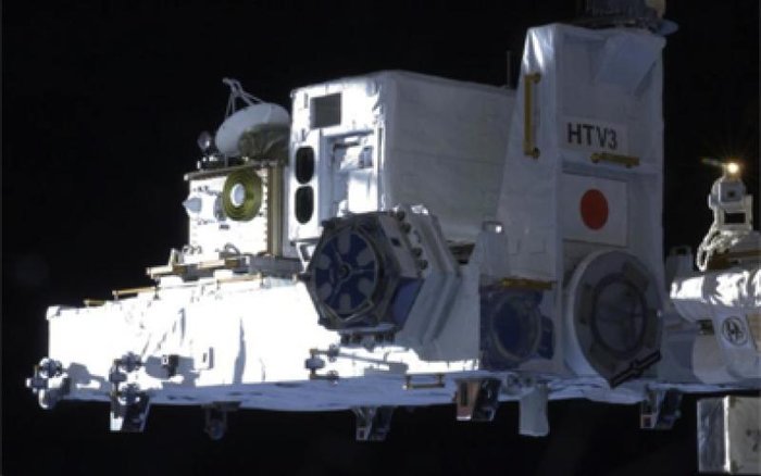
In April, the chest-sized SCaN (seen left of center with an antenna on top) was used to make the first combined Galileo-GPS positioning fix in orbit from the ISS. (Photo: ISS)
Low-Earth orbiting satellites routinely make use of satellite navigation signals to pinpoint their position in space and allow their paths through space to be fixed with extremely high accuracy, known as “precise orbit determination.”
So far, such positioning has mainly been performed using GPS, but this new test proves it can also be achieved on a dual-constellation basis with both GPS and Galileo — as well as through the sole use of Galileo.
The experiment is based on the use of a reconfigurable NASA receiver called the Space Communications and Navigation Testbed, SCaN, attached to the exterior of the ISS.
ESA’s Navigation Support Office, based at its ESOC control centre in Darmstadt, Germany, teamed up with its Radio Navigation Systems and Technology team, located at its ESTEC technical centre in Noordwijk, the Netherlands, and Italy’s Qascom company to develop the techniques, software and firmware required for the experiment, which was passed to NASA’s Glenn Research Center in Ohio for upload to the receiver.
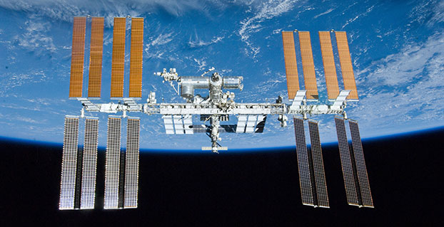
The International Space Station. (Photo: ESA)
“SCaN is a versatile software-defined radio receiver in space for both telecommunications and navigation testing, delivered to the Station back in 2012,” said ESA radio-navigation engineer Pietro Giordano. “It made it possible, with suitable modifications, to demonstrate combined GPS-Galileo positioning determination of the ISS.”
The algorithm developed for the SCaN Testbed had to take account of the high dynamics involved, and resulting Doppler shifting of signals: not only are the Galileo and GPS satellites moving at orbital velocity, so is the ISS itself. Orbital information of all the satellites in both constellations was included in the algorithm, allowing SCaN to make a ‘warm start’ – to search out signals in the correct segments of the sky.
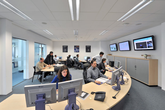
In February 2006, the Navigation Support Office inaugurated its modern Navigation Facility at the European Space Operations Center (ESOC) in Darmstadt, Germany. (Photo: ESA)
In February 2006, the Navigation Support Office inaugurated its modern Navigation Facility, at the European Space Operations Center (ESOC), in Darmstadt, Germany.
“Dual constellation fixes offer many advantages for space, providing extremely robust and high-precision positioning,” Pietro added. “More signals become available overall, and the quality of the Galileo Open service and modernised GPS signals are extremely good.”
Werner Enderle, overseeing the project at the Navigation Support Office noted, “These excellent first results, coming out of great teamwork within ESA, collaboration with industry and with our NASA partners, mark just the beginning of our project data analysis. Many other exciting results are expected related to signal aspects, precise orbit determination and positioning based on optimised algorithms.”
James J. Miller, GPS Sr. Technologist within the SCaN programme office at NASA Headquarters, commented: “We’ve been promoting interoperability of GPS and Galileo through a number of activities within the United Nation’s International Committee on Global Navigation Satellite Systems (GNSS). In particular, NASA, with ESA and other national space agencies, has been identifying benefits to be gained for high altitude users in the multi-GNSS Space Service Volume under development. By further demonstrating multi-GNSS capabilities in low Earth orbit, the drive for additional utility at geostationary orbit and beyond is only strengthened.”
Europe’s Galileo system began Initial Services for users in December 2016, and there are 22 Galileo satellites in orbit. The launch of four more Galileo satellites by Ariane 5 is scheduled for July 25, and will bring the constellation to 24 satellites plus two orbital spares.
ESA is developing dual Galileo-GPS receivers for the next generation of Earth-observing Sentinel satellites. The more precise the orbit determination, the more accurate the environmental data that can be returned to Earth.
Combined use of Galileo and GPS signals on an interoperable basis for positioning and precise orbit determination should bring significant advantages for space users in particular, set to provide a seamless navigation capability from low to high Earth orbits — and potentially beyond.
“This shows the versatility of the Galileo system and the use of the system for scientific and other purposes, way beyond traditional navigation services,” said Paul Verhoef, ESA’s Director of Navigation. “We have also started work to determine whether we can use Galileo, in combination with GPS and other systems, for navigation to the Moon.”
Testing of the three Galileo apps took place in May. (Photo: ESA)
ESA challenged its young graduate and national trainees to develop a smartphone app to perform satnav fixes using only Galileo satellites.
Three teams developed apps in their spare time, presenting their results to a jury of experts from ESA, the European Global Navigation Satellite Systems Agency (GSA) and Google.
“I’m very impressed,” said Javier Benedicto, ESA’s Galileo programme manager. “With little detailed knowledge of satellite navigation, these teams have developed something that didn’t exist just a few months ago. Working on Galileo we love to see that the systems we’re putting together can reach widespread application and inspire new uses.”
The winning Galfins Team put together the GNSS Compare app that promises to turn a smartphone into a “research lab in your pocket” to test Galileo performance in isolation or in combination with other systems. Their prize is to attend an ESA and European Commission-sponsored GNSS Summer School in Austria.
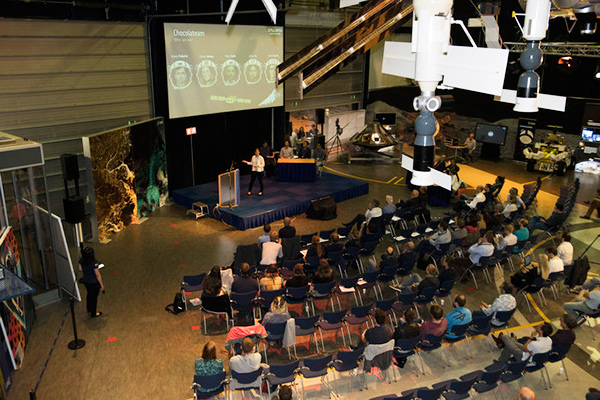
The final presentation and results of ESA’s internal Galileo smartphone app competition took place in the Erasmus centre of ESA’s Erasmus technical centre on May 31. (Photo: ESA)
“Only one of our four-strong team started the challenge with any knowledge about satellite navigation,” said Mateusz Kraiński of the Galfins team. “The rest of us come from different areas — for example, I’m working on the European Robotic Arm project, due to launch at the end of next year. We have learnt a lot and the radio navigation experts at ESTEC were a great source of support.”
“We see a need on the market for such an application, so we will definitely continue with the development. The application will be made available for download when ready, and the project will be released as open source soon after.”
The other two teams were also commended for their work; Chocolateam developed a richly-designed game-based app, giving the user the feeling of observing the Galileo satellites from a spacecraft, while Team 5G distinguished themselves by writing all their own navigation algorithms from scratch rather than relying on open source software.
The challenge was to design an Android smartphone app that allows users to compute and visualize their position based solely on Galileo measurements, as well as the possibility of selecting a combination of satnav constellations to assess their performance.
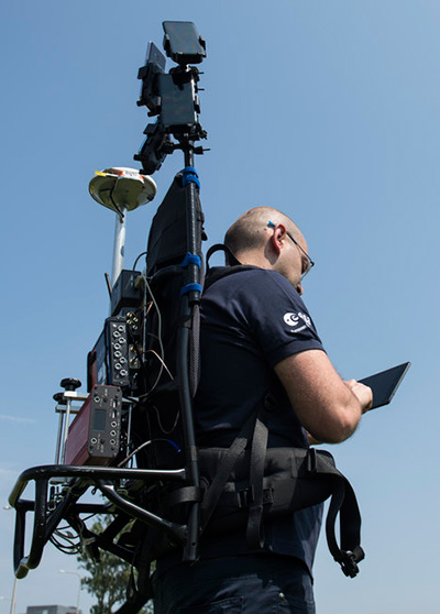
Testing the three apps entered in the Galileo smartphone app competition in the grounds of ESTEC, working in pedestrian mode. (Photo: ESA)
The receiver chipsets inside smartphones make use of Galileo signals in combination with several other satnav constellations — the U.S. GPS, Russian GLONASS and Chinese BeiDou. These chipsets function like “black boxes,” making the resulting positioning fix accessible to users, but not giving any option for the user to select which constellation to employ.
Current phone applications only display general satnav status information, such as which satellites are contributing to the positioning fix, their visibility parameters and overall power levels. This is not sufficient to single out Galileo’s contribution to the phone’s overall positioning performance.
However, in newer Android smartphones it has become possible to access the raw signal measurements used to compute position, opening the door to the development of applications where the user can indeed select which satellites to use.
The teams received one Galileo-enabled smartphone each for developing and testing the app.
ESA’s Director of Technology, Engineering and Quality supported the teams by supplying dedicated software modules to simplify computations of the phone position. During the competition, a technical advisory team also developed an internal app as a benchmark.
The app, named Galileo PVT and developed by ESTEC engineers Paolo Crosta and Tim Watterton, includes an augmented reality system allowing users to “see” the Galileo satellites from which they were receiving signals in the local sky.
“This was a very useful exercise because it helps us understand the needs of satnav app developers in Android,” said the lead advisor, Paolo Crosta. “Then, once the apps were complete, we tested them together, here on the grounds of ESTEC, working in stationary, pedestrian and vehicular modes.”
“Congratulations to all the teams here today,” said Frank Van Diggelen from Google, who had just come from a satnav raw measurements workshop hosted by GSA. “It’s been great to be here and see all the activity around raw signal measurements. Our aim has always been to raise standards by making these measurements available, to let developers see what’s happening inside. And the work you’re doing here is feeding back to chip and smartphone manufacturers, to help change and improve them for the future.”
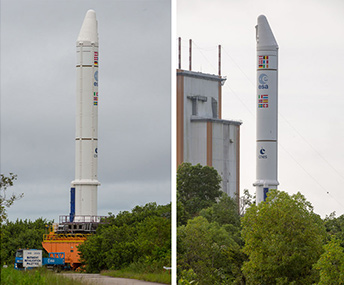
Ariane 5’s cryogenic main stage is moved into position over the mobile launch table inside the Spaceport’s Launcher Integration Building. (Photo: Arianespace)
Four more Galileo satellites will be launched on a customized Ariane 5 on July 25.
The next Arianespace rocket to orbit Galileo satellites has begun taking shape at the spaceport in French Guiana, reported Arianespace. Build-up of the heavy-lift vehicle is now underway inside the spaceport’s Launcher Integration Building.
Following the established assembly flow, the rocket build-up began with this week’s positioning of the launch vehicle’s central core cryogenic stage over one of two mobile launch tables used for Ariane 5.
Ariane 5’s two solid propellant boosters are rolled out. (Photos: Arianespace)
It was followed by integration of the two large solid propellant boosters — installed directly on the launch table and mated to the core stage — clearing the way for placement of the upper stage, topped off with the vehicle equipment bay.
Once the Ariane 5’s basic build-up is completed under the direction of production prime contractor ArianeGroup, it will be moved to the spaceport’s Final Assembly Building for installation of its four Galileo FOC (Full Operational Capability) satellite passengers, which are undergoing their own pre-flight preparations at the spaceport.
The Ariane 5 will deploy its satellite passengers at a targeted orbital altitude of 23,222 kilometers in circular medium Earth orbit. The launch is designated Flight VA244 by Arianespace.
Galileo satellites arrive
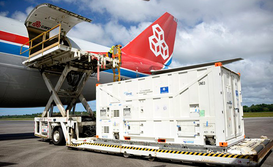
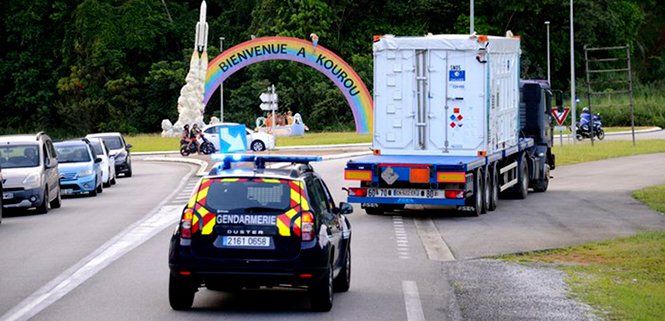
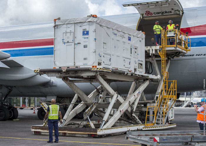
In early June, Galileo satellites 25 and 26 landed at Europe’s Spaceport in Kourou, French Guiana, joining their two predecessors, satellites 23 and 24, according to the European Space Agency (ESA).
One of the two Galileo satellites 25 and 26 is unloaded from a Boeing 747 cargo jet at Cayenne – Félix Eboué Airport in French Guiana on June 1. The satellites travel inside protective air-conditioned containers. (Photo: ESA)
The pair left Luxembourg Airport on a Boeing 747 cargo jet on the morning of June 1, arriving at Cayenne – Félix Eboué Airport in French Guiana that evening.
After they were off-loaded, they were driven by truck to the cleanroom environment of the S1A payload preparation facility at Europe’s Spaceport, still in their protective air-conditioned containers. In the cleanroom, they joined Galileo satellites 23 and 24, which arrived last month.
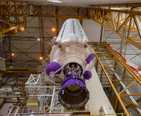
The cryogenic main stage of the Ariane 5, known as the EPC — from its French title Etage Principal Cryogénique — arrived by sea at French Guiana’s Port Pariacabo on May 30.
A further 12 Galileo “Batch 3” satellites were ordered in 2017, supplementing the 26 built so far to provide further in-orbit spares and replacements for the oldest Galileo satellites, first launched in 2011.
A steady stream of orbital spares, ready to replace satellites reaching the end of their operational lives, is essential to ensure Galileo continues operating seamlessly, according to ESA.
Looking further ahead, with the aim of keeping Galileo services as a permanent part of the European and global landscape, new satellites will be required by the middle of the next decade, offering improved performance and added features.
An increasingly bitter political and economic argument between the United Kingdom (U.K.) and the European Union (EU) has alternately stalled and unfrozen progress on Galileo.
Why does this matter from a defense and security viewpoint? Because it’s all about access to Galileo’s Public Regulated Service (PRS), the military-grade service and signal — in addition to billions of pounds and euros.
The byzantine maneuvering on both sides may have further implications, in the form of a much-expanded role for the current European GNSS Agency (GSA), with a corresponding reduction in funding scope for the European Space Agency (ESA).
ESA is not directly affected by the Brexit brouhaha, but indirectly, the impacts mount and extend. ESA is technically independent of the EU, but acts as the union’s procurement body for space programs. It is run by the 22 member states on the ESA council — which crucially includes the U.K., as well as non-EU members Norway and Switzerland. Thus, the Brits, while exiting the union in March 2019, will continue to play a voting role in the space agency.
In an second-round gambit, the U.K. had threatened to use its veto on the ESA council to delay procurement of future Galileo satellites. This was seen as an attempt to bring the EU into negotiations over U.K. access to the highly encrypted Galileo PRS.
A navigation and timing signal restricted to use by authorized government agencies, armed forces, police, emergency and other security services, the PRS is designed to be robust to jamming and spoofing and available even in times of crisis.
Under EU rules, only EU member states can access or work on the PRS. Similar to GPS M-code, PRS could be said to be the prime motivating factor for the origins of the European GNSS: the desire, some would say the compelling requirement, to have a military-grade signal under one’s own control.
The U.K. says it will encounter “significant gaps” in a wide range of areas including prisoner transfers, asset recovery, sharing of financial intelligence, victim compensation and access to criminal records for child protection vetting, should it be shut out from the PRS. This doesn’t begin to reveal the real reason: the ability to conduct military, security and defense operations confidently undertaken with a secure and enrypted GNSS signal.
The European Commission maintains that the U.K. will have to “apply” to use the PRS, like any other non-EU country, tacitly as a “foreign entity.” PRS is for EU member states only.
U.K. companies such as CGI U.K. have developed much of the programming and coding of the PRS signal. Current EU rules bar all U.K. companies from bidding on new contracts unless they transfer their work to EU countries before Brexit. The EU wants CGI U.K. to hand its encryption security intellectual property to the Franco-Italian firm Thales Alenia Espace.
This would poke Britain’s defense ministry where it hurts most: access to the key source codes, and a measure of security in military, defense and police operations. The U.K. government also wishes to retain the encryption expertise and personnel, rather than see them outsourced.
Four Galileo satellites placed in the payload container prior to December 2017 launch, which brought the total Galileo constellation to 22. (Image courtesy of ESA)
Whither GSA?
In a separate but closely related debate within the EU, a strategic repositioning is proposed for the GSA: renaming and remaking it into the EU Agency for the Space Programme. This would not only greatly enlarge its sphere of activity and authority, it could create two sparring space agencies in Europe, one wholly under the control of the EU and one with the maverick U.K. on its ruling council.
A draft EU document states ESA’s decision-making procedures “cannot lead to a call into question of the decisions of the [European] Commission or the European Space Agency within the framework of the actions and space programmes of the union.”
ESA is naturally bitterly opposed to its parent organization creating a rival. It has long struggled — behind closed doors — with its semi-independent, semi-subservient role to the EU, which after all holds the ultimate purse strings.
Some in Europe see indications that the GSA rebadging could lead to a gradual transfer of space funding from ESA to the newly rechristened agency if EU discontent rises. “A creep in power” was the term used by one official.
The EU has long expressed concerns over ESA’s governance of the funds handed to it by the EU for space projects. The long stall in Galileo getting up a full head of steam, a period that could be said to have extended from 2002 to 2008 or thereabouts, was seen by some atop the EU as evidence of ESA over-extension: technically expert but fiscally untrained or unqualified.
Opening Salvos
In what now appears to be a dead issue, the U.K. had first demanded reimbursement for the €1 billion it contributed to Galileo. The EU rejected that out of hand, saying it would not negotiate “under threat.”
In a follow-up, the U.K. claimed that while it wished to continue participating in Galileo, it could well start up its own GNSS if it did not receive adequate access to Galileo PRS. The EU stuck to its guns, so to speak: “Third countries [and their companies] cannot participate in the development of security-sensitive matters.”
The U.K. has also bruited blocking Galileo from use of ground tracking stations in British overseas territories, such as the Falklands.
A U.K. minister stated: “The U.K. genuinely wants to remain a major player in the project, with privileged ongoing access from outside the EU, and views its capabilities and contribution to date as giving it the right to that ticket.”
A European spokesperson countered: “For the EU, the decision to leave inevitably entails relegation to a different role and status in the project, and, let’s be candid, offers scope for EU-located firms to take contractual business away from U.K. ones.”
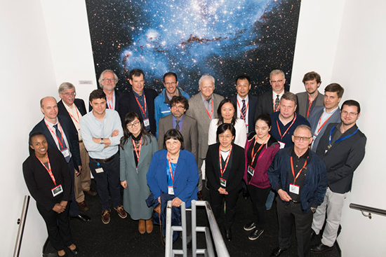
Delegates from the UN’s International Committee Global Navigation Systems (UN ICG) at the entrance to ESA’s ESTEC Test Centre, used to test the last 22 Galileo satellites. (Photo: ESA)
The UN ICG group visited ESTEC on May 16 during a meeting in the Netherlands.
News from the European Space Agency (ESA)
Members of the United Nations (UN) technical group supporting global cooperation in satellite navigation toured ESA’s technical centre in the Netherlands to see key facilities used to develop Europe’s Galileo system.
Delegates from the UN’s International Committee on Global Navigation Systems (UN ICG) met in mid-May at the nearby Galileo Reference Centre, operated by the GSA, European Global Navigation Satellite Systems Agency.
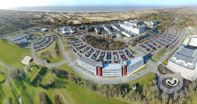
ESA, one of the founding members of the ICG in 2005, invited them to visit the agency’s European Space Research and Technology Centre, ESA’s single largest establishment and home to its Navigation Directorate.
Javier Benedicto, ESA’s Galileo program manager was joined by Rodrigo Da Costa, GSA’s Head of Exploitation, in giving the visitors a hearty welcome. “I’m honored to work with the amazing team of engineers and managers responsible for developing the Galileo system,” Benedicto said. “The laboratory and testing facilities here are very much at the heart of Galileo development.”
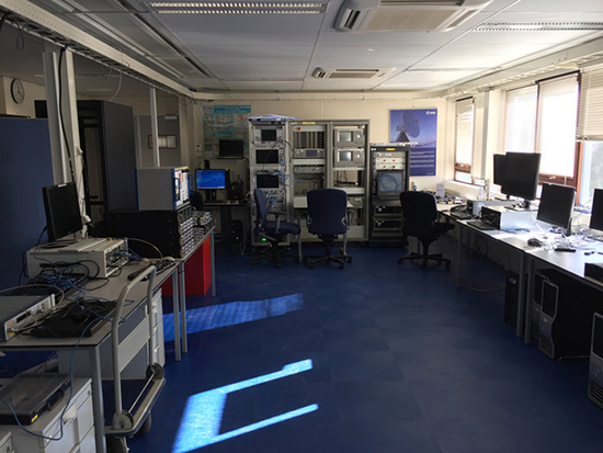
ESA’s Receiver Testing Facility is the historic location of the first Galileo positioning fix in 2012. (Photo: ESA)
“I’m very happy to welcome members of the UN ICG group, doing a great job in bringing navigation satellite system operators together, to share achievements and challenges and encourage interoperability – our users love our systems working together.”
The tour began at ESA’s Receiver Testing Facility — historic location of the world’s very first Galileo positioning fix back in 2012 – equipped with a multitude of specialized satnav receivers for not only Galileo satellites but also the US GPS, Russian Glonass, Chinese BeiDou, India’s NAVIC and Japanese QZSS systems, together with augmentation systems such as Europe’s own European Geostationary Navigation Service, EGNOS. The signals from all these systems can also be recorded to very high fidelity for subsequent investigation or reuse.
Lab simulation systems can recreate all these outputs in combination to test receiver systems across a huge range of scenarios, such as amid interference induced by a solar storm, or to see how receivers cope while flying, or even in orbit.
Smartphone receivers can be assessed with simulated augmentation from cellular network stations, wifi mapping or inertial navigation, while simulating their user’s continuous motion. The flexibility the facility’s simulators offer also allows early testing of enhancements planned for next decade’s ‘Galileo Second Generation’ satellites.
“Our aim is to go closer to the market, and how they’re doing things because how current services are being exploited is very important for developing the next generation,” said Olivier Smeyers of ESA’s Commercial User Segment Section.
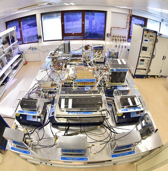
This table in ESA’s Galileo Payload Laboratory comprises a replica Galileo In-Orbit Validation satellite payload (other than its atomic clocks, which are housed separately nearby). Kept in cleanroom conditions at ESTEC in the Netherlands, it is employed for ground-based testing or anomaly investigation. (Photo: ESA)
Next came the Galileo Processing Centre, which provides ESA with continuous monitoring of Galileo services. It functions independently from the rest of the global Galileo infrastructure, to allow independent assessment of its performance, down to individual satellites and the onboard atomic clocks at the heart of the system — working closely with facilities such as the Galileo Time Validation Facility in Spain and the Galileo Control Centres in Germany and Italy.
The group was also shown ESA’s Time and Metrology Facility: an ensemble of six high-performance atomic clocks sufficiently stable to monitor the nanosecond-scale performance of Galileo System Time, and since 2012 maintaining their own timescale called UTC (ESTC), employed in turn to help set Coordinated Universal Time (UTC) — the world’s global time.
The cleanroom environment of the Galileo Payload Laboratory contains the same atomic clocks flown aboard Galileo satellites with the rest of its navigation payload, used to replicate any performance anomalies identified in orbit and make early tests of Galileo Second Generation design improvements.
“ESA is a very active member of UN ICG,” commented Rafael Lucas Rodriguez of ESA’s Galileo Services Engineering Unit and tour organizer. “We’re currently co-chairing an ICG working group on system performance enhancement and supporting the European Commission and GSA on all Galileo-related technical matters discussed at the committee.”
An aerial view of ESTEC. The Erasmus building is at front right. The T building (home to ESA’s Galileo team) is in the foreground.
The next two satellites in Europe’s Galileo satellite navigation system have arrived at Europe’s Spaceport in Kourou, French Guiana, ahead of their planned launch from the jungle space base in July.
Galileo satellites 23 and 24 left Luxembourg Airport on a Boeing 747 cargo jet on the morning of May 4, arriving at Cayenne – Félix Eboué Airport in French Guiana that evening.
Arrival at the Felix Eboué airport on April 5, 2018. (Photo: ESA)
They were then unloaded, still in their protective air-conditioned containers, and transported by truck to the cleanroom environment of the preparation building within Europe’s Spaceport.
This pair will be launched along with another two Galileo satellites, which are due to be transported to French Guiana later this month.
The quartet will be launched together on a customized Ariane 5 on July 25.
The Galileo System began Initial Services on Dec. 15, 2016, and a growing number of commercial devices are using Galileo today. Completion of the constellation should improve Galileo’s positioning accuracy further still.
One of two Galileo satellites being driven by truck to the Guiana Space Centre inside its container. Galileo satellites 23 and 24 left Luxembourg Airport on a Boeing 747 cargo jet on the morning of May 4, arriving at Cayenne – Félix Eboué Airport in French Guiana that evening. (Photo: ESA)
But Galileo satellites will continue to be launched into the future: a further 12 Galileo “Batch 3” satellites were ordered last June, supplementing the 26 built so far to provide further in-orbit spares, and replacements for the oldest Galileo satellites, first launched in 2011.
A steady stream of orbital spares, ready to replace satellites reaching the end of their operational lives, is essential to ensure Galileo continues operating seamlessly.
Looking further ahead, with the aim of keeping Galileo services as a permanent part of the European and global landscape, replacement satellites will be required by the middle of the next decade, offering improved performance and added features.
Less than two weeks after it was launched, the Copernicus Sentinel-3B satellite has delivered its first images of Earth. Exceeding expectations, this first set of images include the sunset over Antarctica, sea ice in the Arctic and a view of northern Europe.
One of the Copernicus Sentinel-3B’s first images featured Greenland. Captured on May 7, 2018, at 13:20 GMT (15:20 CEST), the image shows sea ice swirled into eddies caused by the wind and ocean currents. The image was taken by the satellite’s ocean and land colour Instrument, which features 21 distinct bands, a resolution of 300 m and a swath width of 1270 km. The instrument can be used to monitor aquatic biological productivity and marine pollution, and over land it can be used to monitor the health of vegetation. (Image: ESA)
The very first image, captured on May 7 at 10:33 GMT (12:33 CEST), shows the transition between day and night over the Weddell Sea in Antarctica. The satellite also captured swirls of sea ice off Greenland on the same day. Another in this first set of images offers a rare cloud-free view of northern Europe.
They were taken by the satellite’s ocean and land colour instrument, which features 21 distinct bands, a resolution of 300 m and a swath width of 1270 km. The instrument can be used to monitor aquatic biological productivity and marine pollution, and over land it can be used to monitor the health of vegetation.
Josef Aschbacher, ESA’s Director of Earth Observation Programmes, said, “The launch of Sentinel-3B completed the first batch of Sentinels that we are delivering for Copernicus.
“We finished the launch and early orbit phase in a record time and we are now getting on with the task of commissioning the satellite for service.
“These first images from the ocean and land colour instrument already show how the satellite is set to play its role in providing a stream of high-quality environmental data to improve lives, boost the economy and protect our world.”
The Copernicus Sentinel-3B satellite captured this rare cloud-free view of Northern Europe on May 8, 2018, at 09:33 GMT (11:33 CEST). Features over land and water can been seen clearly such as different types of land cover, snow and also a plume of phytoplankton in the North Sea. The image was taken by the satellite’s ocean and land color Instrument. (Image: ESA)
The Sentinel-3B satellite lifted off from Russia on 25 April and joins it identical twin, Sentinel-3A, in orbit. This pairing of satellites increases coverage and data delivery for the European Union’s Copernicus environment programme.
As the workhorse mission for Copernicus, the two satellites carry the same suite of instruments to systematically measure Earth’s oceans, land, ice and atmosphere.
Over oceans, it measures the temperature, colour and height of the sea surface as well as the thickness of sea ice. These measurements are used, for example, to monitor changes in Earth’s climate and for more hands-on applications such as for monitoring marine pollution.
Over land, this innovative mission monitors wildfires, maps the way land is used, checks vegetation health and measures the height of rivers and lakes.
European Commissioner for Internal Market, Industry, Entrepreneurship and SMEs Elzbieta Bienkowska, said, “This new satellite will deliver valuable images of how our oceans and land are changing.
“This will not only speed up the response to natural disasters, but also create new business opportunities. Earth observation is a larger market than you would think – a driver for research discoveries, a provider of highly skilled jobs and a developer of innovative services and applications.”
One of the Copernicus Sentinel-3B’s first images featured Greenland. Captured on May 7, 2018, at 13:20 GMT (15:20 CEST), the image shows sea ice swirled into eddies caused by the wind and ocean currents, and was taken by the satellite’s ocean and land color Instrument. (Image: ESA)
Bruno Berruti, ESA’s Sentinel-3 Project Manager, said, “We are extremely pleased to see these first images, which show that the satellite is in good health.
“ESA will spend the next five months carefully calibrating the instruments and commissioning the satellite for service before it is handed over to Eumetsat for routine operations.”
During this commission phase the two Sentinel-3 satellites will be flown in a tandem formation, separated by about 30 seconds.
Sentinel-3B will then be phased to reach its final position – flying in the same orbit, but adjusted to be separated by 140° with respect to Sentinel-3A.
Once commissioned, ESA will hand over satellite operations to Eumetsat. It will then be managed jointly, with ESA generating the land products and Eumetsat the marine products for application through the Copernicus services.
Alain Ratier, Director-General of Eumetsat, added, “The Sentinel-3 constellation establishes the European backbone of a space-based, global ocean-monitoring system.
“These first images are the first demonstration that Sentinel-3B will deliver on its promise to usher in a new era for operational oceanography and flow-on benefits for human safety, businesses and industry.
“They will amplify the benefits of the Sentinel 3 mission for ocean forecasting and the blue economy.”
Sentinel-3B is the seventh Sentinel satellite launched for Copernicus. Each mission carries different state-of-the-art technology to deliver a stream of complementary imagery and data to monitor the environment.
This month, we bring you a guest column on the 34th Space Symposium in Colorado Springs, Colorado. Robin Wrinn, a communications professional based in Atlanta, gives her perspective on the premier annual space event, held in April. Among her findings: information on the mission longevity vs. technology innovation debate, GPS IIIF program bids, discussions of time and space, and more.
— Alan Cameron, editor
During recent interviews with Lockheed Martin and Harris Corporation conducted during the 34th Space Symposium (April 16-19) in Colorado Springs, time and space were a frequent focus of discussion, but not in the normal “continuum” kind of way.
Greater mission longevity is one of the key improvements GPS III delivers over those currently in service. Space Vehicles 1-10 have a planned mission life of about 15 years – 25 percent longer than their satellite predecessors. Yet that bragging right begs the question “How long should a satellite ‘live’ up in space with technology innovation occurring almost annually?” After all the last Block IIR-M series satellite was launched in 2009. To put that into perspective, that same year the Canadian company Blackberry (RIM) held 20 percent of the smartphone OS market share and was the second largest OS in the world. Apple had just introduced the iPhone two years earlier.
A partial answer to that question it seems is advanced payload technology. Both Lockheed Martin and Harris Corporation highlighted their advances in payload capabilities that would enable built-in flexibility to adapt satellites in orbit to advances in technology, as well as changes in missions. Lockheed Martin provided the media a tour of their RF (Radio Frequency) Payload Center of Excellence (Payload Center). Meanwhile, Harris Corporation recently announced that is has completed development of the company’s fully digital Mission Data Unit (MDU), which is core to the navigation payload for GPS III 11 +.)
As a reminder, the current Harris payload for SVs 1-10 includes:
Greater than three times reduction in range error,
Up to eight times increase in anti-jamming power,
Added signals – including one (L1C civil signal) compatible with other Global Navigation Satellite Systems (GNSS), like the European Space Agency’s Galileo.
And greater signal integrity.
According to Harris, the new, fully digital navigation payload it has engineered will deliver more powerful signals, PLUS the ability to change and upgrade the satellites incrementally over the mission life.
Meanwhile, Lockheed recently announced a partnership with NEC to introduce artificial intelligence for computer learning in orbit. And the company’s Payload Center subject matter experts touted their significant advances in processers and a move toward the next generation of antennas, arrays and transmitters that would drive more flexibility and capability and resilience into satellites.
Observation: It seems the market pressures of ‘new space’ players is prompting delivery of products that can drive more value for less cost. In this case, delivery of a common payload architecture and electronically steered beams to make satellite antennas become any shape you want. Most likely, beams of a different size on demand is a much better business case than a static one built five years ago.
GPS III 1-10 on track. in full production. GPSIII SV1 awaiting U.S. Air Force “Call Up” for Launch
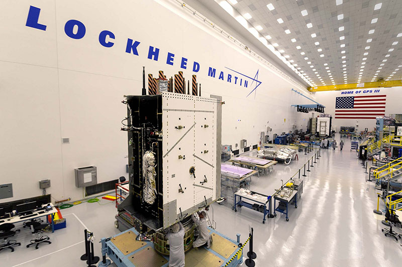
Lockheed Martin’s GPS III SV03 became fully integrated in August 2017. Photo: Lockheed Martin
The day I interviewed Lockheed Martin’s Navigation Systems mission area Program Manager Johnathon Caldwell, the company had submitted its proposal for the U.S. Air Force’s GPS III Follow On (GPS IIIF) program. That same day, April 16, the media was given a tour of Lockheed Martin’s GPS III satellite assembly floor. It was clear from both Lockheed’s press materials and Caldwell that Lockheed Martin believes it is fully recovered from prior production hiccups and is
• “on track” to deliver GPS Space Vehicles (SVs) 1 through 10, and
• deserves to win the bid for GPS IIIF. Now that Boeing has dropped out of the running, it seems they probably have it. (The government has said it will announce the award in March 2019.)
Here is the GPS III SVs 1-10 Update:
SV 01. Declared “Available for Launch” (AFL) by the Air Force on Sept. 28, 2017. Awaiting “Call Up” for launch. A formal date has not been set. “Sometime this year” was the answer Lockheed Martin provided when asked a timeframe.
SV 02. Completed Thermal Vacuum (TVAC) testing, Dec. 2017. Currently in final environmental EMI (electromagnetic)/EMC (electromagnetic compatibility)/PIM (passive intermodulation) testing. AFL expected Summer 2018.
SV 03. Fully integrated, Fall 2017. Currently in TVAC testing, AFL expected. Spring 2019
Interview with Harris Corporation’s Jason Hendrix, PNT Program Director.
GPS World readers are familiar with the differences in the GPS III signals as compared to those transmitted by satellites to date. What are the differences in the GPS III satellite payloads that were instituted to enable those new signals?
The main difference is the power. The Air Force’s requirements called for significantly more anti-jamming capability. All the transmitters are a higher power.
What was the most significant obstacle (or top obstacles, plural) in designing and manufacturing this new payload, to new Air Force specifications? How did you overcome it/them?
Same answer really, the higher power. Keeping in mind, we went from a 7-year mission life requirement to a 15 year. That higher power puts more strain on components and new cyber requirements in software. When you couple all that together we are not just upgrading payload technology. It is really engineering a new set of payload requirements. It’s new generation, advanced.
What are the advantages of a digital payload over the alternative? When you say “Our current GPS payload is 70 percent digital” does that refer to the IIR payload? The offered “fully digital navigation payload with enhanced performance” — is that the GPS III payload? What’s the new 30 percent that has gone digital?
The advantages and the 30 percent difference are the timekeeping system portion. We’re moving from a manual, analog timing to digital to deliver to the Air Force more flexibility. It’s a nice option to have to be able to reprogram in orbit and maybe enhance capabilities desired in the future.
Can you provide any perspectives on how Harris is performing now in delivering payloads for SVs 1-10?
We’re now ahead of schedule. We delivered the 5th payload three weeks early (early March 2018). We are on time for 4 and three more are due this year.
Interview with Lockheed Martin’s Navigation Systems Mission Area Program Manager Johnathon Caldwell
Can you provide some general updates on assembly of GPS 1-10?
Photo: LMCO
Vehicle SV01: It is ready and we’re very excited about that. We defer to the Air Force on questions about launch date. But once they call it up we will install the solar panels and take it to a C-17. Then load it in the back of the plane and fly it down to Florida. We will then take it over to the vehicle processing facility and mate it up with the launch vehicle provider. The GNST – the satellite prototype -has gone to the Cape twice already. So, we have conducted a dry run for shipping SV 01.
Vehicle SV02: It has completed thermal vacuum testing – a major milestone. We’re in the last of the environmental tests. And we’re tracking to have that vehicle declared AFL this summer.
Vehicle SV03. It is fully integrated and is in the T-Vac chamber now. The door is closed and it’s going through tests. (Pump down to vacuum is achieved in approximately three hours and the total testing time is 70 days.)
Vehicle SV04: It is fully integrated on the floor. It is in its baseline electrical tests and will be in environmental tests as soon as 3 comes out of the chambers. It is staged to go in right after – 3.
Vehicle SV05: It is about to go through its integration to the propulsion core. And five has its navigation payload. Integrating it this summer.
Any changes in your production approach having completed SV01 that you are fixing in your production approach to SV02, 03 or 04?
No, the performance on Vehicle 01 was as designed there were no technical or design changes necessitated throughout the rest of the fleet. So, it was a very successful from that perspective – from the standpoint of validating the design and wringing it out, Vehicle 01 served its purpose well.
It had a very good T-Vac. I would say overall when you look at the industry, Vehicles 01 – 02, our vacuum test campaigns are the most rigorous test. Both went through their tests quite well. Some of the best I’ve seen.
We consider thermal vacuum the gold standard for testing any satellite before it goes into operations. It really is putting the craft through the paces. When it goes through the testing, the satellite is on. It is working. It is exposing it to the heat and the cold and the zero pressure while the satellite is functional. The entire thermal vac testing from start to end is a little over 70 days. “Test like you fly.” From the time it launches and deployment sequence we test it like it is real. Minus the shaking, the satellite thinks it is getting launched. Meanwhile, our people are looking at the data and its health. T Vac is a huge milestone for a satellite to go through it and come out without any issues. Which is why we are so pleased about the two.
Have there been any production delays since last year.
No, we’ve been quite stable in our production schedule.
Can you shed some light as to how many Lockheed Martin employees are involved in the production of GPS III?
The way we’re organized, there are engineers that flux in and out of the project depending the stage we’re in. This is production program, so we use the skillsets we need at the time we need them, then those engineers go on to do other work. But this also comes back to some of the commonality we’re trying to achieve across out product lines. That when you have common processes, common parts and common procedures in building spacecraft you gain leverage and major cost savings to have flex in resources.
Can you speak to any issues with subcontractors? Any delays?
No, since last year, the Harris production line has stabilized. We’ve been receiving Harris payloads, and we’ve just received the 5th payload and we’re finishing up integration. Vehicle 6 navigation payload is currently in test. And Vehicle 7 and 8 payload production is going according to schedule. We feel Harris has definitely overcome some of the challenges of the past. And we’ve been seeing stable production deliveries. By the end of this year we should receive 3 more payloads and by the first quarter of next year, the 8th, and they are contracted for 9 and 10.
From a civilian perspective, can you remind us what will be different with GPS III?
Three times better accuracy and up to eight times improved anti-jamming capabilities. And it is a longer life vehicle and healthy constellation of satellites that people can rely on. The new L1C signal is common with other GNSS, like Galileo, so as that becomes incorporated into equipment, it will give you more data points for better service, more accuracy and reliability.
For GPS IIIF requirements, are there capabilities that will require innovation or new technology?
We’ve designed with some of those capabilities in mind. If you just look down the list. The regional military protection is about bringing higher power and boosting the signal where the military needs it most. That’s not a particularly new technology per se, but it is bringing a new capability that the current GPS satellites don’t have.
The Search and Rescue payload, again, I wouldn’t consider it a new capability, it is provided by a partner nation, a Canadian company, but it effects those folks in need.
Digital payload. For 11+, fully digital payload for greater flexibility for the government. It allows the government to expand or enhance capabilities of the mission over time. It enables loading new software to do different things.
GPS III was designed with a modular, flexible architecture. Because Lockheed Martin knew that as time goes by, technology evolves. New technology becomes available and the government’s mission needs are likely to change.
Now that ability to evolve is down to the payload with a fully, 100 percent digital payload.
Lockheed Martin has been working on a lot of the GPSIII F design requirements already (preliminary design review level).
Can you speak to the other “Risk Retired” you mentioned in your slides?
Last fall, we had our first time with the OCX zero ground system. It’s one thing to talk to satellite in the high bay, it’s another thing to talk to it with the entire Air Force control network you plan to use when you’re operating. So, we were excited to get that done and run the entire chain from the vehicle out from the Air Force control network the AFCN network, utilizing the OCX system to command the vehicle. It was a big milestone for us. And previously we demonstrated our compatibility of our signals (with OCX).
Our future satellites in our GPS IIIF proposal share a common design with GPS III so they also will be compatible with OCX because we have proven that compatibility.
Can you speak to the GPS III Ground System Support Contracts Lockheed Martin has received?
The government asked us to help provide some gap fillers for the ground system (rmw note: if OCX isn’t there yet). To take the heritage AEP ground system and provide the ability to fly GPS III satellites using that ground system. So that activity has been going well and the critical design review has been completed and it is on track for delivery to the government next year. And subsequently, we were also put on contract for the M-code new signal to add some capabilities to the legacy ground system to begin to furnish early use of that new GPS III M-code signal to the military. We’ve been working hard on that. We conducted our preliminary design review last fall and just recently completed a critical design review to add that capability.
The ninth Workshop on Satellite Navigation Technologies, NAVITEC 2018, will be held Dec. 5-7 at the European Space Research and Technology Centre (ESTEC) in Noordwijk, the Netherlands.
The workshop, themed “Golden opportunities for PNT,” is organized by the Radio Navigation Systems Implementation & Verification Section of the Directorate of Technical and Quality Management, European Space Agency (ESA).
NAVITEC 2018 will include the GNSS Signals and Signal Processing Workshop in coordination with CNES, DLR and the University of the Federal Armed Forces Munich.
The aim of the workshop is to provide an open forum to space and terrestrial satellite navigation technology designers, developers, integrators, users, universities and agency representatives.
“We are now seeing an explosion of new applications using position and time,” stated an ESA event announcement. “People expect PNT to be available always and everywhere. Solutions require reliable service outdoors and indoors, high-accuracy and able to survive in challenging environments with new security threats. All this at ever lower prices. These solutions require innovative technologies such as integration with other sensors, cloud processing, low power technologies, all with the latest security measures.”
Participants will have the opportunity to share their technical expertise and experiences by formal presentations, informal discussions and round tables. The workshop will provide an overview of satellite navigation technologies that are available, or being developed, especially in the frame of current research and development programmes.
Scope and topics of interest
The scope of the workshop will include navigation equipment and techniques: receivers, payloads, signals, navigation algorithms, signal processing techniques and applications of GNSS (terrestrial and space).
A call for papers will be issued soon. The papers should describe new equipment developments and systems concepts, innovative technologies and designs, testing/validation procedures, linked to the topics that are listed below.
Mass-market GNSS/Galileo results
GNSS in IoT (low-power & snapshot processing)
Positioning and Timing for 5G
Cloud and collaborative positioning techniques and applications
Precise Positioning in challenging environments
Augmentation services
Interference, Spoofing and Authentication and Cyber Security
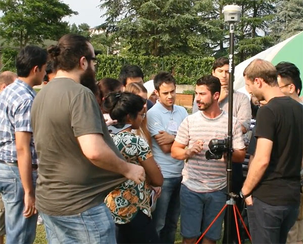
The 10-day school will cover all aspects of satellite navigation, up to and including the creation of a satnav-based business. It is open to graduate students, Ph.D.s and postdoctoral researchers, as well as young engineers and academics working within industry or agencies, aged 35 or younger.
The number of participants is limited to 50, on a first-come, first-served basis.
Internationally renowned scientists and specialists will be giving lectures as well as overseeing practical exercises and lab work.
Participants will receive a full-spectrum overview of satellite navigation, starting from the theoretical basis of Global Navigation Satellite Systems, their signals, the processing performed by signal receivers and how the position-navigation-time solution is worked out.
Also discussed will be threats to the satnav systems, such as spoofing or jamming, and countermeasures available against them, along with back-up navigation solutions for a GNSS-denied environment.
Practical exercises will include receiving the various satnav constellations now in orbit — including Europe’s Galileo — to give course members direct, hands-on experience.
In addition, lectures will cover business aspects, including patents and intellectual property rights.
The main emphasis of the course will be the development of a group business project, building on an innovative idea to take in the planning of the product or service, its technical realisation and finally its marketing to customers.
Image: Summer School
The school takes place in cooperation with Stanford University in the United States, the Institut Supérieur de l’Aeronautique et de l’Espace ISAE-SUPAERO in Toulouse, France, Graz University of Technology in Austria, and the University FAF Munich in Germany.
Austria is this year’s host nation, and the summer school is supported by Graz University of Technology and the Austrian Institute of Navigation.