Tag: ESA

  • ESA plans for low-orbiting navigation satellites

    ESA plans for low-orbiting navigation satellites

    Photo:
    New PNT satellites will operate in low Earth orbit (LEO). (Image: ESA)

    News from the European Space Agency (ESA)

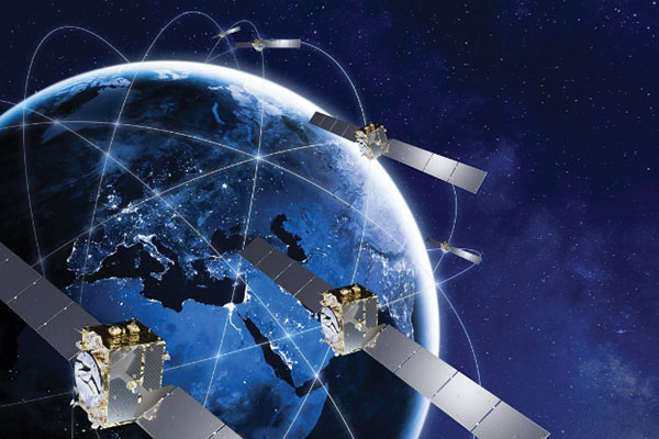
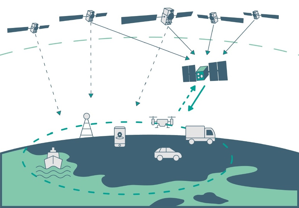
    Satellite navigation is headed closer to users. ESA’s Navigation Directorate is planning an in-orbit demonstration with new navigation satellites that will orbit just a few hundred kilometers in space, supplementing Europe’s 23,222-km-distant Galileo satellites.

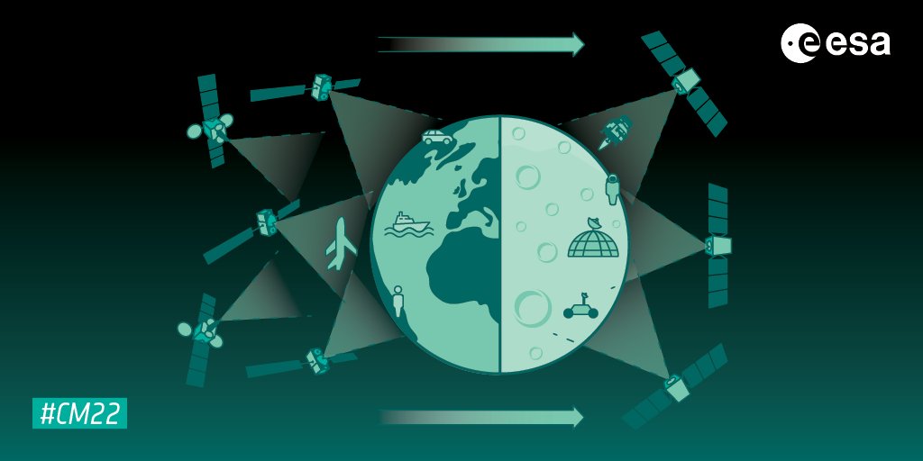
    Operating added-value signals, these novel low-Earth-orbit (LEO) positioning, navigation and timing (PNT) satellites will investigate a new multi-layer satnav system-of-systems approach to deliver seamless PNT services that are much more accurate, robust and available everywhere.

    Global in coverage, free for everyone to use, GNSS such as Europe’s Galileo have already transformed our society, and due to their sheer omnipresence their influence continues to grow. In 2021, the population of satnav receivers reached 6.5 billion around the world, and the sector is projected to maintain a 10% annual growth rate in the years ahead. But in various respects the standard GNSS approach is nearing the limits of optimum performance — to get even better, added ingredients are becoming essential.

    “Satellite navigation has enabled a vast range of applications in recent years, but this very success is inspiring still more demanding user needs for the coming decade,” said Lionel Ries, head of ESA’s GNSS Evolutions R&D team, overseeing the agency’s LEO-PNT studies.

    “For use cases such as autonomous vehicles, ships or drones, robotics, smart cities or the industrial internet of things for control of factory systems, the positioning requirements are growing from the current meter-scale to centimeter scale or even more precise, based on continuously reliable signals that are available anywhere, anytime — even indoors —while able to overcome interference or jamming.

    “Up until now we have relied for positioning on the classical solution of GNSS such as Galileo, located in medium Earth orbit and based on L-band signals. Standard GNSS alone is not going to be able to fulfil all these future user demands. Instead Europe needs to seize the opportunity to investigate the potential of the kind of LEO constellations that are already on the way in the global market to enable new kinds of PNT services.”

    Simply by virtue of physics, with less of a distance to cover down to Earth, the signals from these LEO-PNT satellites can be more powerful, able to overcome interference and reach places where today’s satnav signals cannot reach.

    Additionally, by adopting novel navigation techniques and a wider range of signal bands the satellites can address particular user needs: for instance at lower orbits the satellites themselves move more rapidly relative to Earth’s surface — think of the International Space Station at 400 km that orbits the Earth every 90 minutes — which offers possible advantage in the time needed to reach very accurate positions. Also some bands could offer greater penetration in difficult environments while other bands could offer higher robustness and precision.

    Mega-constellations of hundreds or even thousands of low-orbiting satellites offer a means of acquiring continuous coverage for telecommunications services or Earth observation. (Image: ESA)
    Mega-constellations of hundreds or even thousands of low-orbiting satellites offer a means of acquiring continuous coverage for telecommunications services or Earth observation. (Image: ESA)

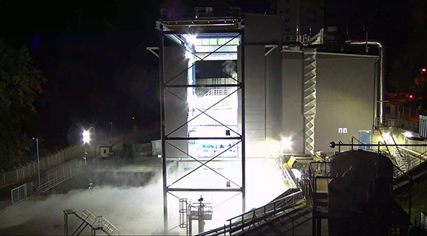
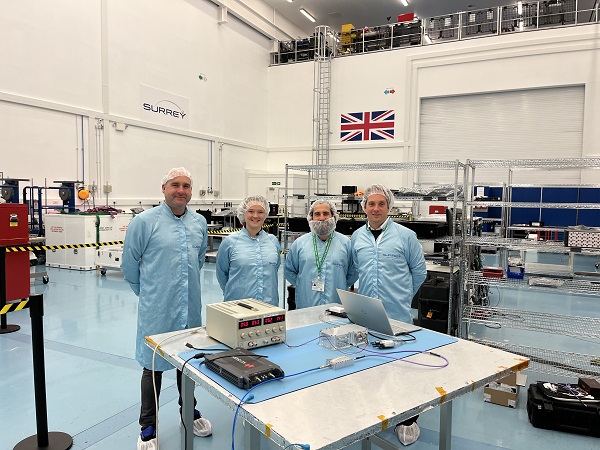
    The purpose of ESA’s plan to perform an in-orbit demonstration of low Earth orbiting satnav satellites is precisely to consolidate the types of signals, enabling technologies and their potential for future services.

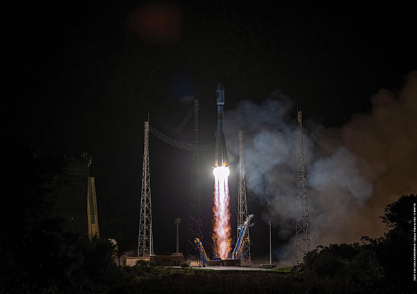
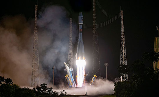
    The plan is to build and fly an initial mini-constellation of at least half a dozen satellites to test capabilities and key technologies, as well as demonstrating signals and frequency bands for use by a follow-on operational constellation, in the same way that Europe’s GIOVE test satellites paved the way for Galileo. Success will place European industry in pole positions for follow-on commercial undertakings, as well as planned institutional programs.

    “Each individual satellite would be comparatively small, below 70 kg in mass, compared to a 700 kg current Galileo operational satellite,” added Roberto Prieto-Cerdeira, Galileo Second Generation satellite payload manager and LEO-PNT project preparation manager as part of ESA’s FutureNAV program.

    “They can be comparatively more streamlined because they can benefit from other means to calculate the accurate time without extremely precise atomic clocks on board — including relayed signals from the Galileo satellites above them. These satellites would also be built on a rapid batch production basis to save time and cost — we are targeting three years at the most from signing the contracts to the first satellites in orbit, the same kind of timescale achieved by GIOVE-A in the early 2000s.”

    A vision of future, layered, satellite navigation, stretching from Earth to the Moon. (Image: ESA)
    A vision of the future shows layered satellite navigation stretching from Earth to the Moon. (Image: ESA)

    “It is ESA’s ambition to ensure Europe maintains a world-class space industry, and navigation today forms the single largest downstream space sector, worth about €150 billion annually and growing at the rate of 10% per year,” said ESA Director of Navigation Javier Benedicto-Ruiz. “Standing still is not an option; instead we need to explore new technical avenues to spur European competitiveness and commercialization.”

    An operational version of the LEO-PNT constellation would represent a whole new layer for PNT delivery, combined with traditional GNSS as well as 5G/6G-based positioning on the ground, and fused with data from sensors in the user terminals.

    Interest from industry

    ESA has been researching core elements of the LEO-PNT concept since 2016. Now, with numerous low Earth orbit constellations already taking shape around the globe, the time is right to move from basic research to in-orbit demonstration.

    Interest from European industry in the LEO-PNT project has been very high, shown by a recent Request for Information where ESA presented details of how companies and institutions might participate and a large number of companies registered and presented possible concepts and contributions.

    Forward to FutureNAV

    LEO-PNT is supported through the ESA Directorate of Navigation’s FutureNAV programme, which also includes the GENESIS satellite to measure the shape of Earth more accurately than ever before while also boosting the positioning performance of satnav satellites. The FutureNAV programme, which includes both GENESIS and the LEO-PNT initiative, is up for decision at ESA’s next Ministerial Conference, taking place in Paris on Nov. 22-23. Read the fact sheet here.

    Until now, all navigation satellites have flown in medium-Earth orbit – up at 23,222 km in the case of Galileo, which delivers meter-level accuracy. At such altitudes the satellites move slowly across the sky, helping ensure global availability of satellite navigation signals, albeit at relatively low power.

    ESA’s LEO PNT constellation would move to a “multilayer system of systems” approach, with medium-Earth orbit signals supplemented by those from LEO satellites at altitudes of less than 2,000 km — along with additional inputs from terrestrial PNT systems and user-based sensors, made up of approximately a dozen satellites, helping European companies move forward at a time when worldwide commercial interest is high in LEO constellations of all kinds, especially for telecommunications and PNT.

    The satellites themselves can be stripped down compared to current navigation satellites, because they would essentially be relaying satnav signals from MEO. This is a key point because there will need to be many more satellites to ensure global coverage — because the lower the orbit the faster each individual satellite will pass across the sky. This fact also opens the way to a more agile “New Space” approach to satellite construction for European firms, with smaller payloads and simplified operations from the ground.

    Their signals will be much stronger (potentially able to penetrate indoors), and transmitted on novel frequencies, which – along with the new geometries made possible by LEO satellites – should enhance overall service resilience. LEO PNT will also deliver faster position fixes and enable rapid two-way authentication checks. And overall signal availability will be boosted enormously, especially in high-latitude and polar regions.

  • Ariane 6 — Galileo’s next ride — undergoes hot-fire tests

    Ariane 6 — Galileo’s next ride — undergoes hot-fire tests

    The Ariane 6 launch vehicle program has taken a dramatic step towards first flight with the start on Oct. 5 of hot-fire tests of the rocket’s upper stage and its all-new Vinci engine, according to the European Space Agency (ESA).

    The tests are a significant step forward. They are being conducted using the specially built P5.2 test bench for engine and stage testing at the German Aerospace Center (DLR) in Lampoldshausen. The P5.2 test bench subjects the entire upper stage to operating conditions representative of a flight from Europe’s Spaceport in French Guiana, with the exception of vacuum and microgravity.

    New Vinci Engine

    Vinci, the upper stage engine of Ariane 6 fed by liquid hydrogen and oxygen, can be stopped and restarted multiple times — a critical capability for the complex missions demanded by launch customers today.

    The rocket can place several satellites into different orbits and de-orbit the upper stage, leaving a minimum of hazardous debris in space. Vinci also has been developed for reliability, simplicity and lower costs.

    Replacement Heavy Launcher

    This test series is a critical milestone on a development path that will soon see Ariane 6 replace Ariane 5 as ESA’s heavy launcher.

    For more than a quarter century, Ariane 5 has been a reliable partner for commercial, institutional and scientific clients. One of its most notable missions was the Dec. 25, 2021, flight that carried the NASA/ESA/CSA James Webb Space Telescope to its operational outpost in deep space.

    But Ariane 6 will be an even more versatile vehicle, strengthening Europe’s autonomy in accessing space.

    Auxiliary Power Unit

    The tests being run at Lampoldshausen are also evaluating an innovative auxiliary power unit (APU) that works in tandem with the Vinci engine and is instrumental to Ariane 6 upper-stage performance.

    To restart in space, earlier engines relied on large quantities of tanked helium to generate the necessary pressure and temperature in the propellant tanks and to ensure there are no bubbles in the fuel lines. However, the APU delivers these conditions using only small amounts of the cryogenic hydrogen and oxygen already carried in the main tanks.

    Heading to ESTEC

    The test series is being run by DLR and ArianeGroup, the Ariane 6 launcher prime contractor. When the test series is complete, the upper stage — integrated by ArianeGroup at its facility in Bremen, Germany — will be shipped to ESA’s ESTEC technical center in the Netherlands for stage separation and acoustic tests.

    Ultimately, the Lampoldshausen tests will investigate hardware behavior and system function of the complete stage with its tanks, engines and avionics.

    “The preparation for these hot firing tests is even more complex than for an actual launch,” said Ariane 6 launcher program manager Guy Pilchen. “Our colleagues in Lampoldshausen have decades of experience in rocket propulsion with extremely advanced test facilities. With ArianeGroup colleagues to control the upper stage and DLR people operating the test bench, we couldn’t ask for a better team.”

    Space independence for Europe

    ESA Director of Space Transportation Daniel Neuenschwander said that this new engine and the upper stage it powers are indispensable components of Ariane 6 and its objective — to guarantee that Europe maintains independent, competitive and sustainable access to space.

    “It’s a fact in the 21st century that Europeans depend on space for safety, prosperity and security,” Neuenschwander said. “Europe needs to work toward complete autonomy in accessing and operating in space. Ariane 6 is key to this, and we are eager to see the liftoff from Europe’s Spaceport in French Guiana.”

    Ariane 6 Vinci engine testing at DLR Lampoldshausen. (Photo: ESA)
    Ariane 6 Vinci engine testing at DLR Lampoldshausen. (Photo: ESA)
  • ESA seeks companies to help guide Moon missions

    ESA seeks companies to help guide Moon missions

    The European Space Agency (ESA) is looking for companies interested in helping create a constellation of lunar satellites to connect and guide missions to the Moon. Creating lasting telecommunications and navigation links with the Moon will enable sustainable space exploration for the hundreds of lunar missions that are due to launch within the next few decades, ESA stated.

    The companies would provide telecommunications and navigation services to these lunar missions, under its Moonlight initiative.

    ESA is completing two studies with two consortia of space companies based in Europe that assess the business case and the technical solutions for building and operating a constellation of lunar satellites. ESA is asking any space firms to indicate whether they would like to become involved in the ambitious project — or simply to develop lunar telecommunication and navigation technologies and products. The deadline is Oct. 28.

    Artist’s rendering: NASA
    Artist’s rendering: NASA

    On Sept. 19, ESA Director General Josef Aschbacher and NASA Administrator Bill Nelson signed a joint statement on lunar exploration cooperation at the International Astronautical Congress in Paris.

    The lunar Gateway  will be an outpost in orbit around the Moon. It will serve as the staging point for both robotic and crewed exploration of the lunar south pole.

    ESA’s European Service Modules will power all Artemis Orion spacecraft to the Moon and back. ESA will also provide refueling elements for Gateway and a communications module that will pave the way for Moonlight.

    ESA has already initiated the Lunar Pathfinder project to provide initial communications services to early lunar missions, which will also help to prepare for the next stage with Moonlight. The Lunar Pathfinder will also include a navigation payload demonstrator, which will allow positioning in lunar orbit using GPS and Galileo systems for the first time, and is due to launch in 2025.

    Space companies in Europe and Canada will be invited to tender for the initial Moonlight work in December.

  • Latest Galileo satellites join constellation with enhanced, faster fix

    Latest Galileo satellites join constellation with enhanced, faster fix

    Galileo launch 11 from Europe’s spaceport in French Guyana. (Photo: ESA/CNES/Arianespace)
    Galileo launch 11 from Europe’s spaceport in French Guyana sent satellites 27 and 28 into orbit. (Photo: ESA/CNES/Arianespace)

    News from the European Space Agency (ESA)

    Europe’s latest Galileo satellites in space have joined the operational constellation, transmitting navigation signals to three billion users across Earth as well as relaying distress calls to rescuers.

    Their entry into service follows a summer test campaign and will result in a measurable increase in positioning accuracy and improved data delivery performance of the overall Galileo system.

    Galileo satellites 27-28 were launched at the end of 2021 and underwent in-orbit test review at the end of April. The review was conducted by ESA, satellite manufacturer OHB, and navigation payload maker Surrey Satellite Technology Ltd (SSTL).

    Key findings showed both satellites’ payloads are performing extremely well — among the best in the entire constellation — and the satellites entering into service increase the position accuracy and robustness of the overall Galileo system.

    A successful system and in-orbit operations review followed, co-chaired by ESA and the EU Agency for the Space Programme (EUSPA), which is in overall charge of commissioning.

    Improved navigation message

    The two satellites are the first to broadcast an improved navigation message, resulting in three key improvements for Galileo’s public Open Service users:

    • faster navigation data acquisition, allowing users to establish a first position fix more rapidly
    • better robustness in challenging environments, such as urban centers
    • easier access to timing information in the navigation message for users possessing only a rough estimate of timing of the order of 1-2 seconds.

    For the testing and broadcasting of this new navigation message, new software for the Navigation Signal Generation Unit was developed by Thales Alenia Space in Italy, SSTL, OHB and ESA, and was uploaded to the two satellites.

    During the summer, an extensive test campaign was conducted by ESA to ensure the compatibility of the entire Galileo system at unit, payload, satellite, ground and system levels with the enhanced message. As part of this effort, EUSPA oversaw receiver testing to ensure this compatibility extended to Galileo receivers and chipsets in the market.

    These latest launched satellites made ideal test cases for the software and the improved navigation message. Transmission of the upgraded signals from Galileo satellites 27-28 allowed the team to confirm its correct implementation and characterize its long-term performance.

    Following a successful Test Review Board, the satellites were brought back into service on Aug. 29

  • Contrasting the use of drones on Mars and in Afghanistan

    Contrasting the use of drones on Mars and in Afghanistan

    NASA and the European Space Agency (ESA) have been cooking up a way to get some of Mars back to Earth, so that samples can be analyzed in detail — just like the rocks the astronauts brought back during the Apollo missions, which gave us a deeper understanding of our Moon.

    The Perseverance rover already on Mars has been seeking promising areas to investigate that might provide evidence of ancient past life, with the help of the Ingenuity helicopter drone. Recently, the two worked together to drive the rover to an old river delta, expected to be a prime location where such samples could be found.

    The rover has been drilling and saving rock and dirt samples in onboard storage tubes. The difficulty is that getting them back to Earth requires another major undertaking.

    Returning the Samples

    Termed the “Sample Return Mission,” the two space agencies have been discussing for months how best to bring the samples back, and have now refined an approach. Given that Perseverance has been so good at the job it was given, the NASA/ESA team has decided that the rover should be used for the return mission in 2030 when things would be in operation on Mars. (We’re not sure if the warranty sticker on Perseverance will still be valid in 2030, but if past performance is an indication, all the rovers have significantly outlived their initial design lives.)

    Its partner Ingenuity has graduated from proving it can fly in the thin Martian air to actually scouting routes for the large rover. Because Ingenuity has proven reliable and capable of traveling significant distances, NASA and ESA have decided that two new helicopter drones will become part of the return mission. They will be based on the successful Ingenuity design, but will be fitted with wheels, one on each of the four landing legs, to enable movement on the ground.

    They will also be fitted with a device which is capable of picking up and carrying a sample tube. Since the prototype drone helicopter was designed to be as light as possible, this infers  a substantial increase in lift capacity will be required. The original mission included a sample-collection rover, but this task will now be assigned to Perseverance, with the two sample-carrying helicopters acting as backup, if needed.

    An earlier concept had the rover dropping sample canisters behind it as it progressed around the surface for subsequent pick up. This concept appears to have been shelved for the moment. Keeping the canisters onboard the rover throughout perhaps simplifies transfer to the return lander.

    NASA Return Sample concept illustration includes wheeled helicopters. (Image: NASA)
    This NASA return sample concept illustration includes wheeled helicopters. (Image: NASA/JPL-Caltech)

    The Mars Ascent Vehicle would then carry the samples into orbit, to a waiting Earth Return Obiter, where the samples would be transferred to a return system for onward transit and atmospheric re-entry to Earth. Some of these details are a little sketchy, but there sure are a lot of moving (autonomous, robotic?) parts. This, of course, means a lot of opportunities for something to go wrong. No doubt continuing refinement of the mission will reduce the risks. The Jet Propulsion Lab (JPL) and AeroVironment designed and built Ingenuity — they may face some challenges developing the successor helicopter drones.

    Meanwhile, Here on Earth…

    Drones led the news Aug. 1, when President Biden announced the killing of Ayman al-Zawahiri in Kabul, Afghanistan. Al-Zawahiri topped the U.S. 9/11 wanted list, and his removal was all about the offensive use of drones. Presumably fired from a General Atomics Reaper variant drone at quite some altitude, two Hellfire AGM-114R9X “knife bomb”missiles took out al-Zawahiri as he stood alone on the balcony of a home in Kabul.

    This means that video/infrared from high altitude was sufficiently clear to determine that the man was alone on the balcony, presumably confirming information on the ground that his family was elsewhere. So long-distance, high-level authorization was then granted to fire on him in a foreign country now run by the Taliban.

    Suspected damaged al-Zawahiri house in Kabul (Photo: Secunder Kermani/BBC News)
    Suspected damage at the al-Zawahiri house in Kabul. (Photo: Secunder Kermani/BBC News)

    To minimize inadvertent casualties, the Hellfire R9X missile was used, which lacks explosive armaments. The weapon is a nasty piece of work, weighing ~100 lb with an inert payload, and fitted with six long knives that deploy before impact. This missile has previously been used in perhaps 11 other instances to take out terrorist individuals and minimize collateral damage.

    Bladed R9X missle lacks warhead (Image: Newsy/Bellingcat)
    Bladed R9X missile lacks a warhead (Image: Newsy/Bellingcat)

    This is another instance of how the U.S. use of military drones has become less devastating, but is still very deadly to the specific target.

    To Sum Up

    We’ve taken a quick glimpse at how NASA and ESA are planning more drones for the surface of Mars, and a much more aggressive use of drones here on Earth.

  • Space Tech Expo Europe opens call for speakers

    Space Tech Expo Europe opens call for speakers

    Space Tech Expo Europe logo

    Space Tech Expo Europe has opened its call for speakers for the free-to-attend conference to be held Nov. 15-17 in Bremen, Germany.

    The conference will focus on the latest advancements in the European and global space industry, including space exploration, in-space manufacturing, launch, system development,  market trends and more.

    The conference will take place alongside the leading supplier trade show with hundreds of exhibitors showcasing the latest space technological advancements. The conference provides attendees with the knowledge on the latest developments in European space. Previous speaking companies include: OHB, NASA, ArianeGroup, Airbus Defence and Space, UK Space Agency, ESA and many more.

    Proposals for speakers will be accepted through April 11, 2022. To submit a proposal or learn more about the event, please visit the Space Tech Expo Europe website.

  • The Moon: Where no satnav has gone before

    The Moon: Where no satnav has gone before

    News from the European Space Agency

    The test version of a unique satellite navigation receiver has been delivered for integration testing on the Lunar Pathfinder spacecraft.

    The NaviMoon satnav receiver is designed to perform the farthest ever positioning fix from Earth, employing signals that will be millions of times fainter than those used by smartphones or cars on Earth.

    The NaviMoon receiver and low-noise amplifier. (Photo: SSTL)
    The NaviMoon receiver and low-noise amplifier. (Photo: SSTL)

    “This engineering model of our NaviMoon receiver is the very first piece of hardware to be produced in the context of ESA’s Moonlight initiative, to develop dedicated telecommunications and navigation services for the Moon,” explained Javier Ventura-Traveset, head of ESA’s Navigation Science Office and manager of ESA lunar navigation activities.

    “It will be flown aboard the Lunar Pathfinder mission into orbit around the Moon, from where it will perform the furthest satellite navigation positioning fix ever made, at more than 400,000 kilometers away to an accuracy of less than 100 meters,” Ventura-Traveset said. “This represents an extraordinary engineering challenge, because at such a distance the faint Galileo and GPS signals it uses will be barely distinguishable from background noise. This demonstration will imply a true change of paradigm for lunar orbiting navigation.”

    Relaying signals for multiple lunar missions
    Relaying signals for multiple lunar missions

    The washing-machine-sized Lunar Pathfinder is being built as a commercial mission by Surrey Satellite Technology Ltd. (SSTL), in the United Kingdom. ESA is funding guest payloads for it, including the 1.4-kg NaviMoon receiver that will be accommodated beside the spacecraft’s main X-band transmitter that links it with Earth.

    “Receiving physical hardware for a mission is always fantastic,” said Lily Forward, SSTL system engineer. “This engineering model receiver will be integrated into our FlatSat Test Bed version of the mission to test that all our systems communicate and work together properly, ahead of receiving the flight-model receiver and antenna later this year.”

    Lunar Pathfinder will relay communications from orbital and surface missions
    Lunar Pathfinder will relay communications from orbital and surface missions

    This will be SSTL’s first full-fledged mission beyond Earth, she added. “Laying the foundations for numerous scientific missions that will come after it, Lunar Pathfinder is a communications relay satellite, intended to serve assets on both the nearside and farside, orbiting in an elliptical lunar frozen orbit for prolonged coverage over the South Pole — a particular focus for future exploration. Then, during regular intervals, we will orient the spacecraft towards Earth to test out the NaviMoon receiver.”

    Satnav position fixes from the receiver will be compared with conventional radio ranging carried out using Lunar Pathfinder’s X-band transmitter as well as laser ranging performed using a retroreflector contributed by NASA and developed by the KBR company.

    Laser ranging station
    Laser ranging station

    “This will be the first time these three ranging techniques will be used together in deep space,” explained ESA navigation engineer Pietro Giordano. “There is a long heritage of lunar laser ranging, going back to the Apollo missions, and the retroreflector we are using is an evolution from NASA’s Lunar Reconnaissance Orbiter. The combination of all ranging techniques will improve the orbit estimation further, potentially beyond what radio ranging can achieve.

    “In principle, this could mean that future missions could navigate themselves to the Moon autonomously using satellite navigation signals alone with no help from the ground.”


    Galileo 'side lobe' signals
    Galileo ‘side lobe’ signals

    Finding ultra-faint satnav signals

    The satnav signals employed here on Earth are already vanishingly faint, equivalent to a single pair of car headlights shining all across Europe. By the time these signals reach the Moon, they have crossed distances of more than 20 times further, attenuating through space like ripples from a stone splashed in water.

    “Adding to the difficulty, the satnav constellations are not designed to transmit up into space, but to keep their antennas facing Earth,” Giordano said. “So we are reliant on much weaker side-lobe signals, like light spilling from the sides of a flashlight. To be able to make use of these signals, we turned to a specialist in space-based satellite navigation, whose signal-processing techniques have really proven the magic ingredient.”

    Testing the NaviMoon receiver and Low Noise Amplifier engineering models at SSTL ahead of integration testing. The flight models of the receiver and amplifier will be delivered later in 2022. (Photo: SSTL)
    Testing the NaviMoon receiver and Low Noise Amplifier engineering models at SSTL ahead of integration testing. The flight models of the receiver and amplifier will be delivered later in 2022. (Photo: SSTL)

    SpacePNT, based in Switzerland, oversaw the NaviMoon receiver design.  “We began working on the idea of lunar-distance satnav positioning back in 2013 as something of a scientific challenge,” said Cyril Botteron, company head.

    “The combination of Galileo dual-frequency signals with those of the existing GPS satellites is what started to make it feasible,” Botteron said. “Although, along with the extreme sensitivity that is demanded, the other big problem is that from the Moon all the satnav satellites are in the same narrow geometry of sky around Earth, periodically rotating out of view.”

    Lunar navigation satellites will ultimately help guide Moon landings, such as with the European Large Logistic Lander. (Image: ESA)
    Lunar navigation satellites will ultimately help guide Moon landings, such as with the European Large Logistic Lander. (Image: ESA)

    The solution that SpacePNT came up with leverages more than half a century of lunar exploration. The company installed a dynamic software model of all the forces acting upon the satellite into the receiver, including the gravitational influences of the Moon, Earth, Sun and planets as well as the very slight push from sunlight itself — solar radiation pressure — along with factors such as clock error and the radio signal direction.

    “As we experience a given acceleration the receiver can judge it is most probably at one particular point in its orbit,” Botteron said. “Usually a satnav receiver needs signals from four satellites to fix its position, but with this approach, less than four signals is still enough to obtain useful information, constraining the model to minimize any error drift.”

    European Engineering & Consultancy (EECL) in the UK was assigned the task of turning SpacePNT’s design into fully tested hardware, and also designed the crucial low-noise amplifier that sifts through noise to boost usable signals.

  • Septentrio brings OSNMA anti-spoofing security to market

    Septentrio brings OSNMA anti-spoofing security to market

    Photo:Septentrio has released Open Service Navigation Message Authentication (OSNMA) functionality on its mosaic GNSS receiver modules. OSNMA offers end-to-end authentication on Galileo’s civilian signals, protecting receivers from OSNMA attacks.

    Spoofing is a malicious form of radio interference, where faulty positioning information is sent to a receiver. For the last two years Septentrio has been working closely with the European Space Agency (ESA) during the test phases of OSNMA deployment. The know-how gained during this period is what allowed Septentrio to be one of the first to market with this advanced security feature.

    OSNMA’s anti-spoofing capability complements Septentrio’s Advanced Interference Mitigation technology, AIM+, and further strengthens the overall security of Septentrio GNSS receivers, making them suitable for assured PNT solutions as well as critical infrastructure, such as 5G network synchronization.

    “We are excited to start offering the OSNMA anti-spoofing technology in our industrial GNSS receivers. Our close collaboration with ESA enabled us to get the expertise needed to implement and validate this functionality in a timely manner,” said François Freulon, head of Product Management at Septentrio. “The addition of OSNMA to Septentrio’s already strong anti-jamming and anti-spoofing technology takes our receivers to a new level as the market leader of resilient positioning and timing solutions for industrial applications and critical infrastructure.”

    OSNMA is now supported by the complete mosaic receiver family including GNSS RTK positioning modules, timing modules and heading receiver modules. It will also be rolled out on Septentrio’s latest generation of OEM receiver boards, AsteRx-m3, and subsequently on the ruggedized boxed receivers. Read more here.

  • ESA app turns smartphones into space monitoring tools

    ESA app turns smartphones into space monitoring tools

    Image: ESA
    Image: ESA

    A new Android app released by the European Space Agency (ESA) turns smartphones equipped with dual-frequency GNSS receivers into instruments for crowdsourced science.

    The CAMALIOT app, developed through ESA’s Navigation Innovation and Support Programme (NAVISP) with the support of the GNSS Science Support Centre, is suitable for more than 50 smartphone models.

    Using the CAMALIOT app, the phones will record small variations in satellite signals, gathering data for machine learning analysis of meteorology and space weather patterns.

    As well as helping to create new Earth and space weather forecasting models, participants are also in with the chance to win prizes including new phones and Amazon vouchers. This four-month “citizen science” campaign runs until the end of July.

    “The precisely modulated signals continuously generated by the dozens of GNSS satellites in orbit are proving a valuable resource for science, increasingly employed to study Earth’s atmosphere, oceans and surface environments,” said ESA navigation engineer Vicente Navarro. “Our GNSS Science Support Centre was created to help support this trend.”

    For instance, tens of thousands of permanent GNSS stations are continuously recording GNSS data. As the satellite signals travel down to Earth they are modified by the amount of water vapor in the lower atmosphere, helping to forecast rainfall in particular.

    GNSS signals also undergo delay and fading — known as scintillation — as they pass through irregular plasma patches in the ionosphere. This electrically charged upper atmospheric layer is continuously changing, influenced by solar activity, geomagnetic conditions and the local time of day. Dual-frequency GNSS receivers can compensate for this effect by comparing their two frequencies.

    “The combination of Galileo dual band smartphone receivers and Android’s support for raw GNSS data recording is what opened up the prospect of supplementing data from these fixed GNSS stations with tens of millions of smartphones, vastly increasing our density of coverage,” Vincente said. “We took inspiration from the famous ‘SETI@home’ initiative, where home laptops help seek out signs of extraterrestrial life.”

    The results can then undergo a Big Data machine learning approach, seeking out previously unseen patterns in both Earth and space weather.

    “This is our first step in enlarging GNSS data acquisition using an internet of things data-fusion approach, employing novel sources such as fixed sensors and drones as well as smartphones,” Vincente said. “A wide range of other applications are also possible for the system, including improving the performance of GNSS systems.”

    Formally known as the Application of Machine Learning Technology for GNSS IoT Data Fusion project, CAMALIOT is run by a consortium led by ETH Zurich (ETHZ) in collaboration with the International Institute for Applied Systems Analysis (IIASA).

    “The CAMALIOT effort was underpinned by Element 1 of our NAVISP research programme, spurring innovation in satellite navigation,” said Pierluigi Mancini, ESA’s NAVISP program manager.

  • GNSS signals help map sea-surface topography

    GNSS signals help map sea-surface topography

    News from the European Space Agency

    Monitoring the constantly changing shape of the sea surface is important for scientific and societal applications such as ocean current forecasting, climate research, ship routing, cable laying and debris tracking.

    A project supported by the Discovery element of ESA’s Basic Activities recently investigated a technique to precisely measure sea-surface topography. The project was based on an idea submitted by the Institute for Space Studies of Catalonia (IEEC) through the Open Space Innovation Platform (OSIP) — ESA’s place for your space ideas.

    The technique involves GNSS reflectometry — signals that have been reflected off of the sea surface at very low angles. At these “grazing” angles, waves and surface roughness have little impact on the reflection process; the sea surface acts as a very smooth mirror.

    “In a mirror-like reflection the phase of the signal can be tracked — it is continuous,” explained IEEC’s Estel Cardellach, principal investigator and submitter of the OSIP idea. “Different surface heights result in different phase measurements. It gives a very precise measurement of the surface altitude at a few centimetres’ precision.”

    Balearic Islands Project

    The ESA-funded activity involved developing a GNSS receiver and setting up an experiment in the Balearic Islands to collect GNSS signals reflected off the sea surface. The team — made up of IEEC, imedeaSOCIB and DLR — then processed the signals for optimized measurements of the shape of the sea surface.

    “Thanks to OSIP and ESA Discovery we have been able to conduct this experiment on grazing GNSS reflectometry under monitored conditions,” said Manuel Martin-Neira, ESA technical officer for the project. “We have linked the coherence of the reflected signals to wave height and the elevation angle of GNSS satellites. These results have been very useful for preparing the PRETTY mission.”

    ESA’s PRETTY (Passive REflecTomeTry and dosimetry) CubeSat mission is a small satellite that will carry out grazing angle GNSS altimetry from orbit. It is due to launch later this year.

    Image: ESA
    Image: ESA
  • ESA seeks new PNT ideas for annual NAVISP workplan

    ESA seeks new PNT ideas for annual NAVISP workplan

    The European Space Agency is looking for navigation and positioning ideas, with its Navigation Innovation and Support Programme (NAVISP) seeking input by March 31.

    NAVISP is divided into a trio of elements. Element 1’s scope of activities ranges from initial feasibility studies and viability analyses all the way to full proof of concept for promising positioning, navigation and timing (PNT) systems and services.

    To compile its annual Element 1 workplan, NAVISP invites innovative PNT concepts from companies or academic entities across NAVISP participating states. Those interested can submit a 1-page description, along with notifying their national ESA delegation of their application. See details here.

    NAVISP Industry Days took place in 2020 at at ESA’s ESTEC, The Netherlands. (Photo: ESA)
    NAVISP Industry Days took place in 2020 at at ESA’s ESTEC, The Netherlands. (Photo: ESA)

    The NAVISP Element 1 workplan supports cutting-edge European companies in development of novel PNT technologies and services. Underscoring the commercial priority of this field, 20 ESA Member States plus Canada have joined the program.

    PNT underpins a 10th of Europe’s economy, according to ESA, in areas such as transport, precision agriculture, power, communication, banking and the fast-growing internet of things.

    Satellite navigation, with signals from space extending across the globe, represents the single biggest source of PNT information, but these signals are not available in all locations and are vulnerable to natural or human-made interference.

    NAVISP Element 1 is focused on innovation in PNT, involving novel concepts, techniques, technologies and systems along the entire value chain. They often combine GNSS with other solutions such as artificial intelligence, other sensors, adding Wi-Fi or 5G signals to PNT fixes, or employing high-altitude atmospheric platforms to supplement GNSS coverage over regions in need.

  • Directions 2022: Galileo FOC, G2 on the horizon

    Directions 2022: Galileo FOC, G2 on the horizon

    Galileo Second Generation Batch#1A satellites. (Image: ESA).
    Galileo Second Generation Batch#1A satellites. (Image: ESA).

    Successful European Cooperation

    Galileo is Europe’s civil global satellite navigation constellation and a major success, being the world’s most precise satnav system and offering meter-scale accuracy to more than two billion users around the globe.

    The signature of the Financial Framework Partnership Agreement (FFPA) on June 22, 2021, further strengthened effective cooperation between the European Commission (EC), the European Union Agency for the Space Program (EUSPA), and the European Space Agency (ESA) — key to successfully achieving a crucial EU Space Program component like Galileo in the current EU Multi Financial Framework (2021–2028).

    The EC is the program manager, with EUSPA acting as the exploitation manager and ESA as the system development prime.

    Stable Service Performance

    Galileo continues to deliver excellent service performance every month in a safe, secure and seamless manner. Delivery of Galileo services is managed by EUSPA, as the Galileo service provider, with industrial partner SpaceOpal, the Galileo service operator prime contractor. The performance of Galileo services is independently monitored by the Galileo Reference Center (GRC) and regularly published on the GNSS Service Center (GSC) web portal at www.gsc-europa.eu — both agencies were developed by GMV. The security of the Galileo System is monitored by the Galileo Security Monitoring Centers (GSMC), operated by EUSPA.

    With 22 satellites in service, the open service is already delivering more than 99% availability of PDOP <= 6 worldwide. This, together with the excellent ranging accuracy, suggests that most Galileo dual-frequency users are typically experiencing positioning accuracy in the order of only 2 to 3 meters.

    Timing users also continue to receive accurate (in the order of 5 ns) access to Galileo System Time, which they can trace to Universal Coordinated Time (UTC) through the corresponding offset parameters transmitted by the satellites.

    The SAR/Galileo service, contributing to COSPAS/SARSAT, continues to deliver both the Forward Link Service (FLS) and the Return Link Service (RLS) with more than 99% availability, allowing users in distress not only to issue an alert and be located within a few minutes, but also be notified that the alert was successfully processed and rescue is on the way. The SAR/Galileo control center is located in Toulouse (France) and operated by CNES under the authority of EUSPA. The excellent performance of the service has been demonstrated both through several rescue exercises and real-life emergencies.

    Galileo Launch 11

    Soyuz launcher VS-26 lifted off from French Guiana with the first pair of Galileo Batch 3 satellites on Dec. 5, 2021, at 01:19 CET. This marks the 11th Galileo launch of operational satellites in 10 years: a decade of hard work by Europe’s Galileo partners and European industry. With these satellites, the robustness of the constellation has increased, guaranteeing a higher level of service.

    Thanks to an upgrade of the Ground Control Segment, the Launch and Early Orbit Phase has been for the first time conducted directly from the Galileo Control Center, rather than requiring an external mission control site. This version of the ground segment increases overall reliability and cybersecurity and opens the way to significant expansion of the Galileo constellation, allowing command and control of up to 38 satellites. The development has been performed by an industrial consortium led by GMV, harnessing state-of-the-art technology using the latest solutions on the market.

    Galileo launch 11 from Europe’s spaceport in French Guyana. (Photo: ESA)
    Galileo launch 11 from Europe’s spaceport in French Guyana. (Photo: ESA)

    On Route to Full Operational Capability

    This year will pave the way toward Full Operational Capability of Galileo services.

    Industrial prime contractor OHB Systems has nearly completed production of the additional 10 recurrent satellites belonging to Galileo Batch 3. Six of them are undergoing final acceptance testing at the ESA satellite test center, and the other four are under integration at the satellite prime facilities.

    Preparation for Launch 12 has already started, with the satellites’ acceptance for a launch date planned in the first months of 2022, followed by Launch 13 in autumn. This is leading toward completion of the Galileo constellation, providing an increased availability of the Galileo signal in space for both GNSS and search-and-rescue users.

    From 2023 onward, the remaining Batch 3 satellites will be launched with the new Ariane 62 launch vehicle, a variant of Ariane 6 with two strap-on solid boosters. The launcher is undergoing the final stages of development, led by prime contractor ArianeGroup.

    The Galileo Ground Mission Segment will undergo a complete technological refresh, including hardware virtualization and porting of several million lines of code, performed by an industrial consortium led by Thales France. A series of improvements will be introduced to increase system resilience, including an extended mode of operation to improve service continuity and robustness.

    Cybersecurity monitoring of all the ground assets will be introduced as an overlay to the current ground infrastructure. The upgrade will undergo a rigorous level of qualification testing followed by worldwide deployment in a seamless way in both Galileo control centers, in both Galileo security monitoring centers, and at all remote locations without affecting continuity of service.

    The service facilities that contribute to the delivery of Galileo services (the European GNSS Service Center, the Galileo Reference Center, and the SAR data service providers) will also evolve to support not only the transition from Initial Services to Full Operational Capability, but also the early roll-out of service evolutions. In this regard, extensive work is ongoing to deliver an exciting set of improvements, some of which are already in development or testing, to reach the users in the year to come:

    • Improvements of the I/NAV signal to increase robustness and time-to-first-fix, while assuring full backward compatibility with legacy receivers.
    • OS Navigation Message Authentication (OS-NMA) to support applications that require trust in the authenticity of the data transmitted by the Galileo satellites (a public observation campaign was launched in November 2021 to engage stakeholders and collect their feedback before moving to the initial service provision).
    • An initial phase of the High Accuracy Service, delivering corrections in the Galileo E6 signal and over terrestrial network to allow users to perform precise point positioning over Europe; test signals were already transmitted with promising results.
    • A Search and Rescue Beacon Command Service complementing the SAR Return Link, providing improved capabilities to timely locate beacons under authorized emergency situations (such as the disappearance of Flight MH370 in the Indian Ocean in 2014).
    • A first implementation of an Emergency Warning Service over Europe, allowing the authorized national emergency-management authorities of the EU Member States to relay alert messages through Galileo signals, which can reach target areas even in case of disrupted terrestrial communications (such as due to floods or earthquakes).
    Galileo worldwide ground segment. (Credit: ESA)
    Galileo worldwide ground segment. (Credit: ESA)

    Second Generation in the Making

    The FFPA will bring Galileo to the next level with the development of the second generation, a further step forward with the use of many innovative technologies to guarantee the system’s unprecedented precision, robustness and flexibility.

    In parallel to the completion of the first generation of Galileo, Europe has conducted in recent years preparation activities for the Second Generation (G2). Elaborating on market, user and exploitation needs collected by EUSPA, ESA identified a number of system evolution scenarios, which were discussed among relevant EU stakeholders to select the second-generation mission and services baseline to build the system infrastructure.

    The evolution of Galileo capabilities will not only provide better services through advanced technical solutions identified by ESA, but will also ensure continuity of service and backward compatibility for
    first-generation legacy users.

    Two parallel contracts to develop and manufacture each of the six Galileo Second Generation Batch#1 satellites were kicked off in the first half of 2021 with Thales Alenia Space (Italy) and Airbus Defence & Space (Germany). The new G2 satellites will be constructed on a short time scale, with their first launch via Ariane-62 expected in less than four years, allowing them to commence operations in space as soon as possible. Both contracts have already undergone preliminary design reviews.

    Development of the G2 satellites is supported by the Galileo Payload Test Bed, which provides an early proof-of-concept of the advanced G2 payload architecture. These satellites will provide, among others, the following key innovations:

    • Reconfigurable fully digital navigation payload.
    • Point-to-point connection between satellites by Inter-Satellite-Link for command and control and ranging functionalities.
    • Electric propulsion for orbit-raising capabilities.
    • Advanced jamming and spoofing protection mechanisms to safeguard Galileo signals.

    System and Ground Segment definition studies, together with the associated technology pre-developments, have been performed, leading to the definition of the preliminary design and technical requirement baseline for the G2 system, a project involving most of Europe’s space industrial partners.

    The G2 In-Orbit Validation Ground Segment and System Test Bed have been defined and relevant procurement procedures are ongoing, with these objectives:

    • G2 Batch#1 satellites launch and early orbit phase, in-orbit testing and enhanced legacy services provision.
    • G2 new capabilities in-orbit validation, including prototyping and validation of all the novel technologies that can exploit the full capabilities of the G2 Batch#1 satellites.
    Galileo Second Generation Batch#1B satellites. (Image: ESA).
    Galileo Second Generation Batch#1B satellites. (Image: ESA).

    Definition activities for the G2 Initial Orbit Capability (IOC) are progressing well and are expected to converge in the first half of 2022, in order to establish the future roadmap for new G2 services provision in the years to come.

    2022 will be a key year for the evolution of Galileo Second Generation activities, through the consolidation of the first batch of G2 satellite design and development activities and the start of development of associated G2G IOV Ground Segment and System Test Beds.

    A bright future awaits Galileo, both through the completion of its Final Operational Capability and the start of evolution towards Galileo Second Generation.


    Guerric Pont is Galileo Exploitation Program manager for the European Union Agency for the Space Program (EUSPA).

    Marco Falcone is Galileo First Generation Project manager for the European Space Agency (ESA).

    Miguel Manteiga Bautista is Galileo Second Generation Project manager for the European Space Agency (ESA).