The U.S. Department of Transportation’s Federal Aviation Administration (FAA) has awarded $2.7 million to support research on how drones can assist in disaster preparedness and in emergencies.
“Every second counts in an emergency, and this funding will allow drones to safely and more quickly deploy in moments when minutes matter,” said Acting FAA Administrator Billy Nolen.
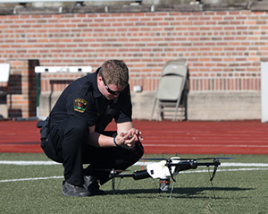
A policeman works with a drone. (Photo: FAA)Photo:
The research will explore the use of drones in providing effective and efficient responses to different natural and human-made disasters. It will address coordination procedures among drone operators from federal agencies as well as state and local disaster preparedness and emergency response organizations. The five universities and their award amounts are:
University of Vermont: $1,195,000
University of Alabama Huntsville: $828,070
New Mexico State University: $400,000
North Carolina State University: $200,000
Kansas State University: $145,000
Today’s announcement is the third round of Alliance for System Safety of UAS through Research Excellence (ASSURE) grants, which brings the total to 20 grants valued at $21 million for Fiscal Year 2022.
The ASSURE Center of Excellence is one of six the agency has established to help advance technology and educate the next generation of aviation professionals. Research conducted through ASSURE is focused on helping the drone community safely grow and integrate into the nation’s airspace.
Earlier in 2022, Transportation Secretary Pete Buttigieg outlined six key Innovation Principles the department will apply when fostering transportation technologies. While continuing to commit to the highest standards of safety across technologies, these awards demonstrate the department’s commitment to exploring ways to leverage innovation to help communities and public-sector partners through experimentation.
More than 850,000 recreational and commercial drones are in the active drone fleet, and that number is expected to grow.
FAA TSO-C190 authorization makes multi-platform anti-jam GPS navigation antenna (MAGNA) systems available for both military and commercial aviation use
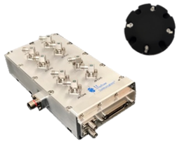
MAGNA-F anti-jam system. (Photo: Mayflower)
Mayflower Communications Company Inc. has received technical standard order Mayflower Communications (TSO-C190) authorization from the U.S. Federal Aviation Administration (FAA) for both models of its MAGNA GPS anti-jam product.
Mayflower’s MAGNA GPS anti-jam products — MAGNA-Federated (MAGNA-F) and the MAGNA-Integrated (MAGNA-I)— can be installed on both military and civilian aircraft. Both MAGNA products offer simultaneous L1/L2 protection and can protect commercial and military GPS receivers.
Mayflower’s MAGNA products build on Mayflower’s SWaP-optimized GPS anti-jam antenna technologies, which are optimized for small size, weight and power (SWaP), including small antenna systems. The MAGNA products were developed with sponsorship by the U.S. Navy SPAWAR and further improved under the U.S. Army PEO AVN to support GPS protection requirements for SWaP-constrained air, sea and ground platforms, such as fixed-wing/rotary aircraft, ships, UAVs and tactical vehicles.
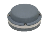
MAGNA-I anti-jam system. (Photo: Mayflower)
The MAGNA-F (NavGuard 710) has been extensively integrated, tested and flown in navigation warfare (NAVWAR) operational environments by the U.S. government on multiple aircraft platforms. MAGNA-F is the highest performance and smallest federated GPS anti-jam solution on the market in its class, utilizing a 3.5-inch diameter controlled reception pattern antenna (CRPA) compatible with existing fixed radiation pattern antenna (FRPA) footprints.
The MAGNA-I (NavGuard 730) is a high-performance yet small GPS anti-jam integrated solution on the market, with a 4.5-inch diameter FRPA-compatible footprint. MAGNA-I simplifies platform integration and reduces lifecycle costs. The MAGNA-I integrated anti-jam solution (antenna array integrated with antenna electronics in a single module) is designed for platforms with difficult integration challenges.
“The MAGNA GPS protection system provides pilots with improved GPS availability in a global environment with disrupted GPS signals,” said Triveni Upadhyay, Mayflower’s founder and president.
Mayflower Communications management team will be participating in the upcoming Joint Navigation Conference (JNC).
Mayflower Communications is exhibiting its MAGNA suite of products at booth #216 at ION’s 2022 Joint Navigation Conference, which takes place June 6-9 in San Diego, California. Also at the conference, Naresh Jarmale, Mayflower vice president of engineering, will present a paper during Session B4: Military PNT User Equipment 2 – EGI and Platform Integrated PNT.
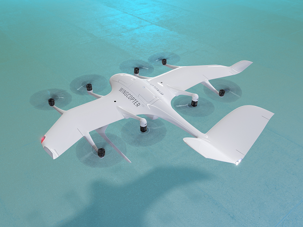
The U.S. Federal Aviation Administration (FAA) has issued the Special Class Airworthiness Criteria for the Wingcopter 198 U.S. unmanned aircraft. This approval marks a critical milestone in the certification process of Wingcopter’s flagship delivery drone in the United States.
Wingcopter is a German manufacturer of fixed-wing unmanned aircraft systems (UAS) and provider of drone delivery services, focused on optimizing medical supply chains, as well as last-mile logistics of packages, tools, spare parts, food, and groceries.
With the Airworthiness Criteria, the FAA defines technological requirements under title 14, Code of Federal Regulations (14 CFR), § 21.17(b) that must be met to have an aircraft type-certified for regular commercial operations in the United States.
The Wingcopter 198 is an electric vertical-takeoff-and-landing (eVTOL) drone engineered to meet stringent safety standards. In its development, Wingcopter was able to leverage the operational experience of more than five years with the company’s first delivery drone type in various geographical settings, from the Arctics to the Middle Eastern desert and from remote islands in the South Pacific to San Diego Bay in the United States.
Once type-certified, Wingcopter will be able to fly conventional routes through airspace and over populated areas, ultimately providing the basis for scaling commercial drone delivery operations across the United States that will help save and improve lives, the company said.
The certification is expected to have a positive impact on Wingcopter’s further certification efforts such as with the National Civil Aviation Agency (ANAC) in Brazil or the Japan Civil Aviation Bureau (JCAB).
Since applying for the Special Class Type Certificate in March 2020, Wingcopter has collaborated closely with the FAA. The issuance allows Wingcopter to focus its development efforts even more on what the FAA deems necessary for this particular aircraft to receive certification quickly and efficiently.
“We are proud to be among the first delivery drone companies worldwide to ever get their Airworthiness Criteria approved by the FAA,” said Tom Plümmer, co-founder and CEO of Wingcopter. “This is a very important milestone for us, not only in our Type Certification Process in the United States, but also for our international expansion efforts and for achieving our vision of building logistical highways in the sky. I would like to thank my team as well as the FAA for all the effort and great collaboration to reach this milestone.”
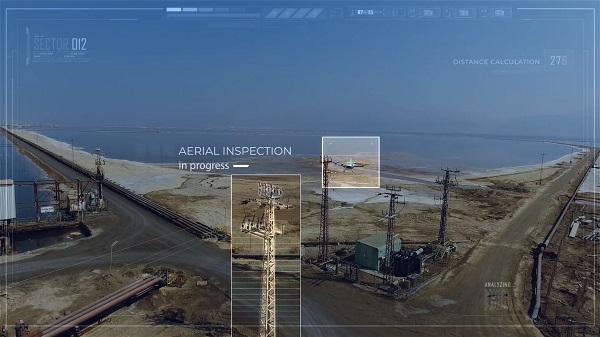
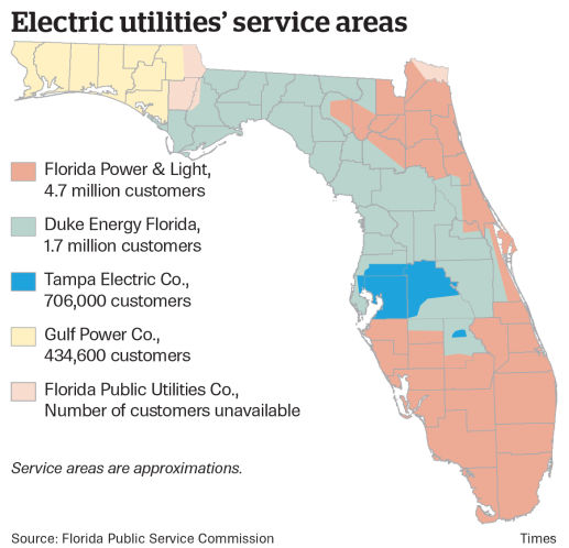
Florida Power & Light to deploy 13 autonomous drones, with plans for hundreds more in coming years to monitor statewide power grid
UAV company Percepto will deploy autonomous drones to monitor Florida power substations and distribution grids across the state.
Florida Power & Light (FPL) will deploy drone-in-a-box technology statewide, which Percepto claims is the largest commercial autonomous drone project in the world.
FPL serves the northeast and southern half of Florida. (Image: Florida Public Service Commission)
Serving more than 11 million people in Florida, FPL uses Percepto’s Autonomous Inspection and Monitoring (AIM) solution powered by drones to perform routine infrastructure inspection and monitoring.
In the first phase of the project, 13 drones will take flight in the West Palm Beach area this year, with long-term plans to field hundreds of Percepto over the next five years.
The drone-in-a-box solution was the first to pass Level 5 hurricane testing at a wind speed of up to 155 mph, making it suitable for minimizing incident response times and power outages in Florida.
Percepto has served FPL since 2018, working closely to develop optimized drone monitoring solutions and build consensus and compliance with Federal Aviation Administration (FAA) regulations. The FAA issued a nationwide waiver for FPL to fly Percepto drones for surveillance and inspection purposes at sites owned and serviced by FPL.
As part of its ongoing work with the FAA, Percepto is a member of the Beyond Visual Line of Sight (BVLOS) Aviation Rulemaking Committee (ARC) that has provided its regulatory recommendations to fully incorporate highly automated BVLOS operations flights in the national airspace.
The drones in operation across the state will be coordinated on a single platform through Percepto’s AIM solution. With Percepto AIM, drones can be operated remotely to ensure that they work together in sync, providing maximum coverage at the sites they monitor.
Last month we attempted to provide an overview of the issue concerning Federal Communication Commission’s (FCC) licensing of C-Band radio spectrum, the subsequent fielding of wireless service for 5G phones and the Federal Aviation Administration’s (FAA) announcements that potential interference could be possible between 5G signals and C-Band radio altimeters on commercial aircraft.
Not a big deal most people might say, as faster and improved phone and data messaging on their smartphones begins to kick in, while wireless companies continue roll-out of the new 5G service. But wait – don’t some of these people fly out on vacation and then back and land at local airports, and many of us fly around the US to visit friends and family, or each week shuttle around the country doing fly-in/fly-out business?
Well FAA and the wireless companies have largely collaborated during 5G service roll-out, and the FAA has been rapidly clearing a good number of rad-alt (radio altimeter) equipped aircraft to continue regular operations into most airports. And it seems that wireless companies have limited 5G fielding around some US airports by reducing transmitted power and/or limiting the density of 5G towers.
But where are we now? Seems some aircraft equipped with some types of rad-alt can fly into some airports – the FAA published a list for aircraft operators and pilots identifying who can do what and where. They also published several ADs (Airworthiness Directives) which limit several aircraft types from flying into certain airports, ‘prohibiting certain operations, which require radioaltimeter data to land in low visibility conditions, when in the presence of 5G C-Band interference’. For any aircraft passengers flying into LaGuardia on a foggy day or Boston when ice-fog hangs in the air – low visibility landing capability on modern aircraft is a blessing and a wonder which allows us to travel, even in bad conditions.
Seems that, typically – ‘many systems on (XY Type) aircraft rely on the radio altimeter, including autothrottle, ground proximity warning, thrust reversers and Traffic Collision Avoidance System,’ says one recent FAA AD.
That’s a whole bunch of critical systems which help an aircraft land. Many experts over many years have spent whole careers supporting the process of developing safety systems for auto-land and those which assist in the manual landing of aircraft. And the FAA and other agencies around the world have made every manufacturer prove and prove again that these systems work and work extremely, reliably, well.
Not that I’m against 5G – I have a 5G phone and I’m eagerly waiting for 5G applications to use on my phone. – the service seems to be very fast when in an area where 5G has been fielded. There are some wireless companies who have decided that 5G can by-pass cable in the distribution of TV channels – this is good stuff! Let’s have more of it!
But why on earth do we need to even partially compromise any aircraft systems which safely land aircraft?
Japan and France have been cited as counties in which 5G has not had any impact on the very same aircraft and their operations with which the FAA has found problems. Well, except those countries seem to have taken steps in the fielding of 5G which have protected their aircraft operations. The FAA quotes several mitigations used in those countries:
• Lower power levels
• Antennas adjusted to reduce potential interference to flights
• Different placement of antennas relative to airfields
• Frequencies with a different proximity to frequencies used by aviation equipment
Let’s hope that FAA’s intense efforts to test and clear rad-alts under the simulated intensity of C-Band interference around airports will continue unabated and that soon we aviation nuts will begin to breath more easily.
And let’s hope that the wireless companies cooperation, acceptance and mitigation steps – for which the whole aviation community is extremely grateful – that these very positive steps will directly lead to the whole issue fading away over time as old news.
And then a few words about ‘the war‘ which Russia just began against its neighbor and previous member of the USSR – Ukraine has been independent from Russia since the USSR ‘dissolved’ (Wikipedia) in 1991.
Ukrainians are pretty resilient and the news today is that a woman in Kyiv brought down a Russian drone by throwing a jar of pickles at it from her (high-rise?) balcony. This story of course isn’t verified, but it’s a small lightness in a very grim situation.
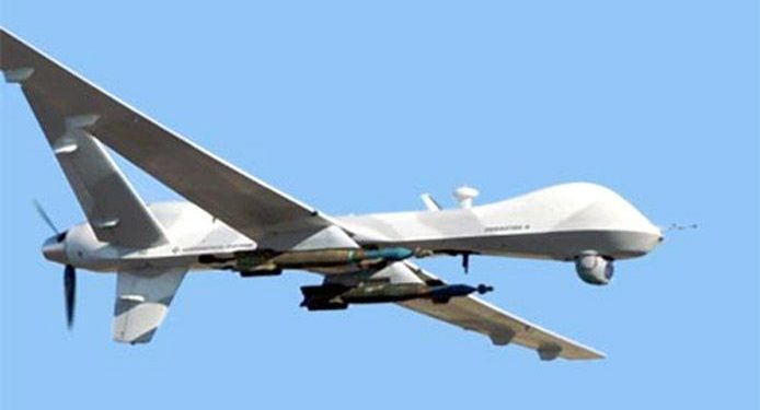
General Atomics armed MQ-9 Reaper (Militaryanalizer.com)
And its reported that Poland just placed an urgent operational requirement for armed MQ-9 Reapers in order to better protect its Eastern border with Ukraine. The border is around 530 miles long and is the main crossing point for the thousands of refugees fleeing the Russian onslaught. Poland has apparently already taken in almost a million people seeking safety.
Drones are now part of modern warfare and both East and West have pretty sophisticated, capable, weapon-carrying unmanned aircraft. But they also usually carry highly accurate satellite navigation and laser-guided weapons which may minimize unintended casualties – unless casualties are exactly what the Russians are after.
Really sad state of affairs which we all may still follow in detail through news reports, even though Russia has completely shut down social media and virtually outlawed on-the-ground news reporting.
The Federal Aviation Administration (FAA) and Association for Unmanned Vehicle Systems International (AUVSI) will co-host the 2022 FAA Drone Symposium April 28 in Orlando. The event will take place at the Orange County Convention Center.
The 2022 FAA Drone Symposium (formerly the FAA UAS Symposium) will focus on commercial operations, both at home and abroad. According to the show organizers, this collaborative event brings together industry and key FAA personnel to share best practices and lessons learned from operations, discuss challenges, and chart the course for the future of drone integration.
Session topics will include drone supply and demand, Beyond Visual Line of Sight Aviation Rulemaking Committee (BVLOS ARC) insights, drone integration and airspace integration.
Radio altimeters are critical in aircraft landing systems. (Getty image). (Photo: guvendemir/E+/Getty Images)
As most GNSS industry insiders already know, the Federal Communications Commission (FCC) has licensed adjacent GNSS L1 protection frequencies to Ligado Networks (formerly Lightsquared) for its nationwide 4G-LTE network.
Many objections emerged as expected this second time around from government agencies, industries and U.S. forces — yet the roll-out is still underway, pending actual interference occurring. This all in an attempt to find communications bandwidth for many emerging commercial radio applications.
Now, as 5G C-Band 3.7–3.98 GHz wireless phone networks begin their FCC approved roll-out, the Federal Aviation Administration (FAA) has apparently lodged an unanticipated objection on the grounds that cross-interference could compromise aircraft radar altimeter and wireless communications that operate at 4.2 to 4.4 GHz in the C-band.
While 5G wireless has already been operating in many parts of the world without reports of interference with aircraft systems, the FAA appears to be taking a more conservative approach to how aviation in the United States should co-exist with the new 5G phone wireless system. The FAA has proposed imposing an exclusion zone around airports for 5G wireless networks — which apparently have already been operating with reduced power in these areas — until cooperative operation has been proven.
Now along comes a new C-band wireless network (SkyLink) aimed at providing high-integrity unmanned aircraft systems (UAS) command and control (C2). The SkyLink company uAvionix has also developed a C-band Control & Non-Payload Communications (CNPC) radio for UAS applications.
Together with Thales, uAvionics recently tested its radio with its SkyLink radio network. The network has been qualified in accordance with the RTCA DO-377 standard for a network management system that monitors network and radio link health, and the radio has been developed to the draft FAA Technical Standard Order (TSO) C-213A to support critical UAS operations.
The network uses new DO-362A-compliant SkyLink C-band radios, integrates certifiable aviation-grade hardware and software, uses frequency agility, and provides critical fault monitoring and control capability. The objective is to obviate the loss of the C2 link with the vehicle, and thereby enable beyond-visual-line-of-sight (BVLOS) operations without an FAA waiver.
It’s unclear whether the emergence of the C-band network — approved by both the FAA and FCC — will play a role in the current phone network interoperability issue. However, uAvionix reports that several sites in the United States and offshore are either rolling out C-band SkyLink networks or evaluating doing so.
North Dakota already has an ISM-band SkyLink network at its UAS test site that will shortly transition to C-band.
The Choctaw Nation in Oklahoma under an FAA program seeks to enable BVLOS operations through a C-band C2 network.
New Mexico State University will use a Skylink C2 network around Las Cruces airport for small UAS (sUAS) operations and testing to overcome anticipated interference from nearby Air Force and Space Force operations.
The Tillamook UAS test range in Oregon has already installed the first ground site of a SkyLink network.
The University of Alaska at the Fairbanks UAS test site will use uAvionics radios for testing large, heavy UAS operations.
In Canada near the Jonesburg airport, a Skylink C2 network will support the safety case for BVLOS pipeline inspection operations for the oil industry.
While many of these new networks are not yet fully online, the use of frequency hopping, safety-monitored C-band, and certifiable transmissions for UAS command and control appears to be moving forward rapidly. Because the FAA is supporting this testing phase, it seems inevitable that large-scale C-band network rollout for UAS C2 will happen eventually.
5G phone networks, wireless UAS command and control, and aircraft safety systems essential for landing will need to find a way to co-exist and provide reliable, sustained service to their respective customer bases. Look for much more to develop in this ongoing tussle between industry groups and agencies who appear to have little in common, other than grudgingly sharing a crowded radio spectrum.
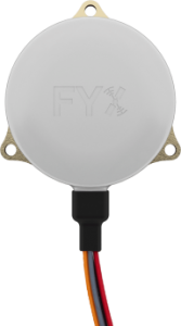
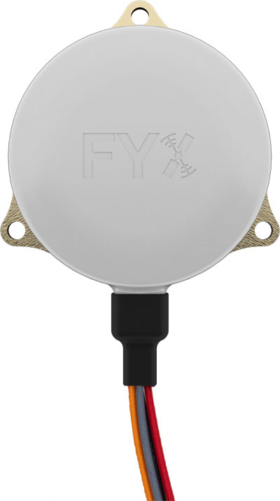
uAvionix Corp. has received a Technical Standard Order (TSO) from the U.S. Federal Aviation Administration (FAA) for its truFYX GPS receiver for unmanned aircraft systems (UAS).
Capable of receiving satellite-based augmentation system (SBAS) and wide area augmentation system signals, the receiver specifically targets UAS platform navigation and surveillance solutions.
With an increased regulatory focus on certifiability of UAS for beyond visual line of sight (BVLOS) operations, truFYX provides a critical component to enable safe navigation and airspace integration. A uAvionix’s blog article — “Why Certified GPS with Integrity for UAS Navigation Matters” — describes the importance of GPS receivers for UAS BVLOS operations.
The TSO-C145e Class Beta 1 GPS weighs 20 grams, which includes the receiver, antenna, DO-160G power supply and interface protection circuits. A Class Beta 1 GPS enables the truFYX to be the primary position source for domestic enroute and terminal navigation, as well as the primary position source for ADS-B OUT solutions.
The Source Integrity Level 3, System Design Assurance 2 system ensures reception and processing by Air Traffic Control and Traffic Collision Avoidance System when used as a position source for ADS-B. For these reasons, the Airbus Zephyr program was announced as a truFYX launch customer in January.
A certified position source for UAS navigation reduces position error by implementing a strict Receiver Autonomous Integrity Monitoring (RAIM) / Fault Detection and Exclusion (FDE) engine, and processing advanced SBAS messages designed to improve accuracy and integrity. These systems combine to detect unhealthy GPS satellite transmissions and remove them from the position calculation, providing critical differentiation from a typical commercial GPS receiver.
Design Assurance Level C software and hardware is achieved through the use of RTCA DO-178C and DO-254 engineering processes. As with all uAvionix TSO certified avionics, truFYX is manufactured in Montana under an FAA Manufacturing Inspection District Office approved quality-control process and facility.
truFYX technology has been previously TSO-certified in several form factors, including the highly integrated and complex skyBeacon, tailBeacon and tailBeaconX platforms.
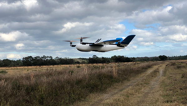
A Censys Technologies Sentaero equipped with a Verizon 4G/LTE link. (Photo: Skyward)
Skyward, A Verizon company, has signed a Memorandum of Agreement (MOA) with the U.S. Federal Aviation Administration (FAA) to test cellular-connected drones. Cellular-connected drones could unlock complex operations like beyond visual line of sight (BVLOS), universal traffic management (UTM) and one-to-many operations.
Titled “Unmanned Aircraft Systems (UAS) — Cellular Technologies to Support UAS Activities,” the MOA enables Skyward and the FAA to mutually research the capabilities of cellular communication networks for command and control (C2) within the National Airspace System.
Partially focused on safety-critical C2 data, the three-year MOA also allows the two groups to propose standards for operations, including BVLOS and over commercial wireless spectrum. Skyward and Verizon will also be using the data and information collected in the course of the MOA to inform its discussions on C2 and BVLOS operations in the FAA’s BVLOS Advisory and Rulemaking Committee.
Today, most commercial drones use unlicensed spectrum, which is restricted in range and subject to interference, limiting its use for complex operations. Verizon’s 4G LTE nationwide coverage, provided over spectrum protected from interference, presents an enormous opportunity for drone operations.
The MOA will inform regulations regarding spectrum used in the C2 link between the drone operator and drone. The MOA will also facilitate information sharing between the FAA and Skyward as the parties continue to explore how wireless networks can support drone operations.
The MOA is inspired by the previous industry collaborations with the FAA, but is intended to address complex UAS operations through joint data collection and analysis.
The agreement also follows Skyward’s announced emergency waiver to inspect critical communications infrastructure near the Big Hollow wildfire in Washington in September 2020. The industry’s first known fully remote BVLOS operation with no pilot or visual observer on site demonstrated low-risk operation as well as a need for analyzing and sharing fully remote data with standard bodies and the FAA.
“Cellular-connected drones play a critical role in enabling tomorrow’s safe, reliable and secure drone operations,” said Matt Fanelli, Director of Strategy and Operations at Skyward. “We are thrilled to be laying this foundation with the FAA and are confident that our efforts will help inform technical standards from which industry regulations authorizing low-risk BVLOS and one-to-many operations will flow.”
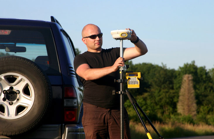
Many have debated how the surveying profession has morphed into something less than what our predecessors would have called surveying.
In earlier times, the surveyor was an honored figure in the community and held in high regard, like the local doctor and clergy. Surveyors had the final word on boundaries and the limits of a family’s land holdings, so they were treated like royalty.
Measuring devices were simple yet complicated enough for only the trained person to understand how boundary lines were determined. Surveyors during those times depended much on natural monumentation and terrestrial features; these items made for solid and definable boundaries. Measurements along these features were to be completed only by surveyors and their means of determining distances.
Much has changed since those centuries past, including the reputation of the surveying profession. No longer are we mentioned in the same breath as doctors, clergy and lawyers. Even engineers are seen as “more professional” than surveyors. Many have debated how the surveying profession has been degraded from the noble status it once enjoyed and morphed into something less than what our predecessors would call surveying.
There are many layers to each of the previously described professions, but they all have several things in common: each one relies on data collection, analysis, and professional opinion. Each of these steps requires a specific skill set that includes education and experience. Nowhere in this process does it allow for advancing technology to completely replace any of these steps.
The evolution of technology and associated tools may help improve the profession, but it will not replace the knowledge necessary to be considered a true professional. Data collection within most professions is the biggest beneficiary of technology; surveying is a testament to these advancements. The breakdown, however, is the availability of the technology to the public and turning non-practitioners into low budget pseudo-surveyors.
Here is the abridged version of the definition of “professional” according to the Merriam-Webster Dictionary Online:
professional (adjective)
: of, relating to, or characteristic of a profession
: engaged in one of the learned professions
: characterized by or conforming to the technical or ethical standards of a profession professional (noun)
: one who is professional
: one who engages in a pursuit or activity professionally
Similar professions have several examples of how the collection of data is a separate process and experience level from its analysis. Consider the following:
MRI technicians train for their jobs through education, interning and experience. They know how to place patients within the equipment, shield them, apply the rays, and produce the scans as required by their job description. In simple terms, they are data collectors of patients’ medical conditions. Technicians do not analyze the scans nor offer any opinion on the prognoses of the patients. They are, however, relied upon to obtain the proper scans correctly and efficiently for review by doctors.
Staff accountants or clerks are typically charged with data entry, maintaining ledgers and journals, and verifying data/entry accuracies. Often, clerks organize invoices, statements, and other receivables for input into clients’ accounts. Much of the work for this position is electronic and relies on the employees to be savvy with spreadsheets and able to import various data formats and spot suspect data. Once this work is completed, it become the responsibility of certified public accountants (CPAs) to review and certify the information. The key role here, however, is the accurate compilation of the accounting data.
Paralegals play a key role in doing the heavy lifting of data collection for lawyers. Paralegals perform client and case research, interview witnesses, handle discovery of case information, and draft many of the documents needed by lawyers. They are tasked with assembling exhibits, delivering and filing necessary court documents, and helping with trial preparation. While they cannot express legal opinions on any case matter, it is the paralegals’ work that lawyers use to develop case strategies. Once again, the data collection is the key to the success of the lawyers’ work.
Professional surveyors are no different from doctors, accountants, and lawyers in these examples. They rely on data collection obtained by experienced staff trained to operate sophisticated instruments and data collectors.
Field technicians often serve as surveyors’ eyes, so specific training is necessary to ensure that they can accurately locate the required information. Technicians, however, cannot offer legal opinions on the location of land and parcel boundaries.
This function is solely on the shoulders of land surveyors, who are licensed specifically in that jurisdiction to apply legal principles and case law to boundary issues.
There is one in every crowd — the North Carolina lawsuit
For those who are not paying attention, we are solidly in the 21st century and fully engulfed in the proliferation of geospatial data. Surveyors remain at the forefront of these technological advances with a plethora of tools and techniques being introduced on a regular basis.
These tools and associated software are much advanced compared to their earlier surveying instrument counterparts, but through extensive programming and easy-to-use interfaces, this equipment may seem simple to use to the layperson. The elder surveying generation likes to refer to newer technicians as button pushers, because the users perform no true calculations.
Yes, there are necessary checks and balances even with the new equipment, but the knowledge to operate these instruments is user-friendly and intuitive. So what happens when the technology is used by someone who is not a surveyor?
Among the hazards of making these newer tools and software widely available is how they are used by the non-professional public. As many surveyors have already read about in the news and social media, a UAV operator in North Carolina has filed suit against the NC Board of Examiners for Engineers and Surveyors.
The board previously ordered the operator to discontinue his UAV flights that engaged in mapping, surveying and photogrammetry services. The operator had been providing images to realtors and homeowners that depicted graphical lines representing property lines, but also included a disclaimer that the product was not intended for surveying purposes. The board ruled he was surveying without a license. The operator is now suing the board and accusing them of violating his First Amendment rights of free speech.
This case is a high-tech example of what surveyors have faced in the past with overzealous owners of metal detectors. Many instances of low-budget outfits and even fence installers have been brought before state licensing boards because they misrepresented surveying services.
It should also be noted that survey field crews who use their equipment during off hours to help family or friends with property location without their licensed supervisor’s knowledge face the same consequences. While the “corner finders” are somewhat harmless and get a slap on the wrist from licensing boards, it is the high-tech offenders who are creating much of the harm to the public.
These situations with unlicensed surveying practices have greatly increased simply because of the available technology and low cost of entry. While GNSS receivers, robotic total stations, and associated data collectors are still quite expensive, new remote-sensing applications are being produced using consumer-grade equipment and advancing software. As technology continues to increase based upon miniaturization and capability, the costs also continue to decrease based upon volume of sales.
Leading the charge into non-licensed use of new technology is the UAV and the new standard use of GPS technology within its guidance system of reasonably priced units. Hobby planes and helicopters have been around for years but required lots of skill and space to fly and were quite expensive. The invention of the multi-rotor UAV with integrated GPS has created an easy-to-fly vehicle with lots of capability.
Couple this new vehicle with a high-resolution camera for photos and video; now it allows amateurs to be aerial cinematographers. Image storage space is not an issue due to increased SD card capacity and speed.
A well-built UAV with all these capabilities is now very affordable and available everywhere. This revolution has led to larger format platforms with more rotors and heavier payloads for more sophisticated cameras and sensors. Once you have the photos and video, now you must do something with them.
The advancement of software technology for processing photos, video, and remote sensing modules has become the hottest ticket in site modeling. The combination of the UAV’s capability and the software’s output enables trained pilots and software technicians to provide orthometric-based imagery. This imagery was previously completed by airplanes and cameras costing hundreds of thousands of dollars and processed by technicians on high-end computers using years of skill and experience.
This entire operation can now be completed by one person with less than a $5,000 initial investment. This is a far cry from the funding needed in years past to outfit a survey vehicle with the necessary equipment and personnel to do this same project.
Enter the FAA and new rules for flying unmanned aircraft. After much consideration, the FAA instituted guidelines for flying UAVs along with requiring a pilot’s certification to fly for commercial purposes. They also specified limits to UAV sizes and payloads, and limited flights to 400 feet above the ground.
Many companies have purchased UAVs to provide aerial photos of their own facilities and projects, but fail to realize that publishing their images or videos qualifies them as a commercial user. Unfortunately, these regulations are much like driving a car without a license or insurance — it is only against the law if one is caught.
The iPhone 12 Pro’s lidar scanner
Another technology that will be catching on soon is lidar imagery from smartphones. The Apple iPhone 12 Pro and Pro Max contain sensors capable of capturing lidar data that is easily imported into computer drafting software. Several phone apps are also available for integrating this data into survey drawings. Geospatial data is literally at your fingertips.
50 states, 50 rulebooks
Rules and policies are put in place to regulate various professions and surveying is no different. The goal of these rules is simply to protect the public. Unlawful practice by non-licensed and/or non-qualified persons is a detriment to public safety.
The question is often raised about professional surveying licensure and the ability to practice in multiple states. Each state differs in statutory rules regarding boundary surveys. The colonial states (and Texas) follow a metes-and-bounds standard while the remaining states generally adopt a PLSS rule. Local surveying methods, terrain challenges and early settlers often affected the statutes enacted by each state, therefore variations in licensing must be applied to applicants.
However, the guiding principles for land surveyors remain the same in all states to protect the public. Boundary establishment and retracement is the sole responsibility of licensed land surveyors.
The tools of the trade are a completely different matter. Controlling the surveying services would be easier if the equipment and supplies necessary to do the work were only available to licensees, but the free market will never let that happen. If a company has $30,000 and wants a robotic total station but has no surveying license, the dealer will not stop the sale. When we drop the price tag to an $800 UAV purchase for performing aerial photography, no one bats an eye. As the cost of equipment continues to fall, the number of unlicensed users will climb.
Photo: Francesco Scatena/iStock/Getty Images Plus/Getty Images
‘Men have become the tools of their tools’ (Henry David Thoreau)
The point of this topic is that surveying is not about the tools necessary to complete the task. Surveyors carried out their work for thousands of years before electronic instruments and can continue to do so if they choose. The advancement of the equipment and the technology has made it easier for surveyors to do their work, but the true meaning of the task lies within the profession.
Boundary analysis and determination is the responsibility of land surveyors. Data collection for that analysis can be completed by technicians using a variety of measuring tools. The team works together to complete the surveying process.
Anyone can buy the tools; that, however, does not make them qualified to use them properly. It is not reasonable for one to buy a scalpel and offer brain surgery with a disclaimer. Ask any surveyor; there are some boundary retracements that are the equivalent of brain surgery. And we do not get to put a disclaimer on it.
Can GPS support a greener, more sustainable planet? The answer is an emphatic “yes,” and it is already doing so today.
GPS has become a fundamental technology across nearly every sector of the U.S. economy, including agriculture, transportation, construction and municipal services. In each of these industries, the use of GPS has produced substantial environmental benefits, such as lowered carbon emissions, increased water efficiency, decreased use of environmentally sensitive inputs, and reduced waste.
Agriculture
Let’s take a closer look at how GPS is protecting our nation’s critical environmental resources. We begin with agriculture where it is estimated that the absence of GPS during peak planting season could result in an economic loss of more than $15 billion, according to a National Institute of Standards and Technology report.
During the past two decades, GPS has transformed American farming, enabling increased crop yields, cost efficiencies, and environmental sustainability through the precise application of seed, water, fertilizers and pesticides and the efficient use of fuel. In sum, precision agriculture lets farmers do more with less wasted seed, less fertilizer, less fuel, less pesticide, and more crop yield.
GPS Innovation Alliance (GPSIA) founding member Deere & Company reports that precision agriculture technologies can have a huge impact on resource efficiency and sustainability. By 2030, GPS-enabled precision agriculture implemented globally could save 180 billion cubic meters of water, says the World Economic Forum.
Similarly, according to the U.S. Department of Agriculture’s Natural Resources Conservation Service (NRCS), if “[GPS] guidance systems were used on 10 percent of the planted acres in the United States, fuel use would be cut by 16 million gallons, herbicide use by two million quarts, and insecticide use by four million pounds per year.” For a single Midwest row crop farmer, with 6,500 acres using precision agriculture techniques, Deere & Company estimates that more than 1,600 gallons of fuel could be saved, and more than 400,000 kg CO2 equivalent emissions could be avoided, over the course of a production cycle — the equivalent of nearly a million (992,000) passenger car miles driven per year.
Infographic: GPS Innovation Alliance
Construction
Construction is another industry that has been revolutionized by GPS. Today, high-precision GPS is used to support the building of roads, bridges and other significant infrastructure projects. In 2019, testimony before the U.S. House Small Business Committee, an executive of GPSIA founding member Trimble described several examples of how digital construction technologies, including GPS, can more efficiently plan and execute complex construction projects.
In one such example from Southern California, the improvements “reduced the wetland impact by 58 acres; reduced the impact to sensitive species; reduced landslide risk; reduced residential displacement; and minimized the impact on existing utilities (resulting in few utility relocations to undisturbed areas).”
GPS receivers are also embedded in many bulldozers, excavators and graders, resulting in reduced waste and lower fuel consumption. They can reduce greenhouse gas emissions, with an estimate from Trimble suggesting that the use of machine control technologies can cut more than one billion pounds of CO2 usage per year.
NextGen Air
GPS is also at the heart of the Next Generation Air Transportation System, or NextGen, of the Federal Aviation Administration (FAA). Capt. Sully Sullenberger, during a 2020 GPSIA-sponsored event, described air traffic control modernization as depending “massively on the ubiquity and reliability of GPS.”
Along with the safety benefits of knowing the precise location of an aircraft, GPS enables optimized flight paths that the FAA says can reduce “flying time, fuel use, and aircraft exhaust emissions.” These efficiencies have already resulted in $1.2 billion in fuel savings, according to the FAA.
During a 2010 test flight over Puget Sound, Washington, Alaska Airlines found that the use of GPS-aided flight procedures reduced emissions by 35% compared to a conventional landing. Other airlines have also quantified these benefits, finding substantial savings in fuel consumption simply by cutting a single minute from each flight.
Weather and Disaster Forecasts
No one can argue the fact that weather events like hurricanes, floods and droughts have a huge impact on the environment and public safety. According to the National Oceanographic and Atmospheric Administration (NOAA), in 2020 such events cost $95 billion in damages. You may not realize, however, that NOAA uses GPS signals to support three-dimensional meteorology, space weather and geophysical applications throughout the United States.
Even NOAA’s Geostationary Operational Environmental Satellites (GOES) use GPS signals to enhance their ability to provide the data we all receive in each morning’s TV weather forecast, improving weather predictions and our own storm situational awareness. GPSIA member Lockheed Martin manufactures both the GOES-R series of weather satellites and the U.S. Space Force’s more powerful, next-generation GPS III satellites that are now being launched to modernize the GPS constellation.
Municipalities
Lastly, we examine the environmental benefits for municipalities that use GPS for key government services, including the real-time tracking of garbage trucks, snowplows and buses. Throughout the country, towns and cities have seen substantial savings in dollars, fuel and time from implementing GPS-enabled technologies.
In Niles, Illinois, for example, the Department of Public Works partnered with GPSIA founding member Garmin to optimize the routing of snowplows. Using GPS technology, drivers reduced the use of salt by as much as 40%, resulting in more than 700 tons saved. In 2020, in recognition of its innovative use of GPS, the department received the Management Innovation Award from the American Public Works Association. Similarly, GPSIA member CalAmp found that GPS use for vehicle tracking can result in fuel savings of $90 per vehicle per month.
Ensuring GPS
Ensuring these environmental benefits can continue to be realized requires that the spectrum used by GPS be protected from harmful interference. It will also depend on continued funding by Congress to modernize the GPS constellation and ground control. Additionally, as Congress considers a major infrastructure bill, including funding for states and localities, we would encourage projects to make use of GPS and other innovative technologies that can drive down costs, reduce carbon emissions, and eliminate waste — including advanced digital-construction management systems that use GPS data to reduce project costs and speed project delivery.
GPS has changed our everyday lives for the better, and as our dependence on this technology continues to grow, so will its impact on environmental sustainability efforts.
The UPP results will provide a proof of concept for UTM capabilities and serve as the basis for policy considerations, standards development and the implementation of a UTM system.
“The demonstrations will help move us closer to safe beyond-visual-line-of-sight drone operations,” said Pamela Whitley, the FAA’s acting assistant administrator for NextGen. “Flight testing UTM capabilities in high-density airspace will help us develop policy for safely and efficiently integrating drones into our national airspace while benefiting and serving communities.”
The demonstrations showcased emerging UTM capabilities that will support beyond-visual-line-of-sight (BVLOS) operations:
The FAA UTM Flight Information Management System prototype and infrastructure, which gives the FAA access to information from industry and other stakeholders.
New technologies and data to validate the latest international standards for remote identification and support authorized users with specific operator data.
In-flight separation from other drones or manned aircraft in high-density airspace to validate recently proposed international UTM standards to help drones avoid each other.
UAS volume reservations to notify drone operators of emergencies and make sure other UTM capabilities work properly in these scenarios.
Secure information exchanges between the FAA, industry and authorized users to ensure data integrity.
Each event attracted more than 100 participants and included local and state elected officials and representatives from international civil aviation authorities. Both test sites collaborated with drone operators and local public safety agencies to demonstrate scenarios that featured various complex UTM capabilities working together to support BVLOS operations with increasing volumes and densities.
MAAP hosted an event on Oct. 28 in partnership with UAS Service Suppliers (USS) AirMap, AiRXOS, ANRA Technologies, and Wing. On Nov. 9, NYUASTS hosted its showcase in coordination with the Griffiss International Airport, Northeast UAS Airspace Integration Research Alliance (NUAIR), and USS partners AiRXOS, ANRA Technologies, AX Enterprize, and OneSky.
The FAA has worked closely with NASA, industry and other stakeholders since 2017 to identify the initial set of capabilities needed to support small drone operations and advance UTM. The FAA Reauthorization Act of 2018 extended the objectives of the program to further enable safe BVLOS drone operations, paving the way for the program.
Stay tuned for more updates on how emerging technologies are being field tested to support the growing UAS industry.