uAvionix has partnered with Civil Air Patrol (CAP) to deploy a DO-260B-compliant, dual-band Automatic Dependent Surveillance-Broadcast (ADS-B) receiver network to complement Federal Aviation Administration (FAA) sensor data with low-altitude aircraft positions in support of CAP’s radar analysis mission.
The ADS-B receiver technology — already in use in Virginia — is designed to shorten the accident-to-rescue time in the National Radar Analysis Team’s search and rescue efforts.
Through the leadership of CAP’s Virginia Wing, members throughout the state have assisted uAvionix in locating suitable receiver sites and supported the installation of small, low-weight FlightStation ADS-B receivers at various airports.
The dual-mode (1090 MHz and 978 MHz) FlightStations receive transponder data from aircraft, which is centrally received and transmitted to the radar team server at Maxwell Air Force Base, Alabama, where it’s combined with FAA sensor data.
The CAP team uses FAA data and advanced technologies in its search and rescue efforts. The team is activated by the Air Force Rescue Coordination Center when there is a report of a possible missing aircraft or crash. Once the team is activated, analysis and actionable data can be provided in minutes to an incident commander, instead of the days or hours required before the team’s creation.
The FlightLine roll-out consists of several ATC grade ADS-B receivers with overlapping coverage, allowing for validation of transmitted ADS-B data and pinpoint multilaterated positions. Traditional ADS-B and radar concentrate mostly on airports and higher altitudes in support of air traffic control.
Most other available data sources largely exclude coverage for 978Mhz transponders, typically used by general aviation aircraft. Virginia is the first state in the U.S. to have complete coverage down to 500 ft of altitude. The new ADS-B is rapidly expanding to other CAP wings across the U.S.
“The introduction of ADS-B has resulted in a significant improvement of general aviation safety,” said Christian Ramsey, managing director, uAvionix. “Expanding on the FAA coverage at lower altitude and for UAT [universal access transceiver] transponders typically carried by general aviation will further enhance the tools used in safety of life activities such as CAP’ ‘s emergency services mission.”
The radar analysis team is calling on all CAP Squadrons to volunteer to host and install additional receivers where additional coverage is needed. Young said his team will prioritize areas where existing coverage is weak.
For more information and to register your squadron for a FlightStation unit, click here.
The Federal Aviation Administration (FAA) has released an implementation plan outlining the steps it and others will need to take to enable advanced air mobility (AAM) operations safely. The plan, called Innovate28, includes various components and a timeline for their implementation to hopefully be completed by 2028.
This plan serves as a foundation for making entry into service routine and predictable by maximizing the use of existing procedures and infrastructure. It addresses how the agency and partners will certify aircraft and pilots, manage airspace access, ensure pilot training, develop infrastructure, maintain security and engage communities.
The plan also includes a planning guide that can be applied to any site, laying out key integration objectives and sequences.
Among the entities that play a role in this plan include: the FAA; the advanced air mobility industry; labor partners, NASA; United States Department of Homeland Security; United States Department of Energy; power industry; and state, local and tribal communities.
Pilots will be able to fly the new advanced mobility aircraft to and from multiple locations at the sites, using predetermined flight schedules with pilots aboard.
Advanced air mobility aircraft likely will operate up to 4,000 feet altitude in urban and metropolitan areas, using existing or modified low altitude visual flight rules (VFR) routes where possible within controlled Class B and C airspace around major airports.
Infrastructure
Operators, manufacturers, state and local governments, and other stakeholders will be responsible for planning, developing and enabling heliport/vertiport infrastructure.
Advanced air mobility will initially operate at existing heliports, commercial service airports and general aviation airports. Modifications may be necessary to install charging stations, parking zones and taxiing space.
Power Grid
The electrical power grid may require upgrades to serve advanced air mobility operations.
The FAA has an interagency agreement with the Department of Energy’s National Renewable Energy Lab to determine how aircraft electrification affects a vertiport, heliport or airport’s electrical grid.
Security
The Department of Homeland Security will determine what type of security is necessary.
The Transportation Security Administration and FAA are evaluating the need for expanded cybersecurity requirements due to the use of advanced technology and operational protocols.
Environment
The FAA will consider the environmental impacts of advanced air mobility operations, including factors such as noise, air quality, visual disturbances and disruption to wildlife.
Community Engagement
The FAA will engage with airports, and local, state, and tribal communities to better understand community concerns about advanced air mobility operations, including noise and mitigations.
Many other stakeholders, such as advanced air mobility operators and airport and vertiport operators will have important roles in community engagement.
The U.S. government has visibly and physically conveyed its interest in getting air taxis into operation, through a visit of 70 people — attached to the newly formed Advanced Air Mobility (AAM) Coordination group — to Archer Aviation. The group talked with the executives of the company developing the “Midnight’ air-taxi aircraft and watched a flight test.
The AAM group includes members from leading government agencies concerned with making and keeping this segment of aviation successful, including the Federal Aviation Administration (FAA), the Department of Transportation (DOT), the National Aeronautics and Space Administration (NASA), the Department of Defense (DOD) and other agencies.
AAM group visits Archer Aviation. (Image: Archer Aviation)
Gathering the views of Archer and other electric vertical takeoff and landing (eVTOL) developer executives should be an essential part of the AAM group’s information collection task. And while it’s great to see that the interagency group has every intention of promoting the AAM concept of air taxis, it would perhaps be better if the group also had access to representatives of manufacturers, developers, and those with UAS experience. It’s clear that we need to start by spreading the word, but also by including people in the group who have dedicated themselves to bringing these capabilities to market — that may make the process more efficient.
Along the way, it may also help to understand that the processes we have used in the past to get airframes like this into passenger carrying operations might not work well with this new industry. It’s understandable that it should take a lengthy period to assess, verify, qualify and certify such vehicles in the name of safety, but if companies run out of cash and fold in the interim — which is highly likely with this “start-up industry” — then shouldn’t we be looking for a better way to get these guys off the ground?
No one wants safety to be sacrificed, but could there be some way to streamline, speed up, or simplify the process without skipping essential steps — a way to get new technology into use before it’s obsolete, or a lack of start-up money dooms its progress? The forecast for the economy in the near future is in the billions of dollars. So, providing funding to improve the current processes does make sense. DOD has started to put serious effort into speeding up its acquisition process and has empowered the Defense Innovation Unit (DIU) to find quicker ways to bring commercial technologies into defense.
The processes used to bring new technologies into use are tried and proven, but they are lengthy. In defense, if our opposition can field things quicker than we do, they have an edge in strategy, tactics and a higher probability of winning in battle. These countries are using the same approaches in the commercial world too, and we need to be wary that they may also have a greater chance of winning the “economic war.”
Nevertheless, Archer in California and others such as Joby, also in California, and Liliam in Germany, plod on through varying stages of FAA and European Union Aviation Safety Agency (EASA) certification paths. An example of the effort that a company has been required to put into fulfilling the requirements of a certification agency is that of Lilium, which first applied for its Design Organization Approval (DOA) in 2017, is still churning through the qualification efforts and does not expect approval until 2025. Of course, the answer is “Don’t get on the certification ‘hamster-wheel’ unless you can stand the journey.” However, we do want these systems and vehicles to make it in order to overcome some of the traffic nightmare that we are living through in our major cities and to contribute to the growth in the economy.
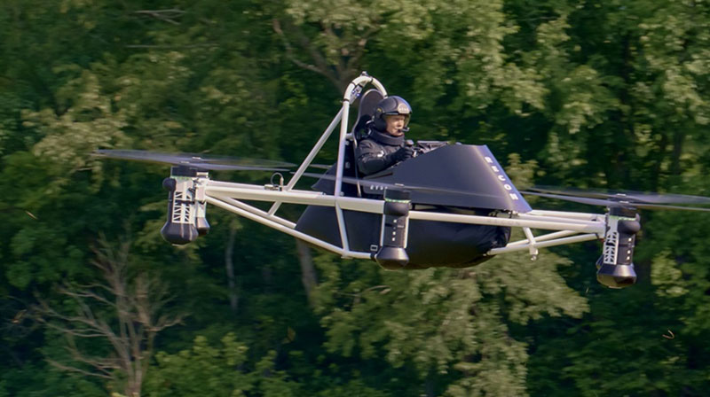
Meanwhile, the great hope (even expectation) of the “flying car” is being kept alive by Doroni in Miami with its two seat H1 eVTOL. Having largely burnt through its $3.6 million StartEngine launch money, Doroni is looking for its second round of funding to build more prototypes and join the certification race. However, other single seat eVTOL flying cars have taken the easier route to certify under the FAA Ultralight category.
Doroni H1 prototype. (Image: Doroni)
The H1 has semi-autonomous capability, which Doroni claims will make its eVTOL easy to fly, and allow general sales to any car driver. With air bags, an aerodynamic fuselage — which generates lift — 10 independent propulsion systems (four double prop ducted fans and two forward thrust props), an airframe that can behave as a parachute and “dissipate energy” in case of a crash, and landing gear, the H1 also has multiple independent batteries — all aimed at safety, which will help make it through certification verification. So, if you happen to have the $250,000 proposed sale price and are willing to wait on the completion of FAA certification, you could own your own “flying car.”
Doroni just announced that they have already made 50 test flights within their manufacturing facility along that test and qualification road.
Meanwhile, Ryse Aerotech in Ohio, recently demonstrated a manned test flight of its single seat Recon eVTOL — billed as an aid to farmers, with a top speed around 58 mph, a range of about 25 miles and with the right FAA clearance it could even reach an altitude of 700 ft — an airborne ATV for inspecting crops and the like.
Recon manned test flight in June 2023. (Image: Ryse Aerotech)
The path to market that Ryse has selected, however, should see more vehicles in earlier use than Doroni’s H1. All you may need is a driver’s license to take off in a Recon because it’s qualified as an Ultralight craft — just buy and fly. Beware, you cannot fly anywhere near an airport or after dark. FAA has restrictions on Ultralight craft.
So, progress on the semi-autonomous “flying-car” front and a plea to consider the economic benefits and to look to how to improve the efficiency of the existing certification process — not a request to cut corners, rather a request to speed up the processes and save this start-up industry before it goes broke.
uAvionix has received Federal Communications Commission (FCC) approval, coordinated with the Federal Aviation Administration (FAA), to operate its SkyLink C-band command and control (C2) radios for beyond visual line of sight (BVLOS) operations at the Choctaw Nation of Oklahoma Emerging Technology test site.
The radios — operating on aviation-protected C-band frequencies — will be controlled by uAvionix’s SkyLine cloud-based C2 network solution that supports fleet management, network health monitoring, detect and avoid, and roaming between multiple radio networks and ground stations.
According to uAvionix, with the BVLOS Waiver, businesses looking to use aviation-protected C-band and other radio networks for assured control and non-payload communications can now develop, test and implement solutions for business initiatives such as package delivery and medical resupply.
With over 200,000 tribal members and more than 11,000 employees, the Choctaw Nation is the third largest Indian nation in the United States. It is developing an aviation test facility in southeastern Oklahoma that utilizes more than 44,600 acres of remote land it tribally owns to support the innovative research, development, test and evaluation of emerging manned and unmanned aerial system technologies in a safe and low-risk environment.
Interested businesses should contact the Choctaw Nation and uAvionix to support implementation and scaling of uncrewed aerial system operations with multiple C2 links including aviation protected C-band.
Drone Safety Day (DSD) is returning for its fifth consecutive year on April 29. The annual campaign, designed by the Federal Aviation Administration (FAA), is dedicated to educating the drone community on the importance of flying safely.
The event will highlight the societal, economic, and safety benefits of safe drone operations. DSD will feature in-person, virtual and hybrid events in areas such as education, economics, equity, environment and emergencies.
DSD provides opportunities for businesses, schools and organizations to share how they use drones, as well as kick off new safety initiatives. The 2023 campaign encourages drone pilots and recreational flyers to “Fly RIGHT” by focusing on five safety elements:
Register your drone
Interact with others
Gain knowledge
Have a safety plan
TRUST and Train
A full list of events and registration can be found on the FAA website.
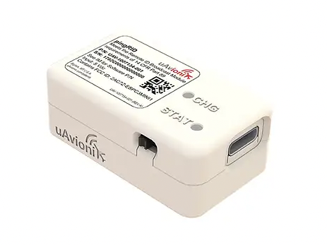
UAvionix has launched its remote ID broadcast module for UAVs, pingRID. The pingRID meets the Part 89 remote ID standards of the Federal Aviation Administration (FAA), which will become effective on Sept. 16, 2023, to keep operators safe and compliant throughout a flight.
The pingRID comes pre-configured and ready for use out of the box. After assigning the pingRID unique identification number to the aircraft’s registration with the FAA, operators can attach the battery-powered device to their UAV and prepare for flight.
A set of LED indicators provides status on the battery charge, device readiness for flight and inflight operations. The compact, lightweight design fits most aircraft without impacting performance. The module can also be quickly recharged via USB-C.
The FAA’s final rule on remote ID requires all UAV pilots to meet the operating requirements of Part 89. For most operators, this will require flying a UAV equipped with standard remote ID, a remote ID broadcast module such as the pingRID, or flying at a Federally Recognized Identification Area.
Feb. 4 saw the news networks alive with sometimes wild reports about UFOs, UAVs and then a balloon. Balloons are used for weather forecasting on a regular basis, launched daily into the stratosphere with payloads gathering wind speed and direction, temperature, humidity, pressure and, of course, position.
Synchronized twice a day at about 900 locations around the world, balloons are released into the stratosphere gathering essential atmospheric data to feed our weather forecasts. Reaching altitudes of 20 miles, these balloons often drift on winds as far as 125 miles from the release point, broadcasting measurements from their onboard sensors.
At first, maybe North American Aerospace Defense Command (NORAD) thought the balloon crossing into Alaska’s airspace was just one of these high-altitude weather prediction vehicles. Aircraft were apparently scrambled, and initially it was decided there was no threat, so the balloon was allowed to continue and enter Alaskan airspace. It was detected and subsequently tracked by both the United States and Canada for some time as it continued to drift on the jet stream over the border into the lower 48. Then, people in and around Billings Montana (home to one of the nation’s three nuclear missile silo fields at Malmstrom Air Force Base) started to send in reports of a very large balloon high overhead — according to one observer with a high-resolution camera, it even seemed to be stationary for 35 minutes.
Apparently, by the time the good folks in Montana were looking up, the Pentagon had decided the balloon was a Chinese surveillance vehicle. To get this detail, one or more U-2 high altitude reconnaissance aircraft had been dispatched to investigate. The collected U-2 information spotted markings of a Chinese manufacturer on the 200-foot-tall balloon. A payload the size of a small passenger jet dangled some 20 feet below the balloon canopy. It had several antennas of various configurations. A huge solar panel was attached — presumably to power its suite of surveillance sensors.
The Federal Aviation Administration (FAA) ordered a ground stop for all aircraft traffic at the Billings airport while decisions were made about downing the balloon or allowing it to proceed.
Meanwhile, it may seem obvious that both the United States and China have developed, launched and make use of surveillance satellites. I imagined that a couple of dozen of these space vehicles would be buzzing over not only each other’s landmass, but also surveilling dozens of other countries as they orbit the whole planet.
What I found was a report that China had at least 260 such orbital observation platforms in 2022, and the United States has even more. Isn’t that enough without resorting to lower-tech balloons?
It’s possible that some electronic transmissions are short range and would not be detected by surveillance satellites operating in geosynchronous orbit (22,000 miles out), or even at 300 miles where the International Space Station (ISS) and most surveillance satellites hang out. So, a slow-moving balloon at 20 miles up might be ideal to “sniff” ground transmissions from sensitive military installations, and if you could control the balloon to hover, all the better to pick up radio signals. Could the gathering of transmission data somehow be used to geo-locate the source? It’s something the U.S. military may be working on, too, as it is reportedly also building a fleet of autonomous dirigibles and balloons.
According to press reports, the United States decided not to immediately take down the balloon, even though it subsequently discovered its surveillance capabilities. Not only was there concern over debris falling on populated areas but allowing the balloon to continue its flight over the United States provided an opportunity to observe its behavior and gather useful information. U.S. bases along its path apparently shut down all communications in sequence, as the balloon passed overhead.
The balloon was apparently found to be transmitting – presumably reporting on where it was and what it had detected. But, at some time transmissions ceased, possibly when U.S. Air Force activity was detected nearby.
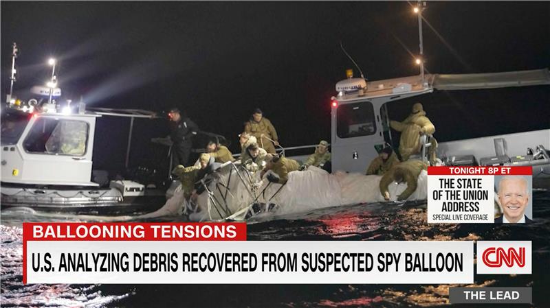
The take-down off Myrtle Beach
An F-22 flew to almost the same altitude as the balloon and fired an AIM-9X Sidewinder missile into it, leaving the payload to tumble from 60,000 feet into the shallow (50-foot deep) Atlantic Ocean off Myrtle Beach, South Carolina. Recovery boats were already on hand to pick up the collapsed canopy, and to begin locating the electronics payload on the seabed. At time of writing, the U.S. recovery effort has yet to inform us on finding the key electronic payload, which would go a long way to confirming the intended mission for the balloon.
Image: Screenshot of CNN news coverage
Strange, but a couple of days later over Canada, F-22s were again in action to take down a “cylindrical object” detected at 40,000 feet — an altitude posing a danger to airline traffic. Little has been released on what this object might have been — could it possibly be a re-entering piece of space debris? Again, debris recovery and analysis is underway, and we patiently wait for a public report about what this was all about.
What have we learned?
Both China and the United States operate huge fleets of surveillance satellites gathering intelligence daily about each other’s capabilities and those of other countries. Both China and United States have also invested in surveillance balloons, but China is the only country to send one over U.S. territory.
There may have been earlier balloon incursions, which are only now being reported. The U.S. response was initially to determine the configuration of the balloon and its payload, then to allow its journey along the jet stream to continue. The United States has said the balloon did not uncover anything already available by other means, but recovery and analysis of the payload would presumably confirm this announcement.
China is not happy about the U.S. takedown of a harmless, stray weather balloon. And what the heck were F-22s shooting at in Canada?
We’ll tell you more when we learn more….
Tony Murfin
GNSS Aerospace
Editor’s Note: Since the initial instance of an unidentified object floating across U.S. airspace — later identified as a Chinese surveillance balloon — three additional unidentified aerial objects were spotted in North American airspace. One was spotted in Alaska, one in northern Canada and one over the Great Lakes region. All three were shot down by U.S. fighter jets out of caution.
The Choctaw Nation of Oklahoma (CNO) Beyond Program and uAvionix have received approval from the Federal Aviation Administration (FAA) for beyond-visual-line-of-sight (BVLOS) operations. The approval signifies uAvionix and the CNO have demonstrated to the FAA that the aircraft procedures, detect-and-avoid systems and control network meet the safety requirement for operation in the national airspace.
This is the second BVLOS waiver granted by the FAA for the combinations of uAvionix SkyLine software and SkyLink hardware, allowing UAV pilots operating at the CNO range to use only an electronic observer.
The CNO will be using uAvionix SkyLine command-and-control (C2) management platform and pingStation3 dual-mode ADS-B receivers at the Emerging Aviation Technology Center UAS Test Range. The SkyLine C2 management platform is integrated with the DeTect Harrier radar for surveillance, and is used to control several CNO and uAvionix owned electric vehicle takeoff and landing aircraft through muLTElink and SkyLink series C2 radios.
“Having this capability available at CNO enables our customers to conduct testing and demonstration in Oklahoma and will further serve as guidance for future applications leveraging this concept of operations,” said uAvionix President Christian Ramsey.
uAvionix has received approval by the Federal Aviation Administration (FAA) to conduct beyond-visual-line-of-sight (BVLOS) small unmanned aerial flight in North Dakota. The test flight to secure approval took place at the Northern Plains UAS Test Site in North Dakota.
Vantis is North Dakota’s UAS network, which serves many UAS operators across different sectors. By leveraging Vantis, uAvionix demonstrated to the FAA it had established adequate risk mitigations to satisfy required safety standards for BVLOS operation within the national airspace system.
The Northern Plains UAS Test Site partnered with Thales USA to develop and implement Vantis. The UAS system enables UAS pilots to command and control the UAS and remain clear of other aircraft when flying BVLOS. Vantis includes ground-based aviation infrastructure, which lowers the barrier of entry to BVLOS flights for multiple users.
The FAA approval to conduct BVLOS UAS flights is another step in bringing UAS to commercial sectors. UAvionix continues to collaborate with FAA as regulations evolve to ensure Vantis meets all necessary requirements.
The Cybersecurity and Infrastructure Security Agency (CISA) at the Department of Homeland Security (DHS) recently released a three page “CISA Insights” document titled “Global Positioning System (GPS) Interference.” The January 2022 GPS jamming incident in Denver is discussed on the first page as an example of bad things that can happen and why GPS users should take precautions against interference.
Issued eleven months after the event, the report provides little new information, and leaves several important questions unanswered.
One of the most important questions is why it took so long to locate and end interference from a strong signal impacting such a large area.
The Federal Aviation Administration (FAA) was the first agency to become aware of the issue and the report credits the Enforcement Bureau of the Federal Communications Commission (FCC) with finding and terminating the spurious transmission.
Despite an “established national coordination process,” the interference was unabated for 33 hours.
While the report does not give details of the delay, likely reasons include the large number of agencies involved, diffuse authorities and responsibilities, the lack of a national interference detection system or a GPS/PNT “command center,” and several decades of funding and staffing reductions for FCC’s Enforcement Bureau.
How and why it happened
One of the primary reasons for doing an analysis of an accident like this is to prevent similar events in the future. Yet the CISA report provides no helpful information in this regard. It does not identify the source, nor the chain of events leading to the presumably accidental interference.
Those who might take steps to ensure that their operations don’t accidentally interfere with GPS signals learn nothing from the document.
A similar GPS jamming event occurred in October 2022 in the Dallas area. That one lasted 44 hours and the source was never identified. One wonders if this could have been prevented if the CISA report had been issued earlier and included more information.
Why the general public was not warned
The FAA issued a Notice to Airmen as soon as it became aware of the problem. The CISA report says surface (road and highway), rail, and telecommunications users were also impacted. Undoubtedly other types of users were also affected. Yet despite the outage lasting almost a day and a half, no public warning was issued to inform and protect non-aviation interests.
At a minimum, such a warning could have saved companies a lot of trouble and effort. A trouble report during the event from one public safety system operator provides an example of the unnecessary effort expended because a company did not know about the on-going disruption:
“Approximately 1530 on 21 DEC 22 two of our base transceiver systems began to lose sync. The GPS receivers, control cabling, and surge protectors were replaced with no change to loss of sync. There are no other BTS affected other than three sites in Aurora, Colorado … also problems with the local public safety P25 simulcast systems which have lost GPS lock in this area. Spok provides critical encrypted health care communications at these facilities.”
Warning the public could also help prevent more serious consequences, like the loss of life and property.
Troubling assertion
In this case, no losses of life or property have been connected to the disruption.
Yet the CISA report makes a more affirmative statement that “No accidents or injuries occurred because of the GPS interference incident.”
While we all certainly hope that was the case, and it may well be true, the CISA statement is troublingly certain.
A fairer and more accurate statement would be that “…none occurred, that we know of…” This would acknowledge that GPS is a safety of life system in many applications, and the seriousness of interference events.
Striving to do better
After its discussion of the Denver incident the report says improving GPS interference detection and mitigation is a CISA priority. And they are leading an interagency review to improve things.
This will be an uphill battle.
One challenge is DHS and other departments and agencies have limited authorities. The FCC is legally responsible for ensuring transmitters don’t trespass into unauthorized frequencies. However, its resources are limited and, as an independent agency not part of the administration, its participation in cross-governmental efforts is entirely voluntary.
Another is the lack of a clear, authoritative leader and champion for positioning, navigation, and timing (PNT) issues within the federal government.
Executive branch policy scatters PNT-related tasks thinly across the administration. These are to be coordinated by a senior level executive committee tasked to make recommendations “…to the President, through the Assistant to the President for National Security Affairs, or the Executive Secretary of the National Space Council…”
It is not hard to imagine that the details of PNT policy are rarely, if ever, brought to the attention of the President. This can lead to a stalemate between much more junior White House officials and greatly inhibit action.
Let’s hope the CISA report, limited as it is, highlights for leadership the many challenges faced by folks across government who care about GPS reception and national PNT issues. And that, as they collaborate on good solutions, they get the policy and budget support they deserve.
New-generation aircraft ELT meets new European Union Aviation Safety Agency (EASA) and U.S. Federal Aviation Administration (FAA) requirements
Photo: Orolia
Orolia has received certifications for yet another survival emergency locator transmitter (ELT), the Ultima-S.
The news follows Orolia’s announcement that it had received certification for the Ultima-DT model, as well as a personal locator now shipping to the U.S. Army.
The Ultima-S is a new generation ELT installed in either the cabins or liferafts of aircraft. It relays accurate aircraft location information to search-and-rescue teams.
Once activated, a 406-MHz distress signal is transmitted and includes the ELT’s location thanks to the Ultima-S internal GNSS receiver. This built-in GNSS capability increases both probability and speed of detection of the distress signal.
“With these key certifications for the Ultima-S, Orolia brings a long-awaited solution to the industry,” said Jérôme Ramé, Orolia’s Aviation & Military Product Line Director. “We have developed strong partnerships with several of the leading aircraft manufacturers that will enable operators worldwide to benefit from the Ultima-S for both their linefit and retrofit needs, allowing fleet standardization.”
The Ultima-S provides free, global coverage service through the dedicated Cospas-Sarsat infrastructure while meeting the highest aviation safety standards. Orolia offers non-rechargeable lithium batteries compliant with the latest FAA and EASA special conditions standards, also known under TSO-C142b/DO227A. The Ultima-S also meets the most recent ELT performance and environmental standards through TSO-C126c.
“What makes the Ultima-S unique is a new feature called the Return Link Service (RLS),” said Ramé. “Through this capability, the user is automatically notified when the distress signal is detected and located by the Cospas-Sarsat ground infrastructure. The Ultima-S links directly to the European Galileo GNSS satellite constellation, providing the most reliable and timely information for reaching aircraft crew members in distress.”
In addition to being available on a linefit basis on major aircraft programs, Orolia has launched an exchange program to make retrofit activities easier for airlines, especially those upgrading to safer battery technology.
WAAS makes airports without ground-based navigation available to pilots. (Photo: Raytheon)
WAAS monitors and evaluates all GPS signals over North America to enable pilots to fly using augmented GPS data for precision landing and enroute navigation
Raytheon Intelligence & Space, a Raytheon Technologies business, has been awarded a competitive indefinite-delivery, indefinite-quantity contract from the Federal Aviation Administration with a ceiling value of $375 million over the next 10 years.
Task orders, valued at $215 million, were executed at contract award to provide technical refresh and dual-frequency operation (DFO) upgrades to the FAA’s Wide-Area Augmentation System (WAAS) to provide safer air travel in support of the National Airspace System.
WAAS monitors and evaluates all GPS signals over North America to enable pilots to fly using augmented GPS data for safety-of-life missions such as precision landing and enroute navigation. The system allows pilots to safely land in places previously inaccessible because of the airport location or weather. It also makes airports without ground-based navigation available to pilots.
Under the WAAS DFO-2 contract, Raytheon will deliver more modern, and therefore sustainable, processing, system security, and network architecture, while also adding dual-frequency service.
“There is no margin for error during take-off, flight or landing,” said Denis Donohue, president, Surveillance & Network Systems at Raytheon Intelligence & Space. “Our modernization effort for WAAS will improve system robustness during ionospheric events and ensure safety-of-life requirements continue to be met.”
WAAS is a satellite-based augmentation system (SBAS) that provides GPS corrections for critical navigation for the aviation community, first responders and other government agencies, ensuring pilots can land safely in austere environments, despite weather challenges. It also provides corrections for SBAS-capable receivers in use across a diverse set of communities, including agriculture, maritime and surveying, among others.
Raytheon Technologies has been the prime development contractor for WAAS since 1996. Since reaching initial operational capability in 2003, Raytheon and the FAA have developed and fielded dozens of enhancements expanding WAAS’ precision approach capability, coverage area, and reliability, including improvements to the system infrastructure in preparation for dual-frequency service.
WAAS dual-frequency service will enable increased system accuracy, integrity and availability when subject to ionospheric perturbations, including solar storms. Work for this effort is based in Fullerton, California.